Aberdeen, SD
Weather Forecast Office
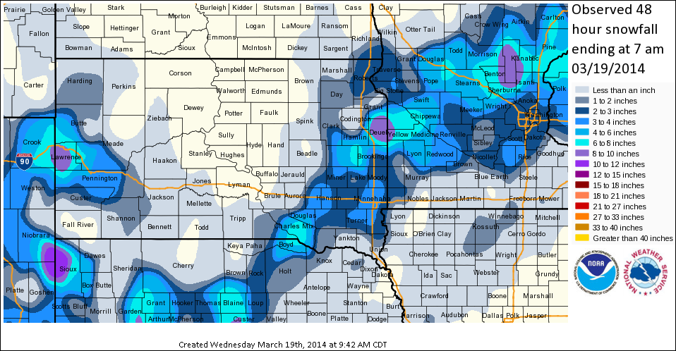
A narrow, but intense snowband developed over eastern South Dakota and western Minnesota from mid-morning through early evening on 18 March 2014. The graphic below shows the extent of the snow band around 1pm CDT. At this time, the most intense portion of the band was only about 20-30 miles wide, but was producing snowfall rates of 1 to 2 inches per hour! As a result, a very tight snowfall gradient was observed across the area. For example, Watertown, SD only picked 0.1" of snow while Clear Lake, SD picked up a whopping 10.5"! A graphical snowfall map and a few tabular snowfall listings are also provided below.
Image 1: KABR Reflecitivity at 1pm CDT:
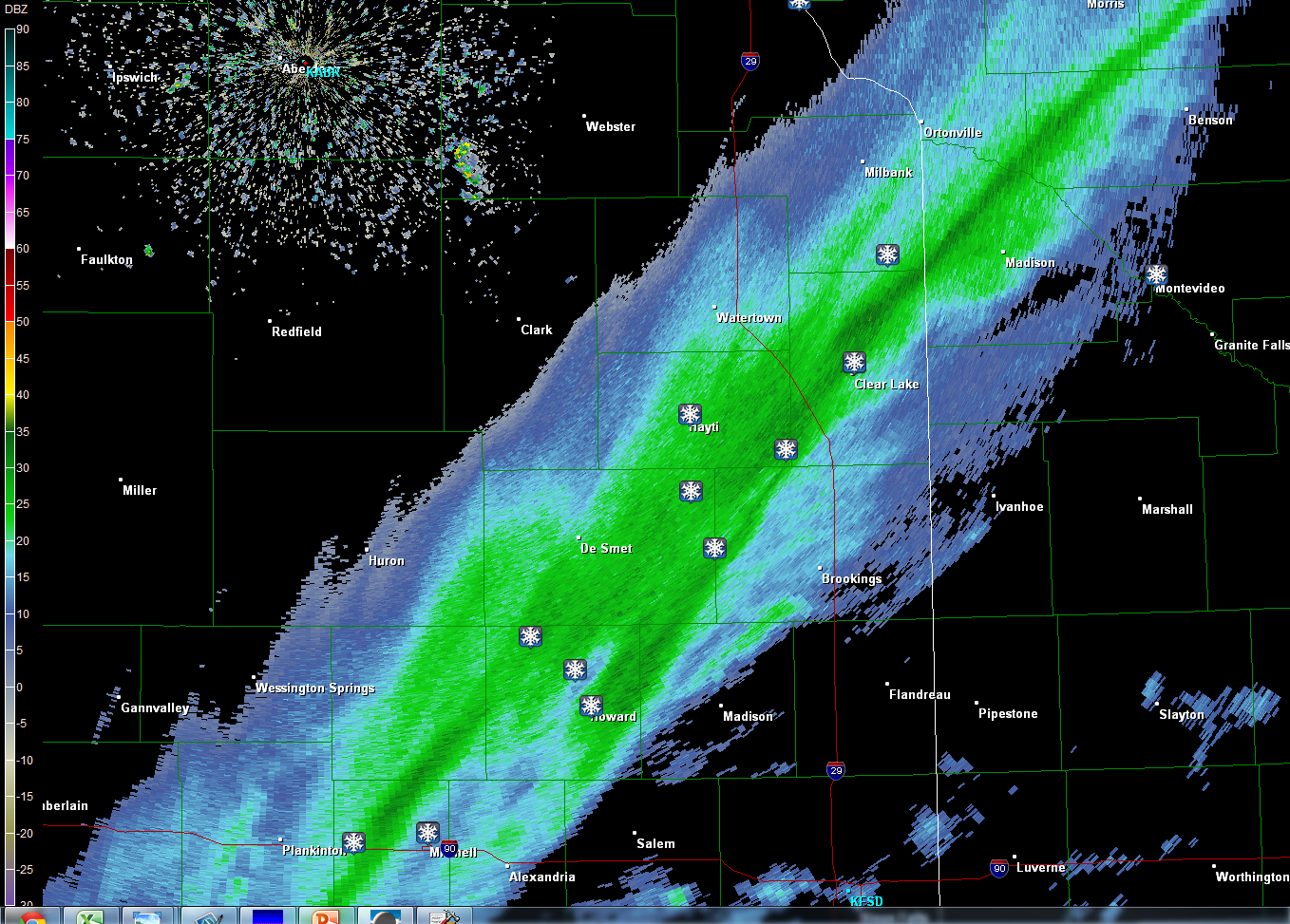
Image 2: Storm Total Snowfall Graphic:
US Dept of Commerce
National Oceanic and Atmospheric Administration
National Weather Service
Aberdeen, SD
824 391st Ave S.
Aberdeen, SD 57401-9311
605-225-0519
Comments? Questions? Please Contact Us.

