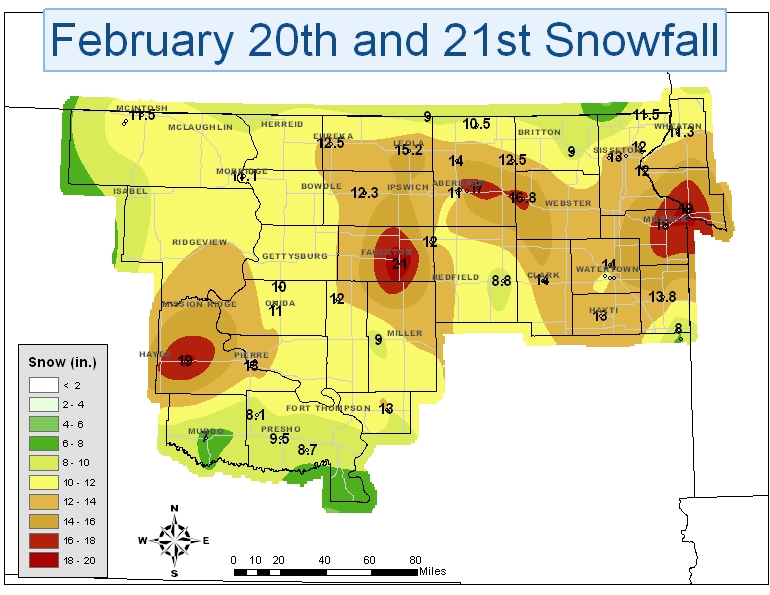
The snowfal/blizzard event on 20-21 February 2011 produced yet another round of impressive snowfall totals across central and northeastern South Dakota and west-central Minnesota. Storm total snowfall amounts generally ranged from 8" to 12" with locally higher amounts in excess of 18" reported in a few locations (see snowfall graphic below).
This 20 February event also set several records in Aberdeen:
Several other interesting snowfall facts or records in Aberdeen are also listed below:
The Top 10 snowiest winters all time in Aberdeen are listed below:
Rank Value Ending Date Missing Days
1 109.8 6/30/1937 (2)
2 94.6 6/30/1897 (205)
3 76.8 6/30/1994
4 75.9 6/30/1997
5 74.6 6/30/2001 (1)
6 74.5 6/30/1915 (141)
7 71.3 6/30/1907 (177)
8 68.0 6/30/1936 (1)
9 67.5 6/30/1893 (245)
10 65.9 6/30/1995 (1)
14 63.0 2/23/2011 (127)
Storm Total Snowfall From 20-21 February 2011: