Severe Weather Summary for July 9, 2013
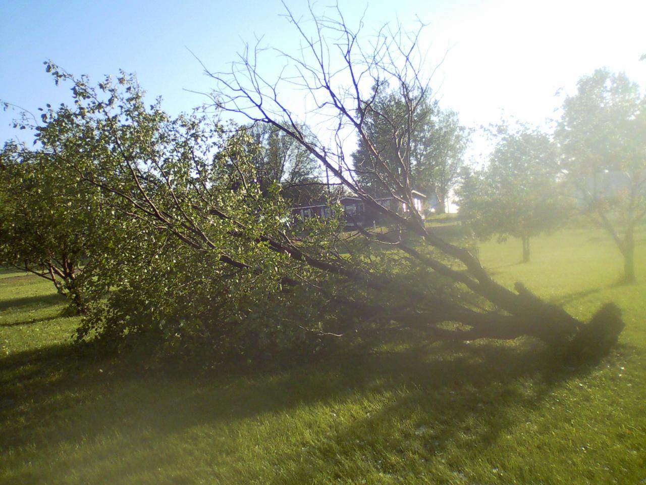
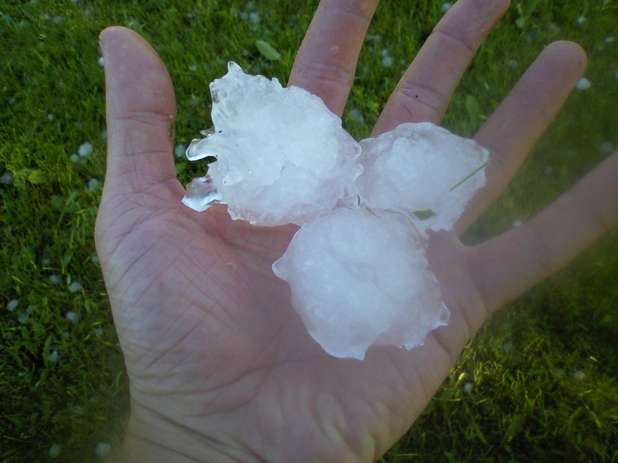
Around 6:30 pm CDT, two supercell storms crossed into northeast South Dakota. These storms had a history of producing large hail and even a small tornado in North Dakota. Even though one cell dissipated rather quickly once into South Dakota, the other storm continued to produce large hail and damaging wind gusts. Hail up to the size of baseballs fell in a narrow corridor from east of Spring Creek Colony in northern McPherson County, to Lily in western Day County. The storm finally dissipated around 8:30 pm CDT as it crossed into northwestern Codington County.
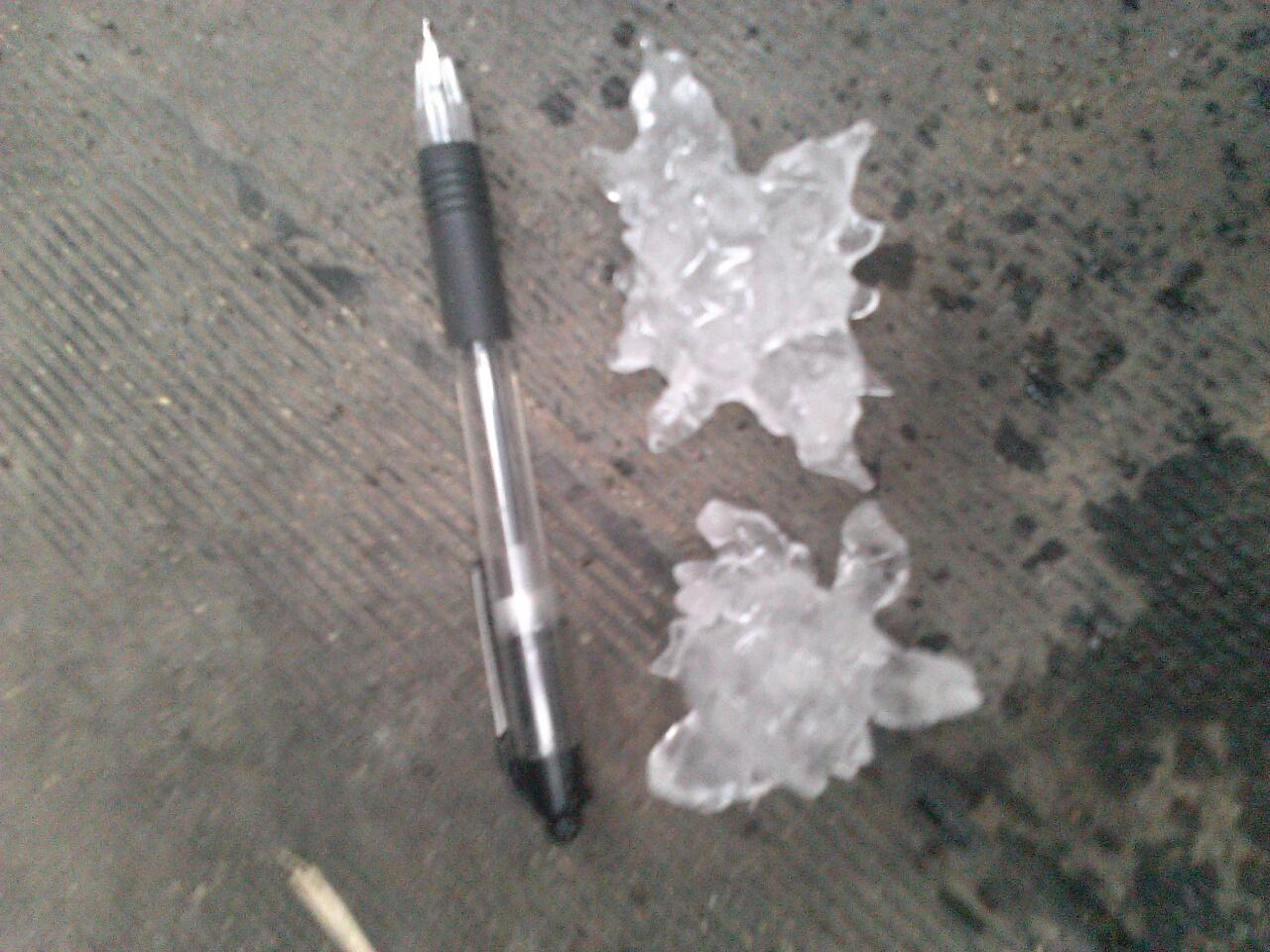
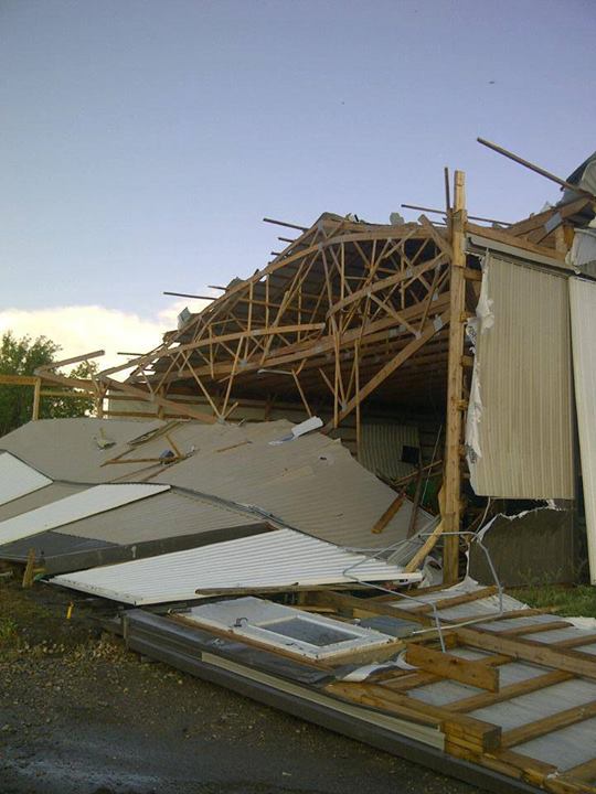
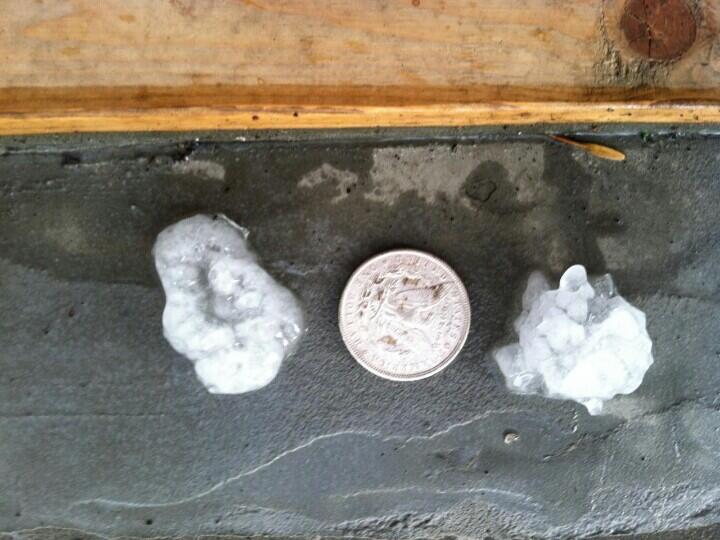
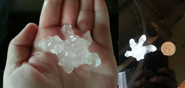
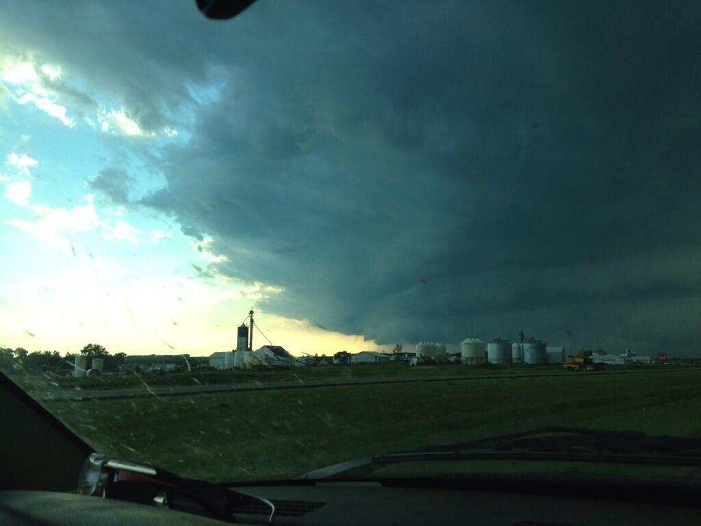
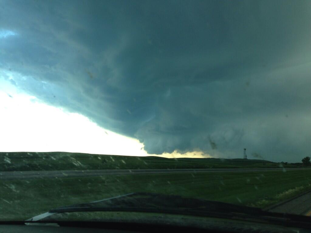
Damage Photos (click to enlarge):
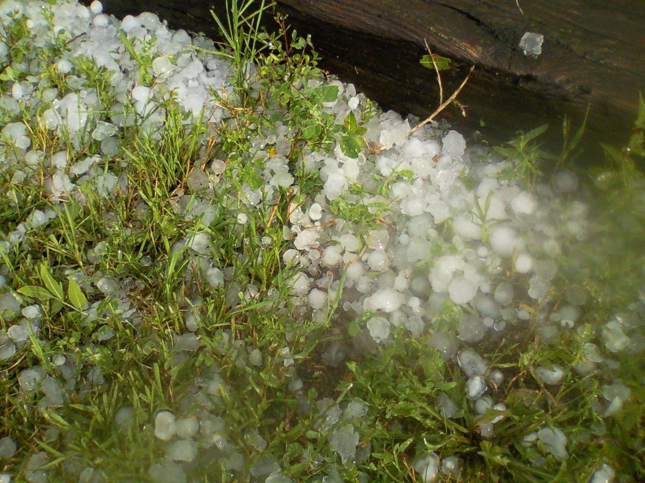
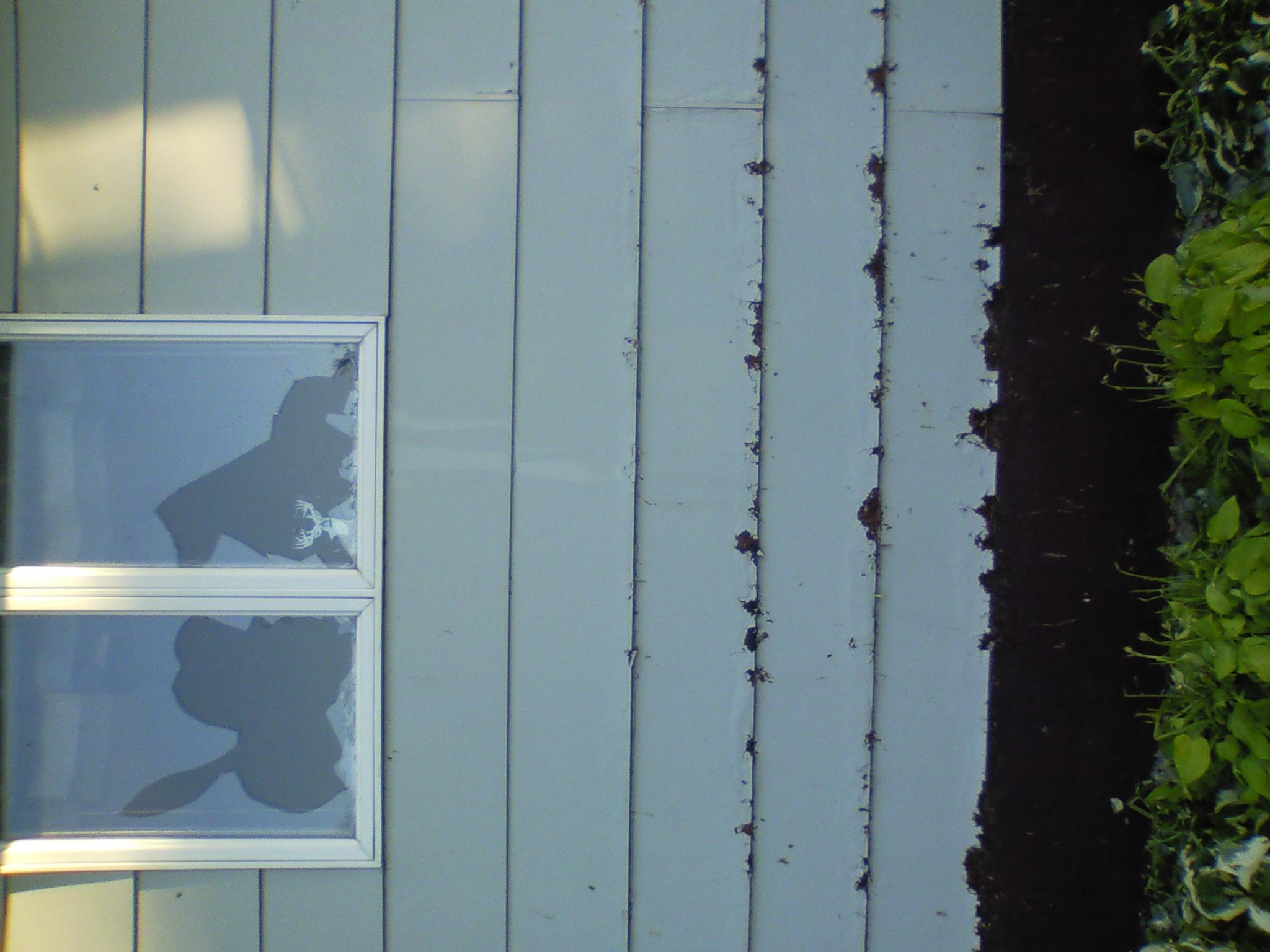
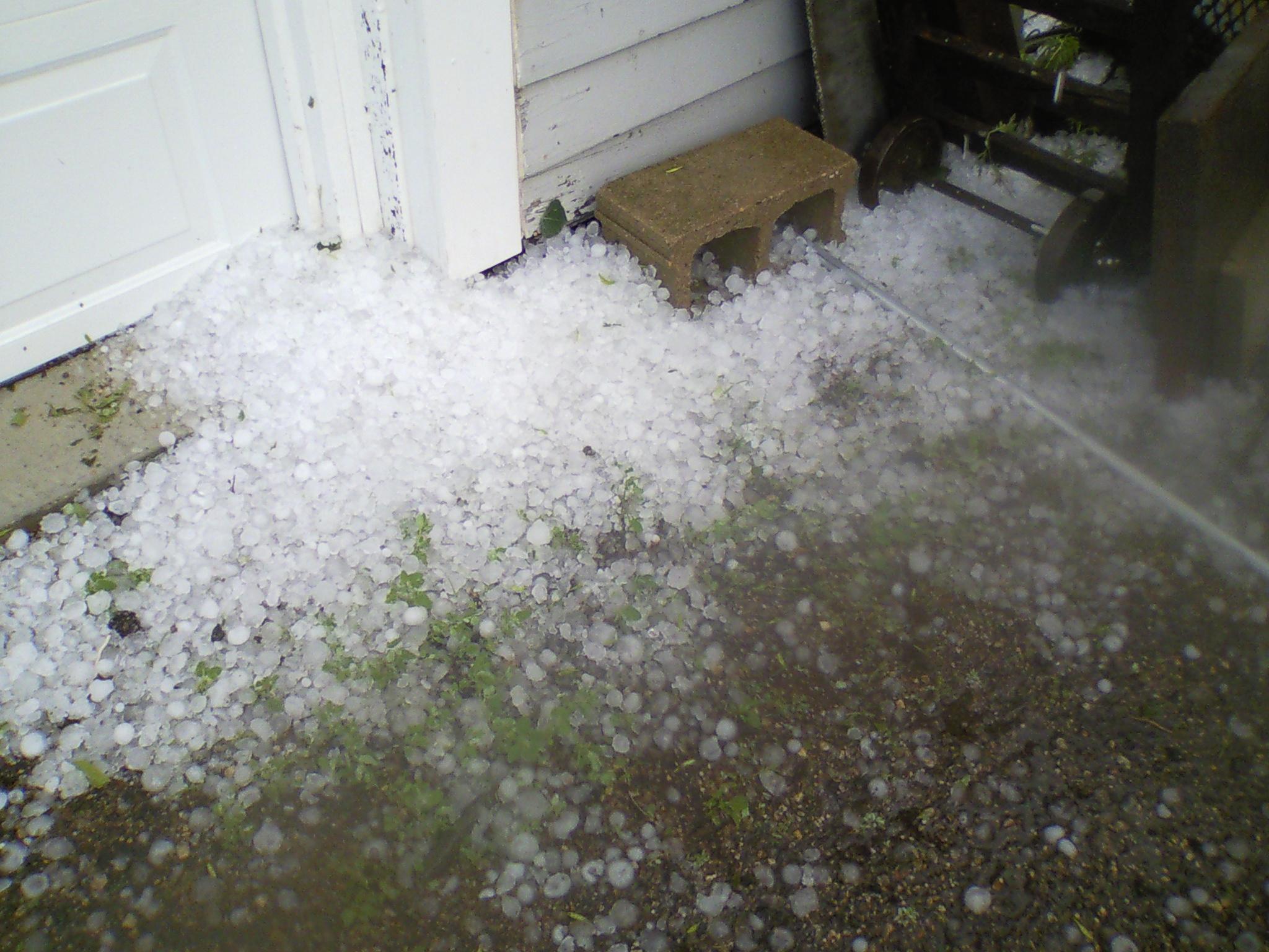
Barnard – courtesy of Scott Meints, Emergency Manager
|
|
|
|
|
|
|
|
|
|
|
|
|
North of Groton – Courtesy of Scott Meints, Emergency Manager
Cornfield west of Frederick – via KSDN

West of the Aberdeen Water Treatment plant – courtesy of Ron Keller

Groton Area – courtesy of Stephen Simon, Michelle Johnson and Dan Richardt

Near Andover – courtesy of Hayley Spitzer
Near Bristol – courtesy of Sarah Harms
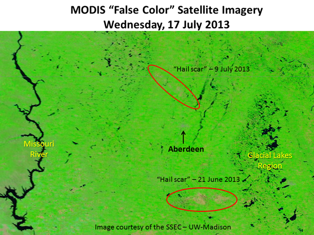
The 250-meter "false color" image was taken from the MODIS satellite imager on July 17th. Hopefully a few geographic features stand out - such as the Missouri River, glacial lakes region of South Dakota, City of Aberdeen, etc.
What are also interesting are the two areas of dull colors (brown/grey) amongst the green. These features are "hail scars" from two recent severe weather events - June 21st and July 9th. These swaths were produced by large, wind-driven hail which unfortunately damaged/destroyed the crops to the point where they are not as green as the surrounding healthy crops.
If you have comments/questions about this image - send them our way!
More info about the MODIS imagery can be found here: https://ge.ssec.wisc.edu/modis-today/about.html
PRELIMINARY LOCAL STORM REPORT...SUMMARY
NATIONAL WEATHER SERVICE ABERDEEN SD
927 AM CDT WED JUL 10 2013
..TIME... ...EVENT... ...CITY LOCATION... ...LAT.LON...
..DATE... ....MAG.... ..COUNTY LOCATION..ST.. ...SOURCE....
..REMARKS..
0638 PM HAIL 6 E SPRING CREEK COLONY 45.91N 98.76W
07/09/2013 E1.00 INCH MCPHERSON SD CO-OP OBSERVER
0646 PM TSTM WND GST 6 SSW SPRING CREEK COLO 45.83N 98.93W
07/09/2013 E60 MPH MCPHERSON SD PUBLIC
CORN FLATTENED BY STRONG THUNDERSTORM WINDS
0650 PM HAIL 17 W HECLA 45.88N 98.51W
07/09/2013 E1.50 INCH BROWN SD TRAINED SPOTTER
INTERSECTION OF HIWAYS 281 AND 10 PING PONG HAIL WITH
45 MPH WINDS.
0655 PM HAIL 1 W FREDERICK 45.83N 98.53W
07/09/2013 E1.00 INCH BROWN SD EMERGENCY MNGR
QUARTER SIZE HAIL. BEAN FIELD DESTROYED.
0658 PM HAIL 3 SSW FREDERICK 45.79N 98.53W
07/09/2013 E1.75 INCH BROWN SD PUBLIC
NSSL SHAVE REPORT.
0701 PM HAIL 2 E BARNARD 45.73N 98.45W
07/09/2013 E1.25 INCH BROWN SD PUBLIC
BROKEN WINDOWS ON HOUSE. NSSL SHAVE REPORT.
0705 PM HAIL 1 N COLUMBIA 45.63N 98.31W
07/09/2013 E2.75 INCH BROWN SD EMERGENCY MNGR
0705 PM HAIL 5 ENE WESTPORT 45.68N 98.40W
07/09/2013 E2.50 INCH BROWN SD PUBLIC
NSSL SHAVE REPORT.
0710 PM HAIL 3 NW COLUMBIA 45.65N 98.36W
07/09/2013 E1.75 INCH BROWN SD PUBLIC
NSSL SHAVE REPORT.
0715 PM HAIL 4 NNW PUTNEY 45.61N 98.21W
07/09/2013 E1.75 INCH BROWN SD PUBLIC
NSSL SHAVE REPORT.
0723 PM HAIL 6 N GROTON 45.54N 98.10W
07/09/2013 E1.00 INCH BROWN SD FIRE DEPT/RESCUE
GROTON FIRE DEPT QUARTER HAIL.
0730 PM HAIL 3 NNE GROTON 45.49N 98.08W
07/09/2013 E2.00 INCH BROWN SD PUBLIC
NSSL SHAVE REPORT.
0732 PM HAIL N GROTON 45.45N 98.10W
07/09/2013 E1.75 INCH BROWN SD EMERGENCY MNGR
BROWN COUNTY EM
0734 PM HAIL 1 N GROTON 45.47N 98.10W
07/09/2013 E1.50 INCH BROWN SD EMERGENCY MNGR
BROWN CO EM
0735 PM HAIL GROTON 45.45N 98.10W
07/09/2013 E1.75 INCH BROWN SD PUBLIC
NSSL SHAVE REPORT.
0737 PM HAIL GROTON 45.45N 98.10W
07/09/2013 E0.70 INCH BROWN SD EMERGENCY MNGR
BROWN CO EM.
0742 PM HAIL ANDOVER 45.41N 97.90W
07/09/2013 E1.00 INCH DAY SD LAW ENFORCEMENT
QUARTER SIZE HAIL AND 50 MPH WINDS.
0800 PM HAIL BRISTOL 45.35N 97.75W
07/09/2013 E1.50 INCH DAY SD LAW ENFORCEMENT
DEPUTY REPORTS BRIEF QUATER TO PING PONG SIZE HAIL.
0815 PM TSTM WND GST 3 E LILY 45.18N 97.62W
07/09/2013 E60 MPH DAY SD LAW ENFORCEMENT