Aberdeen, SD
Weather Forecast Office
A national weather.gov webpage issue is resulting in old images and headlines staying on our page. As a result, the latest Blizzard Warning, Winter Storm Warning, other headlines and graphics are not refreshing. However, the point and click map portion of the forecast is updating with the latest forecast for your specific area. Please check us out on Twitter and Facebook for the latest graphics.
https://twitter.com/NWSAberdeen/
https://www.facebook.com/NWSAberdeen/
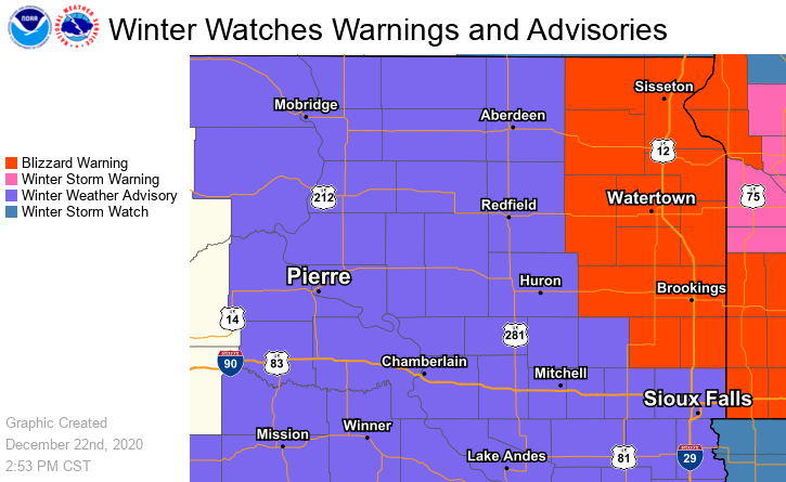
As of 4pm Tuesday...
A Blizzard Warning has been issued for portions of northeastern SD and western MN from 3am until 8pm Wednesday. A Winter Weather Advisory has been issued for the rest of our area from midnight CST/11pm MST tonight until 6pm CST/5pm MST Wednesday.

US Dept of Commerce
National Oceanic and Atmospheric Administration
National Weather Service
Aberdeen, SD
824 391st Ave S.
Aberdeen, SD 57401-9311
605-225-0519
Comments? Questions? Please Contact Us.


 Follow us on X
 Follow us on Facebook
 Follow us on YouTube
 ABR RSS Feed