
Severe thunderstorms and heavy rain are expected across the central High Plains into parts of the central and southern Plains and in the the Mid-Atlantic today. Intense, dangerous heat will persist across the West, Southwest, and Southern Plains into the end of the week. Elevated to critical fire weather conditions expected in the Great Basin and Four Corners region. Read More >
Fairbanks, AK
Weather Forecast Office
IMPACTS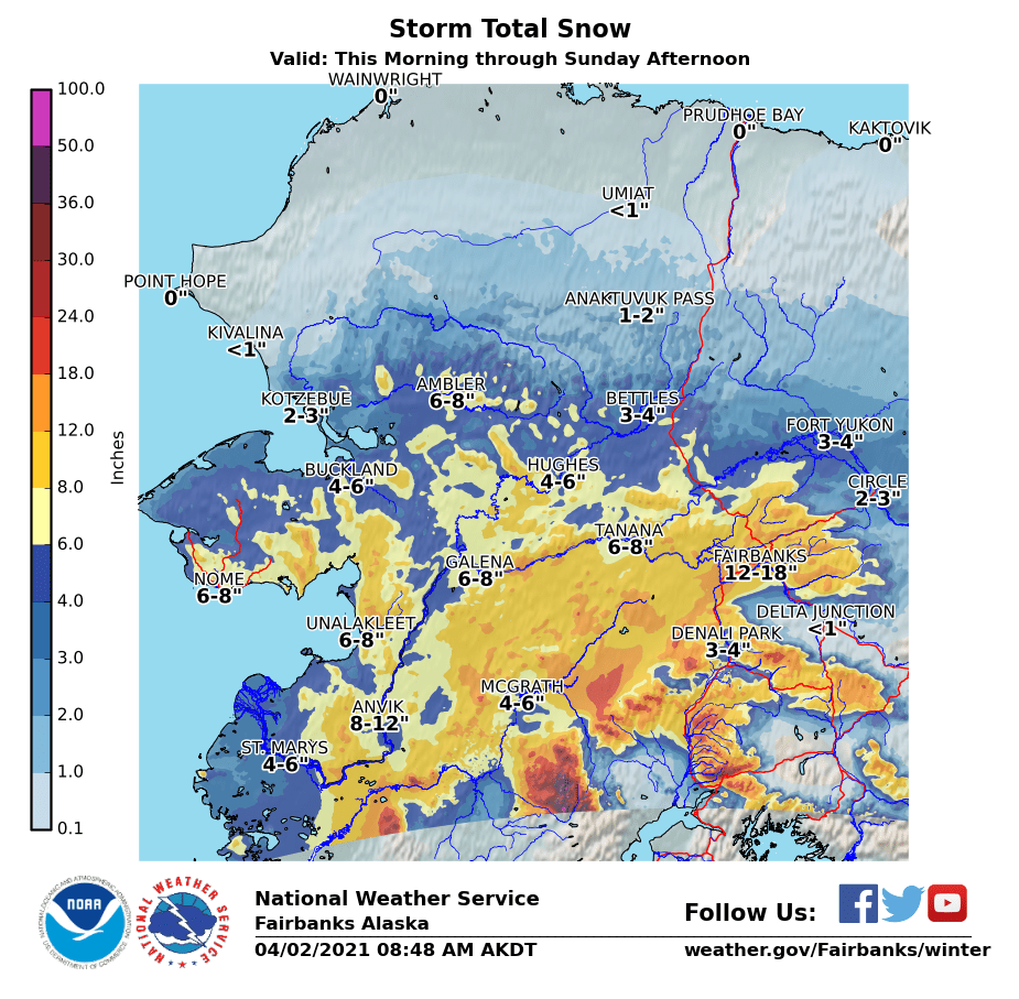
WHAT
WHERE
WHEN
For the latest road condition updates, check https://511.alaska.gov
US Dept of Commerce
National Oceanic and Atmospheric Administration
National Weather Service
Fairbanks, AK
UAF-Akasofu Building
Post Office Box 757345
Fairbanks, AK 99775-7345
907-458-3700
Comments? Questions? Please Contact Us.

