Overview
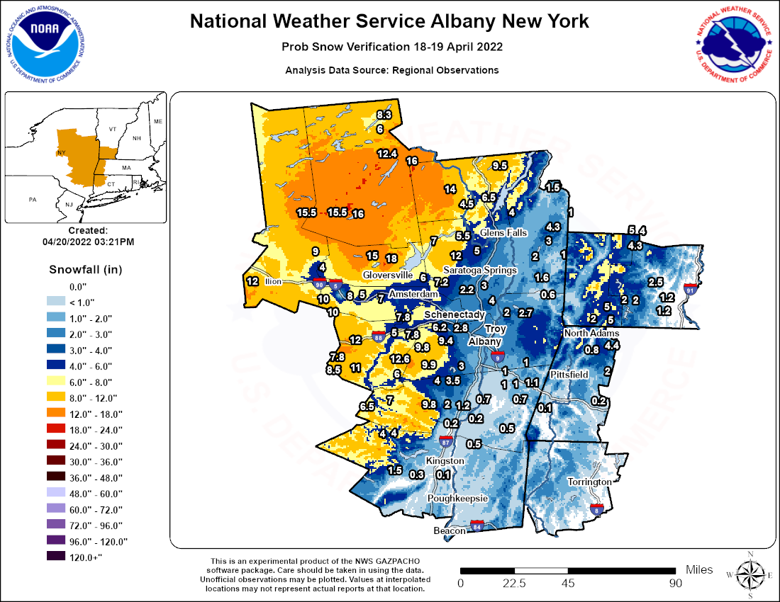
A late season nor'easter tracked up the East Coast on April 18-19, 2022 resulting in widespread precipitation across the region. Precipitation started in the form of rain, but mixed with and changed over to snow as colder air built into the region. The heaviest snow fell across areas west of the Hudson Valley in New York state (i.e., Adirondacks, western Mohawk Valley and eastern Catskills) where snowfall amounts were mainly in the 7 to 14 inch range with a few localized amounts up to 18 inches. Valley areas received less snow as rain mixed in longer with amounts ranging anywhere from less than an inch to up to 6 inches. In addition to the snow, strong winds accompanied this event with widespread gusts ranging from 30 to 50 mph.
The combination of heavy snow and strong winds resulted in widespread power outages across a span of central New York state as it brought down countless trees, limbs and power lines. This included portions of the eastern Catskills, Mohawk Valley, Adirondacks and Lake George/Saratoga region. Over 50 percent of the customers tracked in Herkimer and Hamilton counties were without power at some point.
Snow/Ice
Public Information Statement
Spotter Reports
National Weather Service Albany NY
959 PM EDT Tue Apr 19 2022

The following are unofficial observations taken during the past 20
hours for the storm that has been affecting our region. Appreciation
is extended to highway departments, cooperative observers, Skywarn
spotters and media for these reports. This summary also is available
on our home page at weather.gov/albany

********************STORM TOTAL SNOWFALL********************

LOCATION                TOTAL      TIME/DATE  COMMENTS
                     SNOWFALL       MEASURED
                     (inches)

MASSACHUSETTS

...Berkshire County...
  Savoy                   4.4   618 PM  4/19  WeatherNet6
  Peru                    2.0   845 AM  4/19  Elevation 1900 feet
  Becket                  0.2   602 AM  4/19  WeatherNet6

NEW YORK

...Albany County...
  Rensselaerville        12.6   718 AM  4/19  WeatherNet6
  East Berne              9.8   930 AM  4/19  Facebook
  South Berne             8.5   634 AM  4/19  WeatherNet6
  Knox                    7.8  1032 AM  4/19  WeatherNet6
  5 W Altamont            6.2   615 AM  4/19  NWS Employee
  Altamont                5.0   515 AM  4/19  Facebook
  1 NNW Colonie           2.8   625 AM  4/19  Trained Spotter
  Albany Intl AP          2.8   800 AM  4/19  ASOS
  2 W Albany              2.5   500 PM  4/19  Retired NWS Emp.
  1 W Albany              2.4   800 AM  4/19  NWS Employee
  Albany                  2.1   800 AM  4/19  NWS Albany Office

...Columbia County...
  3 N Austerlitz          1.1   900 AM  4/19  Meteorologist
  Chatham                 1.0   730 AM  4/19  Trained Spotter
  Taghkanic               0.5   807 AM  4/19  WeatherNet6
  Germantown              0.2   646 AM  4/19  WeatherNet6

...Dutchess County...
  Red Hook                0.5   700 AM  4/19  Trained Spotter

...Fulton County...
  Bleecker               18.0   100 PM  4/19  Facebook
  Caroga Lake            15.0   330 PM  4/19  Facebook

...Greene County...
  East Jewett             9.8   700 AM  4/19  2000ft Elevation
  Halcott Center          6.5   650 AM  4/19  WeatherNet6
  Greenville Center       4.0   913 AM  4/19  WeatherNet6
  Cairo                   2.0   527 PM  4/19  WeatherNet6
  Catskill                1.2   540 AM  4/19  WeatherNet6

...Hamilton County...
  Piseco                 16.0   635 PM  4/19  WeatherNet6
  Indian Lake            16.0   654 AM  4/19  WeatherNet6
  Hoffmeister            15.5   800 AM  4/19  CoCoRaHS

...Herkimer County...
  6 SW Frankfort         12.0   855 AM  4/19  Facebook
  Dolgeville              4.0   357 AM  4/19  Trained Spotter

...Montgomery County...
  Hessville              10.0   800 AM  4/19  Trained Spotter
  1 S Canajoharie         8.0  1030 AM  4/19  Facebook
  Glen                    7.0  1151 AM  4/19  WeatherNet6
  Palatine Bridge         5.0   503 PM  4/19  WeatherNet6
  Amsterdam               4.5   555 AM  4/19  WeatherNet6
  Fonda                   4.0   444 PM  4/19  WeatherNet6

...Rensselaer County...
  Speigletown             2.0   600 AM  4/19  WeatherNet6
  East Greenbush          2.0   450 AM  4/19  Trained Spotter
  Rensselaer              1.0   619 AM  4/19  WeatherNet6

...Saratoga County...
  Lake Desolation        12.0  1132 AM  4/19  WeatherNet6
  Galway                  7.2   613 PM  4/19  WeatherNet6
  Edinburg                7.0   345 AM  4/19  Trained Spotter
  3 NE Hagaman            6.0   922 AM  4/19  Facebook
  Corinth                 5.0   616 PM  4/19  WeatherNet6
  Halfmoon                4.0   730 AM  4/19  Trained Spotter
  2 S Clifton Park Cen    3.4   902 AM  4/19  Retired NWS Emp.
  Malta                   3.0  1154 AM  4/19  WeatherNet6
  Clifton Park            3.0   456 PM  4/19  WeatherNet6
  Hickeys Corners         2.5   730 AM  4/19  Retired NWS Emp.
  Ballston Spa            2.2   513 PM  4/19  WeatherNet6

...Schenectady County...
  Delanson                7.8  1117 AM  4/19  WeatherNet6
  3 NNE Pattersonville    6.1   630 AM  4/19  Trained Spotter
  Schenectady             6.0   646 AM  4/19  WeatherNet6
  Duanesburg              4.0   632 AM  4/19  WeatherNet6
  Schenectady-GE Plot     3.0   630 AM  4/19  Retired NWS Emp.
  Niskayuna               2.5   500 AM  4/19  Facebook

...Schoharie County...
  Richmondville          12.0   601 PM  4/19  WeatherNet6
  Jefferson              11.0   502 PM  4/19  WeatherNet6
  Middleburgh             9.0   529 AM  4/19  WeatherNet6
  Charlotteville          7.8   459 PM  4/19  WeatherNet6
  Gilboa                  6.0   456 PM  4/19  WeatherNet6

...Ulster County...
  Phoenicia               4.0   529 PM  4/19  WeatherNet6

...Warren County...
  3 WNW Johnsburg        14.0   740 AM  4/19  Facebook
  Warrensburg             6.5   456 PM  4/19  WeatherNet6
  Lake Luzerne            5.5   608 AM  4/19  WeatherNet6
  Queensbury              3.0   624 AM  4/19  WeatherNet6
  W Glens Falls           1.8   500 AM  4/19  Facebook

...Washington County...
  Hebron                  3.0   656 AM  4/19  WeatherNet6
  Greenwich               2.0   838 AM  4/19  WeatherNet6
  4 E North Easton        1.6  1200 PM  4/19  Trained Spotter
  Granville               1.0   709 AM  4/19  WeatherNet6

VERMONT

...Bennington County...
  5 NW Readsboro          5.0   500 AM  4/19  Trained Spotter
  Landgrove               5.0   453 PM  4/19  WeatherNet6
  Stamford                2.0   838 AM  4/19  Facebook

...Windham County...
  Wilmington              2.0   600 AM  4/19  Trained Spotter


**********************24 HOUR SNOWFALL**********************

LOCATION              24 HOUR      TIME/DATE  COMMENTS
                     SNOWFALL       MEASURED
                     (inches)

MASSACHUSETTS

...Berkshire County...
  1 NNW Cheshire          0.8   700 AM  4/19  CoCoRaHS
  2 SW Alford             0.1   830 AM  4/19  CoCoRaHS

NEW YORK

...Albany County...
  2 NNW Rensselaervill    9.9   700 AM  4/19  CoCoRaHS
  3 SSW Altamont          9.4   802 AM  4/19  CoCoRaHS
  4 NW Altamont           6.2   600 AM  4/19  CoCoRaHS
  Alcove Reservoir        3.0   800 AM  4/19  Co-Op Observer
  1 SW Albany             2.4   700 AM  4/19  CoCoRaHS
  2 WNW Albany            2.2   700 AM  4/19  CoCoRaHS
  NWS Albany              2.1   800 AM  4/19  CoCoRaHS

...Columbia County...
  3 N Valatie             1.0   700 AM  4/19  CoCoRaHS
  1 SW Chatham            1.0   700 AM  4/19  CoCoRaHS
  6 S Hillsdale           0.7   800 AM  4/19  CoCoRaHS

...Fulton County...
  7 NW GLOVERSVILLE       6.8   700 AM  4/19  Co-Op Observer
  5 ESE Broadalbin        5.0   900 AM  4/19  CoCoRaHS

...Greene County...
  2 N Lexington           7.0   700 AM  4/19  CoCoRaHS
  1 E Greenville          3.5   600 AM  4/19  CoCoRaHS
  3 E Freehold            3.5   530 AM  4/19  CoCoRaHS
  WNW Athens              0.7   620 AM  4/19  CoCoRaHS

...Hamilton County...
  2 WNW Hoffmeister      15.5   800 AM  4/19  CoCoRaHS
  2 SW Indian Lake       12.4   720 AM  4/19  Co-Op Observer
  1 N Long Lake           8.3   700 AM  4/19  CoCoRaHS
  SSE Long Lake           6.0   700 AM  4/19  CoCoRaHS

...Herkimer County...
  2 NW Salisbury Cente    9.0   600 AM  4/19  CoCoRaHS
  1 WSW Ilion             8.6   700 AM  4/19  CoCoRaHS

...Montgomery County...
  2 WSW Hessville        10.0   800 AM  4/19  CoCoRaHS
  1 NNW Amsterdam         4.0   624 PM  4/19  CoCoRaHS
  SE Fort Plain           1.1   700 AM  4/19  CoCoRaHS

...Rensselaer County...
  7 NE Troy               2.7   700 AM  4/19  CoCoRaHS
  2 NNE Troy              2.5   800 AM  4/19  CoCoRaHS
  Troy                    2.0   700 AM  4/19  Co-Op Observer
  4 ESE Nassau            1.0   755 AM  4/19  CoCoRaHS
  Buskirk                 0.6   720 AM  4/19  Co-Op Observer

...Saratoga County...
  4 WNW Rock City Fall    9.0   715 AM  4/19  CoCoRaHS
  2 W Greenfield Cente    3.5   800 AM  4/19  CoCoRaHS
  3 ESE Ballston Spa      2.5   830 AM  4/19  CoCoRaHS
  1 S Saratoga Springs    2.3   600 AM  4/19  CoCoRaHS
  2 NW Waterford          2.2   614 AM  4/19  CoCoRaHS
  3 S Clifton Park        1.9   700 AM  4/19  CoCoRaHS

...Schenectady County...
  4 NNW Rotterdam Junc    6.0   900 AM  4/19  CoCoRaHS
  Delanson                4.0   700 AM  4/19  Co-Op Observer
  S Niskayuna             3.5   700 AM  4/19  CoCoRaHS
  2 N Niskayuna           2.7   700 AM  4/19  CoCoRaHS
  2 ENE Schenectady       2.5   700 AM  4/19  CoCoRaHS
  1 NW Scotia             1.5   700 AM  4/19  CoCoRaHS

...Schoharie County...
  S Jefferson             8.5   700 AM  4/19  CoCoRaHS
  Schoharie               5.0   800 AM  4/19  Co-Op Observer

...Ulster County...
  Phoenicia               4.0   700 AM  4/19  Co-Op Observer
  4 N Kerhonkson          1.5   700 AM  4/19  CoCoRaHS
  2 WNW Rosendale Vill    0.3   800 AM  4/19  CoCoRaHS
  5 NW Saugerties         0.2   900 AM  4/19  CoCoRaHS
  2 S Hurley              0.1   700 AM  4/19  CoCoRaHS

...Warren County...
  2 ENE Brant Lake        9.5   700 AM  4/19  CoCoRaHS
  2 WNW Warrensburg       4.5   800 AM  4/19  CoCoRaHS
  5 ESE Lake George       4.0   700 AM  4/19  CoCoRaHS

...Washington County...
  10 SW Granville         4.3   919 AM  4/19  CoCoRaHS
  Whitehall               1.5   800 AM  4/19  Co-Op Observer
  2 SSE Salem             1.0   600 AM  4/19  CoCoRaHS

VERMONT

...Bennington County...
  5 NNE Stamford          5.0   400 PM  4/19  CoCoRaHS
  Peru                    4.3   700 AM  4/19  Co-Op Observer
  1 NNE Landgrove         4.0   700 AM  4/19  CoCoRaHS

...Windham County...
  2 N East Dover          2.5   700 AM  4/19  CoCoRaHS
  1 WNW Wilmington        2.0   553 AM  4/19  CoCoRaHS
  2 NNE Marlboro          1.2   800 AM  4/19  CoCoRaHS
  Marlboro                1.2   800 AM  4/19  Co-Op Observer
Radar
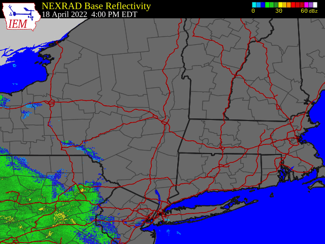 |
| Regional Radar Loop valid 4:00 pm April 18 to 10:00 pm April 19, 2022 |
Environment
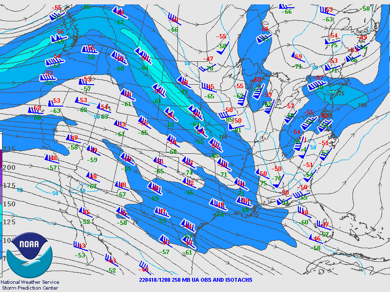
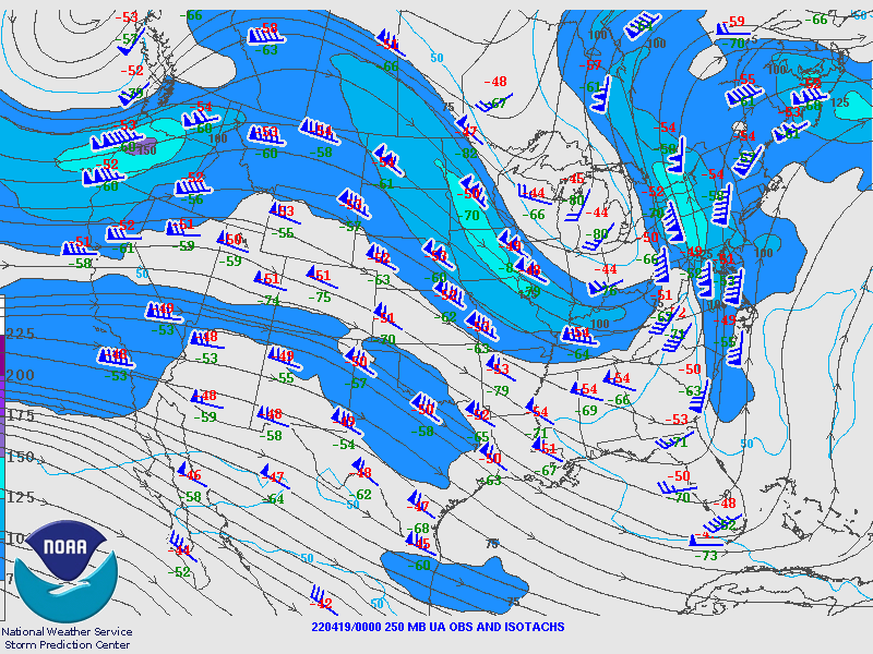
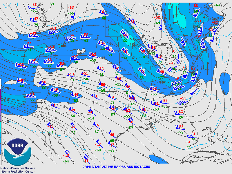
250 hPa Analysis
 |
 |
 |
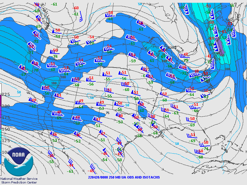 |
| Valid 12z April 18, 2022 | Valid 00z April 19, 2022 | Valid 12z April 19, 2022 | Valid 00z April 20, 2022 |
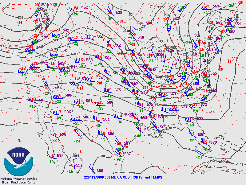
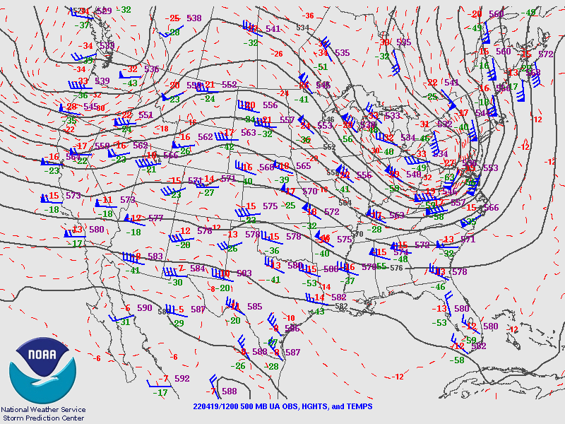
500 hPa Analysis
 |
 |
 |
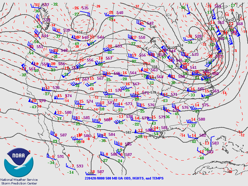 |
| Valid 12z April 18, 2022 | Valid 00z April 19, 2022 | Valid 12z April 19, 2022 | Valid 00z April 20, 2022 |
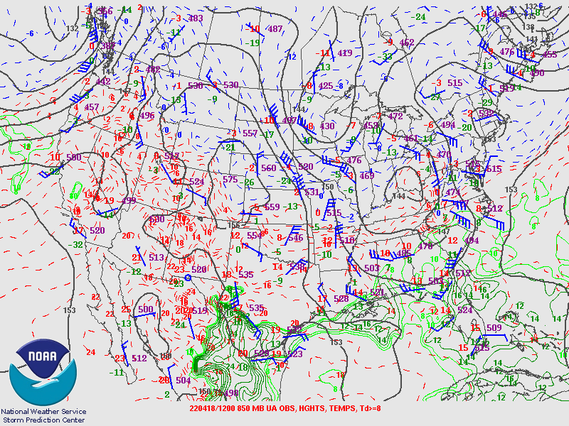
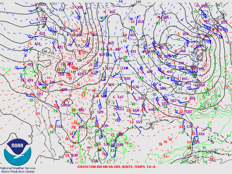
850 hPa Analysis
 |
 |
 |
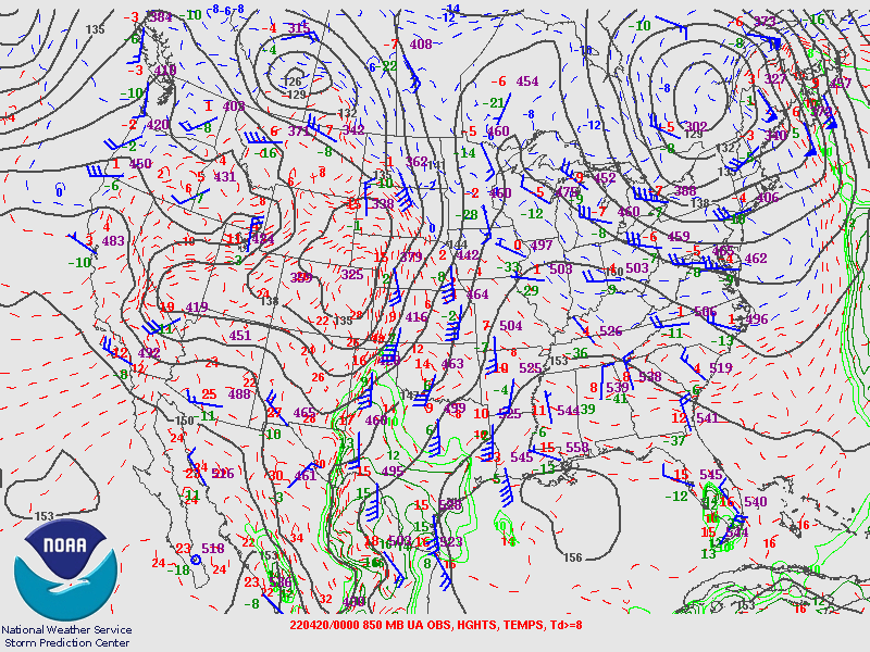 |
| Valid 12z April 18, 2022 | Valid 00z April 19, 2022 | Valid 12z April 19, 2022 | Valid 00z April 20, 2022 |
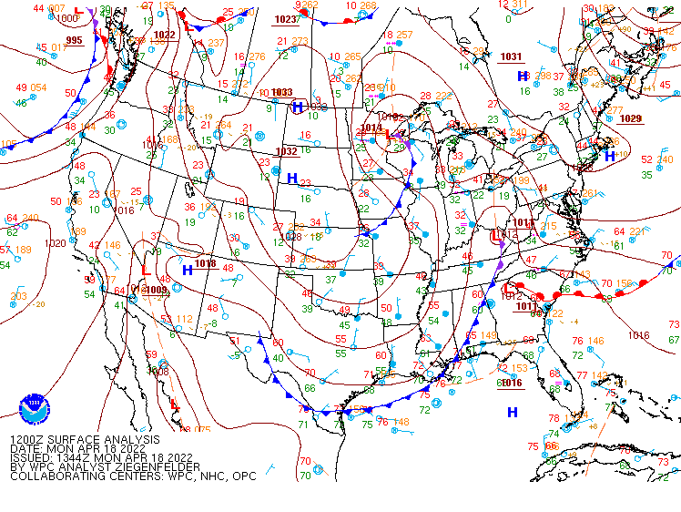
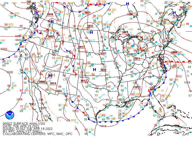
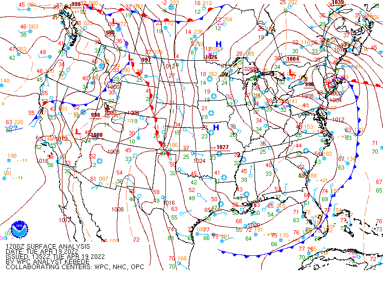
Surface Analysis
 |
 |
 |
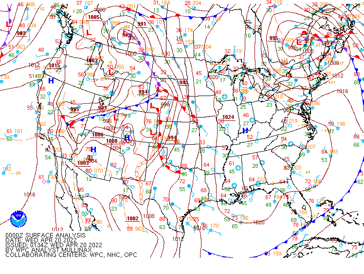 |
| Valid 12z April 18, 2022 | Valid 00z April 19, 2022 | Valid 12z April 19, 2022 | Valid 00z April 20, 2022 |
Additional Environmental Data
 |
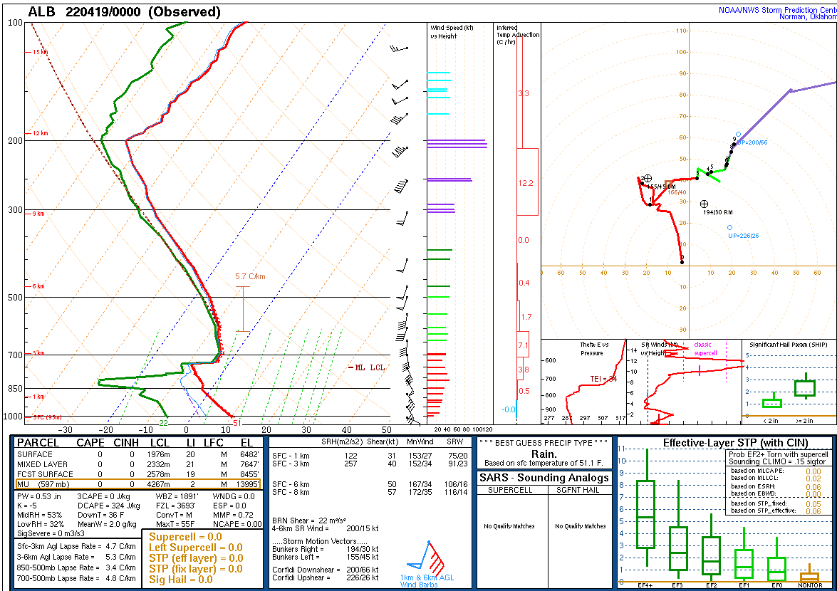 |
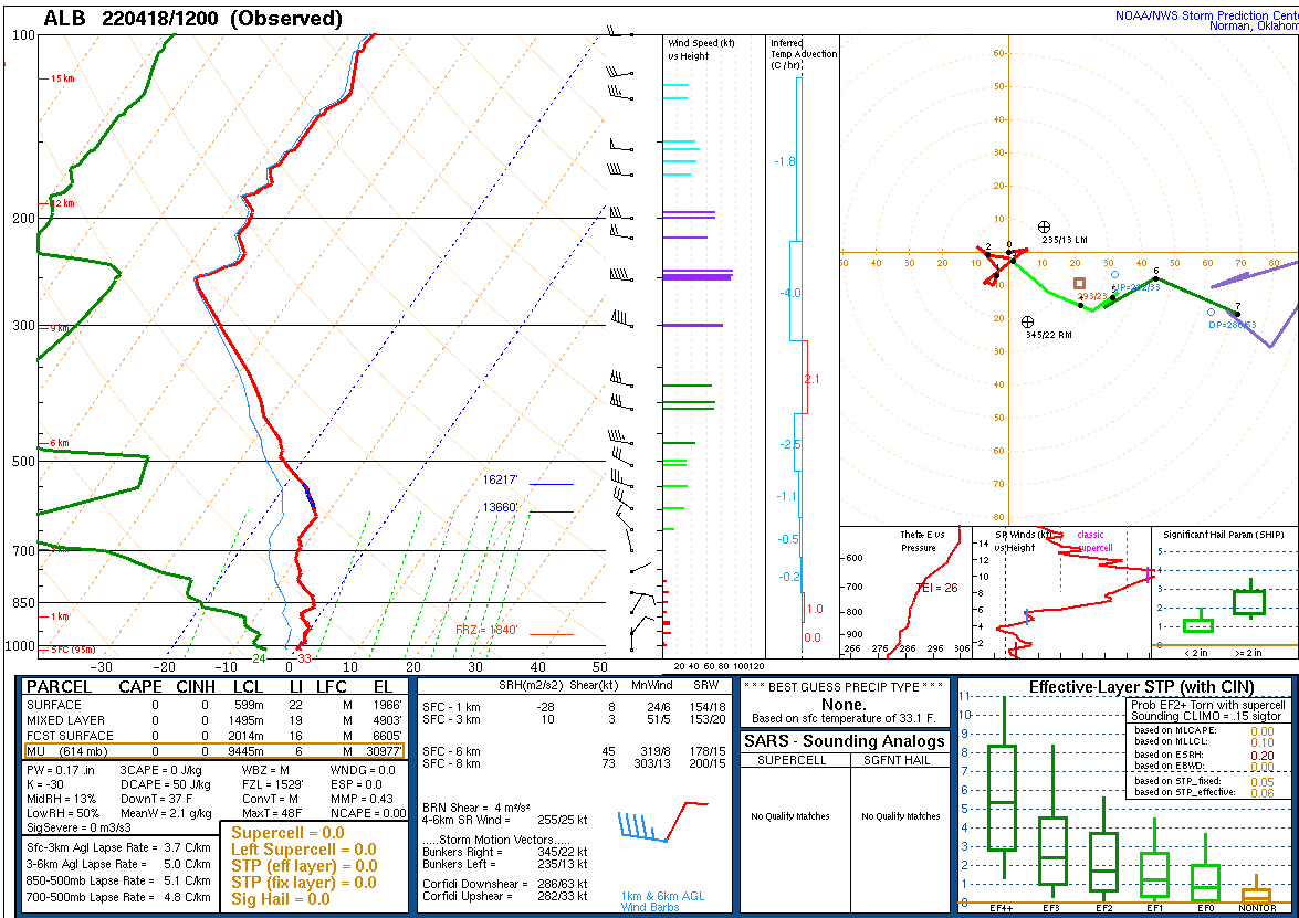
| 12z April 18 KALY Upper Air Sounding | 00z April 19 KALY Upper Air Sounding |
 |
Media use of NWS Web News Stories is encouraged! Please acknowledge the NWS as the source of any news information accessed from this site. |
|

