|
|
 |
 |
 |
| Current Watches | Severe Weather Discussion | Today's Storm Reports | Thunderstorm Outlook |

|
 |
 |
 |
| SPC - Risk Categories | Surface Analysis | Upper Air Soundings | Mesoscale Analysis |
| Day 1 Discussion | |||
|
|
 |
 |
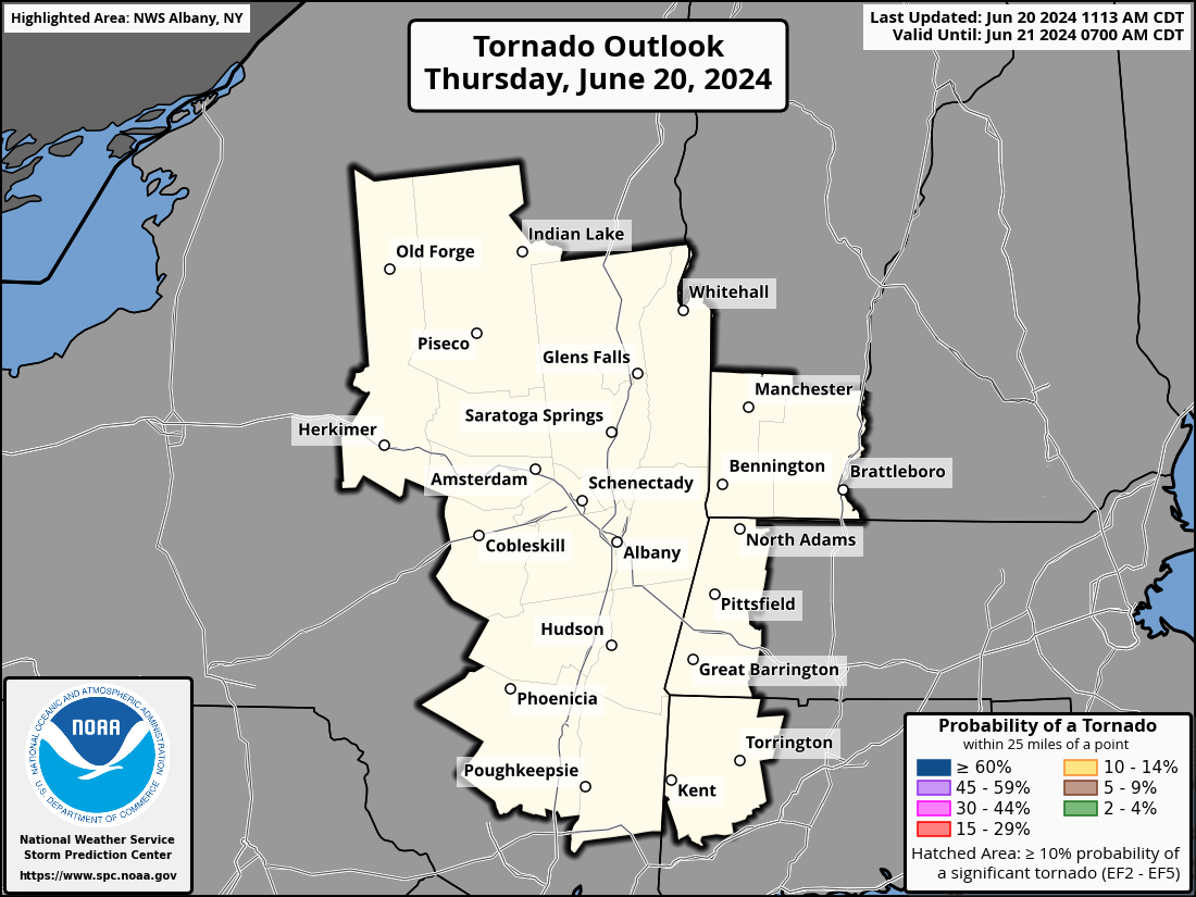 |
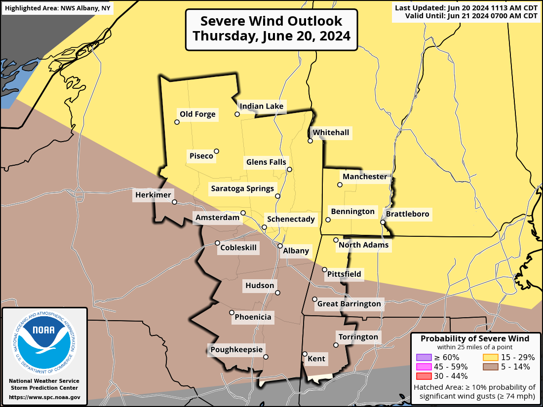
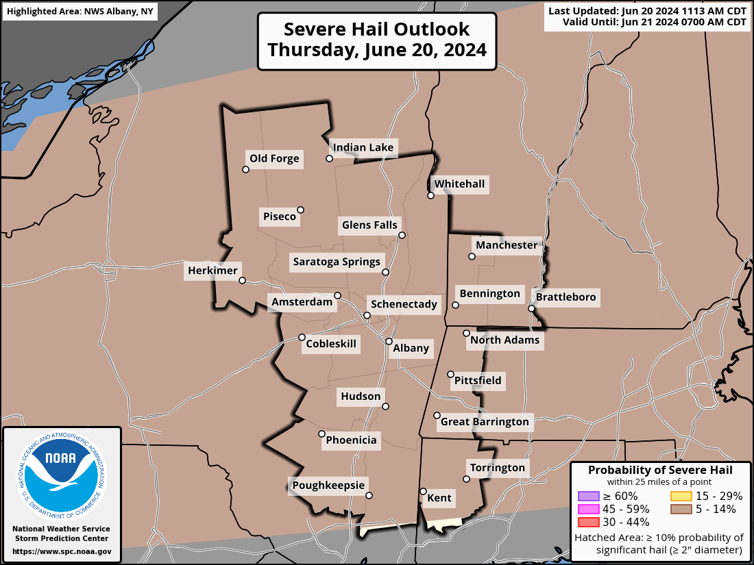
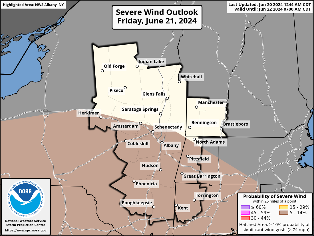
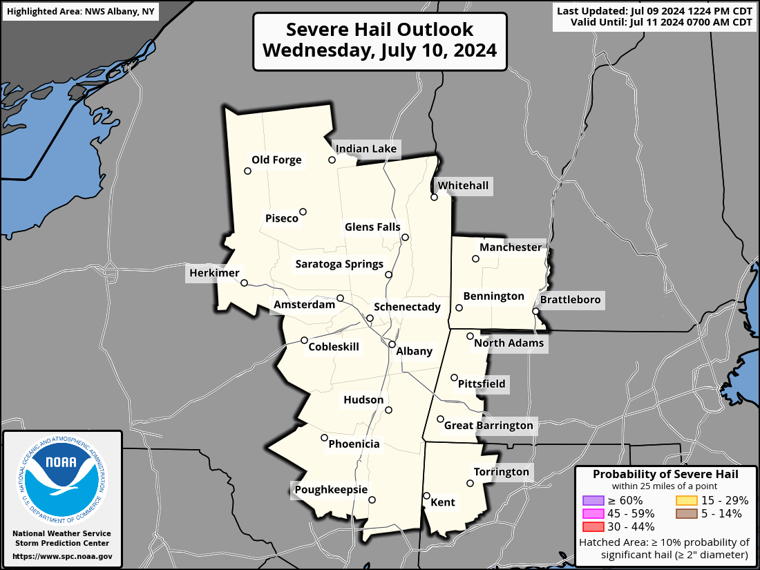
| Day 1 Severe Weather Outlook | Day 1 Wind Threat Outlook | Day 1 Hail Threat Outlook | Day 1 Tornado Threat Outlook |
| Day 2 Discussion | |||
|
|
 |
 |
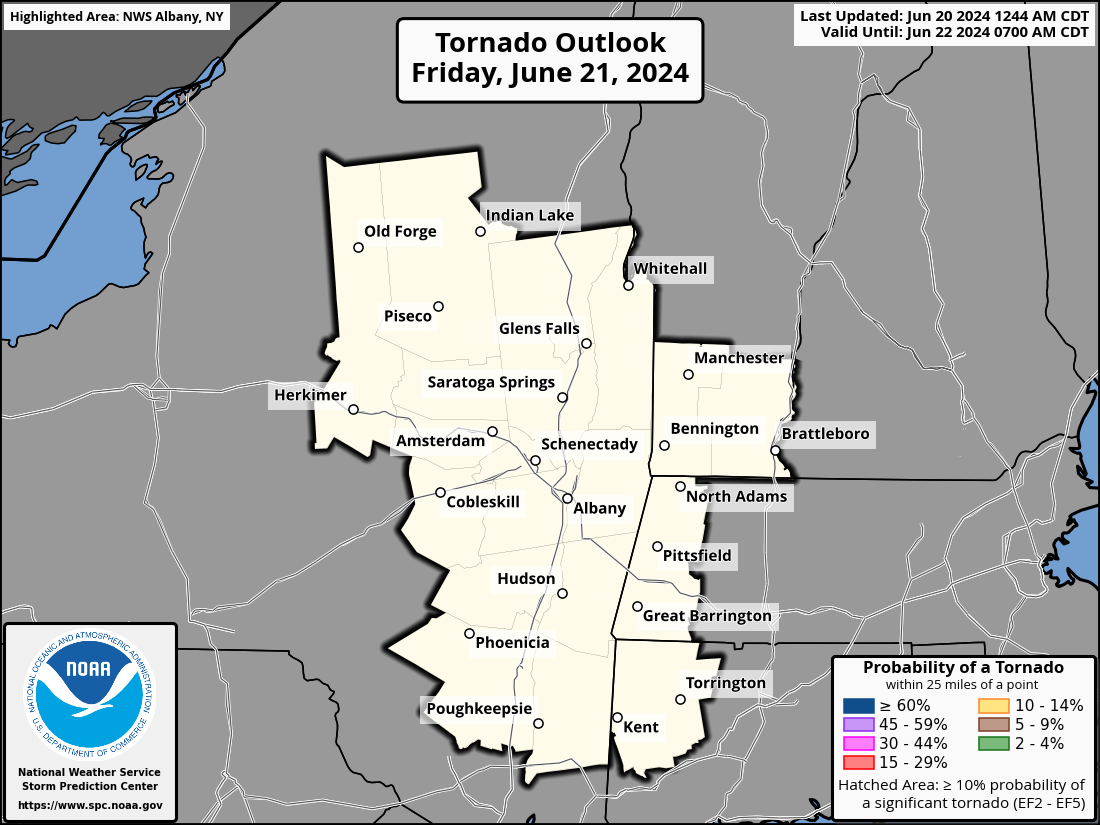 |
| Day 2 Severe Weather Outlook | Day 2 Wind Threat Outlook | Day 2 Hail Threat Outlook | Day 2 Tornado Threat Outlook |
| Day 3 Discussion | |||
|
|
 |
||
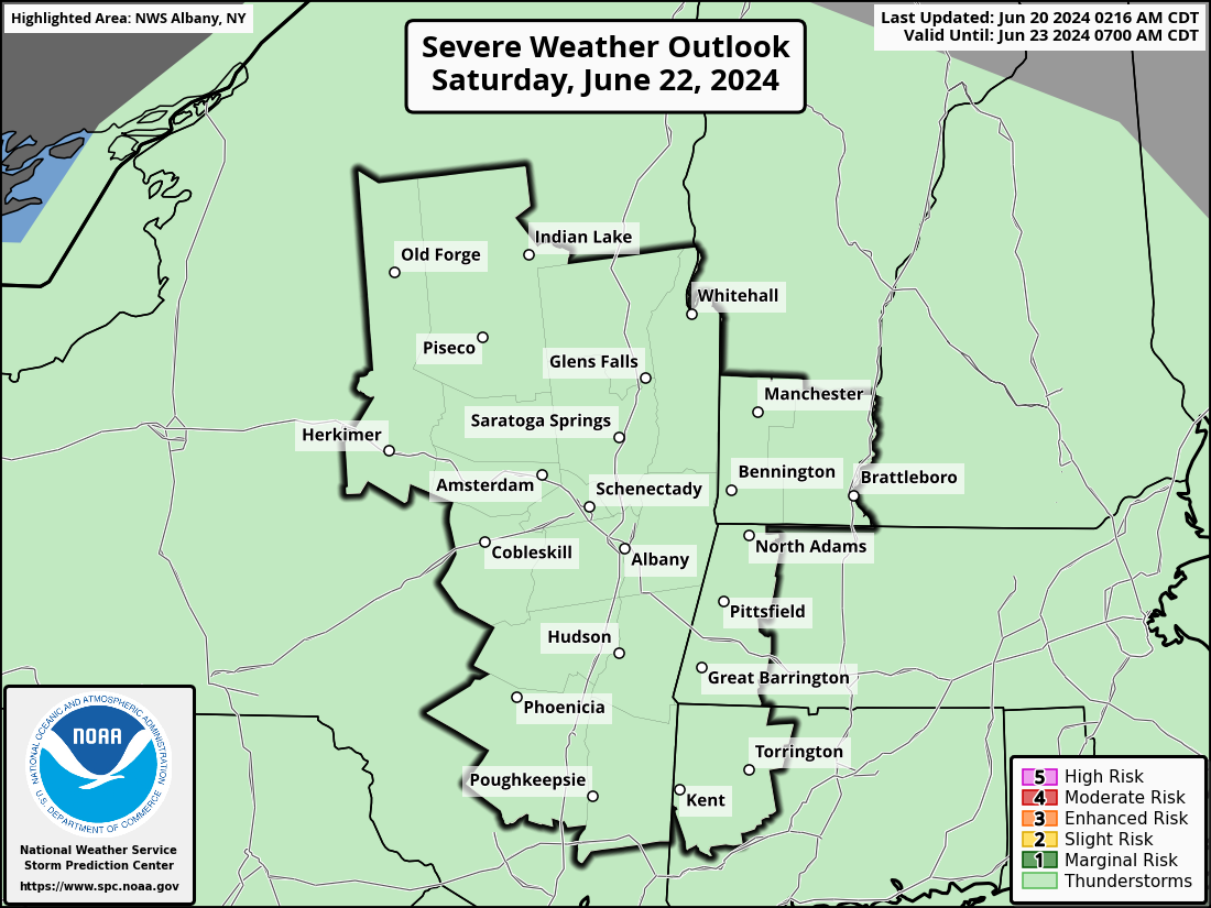
| Day 3 Severe Weather Outlook | Day 3 Probabilistic Outlook |
| Day 4-8 Discussion | ||||
 |
 |
 |
 |
 |
| Day 4 Severe Outlook | Day 5 Severe Outlook | Day 6 Severe Outlook | Day 7 Severe Outlook | Day 8 Severe Outlook |


