Overview
A winter storm began on Thursday, February 3 and continued into Friday, February 4. Precipitation began as rain for most areas on February 3 with the exception of the Adirondacks which began as a mix of rain and snow. Colder air gradually pushed southward into the overnight and early morning hours of February 4 resulting in a changeover to a wintry mix of sleet, freezing rain and snow. Most locations picked up 1 to 2 inches of liquid equivalent precipitation from this event with the majority of it falling as one or multiple types of frozen precipitation. Precipitation ended during the afternoon hours on February 4.
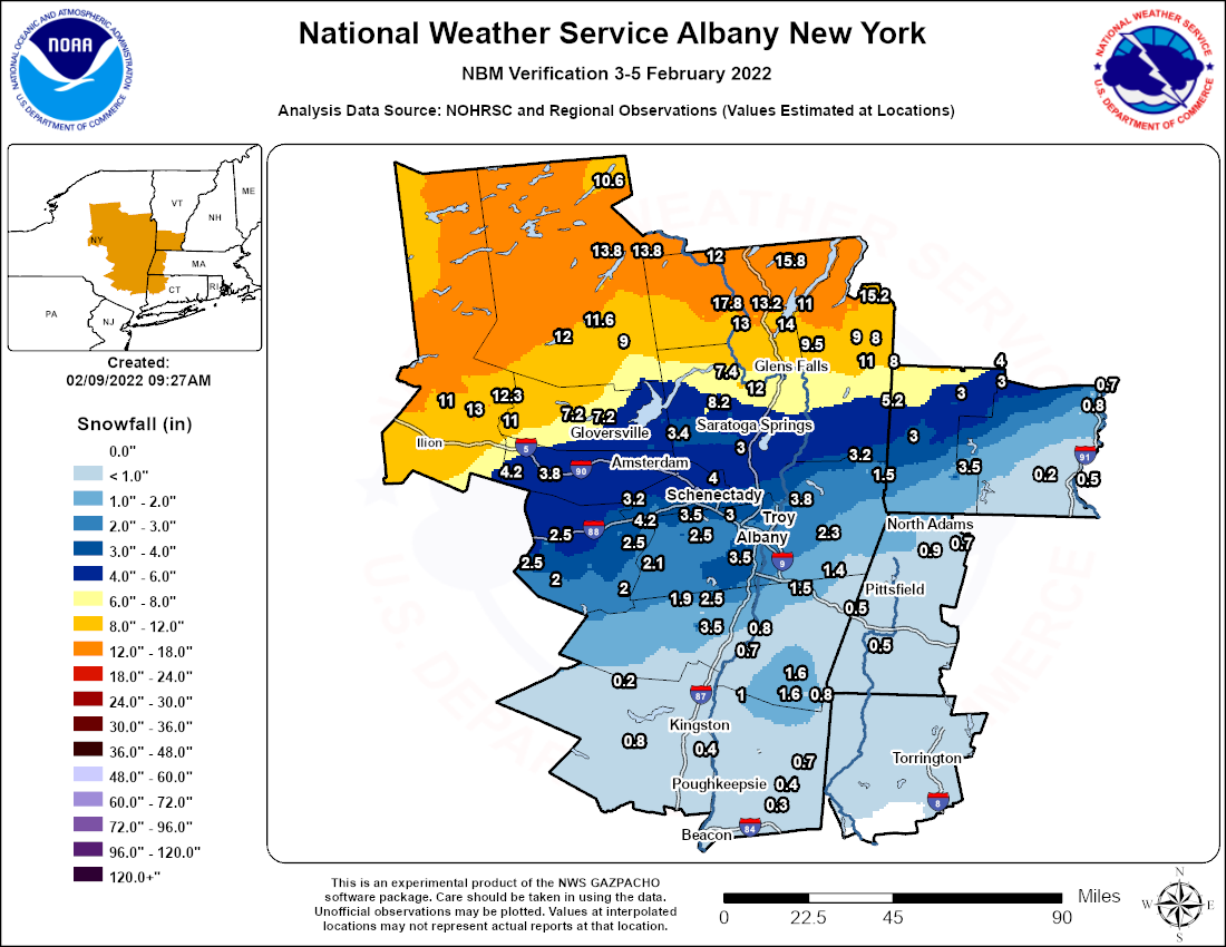
In New York, portions of the western Mohawk Valley and Adirondacks into portions of far northern Washington County saw mostly heavy snow from this event with accumulations ranging from 9 to 18 inches. The remainder of the Mohawk Valley into the Lake George Saratoga Region had mostly a combination of snow and sleet. Storm total snow and sleet amounts in this zone were in the 4 to 9 inch range. The Schoharie Valley into the Capital District and northern Taconics had an initial period of freezing rain before transitioning to a prolonged period of sleet, then ended as a period of light snow. Flat ice accumulations of 0.10 to 0.25 inches were observed followed by 1 to 2 inches of sleet and then 1 to 2 inches of snow. Much of the eastern Catskills, mid-Hudson Valley and central and southern Taconics remained rain for a longer period of time but gradually changed over to a prolonged period of freezing rain before ending as light snow and sleet. Flat ice amounts between 0.25 to 0.75 inches were common across the region with snow and sleet amounts of 2 inches or less.
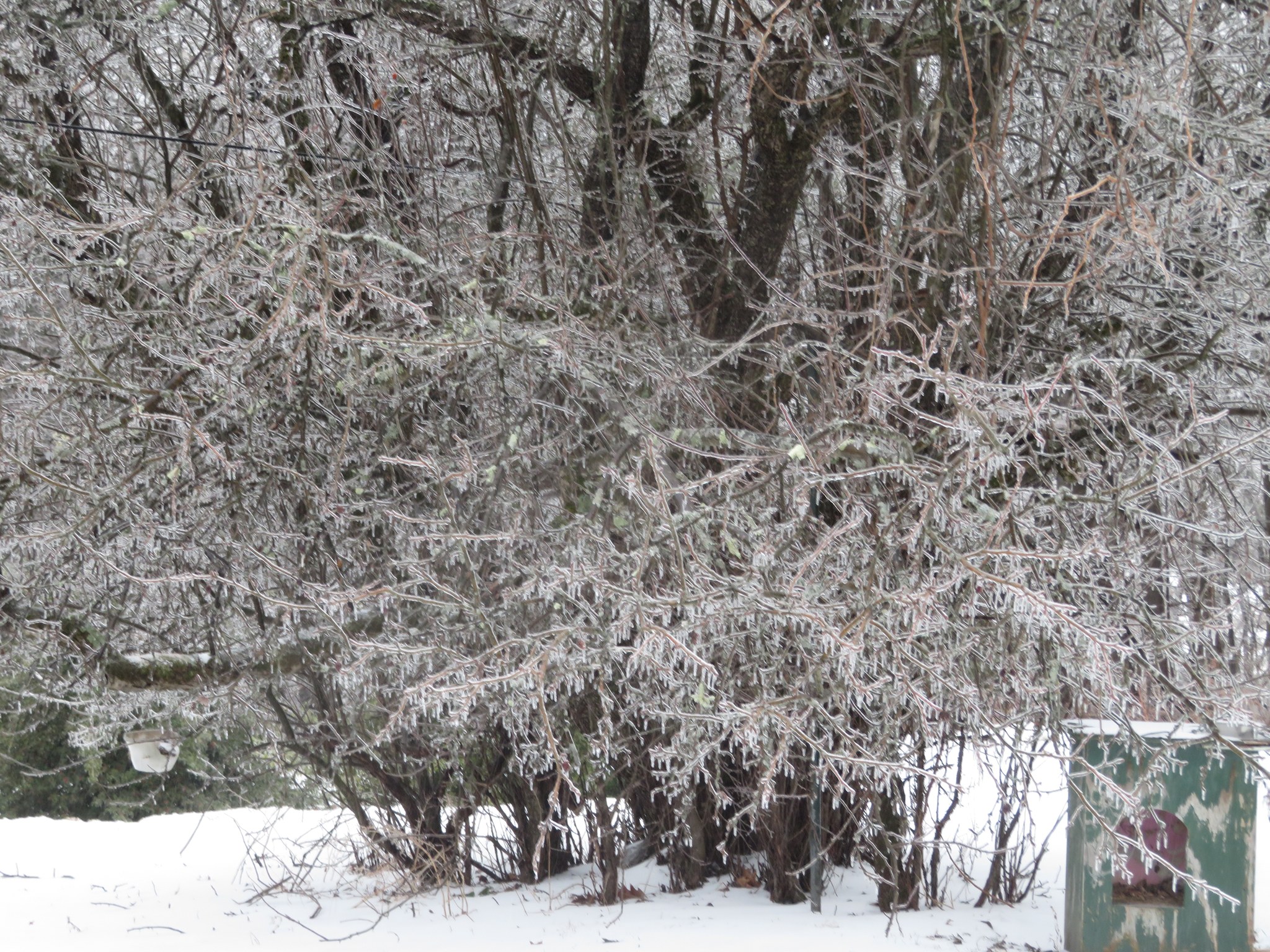
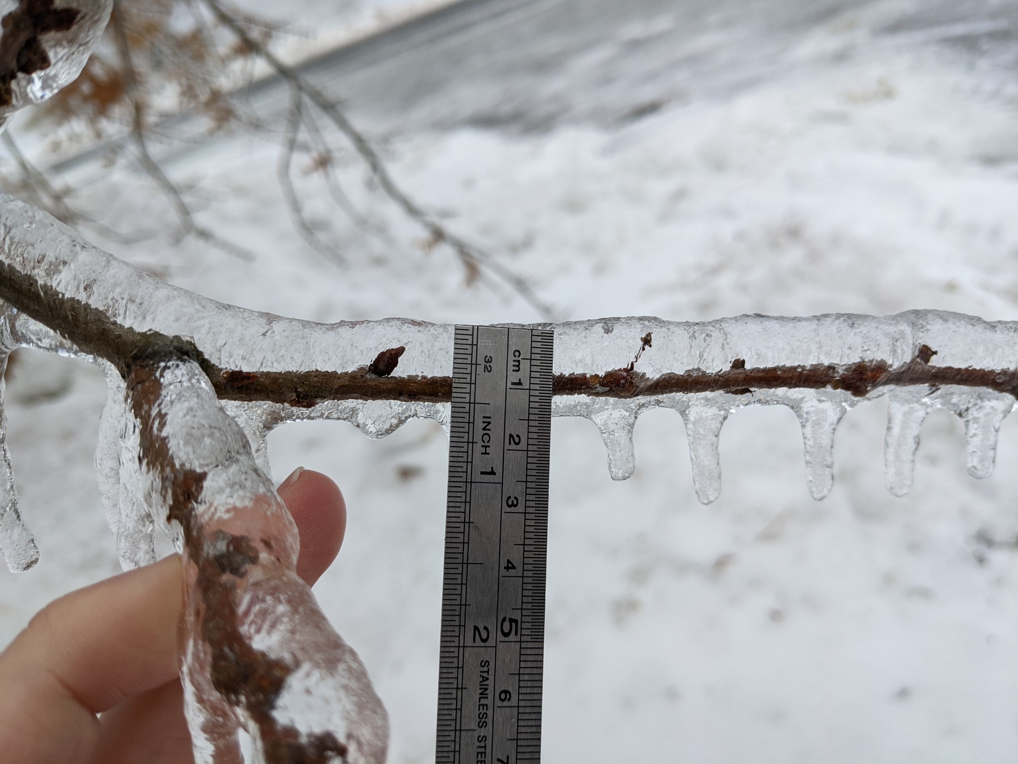
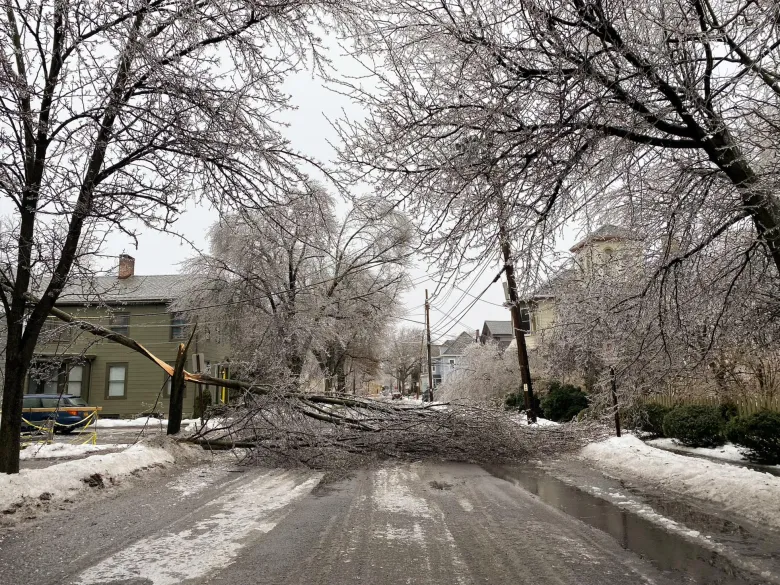
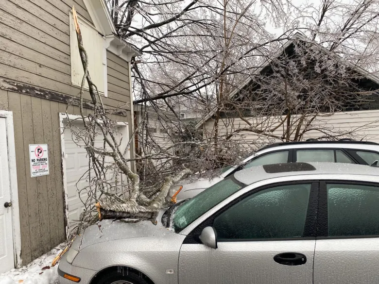
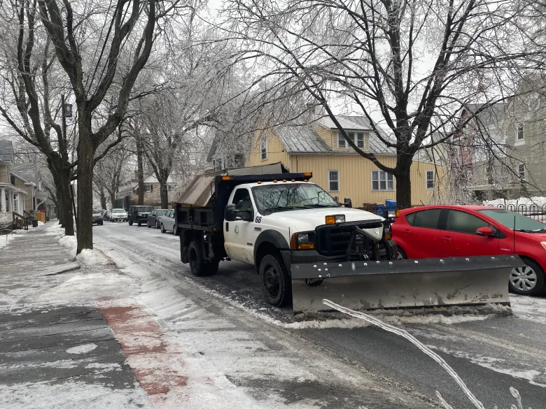
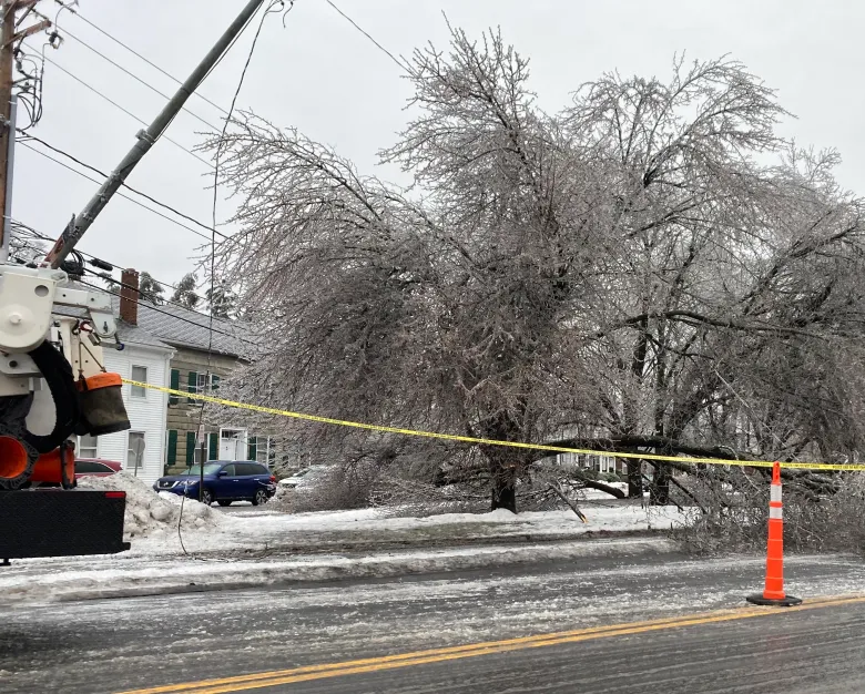
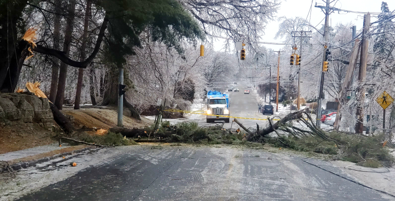
Eastern Ulster County was the hardest hit with widespread damage due to ice accretion including downed trees and power lines and widespread power outages, some of which lasted for days after the event. Utility companies noted that more than 50,000 customers lost power from the storm across the Hudson Valley, most of them in eastern Ulster County. At least 44 utility poles broke and more than 900 power lines came down as a result of the snow and ice with more than 500 individual damage locations. Several hundred electric line and tree cleaning professionals were called in to help clear roads from debris and restore power, some coming in from Indiana and Pennsylvania. Ulster County executive Pat Ryan declared a weather-related state of emergency for the area. The widespread power outages prompted the opening of warming centers and the distribution of dry ice. Members of the National Guard came in to assist in recovery operations. Cleanup efforts in Kingston cost the city approximately $100,000 according to lawmakers.
In southern Vermont, flat ice accumulations ranged from 0.10 to nearly 0.50 inches across both Bennington and Windham counties. Bennington County received a greater amount of snow and sleet (3 to 5 inches) compared to Windham County (2 inches or less). This event left thousands of residents without power in both Bennington and Windham counties due to downed trees and power lines.
In western Massachusetts, freezing rain was the more dominant frozen precipitation type with flat ice accumulations of 0.10 to 0.40 inches common. Storm total snow and sleet amounts of a coating to an inch were observed.
In northwestern Connecticut, flat ice accumulations of 0.10 to 0.20 inches were observed with up to a coating of snow and sleet.
A case study recapping this event can be viewed by clicking on the Environment tab or by clicking here.
Snow/Ice
 |
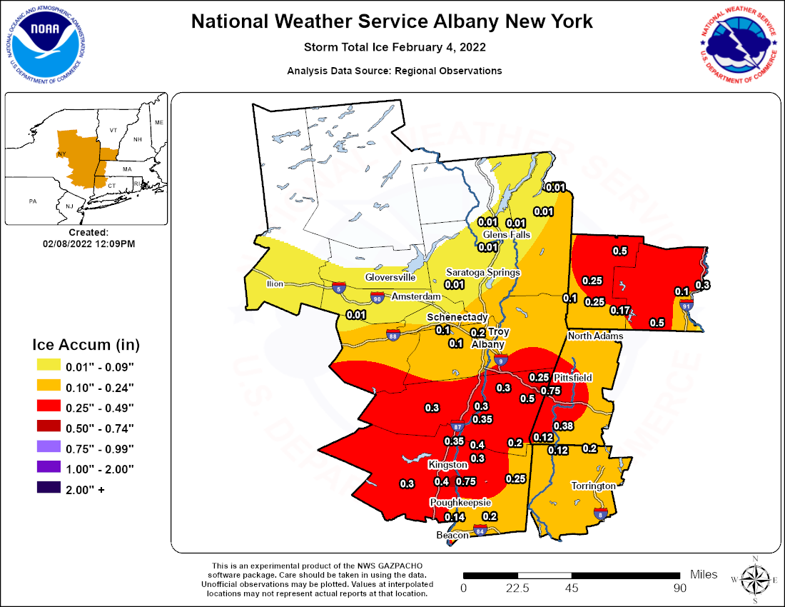 |
| ALY CWA Storm Total Snow/Sleet | ALY CWA Storm Total Ice |
Public Information Statement
Spotter Reports
National Weather Service Albany NY
955 AM EST Sat Feb 05 2022

Amounts include snow and sleet combined. The following are unofficial
observations taken during the past 30 hours for the storm that has
been affecting our region. Appreciation is extended to highway
departments, cooperative observers, Skywarn spotters and media for
these reports. This summary also is available on our home page at
weather.gov/albany

********************STORM TOTAL SNOWFALL********************

LOCATION                TOTAL      TIME/DATE  COMMENTS
                     SNOWFALL       MEASURED
                     (inches)

CONNECTICUT

...Litchfield County...
  2 NNE Litchfield        0.2   700 AM  2/05  CoCoRaHS

MASSACHUSETTS

...Berkshire County...
  1 NNW Cheshire          0.9   700 AM  2/05  CoCoRaHS
  Savoy                   0.7  1105 PM  2/04  WeatherNet6
  N Great Barrington      0.5  1159 PM  2/04  CoCoRaHS
  North Adams             0.4  1130 AM  2/04  Amateur Radio
  Williamstown            0.2   600 AM  2/04  Sleet accumulation

NEW YORK

...Albany County...
  1 WNW Delmar            4.8   550 PM  2/04  Trained Spotter
  Knox                    4.2   904 PM  2/04  WeatherNet6
  Delmar                  3.5   648 PM  2/04  WeatherNet6
  4 NW Altamont           3.5   700 AM  2/05  CoCoRaHS
  Albany Intl AP          3.3   531 AM  2/05  ASOS
  Albany                  3.0   543 AM  2/05  NWS Albany Office
  Colonie                 3.0  1018 PM  2/04  WeatherNet6
  1 SW Albany             2.6   700 AM  2/05  CoCoRaHS
  3 SSW Altamont          2.5   655 AM  2/05  CoCoRaHS
  2 W Albany              2.5   740 PM  2/04  Retired NWS Emp.
  Guilderland             2.2   530 PM  2/04  Snow and sleet
  NWS Albany              1.5   700 AM  2/05  CoCoRaHS

...Columbia County...
  N Ancramdale            1.6   700 AM  2/05  CoCoRaHS
  Taghkanic               1.6   739 AM  2/05  WeatherNet6
  3 N Valatie             1.5   700 AM  2/05  CoCoRaHS
  Ancramdale              0.8   548 PM  2/04  WeatherNet6
  Canaan                  0.5  1130 AM  2/04  Amateur Radio

...Dutchess County...
  1 NNE Red Hook          1.0   700 AM  2/05  CoCoRaHS
  3 SE Millbrook          0.7   700 AM  2/05  CoCoRaHS
  Poughkeepsie            0.6   515 PM  2/04  Sleet and a little snow
  3 NE Lagrangeville      0.4   700 AM  2/05  CoCoRaHS
  3 NE Hopewell Juncti    0.3   600 AM  2/05  CoCoRaHS
  2 S Pleasant Valley     0.3  1200 AM  2/05  CoCoRaHS

...Fulton County...
  7 NW GLOVERSVILLE       7.2   700 AM  2/05  Co-Op Observer
  Gloversville 7nw        7.2   700 AM  2/05  Co-Op Observer
  Perth                   3.0  1052 AM  2/04  WeatherNet6

...Greene County...
  Cairo                   3.5   538 PM  2/04  WeatherNet6
  1 E Greenville          2.5   700 AM  2/05  CoCoRaHS
  Greenville Center       1.9  1159 AM  2/04  WeatherNet6
  WNW Athens              0.8   700 AM  2/05  CoCoRaHS
  Catskill                0.7   505 PM  2/04  WeatherNet6
  3 E Freehold            0.6   530 AM  2/05  CoCoRaHS

...Hamilton County...
  2 SW Indian Lake       13.8   707 AM  2/05  Co-Op Observer
  Indian Lake            13.8   707 AM  2/05  Co-Op Observer
  Piseco                 12.0   504 PM  2/04  WeatherNet6
  2 WSW Lake Pleasant    11.6   655 AM  2/05  CoCoRaHS
  1 N Long Lake          10.6   700 AM  2/05  CoCoRaHS
  Wells                   9.0   540 PM  2/04  WeatherNet6

...Herkimer County...
  2 SSW Salisbury        13.0   324 PM  2/04  Trained Spotter
  Ilion                  13.0   840 AM  2/04  Social Media
  2 NW Salisbury Cente   12.3   530 AM  2/05  CoCoRaHS
  Dolgeville             11.0   630 PM  2/04  Trained Spotter
  Middleville            11.0   324 PM  2/04  Trained Spotter
  Herkimer                8.0   610 AM  2/04  Trained Spotter

...Montgomery County...
  Amsterdam               6.2   457 PM  2/04  WeatherNet6
  1 NNW Amsterdam         5.6   857 AM  2/05  CoCoRaHS
  Fonda                   5.0   705 AM  2/05  WeatherNet6
  2 WSW Hessville         4.2   800 AM  2/05  CoCoRaHS
  SE Fort Plain           3.8   700 AM  2/05  CoCoRaHS

...Rensselaer County...
  2 NNE Troy              3.8   700 AM  2/05  CoCoRaHS
  Buskirk                 3.2   730 AM  2/05  Co-Op Observer
  Troy                    2.4   700 AM  2/05  Co-Op Observer
  Averill Park            2.3   700 PM  2/04  Sleet and snow.
  Center Brunswick        2.2  1048 PM  2/04  WeatherNet6
  Hoosick Falls           1.5   525 PM  2/04  WeatherNet6
  4 ESE Nassau            1.4   732 AM  2/05  CoCoRaHS

...Saratoga County...
  Corinth                12.0   517 PM  2/04  WeatherNet6
  Lake Desolation         8.2  1047 PM  2/04  WeatherNet6
  South Glens Falls       8.0  1018 AM  2/04  Social Media
  1 S Saratoga Springs    6.0   600 AM  2/05  CoCoRaHS
  3 S Clifton Park        4.0   600 AM  2/05  CoCoRaHS
  4 WNW Rock City Fall    3.8   715 AM  2/05  CoCoRaHS
  2 W Greenfield Cente    3.5   800 AM  2/05  CoCoRaHS
  Clifton Park            3.5  1111 PM  2/04  WeatherNet6
  Galway                  3.4   955 PM  2/04  WeatherNet6
  Ballston Spa            3.0   548 PM  2/04  WeatherNet6

...Schenectady County...
  Schenectady             4.4   414 PM  2/04  WeatherNet6
  1 SSW Aqueduct          4.3   800 PM  2/04  NWS Employee
  Glenville               4.0   454 PM  2/04  WeatherNet6
  1 NNE Hawthorne Hill    3.7   630 PM  2/04  Snow/sleet
  Schenectady-GE Plot     3.3   400 PM  2/04  NWS Employee
  Delanson                3.2   731 AM  2/05  WeatherNet6
  Duanesburg              3.0   552 PM  2/04  WeatherNet6
  S Niskayuna             3.0   700 AM  2/05  CoCoRaHS
  Delanson 2ne            2.0   700 AM  2/05  Co-Op Observer

...Schoharie County...
  Schoharie               2.5   830 AM  2/04  Co-Op Observer
  Charlotteville          2.5   536 PM  2/04  WeatherNet6
  Richmondville           2.5   445 PM  2/04  WeatherNet6
  Middleburgh             2.1   527 AM  2/04  WeatherNet6
  Gilboa                  2.0   559 PM  2/04  WeatherNet6
  Jefferson               2.0  1200 PM  2/04  WeatherNet6

...Ulster County...
  4 N Kerhonkson          0.8   700 AM  2/05  CoCoRaHS
  Ulster Park             0.4  1010 AM  2/04  WeatherNet6
  Phoenicia               0.2   700 AM  2/05  Co-Op Observer

...Warren County...
  Johnsburg              17.8  1236 AM  2/05  Storm Total.
  2 ENE Brant Lake       15.8   700 AM  2/05  CoCoRaHS
  1 N Lake George        14.0   600 AM  2/05  CoCoRaHS
  2 WNW Warrensburg      13.2   800 AM  2/05  CoCoRaHS
  Warrensburg            13.0   458 PM  2/04  WeatherNet6
  5 SE North Creek       12.0   700 AM  2/05  Co-Op Observer
  5 ESE Lake George       9.5   700 AM  2/05  CoCoRaHS
  Queensbury              8.0   618 PM  2/04  WeatherNet6
  Lake Luzerne            7.4   600 AM  2/05  Co-Op Observer
  3 S Lake Luzerne        7.4   600 AM  2/05  Co-Op Observer

...Washington County...
  Whitehall              15.2   605 PM  2/04  WeatherNet6
  Pilot Knob             11.0   400 PM  2/04  Trained Spotter
  Hebron                 11.0   654 AM  2/05  WeatherNet6
  Hartford                9.0   645 PM  2/04  Trained Spotter
  6 WSW Pawlet            8.0   800 AM  2/05  CoCoRaHS
  Granville               8.0   533 PM  2/04  WeatherNet6
  2 SSE Salem             5.2   630 AM  2/05  CoCoRaHS

VERMONT

...Bennington County...
  Landgrove               4.0   655 AM  2/05  WeatherNet6
  Woodford                3.5   813 AM  2/05  WeatherNet6
  3 ENE Manchester        3.0   700 AM  2/05  CoCoRaHS
  WNW Shaftsbury          3.0   812 PM  2/04  CoCoRaHS
  1 NNE Landgrove         3.0   700 AM  2/05  CoCoRaHS

...Windham County...
  6 NW Westminster        0.8   700 AM  2/04  CoCoRaHS
  1 NNE Rockingham        0.7   700 AM  2/04  CoCoRaHS
  1 S Brattleboro         0.5   700 AM  2/05  CoCoRaHS
  6 W West Brattleboro    0.2   800 AM  2/04  Co-Op Observer
**********************STORM TOTAL ICE***********************

LOCATION                TOTAL      TIME/DATE  COMMENTS
                          ICE       MEASURED
                     (inches)

CONNECTICUT

...Litchfield County...
  Norfolk                0.20   540 PM  2/04  Flat ice accretion

MASSACHUSETTS

...Berkshire County...
  2 NW Sheffield         0.38   700 AM  2/05  Flat ice
  Pittsfield Municipal   0.31   249 PM  2/04  ASOS
  Harriman-and-west-Ai   0.18   251 PM  2/04  ASOS
  Sheffield              0.12   700 AM  2/04  CoCoRaHS
  Ashley Falls           0.12   200 PM  2/04  Trained Spotter

NEW YORK

...Albany County...
  Albany Intl AP         0.18   248 PM  2/04  ASOS
  2 W Albany             0.15   740 PM  2/04  Retired NWS Emp.
  Guilderland            0.10   830 AM  2/04  Meteorologist
  4 NW Altamont          0.10   800 AM  2/04  NWS Employee

...Columbia County...
  2 S Canaan             0.75   954 AM  2/04  Trained Spotter
  3 N Austerlitz         0.50   900 AM  2/04  Meteorologist
  1 SW Chatham           0.30   718 AM  2/04  Public
  Canaan                 0.25  1139 AM  2/04  Amateur Radio
  3 SE Ancram            0.20   751 AM  2/04  CoCoRaHS

...Dutchess County...
  1 NNE Red Hook         0.40   700 AM  2/05  Storm total flat ice
  Red Hook               0.30   730 AM  2/04  CoCoRaHS
  Hopewell Junction      0.20   630 PM  2/04  Trained Spotter
  Hudson Valley Region   0.14   250 PM  2/04  ASOS
  Poughkeepsie           0.10   515 PM  2/04  Trained Spotter

...Greene County...
  Catskill               0.35   330 PM  2/04  Trained Spotter
  1 ENE Jefferson Heig   0.30   800 AM  2/04  Trained Spotter
  East Jewett            0.30   700 AM  2/04  Trained Spotter

...Ulster County...
  Esopus                 0.75  1148 AM  2/04  Trained Spotter
  Ulster Park            0.40  1000 AM  2/04  Flat ice accumulation
  Kerhonkson             0.30   830 AM  2/04  CoCoRaHS
  Highland               0.25   726 AM  2/04  CoCoRaHS

VERMONT

...Bennington County...
  3 ENE Manchester       0.50   700 AM  2/05  Storm total flat ice
  Shaftsbury             0.25   700 AM  2/05  Storm total flat ice
  Bennington             0.25  1131 AM  2/04  Amateur Radio
  5 NNE Stamford         0.17   700 AM  2/05  Storm total flat ice

...Windham County...
  3 SSW Halifax          0.50  1229 PM  2/04  Trained Spotter
  3 SSW Putney           0.10   911 AM  2/04  Trained Spotter
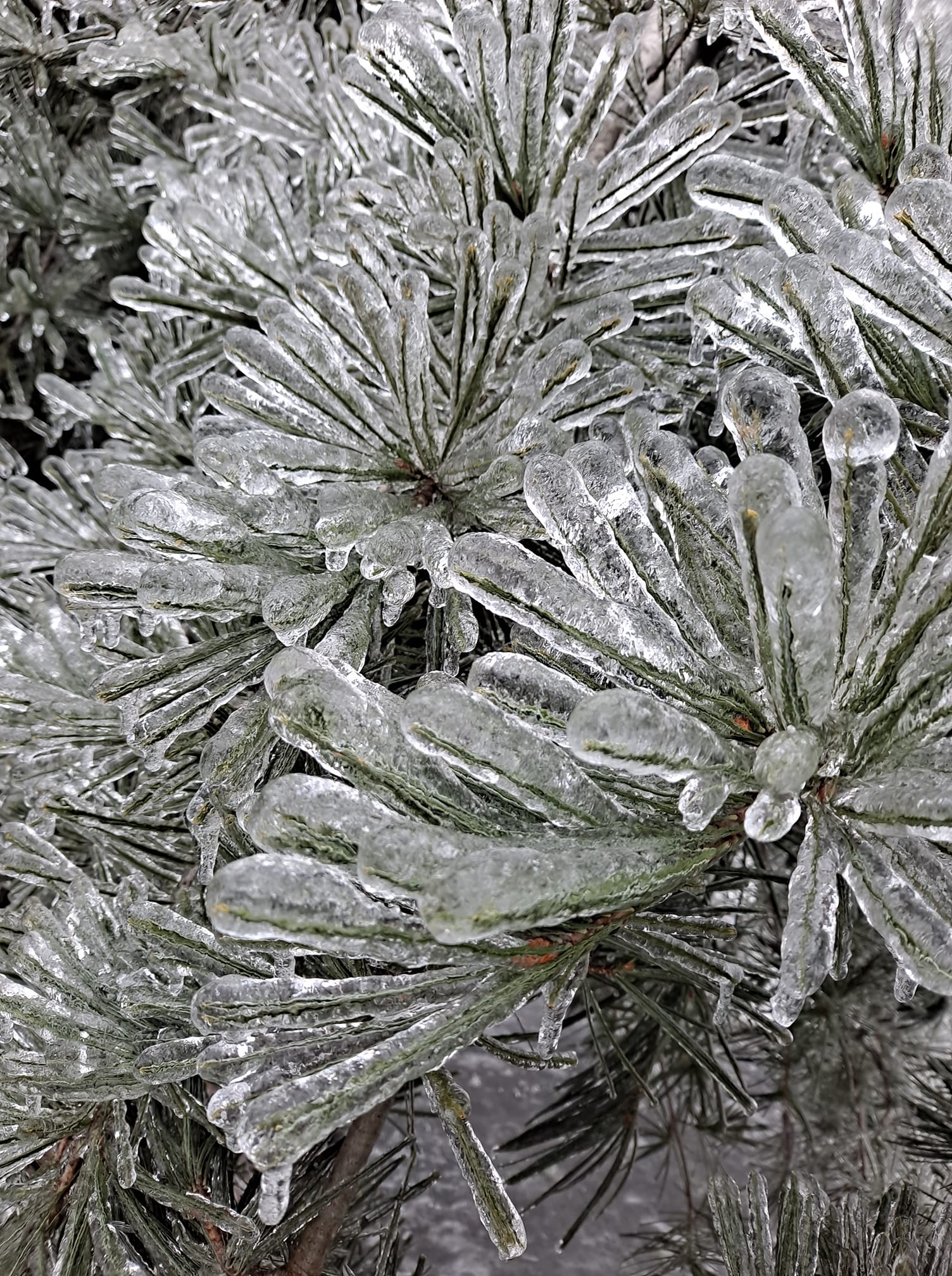
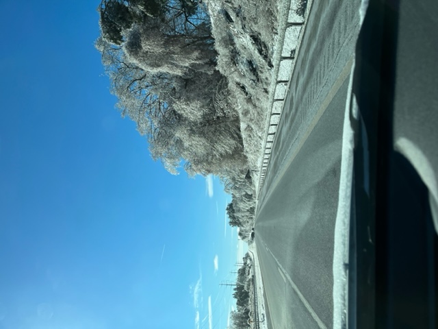
Photos & Video
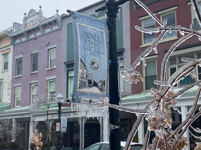
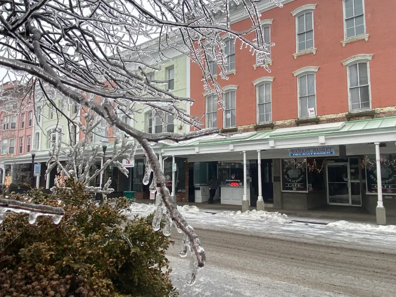
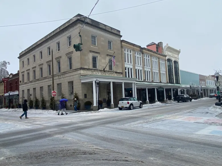
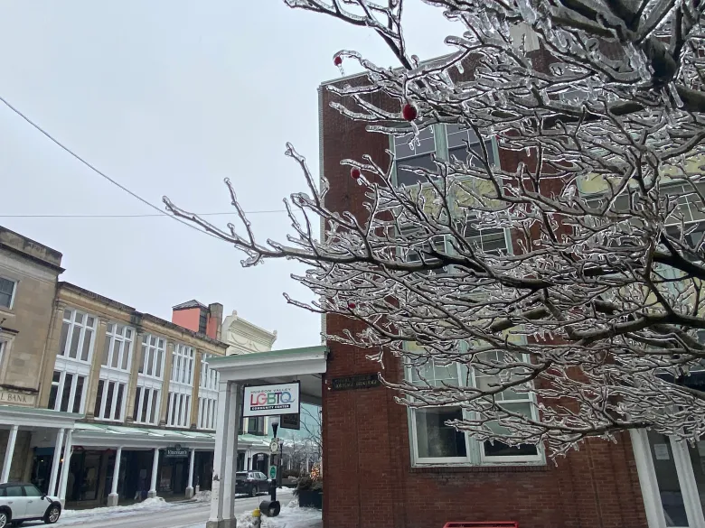
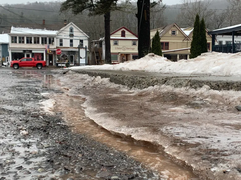
The images below were taken from various locations in eastern Ulster County.
 |
 |
 |
 |
| (Facebook/Derek Burnhans) | Esopus, NY (Dickon McPherson) |
(Facebook/Jessica Jacques) | NYS Thruway southbound (taken on Feb 6) (Brett Rathbun/NWS Meteorologist) |
 |
 |
 |
 |
| A tree on top of a vehicle on Wall Street before the intersection of Maiden Lane and St. James Street can be seen on Friday, Feb. 4, 2022. (Daily Freeman/Nahela Reina photo provided) | Maiden lane between Fair and Pine streets in Uptown Kingston on Friday, Feb. 4, 2022. (Daily Freeman/Nahela Reina photo provided) | Branches on top of cars between Green and Wall Street in Uptown Kingston on Friday, Feb. 4, 2022. (Daily Freeman/Nahela Reina photo provided) | Green Street in Kingston on Friday, Feb. 4, 2022. (Ivan Lajara/Daily Freeman) |
 |
 |
 |
 |
| Academy Green on Friday, Feb. 4, 2022. (Ivan Lajara/Daily Freeman) | Wall Street in Kingston on Friday, Feb. 4, 2022. (Ivan Lajara/Daily Freeman) | Wall Street in Kingston on Friday, Feb. 4, 2022. (Ivan Lajara/Daily Freeman) | Wall Street in Kingston on Friday, Feb. 4, 2022. (Ivan Lajara/Daily Freeman) |
 |
 |
 |
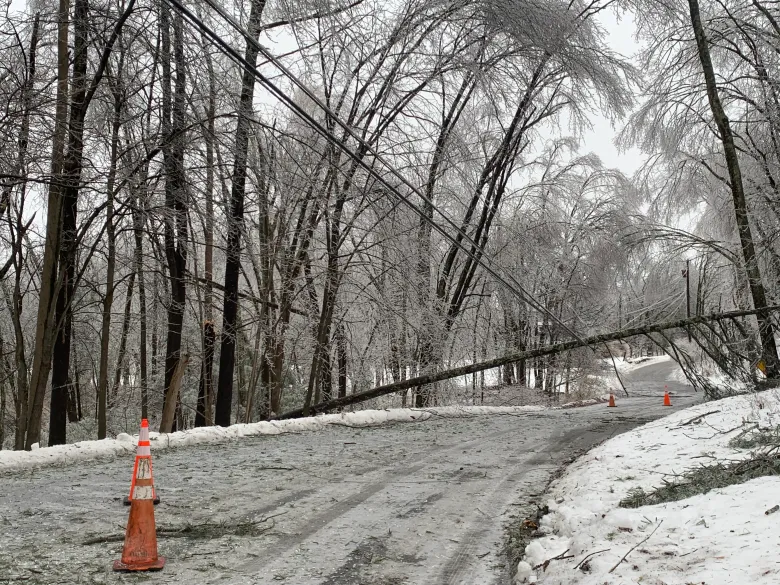 |
| Wall Street in Kingston on Friday, Feb. 4, 2022. (Ivan Lajara/Daily Freeman) | Phoenicia on Friday, Feb. 4, 2022. (ITania Barricklo/Daily Freeman) | Lucas Avenue by Forsyth Park in Kingston on Friday, Feb. 4, 2022. (Daily Freeman/William Marchetti photo) | Tree down on wires completely blocking a portion of South Road in Ruby. (Ariél Zangla/Daily Freeman) |
Radar
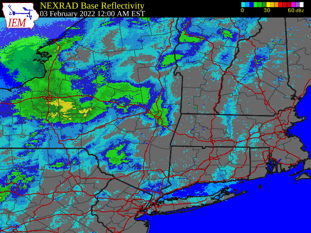 |
| Regional Radar Loop valid 12:00 am February 3 to 6:00 pm February 4, 2022 |
 |
Media use of NWS Web News Stories is encouraged! Please acknowledge the NWS as the source of any news information accessed from this site. |
|

