|
|
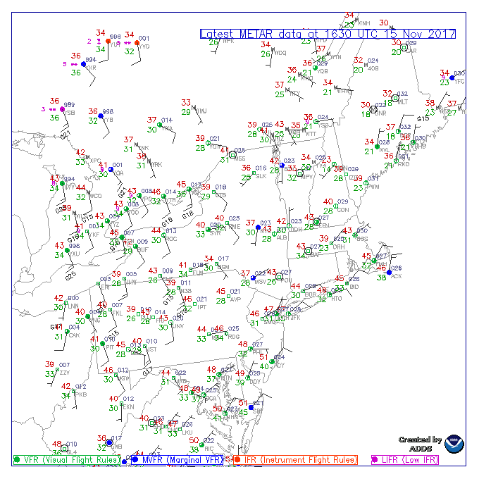
Current obs/TAFsRegional observations/TAFs color coded by flight category. |
 |
RadarWSR-88D Doppler Radar |
|
|
Point ForecastCurrent observation and 7-day forecast for a point of interest. Albany International Airport (KALB) Hudson Valley Regional Airport (KPOU) Floyd Bennett Memorial Airport (KGFL) Pittsfield Municipal Airport (KPSF) |
|
Hourly Weather GraphHourly forecast of several weather elements. User can specify which elements and time range are displayed. Albany International Airport (KALB) Hudson Valley Regional Airport (KPOU) Floyd Bennett Memorial Airport (KGFL) Pittsfield Municipal Airport (KPSF) |
|
|
Graphical ForecastForecast of all weather elements from the National Digital Forecast Database. |
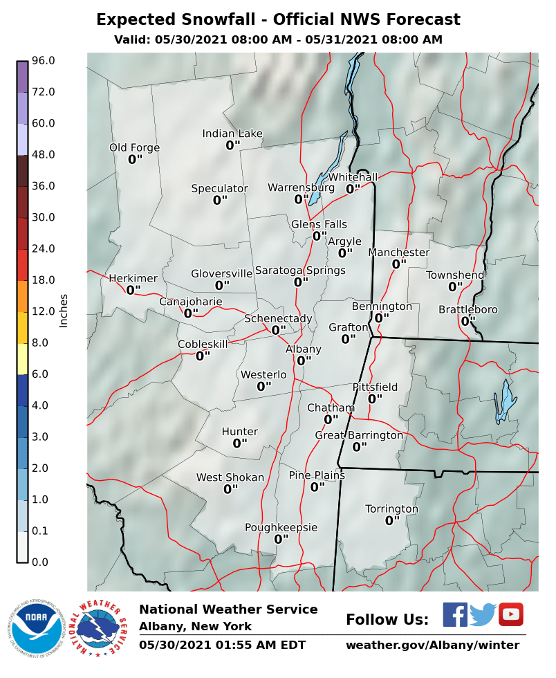 |
Probabilistic SnowfallProvides a range of snowfall possibilities, in compliment to NWS deterministic snowfall forecasts, to communicate uncertainty.
|
Albany International Airport (KALB)
Hudson Valley Regional Airport (KPOU)
Floyd Bennett Memorial Airport (KGFL)
Pittsfield Municipal Airport (KPSF)
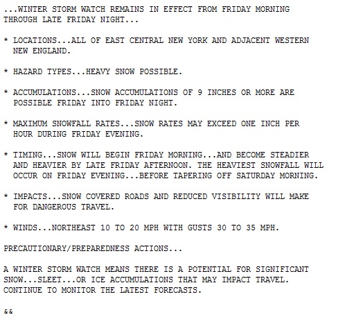 |
Winter Weather Watches/Warnings/Advisories Public Information Statement
|
|
|
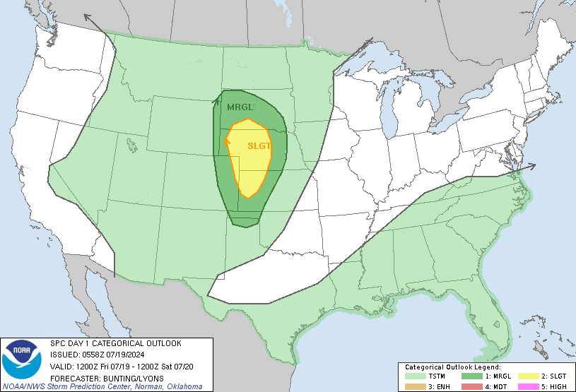
Storm Prediction CenterNational-level convective forecasts. Convective outlooks, mesoscale discussions, convective watches, local storm reports, etc. |
 |
Weather Prediction CenterNational-level weather forecasts. Surface analyses, quantitative precipitation forecasts, excessive rainfall outlooks, snow and ice forecasts, etc. |
|
|
Aviation Weather CenterNational-level aviation forecasts. METARs, TAFs, PIREPs, AIRMETs, SIGMETs, etc. |
|
Boston Center Weather Service Unit (CWSU ZBW)Regional-level aviation forecasts, briefings, and situational awareness aides. |


.PNG)