Overview
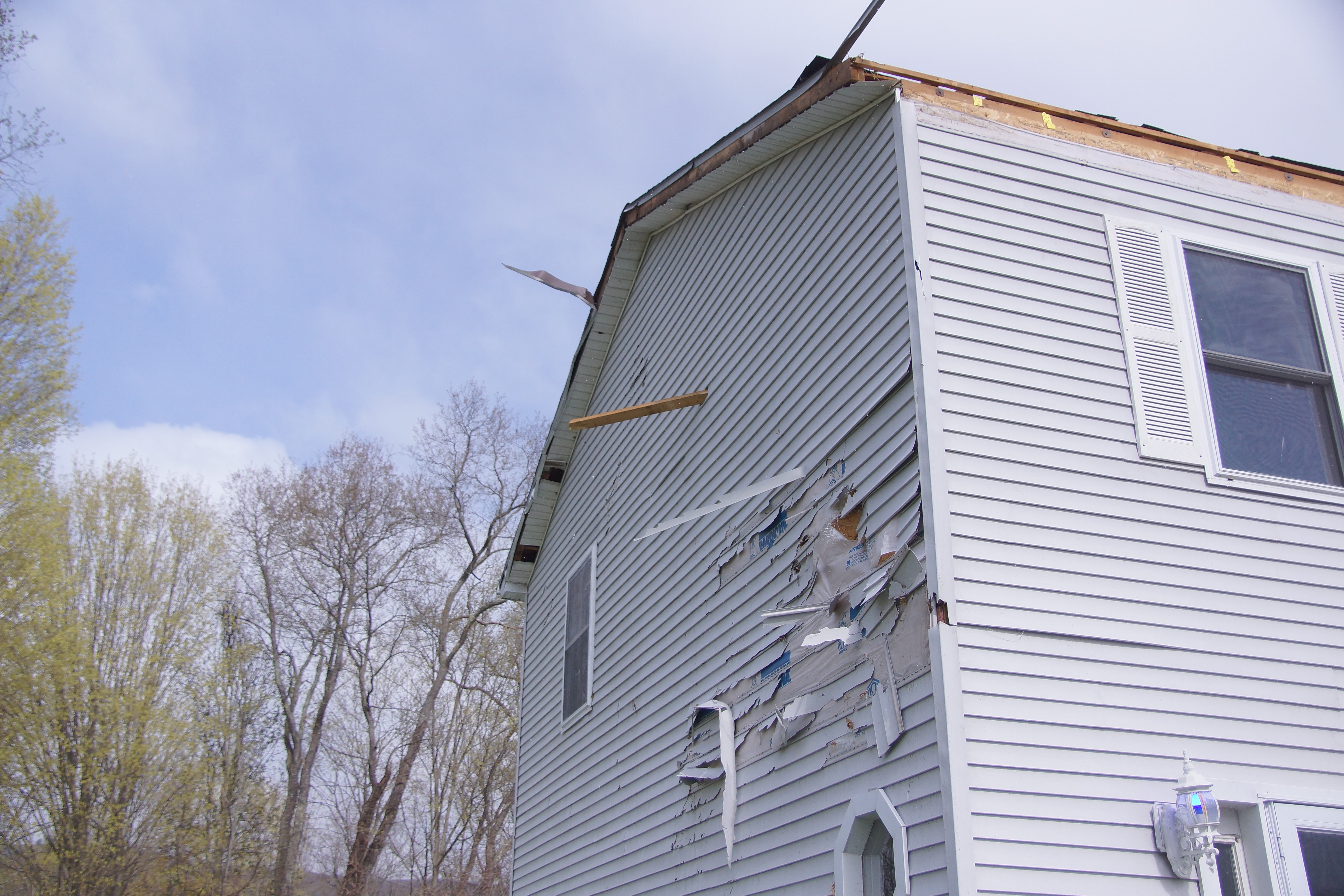
A complex spring storm system impacted eastern New York and western New England on Wednesday, April 21, 2021. While areas north and west of the Capital District and the higher terrain of the Catskills observed rain changing to snow, parts of the Berkshires, Litchfield County, the mid-Hudson Valley and southern Taconics experienced thunderstorms as a potent cold front moved through the region. A sharp air mass contrast set-up between these two regions and strong southwesterly flow ahead of the incoming strong cold front spread a sufficiently mild and moist air mass into our far southeastern zones. Given the very impressive dynamical forcing, steep mid- level lapse rates and mild air in place, a line of thunderstorms developed off the Catskills and became strong to severe as they progressed into western New England. Not only did these storms produce damaging winds in Dutchess and Litchfield counties but a NWS Storm Survey team confirmed two tornadoes (an EF-1 tornado in Amenia, NY [Dutchess County] and an EF-0 tornado in Kent, CT [Litchfield County]).Tornadoes
|
Tornado - Amenia, NY
Track Map 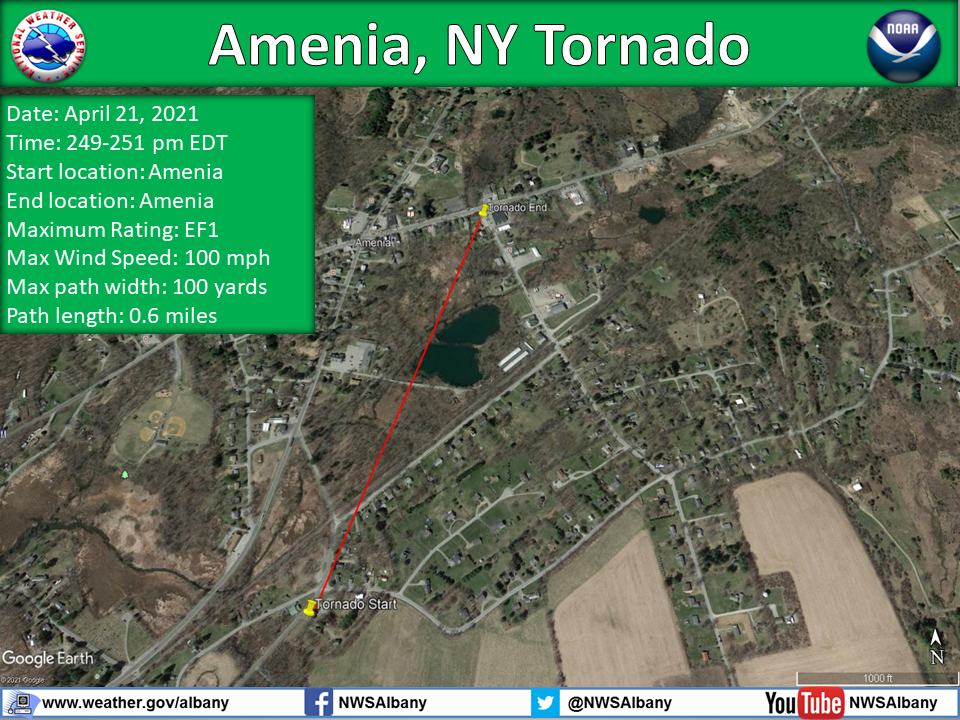 
Downloadable KMZ File |
||||||||||||||||
|
||||||||||||||||
|
Tornado - Kent, CT
Track Map 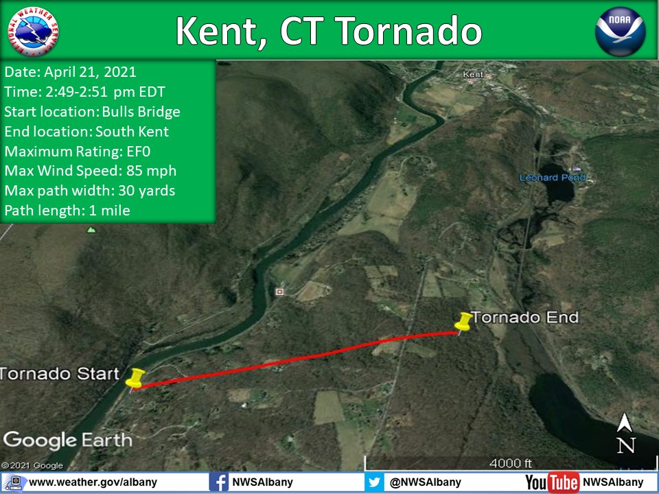
Downloadable KMZ File |
||||||||||||||||
The Enhanced Fujita (EF) Scale classifies tornadoes into the following categories:
| EF0 Weak 65-85 mph |
EF1 Moderate 86-110 mph |
EF2 Significant 111-135 mph |
EF3 Severe 136-165 mph |
EF4 Extreme 166-200 mph |
EF5 Catastrophic 200+ mph |
 |
|||||
Radar
0.5 degree Reflectivity ENX Radar
4-panel ENX Radar 0.5 degree Reflectivity, SRM, Spectrum Width, NROT
Storm Reports
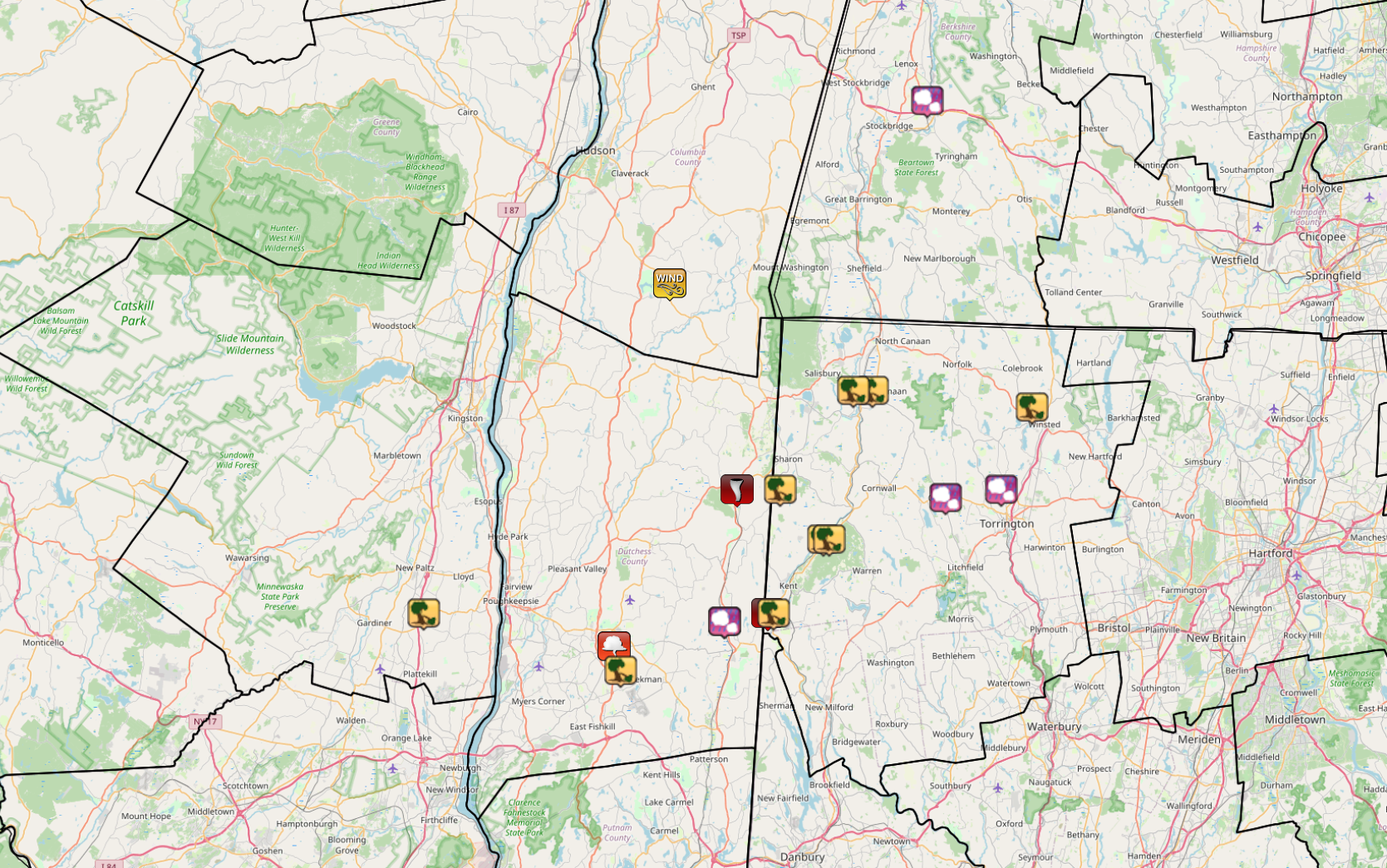
Storm Reports across the NWS Albany County Warning Area from April 21, 2021 (Map above courtesy of Iowa Environmental Mesonet).
Link to the Amenia, NY and Kent, CT Tornadoes
PRELIMINARY LOCAL STORM REPORT...SUMMARY
NATIONAL WEATHER SERVICE ALBANY NY
..TIME... ...EVENT... ...CITY LOCATION... ...LAT.LON...
..DATE... ....MAG.... ..COUNTY LOCATION..ST.. ...SOURCE....
..REMARKS..
0209 PM TSTM WND DMG 1 WSW CLINTONDALE 41.69N 74.07W
04/21/2021 ULSTER NY FIRE DEPT/RESCUE
A TREE WAS DOWNED ONTO WIRES ON ROUTE 44
0220 PM FUNNEL CLOUD LAGRANGE 41.65N 73.76W
04/21/2021 DUTCHESS NY TRAINED SPOTTER
NO DAMAGE AND WIND GUSTS AROUND 30 MPH.
0225 PM TSTM WND DMG 2 SSW BEEKMAN 41.62N 73.75W
04/21/2021 DUTCHESS NY SOCIAL MEDIA
TREES DOWN.
0245 PM TSTM WND DMG 3 NNW WINGDALE 41.68N 73.58W
04/21/2021 DUTCHESS NY SOCIAL MEDIA
TREES DOWN SOUTH OF DOVER PLAINS HIGH SCHOOL.
0245 PM HAIL 3 NNW WINGDALE 41.68N 73.58W
04/21/2021 M0.88 INCH DUTCHESS NY SOCIAL MEDIA
JUST SOUTH OF DOVER PLAINS HIGH SCHOOL.
0247 PM TSTM WND DMG 3 SSW KENT 41.69N 73.51W
04/21/2021 LITCHFIELD CT AMATEUR RADIO
TREE DOWN ON WIRES ON KENT ROAD
0248 PM TSTM WND DMG 4 SW CORNWALL BRIDGE 41.78N 73.42W
04/21/2021 LITCHFIELD CT TRAINED SPOTTER
SMALL TREES DOWN NEAR KENT FALLS STATE PARK ENTRANCE
ALONG ROUTE 7N.
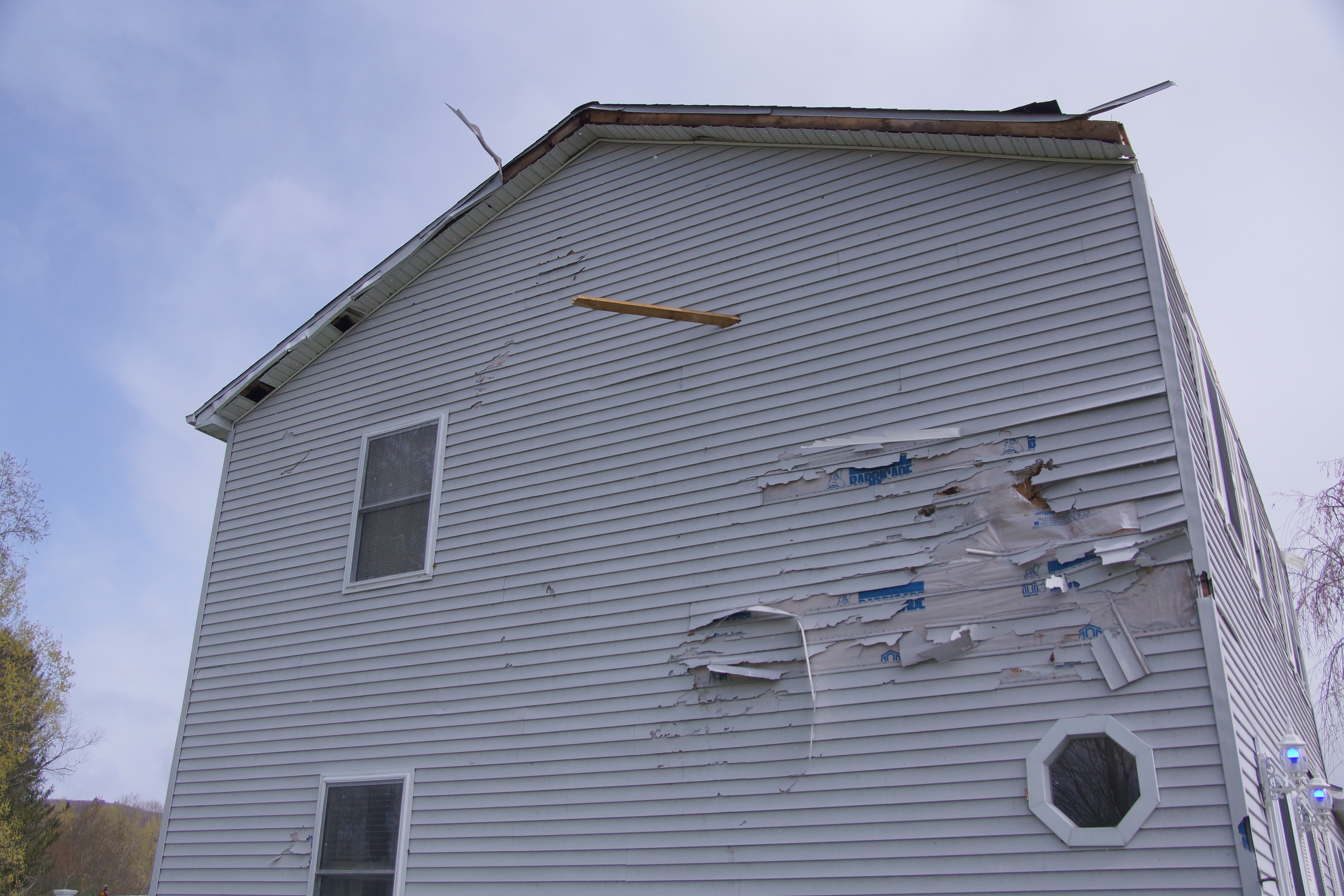
0249 PM TORNADO AMENIA 41.84N 73.56W
04/21/2021 DUTCHESS NY NWS STORM SURVEY
EF-1 TORNADO WAS CONFIRMED IN THE TOWN OF AMENIA, NY.
MAX WINDS OF 100 MPH.
0249 PM TORNADO 3 SSW KENT 41.69N 73.51W
04/21/2021 LITCHFIELD CT NWS STORM SURVEY
NWS SURVEY TEAM CONFIRMED AN EF-0 TORNADO NEAR BULLS
BRIDGE, CT. MAX WINDS OF 85 MPH.
0250 PM TSTM WND DMG 3 SSW KENT 41.69N 73.50W
04/21/2021 LITCHFIELD CT SOCIAL MEDIA
WIRES DOWN, TREES DOWN, CAR PORT FLIPPED OVER AT BULLS
BRIDGE BODY SHOP.
0255 PM HAIL LEE 42.31N 73.25W
04/21/2021 M0.75 INCH BERKSHIRE MA TRAINED SPOTTER
0300 PM TSTM WND DMG 3 SW CORNWALL BRIDGE 41.78N 73.41W
04/21/2021 LITCHFIELD CT SOCIAL MEDIA
TREES WERE SNAPPED AND DOWNED ACROSS ROUTE 7 NEAR KENT
FALLS STATE PARK
0315 PM TSTM WND DMG 1 ENE FALLS VILLAGE 41.96N 73.34W
04/21/2021 LITCHFIELD CT AMATEUR RADIO
TREE DOWN ON WIRES ON ROUTE 7 NORTH TO PAGE RD.
0317 PM TSTM WND DMG FALLS VILLAGE 41.96N 73.37W
04/21/2021 LITCHFIELD CT AMATEUR RADIO
TREE DOWN ON WIRES AT INTERSECTION OF WARREN TURNPIKE
AND WATER ST.
0320 PM TSTM WND DMG 2 SSW SHARON 41.84N 73.49W
04/21/2021 LITCHFIELD CT AMATEUR RADIO
WIRES DOWN FROM WIND.
0323 PM HAIL 5 W TORRINGTON 41.83N 73.22W
04/21/2021 E0.75 INCH LITCHFIELD CT AMATEUR RADIO
0325 PM TSTM WND DMG 1 NW WINSTED 41.94N 73.08W
04/21/2021 LITCHFIELD CT TRAINED SPOTTER
WIRES DOWN FROM WIND. POWER IS OUT.
0423 PM HAIL TORRINGTON 41.84N 73.13W
04/21/2021 M0.88 INCH LITCHFIELD CT TRAINED SPOTTER
SHELF CLOUD. 675 MAIN ST.
Environment
 |
 |
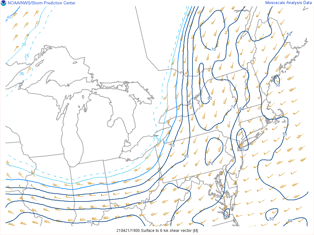 |
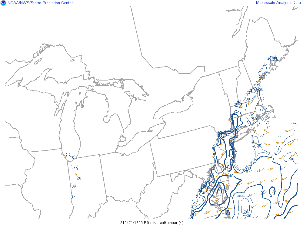
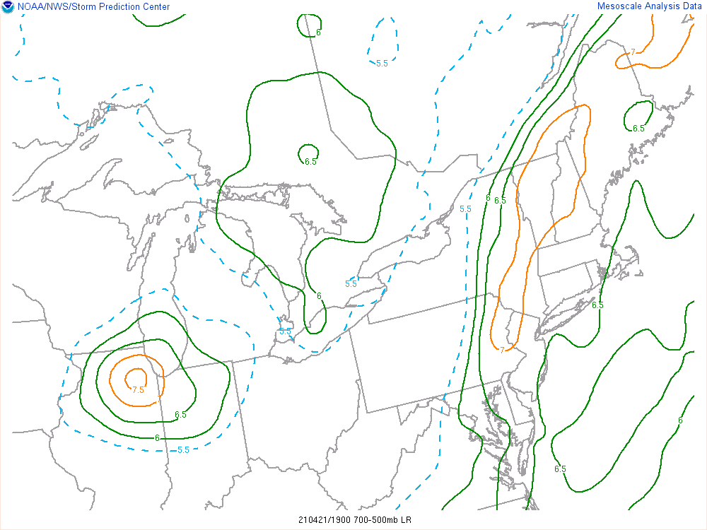
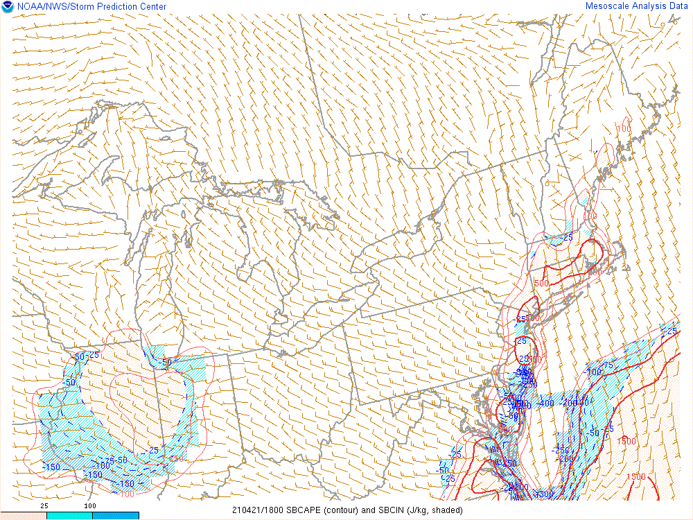
| Figure 1: Effective Shear valid 1PM April 21, 2021 | Figure 2: Mid-level Lapse Rates valid 3PM April 21, 2021 | Figure 3: 0-6km Shear valid 3PM April 21, 2021 |
 |
 |
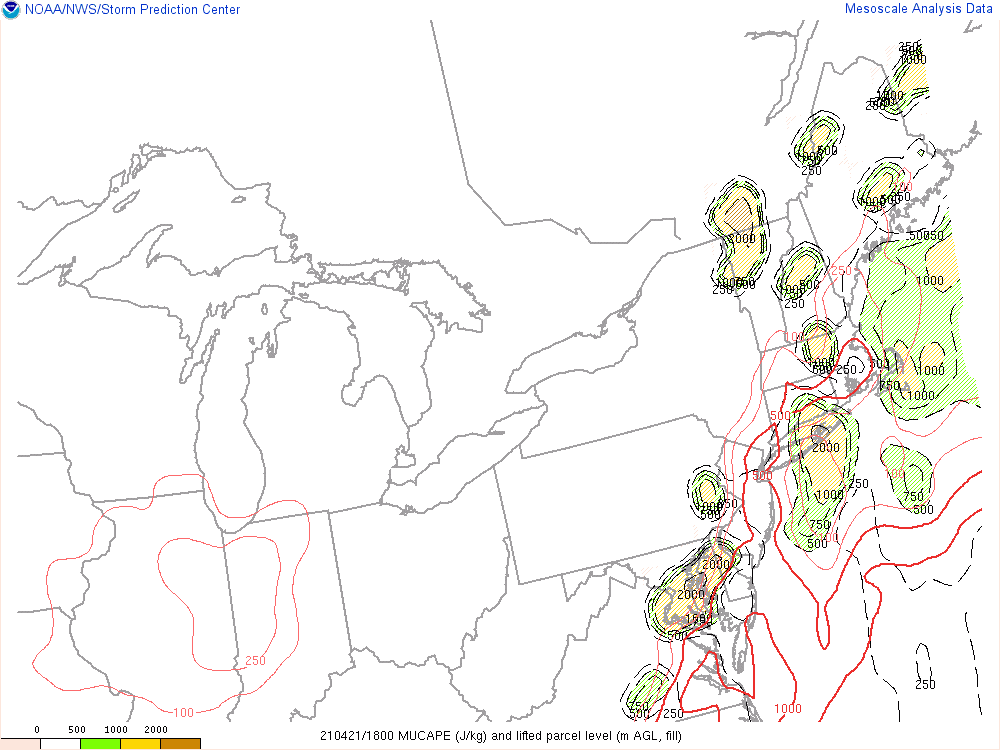 |
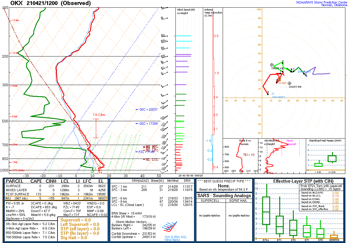
| Figure 4: Surface Based CAPE valid at 2PM April 21, 2021 | Figure 5: 12 UTC (8am) Upper Air Sounding from Upton, NY (OKX) April 21, 2021 | Figure 6: Most Unstable CAPE valid 2PM April 21, 2021 |
MRMS Data
 |
 |
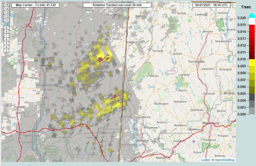 |
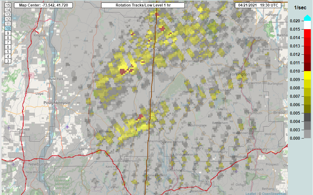
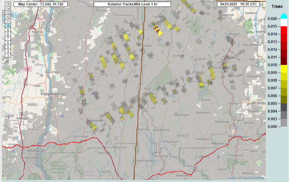
| Figure 7: Low Level Rotational Tracks valid 3:30 PM April 21, 2021 | Figure 8: Mid Level Rotational Tracks valid 3:30PM April 21, 2021 | Figure 9: 30 min Instantaneous Low Level Rotational Tracks valid 2:30 PM April 21, 2021 |
Additional Information
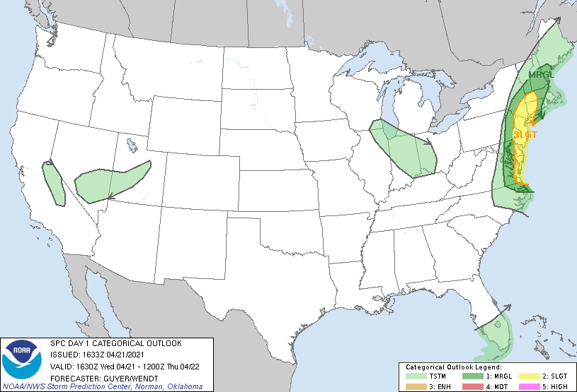
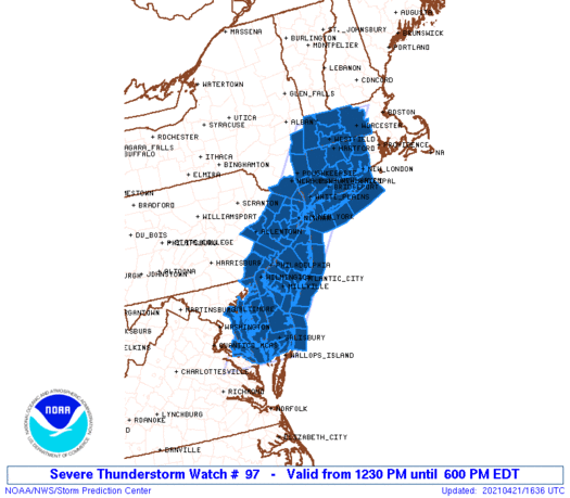
Storm Prediction Center (SPC) Products
 |
 |
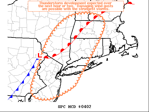 |
| SPC Day 1 Categorical Outlook valid 12:30PM April 21, 2021 | Severe Thunderstorm Watch issued 12:36 PM April 21, 2021 | SPC Mesoscale Discussion |
 |
Media use of NWS Web News Stories is encouraged! Please acknowledge the NWS as the source of any news information accessed from this site. |
|


