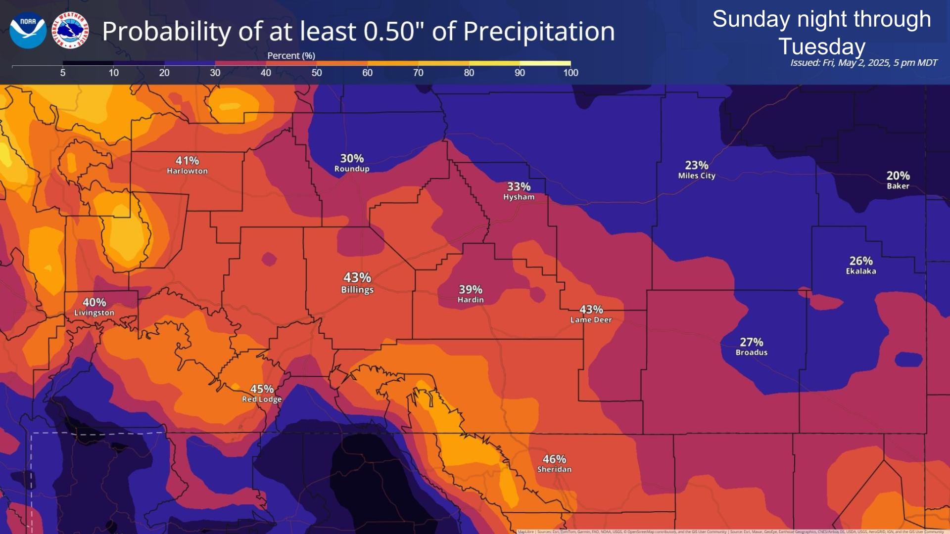
The next weather system looks to move through the region this afternoon through Thursday, bringing periods of showers/thunderstorms and a brief cooldown. There is currently a moderate to high chance of at least 0.5” of rainfall across portions of southern MT and northern WY, especially near the foothills.


 Weather Stats