|
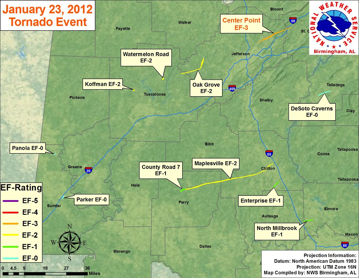
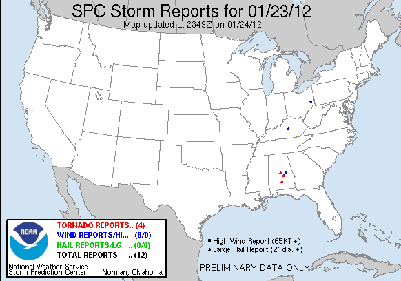
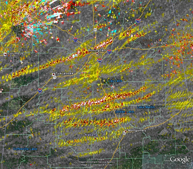
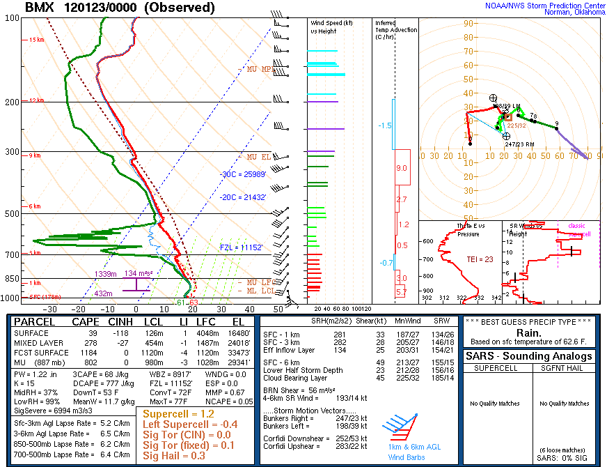
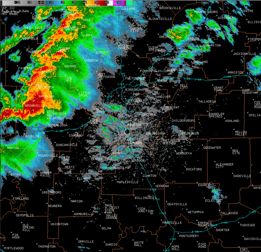
Event Summary for Central Alabama
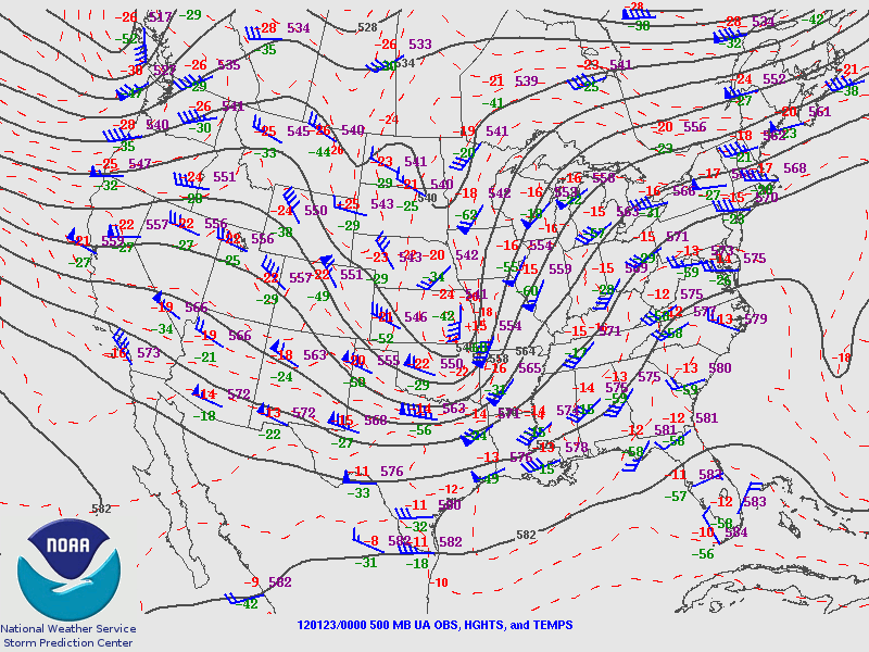
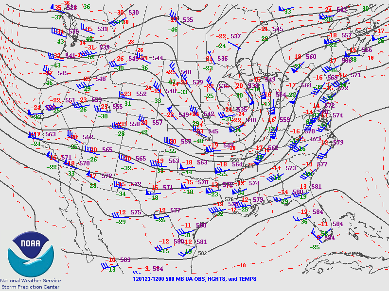
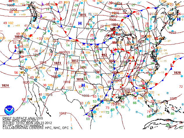
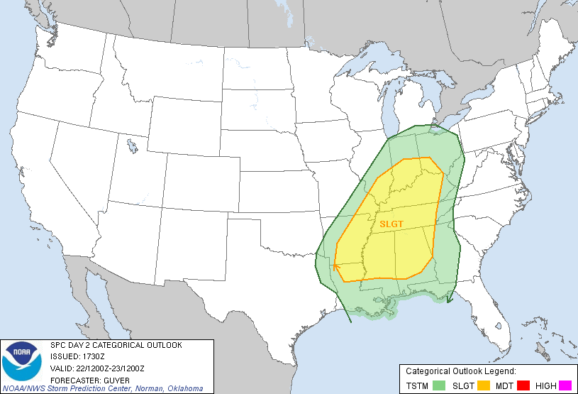
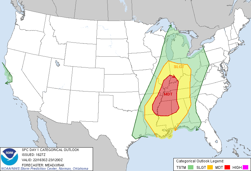
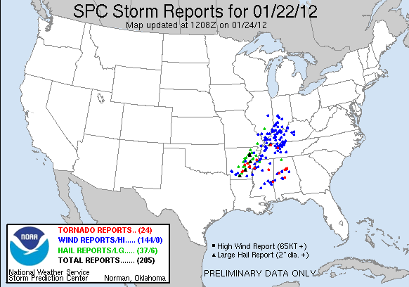
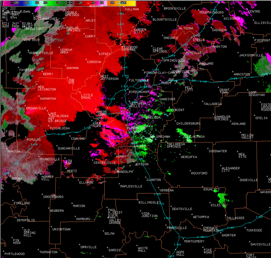
A strong cold front approached the region Sunday night and interacted with a very moist and unstable environment already in place. Numerous showers and thunderstorms developed along and out ahead of the front across Arkansas and Mississippi and pushed eastward across Central Alabama Sunday night and into Monday morning. There were several supercell thunderstorms that produced multiple tornadoes as they tracked across the forecast area. Numerous reports of straight-line wind damage and several reports of large hail and flash flooding were also received during the event.
The information below summarizes the tornadoes from this day, with each tornado path linked to its own webpage:
|