National Weather Service United States Department of Commerce

Tornadoes of February 7, 2018

Event Summary for Central Alabama

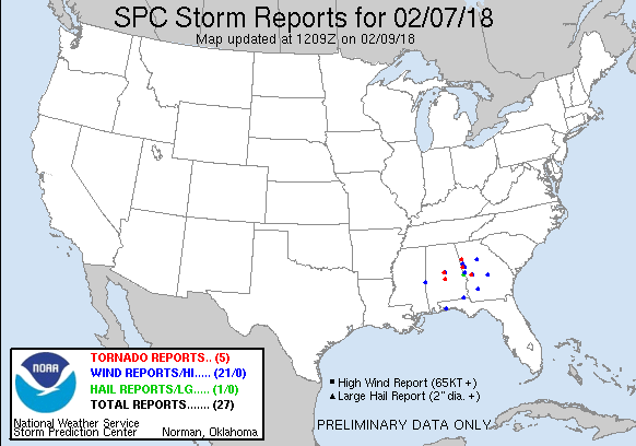
A line of thunderstorms moved across Central Alabama during the morning hours of Wednesday, February 7, 2018. Supercells embedded within the line were responsible for producing large hail, damaging winds, and six tornadoes. In addition, heavy rain over several hours produced localized flash flooding, and river flood warnings and statements became necessary during the event.

Originally, severe weather was not anticipated as most model guidance indicated insufficient instability and wind shear for the development of supercells, tornadoes and other severe convective hazards. Even so, a marginal risk was highlighted for western and southern portions of Central Alabama. The storms exhibited organization and lightning began showing up. These were indicators that instability was likely higher than expected. The radar signatures were marginal at best and therefore, only a few Severe Thunderstorm Warnings were issued during the event. Fortunately, no injuries were reported.

The information contained below is from the 6 individual tornado tracks that occurred. The data is PRELIMINARY and may be subject to change.

 
Location/Clickable Detailed Summary Link
Damage Rating/Estimated Maximum Wind Speeds
Injuries/Fatalities
Damage Path Length/Width
Starting Point/Time
Ending Point/Time
Siloam Tornado
(Sumter County)
EF-0
80 mph
None
1.98 miles
150 yards

5 N Ward
32.4284/-88.2756
5:11 am CST

5 NNE Ward
32.4257/-88.2419
5:14 am CST
Gallion Tornado
(Marengo/Hale Counties)
EF-1
100 mph
None
11.5 miles
1100 yards

2 NNW Old Spring Hill
32.4636/-87.7895
5:44 am CST

2 N Faunsdale
32.4851/-87.5952
5:58 am CST
EF-0
65 mph
None
0.67 miles
50 yards

3 NNW Randolph
32.9484/-86.9247
5:51 am CST

4 N Randolph
32.9512/-86.9137
5:52 am CST
Jemison Tornado
(Chilton County)
EF-0
80 mph
None
2.55 miles
300 yards

2 W Jemison
32.9578/-86.7844
6:03 am CST

Jemison
32.9644/-86.7422
6:06 am CST
Vida Junction Tornado
(Autauga County)
EF-0
70 mph
None 2.09 miles
150 yards
2 WSW Vida Junction
32.5603/-86.7174
7:04 am CST
1 SSW Vida Junction
32.5660/-86.6842
7:08 am CST
(Marengo County)
EF-0
60 mph
None
0.80 miles
100 yards

2 NE Holtamville
32.0121/-87.9099
7:16 am CST

3 ENE Holtamville
32.0095/-87.8970
7:18 am CST
 

Severe Weather Episode Data 

250 mb
250 mb Analysis
Feb 6 at 6 pm

500 mb
500 mb Analysis
Feb 6 at 6 am

850 mb
850 mb Analysis
Feb 6 at 6 pm

250 mb
250 mb Analysis
Feb 7 at 6 am

500 mb
500 mb Analysis
Feb 7 at 6 am

850 mb
850 mb Analysis
Feb 7 at 6 am

sfc
Surface Analysis
Feb 7 at 3 am

sfc
Surface Analysis
Feb 7 at 6 am

sfc
Surface Analysis
Feb 7 at 9 am

Day 1 Outlook
Day 1 Outlook
Issued Feb 6 at 7 am

Day 1 Outlook
Day 1 Outlook
Issued Feb 7 at 6 am

Storm Reports
Storm Reports
Feb 7, 2018

Sounding
KBMX Sounding
  Feb 6 at 6 pm

Sounding
KLIX Sounding
Feb 7 at 6 am

Sounding
KFFC Sounding
Feb 7 at 6 am

Radar Loop
Radar Loop
  Feb 7 from 4 am to 8 am


PM Radar Loop
April 5th