|
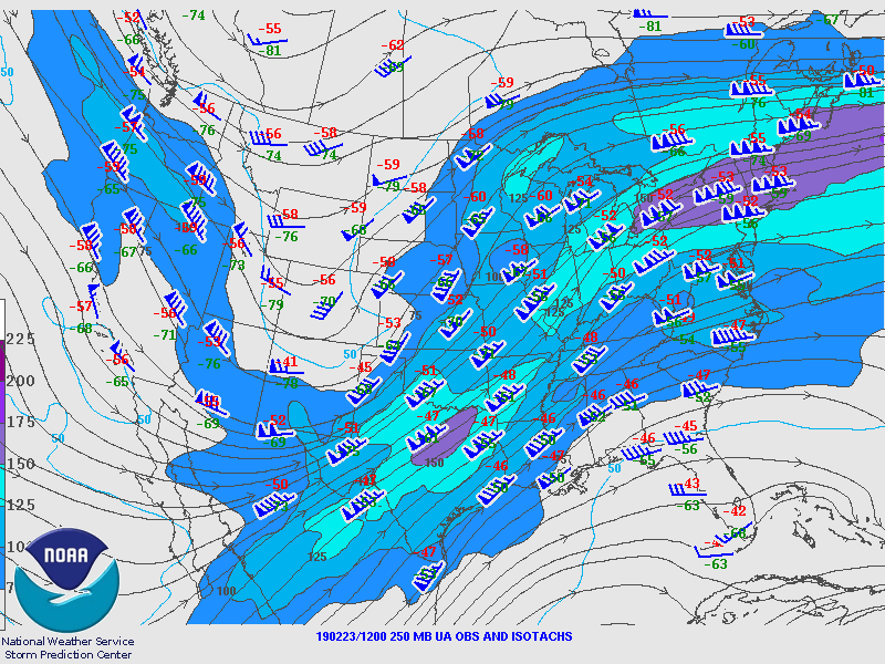
250 mb Analysis
February 23 at 6 am
|
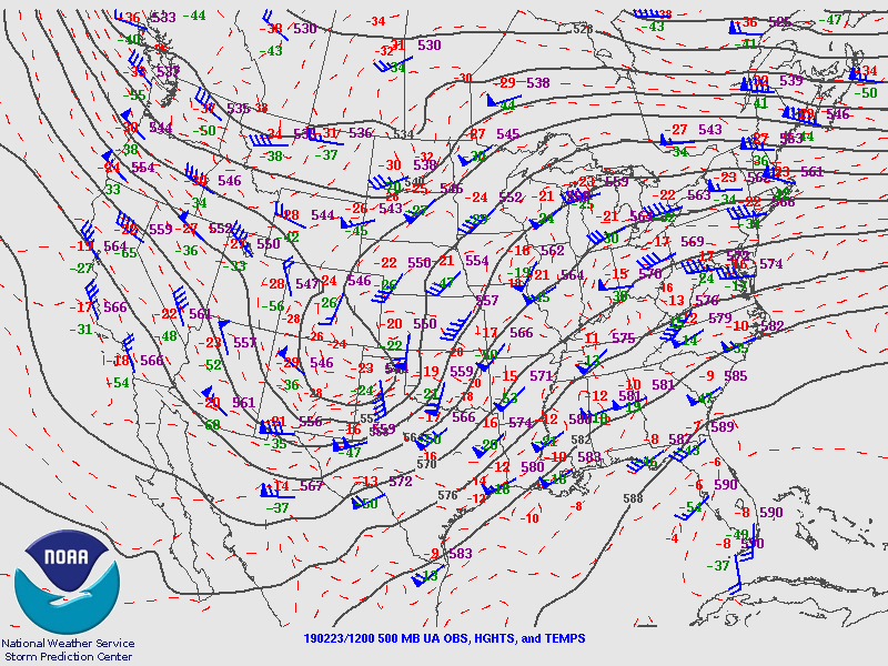
500 mb Analysis
February 23 at 6 am
|

850 mb Analysis
February 23 at 6 am
|
|
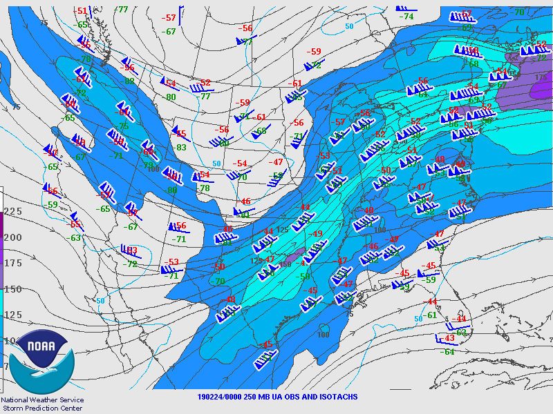
250 mb Analysis
February 23 at 6 pm
|
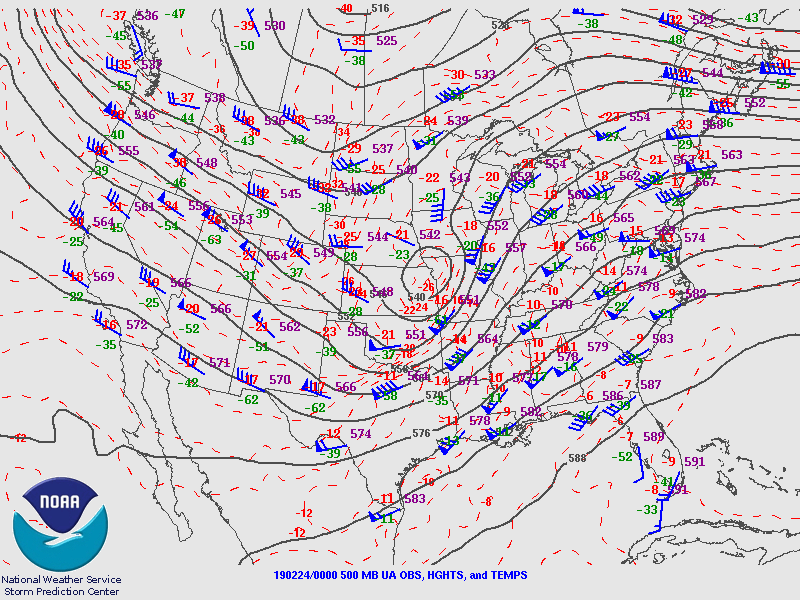
500 mb Analysis
February 23 at 6 pm
|
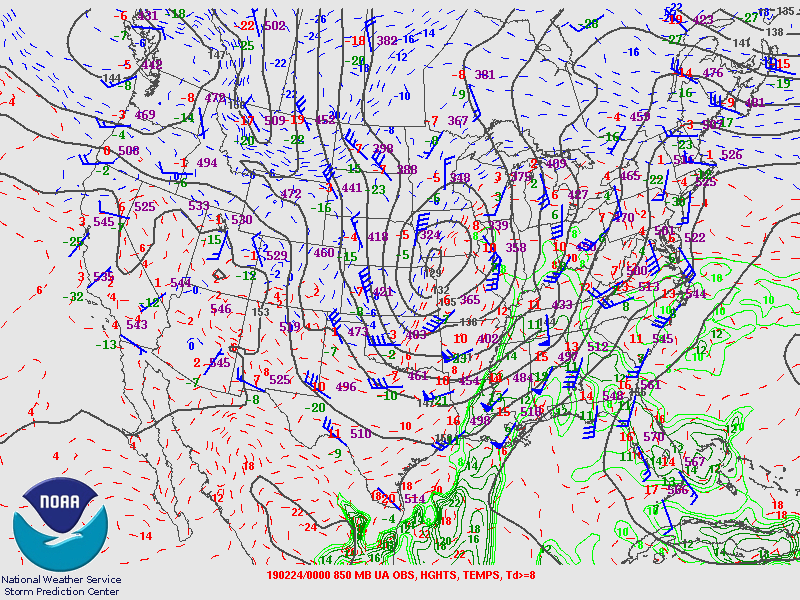
850 mb Analysis
February 23 at 6 pm
|
|
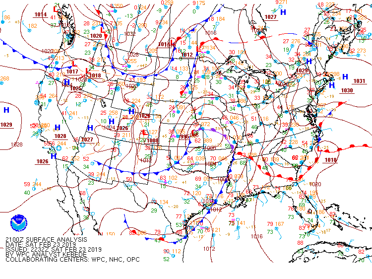
Surface Analysis
February 23 at 3 pm
|
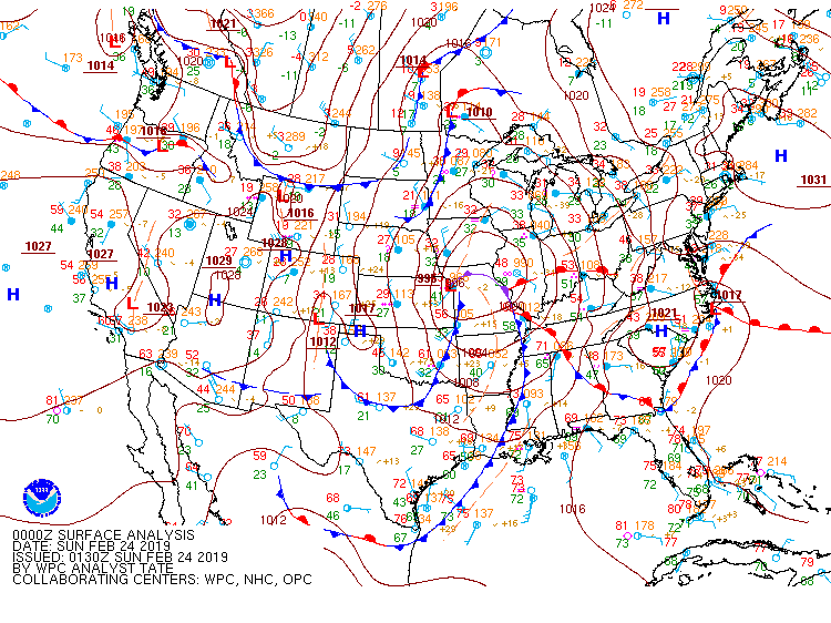
Surface Analysis
February 23 at 6 pm
|
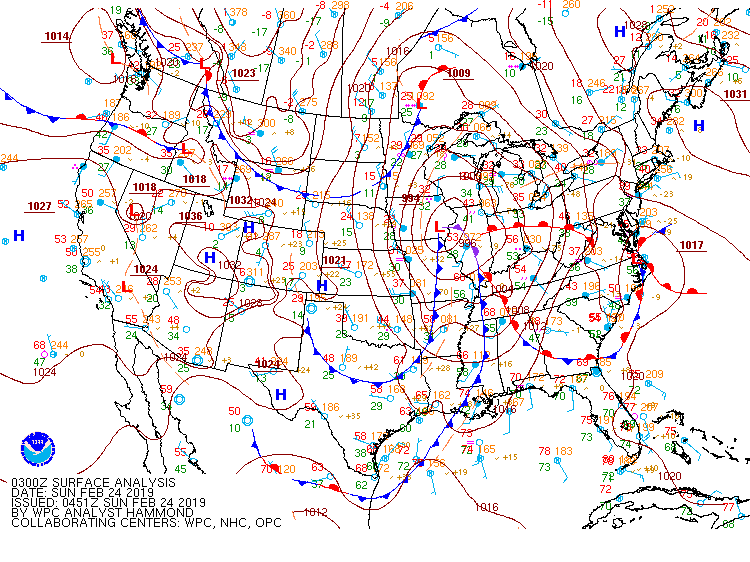
Surface Analysis
February 23 at 9 pm
|
|
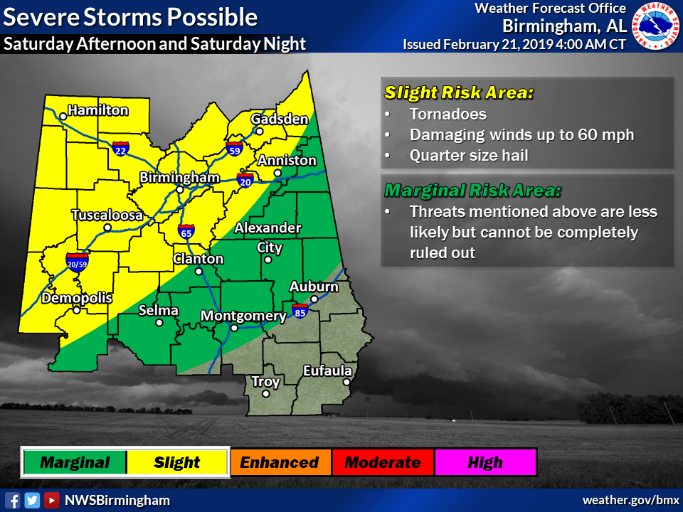
Local Severe Outlook
Issued February 21 at 4 am
|
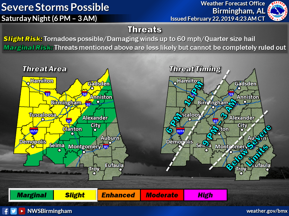
Local Severe Outlook
Issued February 23 at 430 am
|
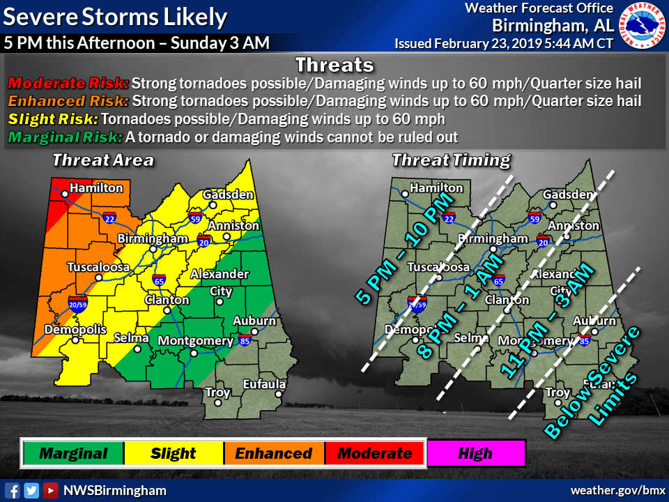
Local Severe Outlook
Issued February 23 at 6 am
|
|
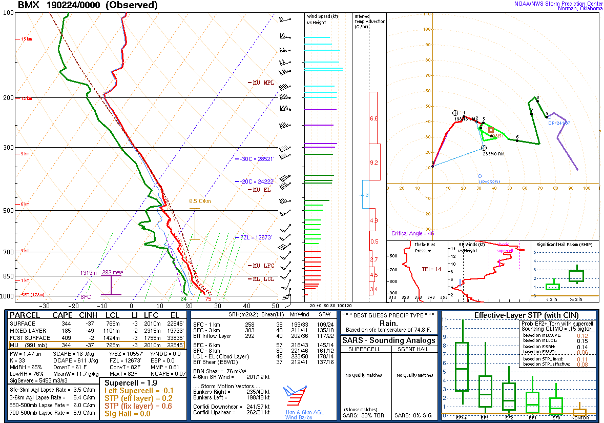
KBMX Sounding
February 23 at 6 am
|
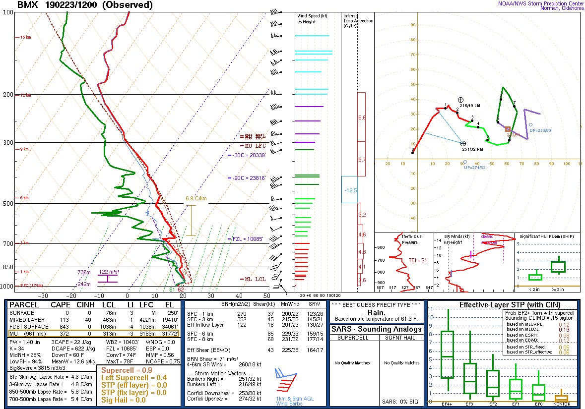
KBMX Sounding
February 23 at 12 pm
|
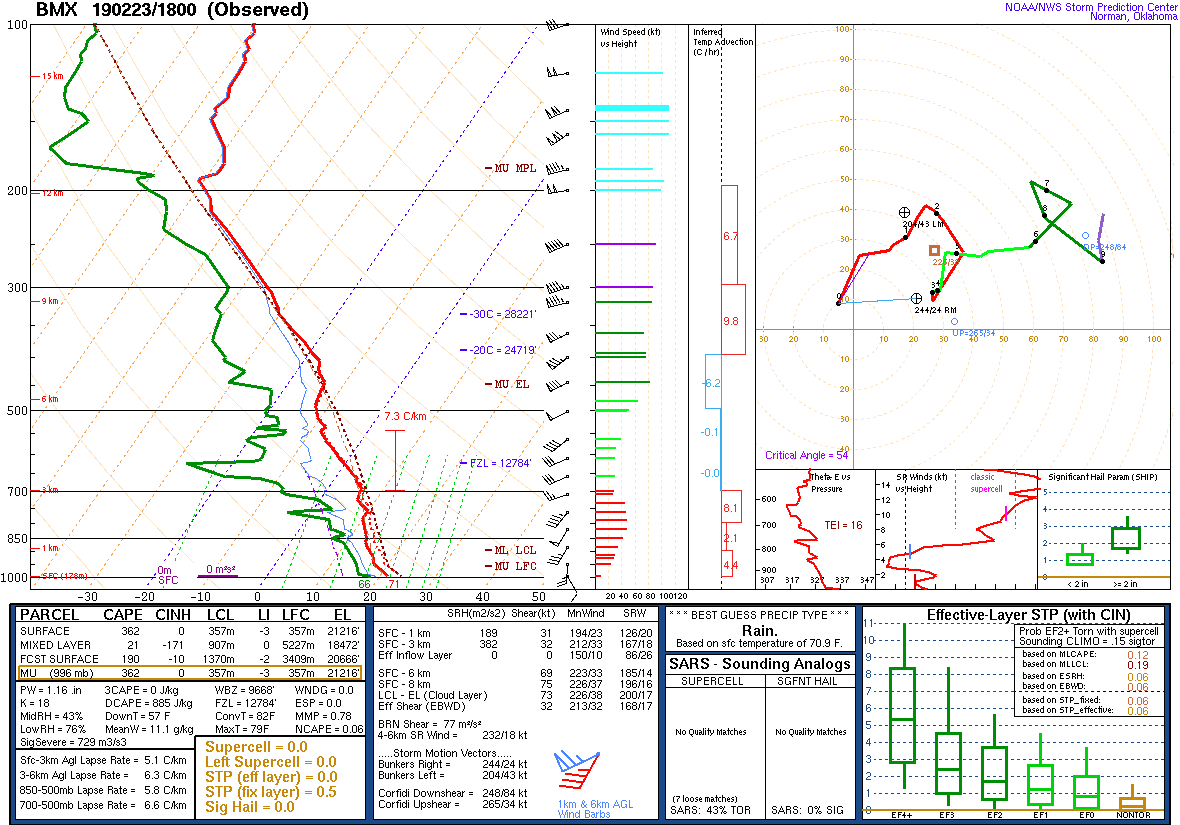
KBMX Sounding
February 23 at 6 pm
|
|
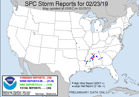
Storm Reports
February 23
|
|
|