|
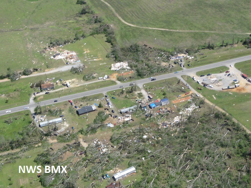
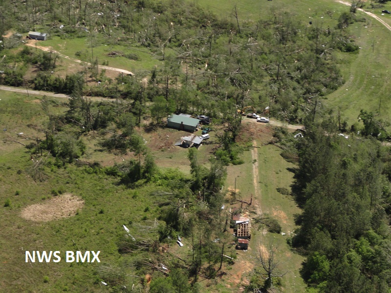
National Weather Service meteorologists surveyed the damage near Geiger via helicopter. It has been determined that the damage was consistent with a tornado. Winds were estimated around 150 mph and this tornado was witnessed by dozens of people and storm spotters. This tornado was a very long-tracked tornado. The tornado originally touched down in Mississippi where it had a damage path over 38 miles long. In Mississippi, the tornado hit Neshoba and Kemper Counties and produced EF-3 damage. The tornado continued into the Geiger area where several homes and businesses sustained extensive damage. The tornado continued east where thousands of trees were either snapped or uprooted. The tornado eventually lifted near the Tombigbee River at the Sumter and Greene County Line. The tornado damage path was 10.5 miles long in Alabama and was 1 mile wide at its widest point. See the Mississippi survey information Here.
The tornado touched down in Neshoba County Mississippi and then moved into Kemper County Mississippi before it moved into Central Alabama. Therefore, the total tornado damage path was 48.52 miles long. The tornado was 1760 yards wide in Sumter County Alabama. The tornado was rated an EF-3 in Kemper and Sumter Counties.
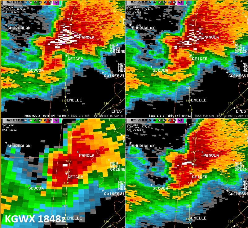
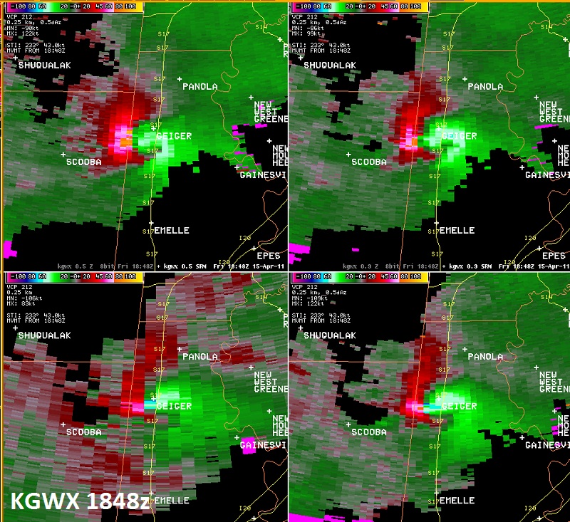
A Tornado Warning was in effect from 125 pm until 230 pm.
|