National Weather Service meteorologists have surveyed and rated the Cordova tornado track. It has been determined that the damage surveyed was consistent with a violent tornado of overall EF-4 Intensity. The tornado track began about 3 miles northeast of Pickensville in Pickens County, and continued northeast along Double Branches Road, near County Road 49. Just northeast of Reform, the tornado destroyed a few chicken houses and tossed grain feed bins up to 100 yards (EF-1). The tornado caused roof damage to houses and destroyed a few outbuildings as it crossed Alabama Highway 159 north of County Road 49.
The tornado then moved into Tuscaloosa County. It crossed Alabama Highway 171 just south of County Road 76, with significant tree damage (EF-2) in a narrow path. The tornado clipped a small part of south central Fayette County along County Road 12 just west of U.S. Highway 43, with tree damage and minor structural damage (EF-1). The Tornado then moved back into Tuscaloosa County, crossing U.S. Highway 43 just north of County Road 12, with only a narrow path width of (EF-0 to EF-1) tree damage. The tornado continued east-northeastward across north central Tuscaloosa County causing mostly minor tree and structural damage before crossing into Fayette County along Old Jasper Road. The tornado strengthened as it approached the Boley Springs area. It crossed County Road 83 north of old Jasper Road where it caused considerable damage to trees and completely destroyed at least one mobile home (EF-3). The frame separated and the remaining debris was thrown a considerable distance which resulted in at least two fatalities. The tornado appeared to strengthen even further as it reached Willcut Road and County Road 46. In this area several mobile homes were completely destroyed with debris thrown a considerable distance and frames twisted and thrown. Many trees were downed with at least two fatalities in this area (at least EF-3).
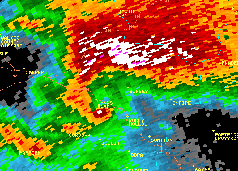
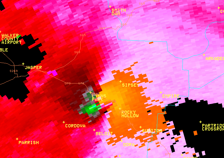
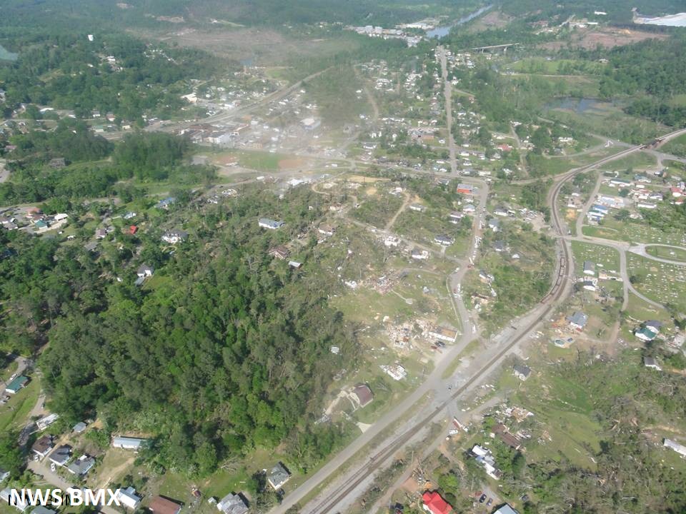
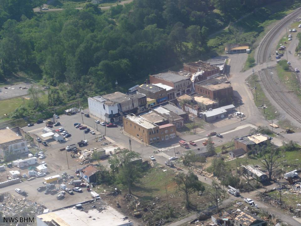
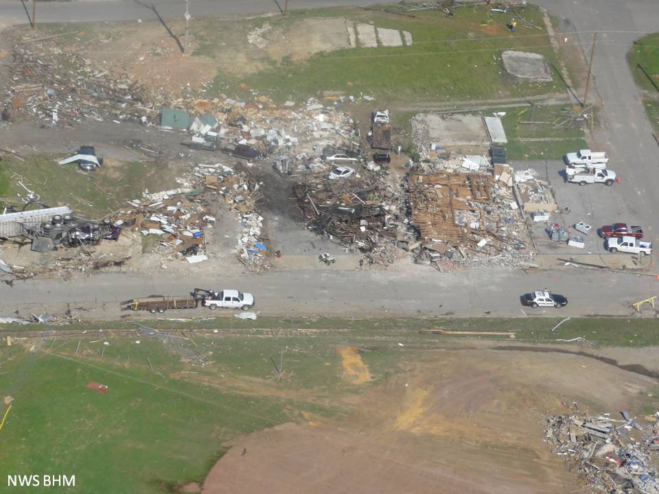
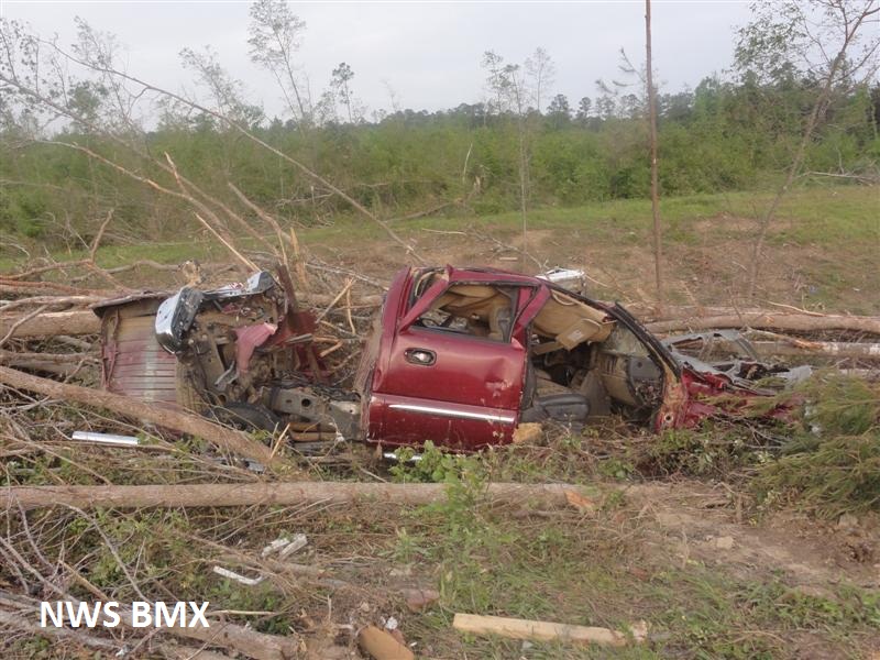
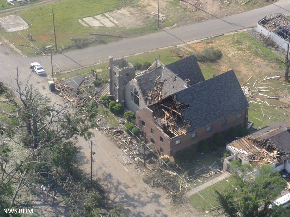
The tornado continued east-northeastward and weakened. It caused mostly minor damage to trees and mobile homes (EF-1) and crossed into Walker County near Bethel Road. The tornado moved across Alabama State Highway 69 several miles south of Oakman where numerous trees were snapped and uprooted, a cell phone tower was knocked down, and mobile homes were destroyed (EF-2). Southeast of Oakman, the tornado crossed Earnest Chapel Road where it rolled vehicles and completely destroyed a cinder block house. It swept away most of the debris (EF-3). At this location there was one known fatality and two known injuries. The tornado continued east-northeast where it crossed County Road 35 and Alabama Highway 269 a few miles south of Parrish. The tornado weakened considerably as it approached Corridor X/future Interstate 22, with only minor tree damage (EF-0) noted, before it strengthened significantly as it entered the Cordova Area. A 1/2 mile wide swath of EF-3 damage was noted in downtown Cordova. From there, the tornado tracked to the northeast across Burton Chapel Loop Road and crossed the Mulberry fork of the Black Warrior River. As it crossed Mountainview Road, the tornado increased and was rated a violent EF-4 here, as it destroyed 2 single-wide mobile homes, as well as a single family home. One of the mobile home undercarriages was missing, having been tossed at least 500 yards. At this site, a small bulldozer was flipped over, a pickup truck was tossed 200 yards and an International 4700 dump truck was tossed 50 yards being destroyed upon landing. A 2 ton utility trailer from this location was found a mile away, with a 2.5 foot impact crater where it landed. As the tornado neared Old Highway 78, it tossed two double-wide mobile homes at least 100 yards where it became airborne with the frames on top of the debris. The tornado continued tracking toward Sipsey, where an unanchored double-wide mobile home was tossed 100 feet up a 50 foot embankment. The tornado continued at a minimum of EF-2 strength to the east, then intensified as it came off a bluff where it destroyed a home. Numerous homes and manufactured homes were either damaged or destroyed along this path.
The tornado continued northeast into Cullman County. WFO BMX survey teams noted a continuous path from Cullman County into Blount County where the tornado passed near Sulpher Springs northeast of Bangor and into the town of Blountsville. In Blountsville, the storm went across Highway 431 damaging multiple well built brick and slab foundation homes on Maple Drive, one of which had the exterior walls collapse which left the interior walls standing. Damage was indicative of 130 mph winds which is consistent with high-end EF-2 damage. As the storm continued to the northeast out of Blountsville, two additional homes were found along the path that sustained heavy high end EF-3 damage with winds of 160 mph. A large portion of the home was wiped off of its foundation leaving only the garage in place with minor roof damage. The debris from the home was tossed across the path of the tornado 10 to 15 yards away from where it originally stood. This home was not a slab foundation home, rather it had a cinder block perimeter foundation. The tornado then continued into Marshall County (see info from WFO HUN).
The tornado was also on the ground in Cullman and Marshall Counties. Therefore, the total tornado damage path length was 127.80 miles long. All the injuries and fatalities occurred in Central Alabama. The tornado was 1408 yards wide at its widest point in Tuscaloosa County. The tornado was rated an EF-4 in Walker County.