|
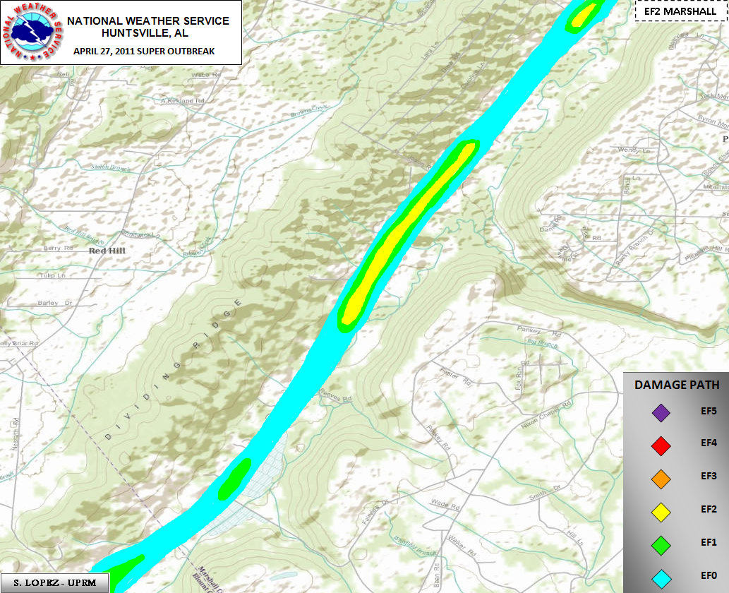
Long Track EF-4 Tornado Extended Into Marshall County
Additional ground and aerial damage assessment surveys from the National Weather Service, Emergency Management Agency and general public, have revealed the long track EF-4 tornado that originated in Pickens County on the afternoon of April 27th, affected southern Marshall County before dissipating. This was the same tornado that did significant damage to the town of Cordova, in Walker County. This is the same tornado that moved through the Arkadelphia area earlier in the afternoon as an EF4 tornado around 5:30 pm.
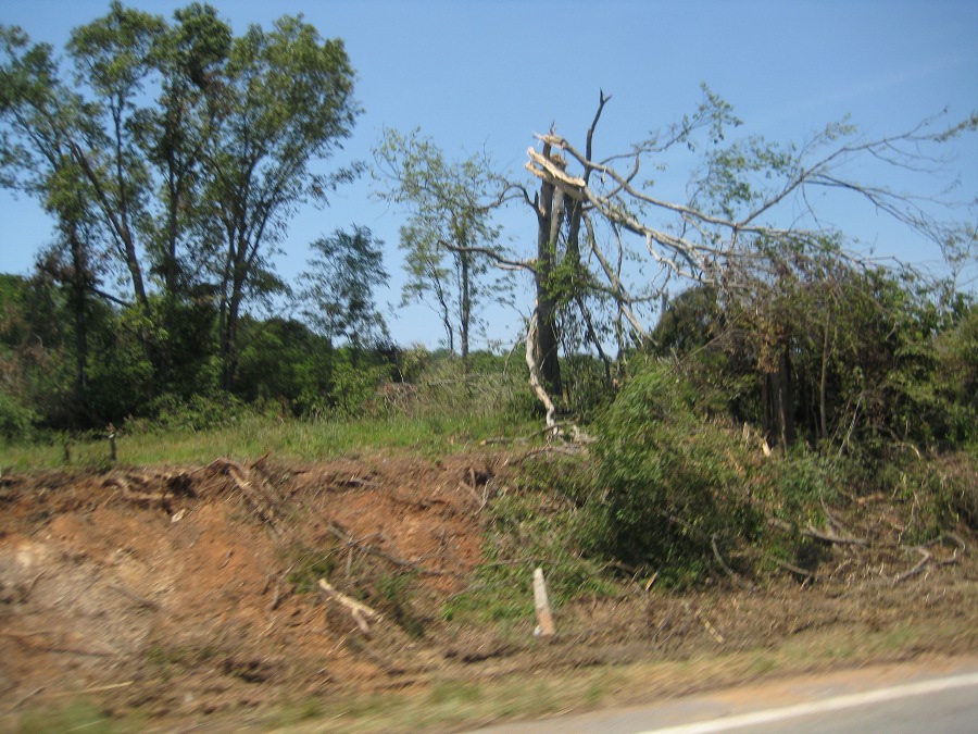
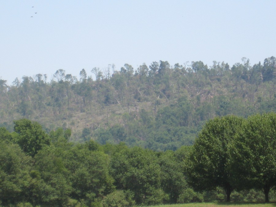
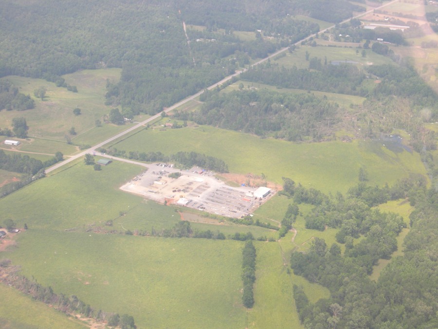
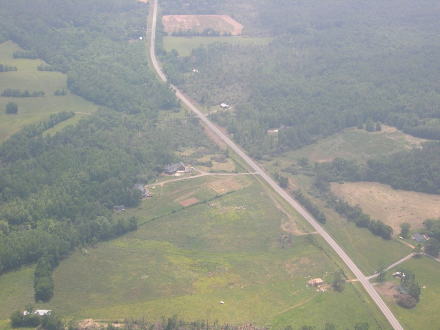
This tornado continued its track across the Blount/Marshall county line along a heavily wooded ridgeline between Highway 79 and Diamond Road. Aerial photography confirms the tornado tracked northeast along this ridgeline doing significant damage to a house just inside the Marshall County line, as well as snapping and uprooting numerous trees. The tornado crossed Highway 79 between mile marker 56 and 57, snapping a few trees and causing damage to the roof of a shed near a residence. Just northeast of this point, the tornado appeared to briefly strengthen (EF-2), completely destroying an industrial plant (Ferguson Industries). The tornado continued northeast moving again over heavily wooded terrain just east of Highway 79. The damage path along this ridgeline can be seen from Highway 79 and aerial pictures confirm this track.
Beyond this point several miles south of Highway 431, little additional damage can be confirmed from this tornado. Radar data also suggests that this storm (supercell) was undergoing a transformation period causing the tornado to weaken and eventually lift.
** Note: this supercell later spawned another tornado that devastated the town of Rainsville (DeKalb County) and moved northeast across the AL/GA state line. This tornado, initially rated an EF-4, was recently upgraded to an EF-5 based on the damage northeast of Rainsville.
** For information on the track of this tornado before it affected Marshall County /Pickens County through Blount County/ refer to the NWS Birmingham web page story at:
/bmx/event_04272011cordova
|


 Local Radar
 Weather Map