
Widespread life-threatening flash and urban flooding continues in south-central Texas, with considerable flooding impacts possible across central Texas. Wildfire smoke is impacting air quality across much of the Great Lakes region into southern New England and the Mid-Atlantic. Monsoonal thunderstorms may produce isolated to scattered flash flooding across the Southwest into the Great Basin. Read More >
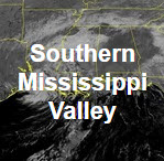
| GeoColor Channel | Southern Mississippi Valley View | CONUS View | Full Disk View | |
 |
 |
 |
||
| GeoColor | Small | Loop | Large | Small | Loop | Large | Small | Loop | Large | |
| Visible Channels | Southern Mississippi Valley View | CONUS View | Full Disk View | |
 |
 |
 |
||
| Visible Blue 0.47 μm (Band 1) | Small | Loop | Large | Small | Loop | Large | Small | Loop | Large | |
| Visible Red 0.64 μm (Band 2) | Small | Loop | Large | Small | Loop | Large | Small | Loop | Large | |
| Near Infrared (NIR) Channels | Southern Mississippi Valley View | CONUS View | Full Disk View | |
 |
 |
 |
||
| Veggie NIR Channel 0.86 μm (Band 3) | Small | Loop | Large | Small | Loop | Large | Small | Loop | Large | |
| Cirrus NIR Channel 1.37 μm (Band 4) | Small | Loop | Large | Small | Loop | Large | Small | Loop | Large | |
| Snow/Ice NIR Channel 1.6 μm (Band 5) | Small | Loop | Large | Small | Loop | Large | Small | Loop | Large | |
| Cloud Particle NIR Channel 2.2 μm (Band 6) | Small | Loop | Large | Small | Loop | Large | Small | Loop | Large | |
| Shortwave IR and Water Vapor Channels | Southern Mississippi Valley View | CONUS View | Full Disk View | |
 |
 |
 |
||
| Shortwave IR Channel 3.9 μm (Band 7) | Small | Loop | Large | Small | Loop | Large | Small | Loop | Large | |
| Upper Level Water Vapor Channel 6.2 μm (Band 8) | Small | Loop | Large | Small | Loop | Large | Small | Loop | Large | |
| Mid Level Water Vapor Channel 6.9 μm (Band 9) | Small | Loop | Large | Small | Loop | Large | Small | Loop | Large | |
| Lower Level Water Vapor Channel 7.3 μm (Band 10) | Small | Loop | Large | Small | Loop | Large | Small | Loop | Large | |
| Infrared (IR) Channels | Southern Mississippi Valley View | CONUS View | Full Disk View | |
 |
 |
 |
||
| Cloud Top IR Channel 8.4 μm (Band 11) | Small | Loop | Large | Small | Loop | Large | Small | Loop | Large | |
| Ozone IR Channel 9.6 μm (Band 12) | Small | Loop | Large | Small | Loop | Large | Small | Loop | Large | |
| Clean Longwave Window 10.3 μm (Band 13) | Small | Loop | Large | Small | Loop | Large | Small | Loop | Large | |
| Legacy Longwave Window 11.2 μm (Band 14) | Small | Loop | Large | Small | Loop | Large | Small | Loop | Large | |
| Dirty Longwave IR Window 12.3 μm (Band 15) | Small | Loop | Large | Small | Loop | Large | Small | Loop | Large | |
| Carbon Dioxide Longwave IR Window 13.3 μm (Band 16) | Small | Loop | Large | Small | Loop | Large | Small | Loop | Large | |


 Local Radar
 Weather Map