Derecho & Tornadoes - May 3, 2009
Event Summary for Central Alabama
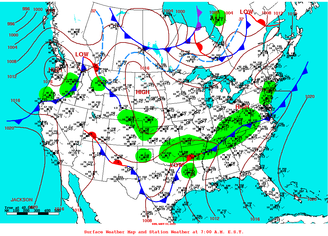
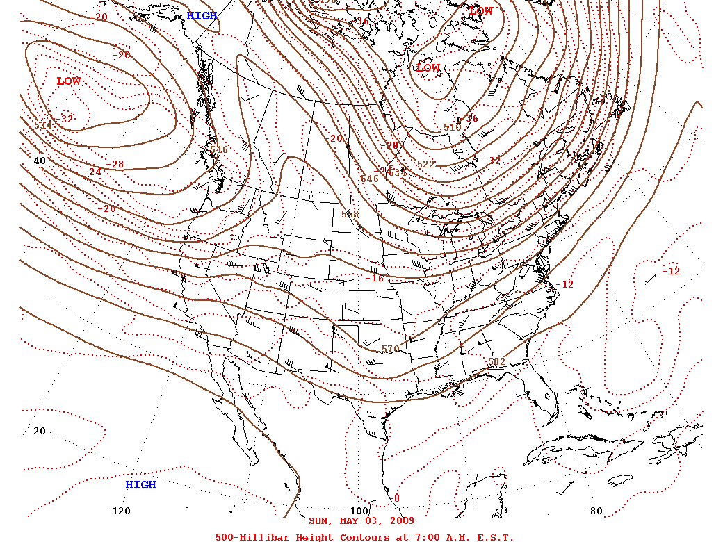
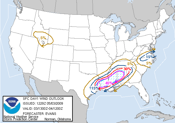
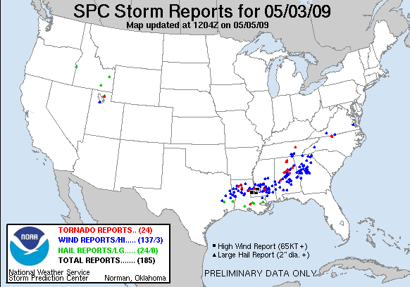
A derecho moved across Central Alabama on Sunday afternoon. A derecho is a widespread and long-lived straight line wind storm associated with a fast moving squall line. A derecho can produce a long-lived gust front which causes straight line wind damage with winds over 58 mph. The derecho on Sunday produced damage in several counties from the Mississippi state line to the Georgia state line.
In addition to the derecho, a few supercell thunderstorms developed just ahead of the squall line. Supercell storms are persistently rotating thunderstorms that produce all types of severe weather. A few tornadoes developed within these supercells.
Our thoughts will be with all those whose lives were impacted by these storms.
|
Location/Clickable Detailed Summary Link
|
Damage Rating/Estimated Maximum Wind Speeds
|
Injuries/Fatalities
|
Damage Path Length/Width
|
Starting Point/Time
|
Ending Point/Time
|
|
|
EF-1
90-95 mph
|
None
|
0.05 miles
50 yards
|
32.5614/-87.5510
132 pm
|
32.5614/-87.5510
132 pm
|
|
|
EF-0
75-85 mph
|
None
|
2.61 miles
200 yards
|
33.4372/-86.6758
154 pm
|
33.4510/-86.6338
157 pm
|
|
|
EF-1
90-100 mph
|
None
|
1.43 miles
300 yards
|
33.4913/-86.5707
203 pm
|
33.4992/-86.5477
205 pm
|
|
|
EF-1
90 mph
|
None
|
1.00 miles
100 yards
|
33.5415/-86.4590
215 pm
|
33.5458/-86.4430
216 pm
|
|
|
EF-1
90-100 mph
|
None
|
16.58 miles
800 yards
|
33.5215/-86.4101
227 pm
|
33.6651/-86.1795
247 pm
|
Derecho Event
Preliminary Local Storm Reports
Public Information Statement
Severe Thunderstorm Watch 233 was in effect from 1135 am CDT until 500 pm CDT.
Severe Weather Episode Data