Excessive rainfall may produce locally considerable flash flooding over parts of the northwestern Gulf Coast, lower Mississippi River Valley, and Deep South through Thursday. Potential Tropical Cyclone One is forecast to become a tropical storm (Arthur) as it moves along or just off the northwestern Gulf coast through Wednesday. An outbreak of severe weather is forecast in the Midwest Wednesday. Read More >
Lake Effect Summary - February 26, 2014
|
|
|
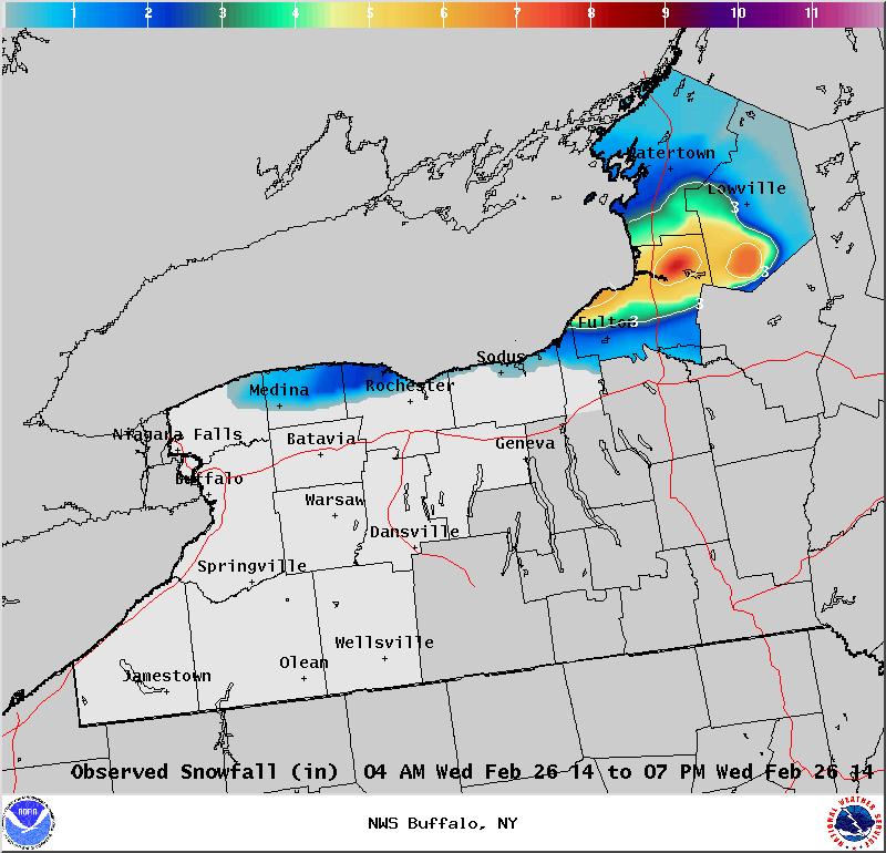
Maximum Snowfall: Lake Erie < 2" ; Lake Ontario 7.6" (Oswego) Duration: 15 hours +/- Prime feature: Marginal event, westerly flow.
Our 14th lake effect snow event of the season was a minor event that occurred behind an arctic front. Lake effect parameters were moderate to good for snow formation. At 850 hPa temperatures dropped down to -25C and this created a fair amount of lake instability, and moisture was good through a yet shallow snow growth zone. However the transitory and brief nature of this band east of Lake Ontario left the region with less than 10 inches of snow at any given spot. Through the morning hours a southerly shift to the band brought some snow along the western Lake Ontario shoreline, and then inland across northeast Wayne, northern Cayuga and western Oswego County. As winds backed through the day the band of snow lifted northward before weakening and becoming diffuse. Off Lake Erie some light snow streamers fell across the western Southern Tier, and across southern Erie and Wyoming counties. Due to the frozen lake, accumulations of snow were light.
|