Dangerous heat will expand from the Gulf Coast into the Southern Plains and Desert Southwest through week's end. Additional extreme heat impacting the Pacific Northwest will shift to the northern Plains by the weekend. Tropical Storm Bertha is expected to continue to impact portions of the northern Gulf Coast from the western Florida Panhandle to southeastern Louisiana through tonight. Read More >
Lake Effect Summary - February 14, 2015
|
|
|
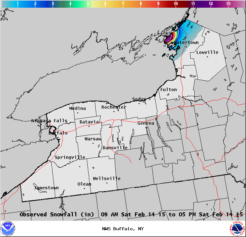
Maximum Snowfall: Lake Erie - No Lake Effect Snow; Lake Ontario 12.0" (Cape Vincent) Duration: 9 hours +/- Flake Scale: 1 flake*
The 10th lake effect snow event of the winter season was a unique event in that it only brushed far northern Jefferson County. This short lived event on Valentine’s Day dropped a fresh foot of snow through the Saint Lawrence Valley. Ahead of a sharp arctic front boundary a band of persistent lake snows formed across northern Jefferson County, and produced snowfall rates over an inch per hour. This lake snow band persisted into the afternoon hours before the arctic boundary swept the snows eastward. Here are some representative snow amounts from this event.
|