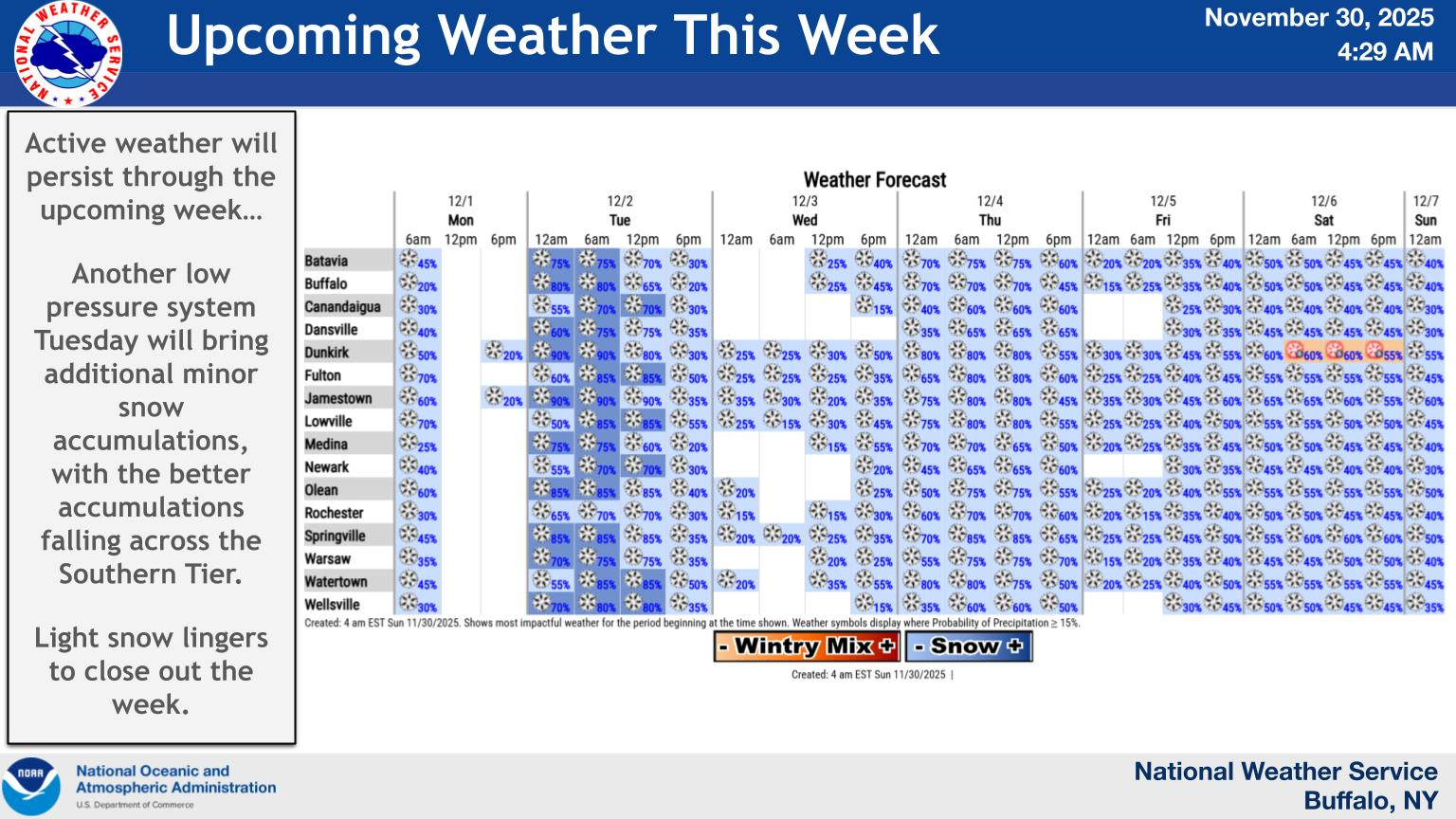
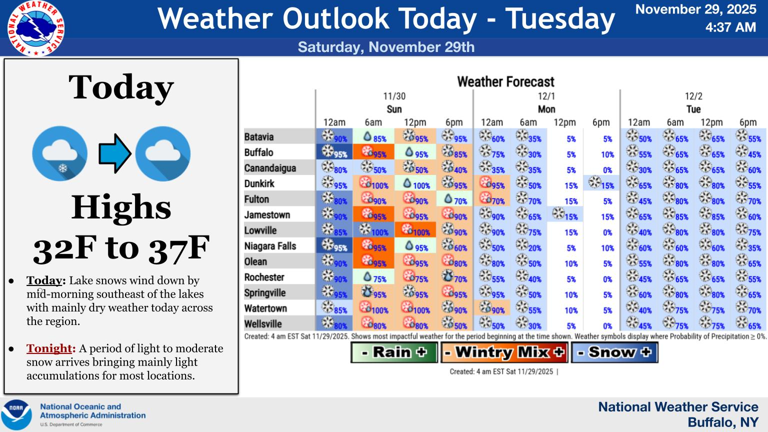
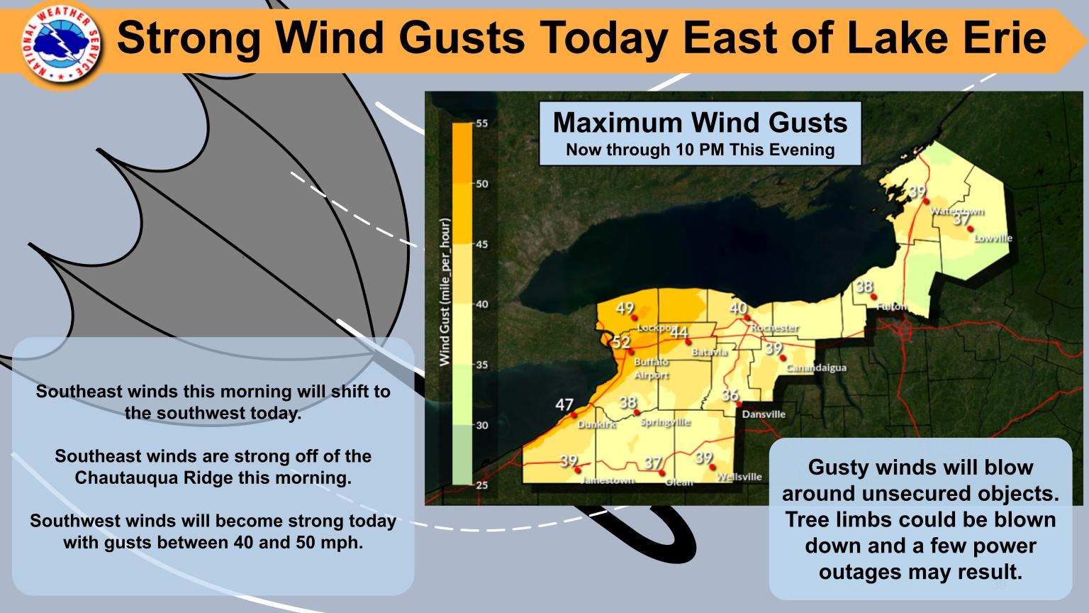
National Weather Service United States Department of Commerce

Hazardous Spring Weather Shifts to the Eastern and Northwest U.S. Wednesday

Isolated to scattered severe thunderstorms are expected Wednesday from the ArkLaTex and Lower Mississippi Valley northeastward through the Ohio Valley and Mid-Atlantic. Thunderstorms may produce heavy to excessive rain that could pose a flooding threat from east Texas into Upstate New York. A moderate atmospheric river will bring heavy snow and high winds to the Northwest U.S. Read More >

Northeast flow through the Saint Lawrence Valley will lower temperatures to just under freezing later tonight through Wednesday morning. In coming rain will freeze through tomorrow morning with slippery spots developing.
Continued snowmelt combined with additional rainfall will bring about the possibility of flooding on the Black, Moose, Independence, and Beaver Rivers as well as other tributaries.
Continued snowmelt combined with additional rainfall is expected to cause the Black River at Watertown to reach minor flood stage later this week, with additional rises possible through the end of the week.
Well above average temperatures continue through midweek. Rain showers move in today through Wednesday with a few thunderstorms possible before a strong cold front plows across the region late Wednesday into Wednesday evening ushering in a period of near to below normal temperatures for the Thursday through Saturday time period. Periodic chances for rain and snow linger through this weekend.