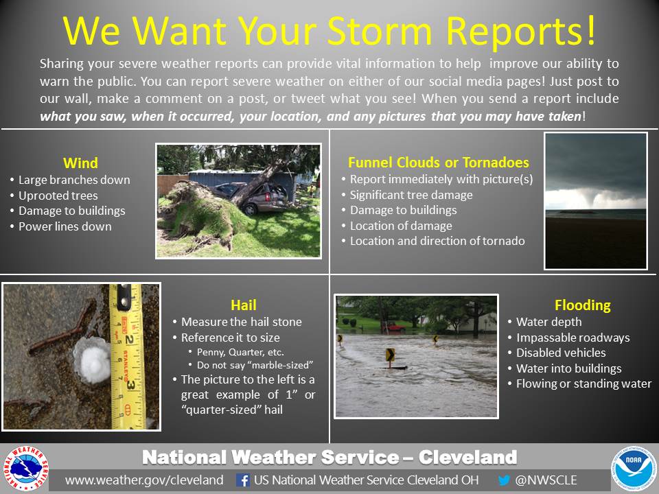
The National Weather Service in Cleveland uses severe weather reports from the public, law enforcement, emergency management, and the local media to help in the warning process. Reports of damaging winds, destructive hail, tornadoes, and flooding help us verify our warnings and provide ground truth of the current weather to assess potential impacts in areas in the path of storms. Storm reports help build our confidence in forecasting ongoing severe weather and help us communicate threats to communities that will about to be impacted by storms. Thus, storm reports are vital to the warning process, so we want your help!
If you see severe weather impacting your area, you can report it on our social media sites! Reference the graphic below to see if your observation qualifies as a severe weather report. Then, proceed either the NWS Cleveland Facebook or Twitter Page and post your report or photos to our page or tweet us your observations. Please be as specific as you can in your reports and pictures are very much appreciated! We only ask that you do not leave a safe shelter if severe weather is overhead! Lightning strikes often occur in thunderstorms are just as deadly as the wind, hail, tornadoes, and flooding, so please be safe first! The National Weather Service in Cleveland appreciates your help in being a part of a Weather-Ready Nation.
Here are the links to the NWS Cleveland Social Media Pages:
NWS Cleveland Facebook: www.facebook.com/NWSCleveland
NWS Cleveland Twitter: www.twitter.com/NWSCLE
Don't forget to give us a like or follow!