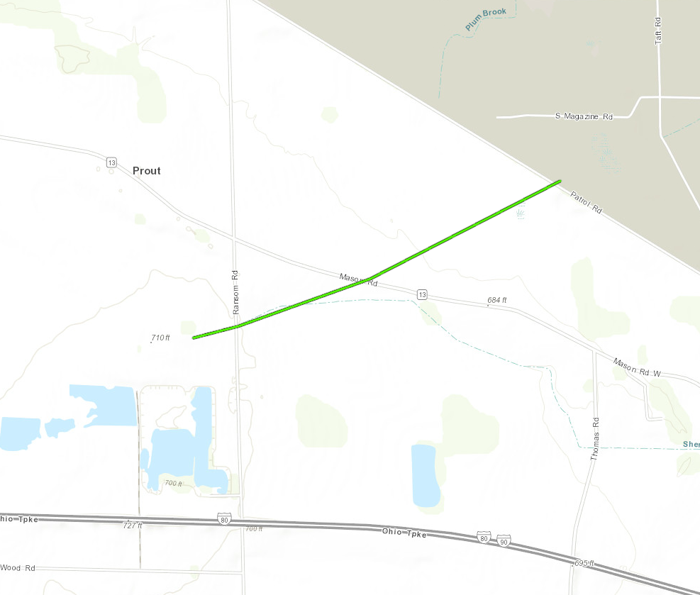
Location...1 ESE Bloomingville in Erie County, Ohio
Date...November 5, 2017
Start Time...2:42 PM EST
End Time...2:44 PM EST
Maximum EF-Scale Rating...EF-1
Estimated Maximum Wind Speed...100 MPH
Maximum Path Width...50 yards
Path Length...1.24 miles
Fatalities...0
Injuries...0
* The information in this statement is preliminary and subject to
change pending final review of the event(s) and publication in
NWS Storm Data.
...Summary...
The National Weather Service in Cleveland OH has confirmed a
tornado near 1 ESE Bloomingville in Erie County Ohio on November
5, 2017.
Two homes were damaged along the path. A house at the starting
point was damaged by several large trees that fell on the
property. All of the damage was due to trees falling on the
house.
Some tree damage and damage to a small barn was at another
point along the path. A trailer was also flipped at the
residence.
At the third location a roof was completely ripped off of a home
on Mason Road. The roof landed in NASA Plum Brook.
The storm ended at NASA Plum Brook as an EF-0. Minor
tree damage on the NASA south end of the property.
This information can also be found on our website at
weather.gov/cle.
For reference: the Enhanced Fujita Scale classifies tornadoes
into the following categories:
EF0...Wind speeds 65 to 85 mph
EF1...Wind speeds 86 to 110 mph
EF2...Wind speeds 111 to 135 mph
EF3...Wind speeds 136 to 165 mph
EF4...Wind speeds 166 to 200 mph
EF5...Wind speeds greater than 200 mph
$$


 Follow us on YouTube