Overview
|
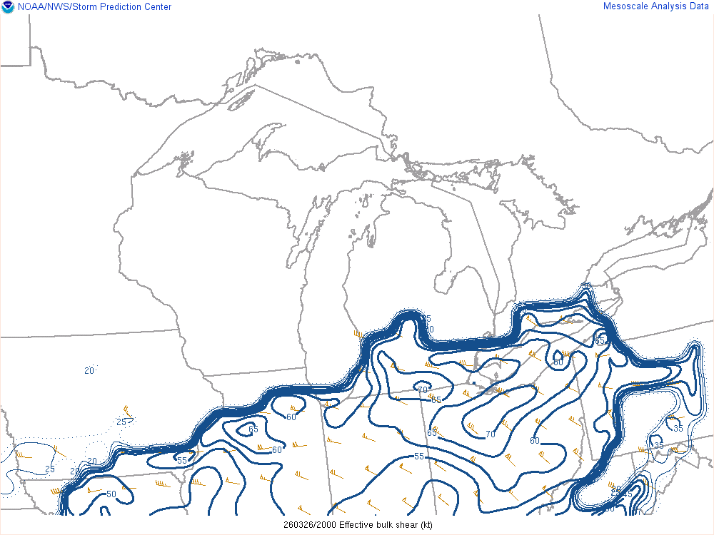
A cold front moved southeast across the area during the late afternoon and evening hours on March 26th. Thunderstorms developed near the cold front as it progressed through the area. A combination of moderate instability, fueled by quickly cooling temperatures in the mid-levels of the atmosphere, along with moderate to strong wind shear, supported organized thunderstorms and all modes of severe weather. Two weak tornadoes were confirmed across the area, along with several reports of hail up to golf ball-sized and sporadic straight-line wind damage. |
 Radar loop from 4 PM to 11 PM on March 26, 2026. |
Tornadoes:
|
Tornado - Mount Gilead, OH
|
||||||||||||||||
|
Tornado - Green Valley, OH
|
||||||||||||||||
The Enhanced Fujita (EF) Scale classifies tornadoes into the following categories:
| EF0 Weak 65-85 mph |
EF1 Moderate 86-110 mph |
EF2 Significant 111-135 mph |
EF3 Severe 136-165 mph |
EF4 Extreme 166-200 mph |
EF5 Catastrophic 200+ mph |
 |
|||||
Environment
 |
 |
| Figure 1: WPC surface analysis map from the morning into the early overnight on March 26, 2026. | Figure 2: Upper air (300 mb) map across the CONUS from 8 PM on March 26, 2026. |
 |
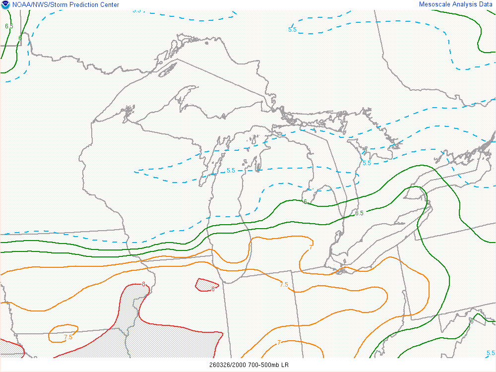 |
| Loop of effective deep layer shear during the late afternoon and evening hours on March 27th. Values of 50 to 70kt were in place, supportive of organized severe weather. | Loop of mid-level (500-700mb) lapse rates during the late afternoon and evening hours on March 27th. Values of 6.5 to 7.5C/km are supportive of large hail. |
 |
Media use of NWS Web News Stories is encouraged! Please acknowledge the NWS as the source of any news information accessed from this site. |
|


