Overview
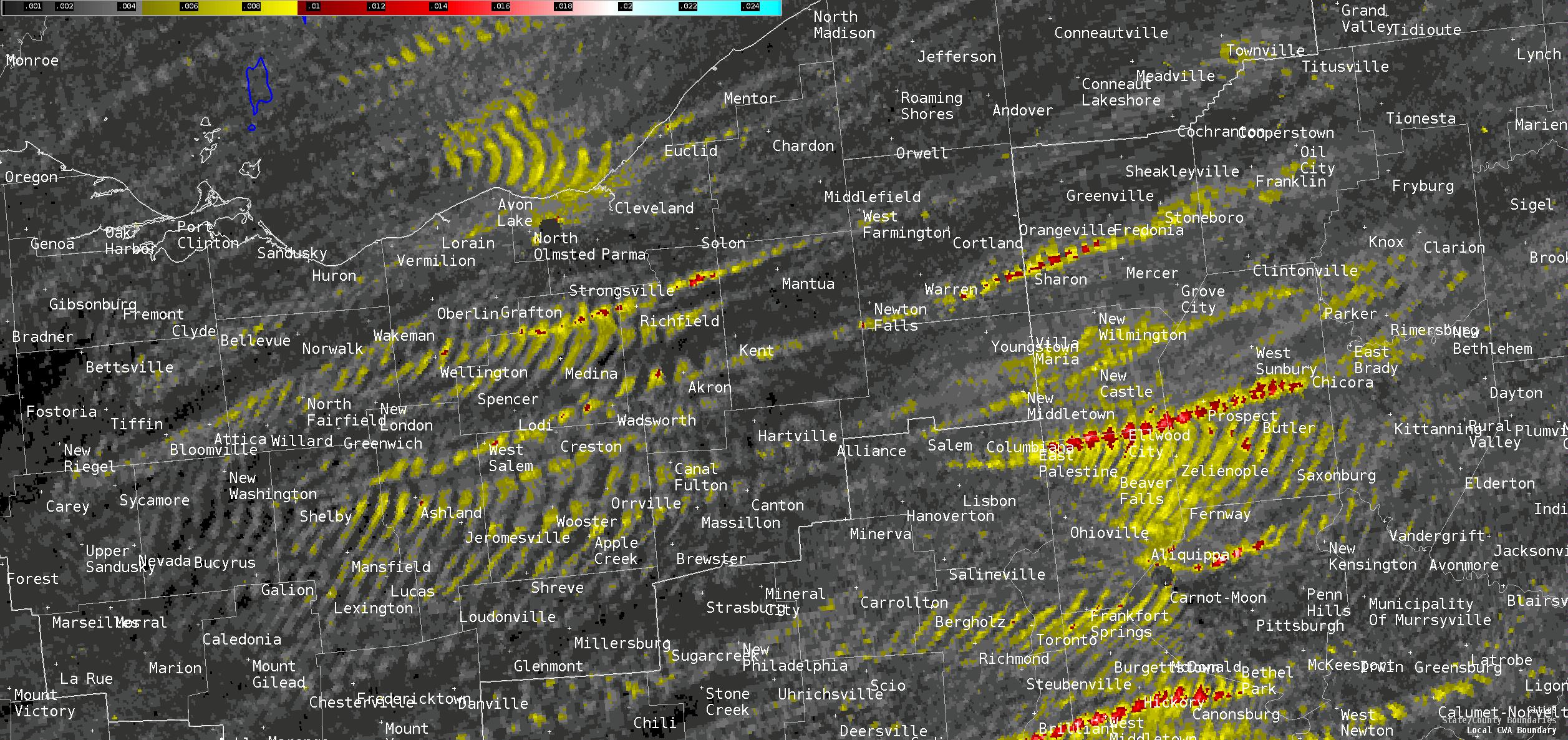
A potent upper-level trough moved into the Great Lakes region on Thursday, October 21st, 2021, with an associated cold front moving east across the forecast area during the afternoon hours. A broken line of low-topped thunderstorms developed along the cold front during the early afternoon hours, moving into an environment characterized as low CAPE, high shear. Instability was very low with MLCAPE less than 500 J/kg. However, deep-layer shear was extremely favorable due to a belt of mid-level flow up to 60 knots. Storm relative helicity (SRH) was particularly favorable in the lowest levels with 0-500m SRH exceeding 100 m^2/s^2. As this broken line of storms moved into this environment, they began to show characteristics of low-topped supercells. These thunderstorms would go on to produce eight tornadoes across portions of northeast Ohio between 4:30 PM and 6:30 PM that afternoon, consisting of four EF-1’s and four EF-0’s.
Tornadoes:
|
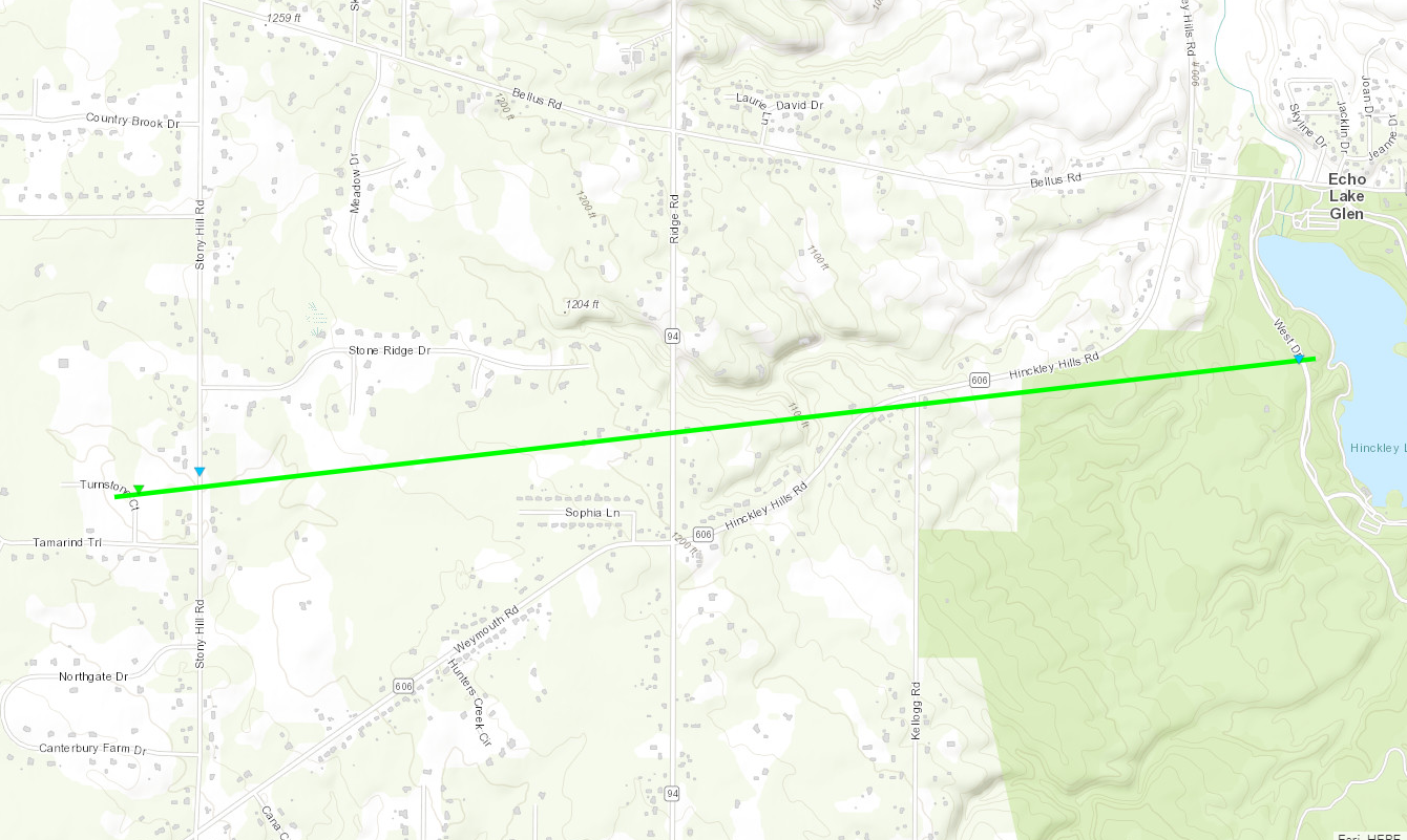
Hinckley Tornado
|
||||||||||||||||
|
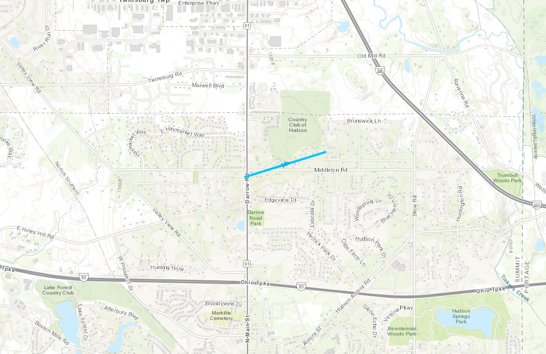
Hudson Tornado
|
||||||||||||||||
|
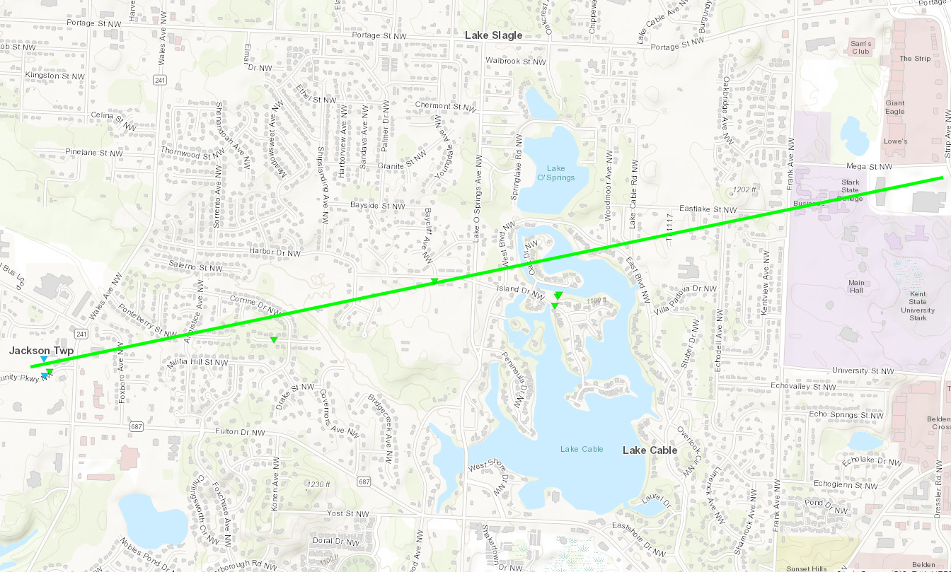
Jackson Township Tornado
|
||||||||||||||||
|
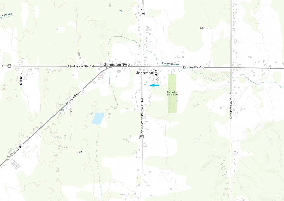
Johnston Township Tornado
|
||||||||||||||||
|
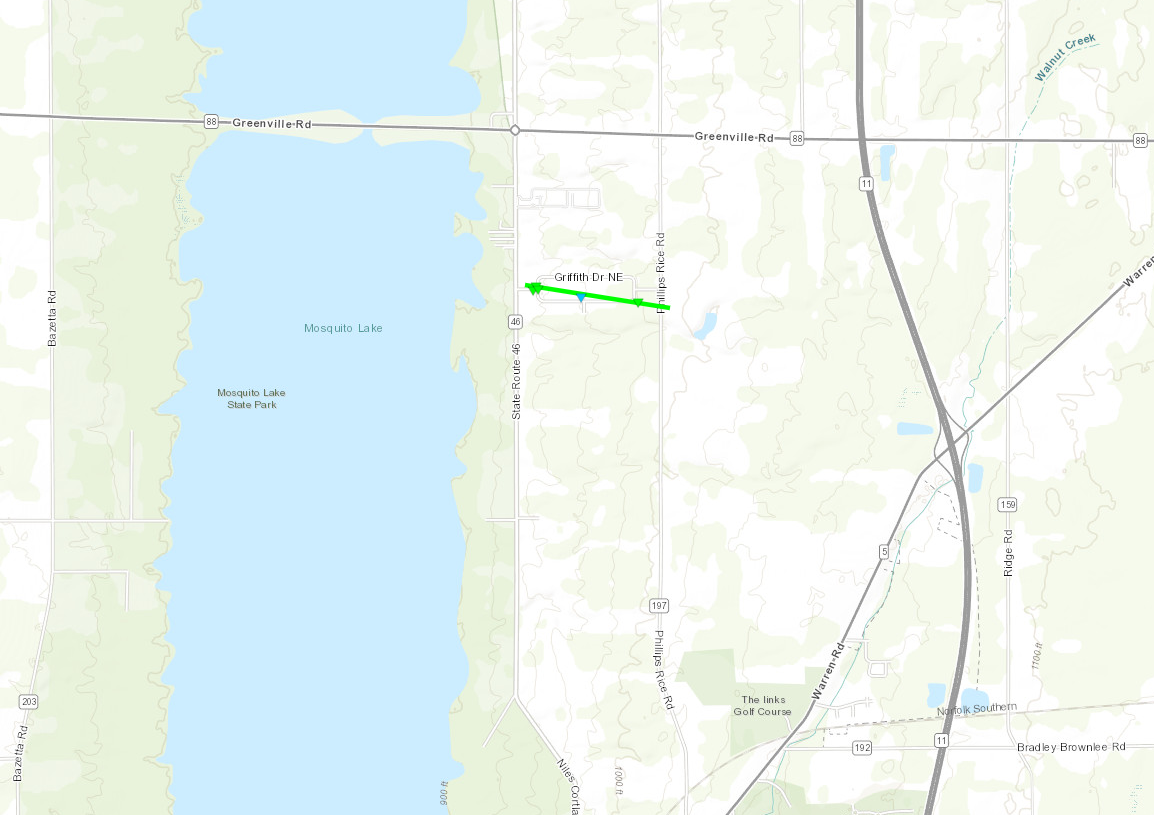
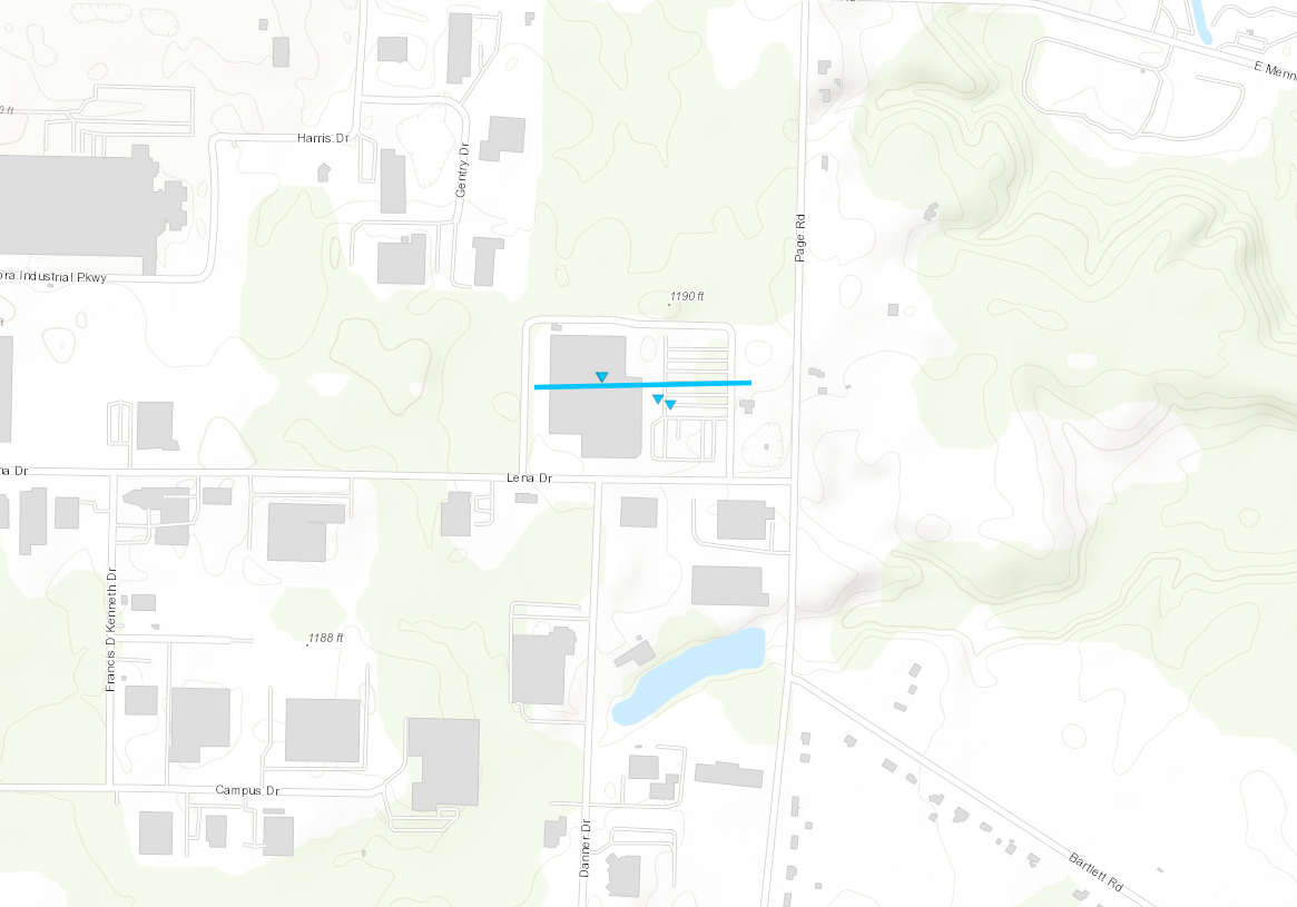
Mecca Tornado
|
||||||||||||||||
|
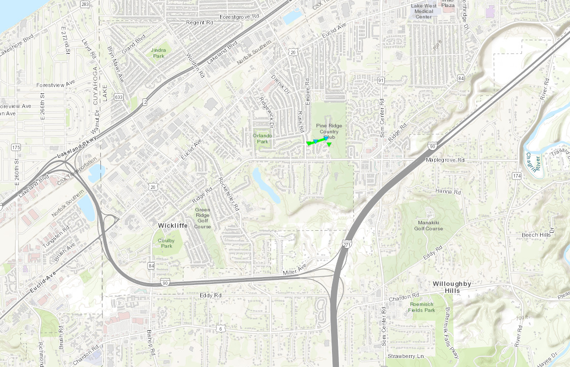
Wickliffe Tornado
|
||||||||||||||||
|
Aurora Tornado
|
||||||||||||||||
|
Seville Tornado
|
||||||||||||||||
The Enhanced Fujita (EF) Scale classifies tornadoes into the following categories:
| EF0 Weak 65-85 mph |
EF1 Moderate 86-110 mph |
EF2 Significant 111-135 mph |
EF3 Severe 136-165 mph |
EF4 Extreme 166-200 mph |
EF5 Catastrophic 200+ mph |
 |
|||||
Photos & Video
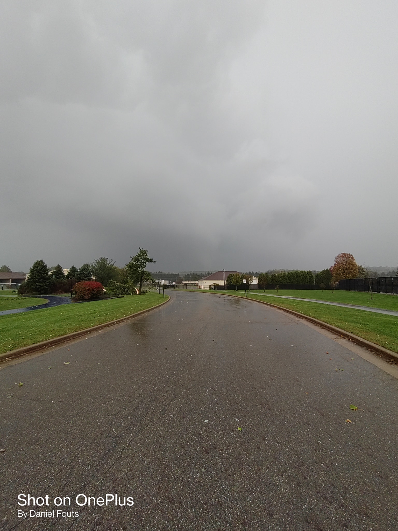
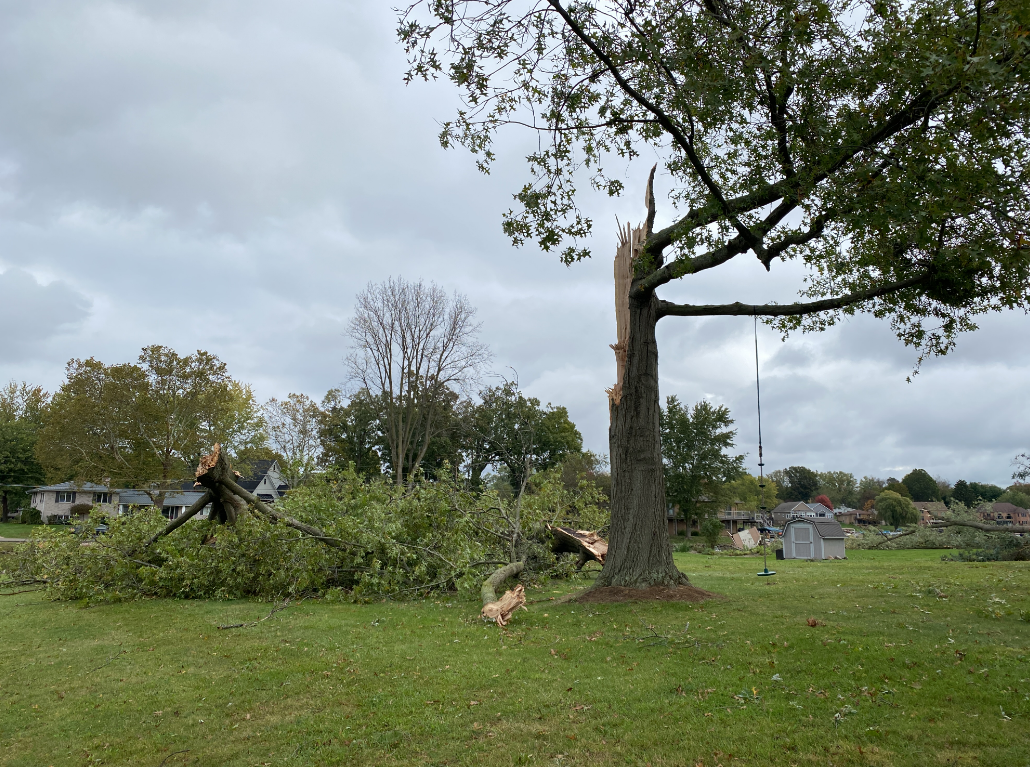
Hinckley/Wickliffe EF-1 Tornadoes
 |
 |
 |
 |
| Damage in Hinckley, OH from an EF-1 tornado survey. | Tree damage in the Hinckley Reservation from an EF-1 tornado survey. | Roof damage in Willowick from an EF-1 tornado survey. | Tree damage in Wickliffe from an EF-1 tornado survey. |
Mecca EF-1 Tornado
 |
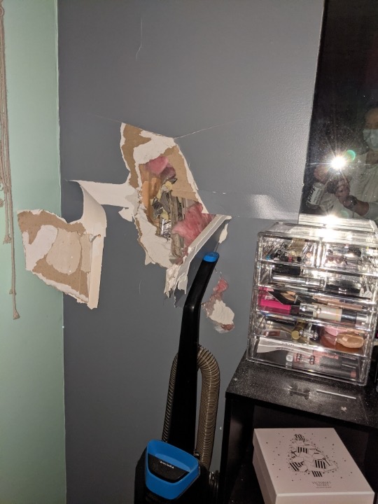 |
 |
 |
| Projectile through a house in Mecca, OH from an EF-1 tornado survey. | Damage to a house in Mecca, OH from an EF-1 tornado survey. | Another angle of the projectile into a house in Mecca, OH from an EF-1 tornado survey. | Outside view of damage to a house in Mecca, OH from an EF-1 tornado survey. |
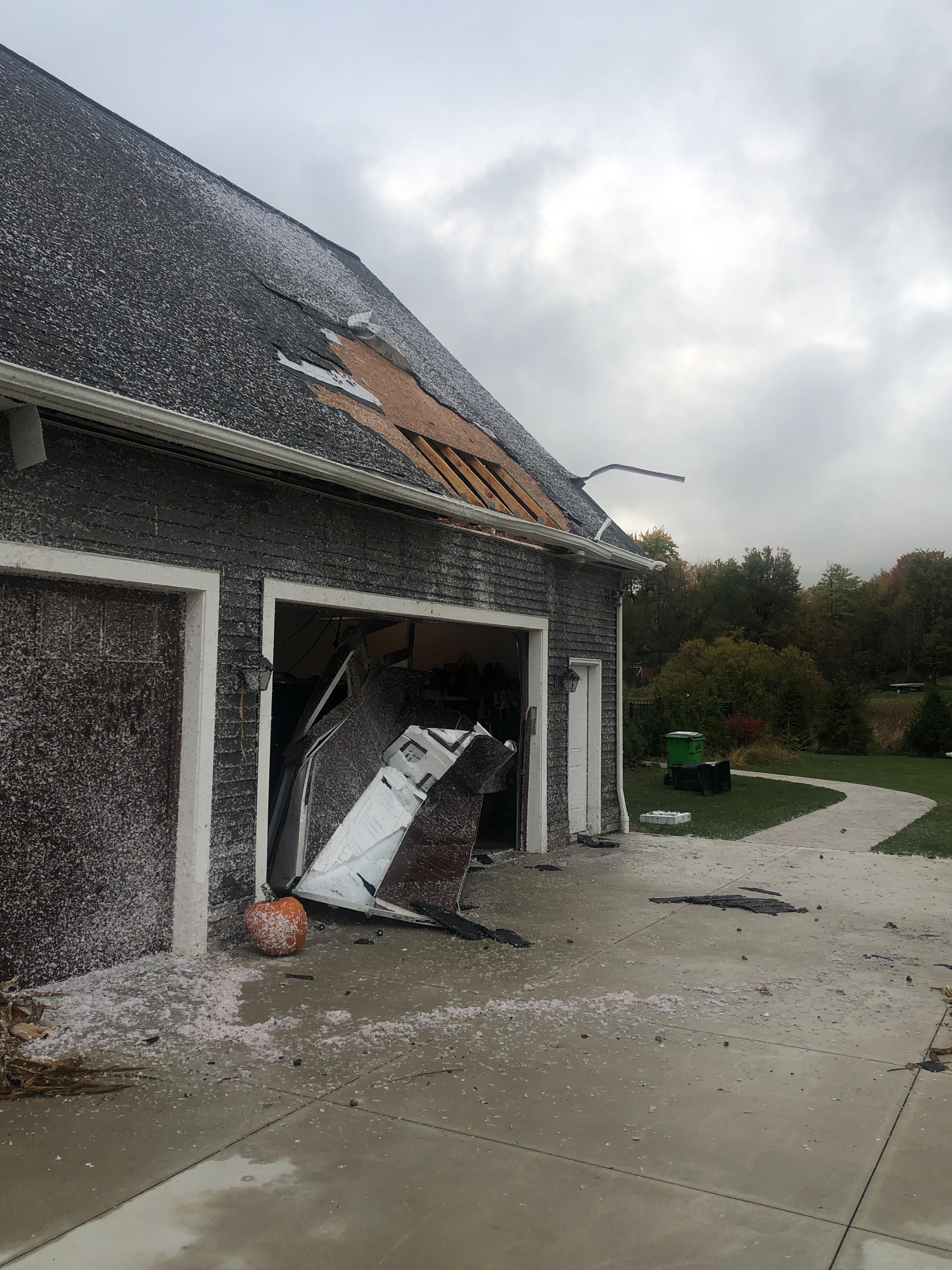
Jackson Township EF-1 Tornado
 |
 |
 |
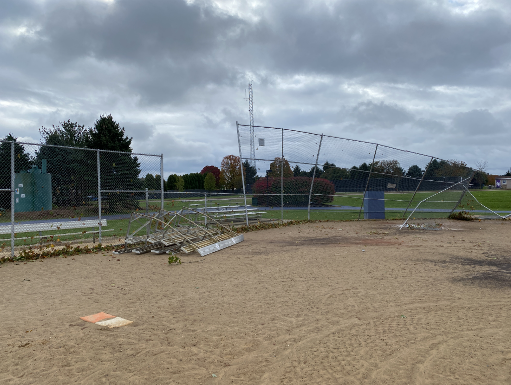 |
| Picture of the EF-1, rain-wrapped tornado in Jackson Township (Daniel Fouts). |
Tree damage from the EF-1 Jackson Township tornado survey. | Roof/structure damage from the EF-1 Jackson Township tornado survey. | Damage to fencing from the EF-1 Jackson Township tornado survey. |
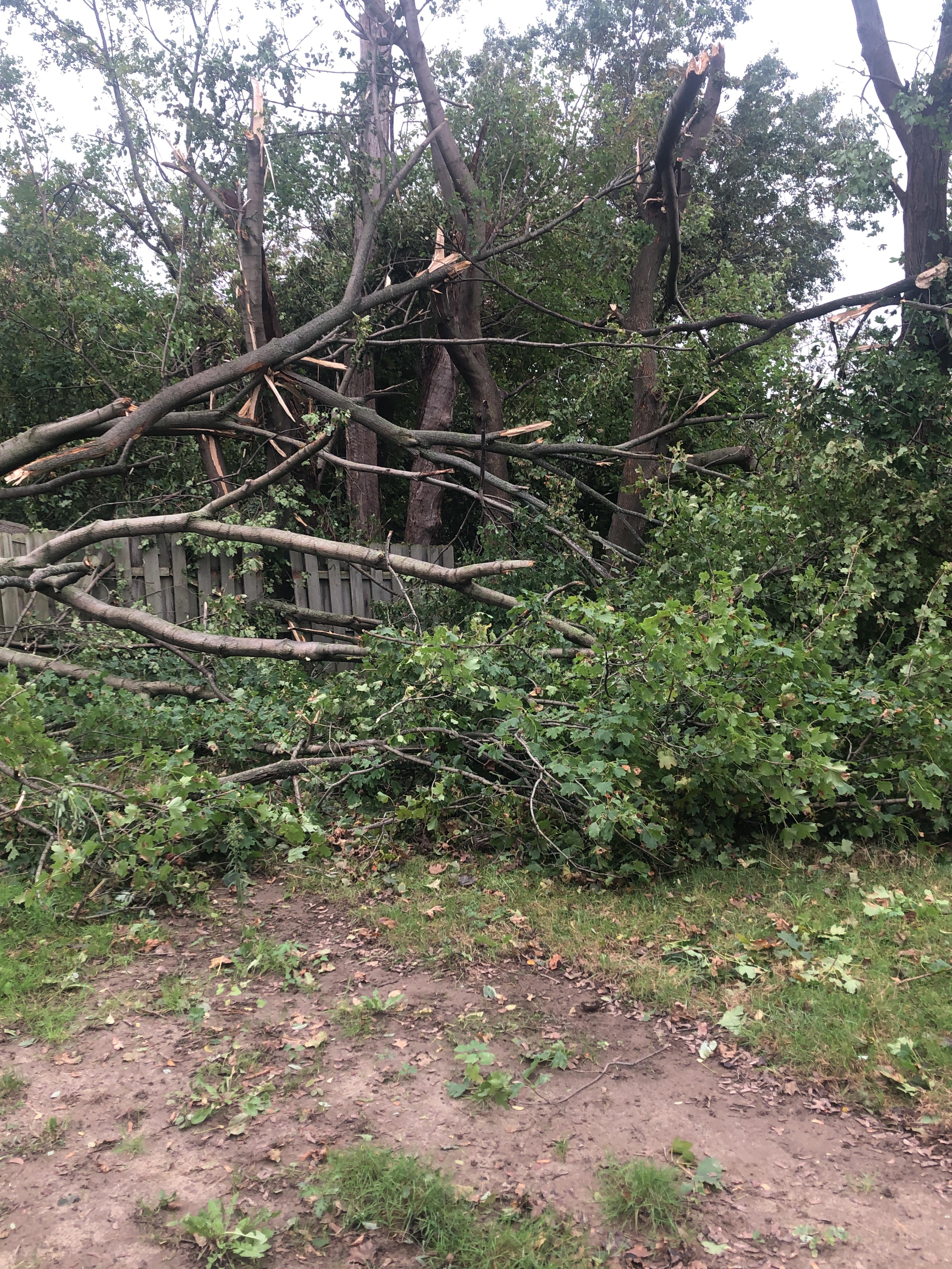
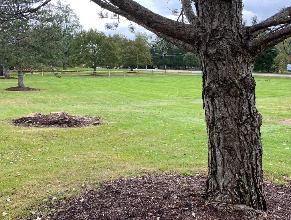
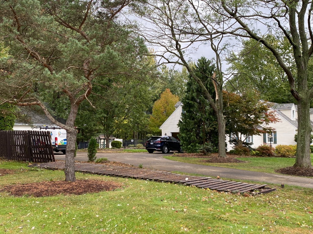
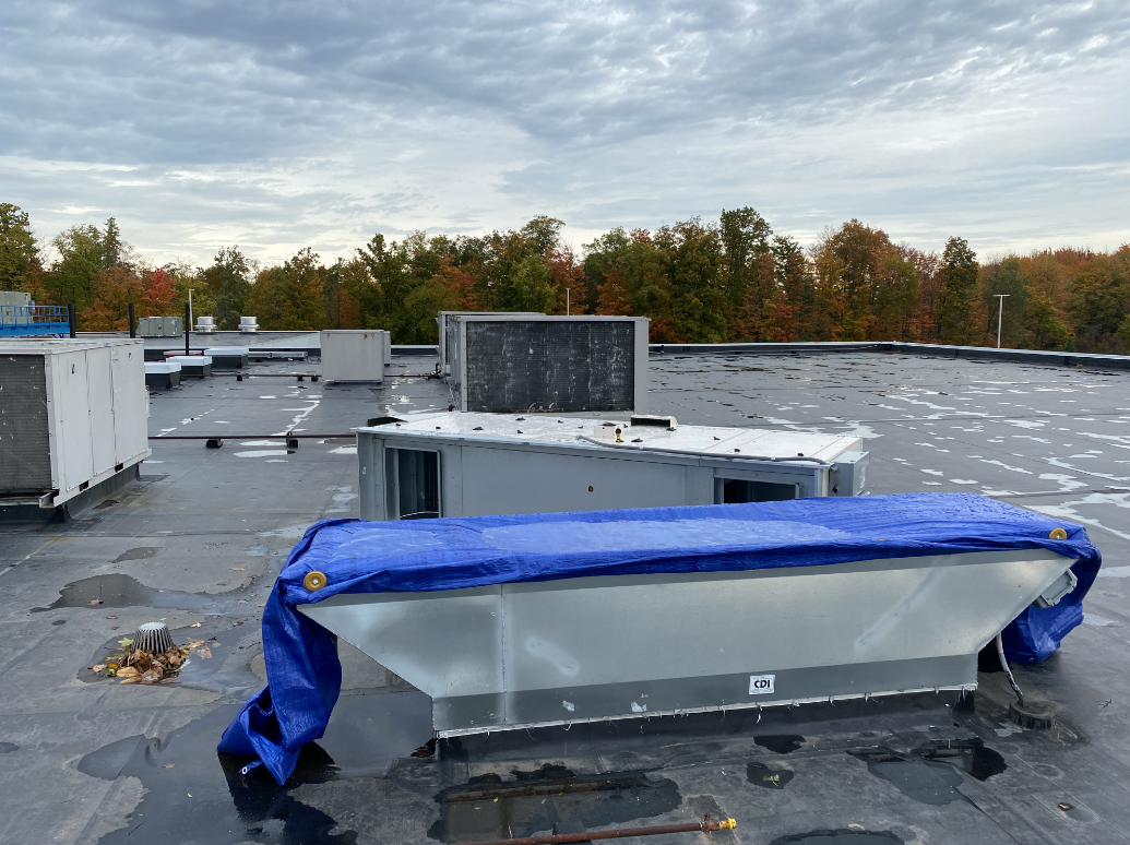
Hudson/Aurora EF-0 Tornadoes
 |
 |
 |
 |
| Tree damage from the EF-0 Hudson tornado survey. | Fence damage from the EF-0 Hudson tornado survey. | Roof AC displaced from the EF-0 Aurora tornado survey. | Intermittent tree damage from the EF-0 Aurora tornado survey. |
Radar
.gif) |
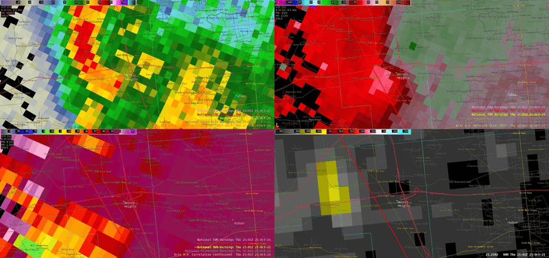 |
 |
 |
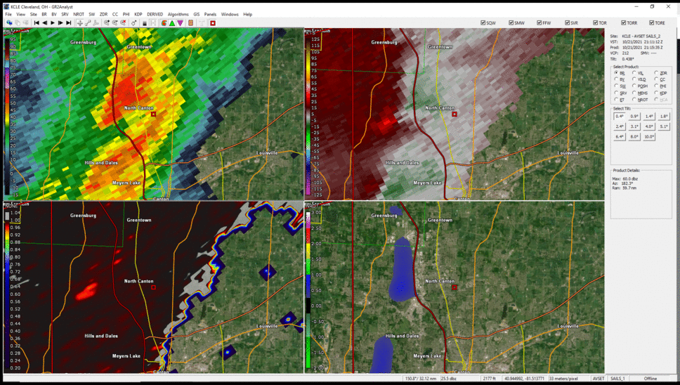
| Radar loop from 3:00 PM EDT to 8:00 PM EDT on October 21, 2021 | Radar loop of the EF-0 tornadic storm from Hudson, OH on October 21, 2021. Shown are reflectivity (top left), velocity (top right), correlation coefficient (bottom left), and MRMS rotation tracks (bottom right). | Radar loop of the EF-1 tornadic storm from Hinkley, OH on October 21, 2021. Shown are reflectivity (top left), velocity (top right), correlation coefficient (bottom left), and MRMS rotation tracks (bottom right). | MRMS rotation tracks from October 21, 2021. This helps give a general idea of the temporal and spatial extent of the tornadoes across the region. |
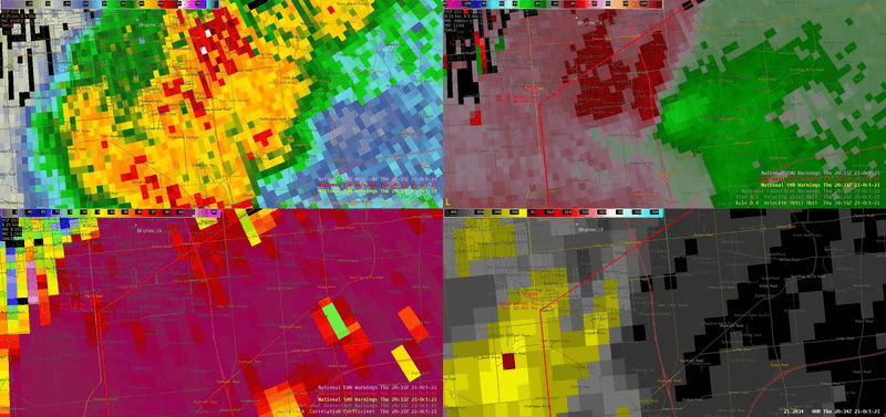
 |
 |
 |
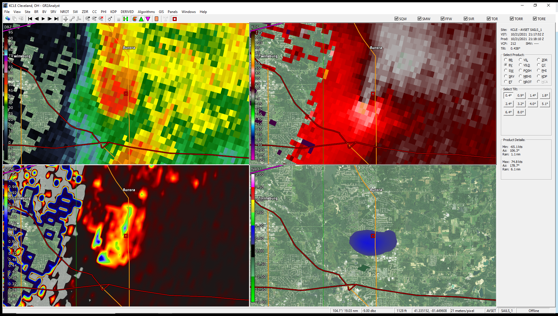 |
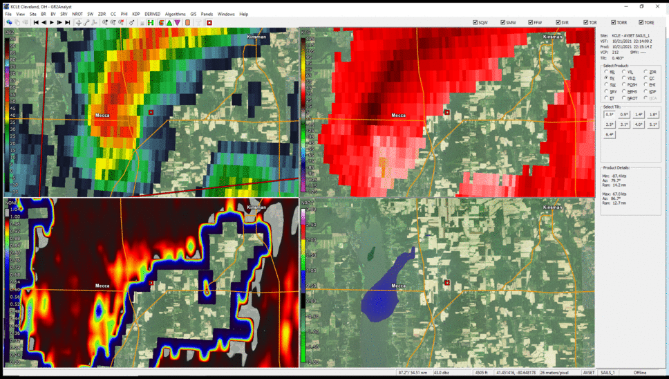
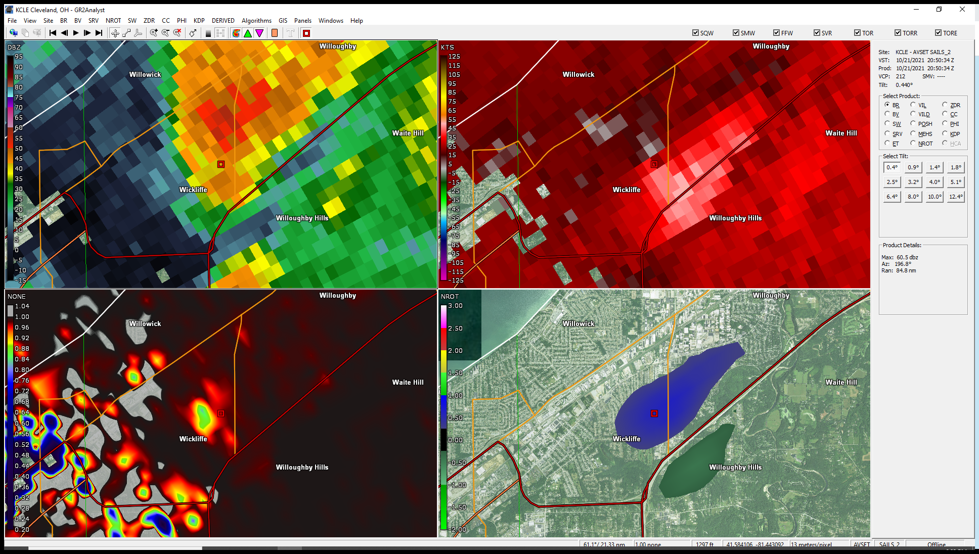
| Radar images from the Jackson Township tornado 5:15-5:17 PM. Displayed is reflectivity (top right), velocity (top left), correlation coefficient (bottom right), and rotational velocity (bottom right). | Radar images from the Mecca and Johnston Township tornadoes 6:15-6:20 PM. Displayed is reflectivity (top right), velocity (top left), correlation coefficient (bottom right), and rotational velocity (bottom right). | Radar image from Wickliffe tornado 4:50 PM. Displayed is reflectivity (top right), velocity (top left), correlation coefficient (bottom right), and rotational velocity (bottom right). | Radar image from the Aurora tornado 5:18 PM. Displayed is reflectivity (top right), velocity (top left), correlation coefficient (bottom right), and rotational velocity (bottom right). |
Environment
Upper air and surface analysis
 |
 |
 |
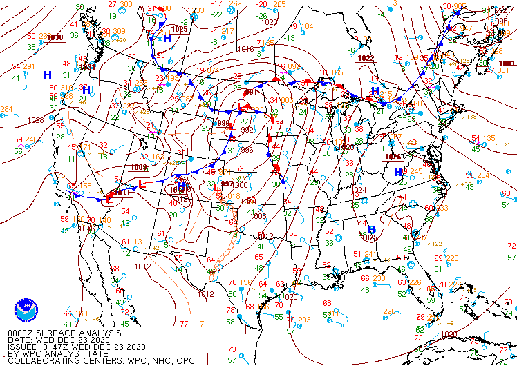 |
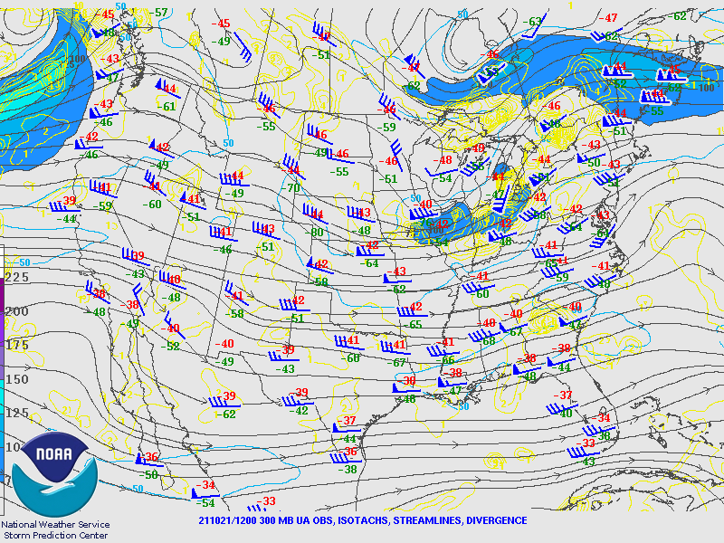
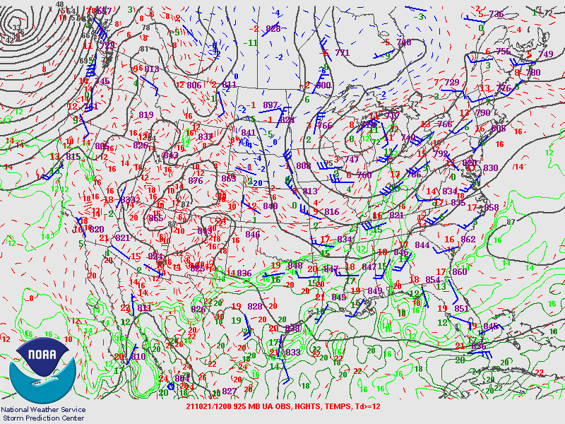
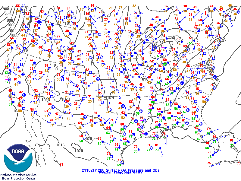
| 300 mb upper air map from 8 AM EDT, October 21, 2021. | 925 mb upper air map from 8 AM EDT, October 21, 2021 | Surface map from 8 AM EDT, October 21, 2021. Notice the slight, backed southerly winds across OH. | WPC surface analysis loop from 8 AM EDT to 8 PM EDT, October 21, 2021. |
SPC Mesoanalysis of the near storm environment
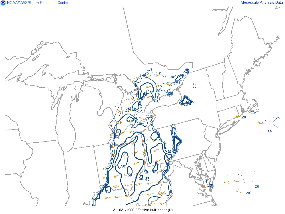 |
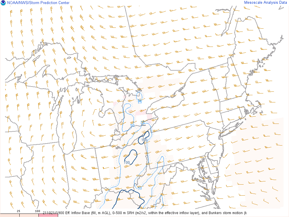 |
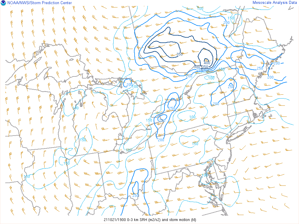 |
| Effective bulk shear values across the area at 3 PM EDT, October 21, 2021. Notice values of 50 knots across northern OH which are favorable for organized severe weather, given enough instability. | 0 to 500m storm-relative helicity at 3 PM EDT, October 21, 2021. Notice values in the 75 to 100 m2/s2 range, creating a marginally favorable low-level environment for rotating storms. | 0 to 3km storm-relative helicity at 3 PM EDT. Notice values in the 200 to 250 m2/s2 range across SE OH. These values were advected north into the area shortly thereafter, creating a moderately-favorable environment for mid-level rotating storms. |
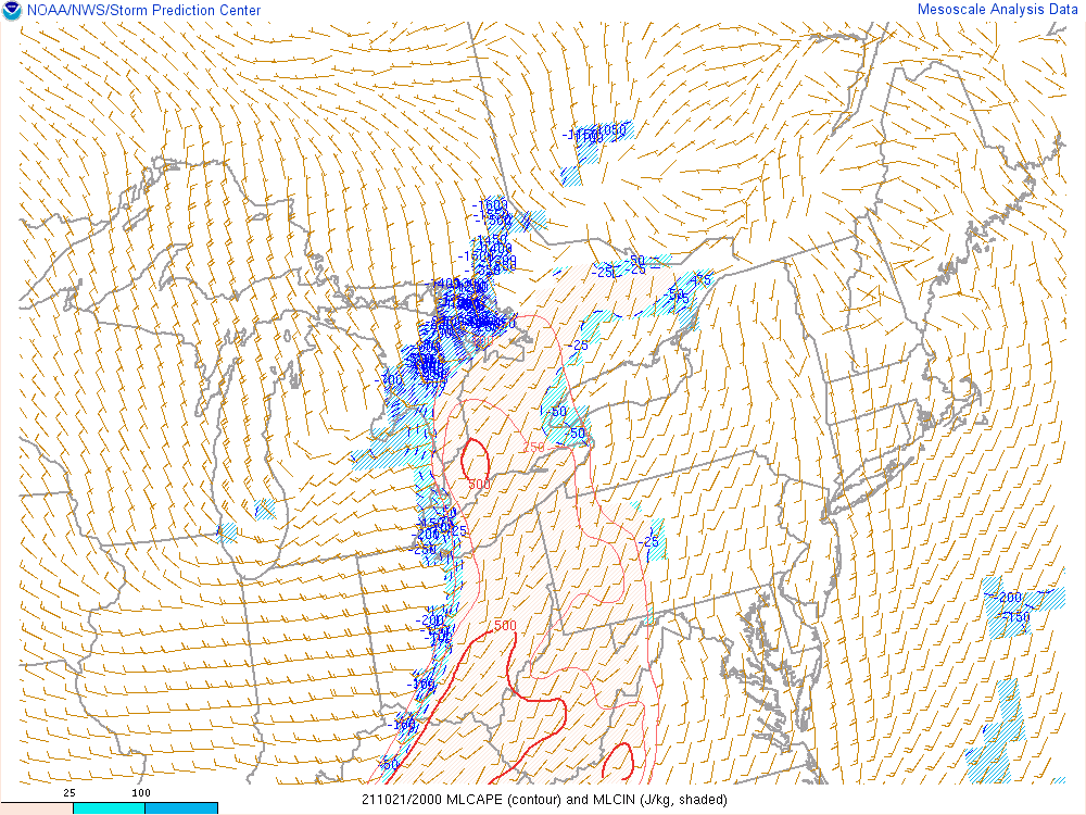
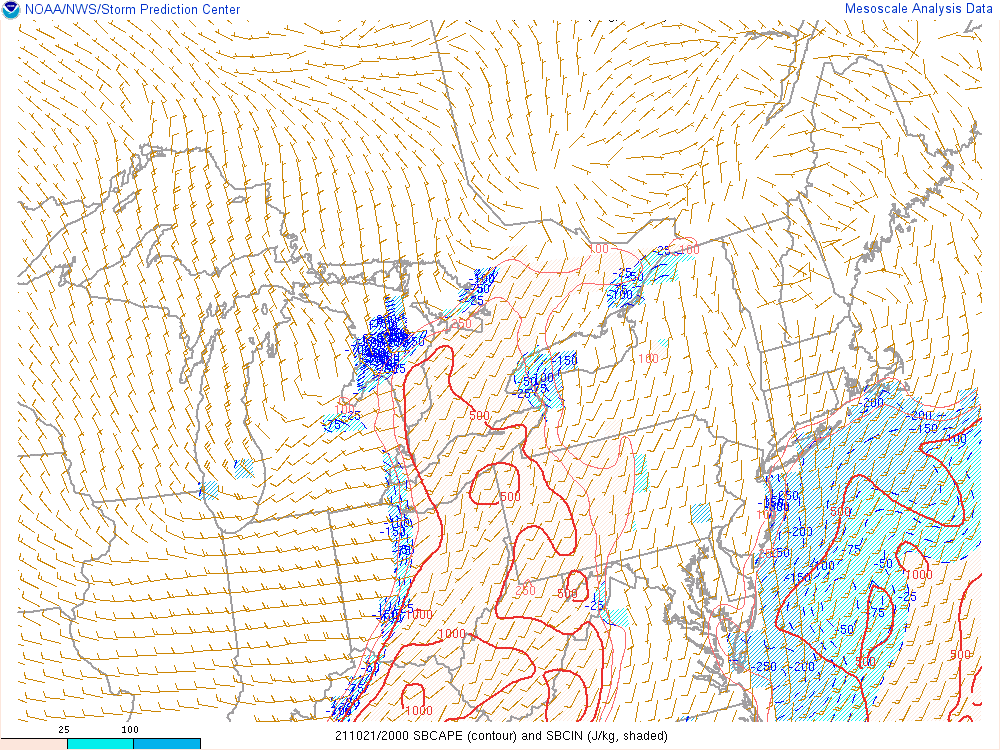 |
 |
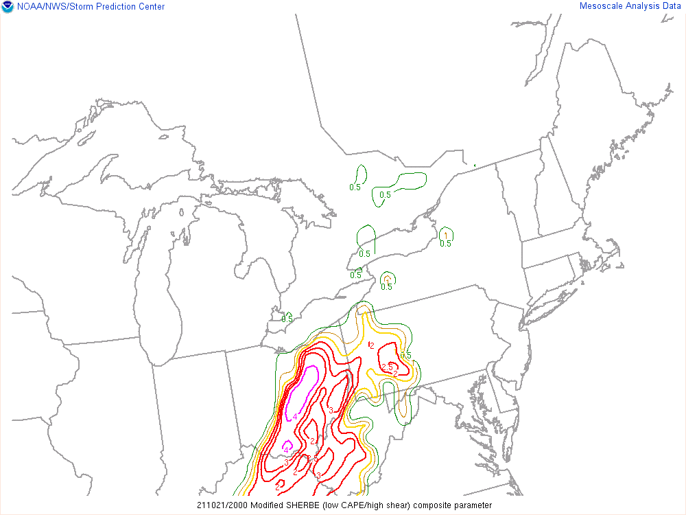 |
| Surface-based CAPE at 4 PM EDT, October 21, 2021. Notice values of around 500 to 750 J/kg, moderately favorable for surface-based storms to develop. | Mixed-layer CAPE at 4 PM EDT, October 21, 2021. Notice values in the 250 to 500 J/kg range, marginally favorable for any storms that do develop to sustain their updrafts. | Modified SHERBE (MOSHE) composite parameter at 4 PM EDT, October 21, 2021. These values indicate a favorable high shear, low CAPE (HSLC) environment parameter space across central and northern OH for severe weather potential. |
 |
Media use of NWS Web News Stories is encouraged! Please acknowledge the NWS as the source of any news information accessed from this site. |
|


.PNG)