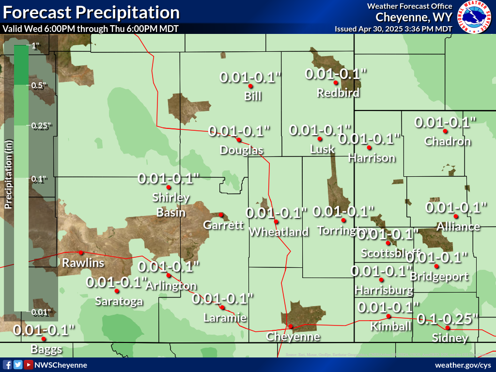
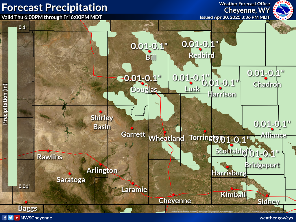
Precipitation Forecast |
||
| Day 1 | Day 2 | Day 3 |
 |
 |
 |
Click to enlarge graphics
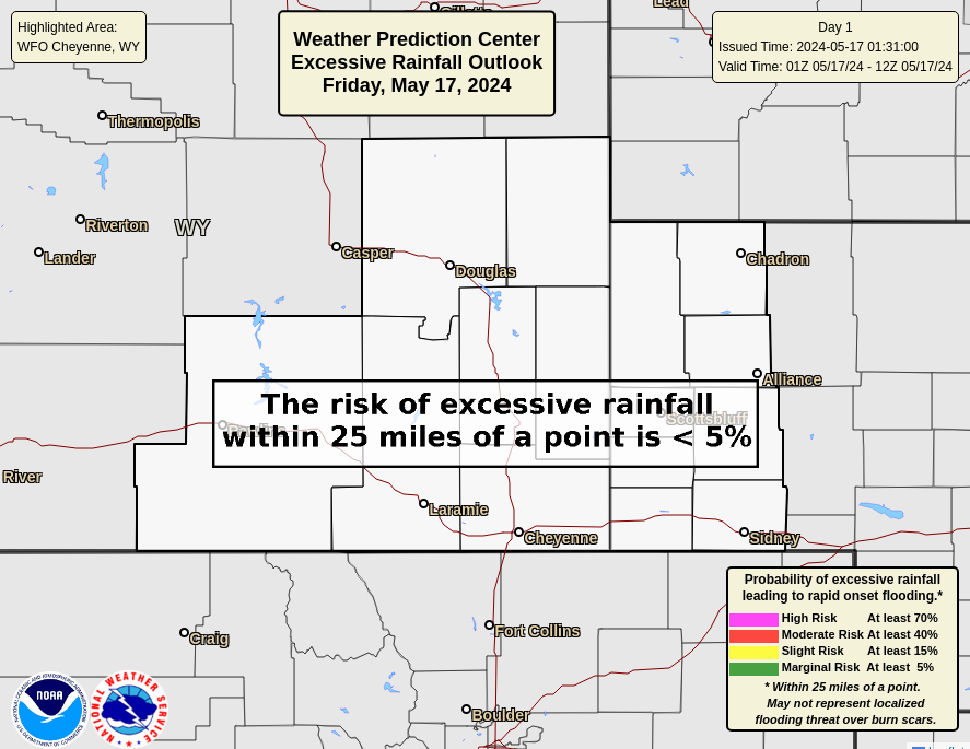
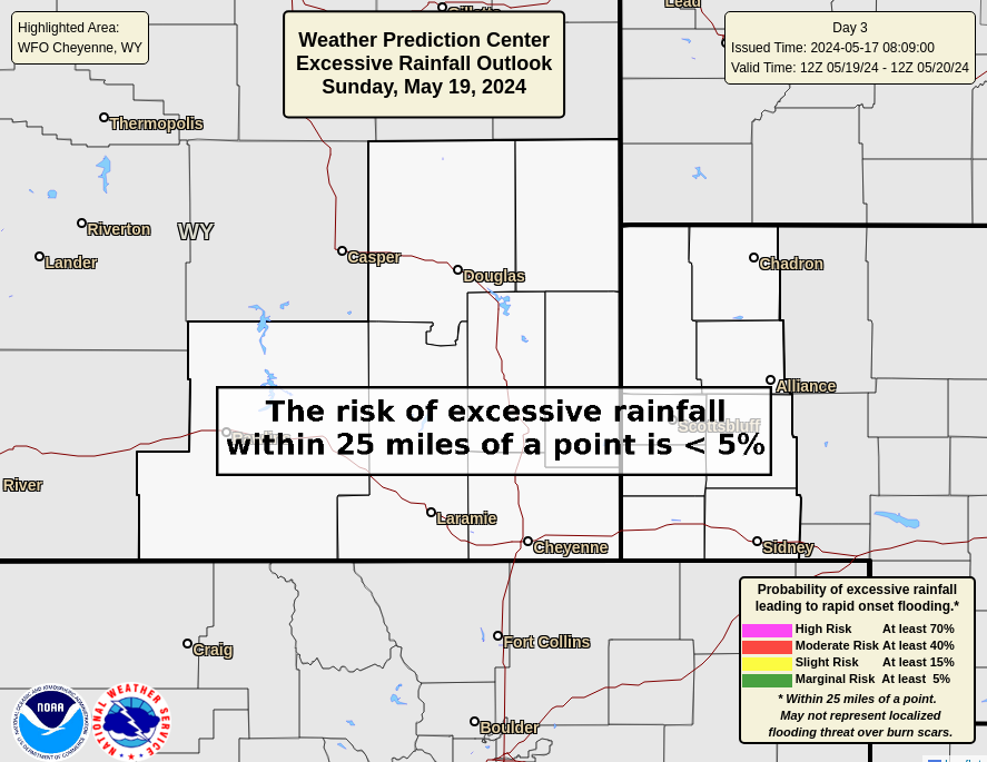
Excessive Rainfall Outlook |
|
| Today's Flash Flooding Potential | Tomorrow's Flash Flooding Potential |
 |
 |
| Day 3 Flash Flooding Potential | |
|
|
|
|
Click to enlarge graphics |
|
Observed Precipitation |
|
|
24 Hour Estimated Precipitation |
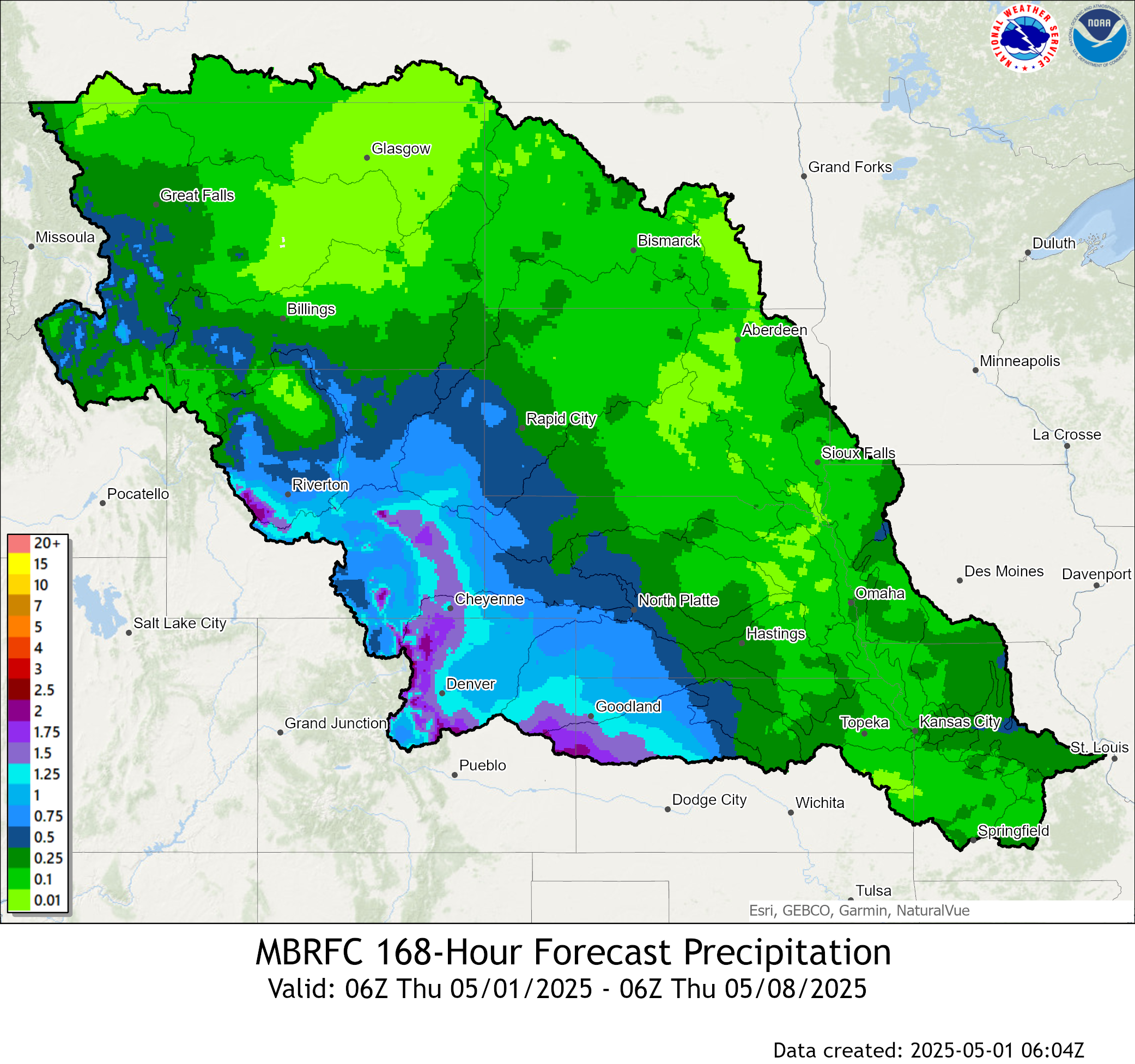
168 Hours Estimated Precipitation |
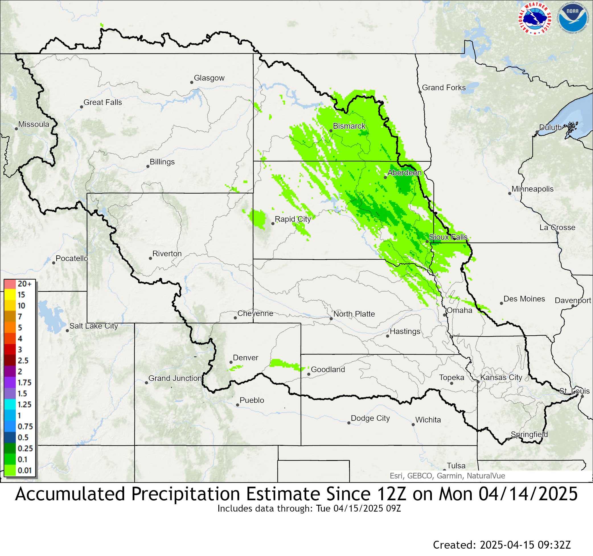 |
 |
Missouri Basin River Forecast Center Outlooks |
||
| Probabilities of Exceeding | ||
| Minor Flood Levels | Moderate Flood Levels | Major Flood Levels |
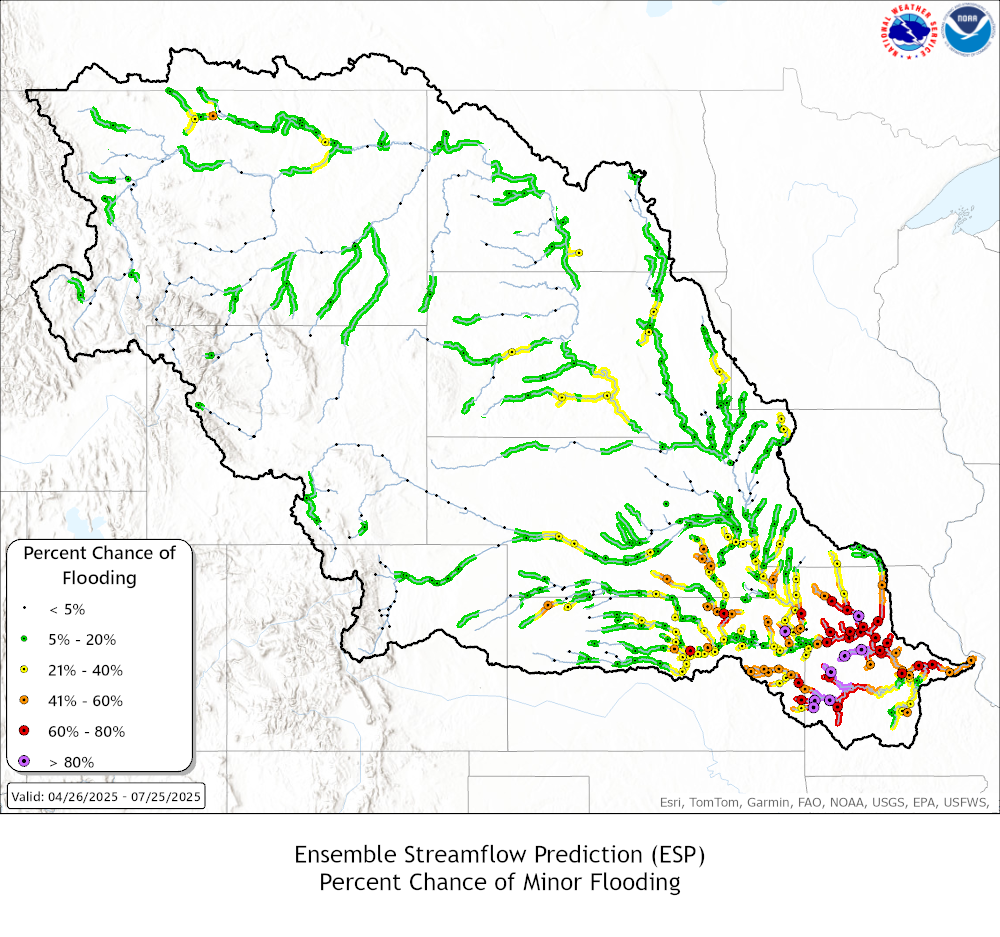 |
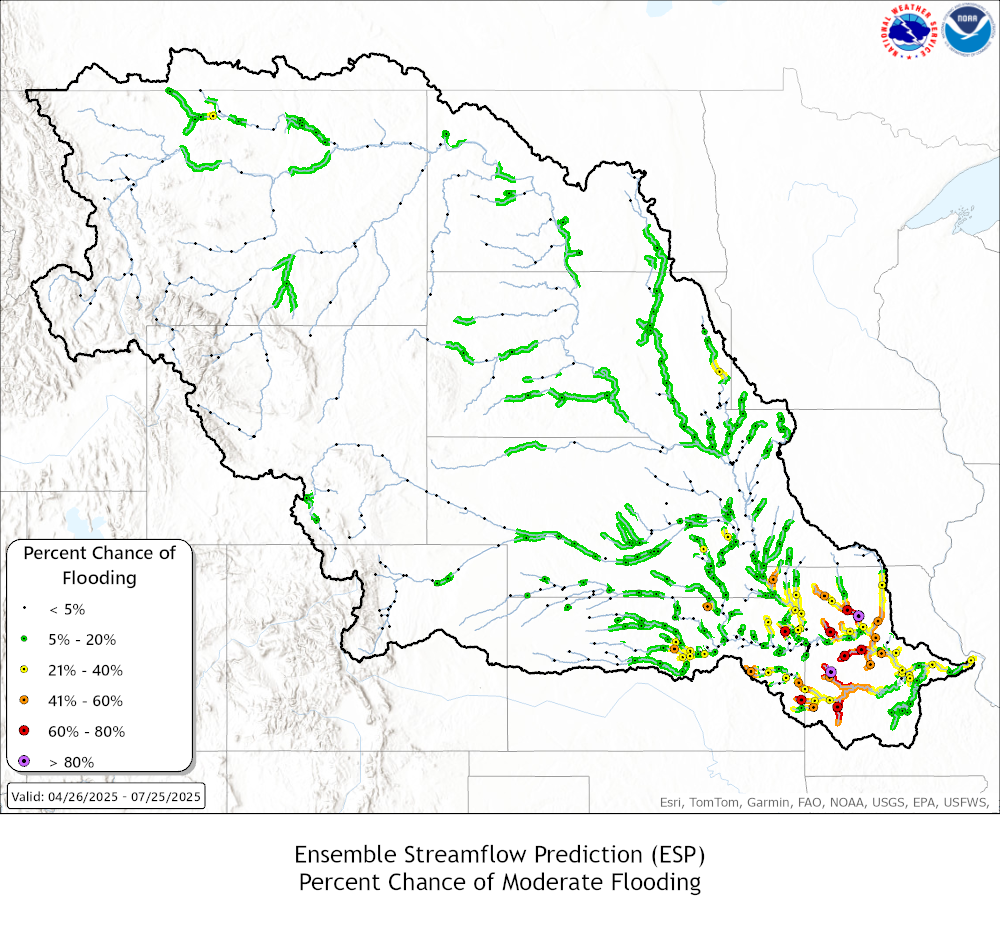 |
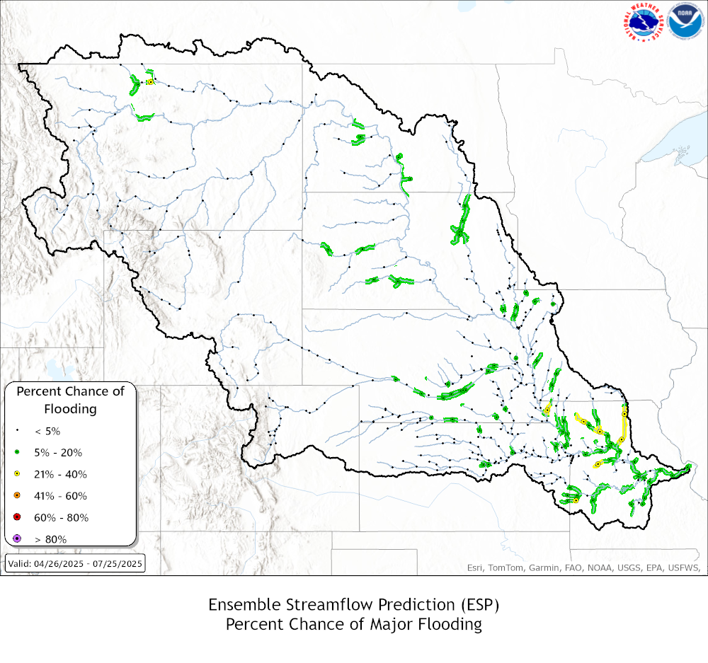 |
|
Click to enlarge graphics |
||
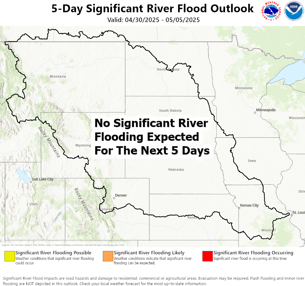
5-Day River Flood Outlook |
| Missouri Basin River Forecast Center |
|
|
|
*Forecasts may not be available for all locations. Forecasts are updated more routinely when flooding is anticipated or ongoing. Click here for all southeast Wyoming and western Nebraska river and lake gauge readings For more information about river forecasts and flooding potential, |
|
North Platte River Hydrograhs & HEFS Click on Hydrograph to expand image, click on text below each image to see stage impacts and historic crests. |
|
|
Saratoga, WY
|
|
|
Sinclair, WY
|
|
|
Casper, WY
|
|
|
Glenrock, WY
|
|
|
Orin, WY
|
|
|
Henry, NE
|
|
|
Mitchell, NE
|
|
|
Scottsbluff, NE
|
|
|
Minatare, NE
|
|
|
Bridgeport, NE
|
|
|
Laramie River Hydrographs & HEFS Click on Hydrograph to expand image, click on text below each image to see stage impacts and historic crests. |
|
|
Woods Landing, WY
|
|
|
Laramie, WY
|
|
|
Bosler, WY
|
|
|
Fort Laramie, WY
|
|
|
Little Snake River Hydrographs Click on Hydrograph to expand image, click on text below each image to see stage impacts and historic crests. |
|
Savery, WY
|
|
Dixon, WY
|
|
Baggs, WY
|
| Explanation of HEFS Graphics |
 |
Basin Snow Water Equivalents |


 Weather Story
 Weather Map
 Local Radar