HOME
FORECAST
Local
Graphical
Aviation
Marine
Rivers and Lakes
Hurricanes
Severe Weather
Fire Weather
Sunrise/Sunset
Long Range Forecasts
Climate Prediction
Space Weather
PAST WEATHER
Past Weather
Astronomical Data
Certified Weather Data
SAFETY
INFORMATION
Wireless Emergency Alerts
Weather-Ready Nation
Brochures
Cooperative Observers
Daily Briefing
Damage/Fatality/Injury Statistics
Forecast Models
GIS Data Portal
NOAA Weather Radio
Publications
SKYWARN Storm Spotters
StormReady
TsunamiReady
Service Change Notices
EDUCATION
NEWS
SEARCH
Search For
NWS
All NOAA
ABOUT
About NWS
Organization
For NWS Employees
National Centers
Careers
Contact Us
Glossary
Social Media
NWS Transformation
Local forecast by
"City, St" or ZIP code
Sorry, the location you searched for was not found. Please try another search.
Multiple locations were found. Please select one of the following:
Location Help
News Headlines
Very Warm & Hot Temperatures Will Continue Into This Weekend. Monsoon Moisture is Forecast to Move Into The Area This Weekend and Next Week With Increasing Coverage of Thunderstorms by Sunday & Monday.
Customize Your
Weather.gov
Enter Your City, ST or ZIP Code
Remember Me
LOADING...
Cheyenne, WY
Weather Forecast Office
webcams_WY
Weather.gov
>
Cheyenne, WY
> webcams_WY
Current Hazards
Experimental Graphical Hazardous Weather Outlook
Storm and Precipitation Reports
Outlooks
Submit a Storm Report
Current Conditions
Local Snowfall Reports
Local Ice Accumulation Reports
Satellite
Observed Precipitation
Snowfall Analysis
Observations
Local Storm Reports
Road Conditions by State
CYS - 5 Min Obs
BFF - 5 Min Obs
Radar
Local Enhanced Radar
Local Standard Radar (low bandwidth)
Regional Standard Radar (low bandwidth)
Forecasts
Experimental Probabilistic Quantitative Precipitation Forecast
Fire Weather
Experimental Heat Risk
Winter Weather
Forecast Discussion
Hourly Forecasts
Recreation
High Wind
Snowfall Probabilities
Aviation
Rivers and Lakes
National Water Prediction Service (NWPS)
Area Hydrographs
Climate and Past Weather
NOAA Climate Service
Drought
Event Summaries
Local
Spring Freeze Stats
Monthly/Annual/Water Year Climate Plots
Fall Freeze Stats
Local Drought Dashboard
Local Programs
Publications
Blog
Hail Climatology
CoCoRaHS
SkyWarn & Spotter Classes
Weather Information for Decision Support
Web Cams by Highway
Cold Weather Advisory for Newborn Livestock
NWS Cheyenne Office Information
NWS Text Products
NOAA Weather Radio
Burn Scar Floods & Debris Flows
Wyoming Decision Support Page
Web Cams Across Southeast Wyoming and the Western Nebraska Panhandle
Continental Divide (WY)
to Lodgepole (NE)
MM 184(WY)-77(NE)
Wyo Hill
Casper
MM 3 to 187
All Southeast
Wyoming Webcams
All Western
Nebraska Webcams
Web Cams Across Southeast Wyoming By Route
Lusk
Red Bird
Natrona
Lusk
Duck Creek
Walcott Jct
Hanna Jct
Rock River
Gun Barrel
Rawhide Creek
Mule Creek Jct
Pumpkin Vine
Muddy Gap
Beaver Rim
Douglas
Belle Fourche
I-80 Summit
Hynds Lodge
Wildcat Trail
Skyline
CO/WY Border
Miscellaneous
Web Cams Across the Western Nebraska Panhandle By Route
Harrison
Hay Springs
Henry
Scottsbluff
Broadwater
Dalton
Hemingford
NE/SD Border
Mitchell
Kimball
Wildcat Hills
NE/SD Border
Miscellaneous
Web Cams Home
Click on Image to Enlarge
US 18 Webcams
Lusk | West
MM 37.6
Lusk | East
3.28 miles west of Lusk
Lusk
Road Surface - US20/US18
US 20 Webcams
Natrona | West
MM 30
Natrona | East
Inside Natrona city limits
Natrona
Road Surface
Van Tassell | West
MM 57.9
Van Tassell | East
11 miles west of Nebraska State Line
Van Tassell
Road Surface
Duck Creek | West
MM 55
Duck Creek | East
8.2 miles west of Nebraska State Line
Duck Creek
Road Surface
US 30 Webcams
Walcott Junction | West
Junction at Interstate 80
Walcott Junction | East
18.84 miles east of Rawlins
Walcott Junction
Road Surface
Hanna Junction | West
MM 249.6
Hanna Junction | East
3.1 miles west of Hanna Junction
Hanna Junction
Road Surface
Rock River | North
MM 288.2
Rock River | South
1 mile north of Rock River
Rock River
Road Surface
Bosler Junction | North
MM 311.2
Bosler Junction | South
17 miles north-northeast of Laramie
Bosler Junction
Road Surface
US 85 Webcams
Gun Barrel | West
MM 46.8
Gun Barrel | North
7 miles south of Meriden Rest Area
Gun Barrel
Road Surface
Lovercheck Hill | South
MM 60
Lovercheck Hill | North
5.7 miles south of Hawk Springs
Lovercheck Hill
Road Surface
Rawhide Creek | South
MM 122
Rawhide Creek | North
5.36 miles south of Jay Em
Rawhide Creek
Road Surface
Red Bird Road | South
MM 185
Red Bird Road | North
11.04 miles south of Mule Creek Rest Area
Red Bird Road
Road Surface
Mule Creek Junction | South
MM 196
Mule Creek Junction | North
0.04 miles south of Mule Creek Rest Area
Mule Creek Junction | East
Junction of U.S. Hwy 18
Mule Creek Junction
Road Surface
US 287 Webcams
Pumkin Vine | South
MM 420.4
Pumkin Vine | Northwest
5.06 miles north of Colorado State Line
Pumpkin Vine | East
Road Surface
Pumpkin Vine
View of Comanche Peak
Midway | South
MM 414.5
Midway | North
11 miles north of Colorado State Line
Midway
Road Surface
Willow Hill | South
MM 14.7
Willow Hill | North
11.6 miles north of Rawlins
Willow Hill
Road Surface
Muddy Gap | East
MM 45
Muddy Gap | West
At Junction of WYO 220 and U.S. 287/WYO 789
Muddy Gap
Road Surface
Jeffrey City | East
MM 23.02
Jeffrey City | West
9.6 miles west of Jeffrey City
Jeffrey City
Road Surface
WY 59 Webcams
Mile Marker 23 | South
MM 23.4
Mile Marker 23 | North
11 miles south of Bill
Mile Marker 23
Road Surface
Douglas | South
MM 3.3
Douglas | North
0.2 miles north of Douglas
Douglas
Road Surface
Cheyenne River | Southeast
MM 43.1 | 40 miles north of Douglas
Belle Fourche | South
MM 87
Belle Fourche | North
19.86 miles south of Gillette
Belle Fourche
Road Surface
WY 210 Webcams
Wildcat Trail | West
MM 21.52
Wildcat Trail | East
17.6 miles west of Cheyenne
Wildcat Trail
Road Surface
Hynds Lodge Road | West
MM 24.53
Hynds Lodge Road | East
20.61 miles west of Cheyenne
Hynds Lodge Road
Gate
Hynds Lodge Road
Road Surface
I-80 Summit | West
MM 323
I-80 Summit | East
Located at Summit Rest Area Exit
I-80 Summit
View facing Happy Jack Road
I-80 Summit
View of Bridge
WY 230 Webcams
Skyline | West
MM 113.2
Skyline | East
13.86 miles north of the Colorado State Line
Skyline
Road Surface
Skyline
View of Colorado Mountain
Colorado Line | South
MM 126.4
Colorado Line| North
Colorado Line
Road Surface
Woods Creek | West
MM 33.2
Woods Creek | East
30 miles southwest of Laramie
Woods Creek
Road Surface
Miscellaneous Webcams
Sierra Madre Webcams
Hog Park Reservoir
Riverside/Encampment
Snowy Range Webcams
Snowy Range Ski Area
Hwy130 West of Centennial
Centennial
Hwy130
Keystone
Critter Cam
Douglas Creek
Keystone
WY130 Green Rock Trailhead | West
MM 33.9
WY130 Green Rock Trailhead | East
31 miles west-northwest of Laramie
WY130 Green Rock Trailhead
Road Surface
Fox Park
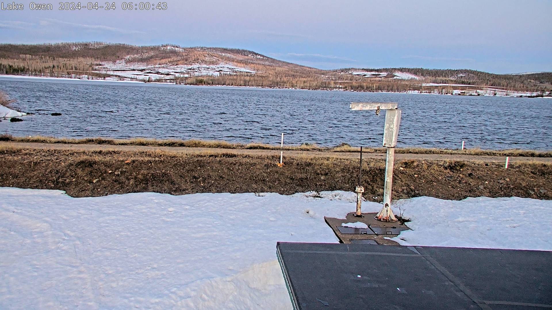
Lake Owen
Near Albany
Rob Roy Reservoir
Albany Lodge
Albany, WY
Albany Lodge
Jelm, WY
Hwy 10
Carbon County Webcams
Rawlins
Saratoga
Alcova Reservoir
Natrona County, north of Pathfinder
North Platte River
Saratoga
Near Skyline
Laramie County Webcams
! ! ! ! ! !
Happy Jack Wind Farm
Cheyenne
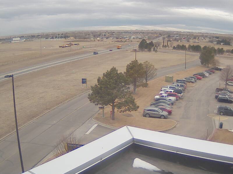
Laramie County Community College
Platte & Goshen County Webcams
Wheatland
Torrington
Weather Story
Weather Map
Local Radar
Follow us on X
Follow us on Facebook
Follow us on YouTube
CYS RSS Feed


 Weather Story
 Weather Map
 Local Radar