 |
Snow Forecasts (through 72 Hours) |
||
Storm Total Snowfall |
||
| Low End Storm Total | Storm Total Snowfall | High End Storm Total |
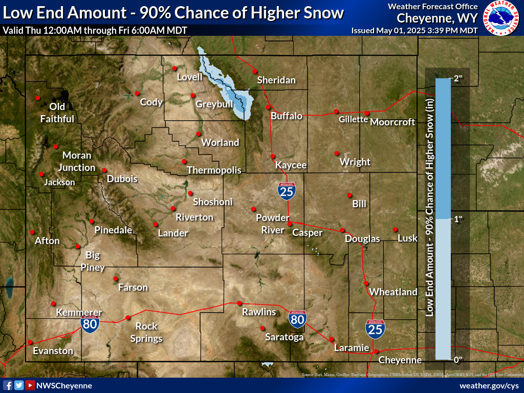 |
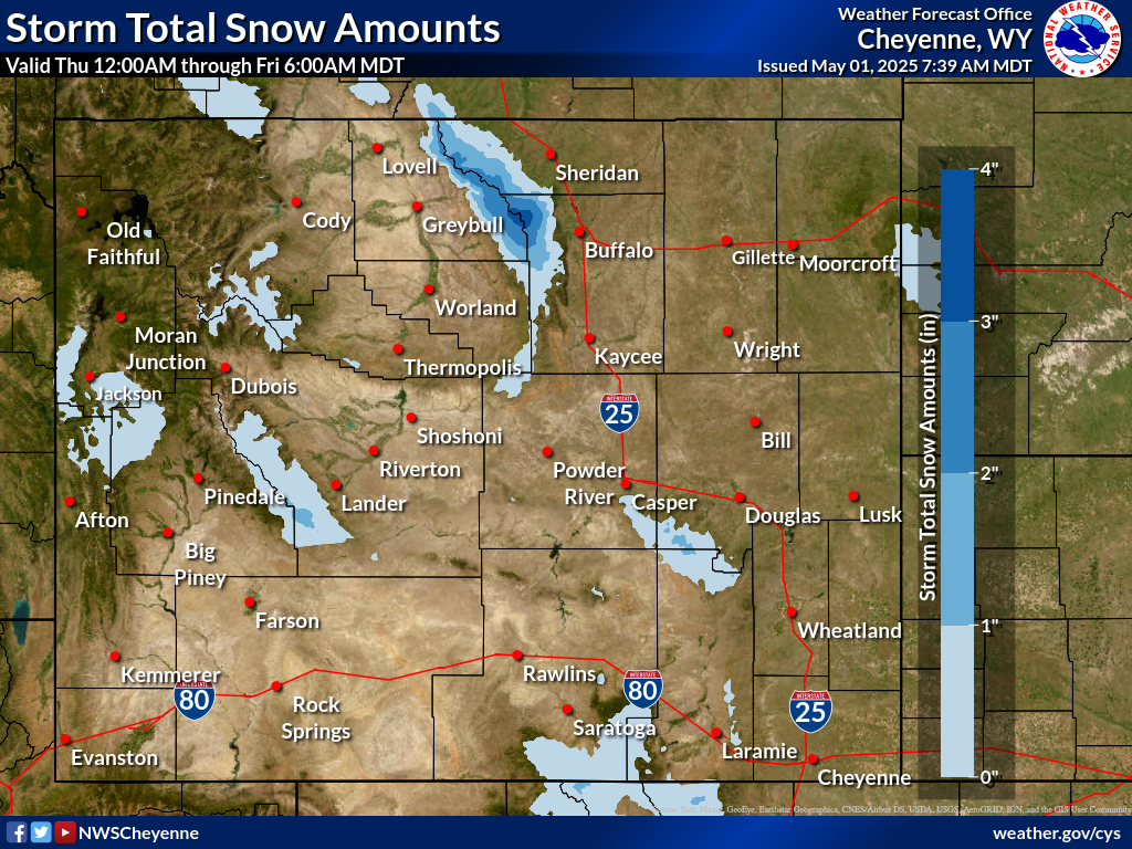 |
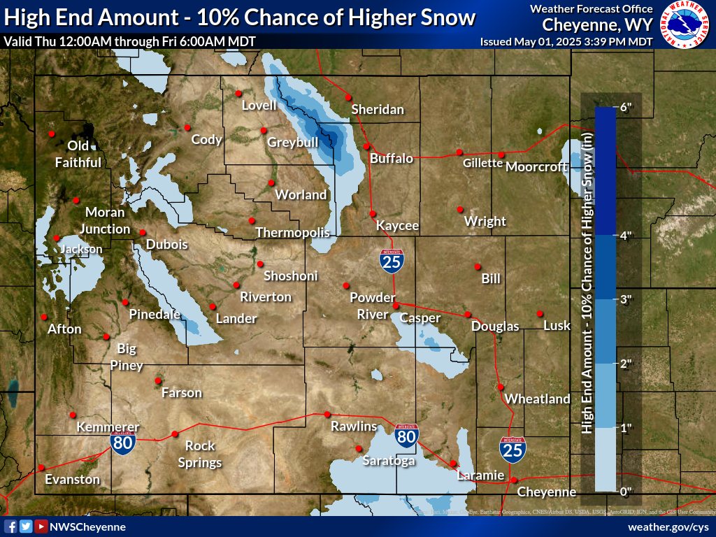 |
| Not regularly updated between June 15th and August 31st except during major out-of-season events. | ||
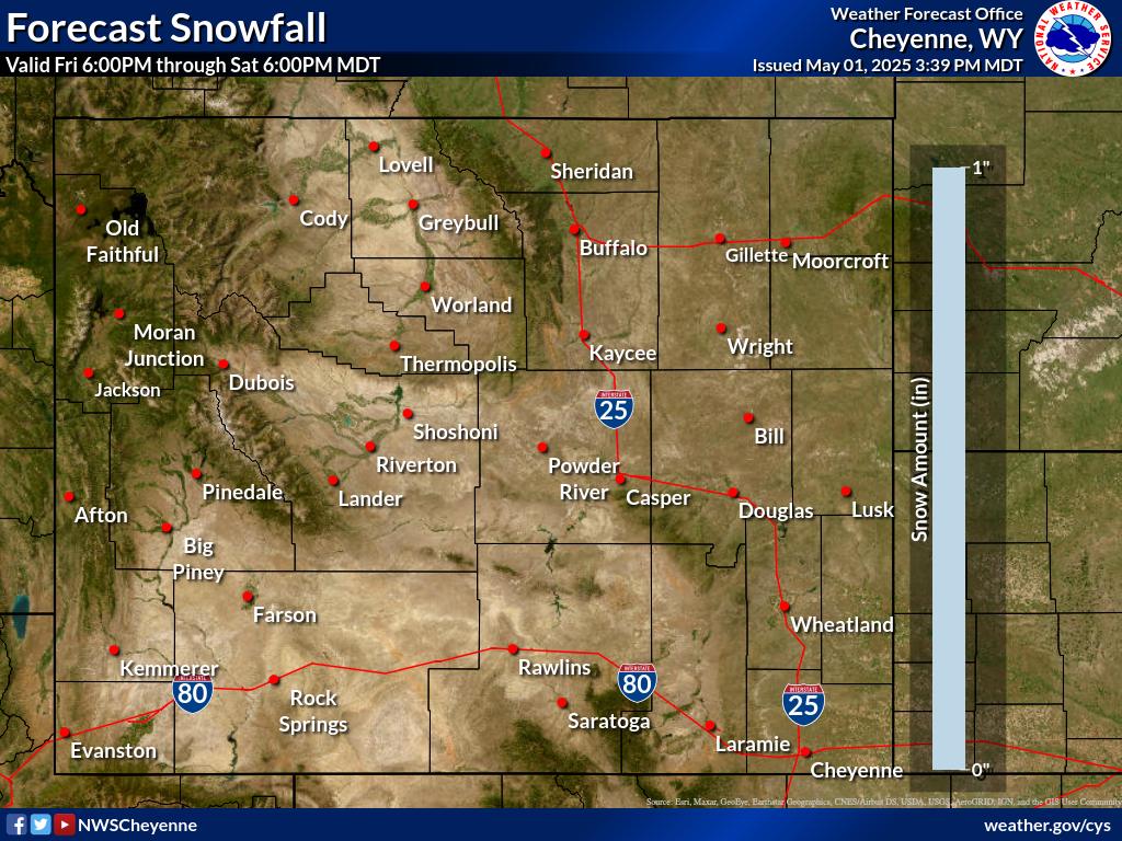
Daily Snowfall Amounts |
||
| Day 1 Snowfall | Day 2 Snowfall | Day 3 Snowfall |
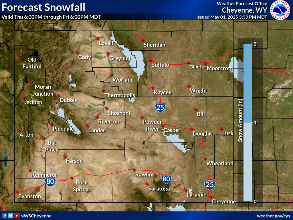 |
 |
 |
| Click to enlarge graphics | ||
|
|
||
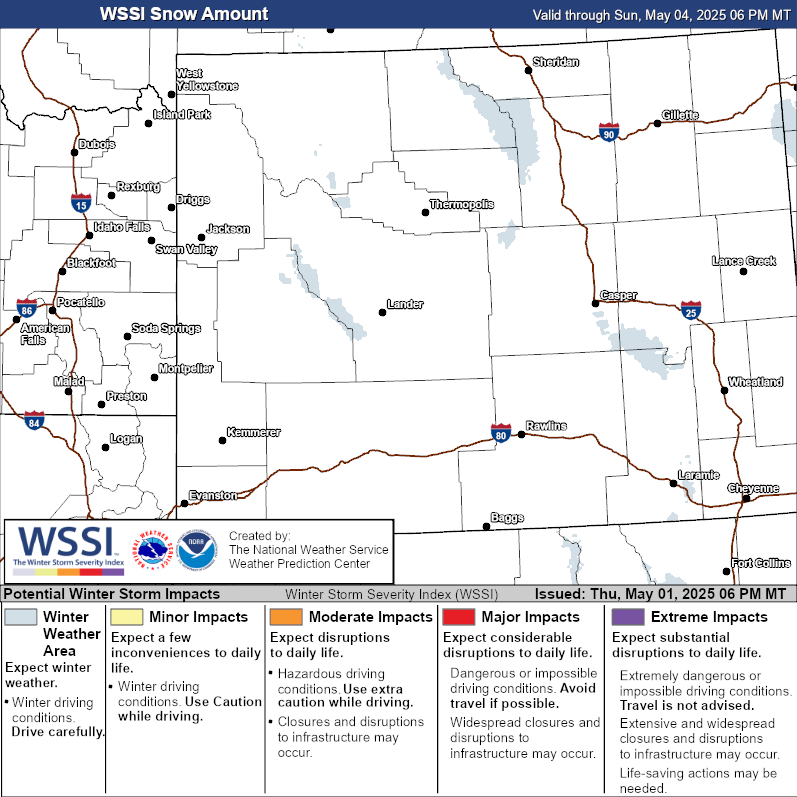
Winter Storm Severity Index (through 72 hours) |
||
| WSSI Overall | WSSI Snow Amount | WSSI Blowing Snow |
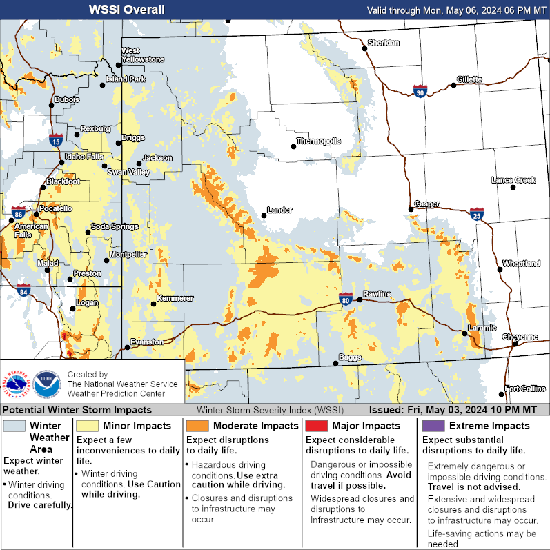 |
 |
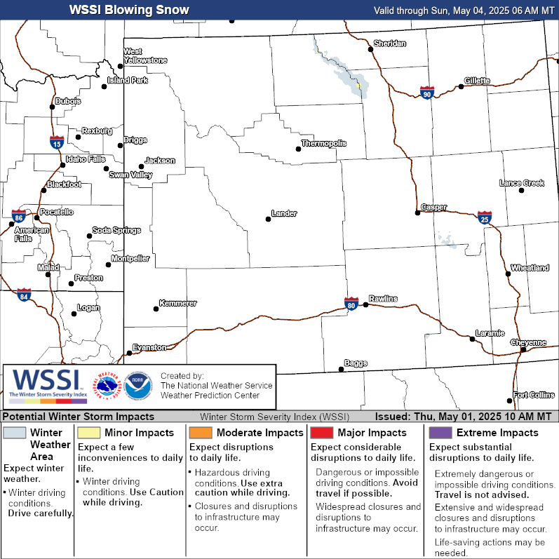 |
| Click to enlarge graphics | ||
Visit the Wyoming tab on our Probabilistic Snow Website for more snowfall range, potential,
and probability of exceeding specific threshold graphics
|
Maximum Wind Gusts |
||
| Day 1 | Day 2 | Day 3 |
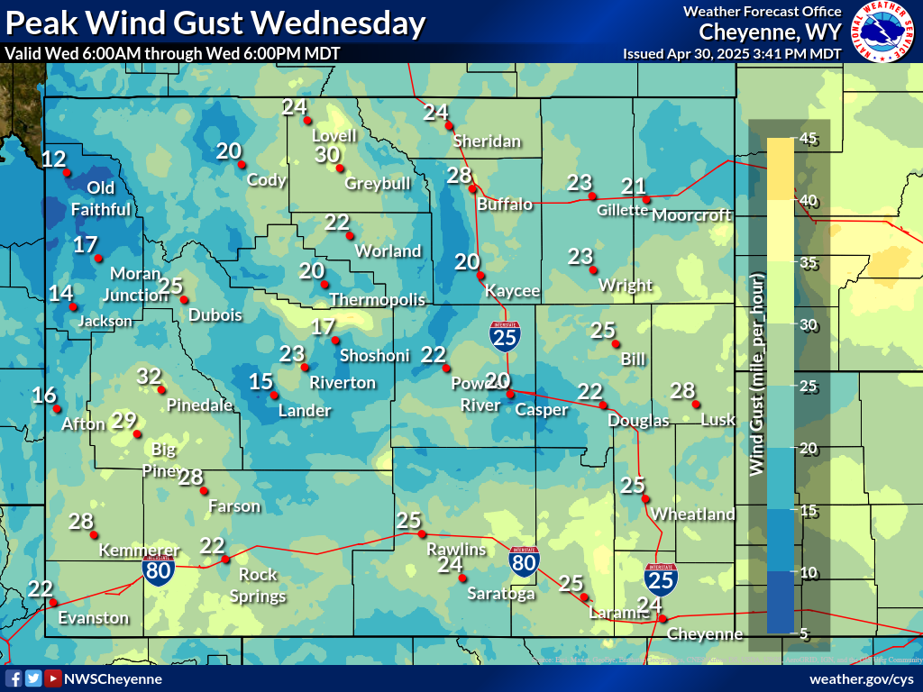 |
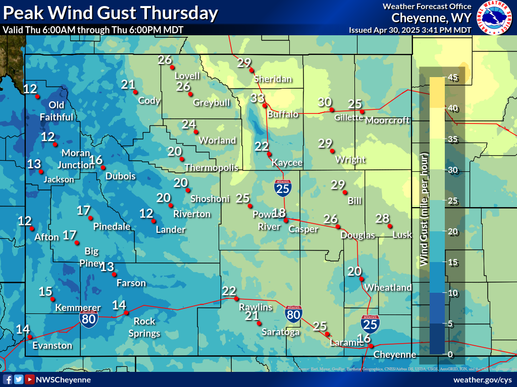 |
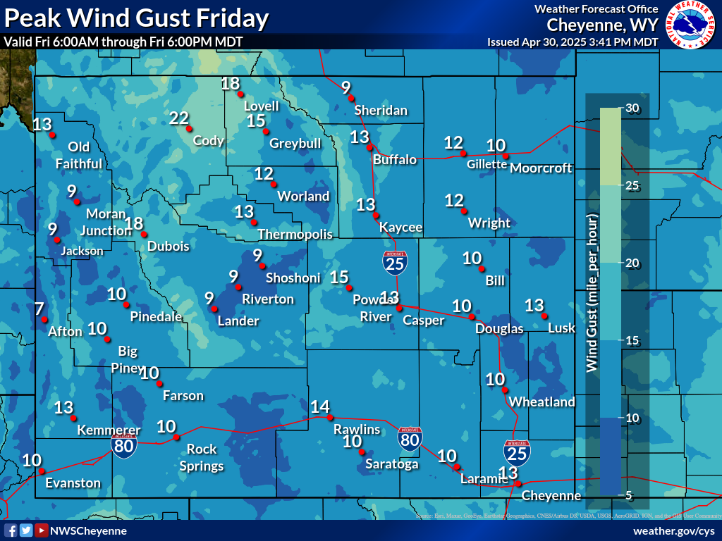 |
2-Day Hourly Forecast for Wind-Prone Locations |
||
| Arlington along Interstate 80 | Bordeaux along Interstate 25 | South Pass along WY-28 |
|
Minimum Wind Chills |
||
| Day 1 Night | Day 2 Night | Day 3 Night |
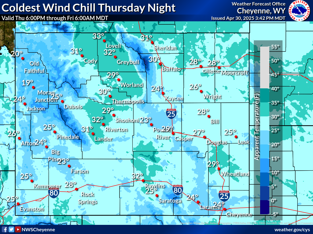 |
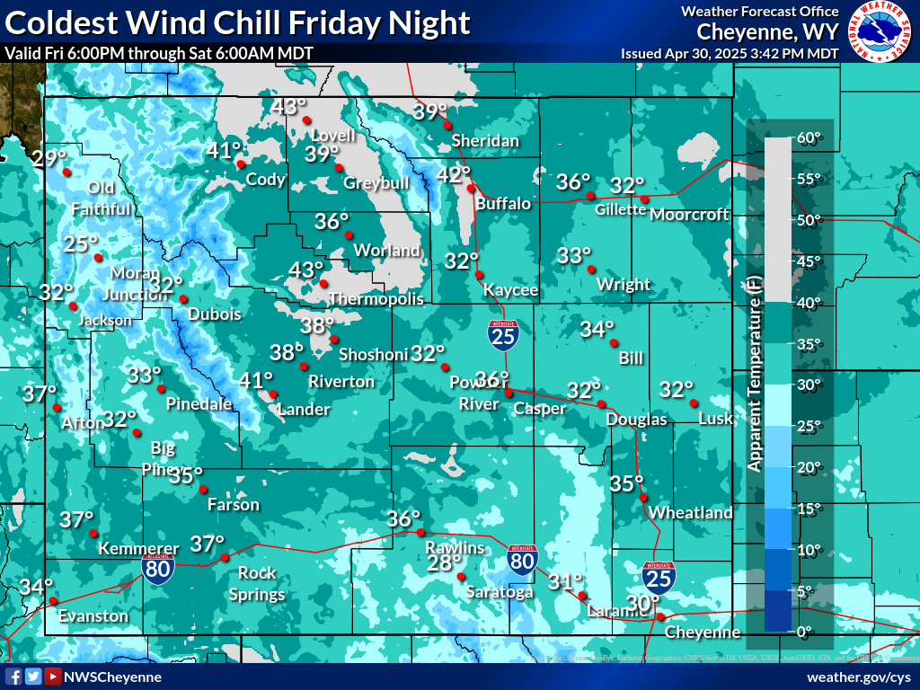 |
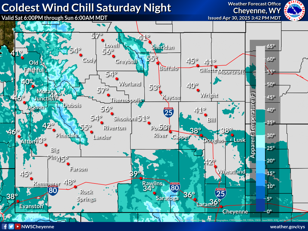 |
| Click to enlarge graphics | ||
Helpful Links and Other Local Resources |
||
|
Road Conditions (wyoroad.info) |
Road Condition Maps
|
|
|
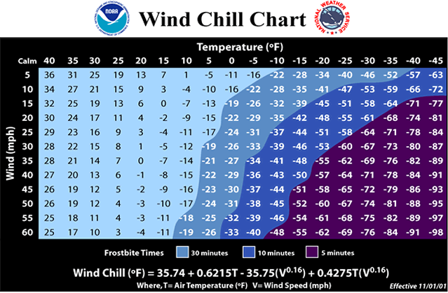
Wind Chill Chart & Frostbite Times
|
Wind Chill Calculator |
|
| Wyoming SNOTEL Map | ||


 Weather Story
 Weather Map
 Local Radar