Heat expands across the Desert Southwest, Plains, Mississippi Valley and Midwest into Monday. Fire weather concerns continue for portions of the Intermountain West. Active monsoonal moisture fuels thunderstorms over the Southwest with possible flash flooding. Tropical cyclone Fausto in the Pacific, should weaken as it approaches Hawaii; Dangerous surf, swells and rip currents are expected. Read More >
Overview
|
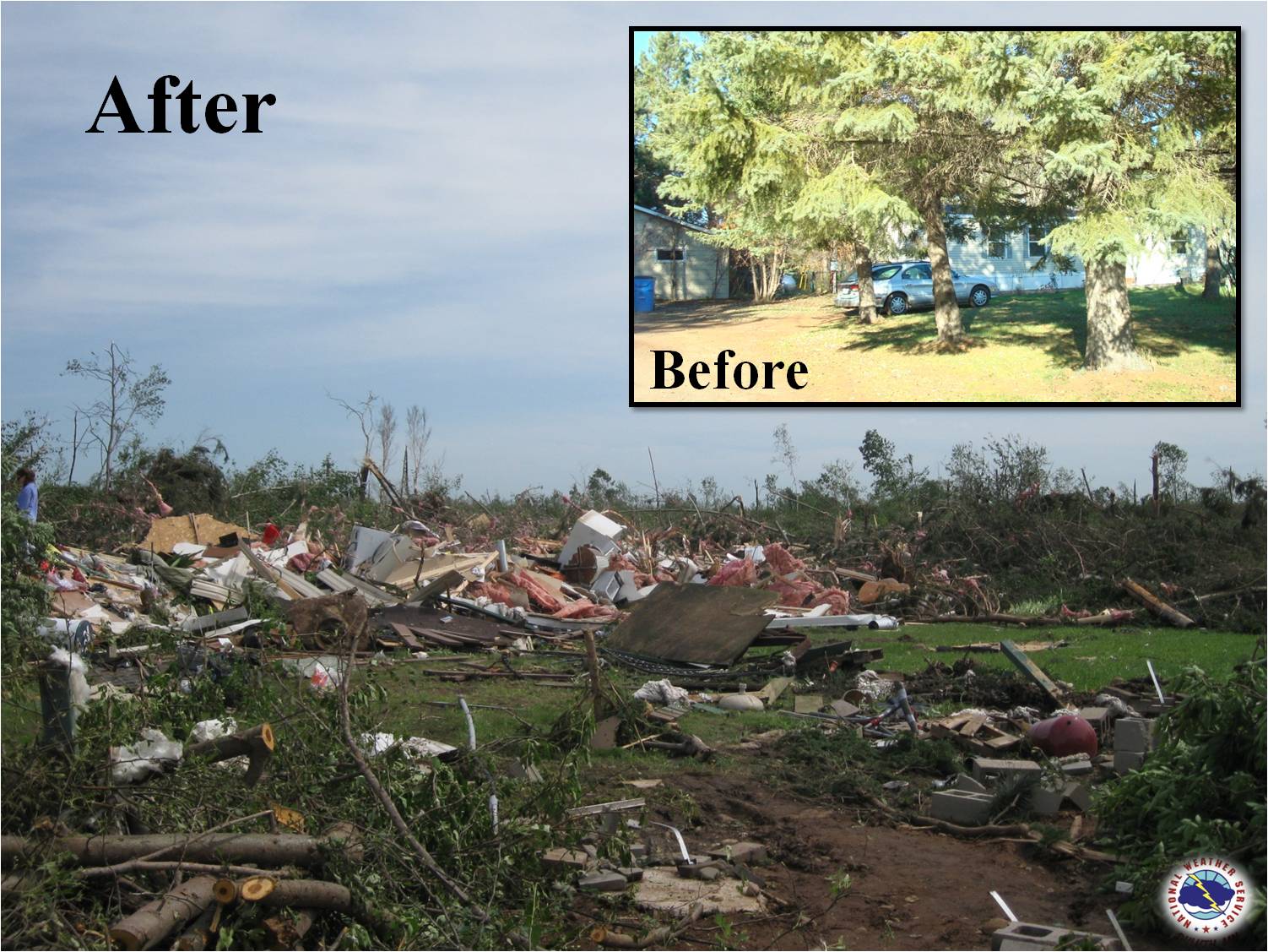
On Thursday June 17, 2010, an outbreak of severe thunderstorms occurred across parts of the Upper Midwest, particularly across North Dakota and Minnesota. This outbreak featured many reports of tornadoes, and many of those reports have been confirmed as tornado tracks by National Weather Service offices across the region. This outbreak affected a portion of the NWS Duluth, MN county warning area (CWA), particularly parts of northeast Minnesota. As of June 17, 2020: This event holds the record for the most tornadoes to occur during a single day in Minnesota with 48. June 2010 also holds the record for the number of tornadoes in one month in Minnesota with 71, and 2010 was the record year for tornadoes in Minnesota with 113. |
 |
Fast Facts:
Tornadoes:
|
Tornado - St. Croix River Tornado
Track Map 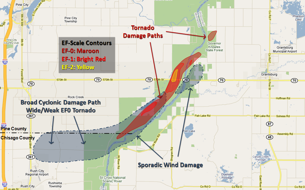
|
||||||||||||||||
|
Tornado - 4 NW Grantsburg, WI
Track Map
|
||||||||||||||||
|
Tornado - Haypoint, MN
Radar Image 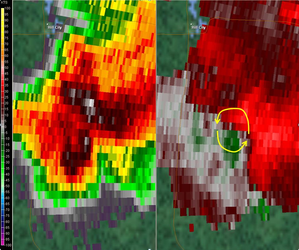
Radar image from the time of the tornado.
|
||||||||||||||||
|
Tornado - Cass County
Track Map 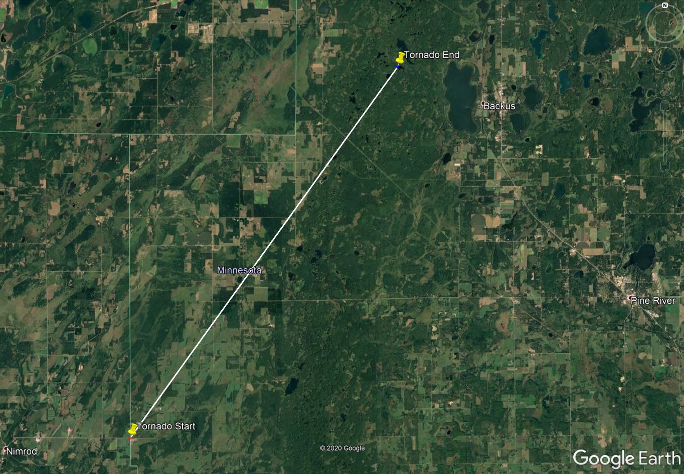
|
||||||||||||||||
The Enhanced Fujita (EF) Scale classifies tornadoes into the following categories:
| EF0 Weak 65-85 mph |
EF1 Moderate 86-110 mph |
EF2 Significant 111-135 mph |
EF3 Severe 136-165 mph |
EF4 Extreme 166-200 mph |
EF5 Catastrophic 200+ mph |
 |
|||||
Storm Reports
PRELIMINARY LOCAL STORM REPORT...SUMMARY
NATIONAL WEATHER SERVICE DULUTH MN
1142 AM CDT SAT JUN 19 2010
..TIME... ...EVENT... ...CITY LOCATION... ...LAT.LON...
..DATE... ....MAG.... ..COUNTY LOCATION..ST.. ...SOURCE....
..REMARKS..
1257 PM HAIL 2 S BACKUS 46.79N 94.51W
06/17/2010 E1.75 INCH CASS MN TRAINED SPOTTER
1257 PM HAIL BACKUS 46.82N 94.51W
06/17/2010 M1.75 INCH CASS MN NWS EMPLOYEE
TIME IS APPROXIMATE. 1 INCH DIAMETER HAIL WAS OBSERVED
STILL LAYING ON THE GROUND AT 135 PM...AND WAS LIKELY
LARGER WHEN IT FELL. OTHER OBSERVERS SAID THERE WAS SOME
GOLFBALL SIZE HAIL WHEN IT ORIGINALLY FELL.
1259 PM HAIL BACKUS 46.82N 94.51W
06/17/2010 E1.50 INCH CASS MN PUBLIC
ALSO GUSTY WINDS REPORTED.
1259 PM HAIL BACKUS 46.82N 94.51W
06/17/2010 E1.00 INCH CASS MN LAW ENFORCEMENT
0110 PM HAIL HACKENSACK 46.93N 94.52W
06/17/2010 E1.00 INCH CASS MN TRAINED SPOTTER
0147 PM HAIL 6 SW BENA 47.28N 94.30W
06/17/2010 E2.75 INCH CASS MN PUBLIC
STARTED SMALL...GRADUALLY INCREASED TO GOLFBALL SIZE. A
FEW LARGE STONES UP TO BASEBALL SIZE WERE FOUND. REPORTED
AT AND NEAR THE NEW LEECH LAKE CAMPGROUND. ALSO MENTIONED
A SECOND HAND REPORT OF HAIL DAMAGE TO
VEHICLES...AWNINGS...AND BUILDINGS AROUND THE CITY OF
BENA TO THE NORTHEAST.
0147 PM TSTM WND DMG 6 SW BENA 47.28N 94.30W
06/17/2010 CASS MN PUBLIC
SUBSTANTIAL WIND DAMAGE. THE WIND BLEW HARD ENOUGH TO
BLOW WATER THROUGH SEALS AROUND WINDOWS ON THE CAMPGROUND
LODGE DURING HEIGHT OF STORM. A 100 LB ACCESS COVER ON
THE ROOF WAS THROWN THE ENTIRE LENGTH OF THE ROOF. DAMAGE
TO SIDING AND SHINGLES. COVERS WERE TAKEN OFF THE BOAT
LIFT. TREES WERE DOWNED...AND A FEW WERE UPROOTED OR
SHEARED OFF. WINDS COULD HAVE BEEN IN EXCESS OF 70 MPH
BASED ON THE UPROOTED/SNAPPED TREES.
0200 PM HAIL BENA 47.34N 94.21W
06/17/2010 E1.75 INCH CASS MN TRAINED SPOTTER
DELAYED REPORT FROM NEAR BENA.
0201 PM HAIL 2 NW BENA 47.36N 94.24W
06/17/2010 E1.00 INCH CASS MN PUBLIC
UP TO QUARTER SIZE HAIL AT THE NODAK LODGE AND RESORT.
0210 PM HAIL 8 NE BENA 47.42N 94.09W
06/17/2010 E1.00 INCH CASS MN PUBLIC
ALSO TREE LIMBS WERE DOWNED BY STRONG WINDS.
0215 PM HAIL 11 NE BENA 47.45N 94.04W
06/17/2010 E1.00 INCH ITASCA MN PUBLIC
ALSO 60 MPH WINDS /ESTIMATED/ THAT BLEW DOWN TREES.
REPORTED AT THE LAKE WINNIE RESORT AND CAMPGROUND AT
INTERSECTION OF HWY 9 AND HWY 46.
0215 PM TSTM WND DMG 6 SW INGER 47.49N 94.08W
06/17/2010 ITASCA MN LAW ENFORCEMENT
SOME SMALL TREES WERE BLOWN DOWN ACROSS A ROAD NEAR EAST
END OF LAKE WINNIBIGOSHISH.
0230 PM TSTM WND DMG 2 NW BOWSTRING 47.56N 93.83W
06/17/2010 ITASCA MN TRAINED SPOTTER
LARGE BRANCHES ABOUT 8 TO 10 INCHES IN DIAMETER AND A FEW
TREES DOWNED. DELAYED REPORT.
0300 PM HAIL WIRT 47.73N 93.96W
06/17/2010 M0.88 INCH ITASCA MN AMATEUR RADIO
0300 PM HAIL NORTH STAR LAKE 47.56N 93.66W
06/17/2010 M0.88 INCH ITASCA MN TRAINED SPOTTER
0330 PM HAIL BOWSTRING 47.54N 93.80W
06/17/2010 E0.75 INCH ITASCA MN TRAINED SPOTTER
DIME TO PENNY SIZE HAIL FOR THE LARGEST STONES. MOSTLY
PEA TO 1/2 INCH IN DIAMETER.
0436 PM HAIL 10 E TOGO 47.82N 92.94W
06/17/2010 E0.88 INCH ST. LOUIS MN TRAINED SPOTTER
0439 PM TSTM WND DMG SNAKE TRAIL 47.71N 93.05W
06/17/2010 ST. LOUIS MN LAW ENFORCEMENT
SEVERE WIND GUSTS BENDING PINE TREES TO THE
GROUND...REPORT ALSO INDICATED THAT A FEW TREES WERE
BLOWN DOWN.
0450 PM TSTM WND DMG LINDEN GROVE 47.86N 92.87W
06/17/2010 ST. LOUIS MN LAW ENFORCEMENT
A FEW REPORTS OF TREES DOWN...ALONG HIGHWAY 1 NEAR LINDEN
GROVE...AND ALSO ALONG HIGHWAY 5 SOUTH NEAR SIDE LAKE.
0620 PM TSTM WND DMG 4 SE FIFTY LAKES 46.71N 94.04W
06/17/2010 CROW WING MN TRAINED SPOTTER
SOME TREE BRANCHES BLOWN DOWN.
0645 PM TORNADO 4 ENE BREEZY POINT 46.62N 94.14W
06/17/2010 CROW WING MN LAW ENFORCEMENT
SPOTTERS TRACKING A TORNADO ON THE GROUND NEAR PELICAN
LAKE.
0753 PM HAIL SWATARA 46.90N 93.67W
06/17/2010 E1.75 INCH AITKIN MN TRAINED SPOTTER
0820 PM HAIL JACOBSON 47.00N 93.26W
06/17/2010 E0.88 INCH AITKIN MN TRAINED SPOTTER
0820 PM HAIL 1 W HILL CITY 46.99N 93.61W
06/17/2010 E0.88 INCH AITKIN MN TRAINED SPOTTER
0821 PM NON-TSTM WND DMG 1 S AITKIN 46.52N 93.71W
06/17/2010 AITKIN MN TRAINED SPOTTER
12 INCH DIAMETER PINE TREE BLOWN DOWN SOUTH SIDE OF
AITKIN.
0827 PM HAIL JACOBSON 47.00N 93.26W
06/17/2010 E1.50 INCH AITKIN MN PARK/FOREST SRVC
REPORTED BY A STATE FOREST EMPLOYEE. ALSO A FEW TREES
DOWN IN THE SAVANNA STATE FOREST...BUT ANY DAMAGE WAS
VERY SPORADIC.
0830 PM HAIL 2 NW MOOSE LAKE 47.41N 93.72W
06/17/2010 E0.75 INCH ITASCA MN TRAINED SPOTTER
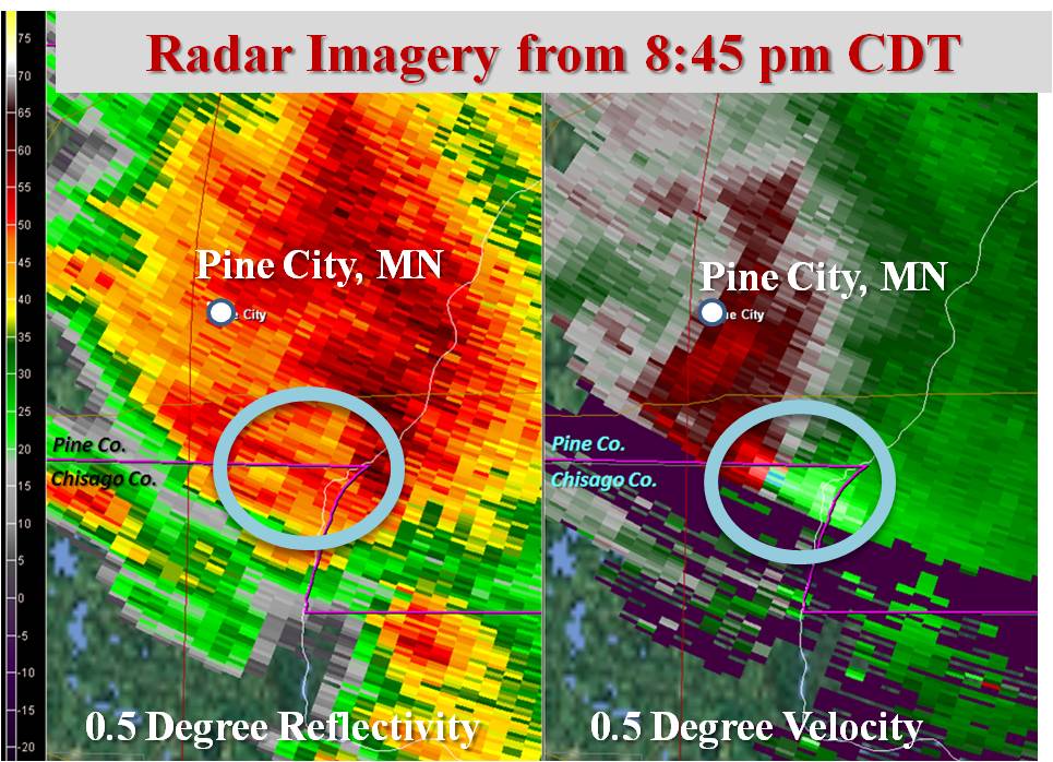
0855 PM TORNADO 5 W GRANTSBURG 45.78N 92.79W
06/17/2010 F1 PINE MN NWS STORM SURVEY
A STRONG EF1 TORNADO CROSSED HWY 70, A 1/2 MILE WEST OF
THE MN/WI STATE LINE. THREE INJURIES HAVE BEEN REPORTED.
HWY 70 IS CLOSED DUE TO DEBRIS AND POWERLINES OVER THE
ROAD. TIME ESTIMATED FROM RADAR.
0900 PM FUNNEL CLOUD 5 S GRANTSBURG 45.71N 92.68W
06/17/2010 BURNETT WI TRAINED SPOTTER
FUNNEL IS ROTATING AND GOING UP AND DOWN BUT NO DEBRIS
VISIBLE.
0900 PM TORNADO 3 W GRANTSBURG 45.78N 92.75W
06/17/2010 BURNETT WI STORM CHASER
POWERLINES DOWN AND DAMAGE TO A HOME OBSERVED NEAR
GRANTBURG ON HIGHWAY 70. LIKELY TORNADO DAMAGE.
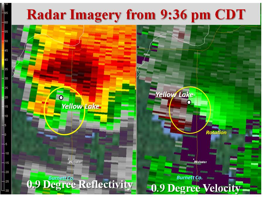
0907 PM TORNADO 2 ENE GRANTSBURG 45.79N 92.65W
06/17/2010 BURNETT WI TRAINED SPOTTER
OBSERVED TORNADO. THE TORNADO BLEW DOWN SOME LARGE
BRANCHES AND THREW SOME SMALL DEBRIS A COUPLE HUNDRED
YARDS. TIME IS APPROXIMATED BOTH FROM SPOTTER
RECOLLECTION AND RADAR DATA.
1008 PM TORNADO 6 WNW WEBB LAKE 46.04N 92.25W
06/17/2010 BURNETT WI TRAINED SPOTTER
TORNADO REPORTED ON THE GROUND NEAR STAPLES LAKE ROAD.
&&
$$
Environment
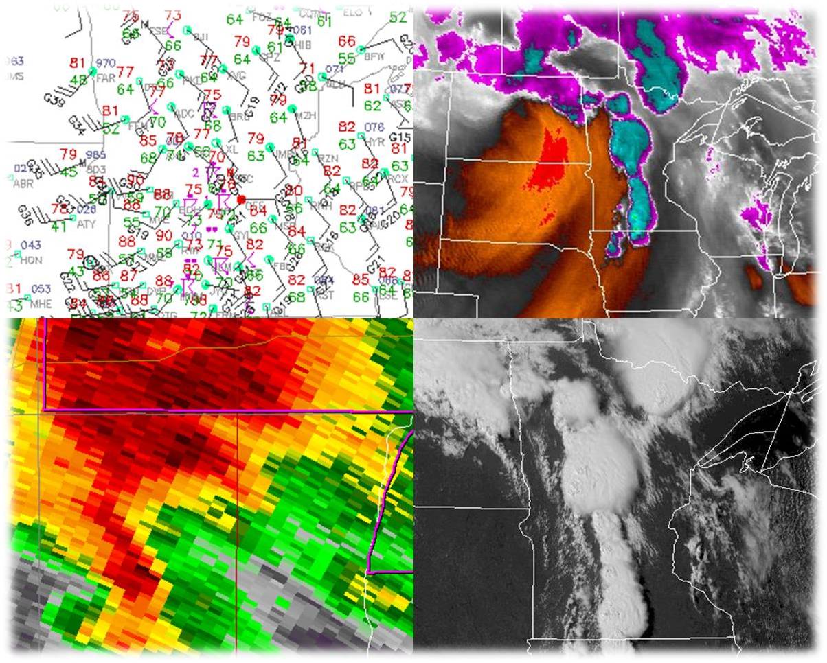
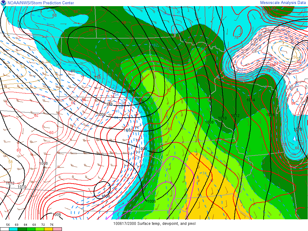
A low pressure system rapidly deepened and intensified over the Dakotas on June 17th, drawing a warm, moist, and unstable air mass north into the Upper Midwest. The image to the left is a computer analyzed map from 3PM CDT that day. Black contours are sea level pressure, and thus you can pick out the area of low pressure in North Dakota. The shaded regions are surface dewpoints, with the brighter colors indicating higher dewpoints. Surface winds are indicated by the small barbs. Surface temperature is shown in colored contours.
Thunderstorms from overnight gradually weakened around dawn as they moved from eastern North Dakota into western Minnesota. A few thunderstorms developed along a warm front in central Minnesota late in the morning and then tracked into northern Minnesota in the early afternoon. Some of these storms were severe, particularly from Cass County into Itasca County - in the Backus to Squaw Lake corridor.
As a cold front surged east during the day into the humid air mass, thunderstorms began firing along the advancing front in the afternoon. This was the main round of severe weather, and the combination of strong instability and wind shear helped provide the necessary ingredients for supercell thunderstorms. These severe storms spread east across much of the state of Minnesota during the afternoon and early evening hours, spawning tornadoes, large hail, and damaging straight-line winds.
 |
 |
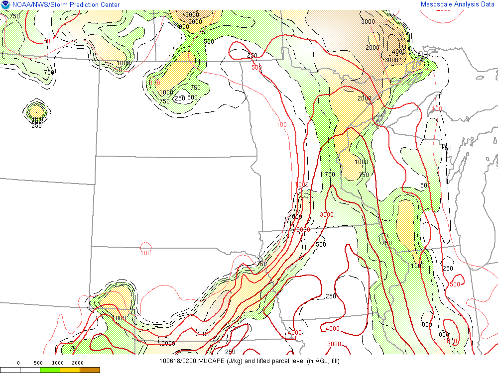 |
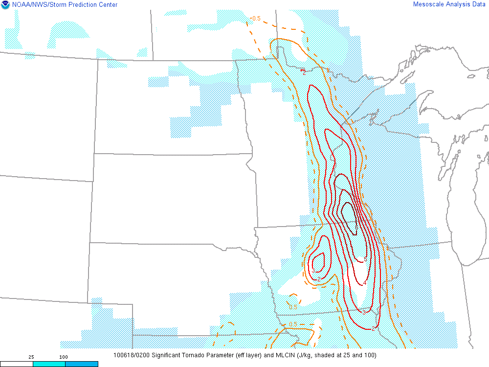
| 3PM CDT Surface Analysis | 9PM CDT analyzed Significant Tornado Parameter (colored contours) - this parameter was developed to highlight areas where conditions are favorable for strong tornadoes. Values over 1 correspond to such environments and you can see these values extend up into the Pine and Burnett county areas. | 9PM CDT analyzed instability (red contours). The axis of greatest instability extends north towards the western tip of Lake Superior. |
Hail Producing Storms
Midday Storms in Cass and Itasca Counties
Thunderstorms developed around midday along a warm front near Cass County. Initially, the storms exhibited an intensity to rapidly fluctuate in intensity, and were not posing much of a threat for severe weather.
However, between Noon and 1 PM, a persistent severe thunderstorm developed and tracked through Cass County, eventually tracking to near Lake Winnibigoshish.
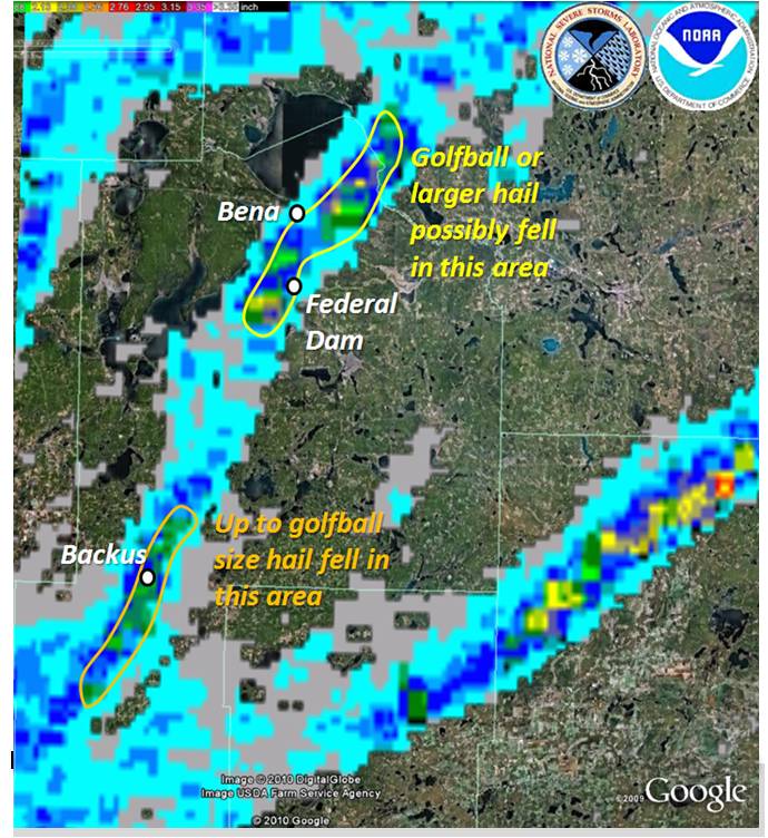
This storm produced golfball size hail in Backus in central Cass County. It was probably at its most intense over northeastern parts of Leech Lake where up to baseball size hail and destructive straight-line winds were reported. The large hail caused damage to some buildings and vehicles in and around Bena.
 |
 |
 |
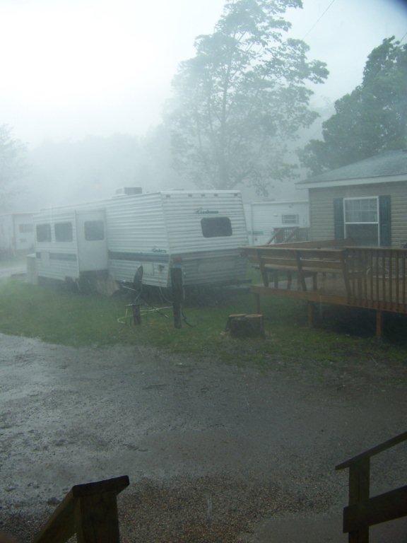
| Radar derived hail size courtesy of the National Severe Storms Laboratory. You can see that a substantial hail swath extended through much of Cass County. | During the storm at the Leech Lake Campground courtesy Holly Ash. | An access cover ripped off the roof of the lodge at the Leech Lake Campground courtesy Holly Ash. |
Evening Storms in Aitkin County
A swath of large hail also developed across northern Aitkin County during the evening hours. Up to golfball size hail was reported with this storm.
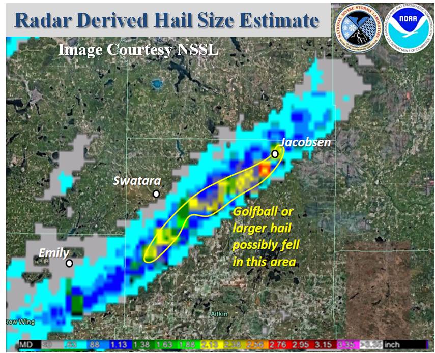 |
| Radar derived hail size courtesy of the National Severe Storms Laboratory. |
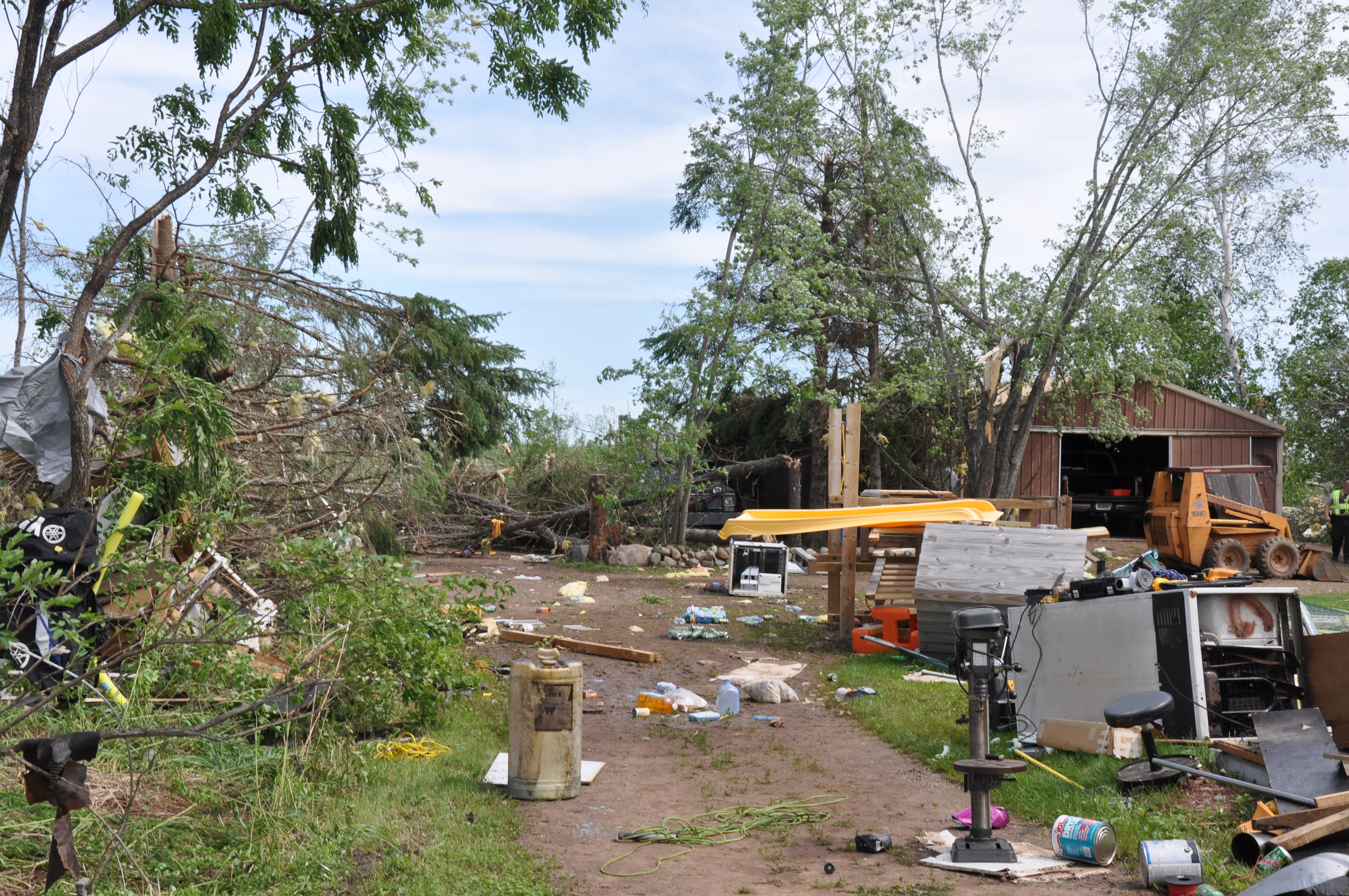
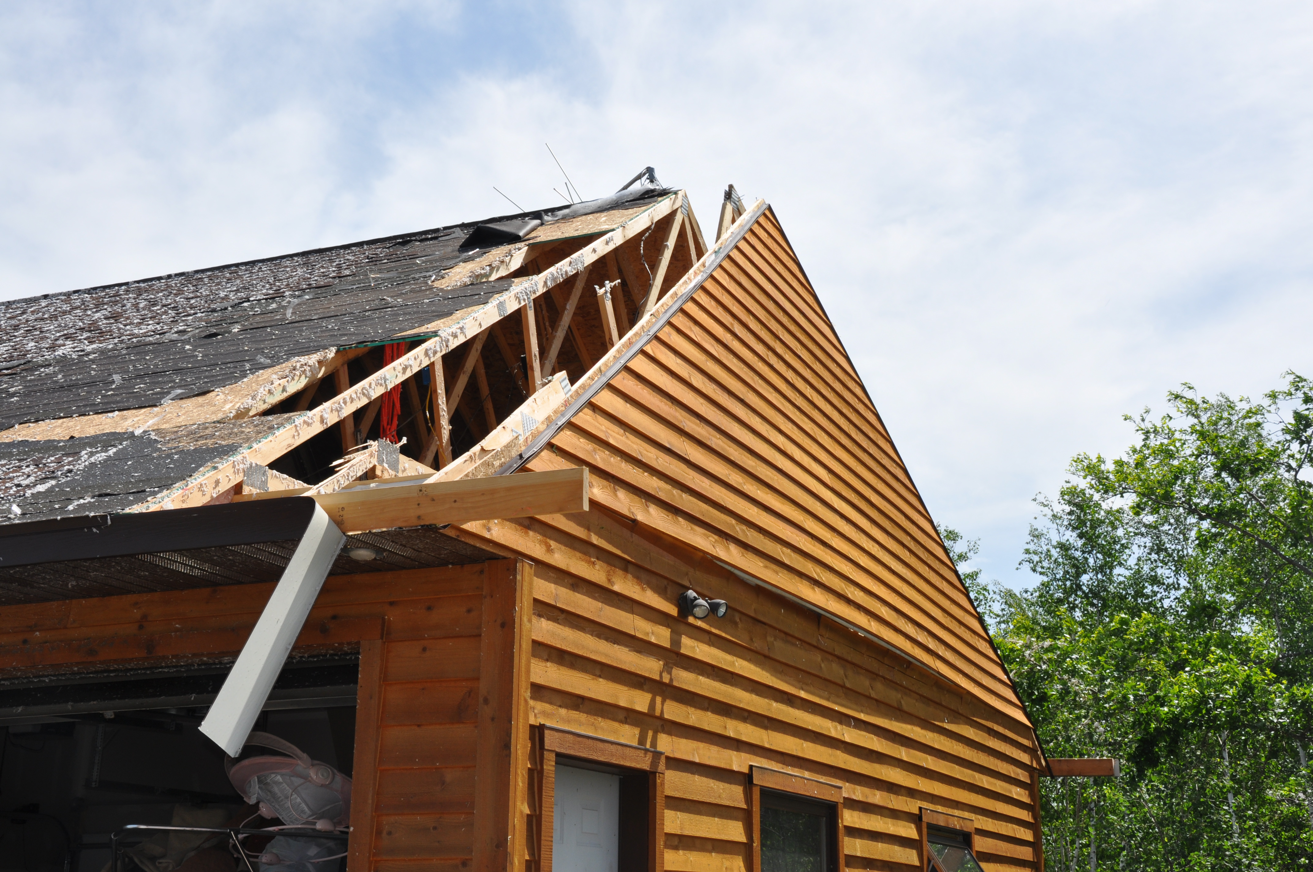
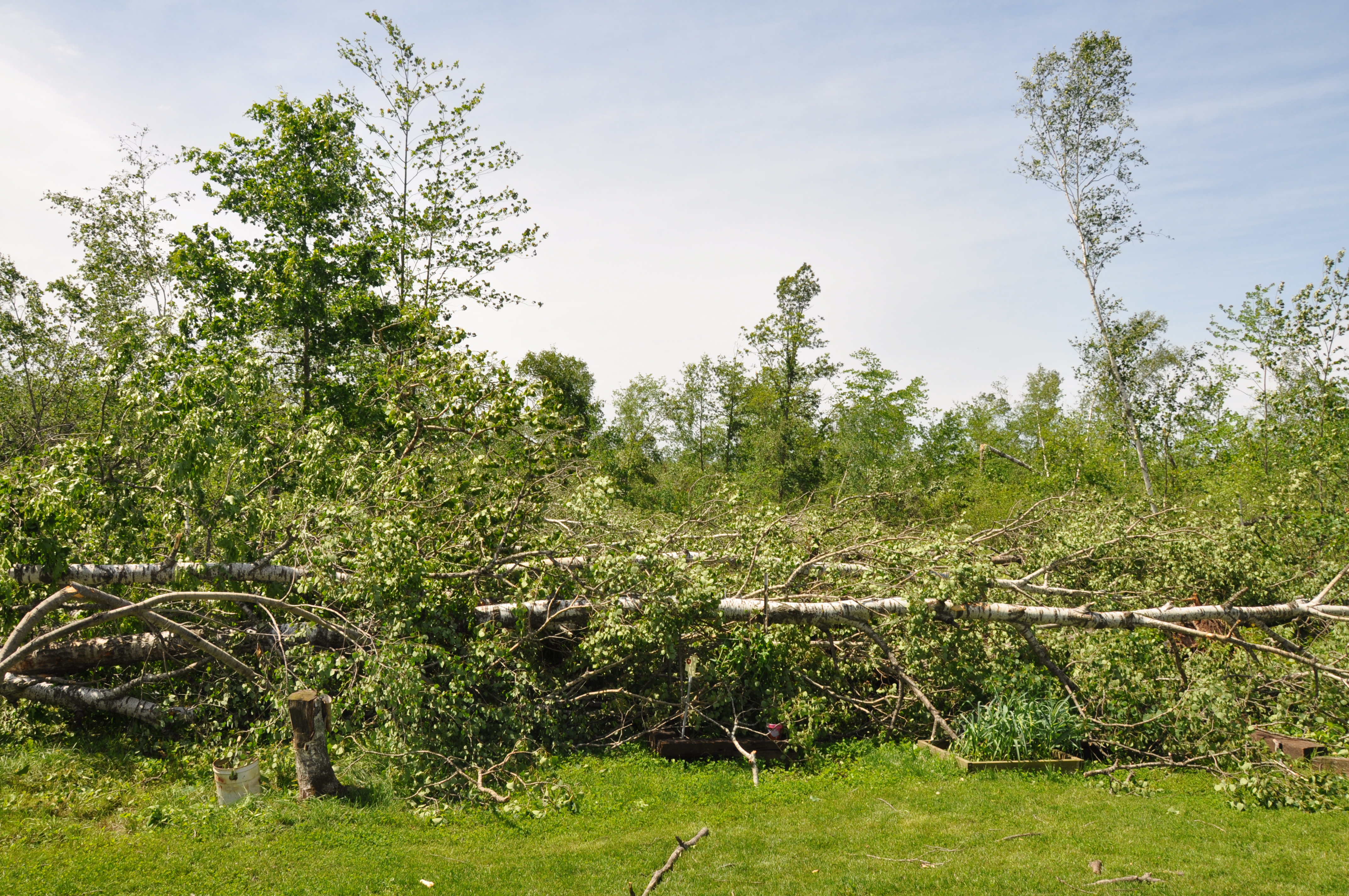
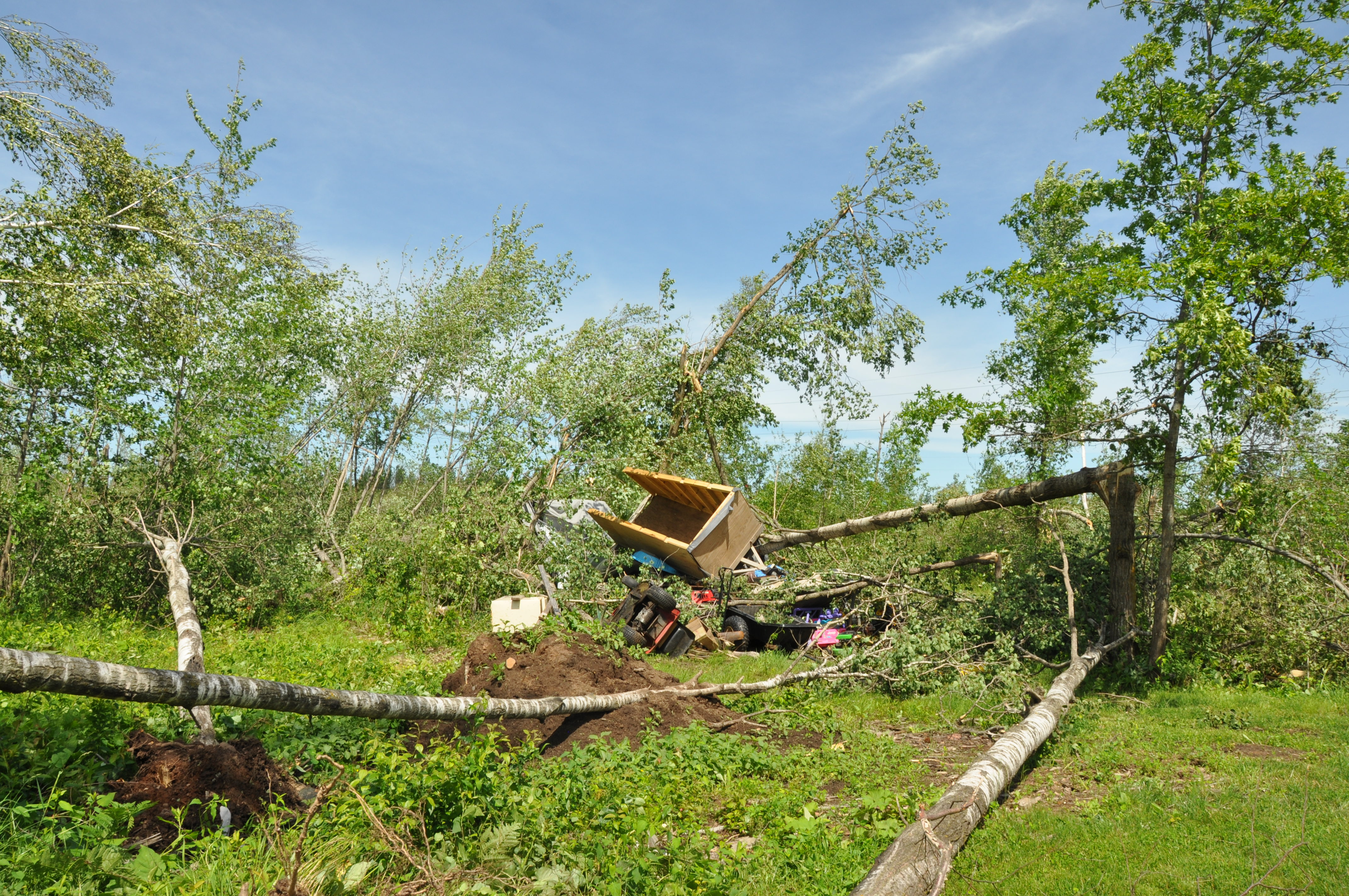
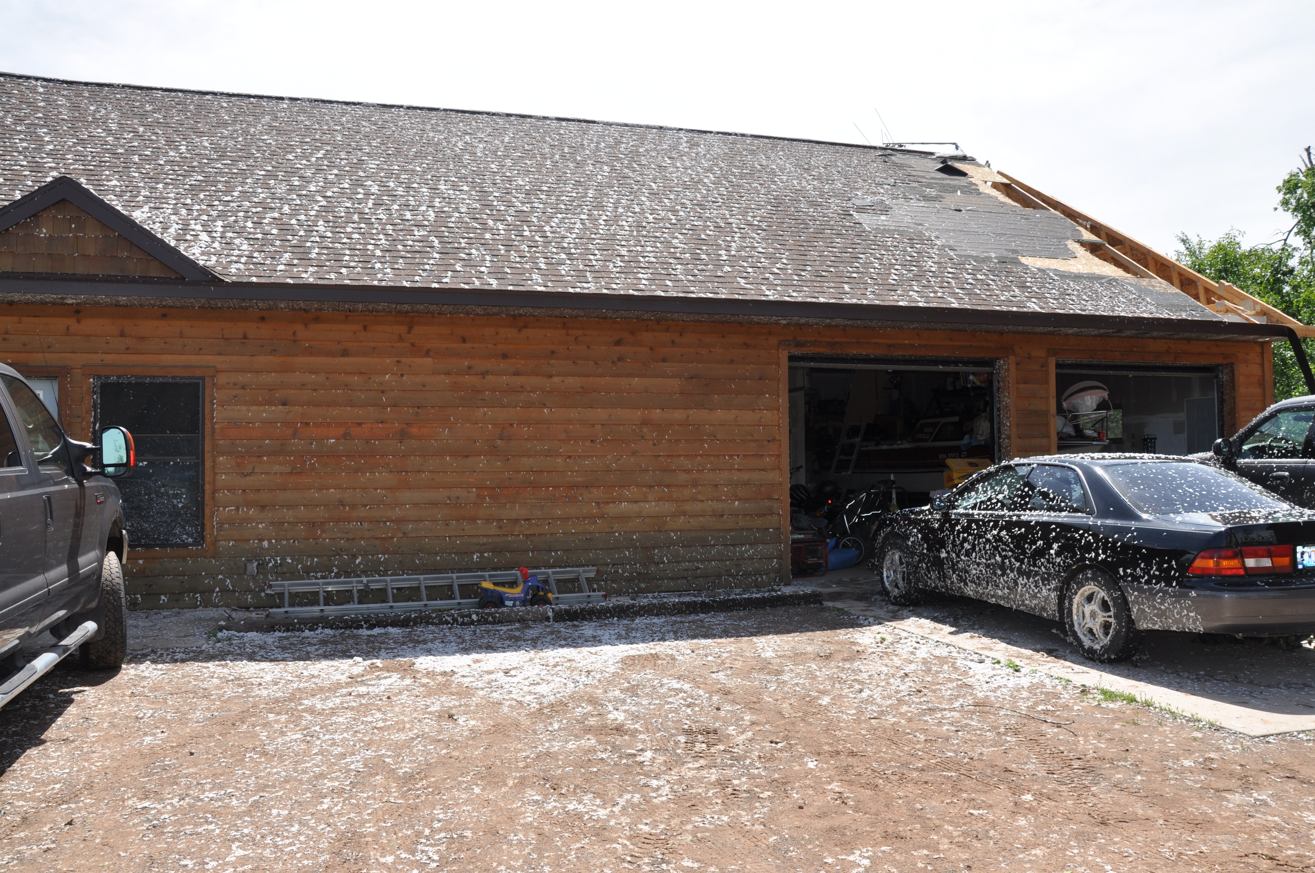
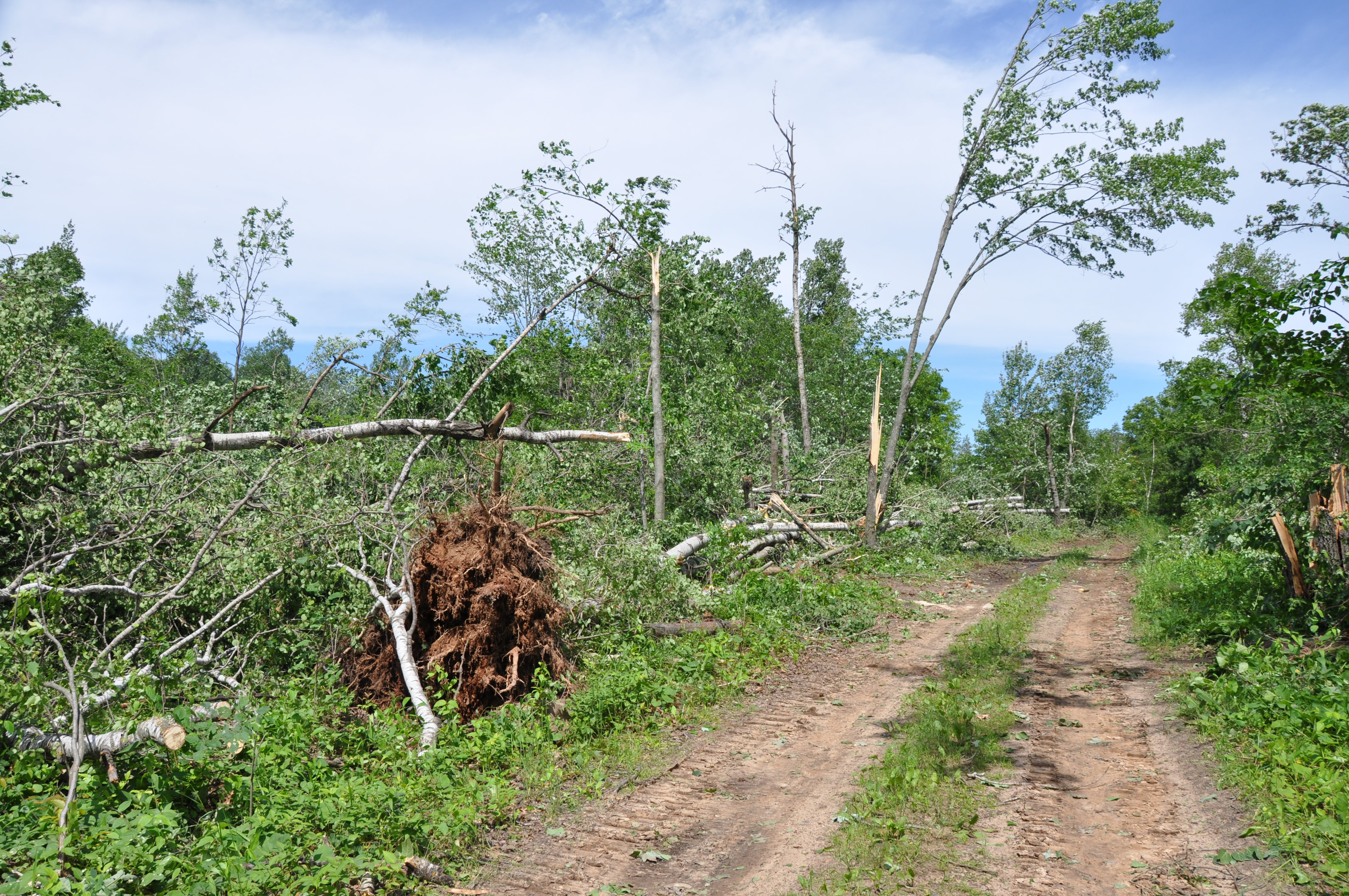
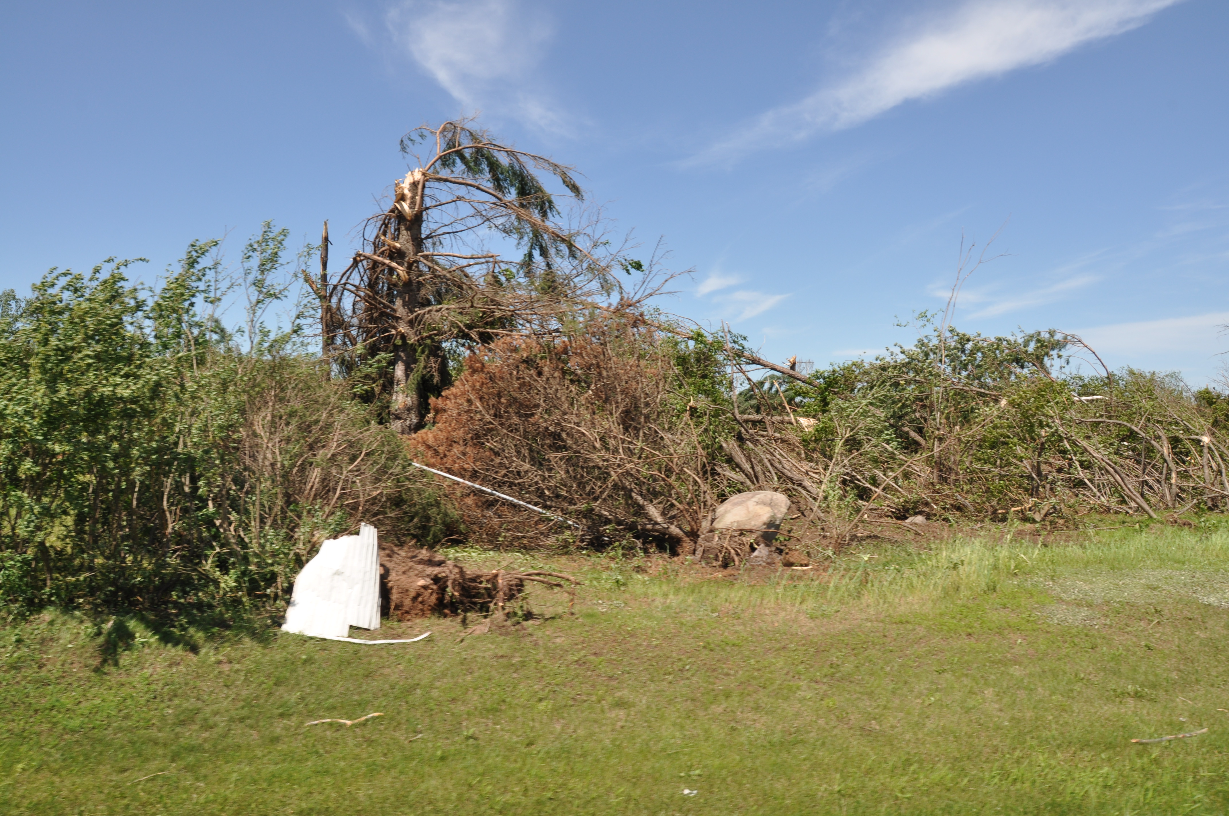
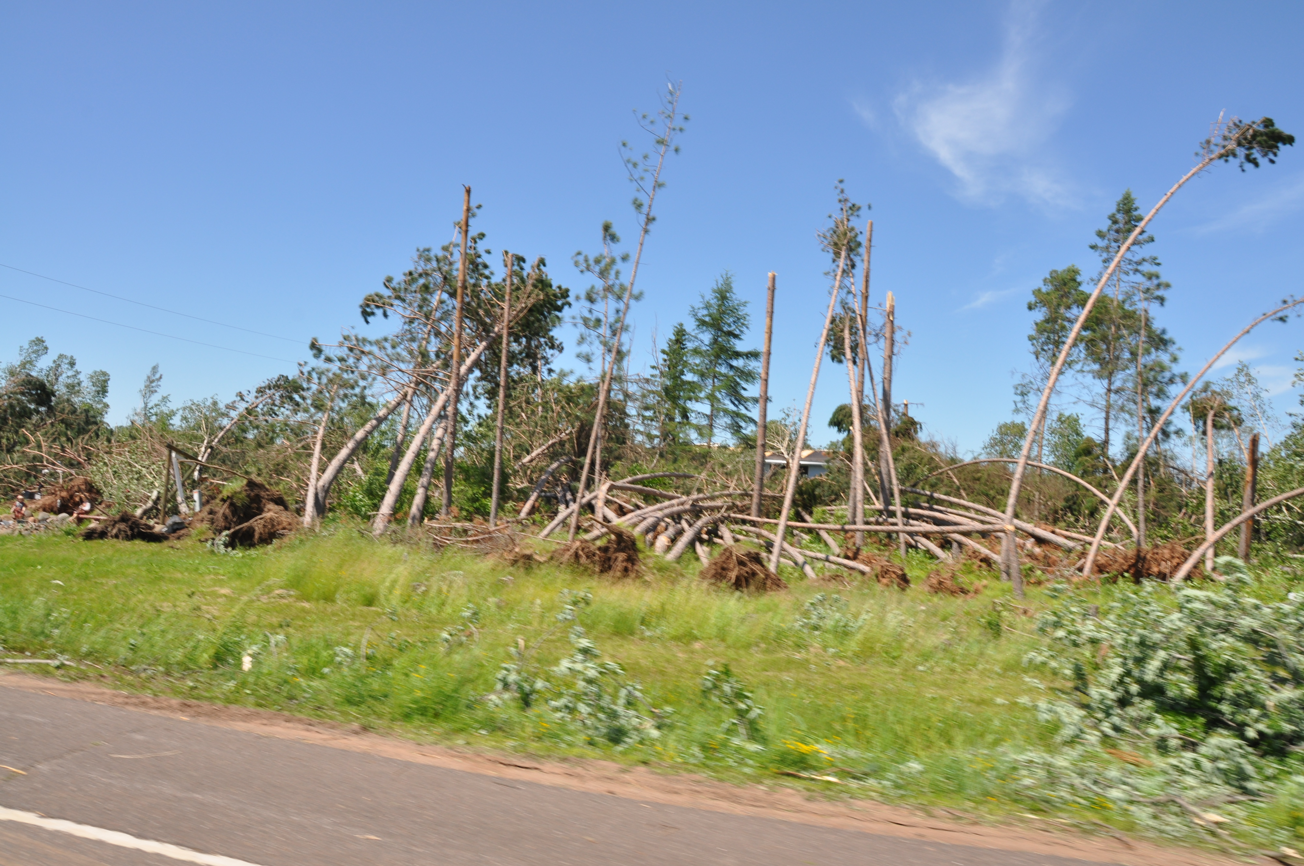
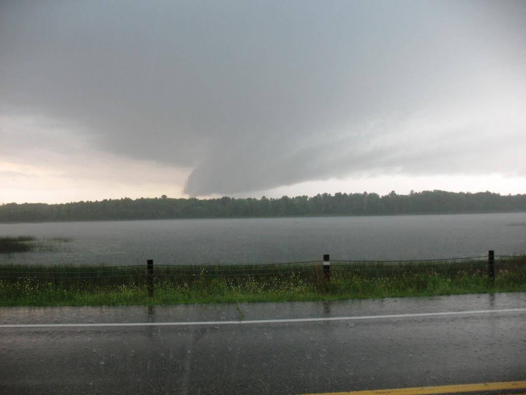
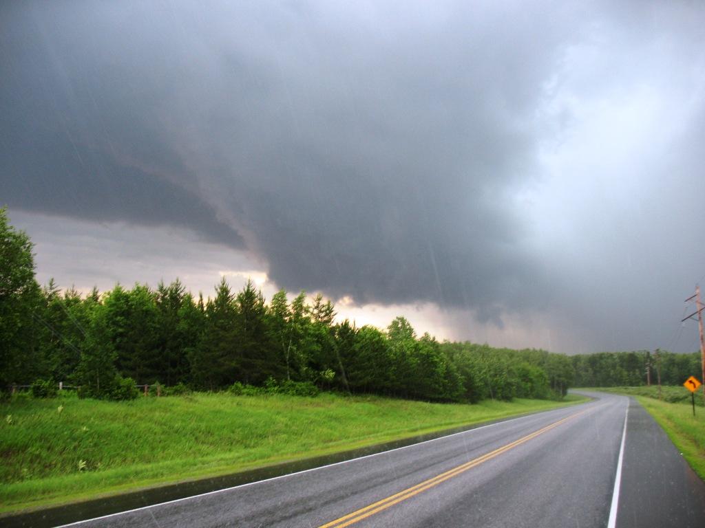
Photos
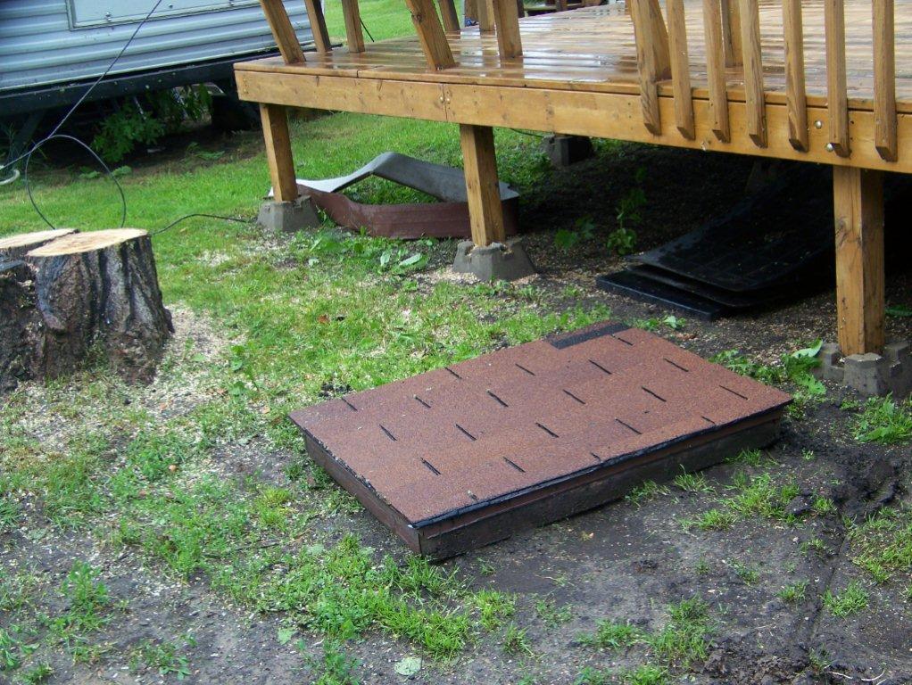
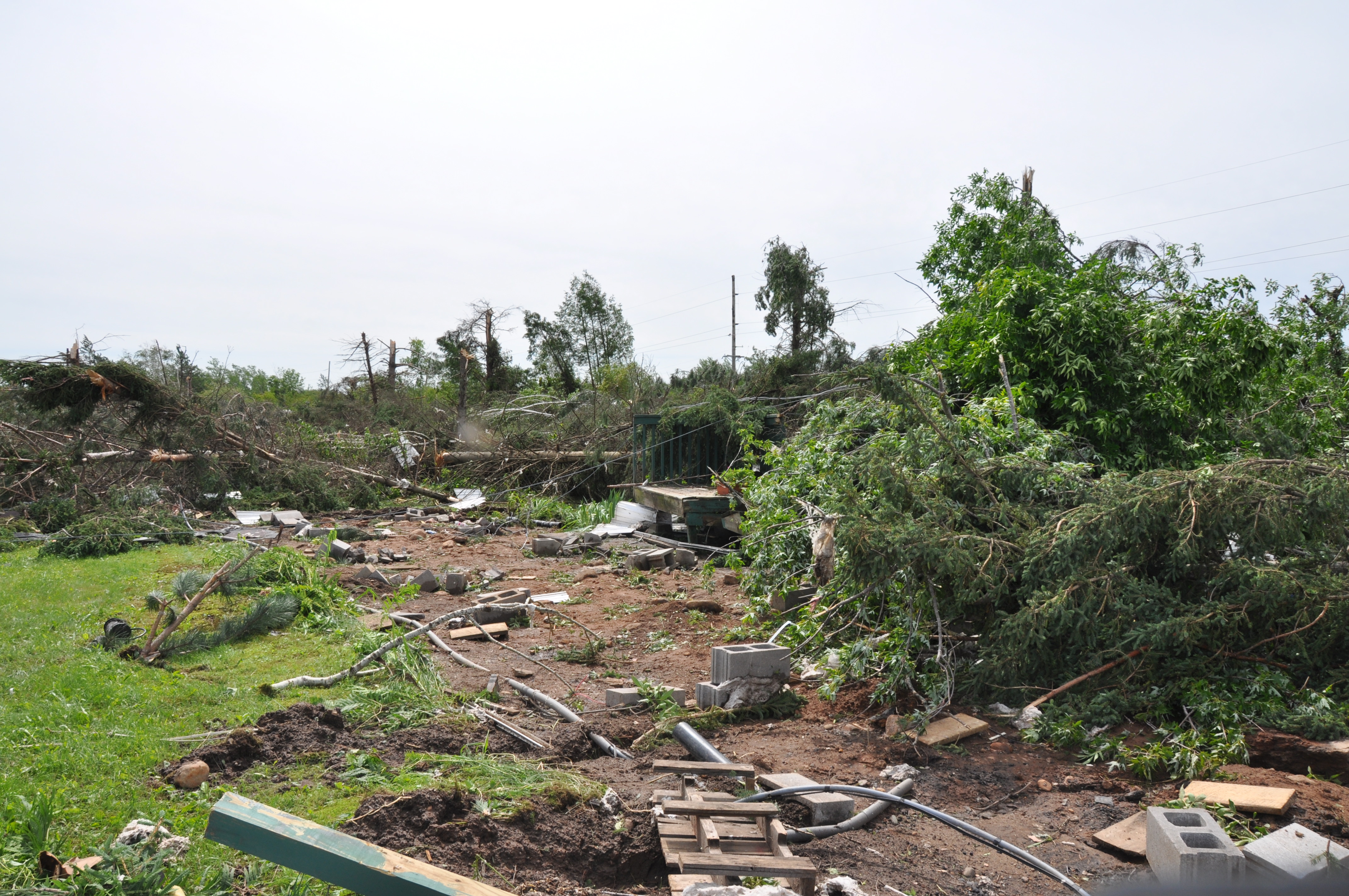
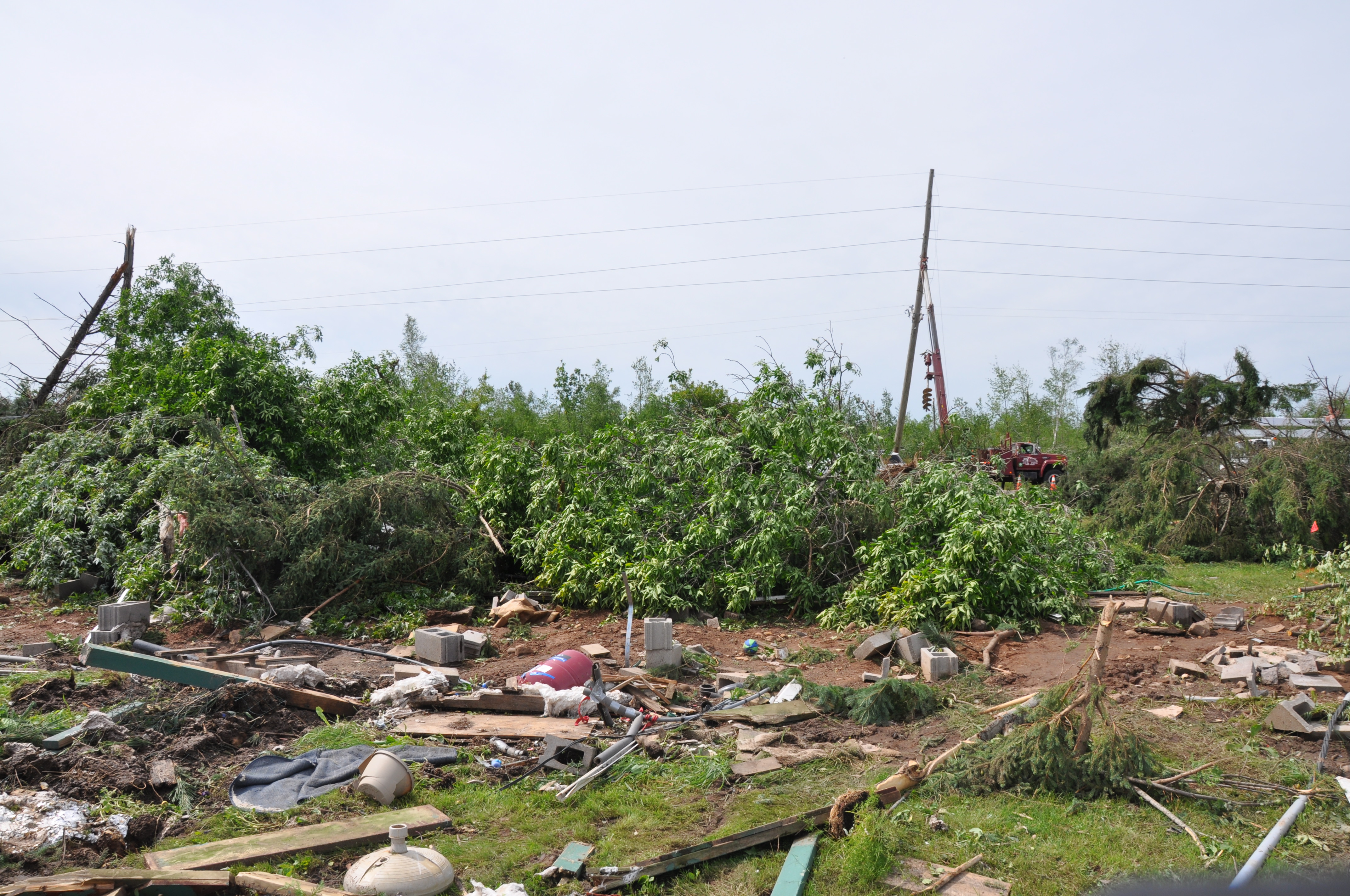
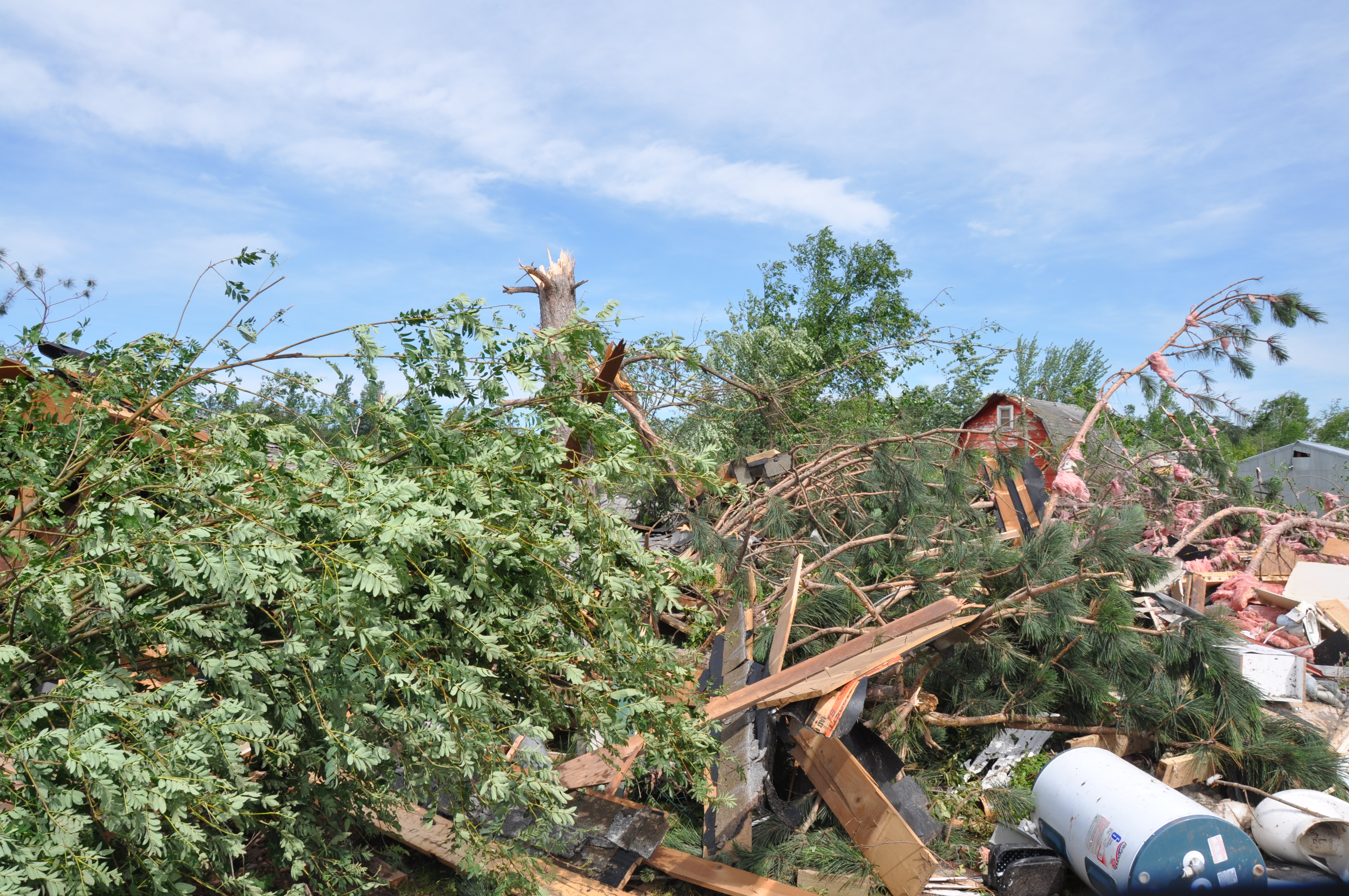
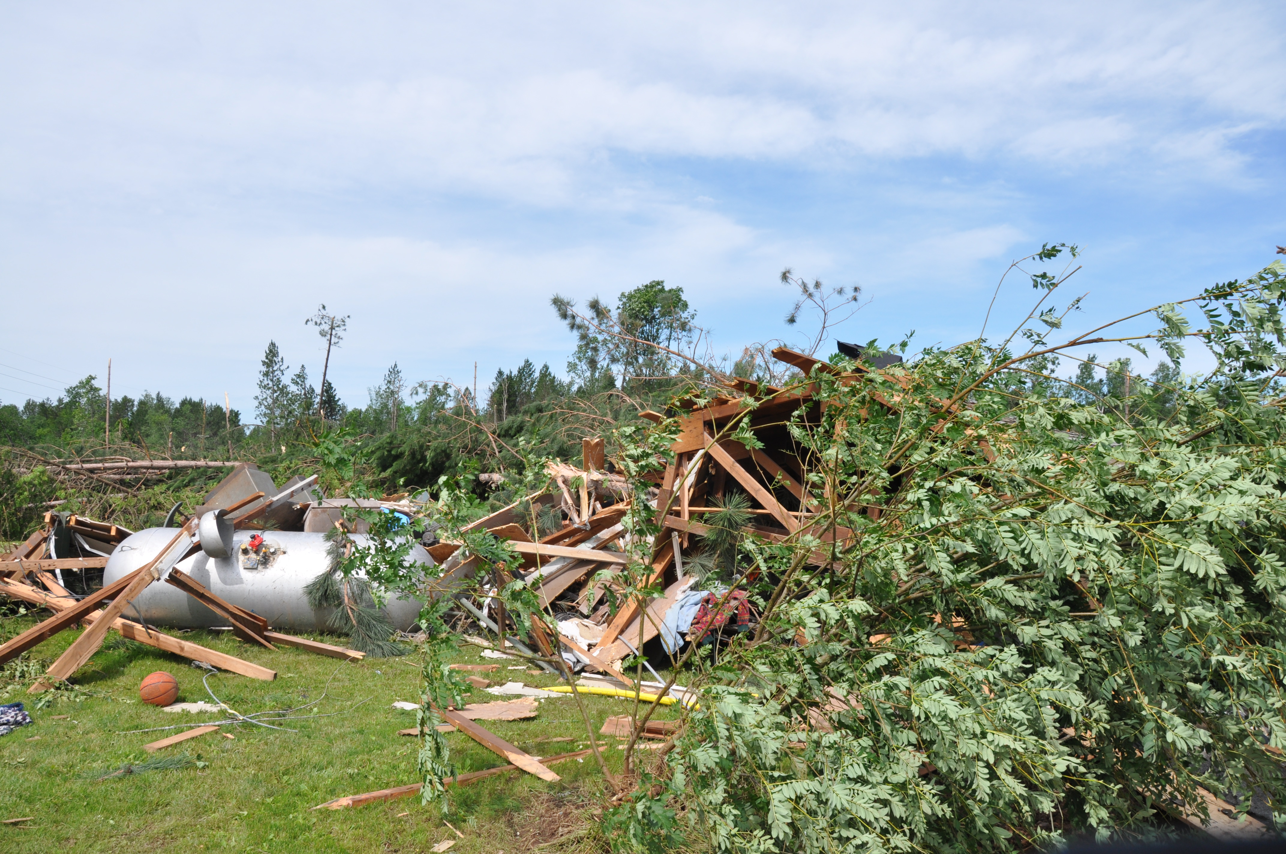
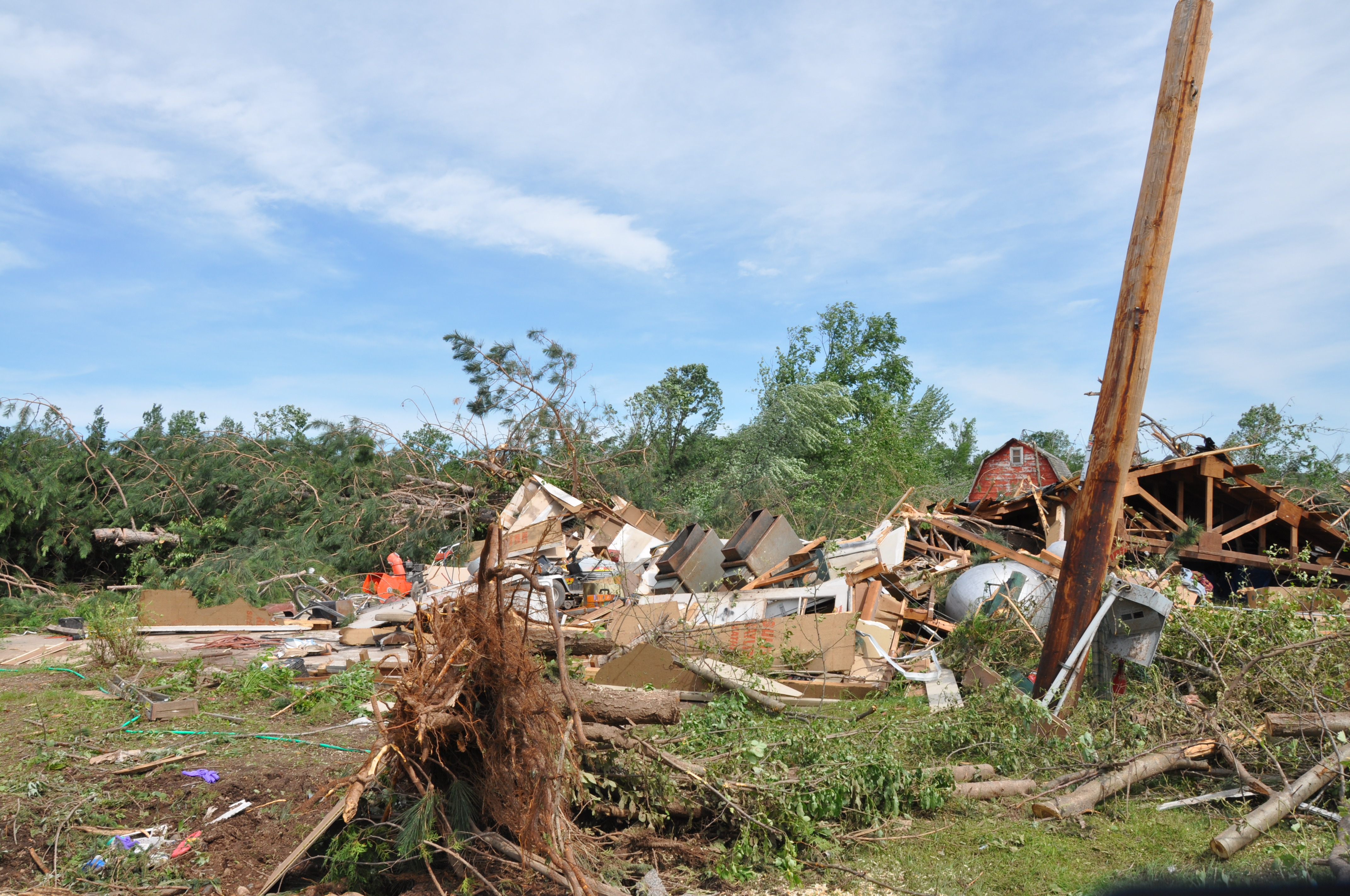
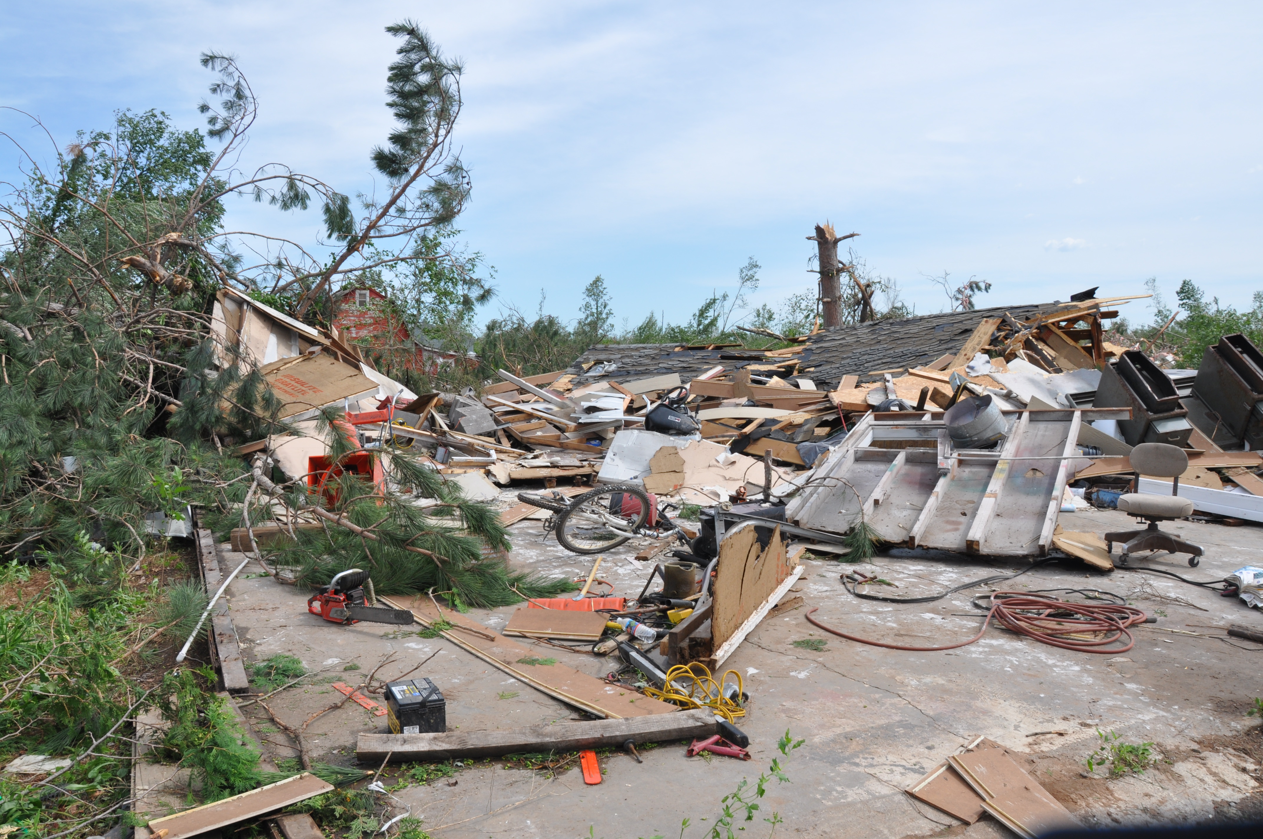
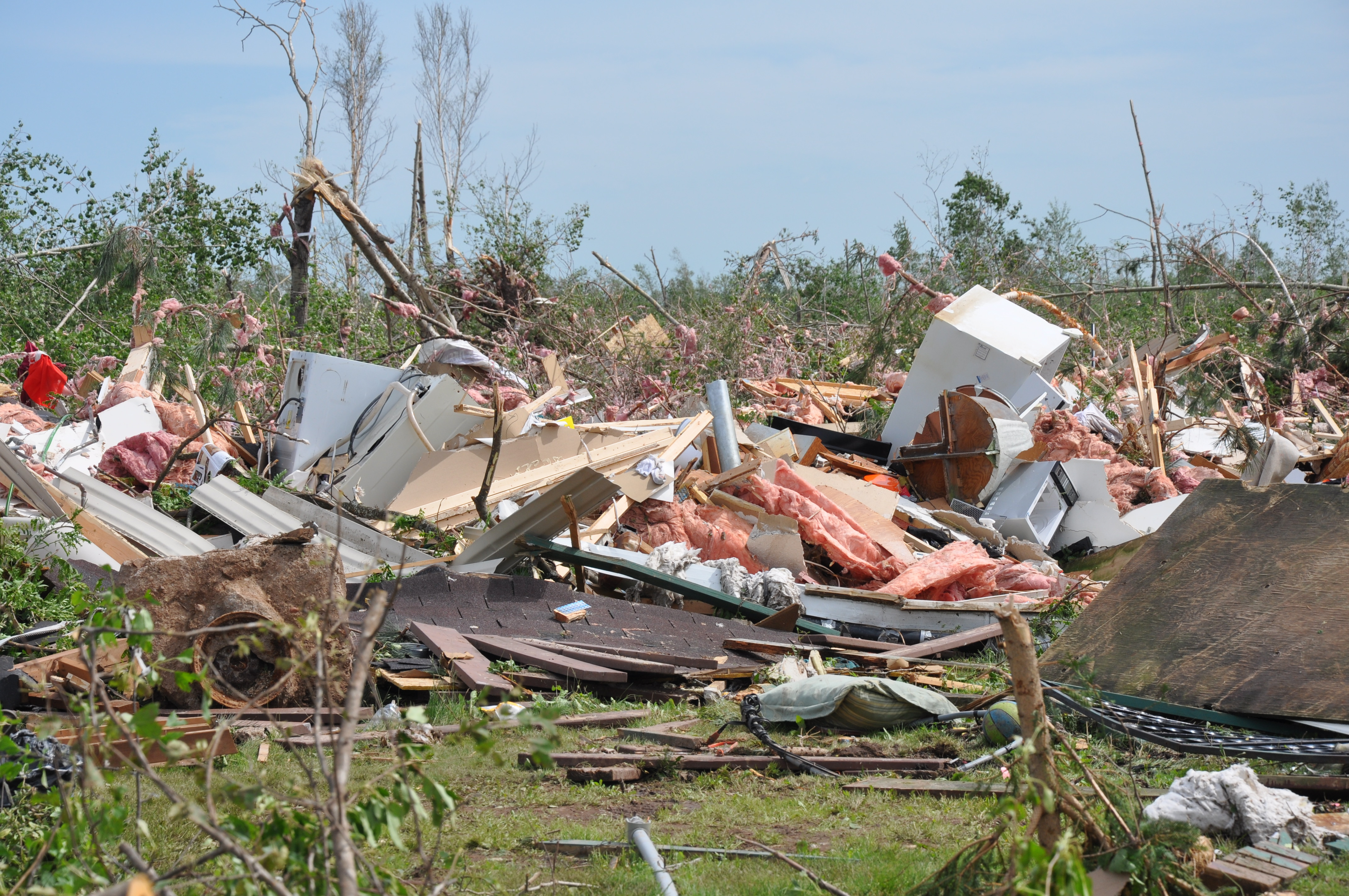
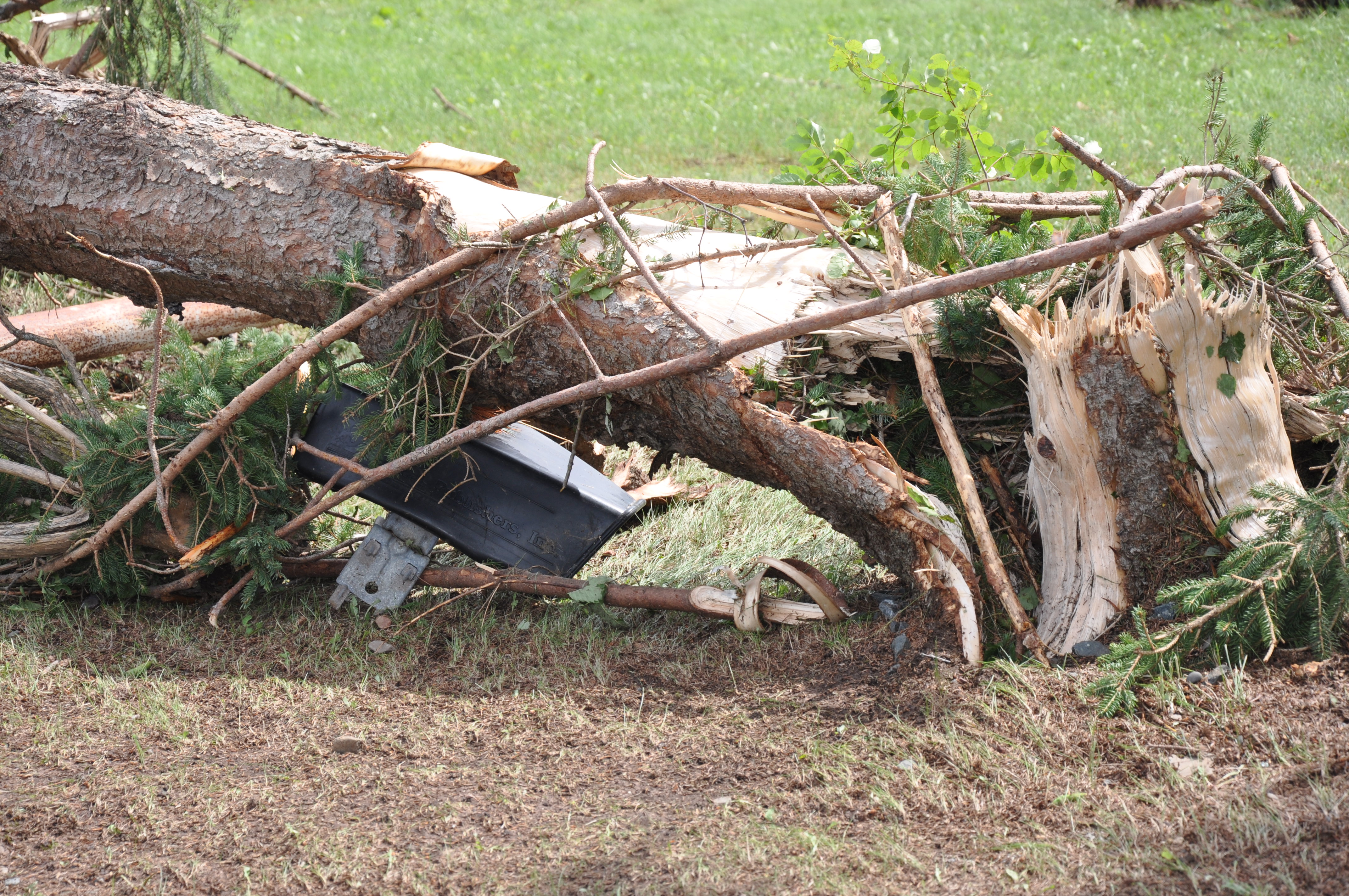
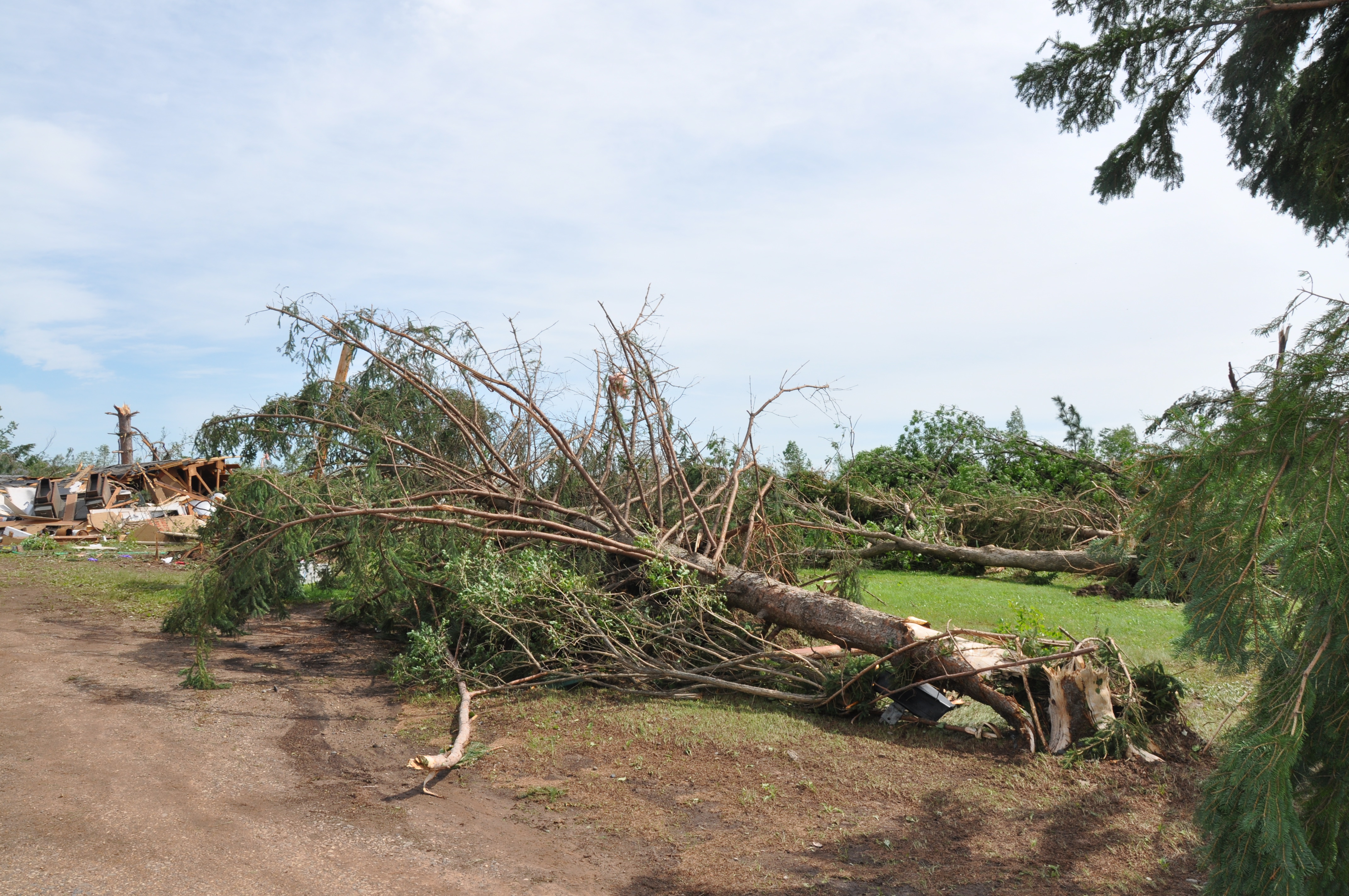
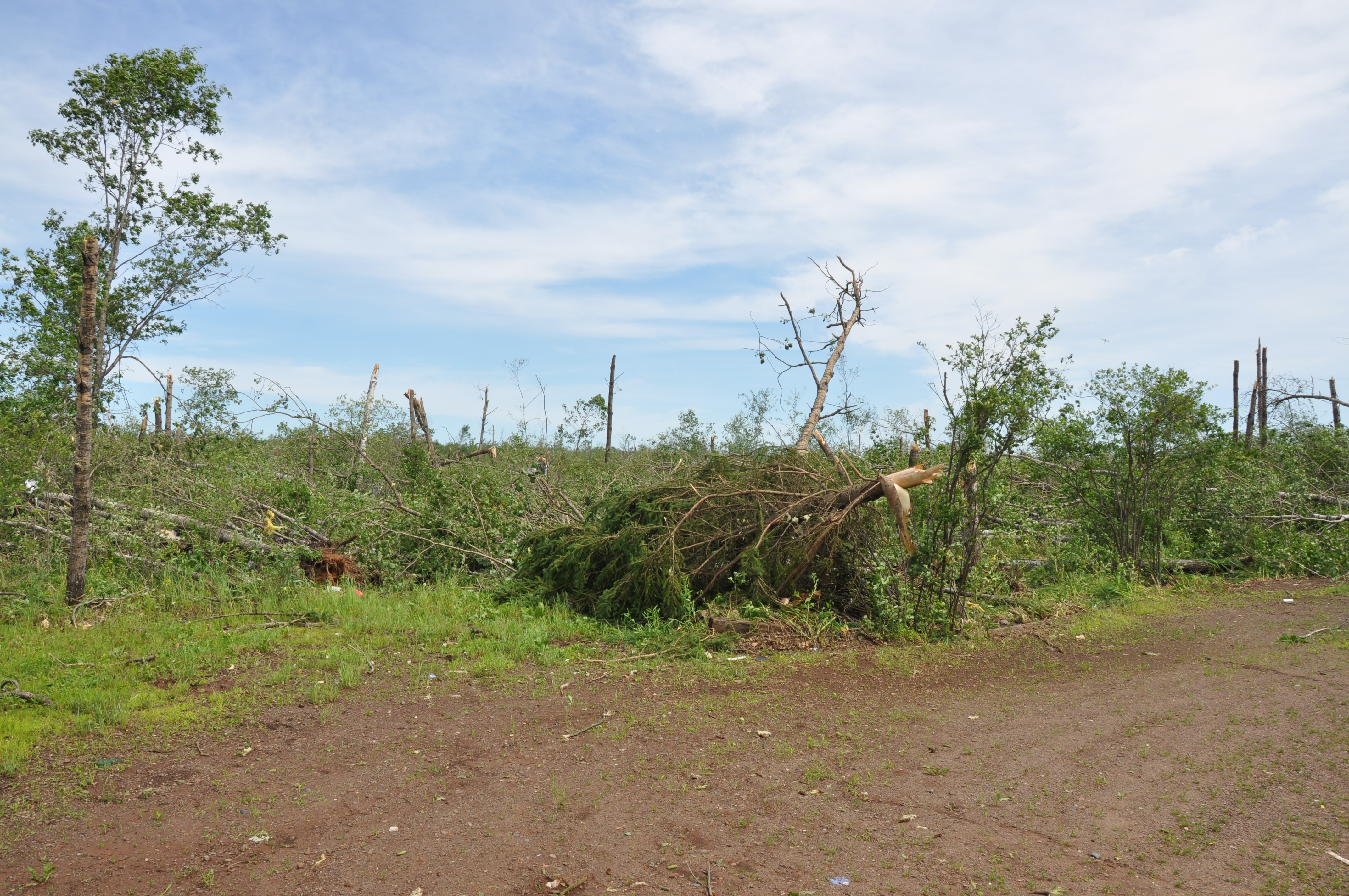
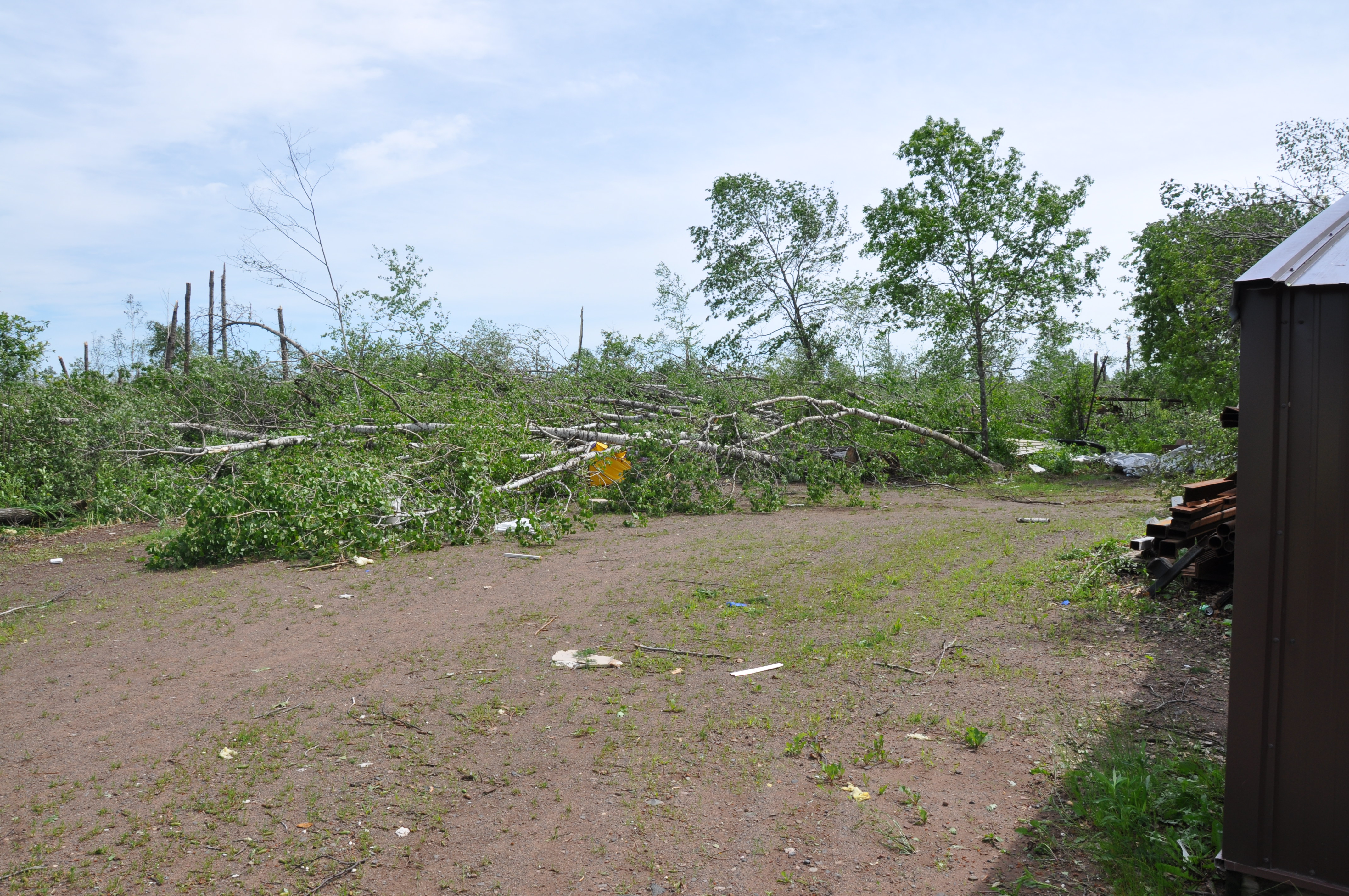
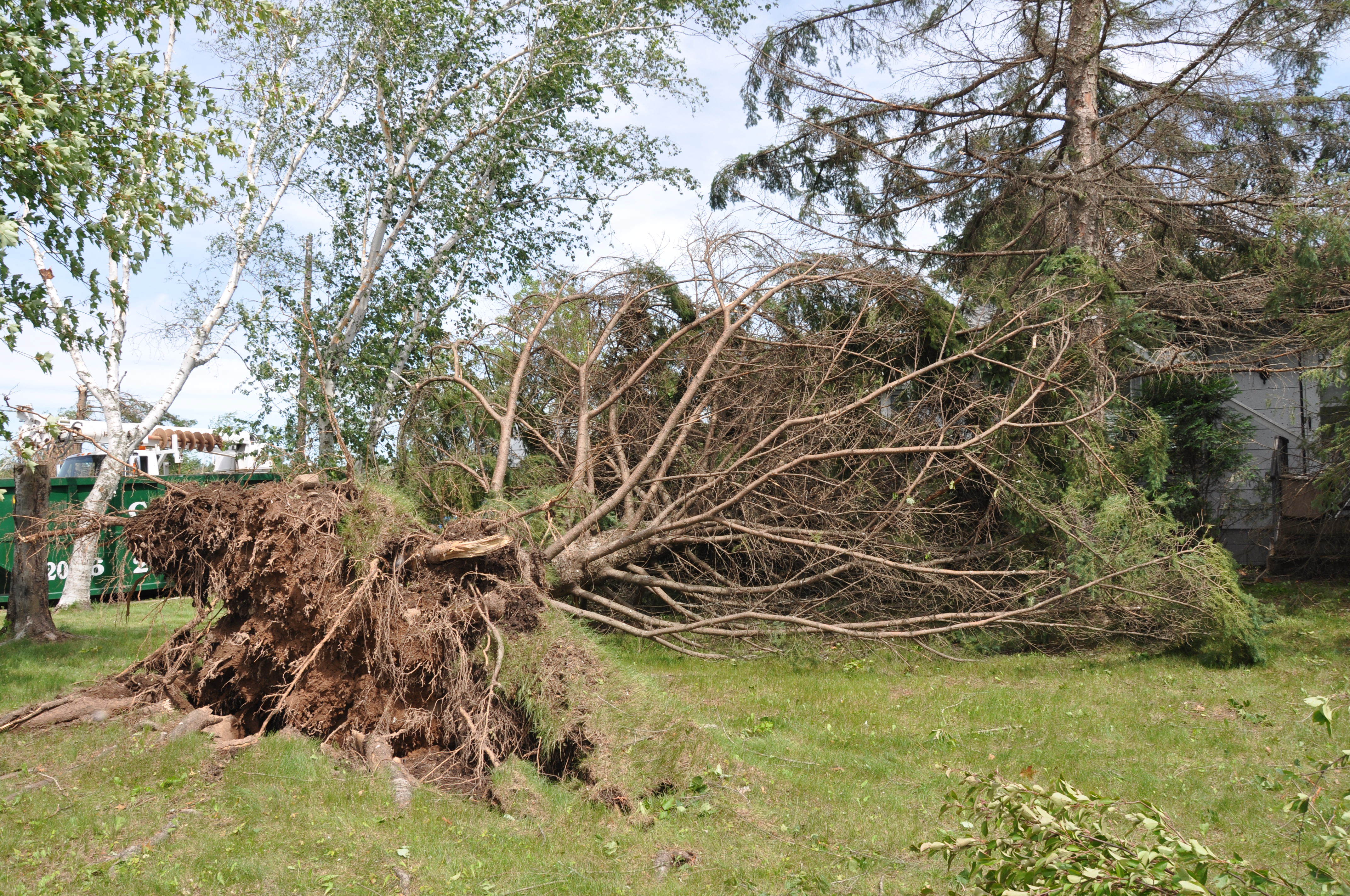
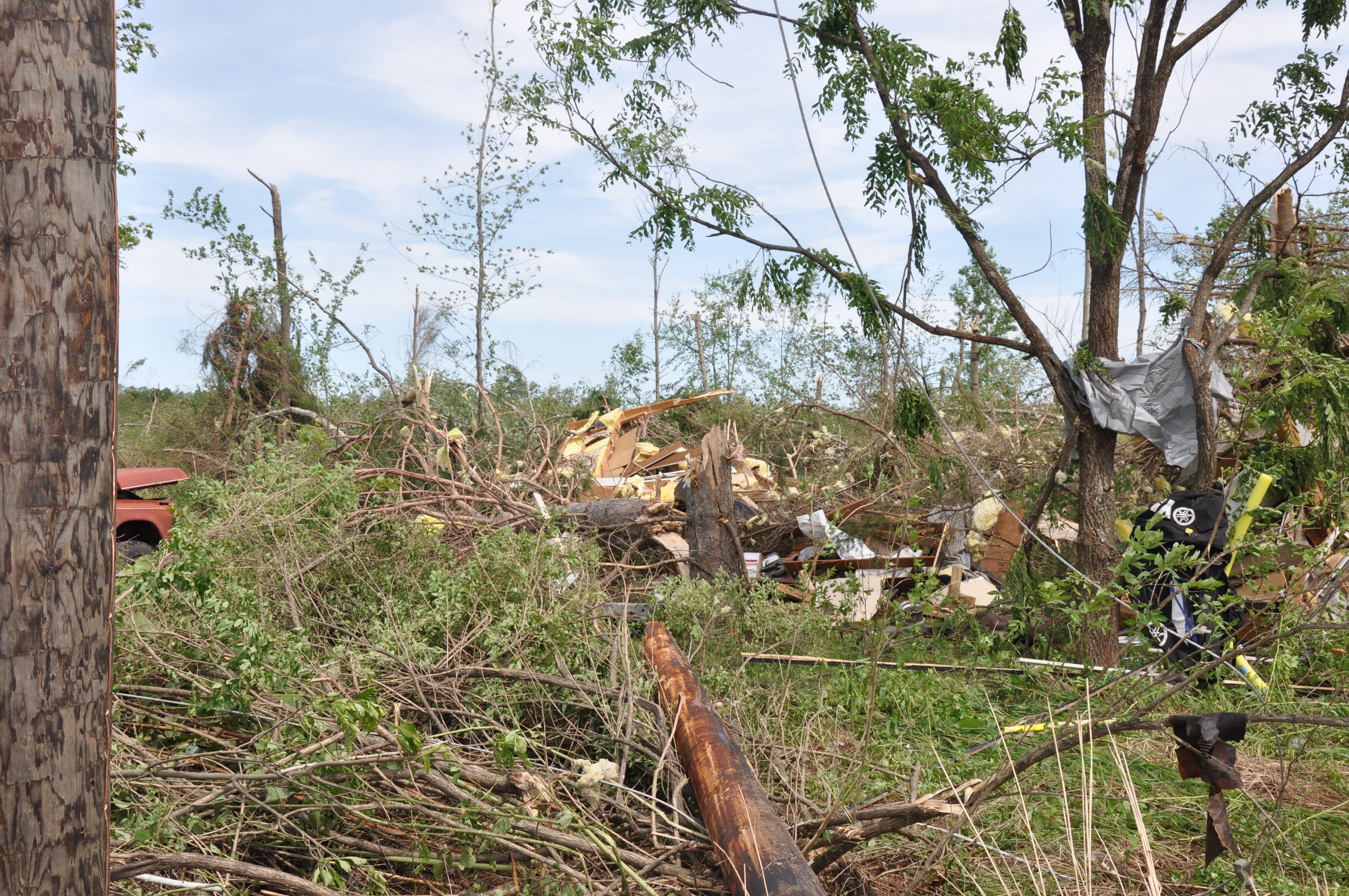
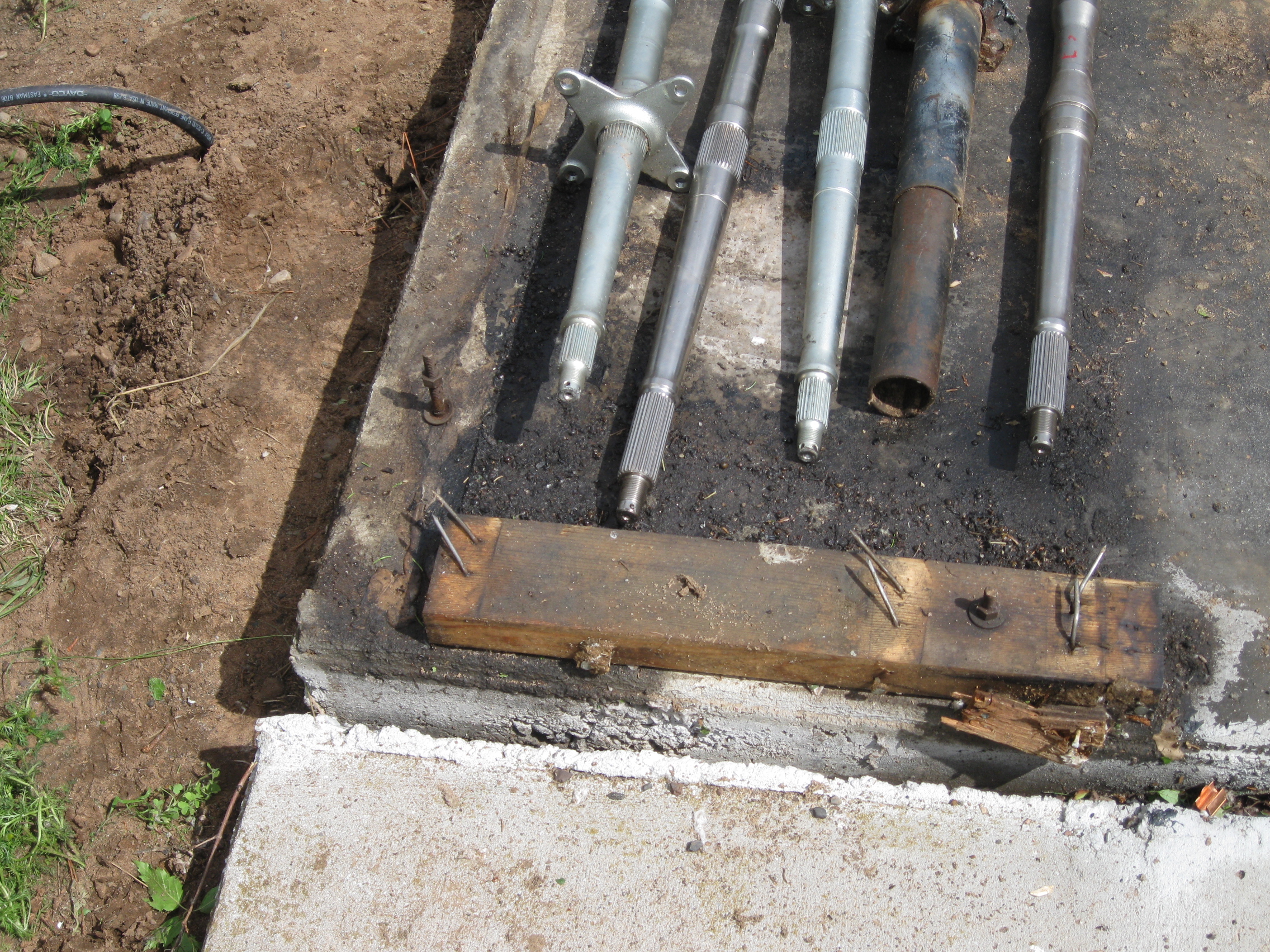
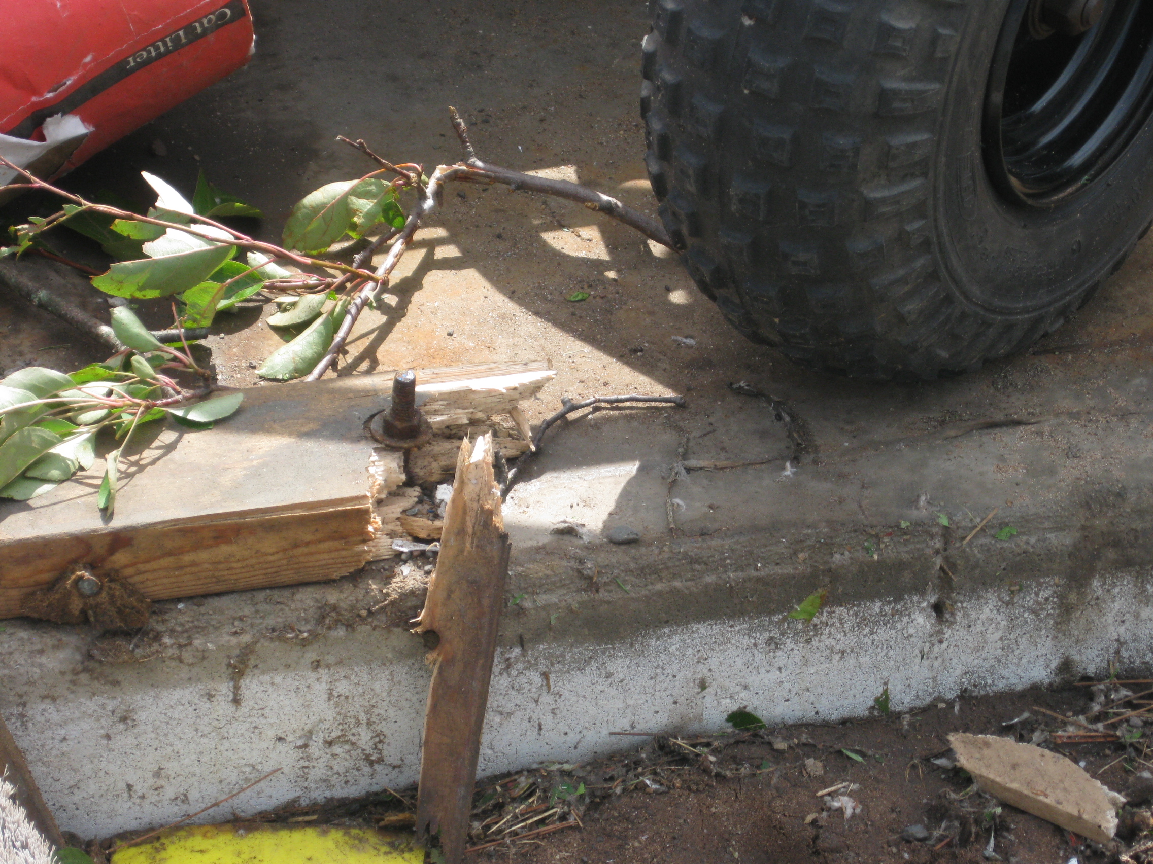
Photos from the damage survey in Pine County:
 |
 |
 |
 |
 |
 |
 |
 |
 |
 |
 |
 |
 |
 |
 |
 |
 |
 |
 |
 |
 |
 |
 |
 |
 |
 |
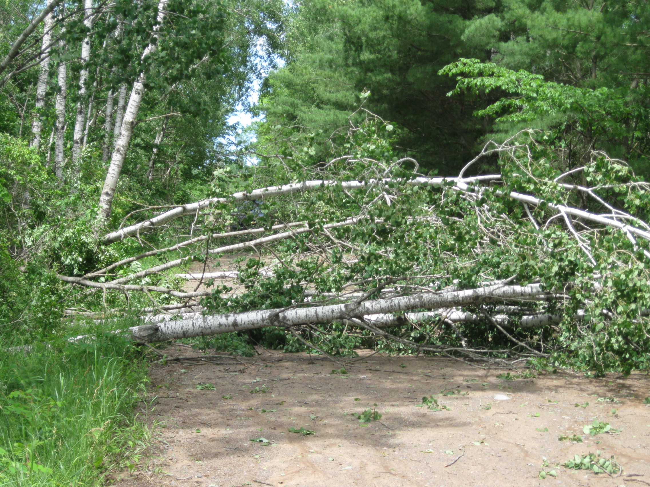
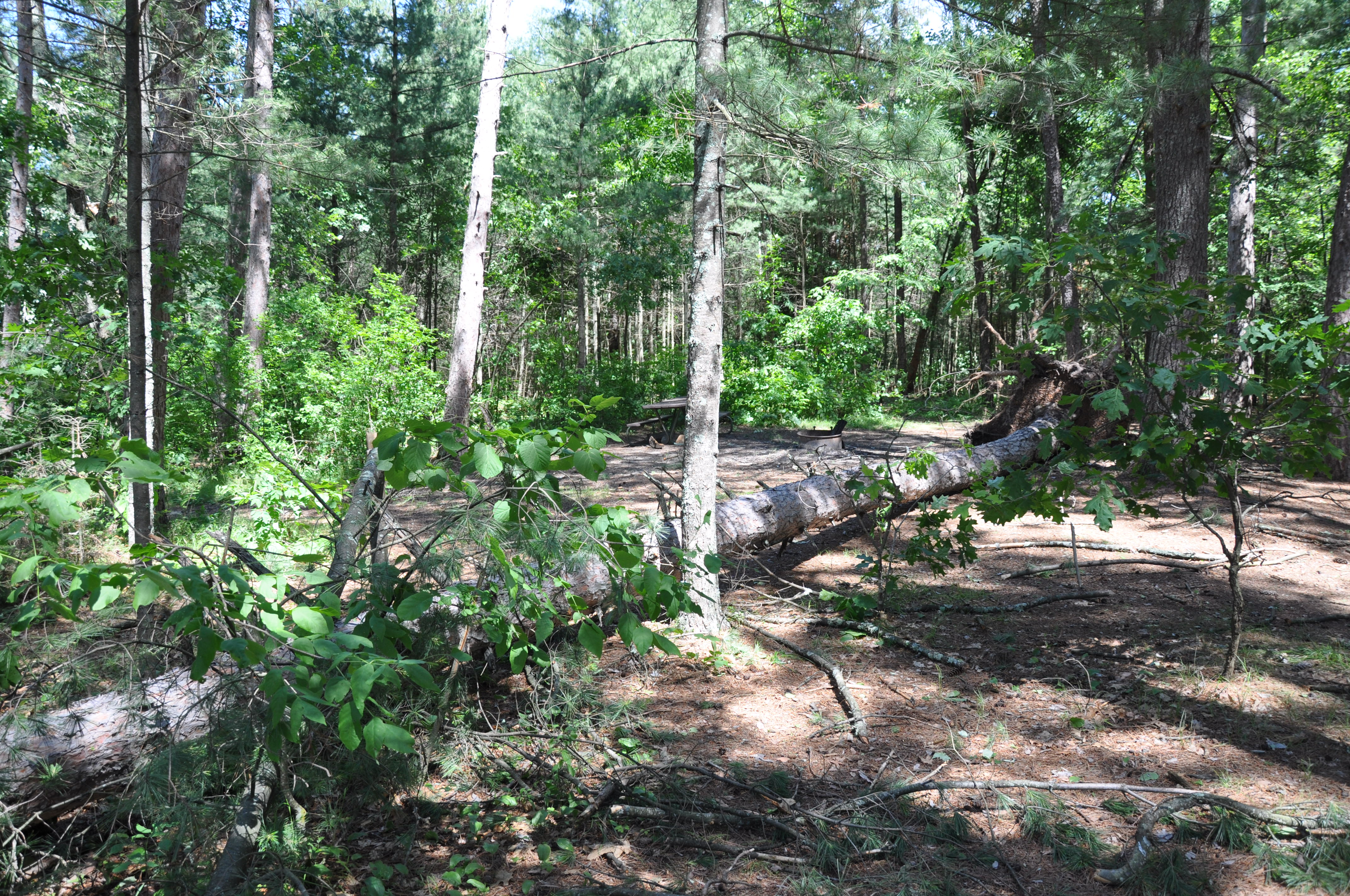
Photos from the St. Croix Landing camping area:
 |
 |
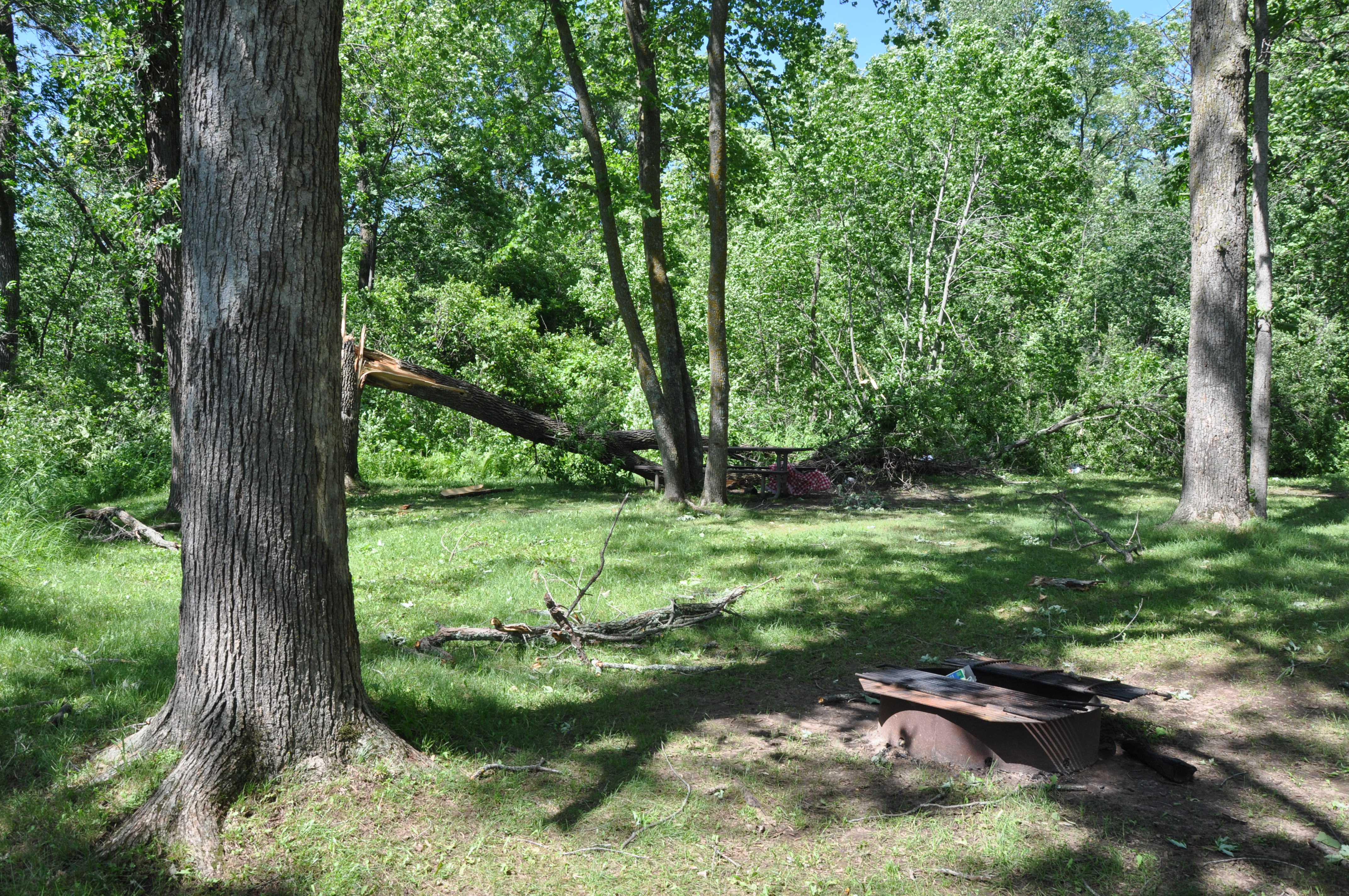 |
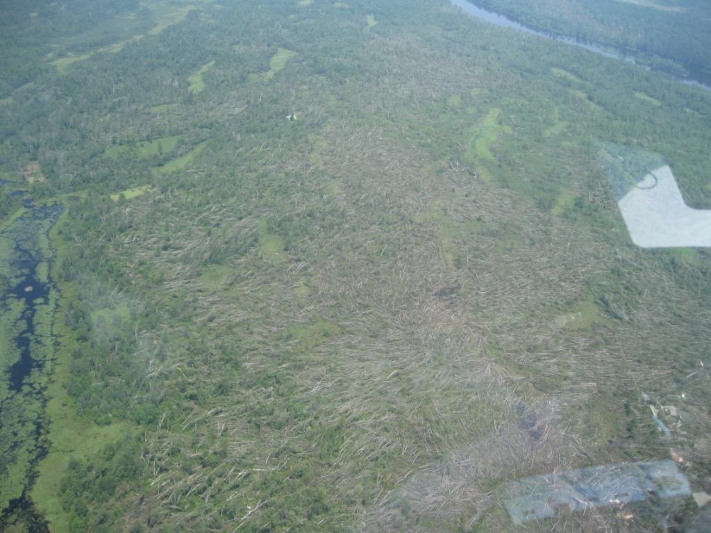
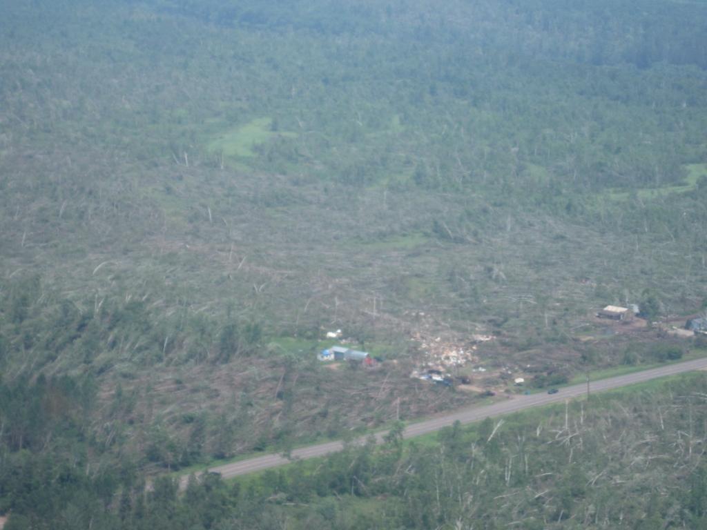
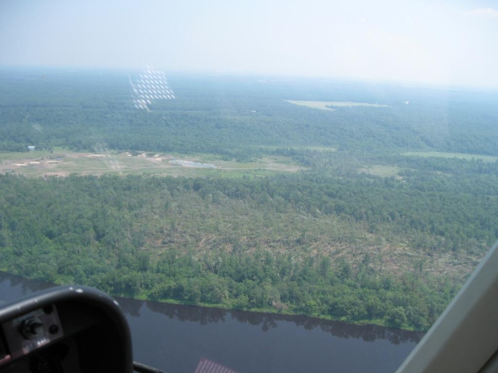
Aerial photos courtesy of the Pine County Sherif and Minnesota State Patrol, unless otherwise noted:
 |
 |
 |
 |
Northern Crow Wing County wall cloud photos courtesy Jason Rieber, Breezy Point Police Department:
 |
 |
Additional Information
Summaries from other NWS Offices
 |
Media use of NWS Web News Stories is encouraged! Please acknowledge the NWS as the source of any news information accessed from this site. |
|