Duluth, MN
Weather Forecast Office
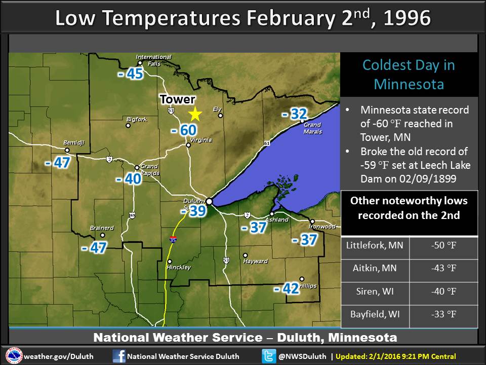
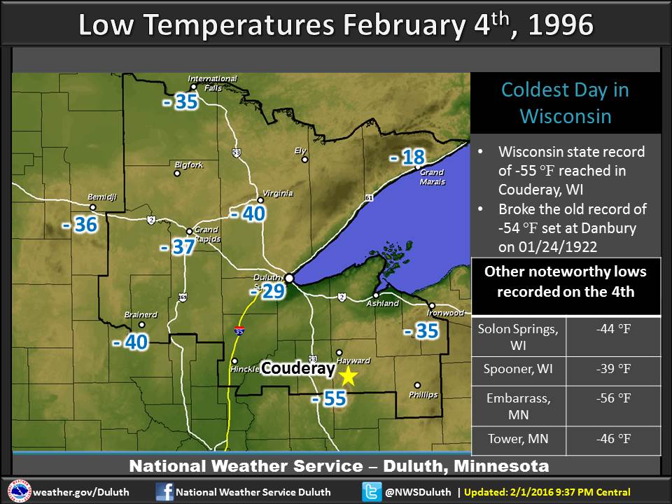
Two decades ago from January 30th to February 4th, 1996, record breaking cold temperatures hit the Northland. Numerous cold records fell, including the all time state record lows for Minnesota and Wisconsin. The temperature at the town of Tower, MN plummeted to -60 °F on the morning of February 2nd. This broke the previous Minnesota record low of -59 °F set on February 9th, 1899 at Leech Lake Dam. On February 4th the town of Couderay, WI saw the temperature plunge to -55 °F. This broke previously existing all time Wisconsin record low of -54 °F set on January 24th, 1922 at Danbury.
It was a a frigid stretch of days across the entire Northland as an arctic high pressure system pulled extremely cold air into the region. However, less than a week later temperatures warmed into the mid to upper 40s above zero, a temperature change of over 80 degrees in some locations.
 |
 |
Forecasts
Fire Weather
Great Lakes
Local Text Products
Winter Weather
Local Area Forecasts
Aviation
Marine
Rainy River Basin Page
Current Conditions
Current Observations
Public Information Statements
National Snowfall Map
NOHRSC Snow Analysis
Rain/Snow Reports
Winter Monitor
US Dept of Commerce
National Oceanic and Atmospheric Administration
National Weather Service
Duluth, MN
5027 Miller Trunk Highway
Duluth, MN 55811-1442
218-729-6697 - Duluth; 218-283-4615 - Intl Falls
Comments? Questions? Please Contact Us.

