
Heat expands across the Desert Southwest, Plains, Mississippi Valley and Midwest into Monday. Fire weather concerns continue for portions of the Intermountain West. Active monsoonal moisture fuels thunderstorms over the Southwest with possible flash flooding. Tropical cyclone Fausto in the Pacific, should weaken as it approaches Hawaii; Dangerous surf, swells and rip currents are expected. Read More >
Overview
|
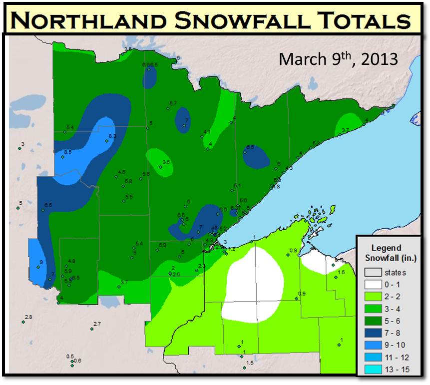
An elongated area of low pressure tracked slowly east across the western Lake Superior region through Saturday and Saturday night, March 9th-10th. This system developed a band of snow north of the Iron Range Saturday morning and a secondary area of significant snow Saturday afternoon from the Brainerd Lakes area to Duluth into the Arrowhead. The heavy snow fell mainly across northeast Minnesota, while locations over northern Wisconsin remained warm enough for mostly rain. |
 |
Snow
854
NOUS43 KDLH 101424
PNSDLH
MNZ010>012-018>021-025-026-033>038-WIZ001>004-006>009-110230-

PUBLIC INFORMATION STATEMENT
NATIONAL WEATHER SERVICE DULUTH MN
924 AM CDT SUN MAR 10 2013

...PRELIMINARY SNOW TOTALS FROM AROUND THE NORTHLAND...


SNOW REPORTS LISTED BY AMOUNT

 INCHES  LOCATION                 ST  COUNTY           TIME
 ------  -----------------------  --  --------------   -------
  9.00   LEADER                   MN  CASS             0547 PM
  8.50   DIXON LAKE               MN  ITASCA           0900 AM
  8.30   BIGFORK                  MN  ITASCA           0900 AM
  8.00   KENWOOD                  MN  ST. LOUIS        0940 PM
  7.00   6 W TWO HARBORS          MN  ST. LOUIS        0700 AM
  7.00   8 ENE COOK               MN  ST. LOUIS        0700 AM
  7.00   10 N ESKO                MN  ST. LOUIS        1101 PM
  7.00   5 N PILLAGER             MN  CASS             0901 PM
  6.60   KABETOGAMA               MN  ST. LOUIS        0700 AM
  6.50   ALBORN                   MN  ST. LOUIS        0701 AM
  6.50   3 N BRAINERD             MN  CROW WING        0921 PM
  6.50   1 S WALKER               MN  CASS             0800 PM
  6.50   KABETOGAMA               MN  ST. LOUIS        0517 PM
  6.30   6 W TWO HARBORS          MN  ST. LOUIS        0716 PM
  6.10   DULUTH HEIGHTS           MN  ST. LOUIS        0739 PM
  6.00   5 NW DULUTH              MN  ST. LOUIS        0926 PM
  6.00   CLOQUET                  MN  CARLTON          0513 PM
  5.90   7 NW BRAINERD            MN  CROW WING        0800 AM
  5.90   3 ENE WRIGHT             MN  CARLTON          0600 AM
  5.80   COLERAINE                MN  ITASCA           0845 PM
  5.70   3 E ORR                  MN  ST. LOUIS        0701 AM
  5.60   NASHWAUK                 MN  ITASCA           0905 PM
  5.60   7 NW TWO HARBORS         MN  LAKE             0800 PM
  5.40   3 S NORTHOME             MN  ITASCA           0700 AM
  5.40   2 W SHESHEBEE            MN  AITKIN           0654 AM
  5.30   SILVER BAY               MN  LAKE             0758 AM
  5.30   LUTSEN                   MN  COOK             0700 AM
  5.30   1 SW BRAINERD            MN  CROW WING        0700 AM
  5.20   HUNTERS PARK             MN  ST. LOUIS        0600 AM
  5.10   2 S BRIMSON              MN  ST. LOUIS        0730 AM
  5.00   CELINA                   MN  ST. LOUIS        0800 AM
  5.00   LARSMONT                 MN  LAKE             0701 AM
  5.00   4 S SAWYER               MN  CARLTON          0825 PM
  5.00   7 SE GRAND RAPIDS        MN  ITASCA           0811 PM
  5.00   TWO HARBORS              MN  LAKE             0749 PM
  5.00   LAKE NICHOLS             MN  ST. LOUIS        0716 PM
  5.00   MCGREGOR                 MN  AITKIN           0657 PM
  5.00   10 NW SAND POINT LAKE    MN  ST. LOUIS        0347 PM
  4.80   BEAVER BAY               MN  LAKE             0800 AM
  4.80   3 NE NISSWA              MN  CROW WING        0408 PM
  4.50   12 N GRAND RAPIDS        MN  ITASCA           0850 PM
  4.30   LITTLE MARAIS            MN  LAKE             1110 PM
  4.30   2 SW PROCTOR             MN  ST. LOUIS        0604 PM
  4.00   ELY                      MN  ST. LOUIS        0800 AM
  4.00   1 SW TOFTE               MN  COOK             0800 AM
  4.00   FORT RIPLEY              MN  CROW WING        0735 PM
  3.70   1 SE MALMO               MN  AITKIN           0900 AM
  3.60   CHISHOLM                 MN  ST. LOUIS        0645 PM
  3.50   INTERNATIONAL FALLS      MN  KOOCHICHING      1132 PM
  3.00   2 E SUPERIOR             WI  DOUGLAS          0700 AM
  2.50   1 SE MOOSE LAKE          MN  CARLTON          0600 AM
  2.30   5 SE SUPERIOR            WI  DOUGLAS          0700 AM
  2.30   HOLYOKE                  MN  CARLTON          0842 PM
  2.00   MOOSE LAKE               MN  CARLTON          0849 PM
  1.50   WSW UPSON                WI  IRON             0700 AM
  1.20   7 SE SUPERIOR            WI  DOUGLAS          0749 PM
  1.10   8 N BAYFIELD             WI  BAYFIELD         0700 AM
  1.00   PHILLIPS                 WI  PRICE            0700 AM
  1.00   SARONA                   WI  WASHBURN         0700 AM
  1.00   MOUTH OF BRULE           MN  DOUGLAS          0442 PM
  0.90   3 WNW CLAM LAKE          WI  BAYFIELD         0700 AM
  0.90   2 N MOQUAH               WI  BAYFIELD         0700 AM
  0.50   1 E LA POINTE            WI  ASHLAND          0700 AM
  0.10   1 WSW SAXON              WI  IRON             0758 AM


$$
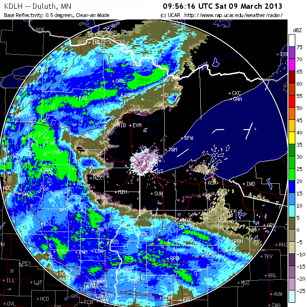
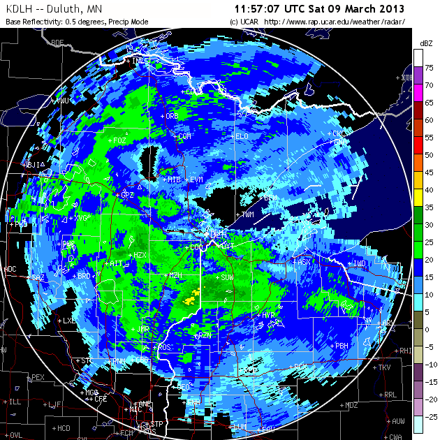
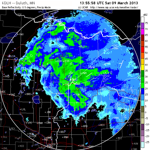
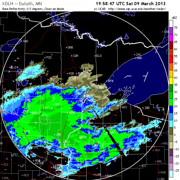
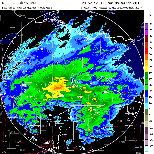
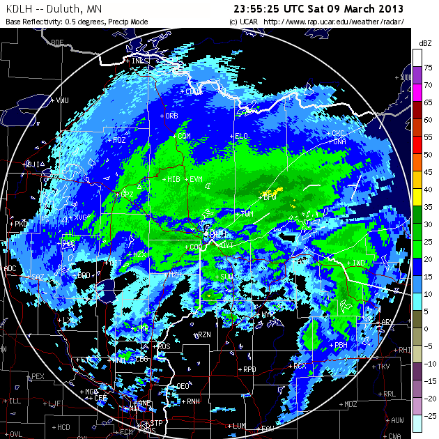
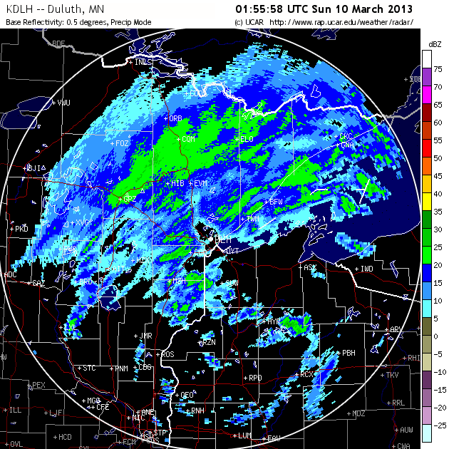
Radar
 |
 |
 |
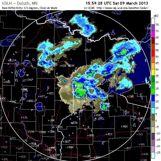 |
| March 9th, 400 am | March 9th, 600 am | March 9th, 800 am | March 9th, 1000 am |
 |
 |
 |
 |
| March 9th, 200 pm | March 9th, 400 pm | March 9th, 600 pm | March 9th, 800 pm |
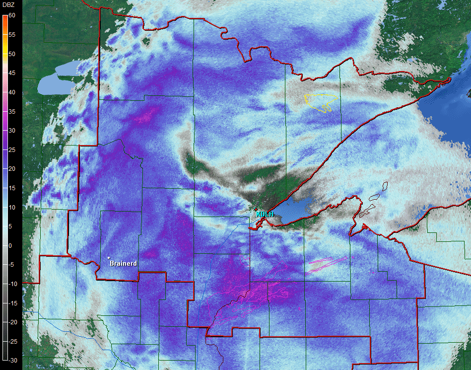
Radar Loop from 5:30am to 5:45 pm 3/9
Environment
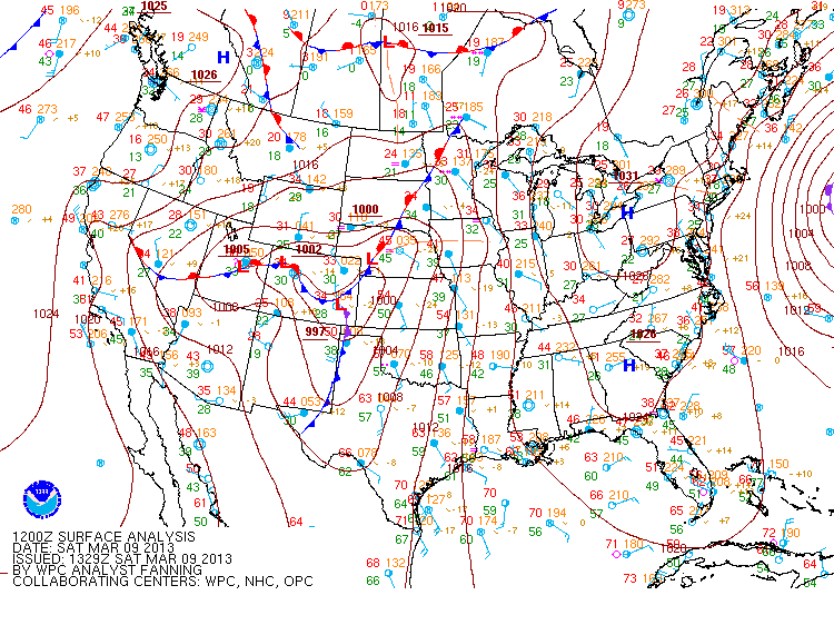
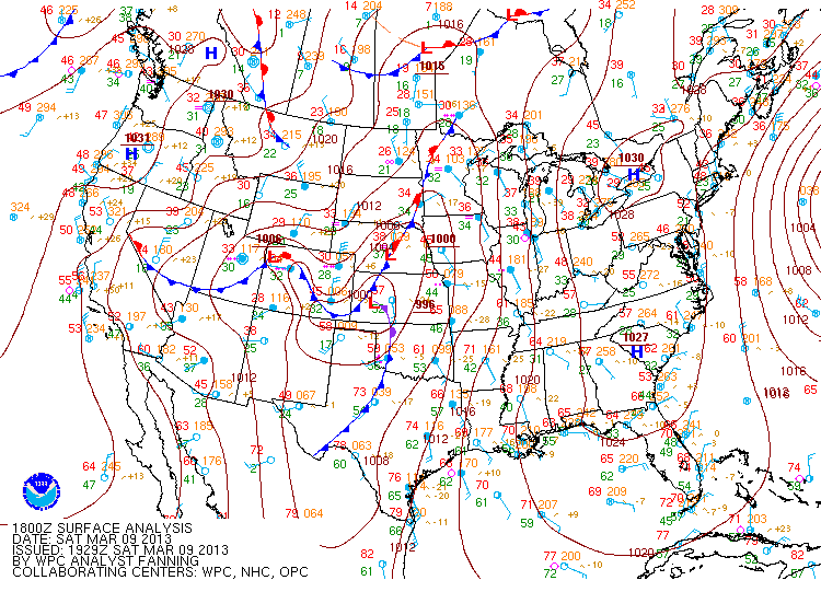
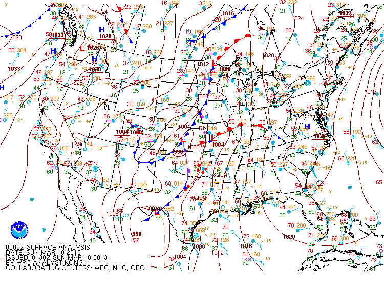
Surface Analysis
 |
 |
 |
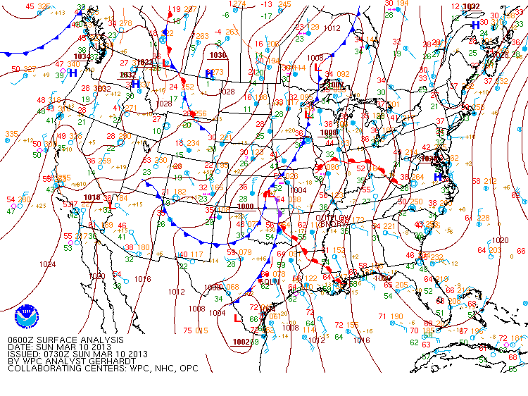 |
| Figure 1: March 9th, 600 am | Figure 2: March 9th, Noon | Figure 3: March 9th, 600 pm | Figure 4: March 10th, Midnight |
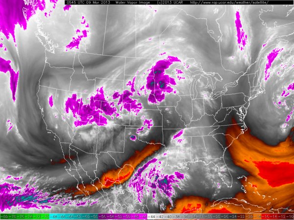
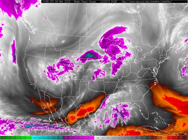
Water Vapor Imagery
 |
 |
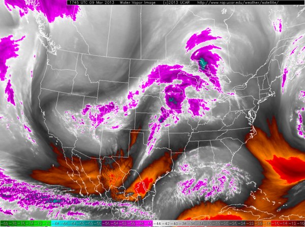 |
| Figure 4: March 9th, Midnight | Figure 5: March 9th, 600 am | Figure 6: March 9th, Noon |
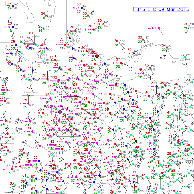
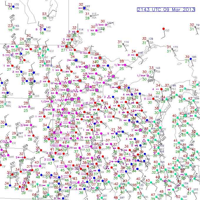
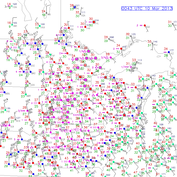
Surface Plots
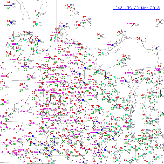 |
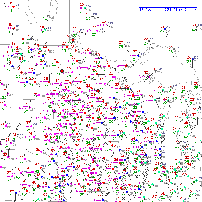 |
 |
| Figure 7: March 9th, 600 am | Figure 8: March 9th, 900 am | Figure 9: March 9th, 1200 pm |
 |
 |
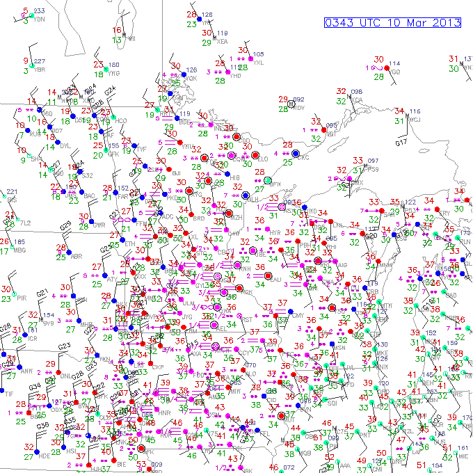 |
| Figure 10: March 9th, 300 pm | Figure 11: March 10th, 600 pm | Figure 12: March 10th, 900 pm |
 |
Media use of NWS Web News Stories is encouraged! Please acknowledge the NWS as the source of any news information accessed from this site. |
|

