Duluth, MN
Weather Forecast Office
| Preliminary Storm Summary Sunday, July 12th, 2015 |
|
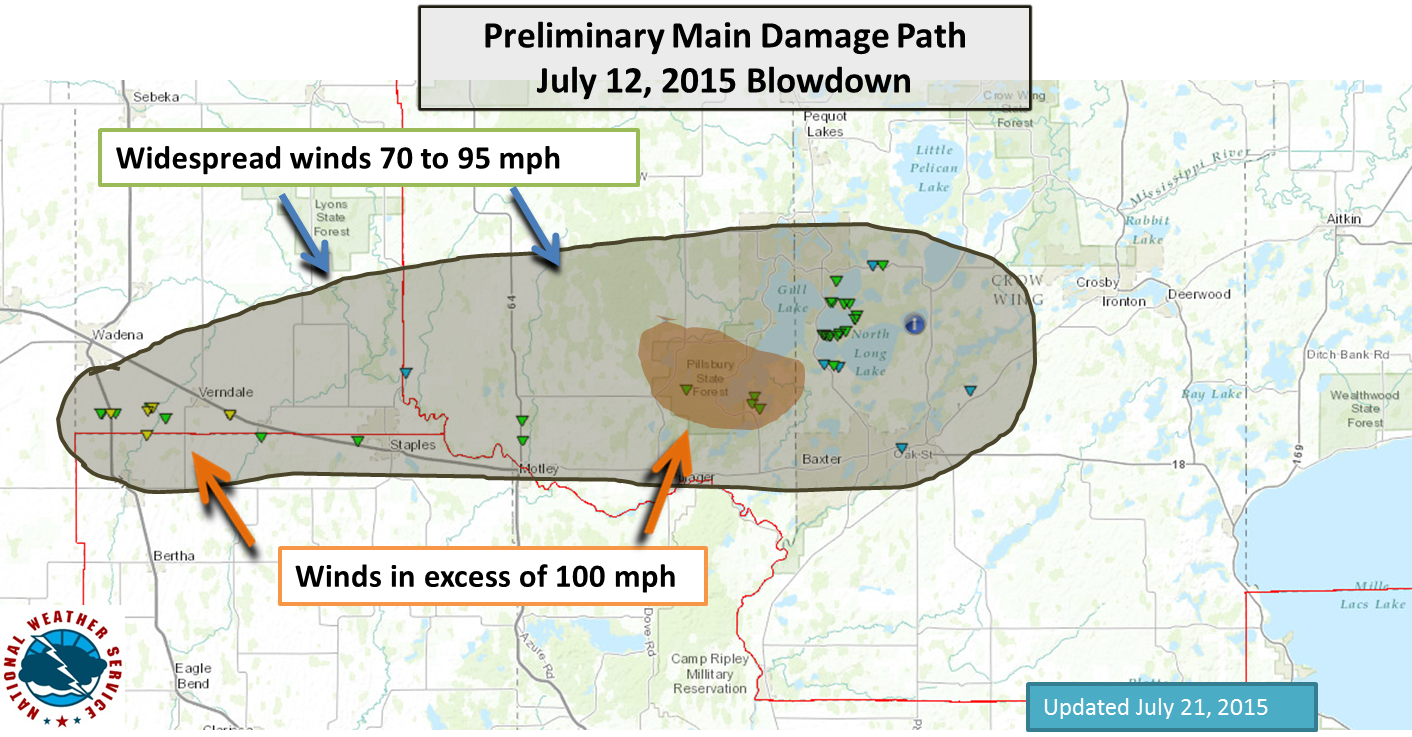
On the evening of July 12th, 2015 a line of severe storms brought damaging straight line winds to the southern portions of Cass and Crow Wing counties in north central Minnesota. An automated weather station in Brainerd, MN recorded a peak wind of 65 mph during the storm. Most of the storm damage in the Brainerd area was consistent with winds in the 70 to 80 mph range.
|
 |
|
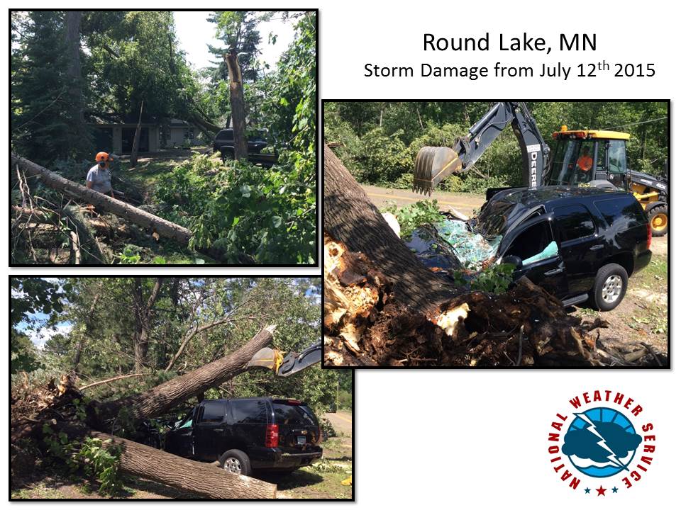
** Storm Damage Photos ** |
.jpg) |
 |
 |
| ** View more storm photos from the Brainerd Dispatch News |
| ** View a video of the storm taken by a GoPro camera on a dock. (Used with permission). |
Forecasts
Fire Weather
Great Lakes
Local Text Products
Winter Weather
Local Area Forecasts
Aviation
Marine
Rainy River Basin Page
Current Conditions
Current Observations
Public Information Statements
National Snowfall Map
NOHRSC Snow Analysis
Rain/Snow Reports
Winter Monitor
US Dept of Commerce
National Oceanic and Atmospheric Administration
National Weather Service
Duluth, MN
5027 Miller Trunk Highway
Duluth, MN 55811-1442
218-729-6697 - Duluth; 218-283-4615 - Intl Falls
Comments? Questions? Please Contact Us.

