A strong atmospheric river will bring prolonged heavy rainfall along with gusty winds to the Pacific Northwest through much of this week. The heavy rainfall may lead to widespread urban and river flooding. Accumulating snow is expected over parts of the central Appalachians and Mid-Atlantic today as well as the Upper Midwest and the Upper Great Lakes this evening into Tuesday. Read More >
Overview
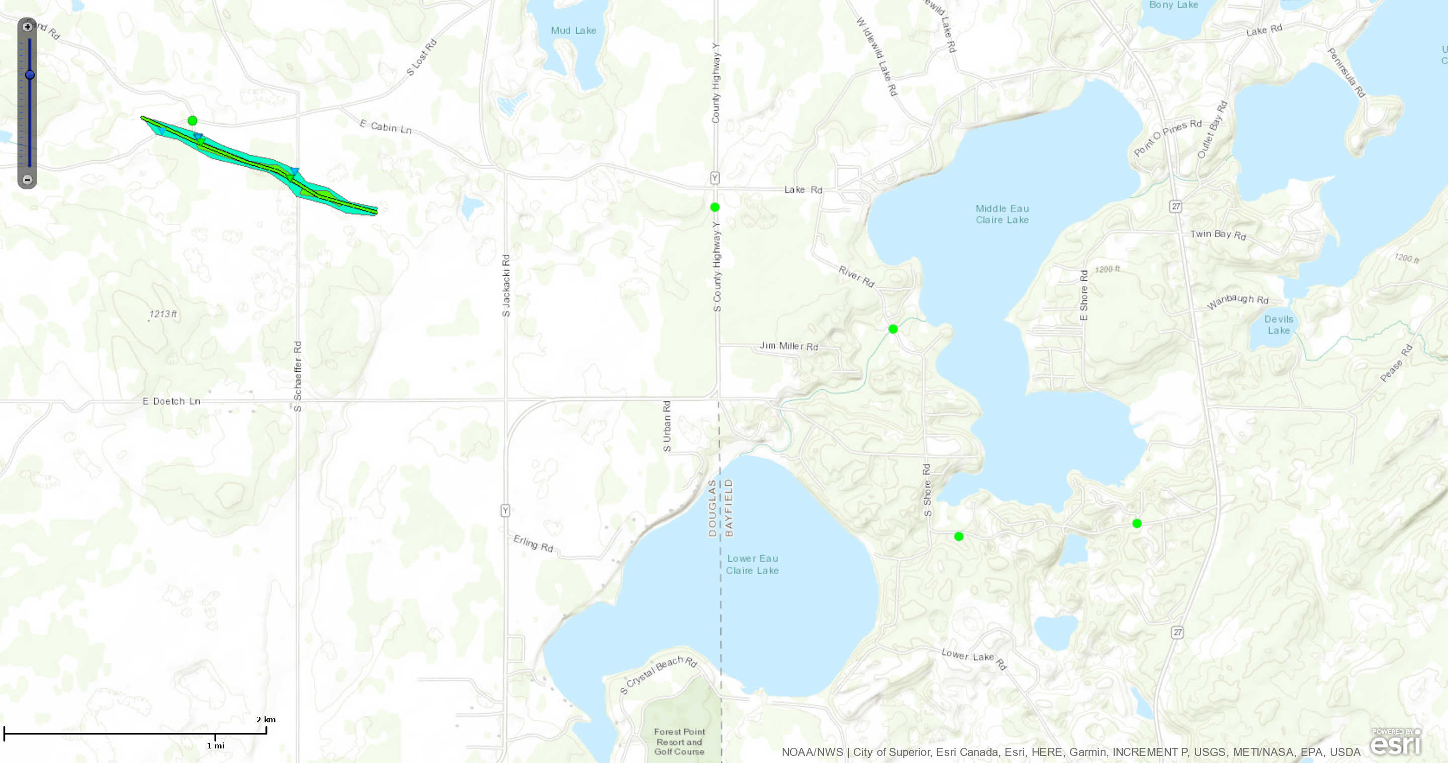
Several supercell thunderstorms developed during the morning and early afternoon hours of Thursday, July 18, 2019, starting around 11 AM near Moose Lake, MN. The first storm produced half-dollar size hail near Foxboro, WI, before dissipating. Another supercell thunderstorm developed near Chaffey, WI, and tracked east-southeastward to a few miles northwest of Solon Springs, WI. The storm then made a right turn and moved into the town of Gordon, WI, where it produced a tornado. The tornado lifted a few minutes after it formed in Douglas County. The supercell storm gradually weakened as it moved across southern Bayfield County and dissipated near Namekagon around 4 PM.Tornadoes
|
Tornado - Gordon, WI
|
||||||||||||||||
The Enhanced Fujita (EF) Scale classifies tornadoes into the following categories:
| EF0 Weak 65-85 mph |
EF1 Moderate 86-110 mph |
EF2 Significant 111-135 mph |
EF3 Severe 136-165 mph |
EF4 Extreme 166-200 mph |
EF5 Catastrophic 200+ mph |
 |
|||||
Photos & Video
Header
 |
 |
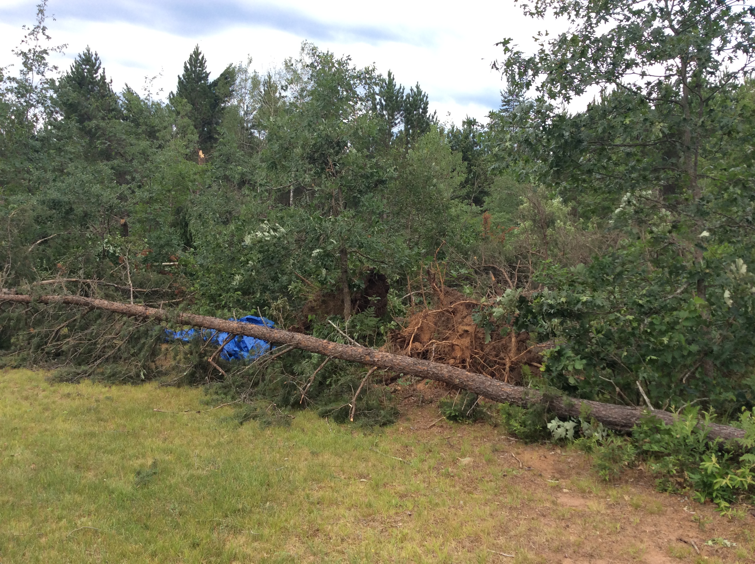 |
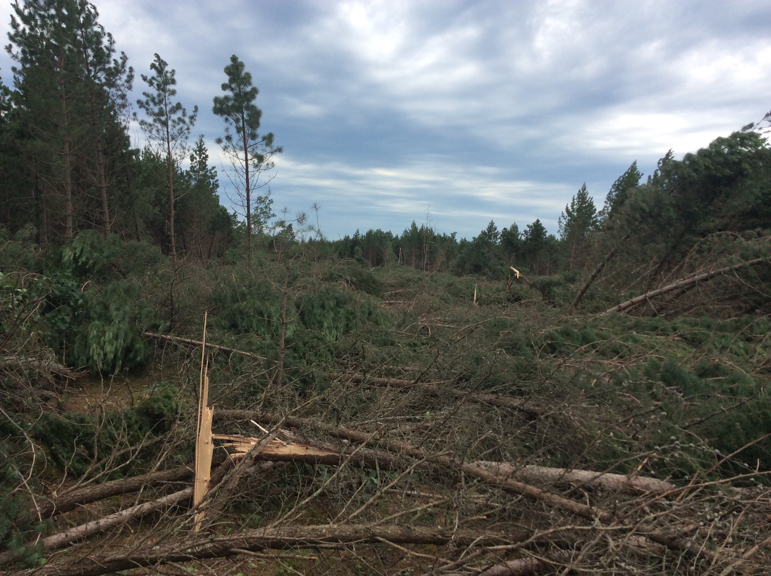
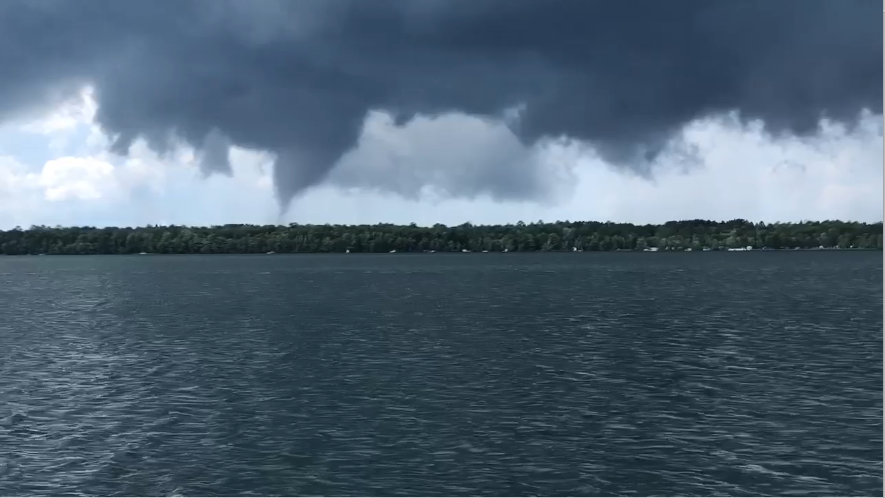
| Trees flattened roughly a quarter mile south of the intersection of Cabin Lane and Shaefer Road. Photo taken by NWS Duluth Damage Survey team looking northwest. | Funnel cloud seen north from Lower Eau Claire Lake around 3 PM CDT. (Screen capture from a video courtesy of Al Schmidt and Kirsten Odegard) | Several trees downed and a few uprooted near a homestead on Cabin Lane. Photo taken by NWS Duluth Damage Survey team. |
Radar
Radar imagery from KDLH radar in Duluth, MN. The loop starts at 2:02 CDT and ends at 2:54 CDT.
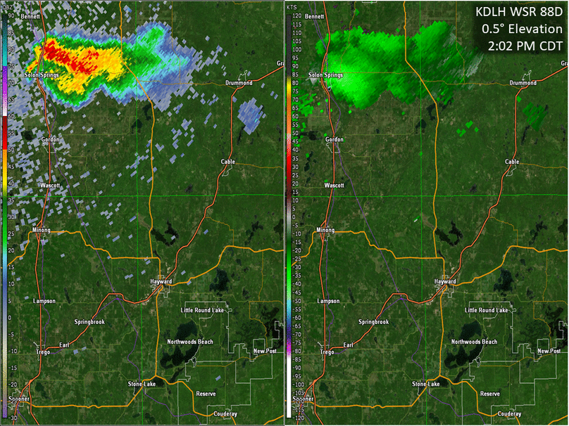 |
| Reflectivity (left) and Storm Relative Velocity (right) |
Environment
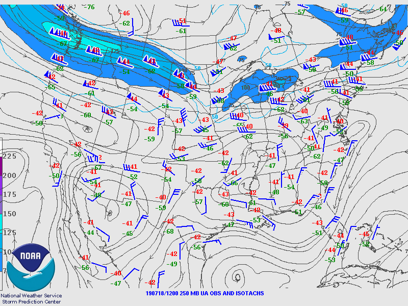
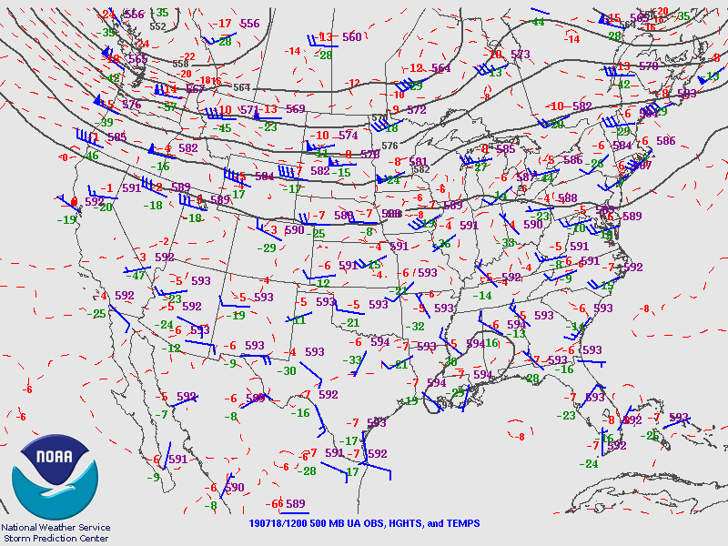
A 250 hPa jet streak lifted out of the Upper Midwest into Ontario. In addition, a subtle 500 hPa shortwave trough lifted from the Northern Plains into the Upper Midwest on July 18th. These features helped aid in lift aloft for thunderstorm development. A bit lower in the atmosphere, strong southwesterly moisture advection was present per 850 hPa analysis.
 |
 |
 |
| Figure 1: 12Z (7 AM CDT) 250 hPa SPC analysis | Figure 2: 12Z (7 AM CDT) 500 hPa SPC analysis | Figure 3: 18Z (1 PM CDT) 850 hPa SPC Mesoanalysis |
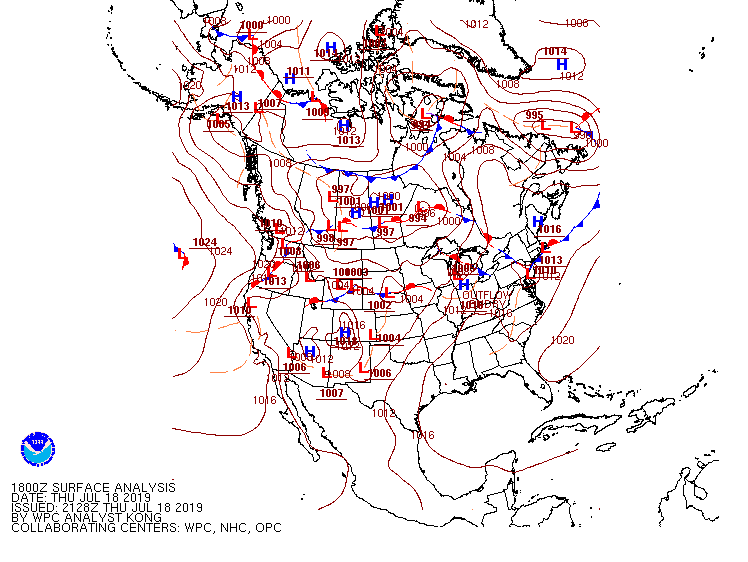
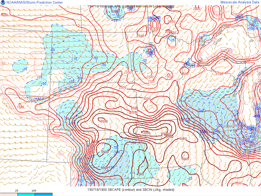
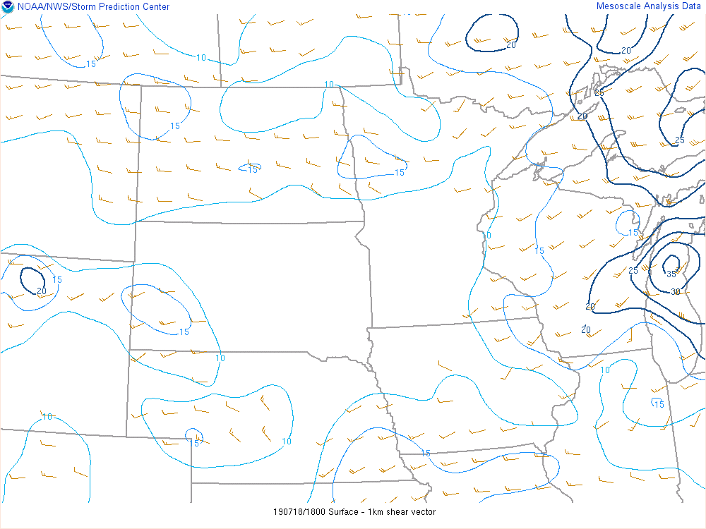
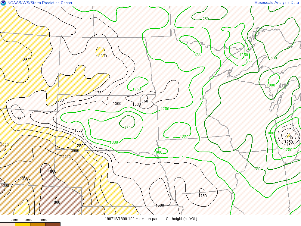
At the surface the nearest feature is a warm front lifting northward into southern Minnesota. An elevated warm front (not shown) was lifting into a region of high instability. Surface Based CAPE values (an indication of how unstable the atmosphere is) ranged from 2000-2500 J/kg around 1 PM with no Surface Based CIN. 0-6 km Bulk shear values ranged from 50 to 60 knots. The high amount of shear combined with the instability is indicative that supercell thunderstorms are possible provided there is sufficient moisture and lift to get storms going. 0-1 km bulk shear values were in the 10 to 15 knot range, which is right around the low end of the threshold that is indicative of a tornado threat. Lifted Condensation Level Heights were between 750 to 1000 meters and the Significant Tornado Parameter (STP) value was around 1. Typically the majority of significant tornadoes (EF2 or greater) are associated with values greater than 1. The thunderstorm that produced the tornado was able to develop due to the lift provided by an outflow boundary that was left over from a thunderstorm that moved through during the morning hours.
 |
 |
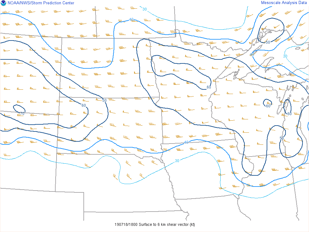 |
| Figure 4: WPC 18Z (1 PM CDT) Surface Analysis | Figure 5: 18Z (1 PM CDT) Surface Based CAPE from SPC Mesoanalysis | Figure 6: 18Z (1 PM CDT) 0-6 km Bulk Shear from SPC Mesoanalysis |
 |
 |
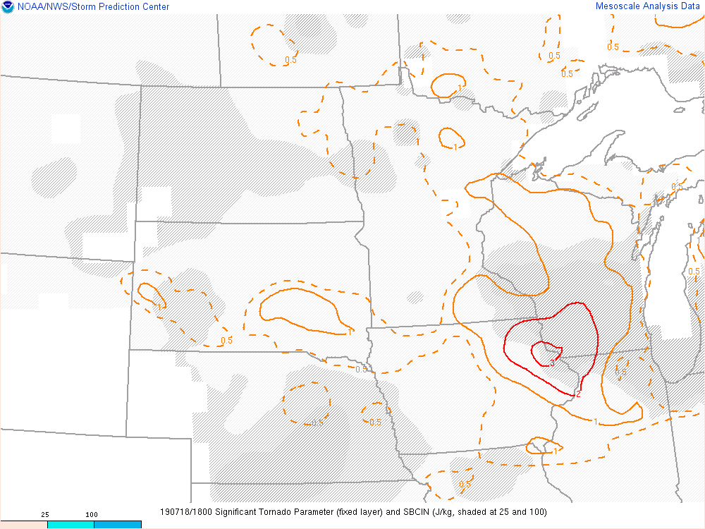 |
| Figure 7: 18Z (1 PM CDT) 0-1 km Bulk Shear from SPC Mesoanalysis | Figure 8: 18Z (1 PM CDT) Lifted Condensation Level (LCL) heights from SPC Mesoanalysis | Figure 9: 18Z (1 PM CDT) Significant Tornado Parameter from SPC Mesoanalysis |
 |
Media use of NWS Web News Stories is encouraged! Please acknowledge the NWS as the source of any news information accessed from this site. |
|