Duluth, MN
Weather Forecast Office
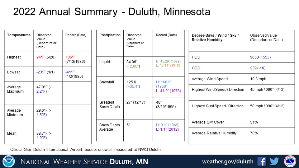
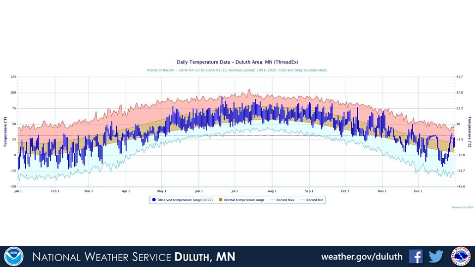
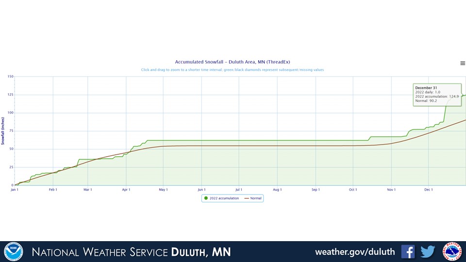
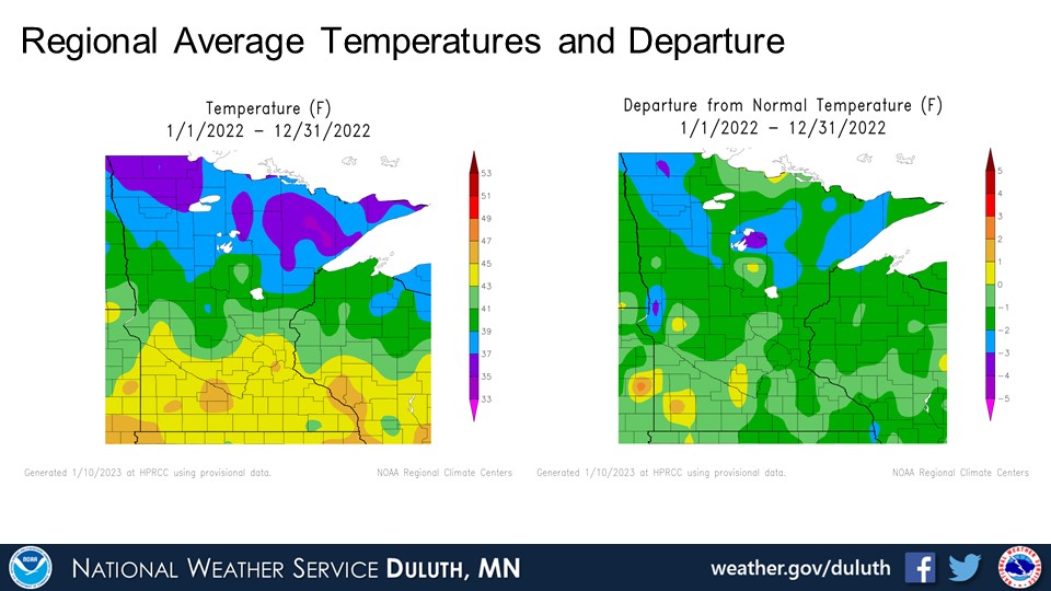
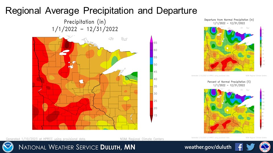
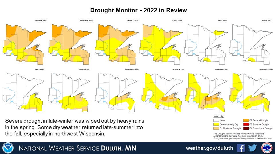
2022 was characterized by temperatures a few degrees below average with above average precipitation across the Northland as a whole. The year started off with most of the Northland experiencing some kind of drought, ranging from abnormally dry conditions to severe drought. Snowpack was plentiful to start off 2022, and this combined with a very rainy spring to produce record flooding along the Rainy River basin in northeast Minnesota that didn’t fully let up until mid-summer.
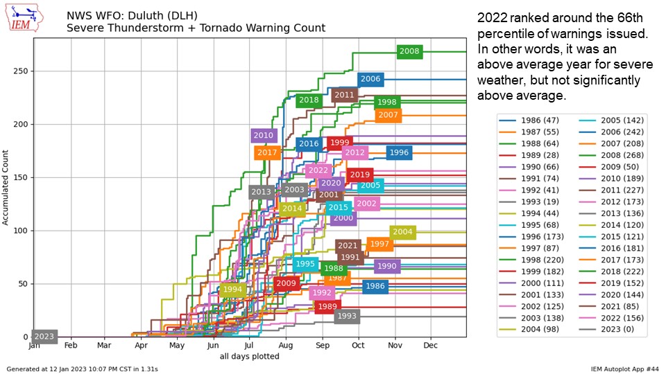
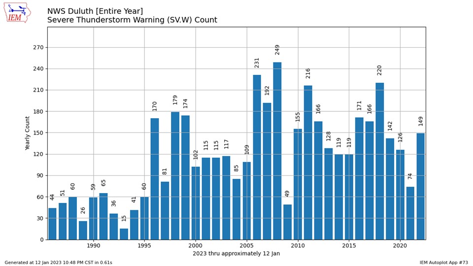
Severe weather activity was a bit above average over the summer, and there were plenty of hot days scattered throughout. Rainfall became less prevalent in the later part of summer and into fall, which brought a reintroduction of some drought conditions, especially in northwest Wisconsin.
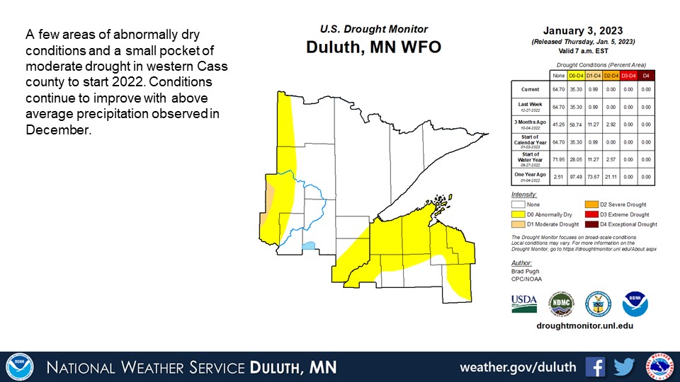
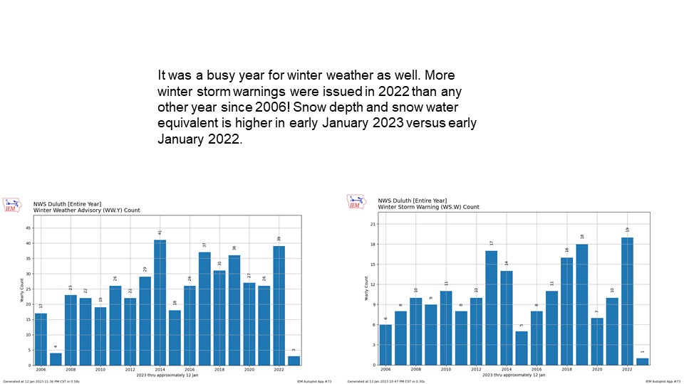
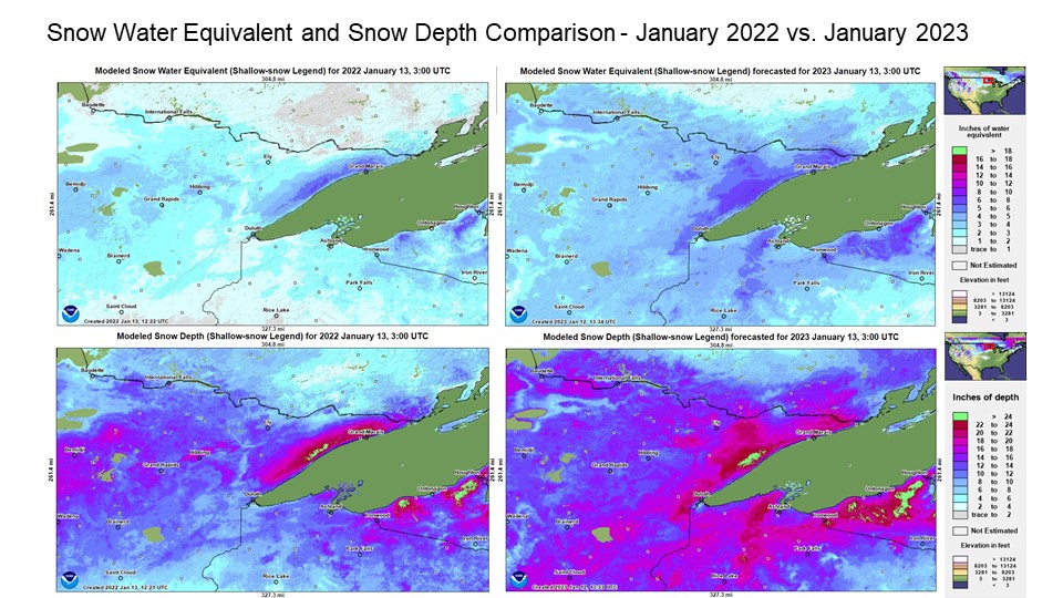
A very snowy and precipitous start to winter occurred in December with several snowstorms (including a blizzard along the North Shore). Some of the drought conditions that worsened during the fall have improved a bit such that there are now mostly just some areas of abnormally dry conditions. Snowpack is also noticeably higher in early January 2023 versus early January 2022.
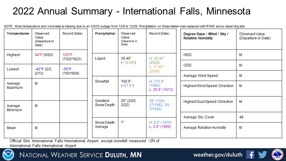
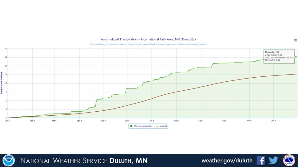
Finally, with all the heavy precipitation that fell throughout the year, International Falls broke their annual maximum precipitation with a total of 35.45 inches. This beat the old record of 34.45 inches from 1941.
Duluth

International Falls
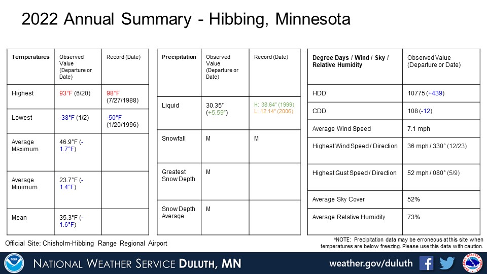
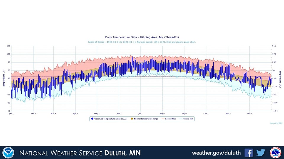
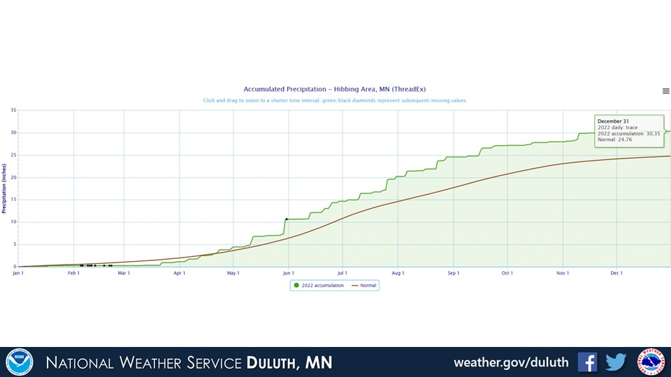
Hibbing
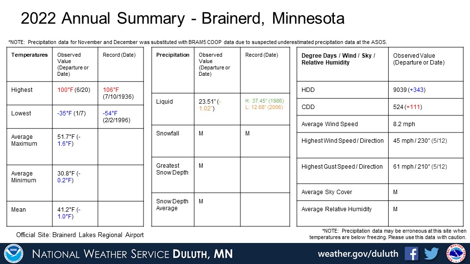
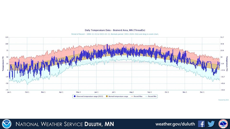
Brainerd

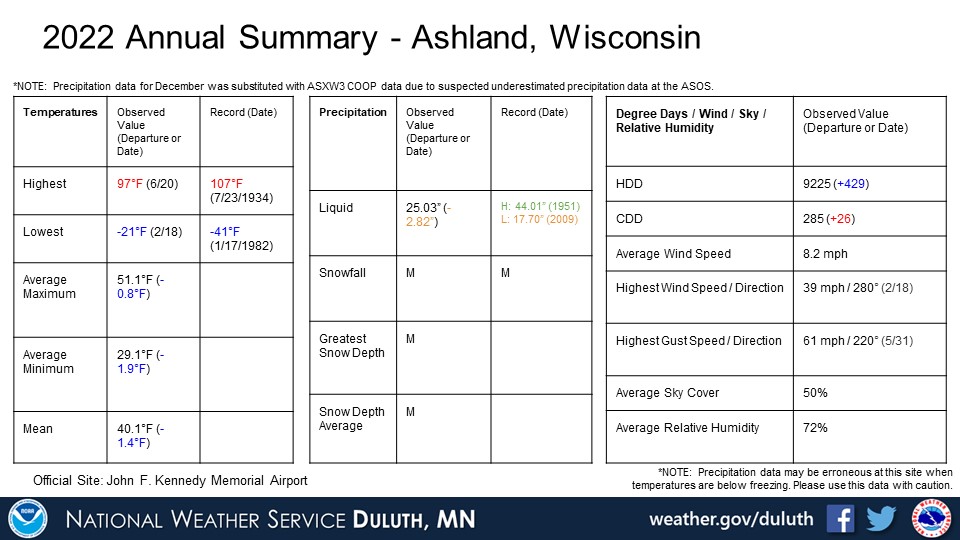
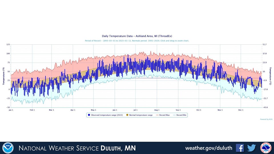
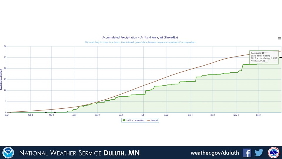
Ashland
Summary
 |
Media use of NWS Web News Stories is encouraged! Please acknowledge the NWS as the source of any news information accessed from this site. |
|
Forecasts
Fire Weather
Great Lakes
Local Text Products
Winter Weather
Local Area Forecasts
Aviation
Marine
Rainy River Basin Page
Current Conditions
Current Observations
Public Information Statements
National Snowfall Map
NOHRSC Snow Analysis
Rain/Snow Reports
Winter Monitor
US Dept of Commerce
National Oceanic and Atmospheric Administration
National Weather Service
Duluth, MN
5027 Miller Trunk Highway
Duluth, MN 55811-1442
218-729-6697 - Duluth; 218-283-4615 - Intl Falls
Comments? Questions? Please Contact Us.

