Duluth, MN
Weather Forecast Office
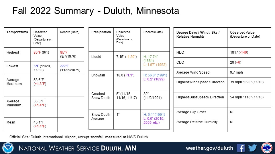
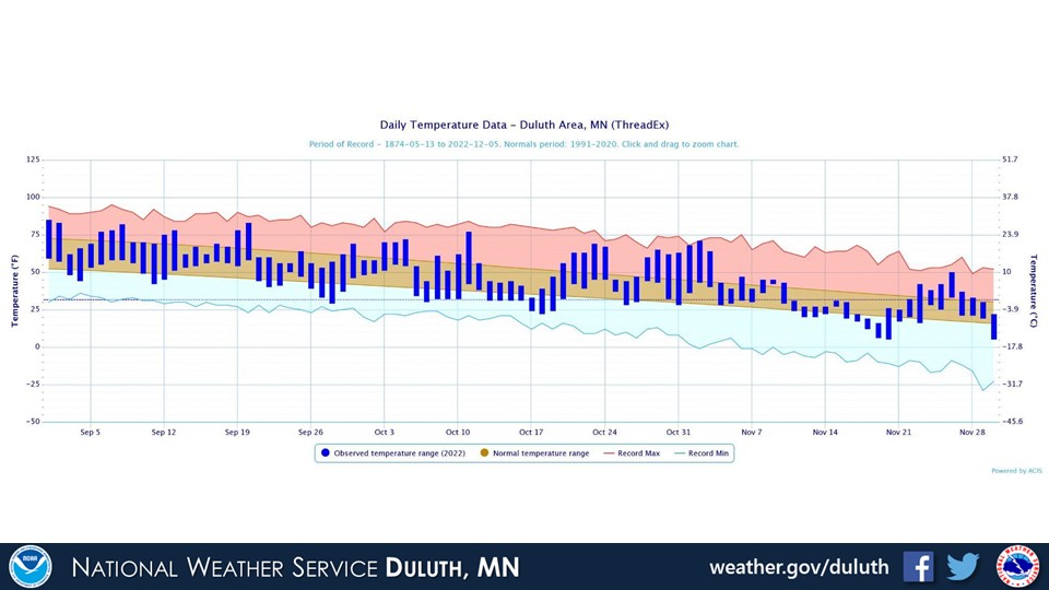
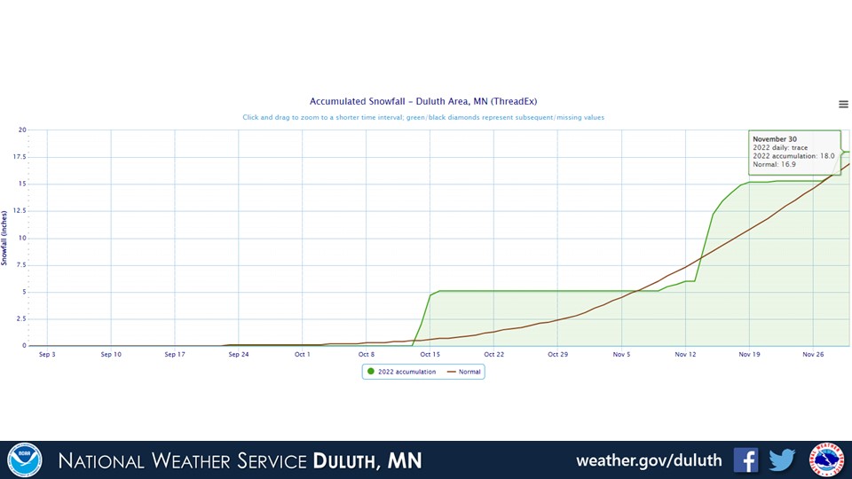
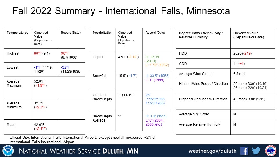
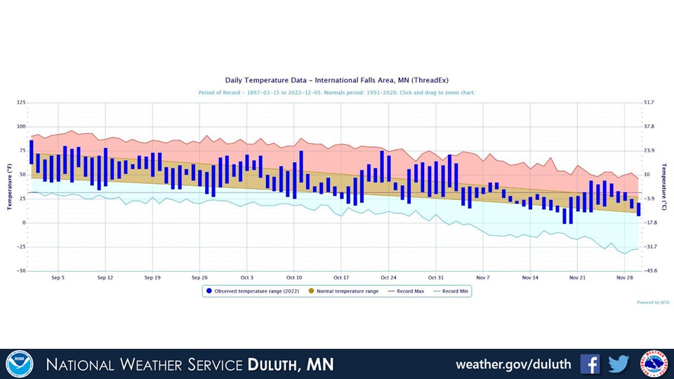
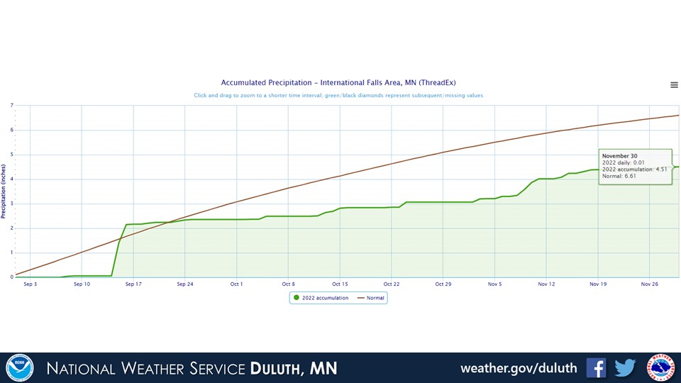
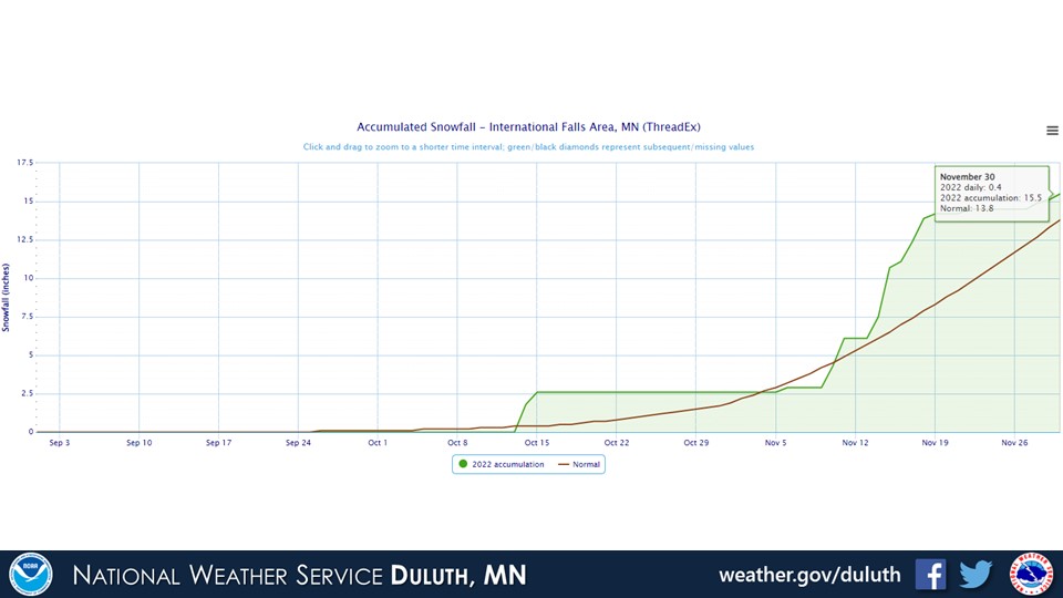
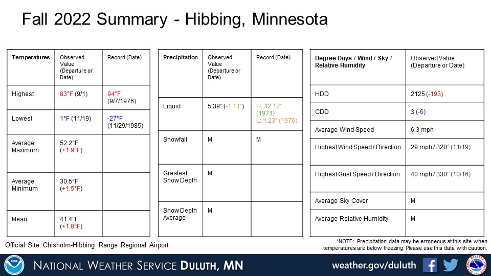
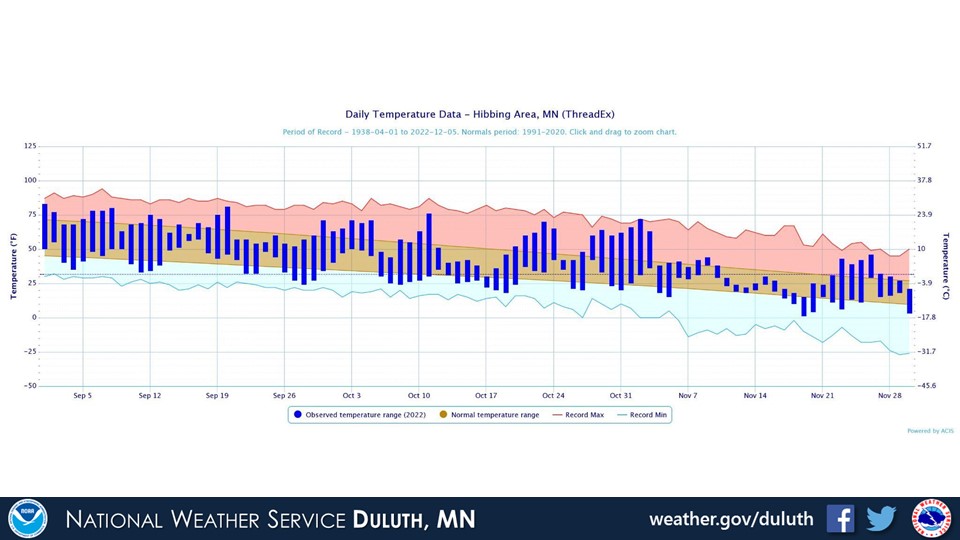
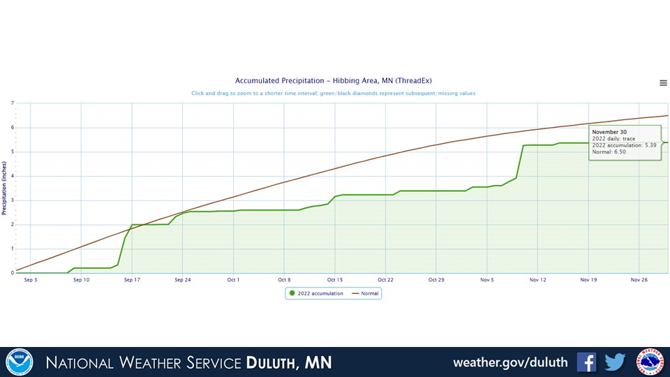
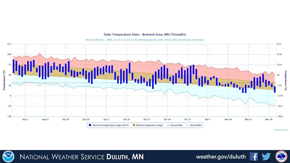
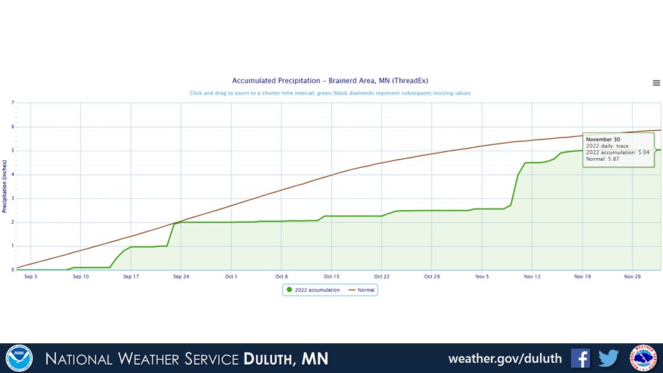
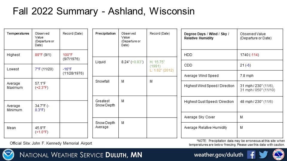
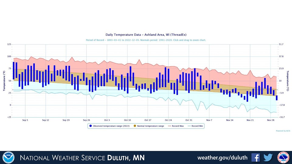
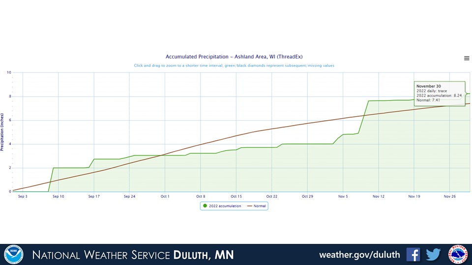
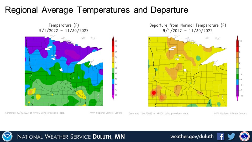
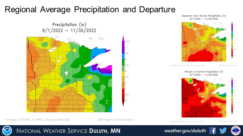
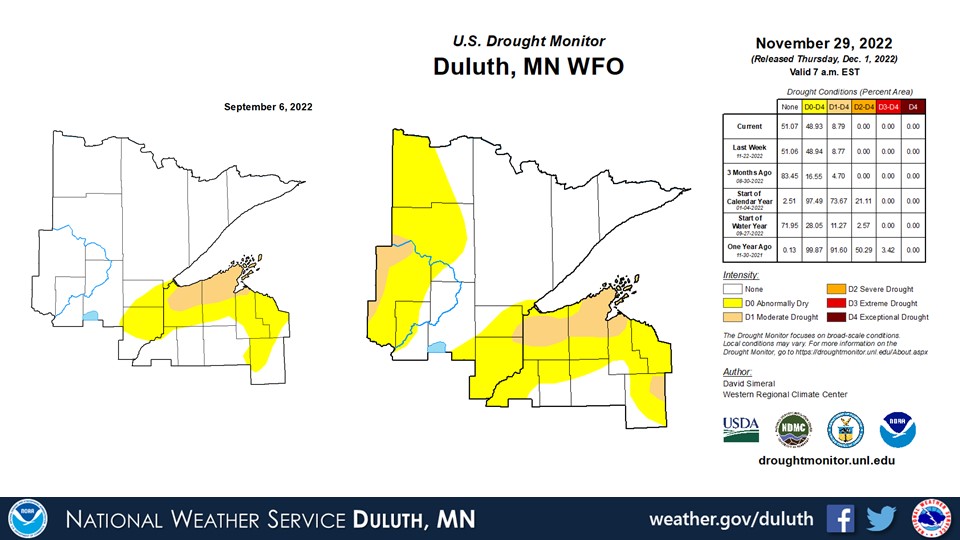
The fall 2022 season (September through November) featured above normal temperatures and below normal precipitation as a whole. Temperatures were about 1 to 2.5 degrees above average at all climate sites, and as is typical with the fall transition season, there were plenty of ups-and-downs. A warm second half of October, spilling into early November, graciously contributed to the above average temperatures. Several high temperature records were tied or surpassed in early November with high temperatures reaching into the 70s. There was a noticeably dry period for much of October that contributed to precipitation values around 1 to 2 inches below average at most sites. The lone exception was Ashland, which observed slightly above average precipitation. The Arrowhead of Minnesota and South Shore of northwest Wisconsin were the only areas that observed above average precipitation. A positive contribution from colder temperatures and increased lake-effect snow in mid-November is likely partially responsible for this trend. As a result of the drier-than-normal conditions, coverage of abnormally dry conditions and moderate drought have expanded in coverage a bit across the Northland since early September.
Duluth

International Falls
Hibbing
Brainerd

Ashland
Summary
 |
Media use of NWS Web News Stories is encouraged! Please acknowledge the NWS as the source of any news information accessed from this site. |
|
Forecasts
Fire Weather
Great Lakes
Local Text Products
Winter Weather
Local Area Forecasts
Aviation
Marine
Rainy River Basin Page
Current Conditions
Current Observations
Public Information Statements
National Snowfall Map
NOHRSC Snow Analysis
Rain/Snow Reports
Winter Monitor
US Dept of Commerce
National Oceanic and Atmospheric Administration
National Weather Service
Duluth, MN
5027 Miller Trunk Highway
Duluth, MN 55811-1442
218-729-6697 - Duluth; 218-283-4615 - Intl Falls
Comments? Questions? Please Contact Us.

