
Dangerous and extreme heat will remain across portions of the central U.S. this week, persisting across the mid to lower Mississippi Valley, Gulf Coast, southern Plains and portions of Texas. A heat wave over the Southwest U.S. will peak this weekend. Heavy to excessive rainfall may produce flash flooding from the Delmarva Peninsula north into the Hudson Valley today and tonight. Read More >
Duluth, MN
Weather Forecast Office
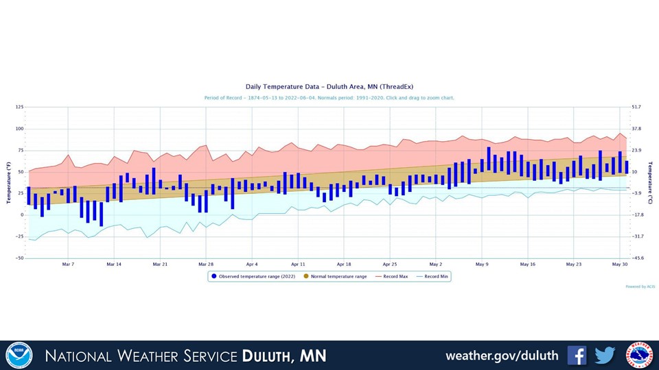
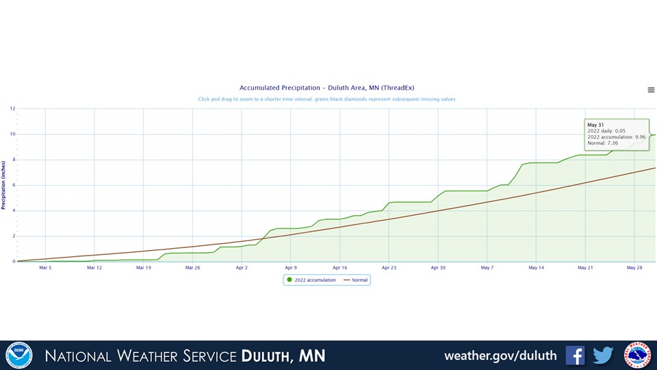
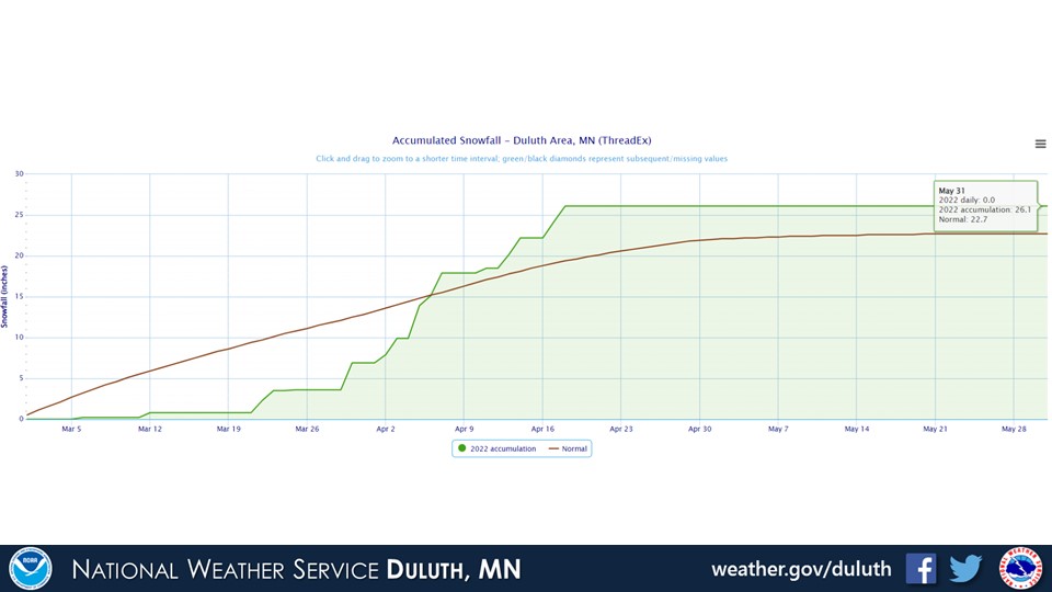
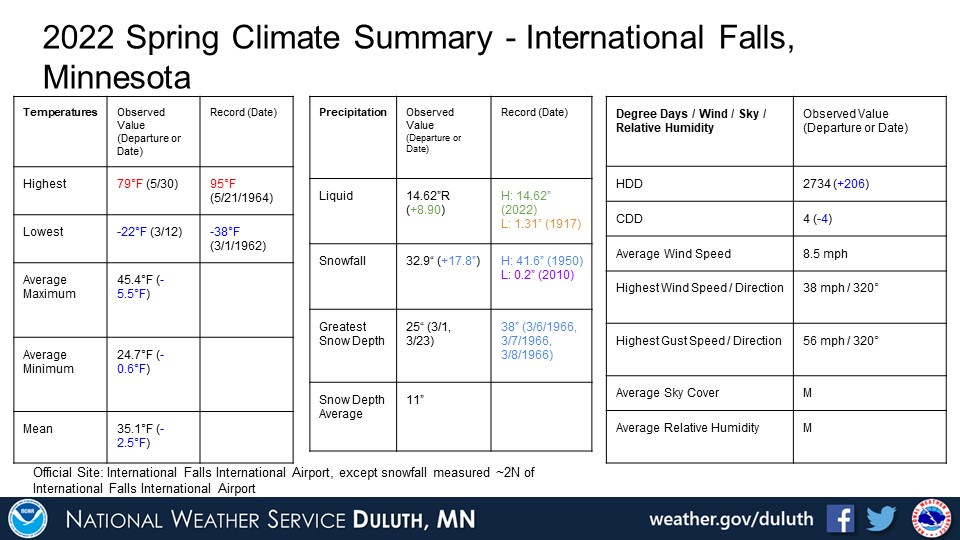
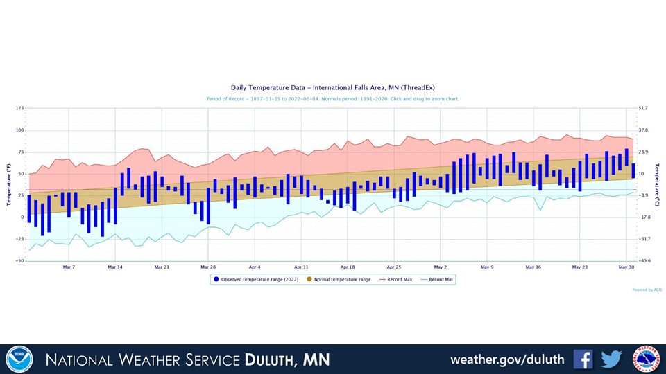
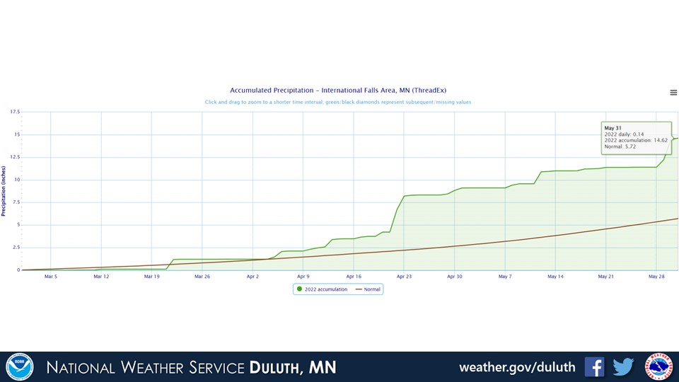
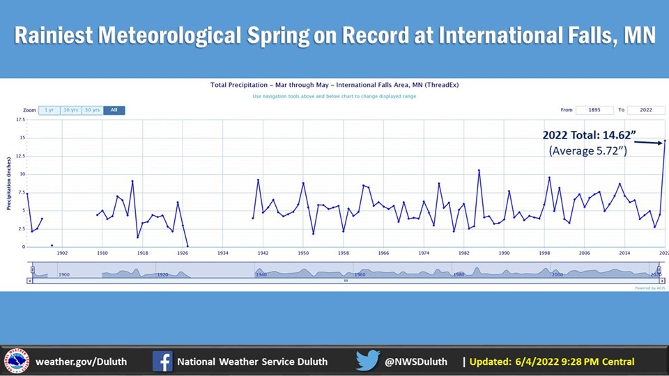
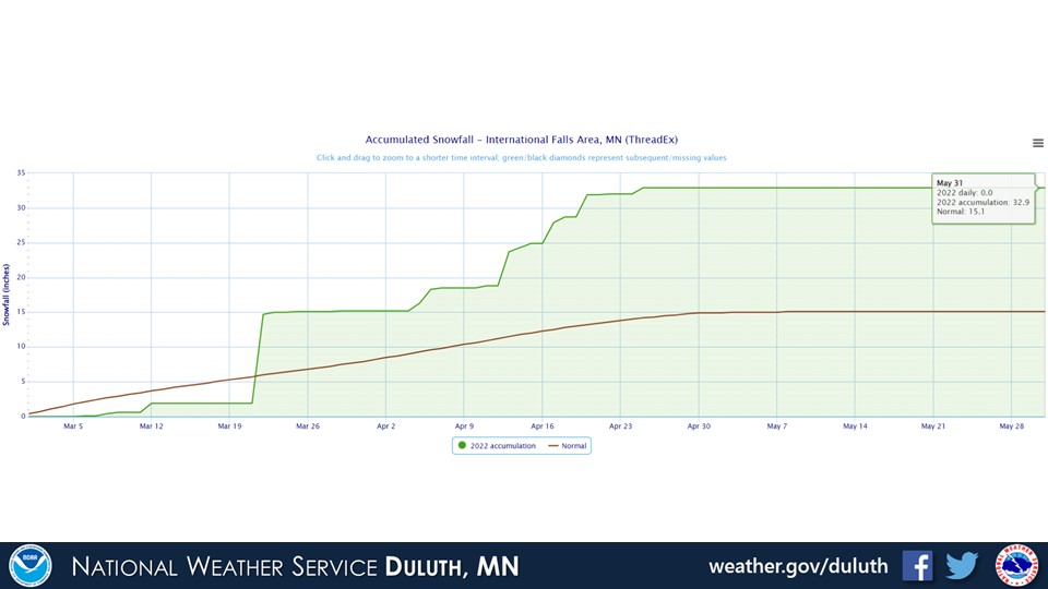
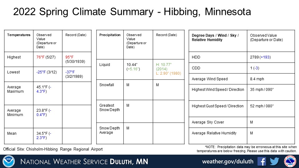
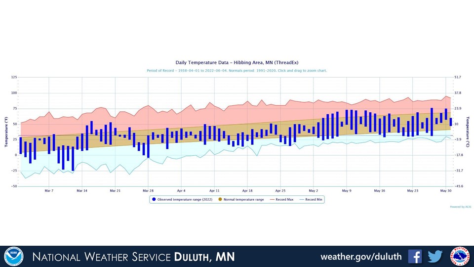
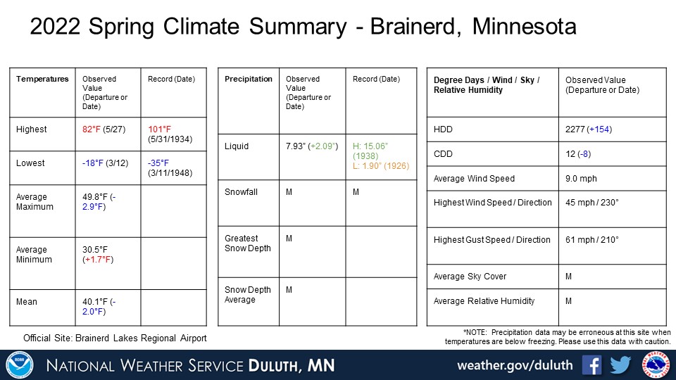
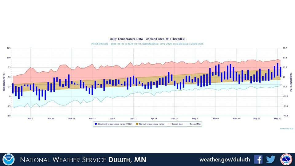
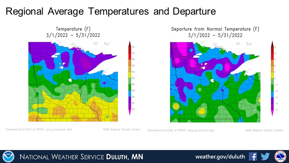
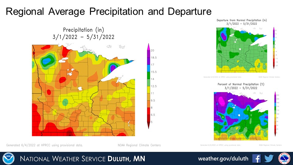
Spring 2022 temperatures ended up about a degree or two below average at Northland climate sites, and the tilt below normal was largely due to below average March temperatures. It was a very rainy/snowy spring as well, with all sites reporting above average precipitation. International Falls broke the all-time record for the rainiest spring, and the total was almost 3 times higher than average. Major flooding has resulted in the Rainy Lake Basin along the International Border, which is expected to continue through at least June. Precipitation amounts were closer to average at Ashland, and that is generally representative of northwest Wisconsin as a whole.
Duluth

International Falls
Hibbing
Brainerd

Ashland

Summary
 |
Media use of NWS Web News Stories is encouraged! Please acknowledge the NWS as the source of any news information accessed from this site. |
|
Forecasts
Fire Weather
Great Lakes
Local Text Products
Winter Weather
Local Area Forecasts
Aviation
Marine
Rainy River Basin Page
Current Conditions
Current Observations
Public Information Statements
National Snowfall Map
NOHRSC Snow Analysis
Rain/Snow Reports
Winter Monitor
US Dept of Commerce
National Oceanic and Atmospheric Administration
National Weather Service
Duluth, MN
5027 Miller Trunk Highway
Duluth, MN 55811-1442
218-729-6697 - Duluth; 218-283-4615 - Intl Falls
Comments? Questions? Please Contact Us.

