Duluth, MN
Weather Forecast Office
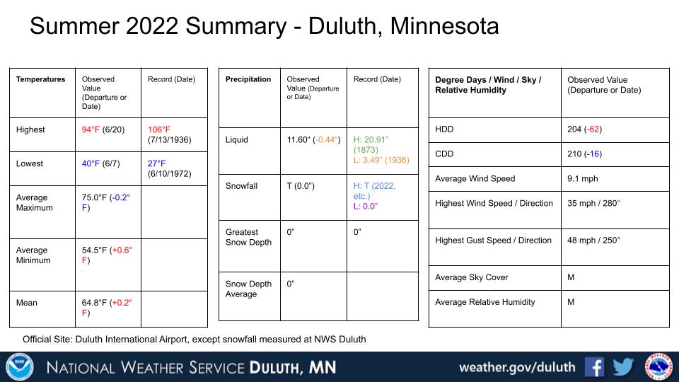
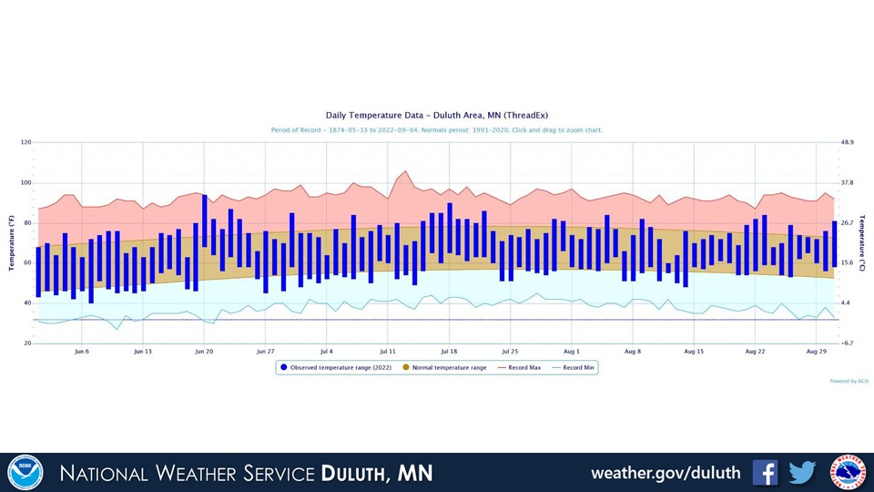
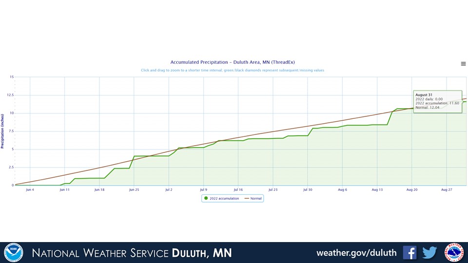
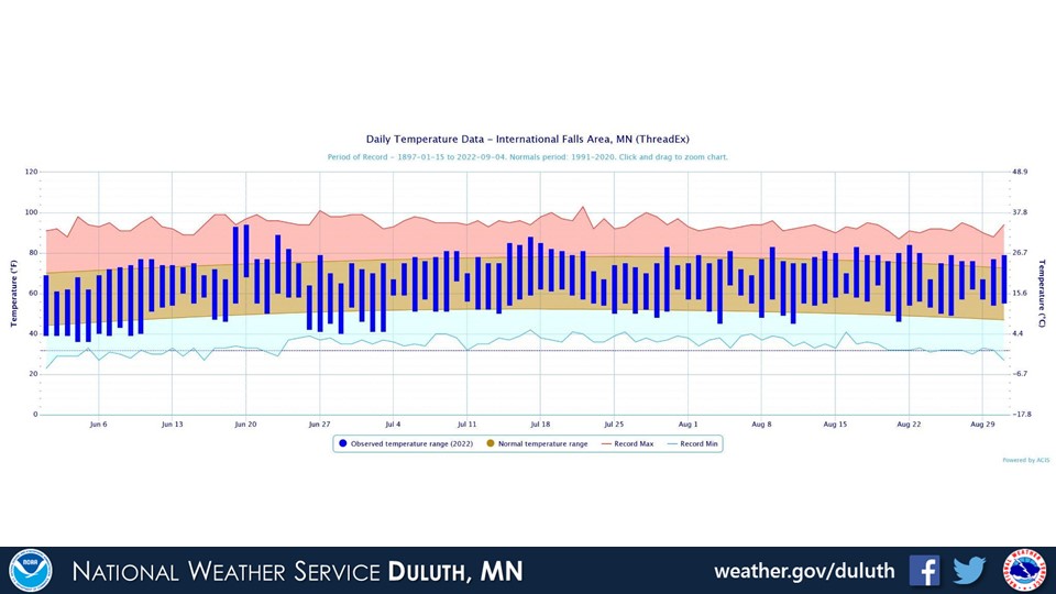
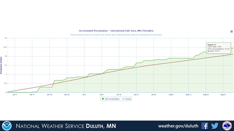
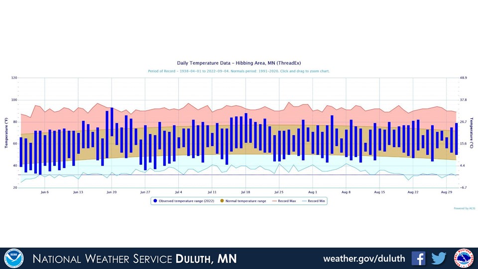
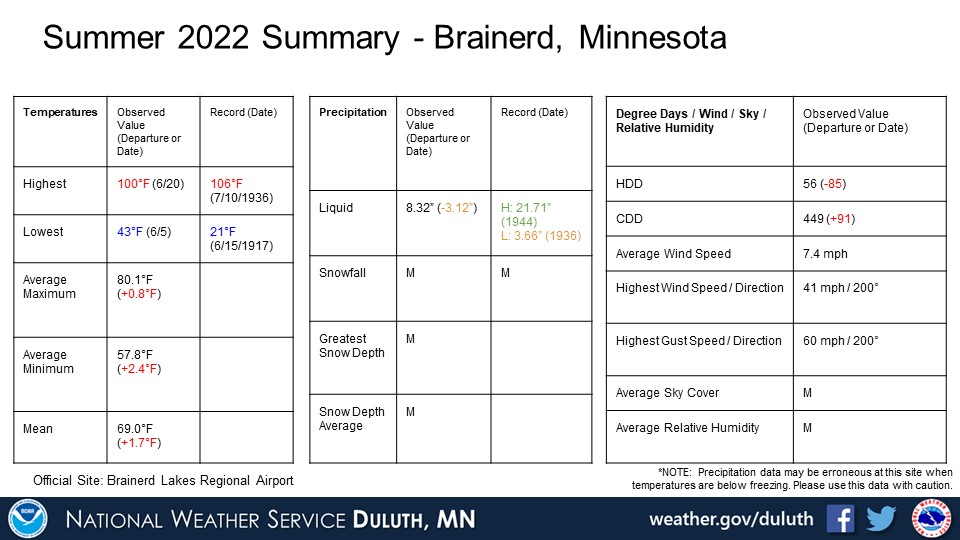
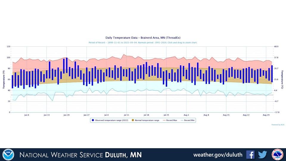
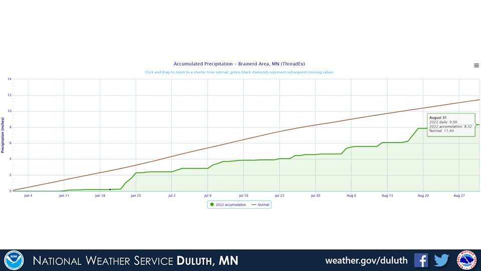
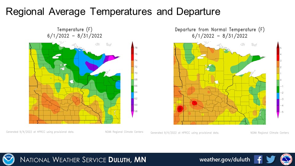
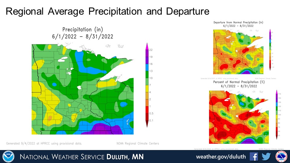
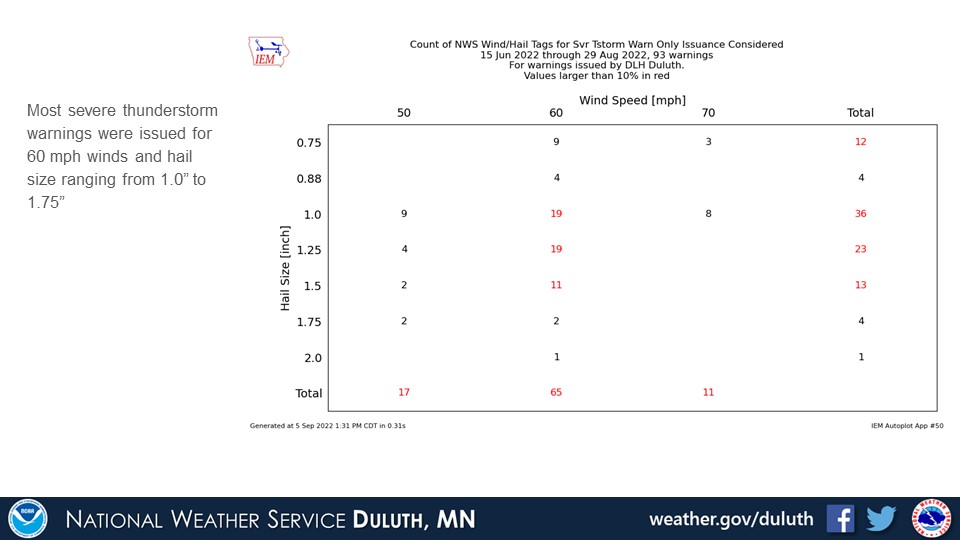
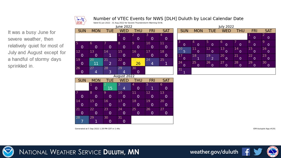
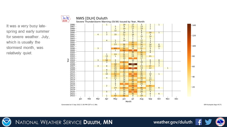
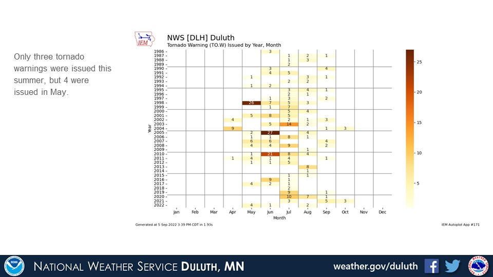
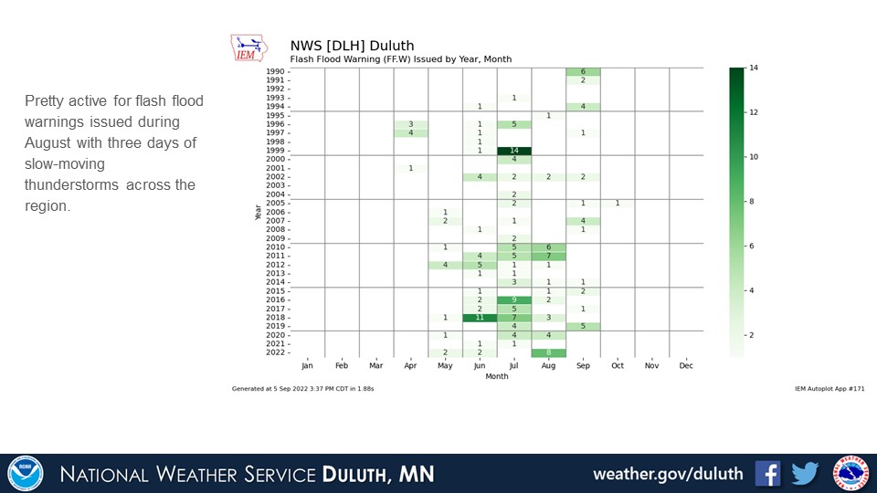
Summer 2022 temperatures were generally around or slightly above average across the region. Many areas saw below average rainfall, especially from Pine County to Ashland County along the South Shore. Some of those areas saw around 6-8” below average rainfall. The tip of the Arrowhead in Cook County also saw below average rainfall. Areas north of US highway 2 in northeast Minnesota, however, generally saw slightly above average rainfall. There were some periods of active severe weather especially in June, but there was generally quieter weather during July and August. Some slow-moving thunderstorms in the middle of August led to some flash flood warnings. The rainfall from these storms led to improvement of the dry weather for some, but largely missed the parts of northwest Wisconsin that were experiencing drought conditions. With generally dry weather in the forecast for the start of September, drought conditions will likely persist for areas currently experiencing it.
Duluth
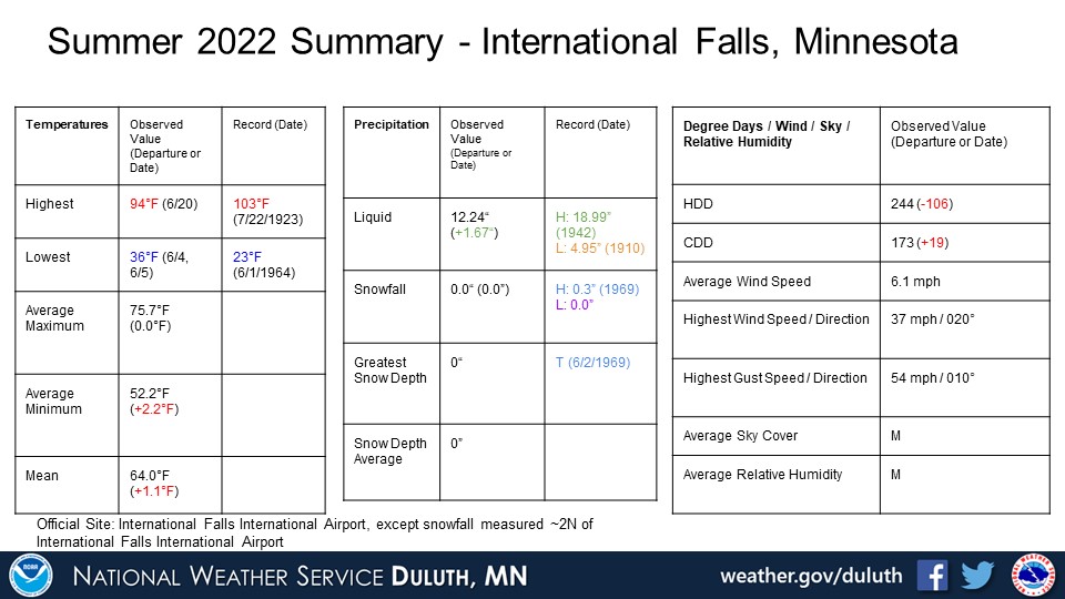
International Falls
Hibbing

Brainerd
Ashland
Summary
 |
Media use of NWS Web News Stories is encouraged! Please acknowledge the NWS as the source of any news information accessed from this site. |
|
Forecasts
Fire Weather
Great Lakes
Local Text Products
Winter Weather
Local Area Forecasts
Aviation
Marine
Rainy River Basin Page
Current Conditions
Current Observations
Public Information Statements
National Snowfall Map
NOHRSC Snow Analysis
Rain/Snow Reports
Winter Monitor
US Dept of Commerce
National Oceanic and Atmospheric Administration
National Weather Service
Duluth, MN
5027 Miller Trunk Highway
Duluth, MN 55811-1442
218-729-6697 - Duluth; 218-283-4615 - Intl Falls
Comments? Questions? Please Contact Us.

