Overview
|
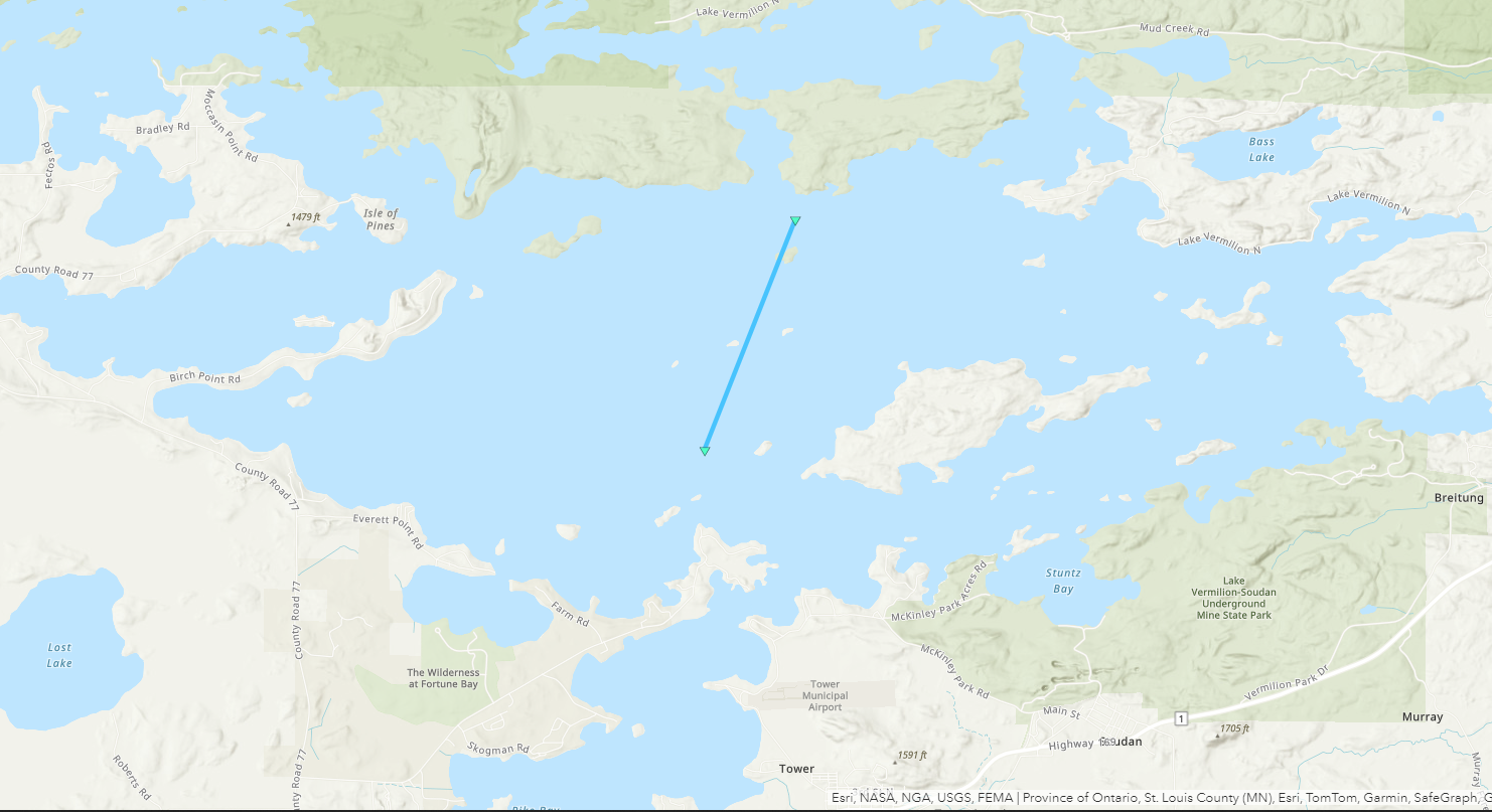
Low pressure located over northern Minnesota the afternoon of July 7th led to the development of scattered showers and isolated thunderstorms over northeastern Minnesota and northwestern Wisconsin. Most of this activity was very shallow in nature and were not producing hail larger than peas or much in terms of wind gusts. One shower produced a waterspout over Lake Vermilion shortly before 2:30 PM CDT. Waterspouts and funnel clouds were possible across the region due to favorable atmospheric conditions in the vicinity of the low pressure center over the region. This survey was conducted utilizing photos and videos of the waterspout that were posted to social media and through interviews with witnesses. No injuries or fatalities were reported and the waterspout likely remained over open waters of Lake Vermilion. This information is preliminary in nature and may be revised as we continue to review additional reports, images, and videos. NWS Duluth sincerely appreciates the photos and videos shared with us from the public of this event. |
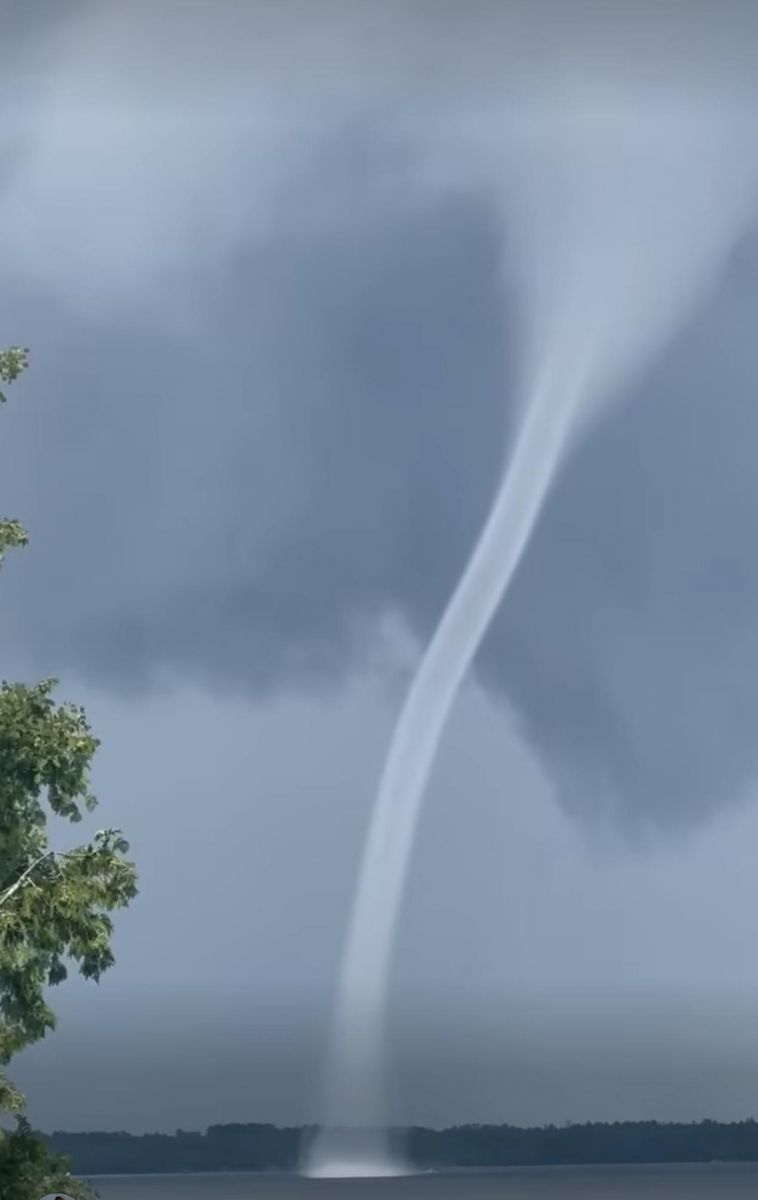 (Kate Higgins photo) |
Waterspout:
|
Waterspout - Lake Vermilion, MN
|
||||||||||||||||
The Enhanced Fujita (EF) Scale classifies tornadoes into the following categories:
| EF0 Weak 65-85 mph |
EF1 Moderate 86-110 mph |
EF2 Significant 111-135 mph |
EF3 Severe 136-165 mph |
EF4 Extreme 166-200 mph |
EF5 Catastrophic 200+ mph |
 |
|||||
Photos & Video
Photos
 |
 |
 |
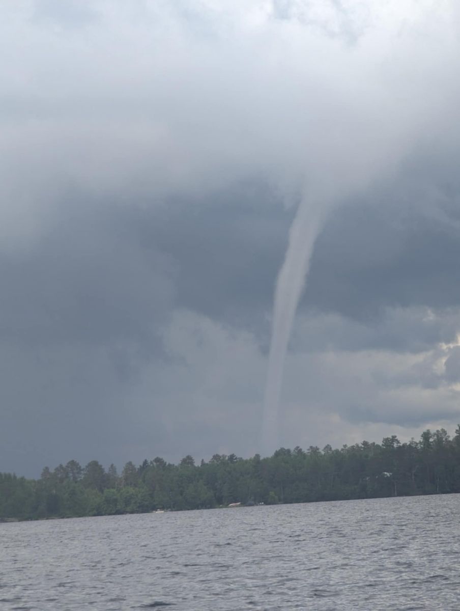 |
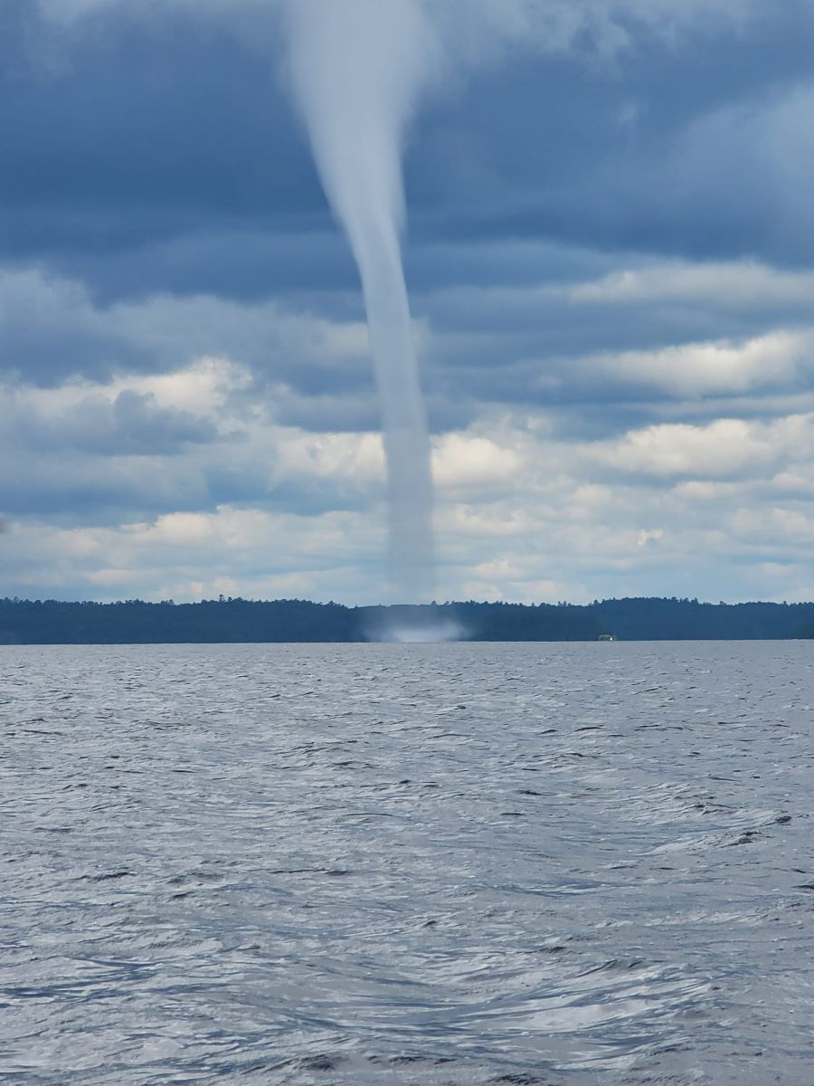
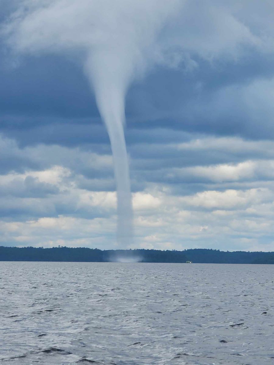
(Alex Jacobs photo) |
(Alex Jacobs photo) |
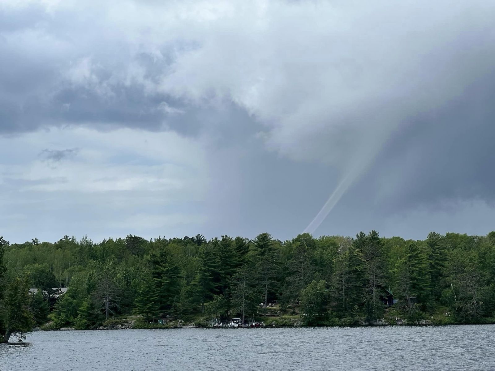
Looking across Big Bay towards the end of the waterspout's lifecycle. (Amy Plaisted photo) |
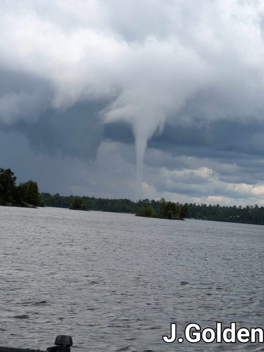
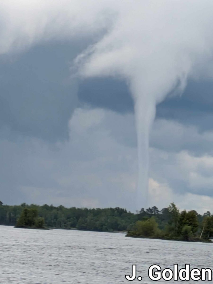
(James Golden photo) |
 |
 |
 |
 |
| A view of the part of the shower that produced the waterspout. (James Golden photo) |
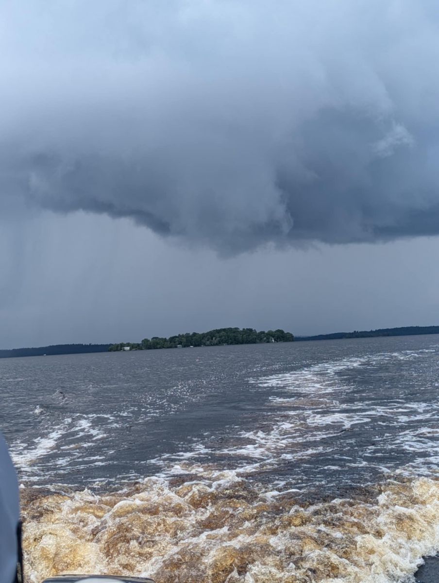
(JoAnn Golden photo) |
(JoAnn Golden photo) |
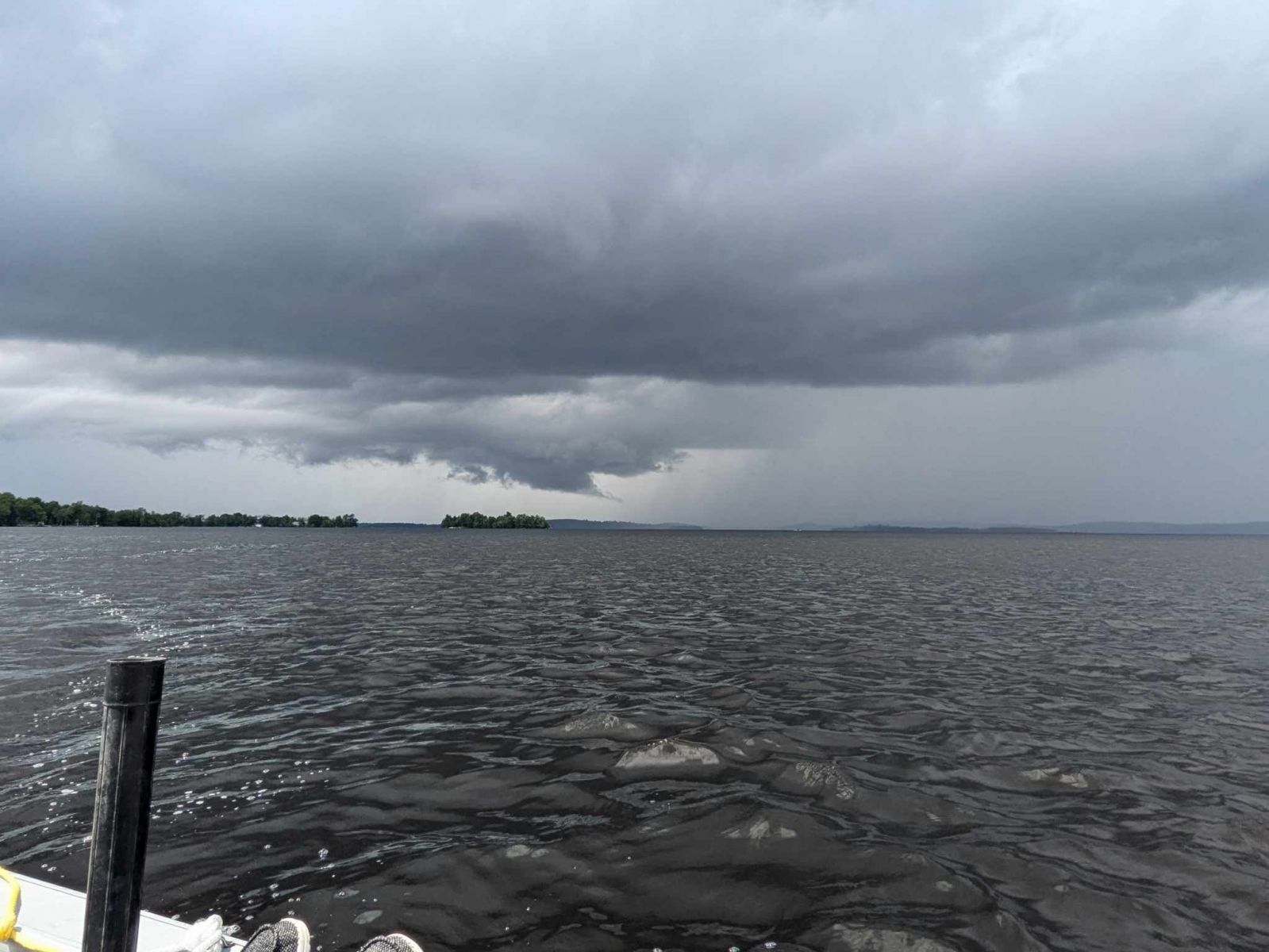
A view of the wall cloud that produced the waterspout. (JoAnn Golden photo) |
Videos
As I was sitting on my porch on lake vermilion, this happened. #waterspout #Tornado #lakevermilion pic.twitter.com/7C0gCl2Dwk
— Kate Higgins (@kateHigginsMN) July 8, 2024
Environment
Synoptic summary at 7AM.
 |
 |
 |
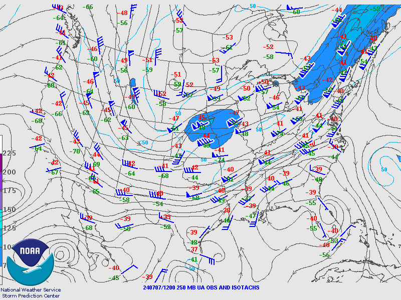
| 200mb analysis from 7AM showing the upper low over the Dakotas with the Northland being in a weak flow pattern aloft north of the jet stream stretching from the Central Plains into the Canadian Maritimes. (NWS SPC Photo) |
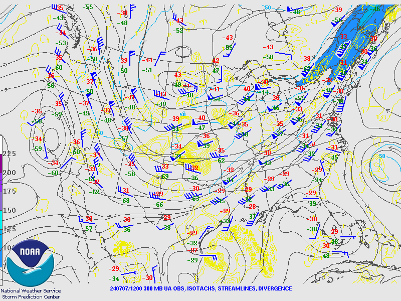
300mb analysis from 7AM showing the upper low over the Dakotas with the Northland being in a weak flow pattern aloft north of the jet stream stretching from the Central Plains into the Canadian Maritimes. (NWS SPC Photo) |
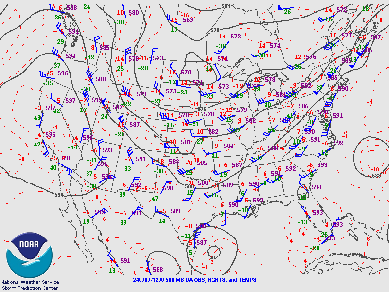
500mb analysis from 7AM showing the midlevel low over the Red River Valley and into the western reaches of the Northland. (NWS SPC Photo) |
 |
 |
 |
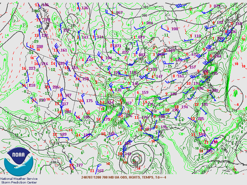
| 700mb analysis from 7AM showing the midlevel low over northwestern Minnesota along with ample moisture in place across the Upper Midwest. (NWS SPC Photo) |
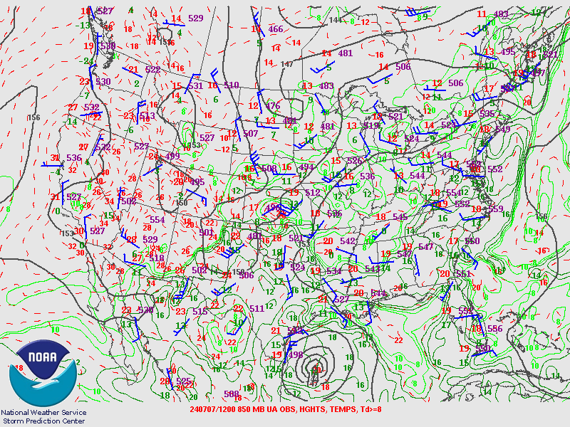
850mb analysis from 7AM showing troughing over the Red River Valley into the Central Plains. Note the temperature at INL of 13C/55F. Water temperatures on Lake Vermilion were around 68F. Warm lake temperatures will cooler air aloft is one of the ingredients for waterspouts. (NWS SPC Photo) |
925mb analysis from 7AM showing the very light winds in place near the surface. (NWS SPC Photo) |
Additional environmental data.
 |
 |
 |
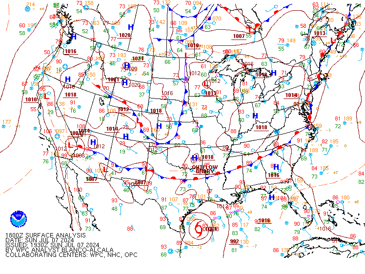
| 1PM surface analysis showing low pressure north of Grand Forks. Areas near the surface low are favored for enhanced vorticity. (NWS WPC Photo) |
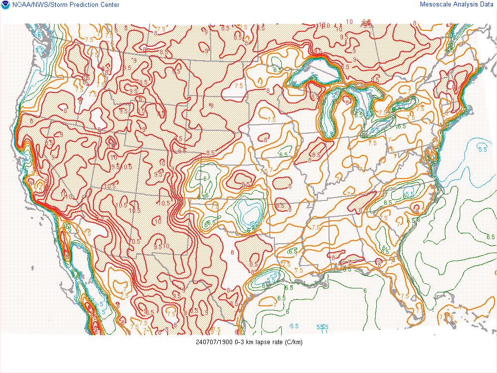
2PM analysis of low level lapse rates. Values were around 6.5-7.5C/km across the area. (NWS SPC Photo) |
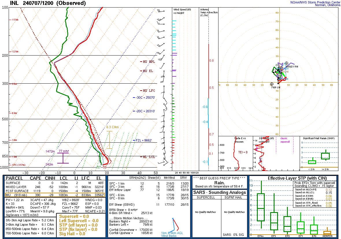
7AM sounding from INL showing the cooler air aloft and the weak low level wind profile. When adjusted for the lake temperature, low level instability was favorable. (NWS SPC Photo) |
 |
 |
 |
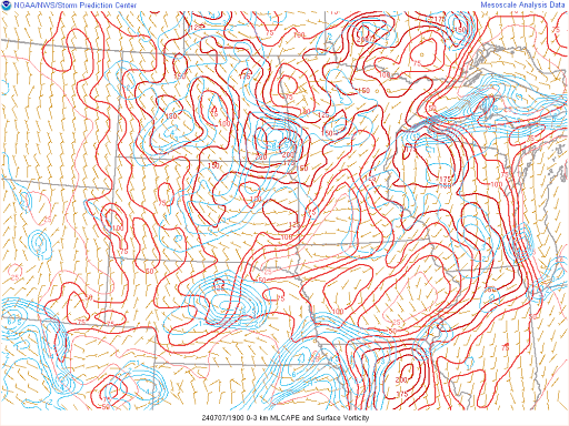
| 2PM analysis of MUCAPE and surface vorticity. There is MUCAPE in the area of the waterspout, but the surface vorticity is lagging back to the west, which was likely not correct. (NWS SPC Photo) |
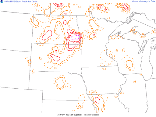
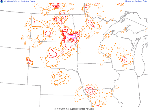
2PM non-supercell tornado parameter analysis. While there is nothing over northeastern Minnesota, there is a signal to the west over north-central Minnesota and there was likely favorable NST conditions in place further to the east. (NWS SPC Photo) |
3PM non-supercell tornado parameter analysis. While there is nothing over northeastern Minnesota, there is a signal to the west over north-central Minnesota which has expanded eastward over the last hour, but still remains to the west of the waterspout location. (NWS SPC Photo) |
 |
Media use of NWS Web News Stories is encouraged! Please acknowledge the NWS as the source of any news information accessed from this site. |
|