Duluth, MN
Weather Forecast Office

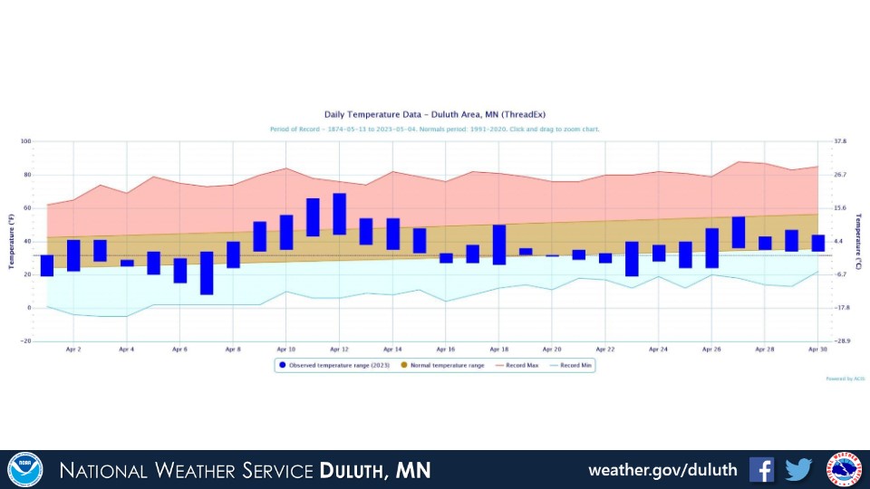
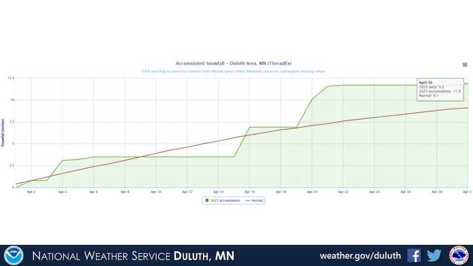
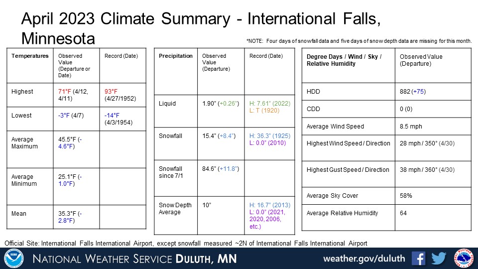
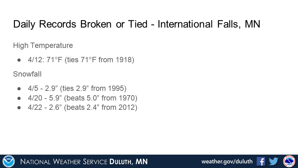
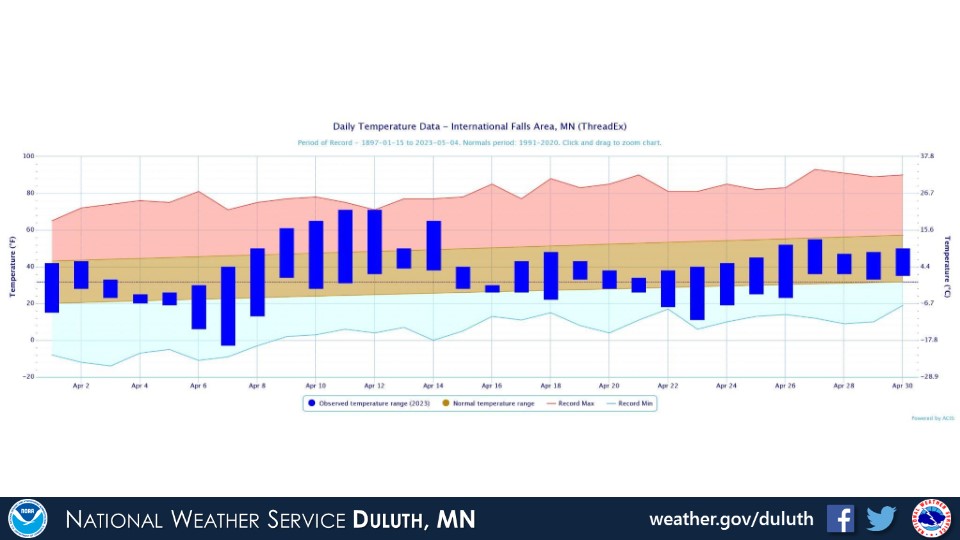
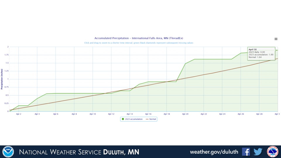
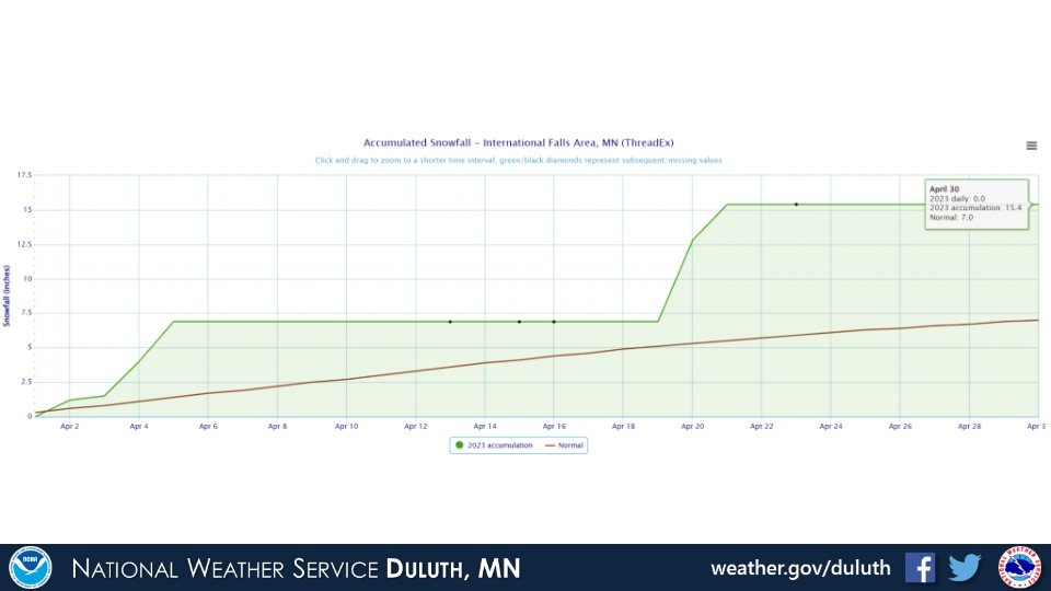
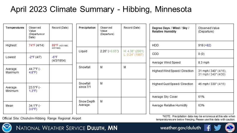
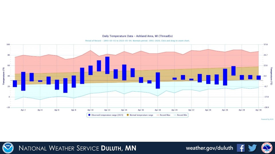
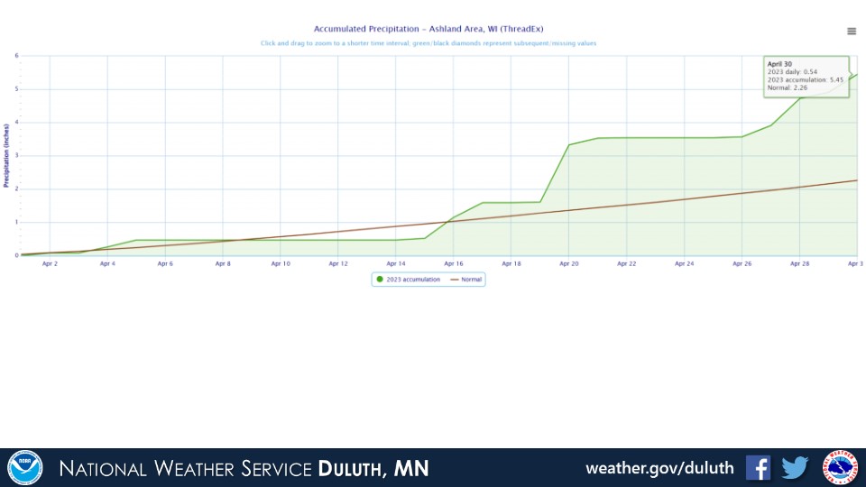
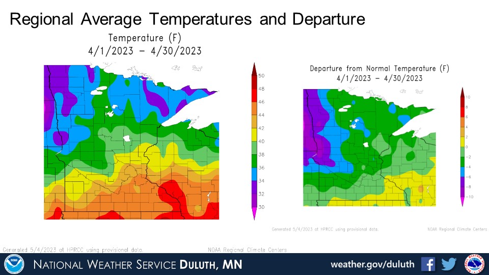
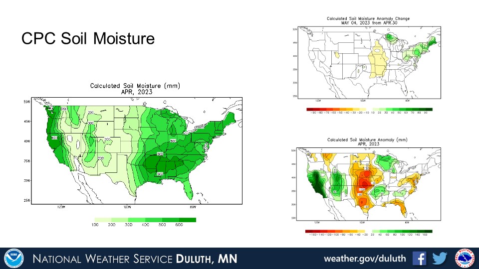
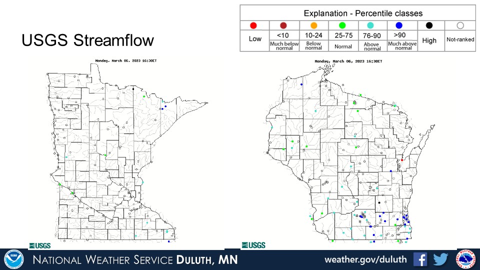
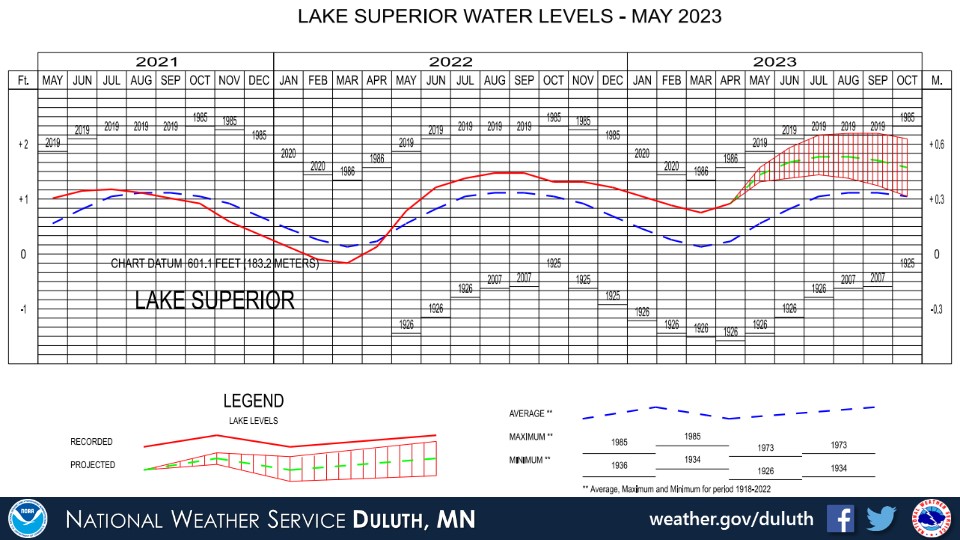
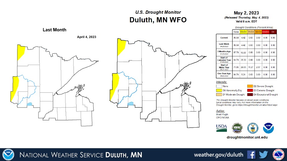
April 2023 was quite eventful weather-wise with temperatures trending a bit below normal and precipitation above normal pretty much everywhere. Within the below normal temperatures was about a week of well above normal temperatures early to mid month, which led to a rapid melt of a very unseasonably high snow pack across the region. This brought widespread minor areal and river/stream flooding with some areas where flooding was more impactful, including (but not limited to) Aitkin, Barnum, Moose Lake, and Clam Lake. More wintry and rainy weather followed this snow melt through the month. Record breaking seasonal snowfalls were set at several locations, including Duluth, with snow that fell in April. With all of the rain and snow, river levels generally remain elevated and drought conditions are pretty much non-existent. Flooding concerns are expected to continue into early May with snow pack still remaining over parts of the North Shore.
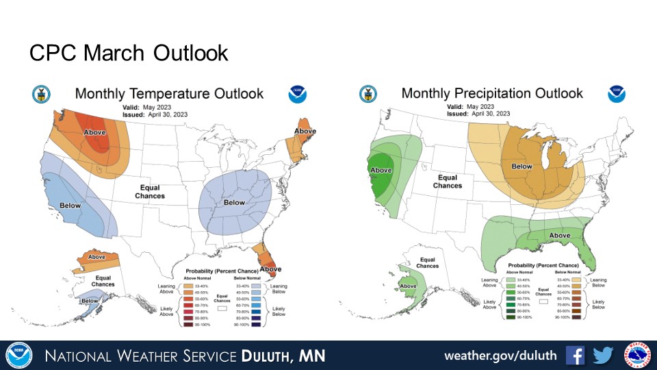
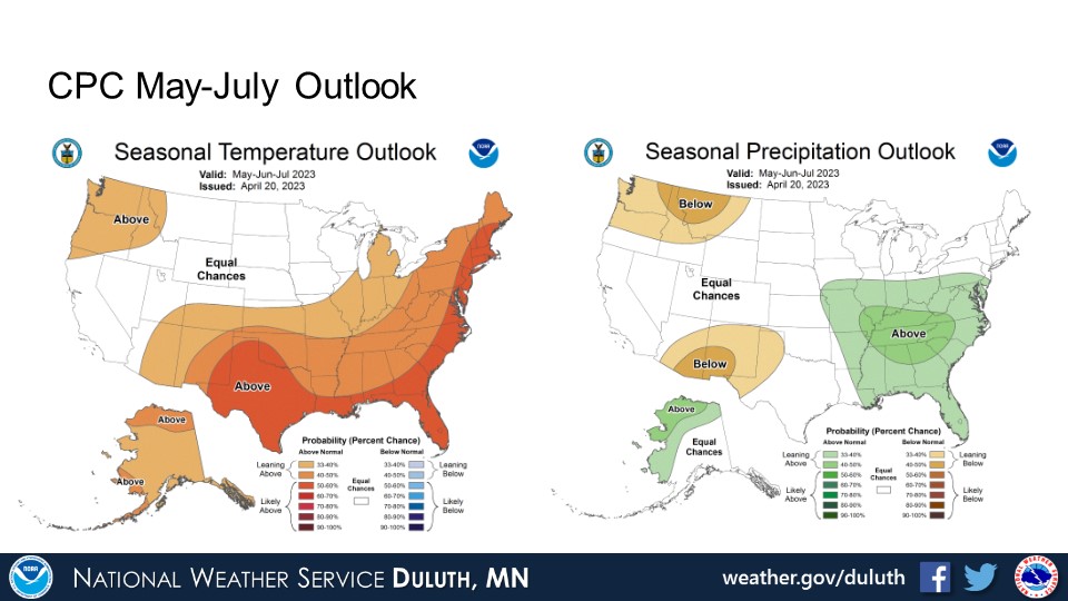
Looking ahead, above average temperatures are expected through May per CPC outlooks. There are no clear signals for above or below average temperatures or precipitation in the 3 month outlooks going into the early summer.
Duluth


International Falls
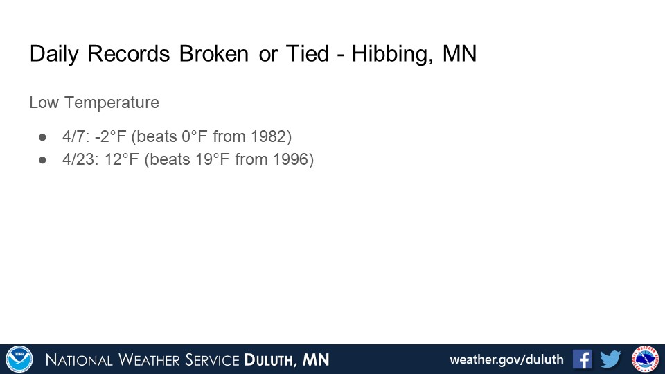
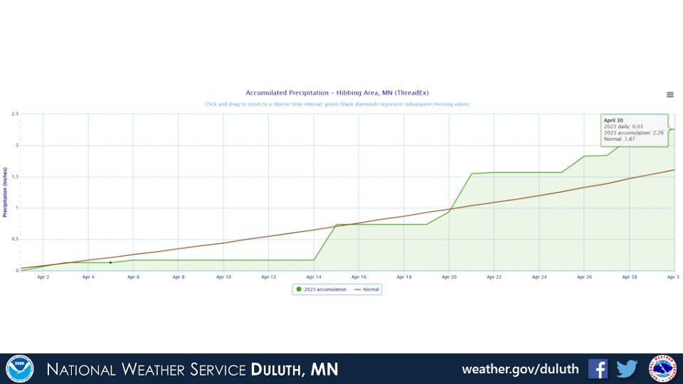
Hibbing

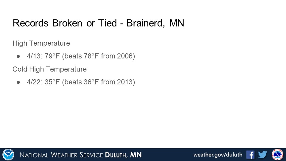
Brainerd


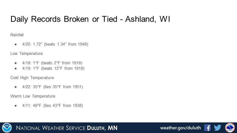
Ashland

Summary

Hydro
Outlook


 |
Media use of NWS Web News Stories is encouraged! Please acknowledge the NWS as the source of any news information accessed from this site. |
|
Forecasts
Fire Weather
Great Lakes
Local Text Products
Winter Weather
Local Area Forecasts
Aviation
Marine
Rainy River Basin Page
Current Conditions
Current Observations
Public Information Statements
National Snowfall Map
NOHRSC Snow Analysis
Rain/Snow Reports
Winter Monitor
US Dept of Commerce
National Oceanic and Atmospheric Administration
National Weather Service
Duluth, MN
5027 Miller Trunk Highway
Duluth, MN 55811-1442
218-729-6697 - Duluth; 218-283-4615 - Intl Falls
Comments? Questions? Please Contact Us.

