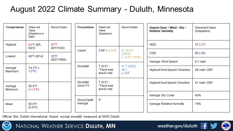
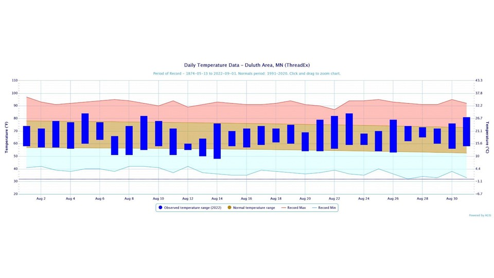
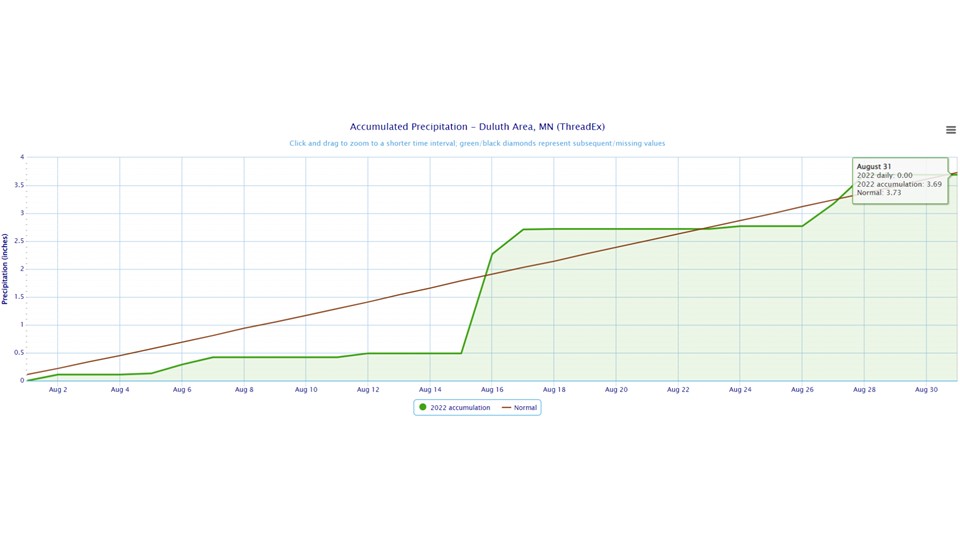
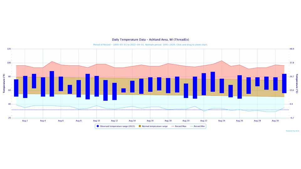
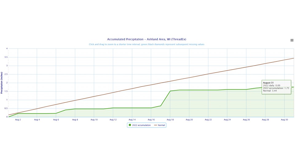
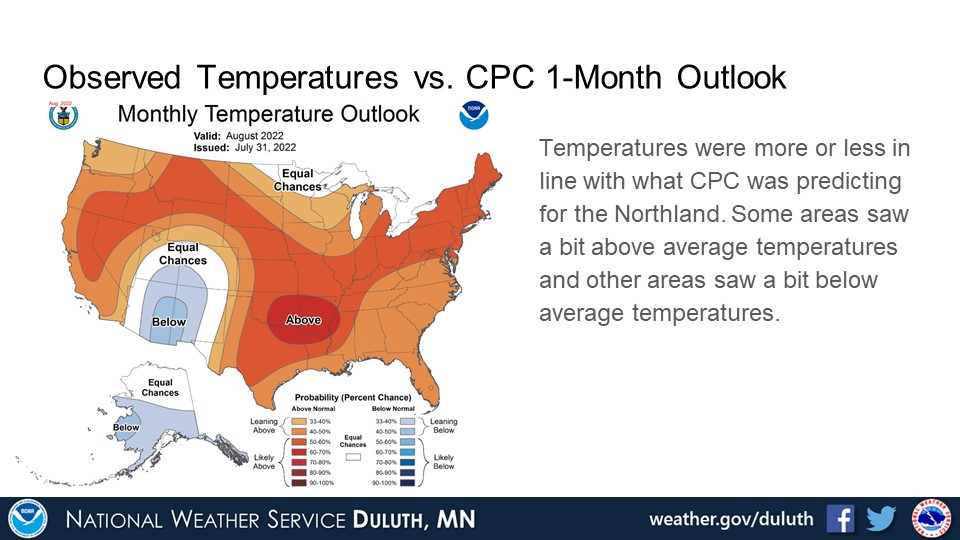
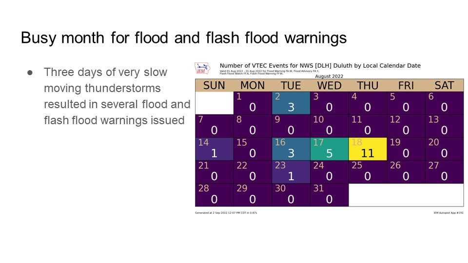
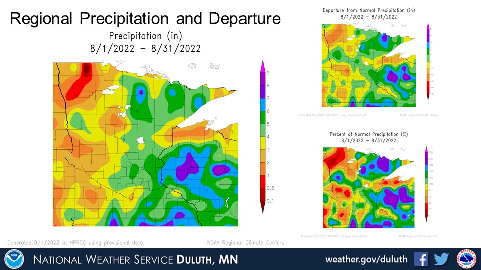
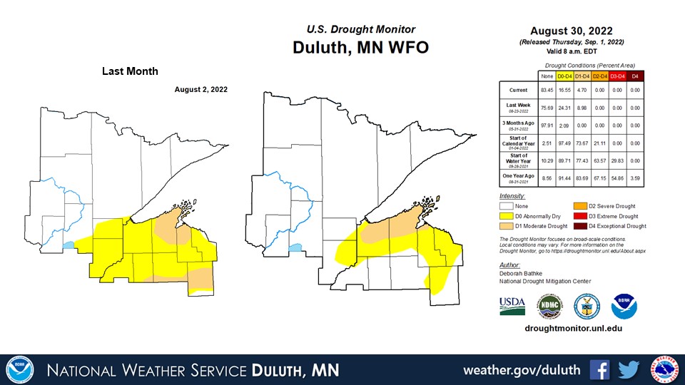
August was a somewhat insignificant month temperature-wise. Some areas were a bit below average, while other places were a bit above average. There was an interesting pattern with rainfall where many areas saw near average or a bit above average rainfall, except for a stripe of below average rainfall along the South Shore and extending west a bit towards Aitkin County. It is not clear if there is any notable feature that caused this, such as a persistent lake breeze, but a quick analysis of some of the rainier days around the 16th to 18th suggests that it may just be by chance. However, the lack of rain in this area, which has been experiencing dry conditions for most of summer, has resulted in an expansion of moderate drought conditions across northern Douglas and Bayfield counties with some improvement elsewhere. It has also been fairly quiet in terms of severe weather aside from three active days. Another notable feature is a high amount of flash flood and flood warnings and advisories issued on the 16th through 18th due to persistent and slow moving thunderstorms.
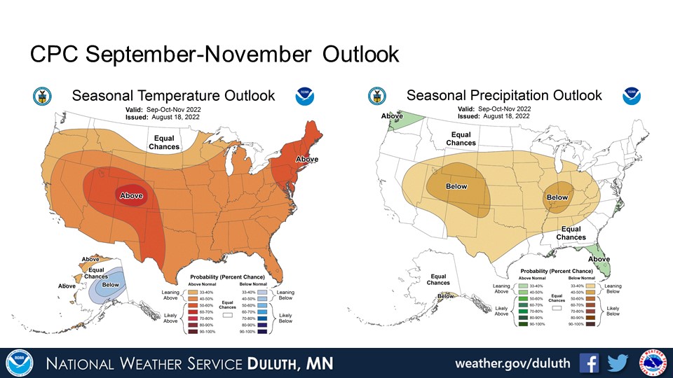
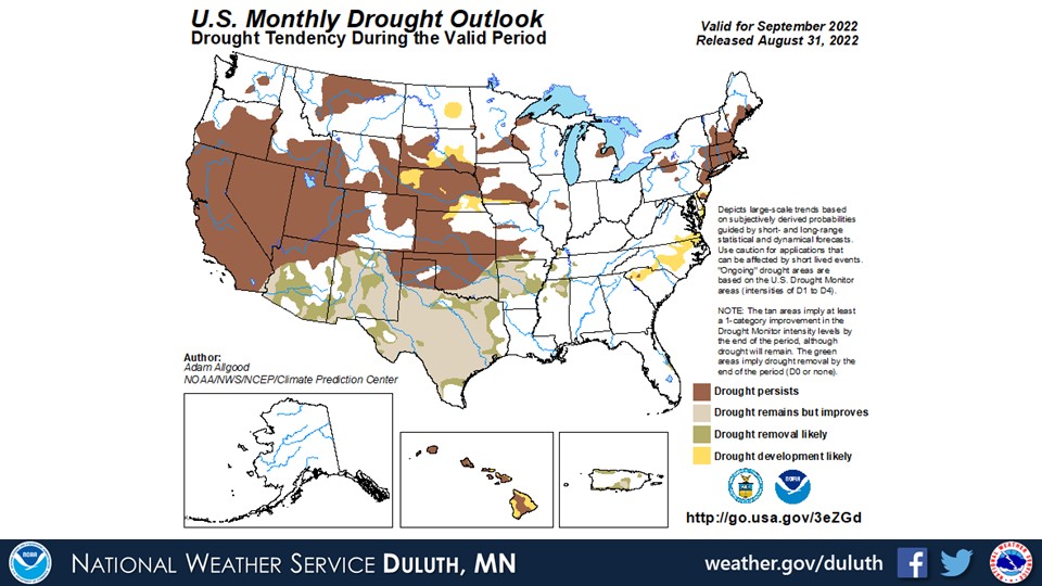
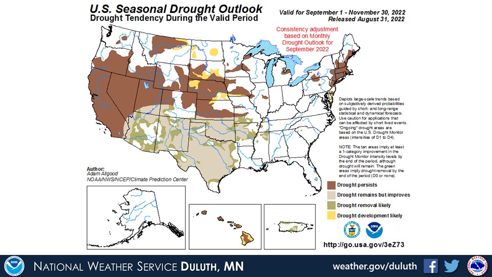
Looking ahead, the CPC is forecasting a continuation of warm and dry conditions as we go into September. This pattern may extend a bit into October and November. The drought conditions over northwest Wisconsin are likely to persist into the fall.
Duluth
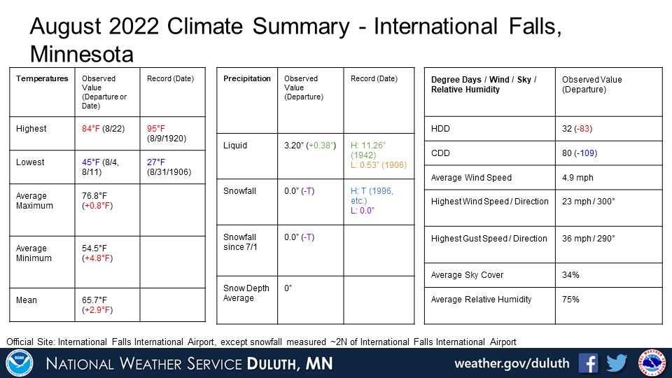
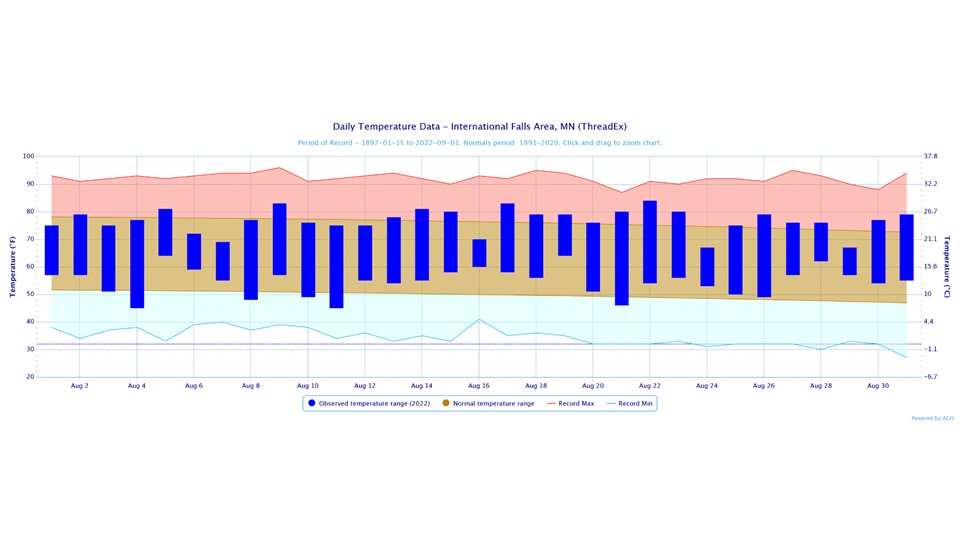
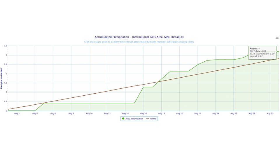
International Falls
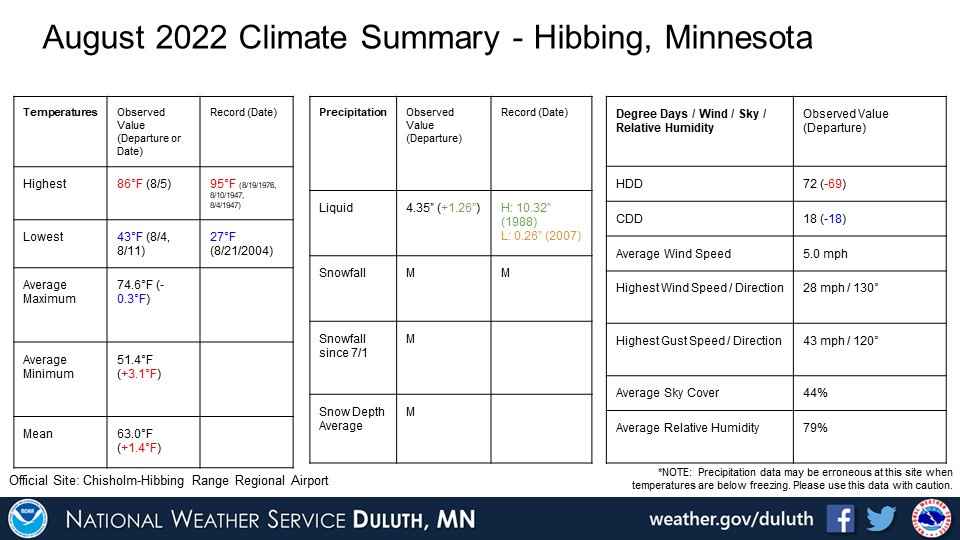
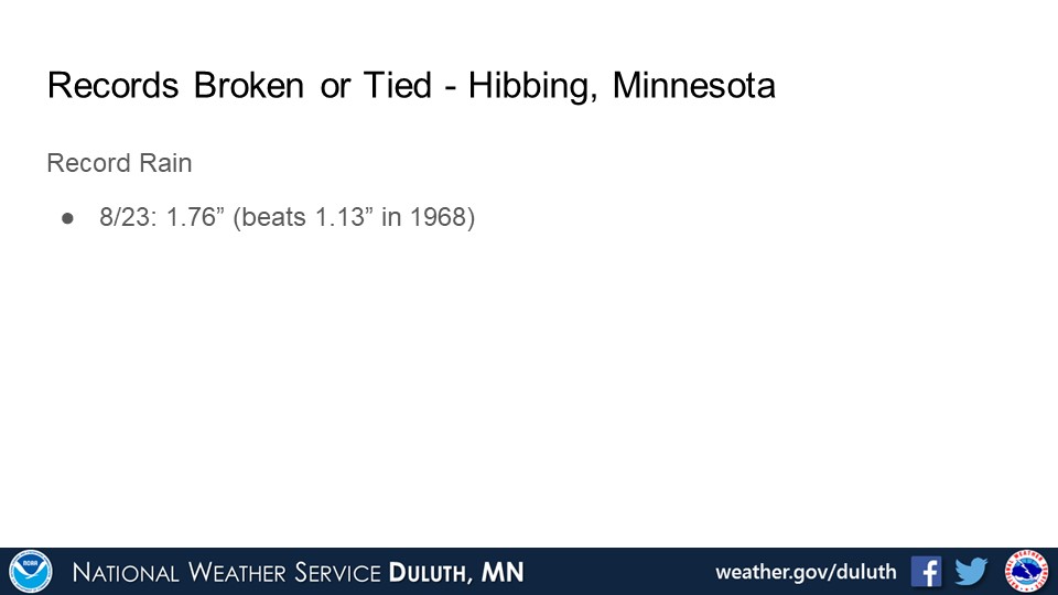
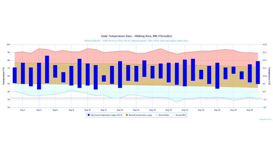
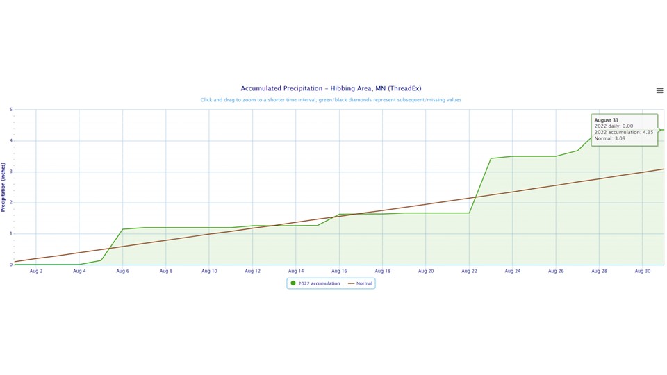
Hibbing
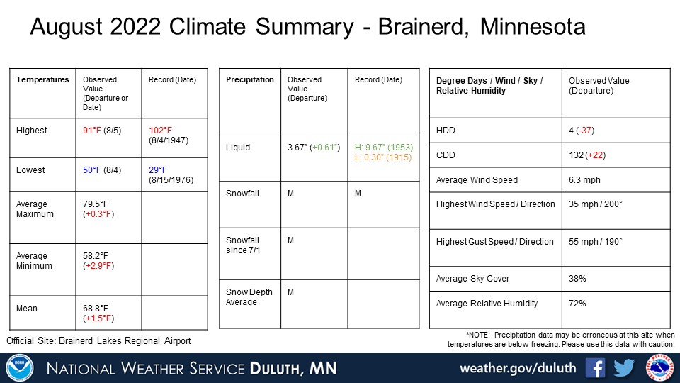
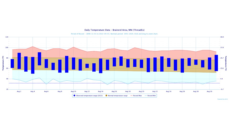
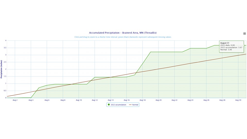
Brainerd

Ashland

Summary


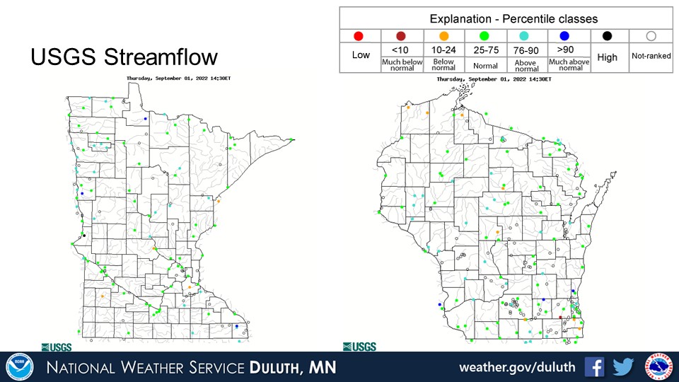
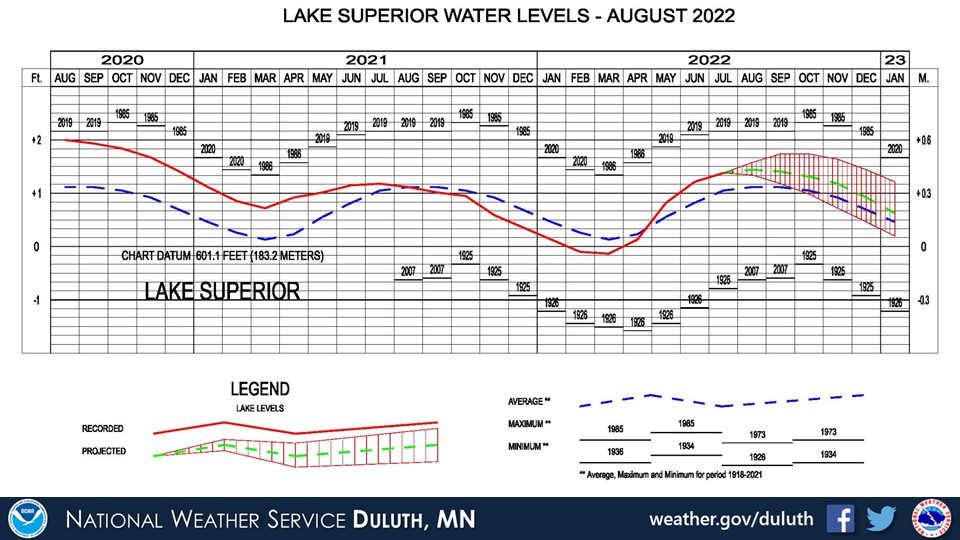
Hydro
Outlook

 |
Media use of NWS Web News Stories is encouraged! Please acknowledge the NWS as the source of any news information accessed from this site. |
|

