Duluth, MN
Weather Forecast Office
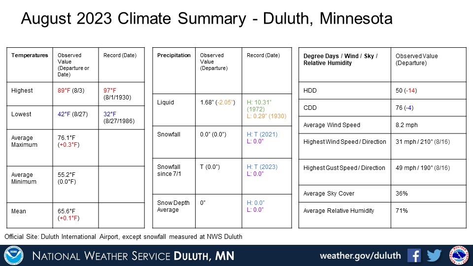
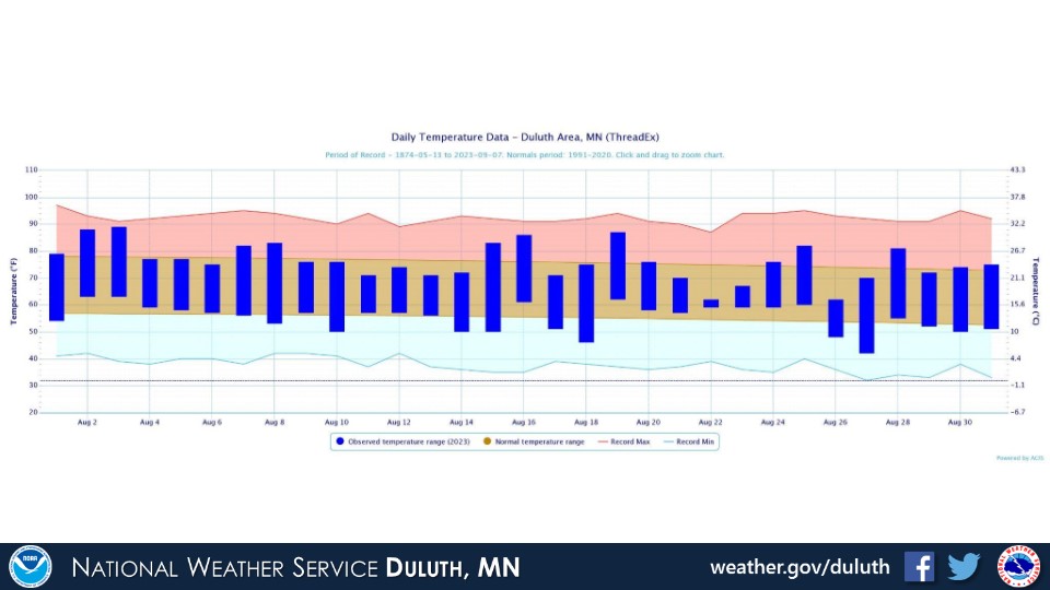
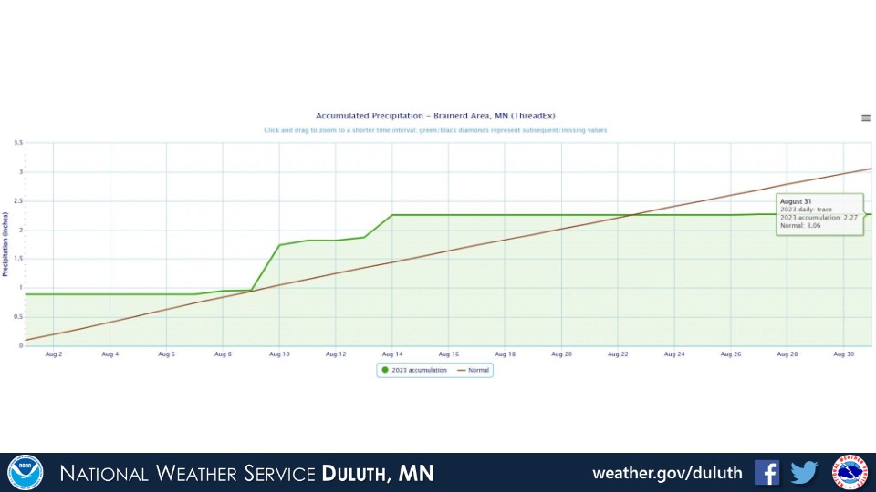
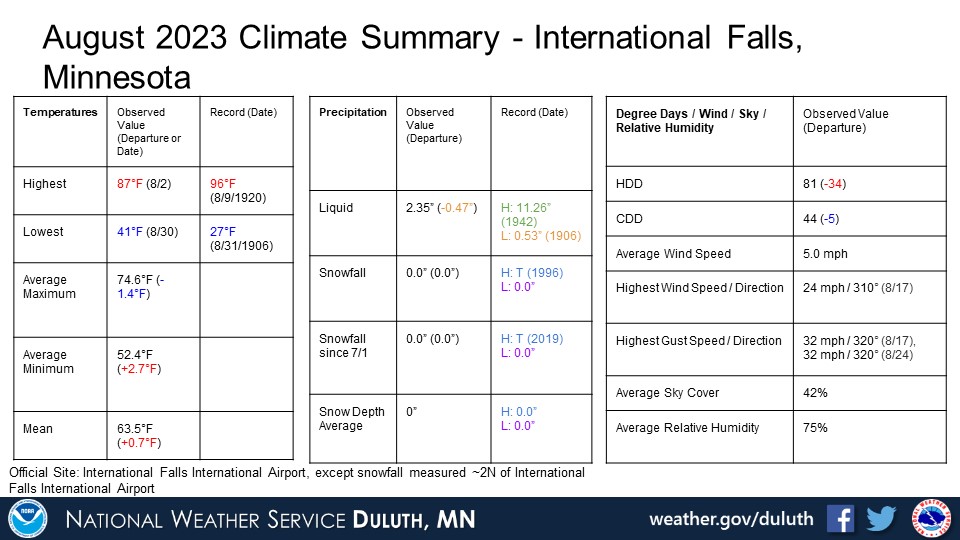
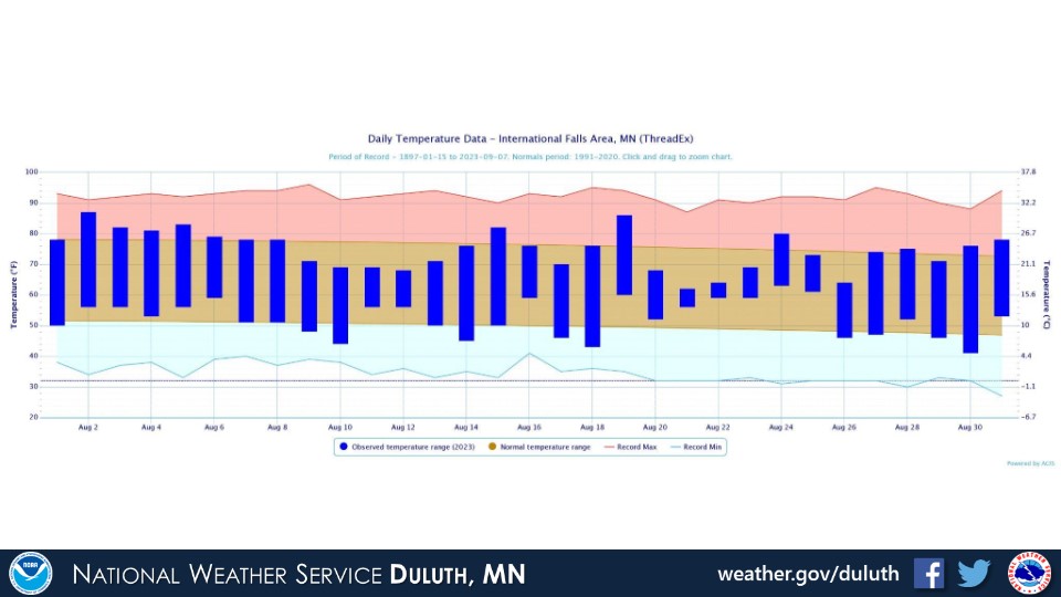
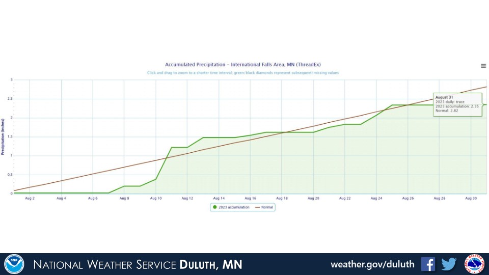
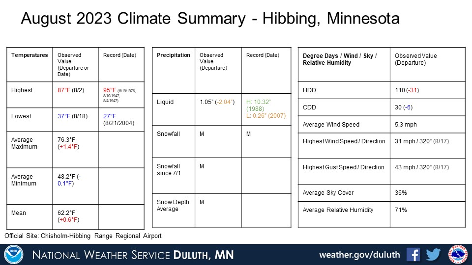
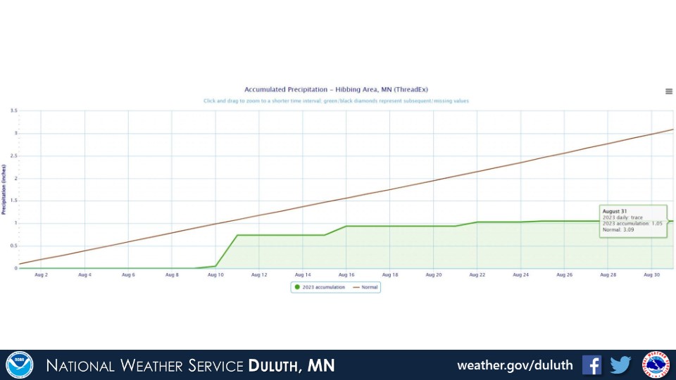
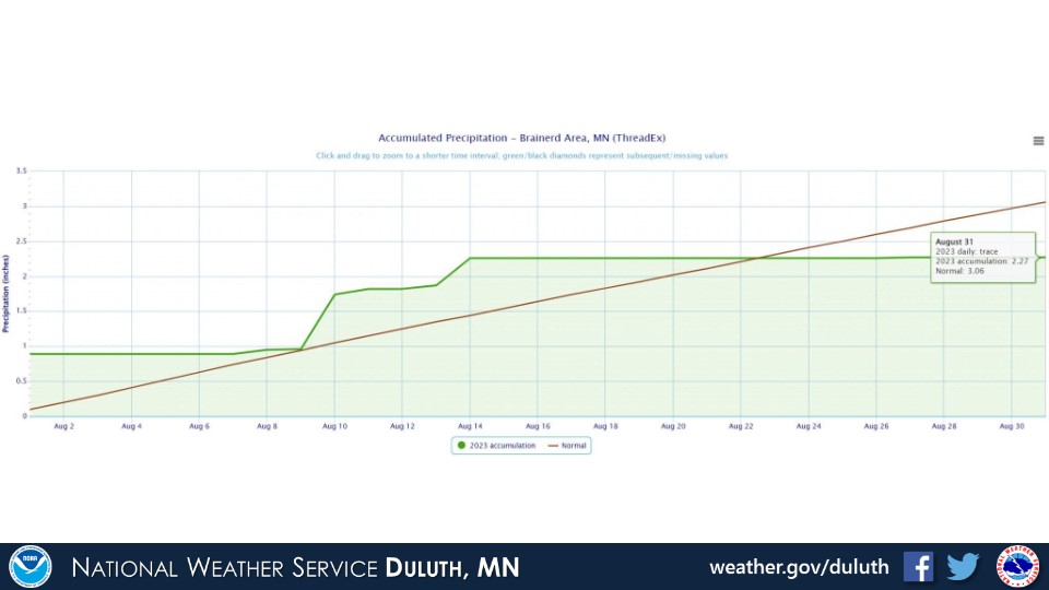
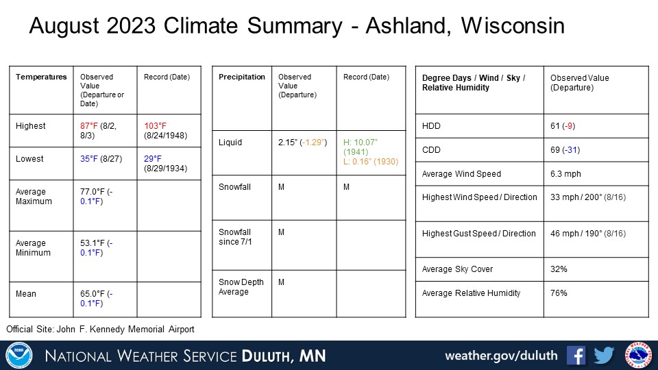
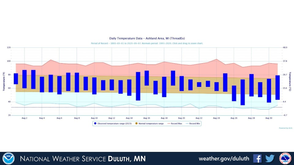
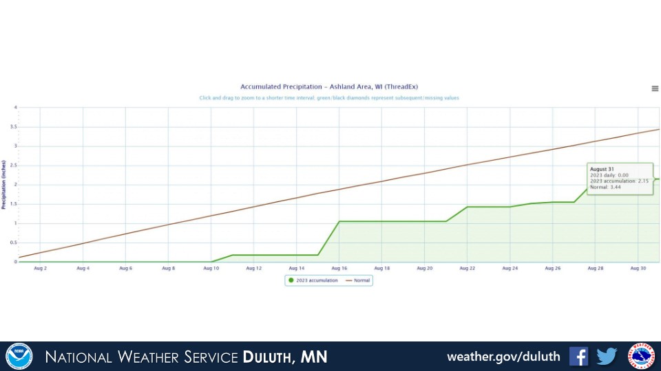
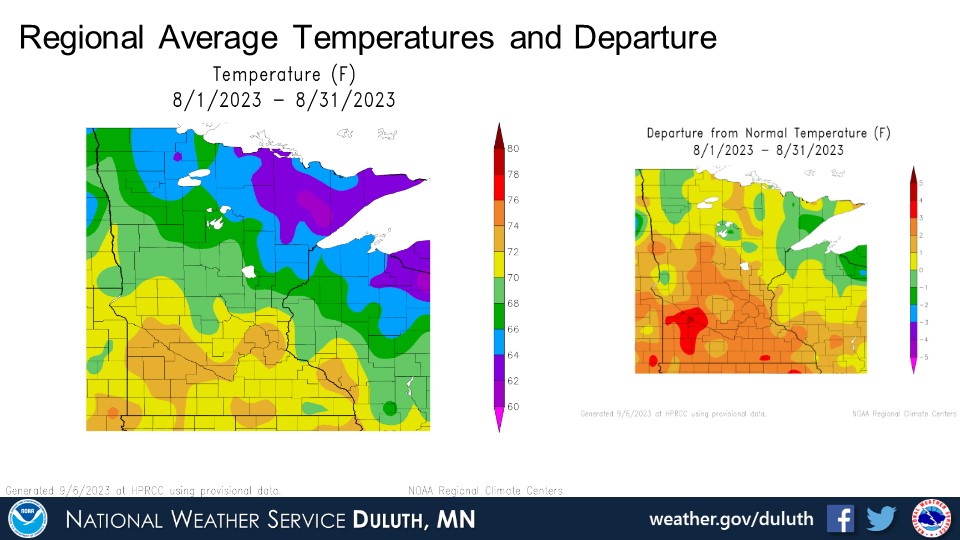
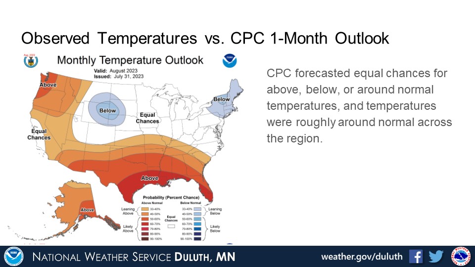
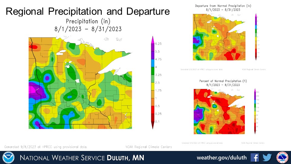
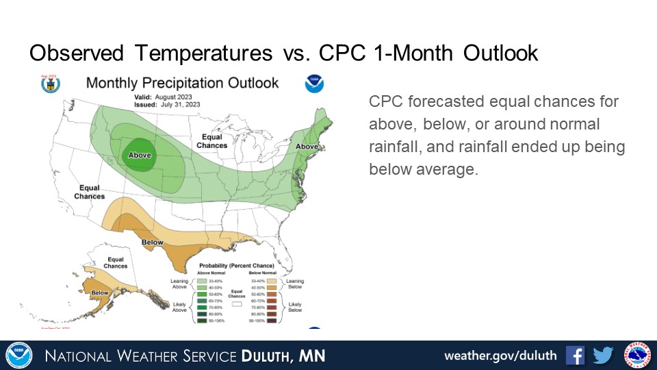
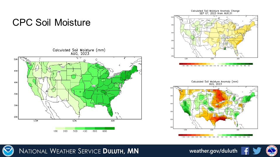
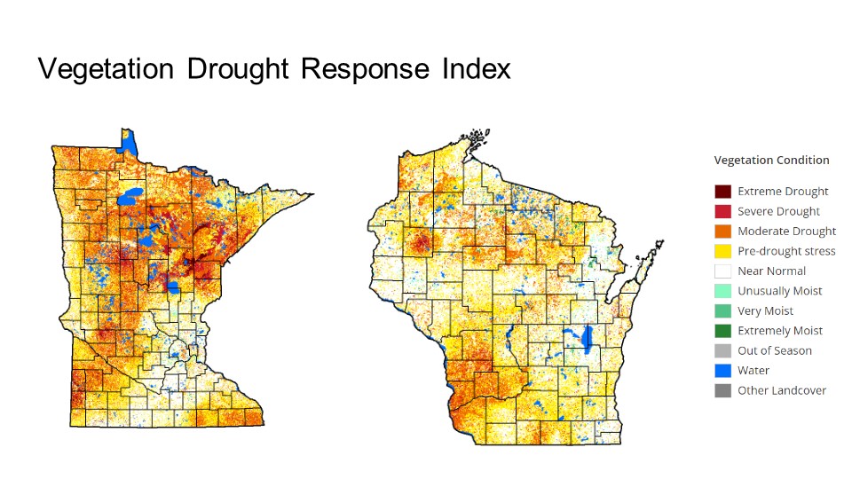
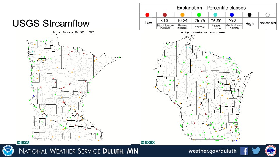
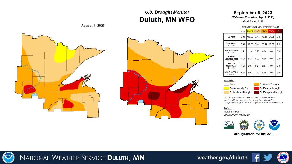
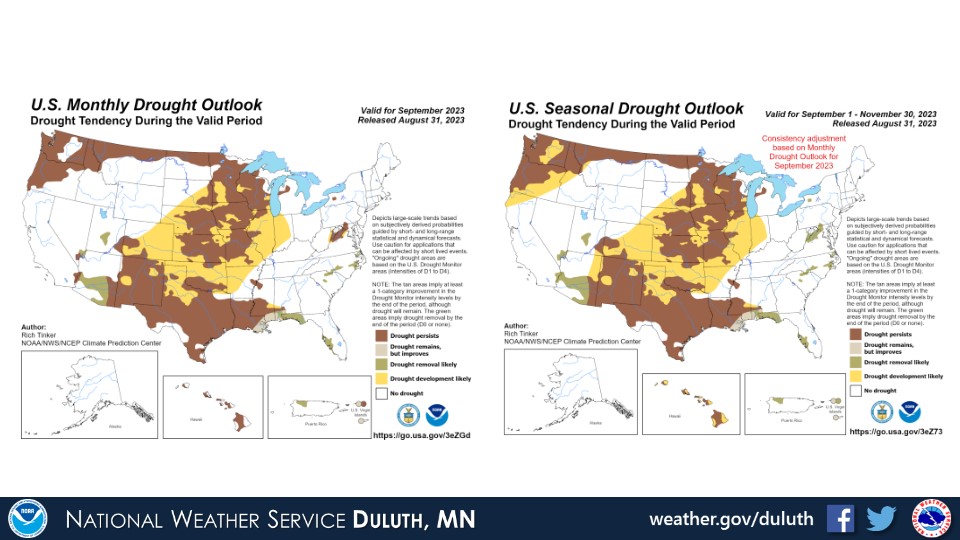
August temperatures hovered around average, but rainfall was quite a bit below average at all climate sites. The lack of rain caused drought conditions to worsen, with some areas experiencing extreme to exceptional drought and at least moderate to severe drought persisting across most of the region. Rivers and streams remain around to below average as a result and soils remain dry.
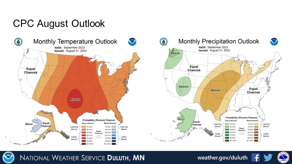
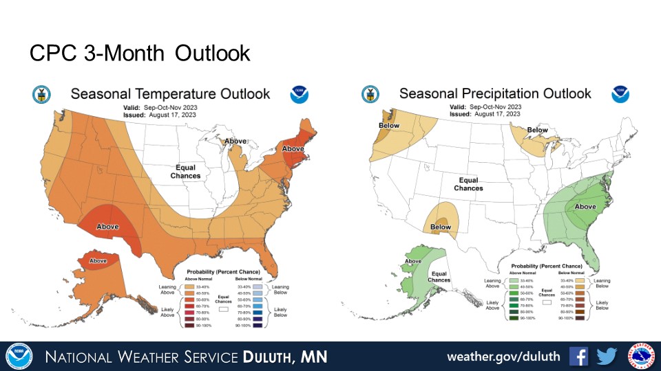
CPC outlooks suggest that warm and dry conditions may persist through the remainder of September, with equal chances for above, below, or around average temperatures for the next three months going into fall. There is some signal for below normal precipitation in the next three months.
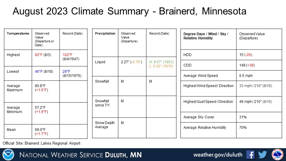
NOTE: No records were tied or broken at any climate site in August 2023.
Duluth
International Falls
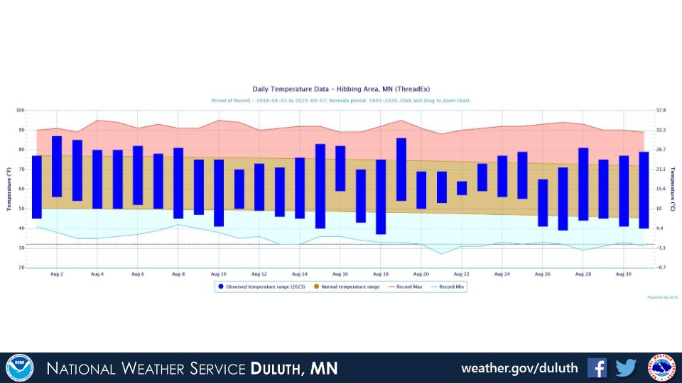
Hibbing
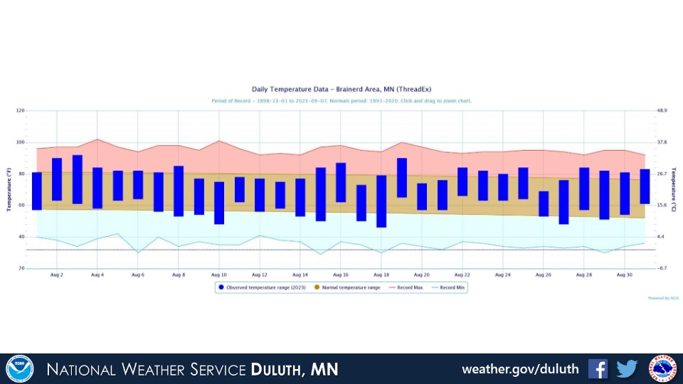
Brainerd
Ashland
Summary
Hydro
Outlook
 |
Media use of NWS Web News Stories is encouraged! Please acknowledge the NWS as the source of any news information accessed from this site. |
|
Forecasts
Fire Weather
Great Lakes
Local Text Products
Winter Weather
Local Area Forecasts
Aviation
Marine
Rainy River Basin Page
Current Conditions
Current Observations
Public Information Statements
National Snowfall Map
NOHRSC Snow Analysis
Rain/Snow Reports
Winter Monitor
US Dept of Commerce
National Oceanic and Atmospheric Administration
National Weather Service
Duluth, MN
5027 Miller Trunk Highway
Duluth, MN 55811-1442
218-729-6697 - Duluth; 218-283-4615 - Intl Falls
Comments? Questions? Please Contact Us.

