Heat expands across the Desert Southwest, Plains, Mississippi Valley and Midwest into Monday. Fire weather concerns continue for portions of the Intermountain West. Active monsoonal moisture fuels thunderstorms over the Southwest with possible flash flooding. Tropical cyclone Fausto in the Pacific, should weaken as it approaches Hawaii; Dangerous surf, swells and rip currents are expected. Read More >
Overview
|
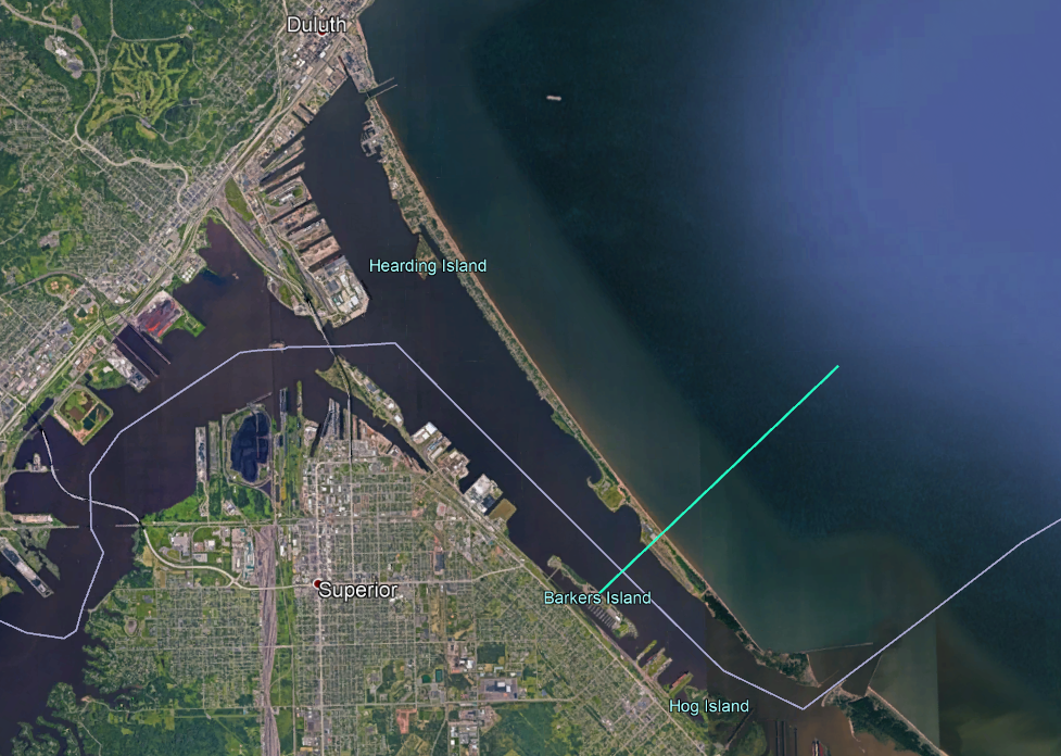
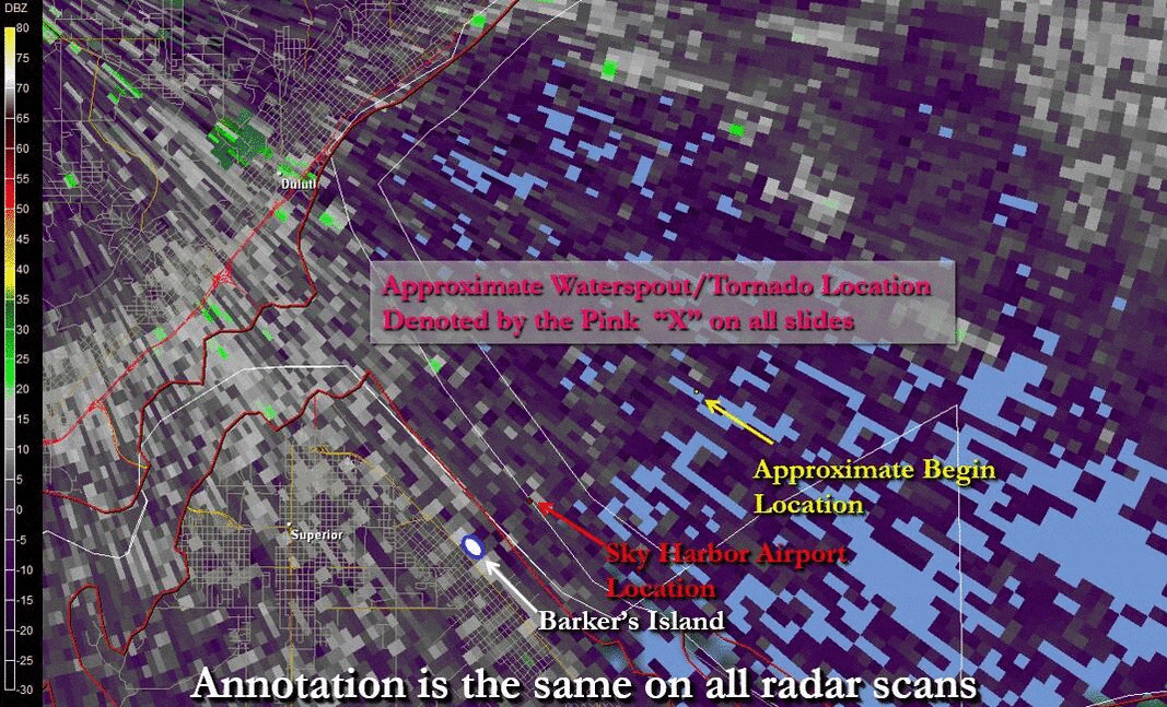
A waterspout developed at approximately 1100-1105 AM CDT about 2 miles offshore of Sky Harbor Airport the morning of August 9, 2012. The waterspout/EF-0 tornado crossed Minnesota Point and Sky Harbor Airport between 1110-1115 AM CDT before crossing Superior Bay and briefly coming onshore as an EF-0 tornado at Barker’s Island before dissipating around 1120 AM CDT. Eyewitnesses at Sky Harbor Airport reported a couple of float plane pontoons were briefly lifted and set back down (not moved), but otherwise no damage was reported on Minnesota Point or at Barker’s Island. |
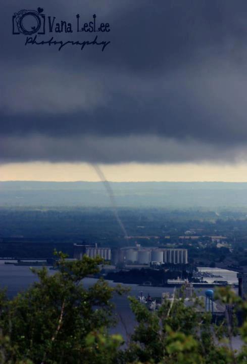
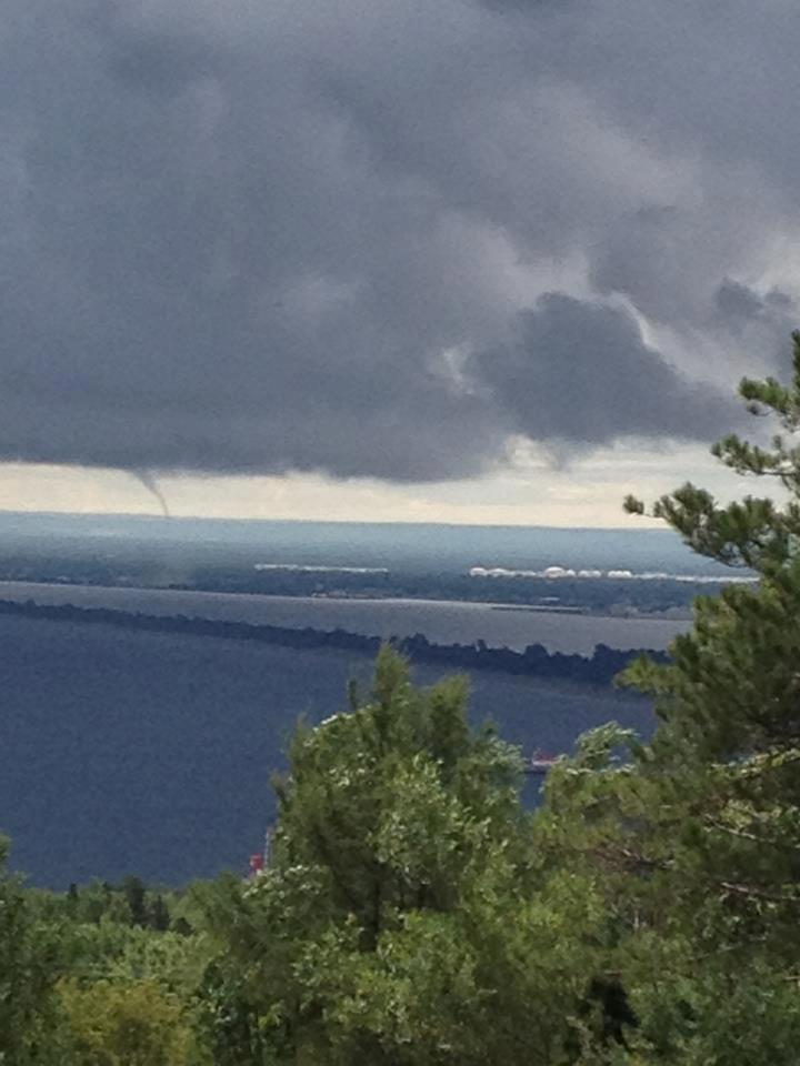 The waterspout near Minnesota Point as seen from the Duluth hillside ~1120AM. (Michael Mirtica photo) |
Tornado
|
Tornado - Park Point, Duluth to Barker's Island, Superior
|
||||||||||||||||
The Enhanced Fujita (EF) Scale classifies tornadoes into the following categories:
| EF0 Weak 65-85 mph |
EF1 Moderate 86-110 mph |
EF2 Significant 111-135 mph |
EF3 Severe 136-165 mph |
EF4 Extreme 166-200 mph |
EF5 Catastrophic 200+ mph |
 |
|||||
Photos & Video
 |
 |
.jpg) |
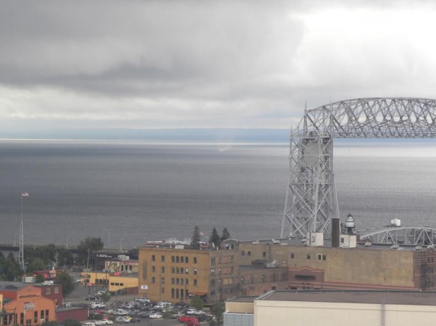
| Looking east over Lake Superior from the DECC parking deck ~1100AM. (Photographer Unknown) |
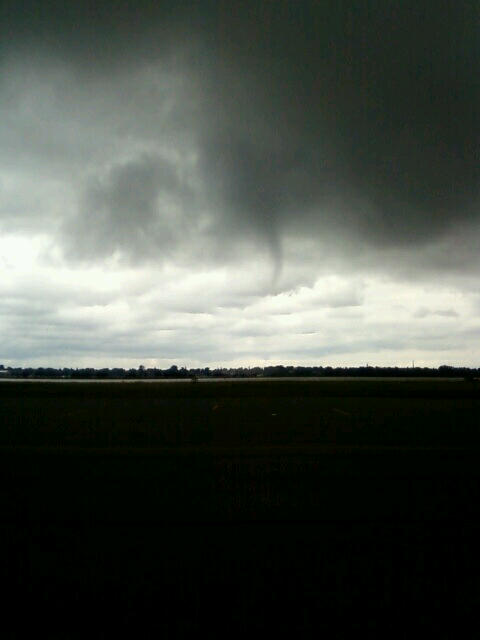
A view of the waterspout at Sky Harbor Airport ~1117AM. (Tom Betts photo) |
The waterspout as seen from Duluth Central High School ~1120AM. (Photographer Unknown) |
 |
 |
 |
| The waterspout moving ashore on Barker's Island with Superior in the background ~1120AM. (Vana LesLee Photography) |
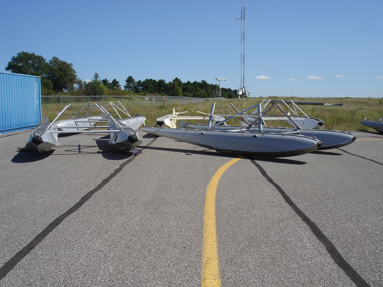
Float plane floats moved by the waterspout at Sky Harbor Airport. Note the KDYT AWOS in the background. (Photographer Unknown) |
Float plane floats moved by the waterspout at Sky Harbor Airport. (Photographer Unknown) |
A brief video of the waterspout.
(Photographer Unknown)
Radar
 |
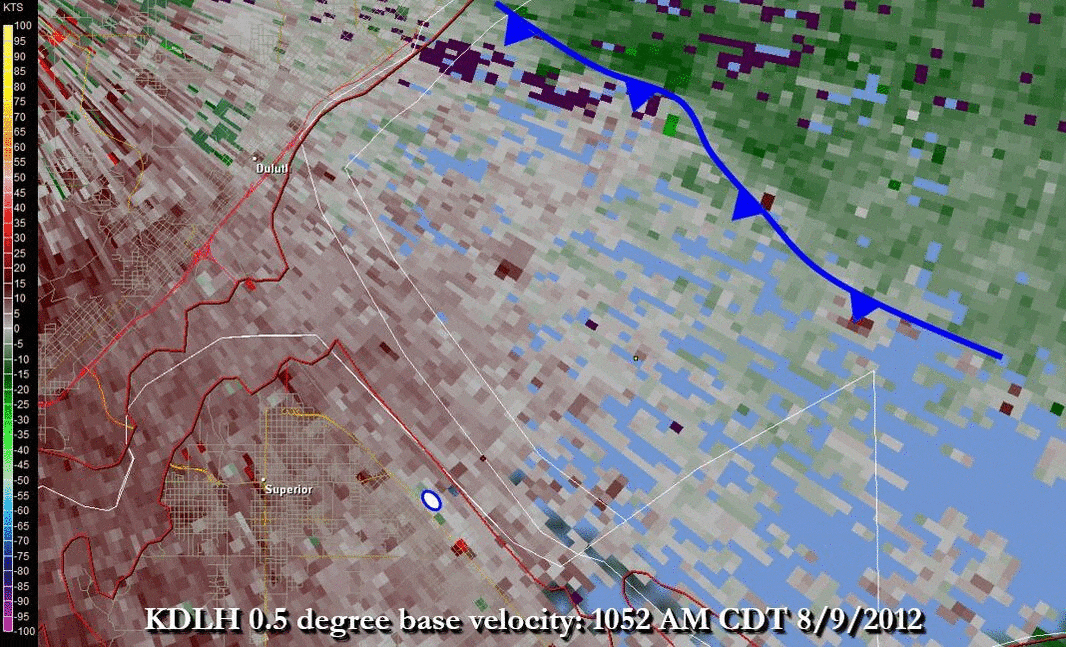 |
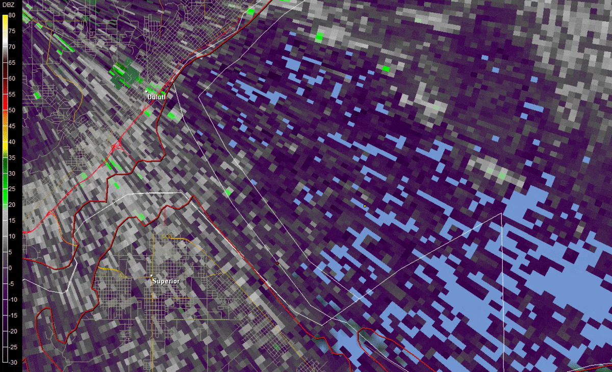 |
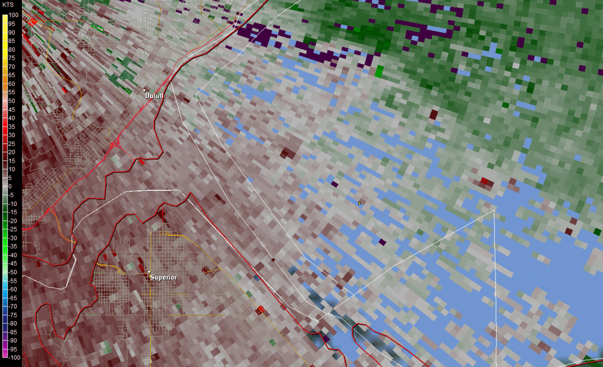 |
| KDLH Radar Reflectivity Loop with Annotation. | KDLH Radar Velocity Loop with Annotation. | KDLH Radar Reflectivity Loop | KDLH Radar Velocity Loop |
Environment
The waterspout appears to have developed near an inflection point along the leading edge of strong surge of northeast winds (marine cold front). From photos, it appears to be a bottom-up generation process resulting from pre-existing vertical vorticity along the boundary, which was concentrated and stretched when an updraft developed above it (classic landspout type process, but over water). Non-supercell generation/maintenance processes were likely enhanced by the very warm Lake Superior water temperatures near 70F. Eyewitnesses stated it appeared to weaken while crossing Minnesota Point. Dissipation was likely due to a combination of the cold air near the surface rapidly surging to the west-southwest underneath the updraft and undercutting the maintenance processes (strongly supported by picture from when it was near Barker’s Island) and also due to increased surface friction as it moved over land.
The mesoscale environment was marginally favorable for waterspout development as well. There was some super-position of a low-level CAPE max and a surface vorticity wind shift/front. The SPC Non-Supercell Tornado Parameter was hinting at the possibility as well.
 |
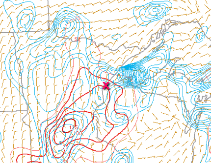 |
| Figure 1: SPC Non-Supercell Tornado Parameter | Figure 2: 3km CAPE/Surface Vorticity |
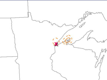
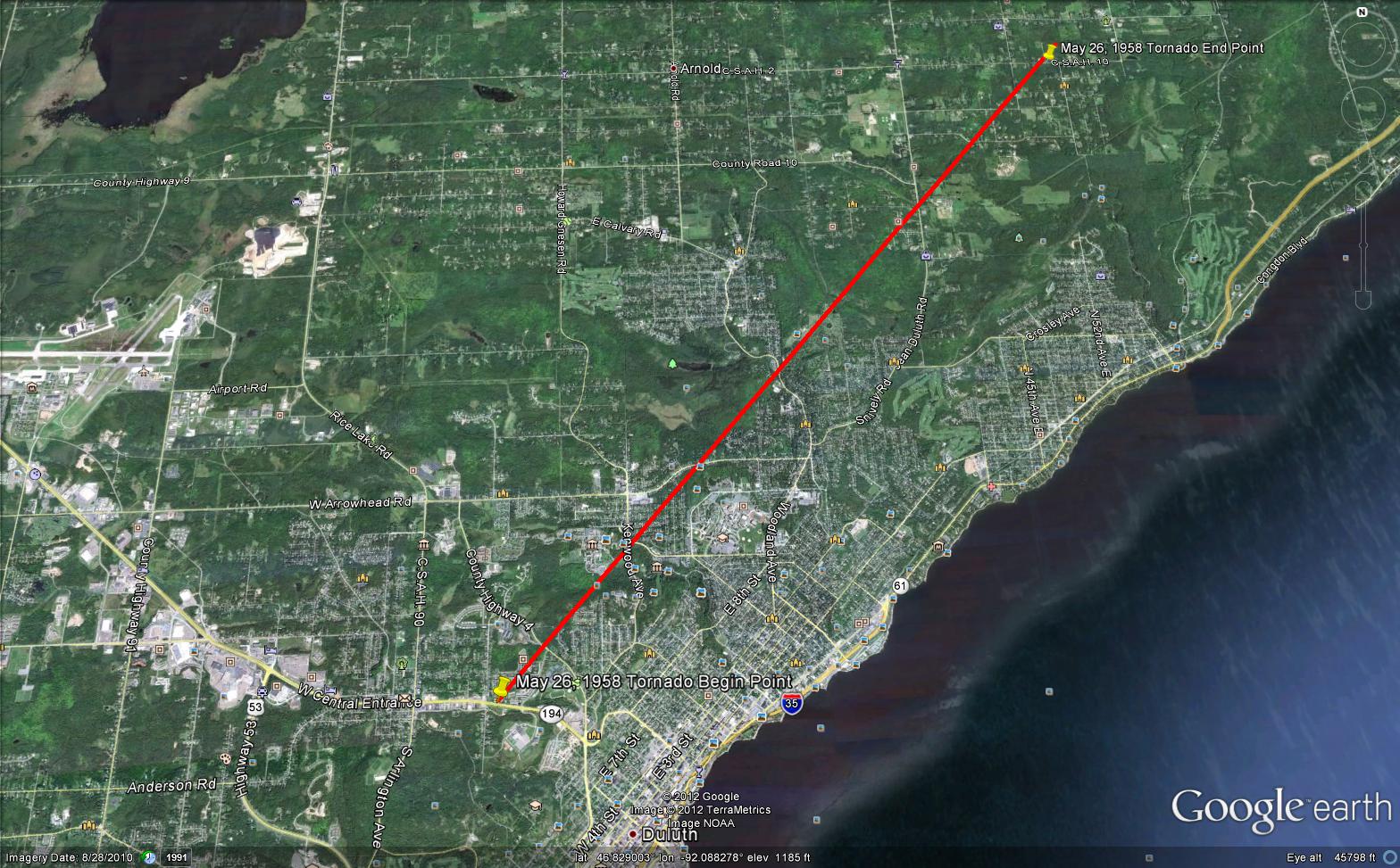
1958 Duluth Tornado
This was not the first tornado to touch down within the Duluth City limits. On May 26, 1958, at 3:35 pm, a tornado touched down in the Duluth Heights neighborhood then traveled northeast for 6.9 miles before lifting just south of Arnold Road. There were no injuries reported. Below is a map of the 1958 tornado path.
 |
Media use of NWS Web News Stories is encouraged! Please acknowledge the NWS as the source of any news information accessed from this site. |
|