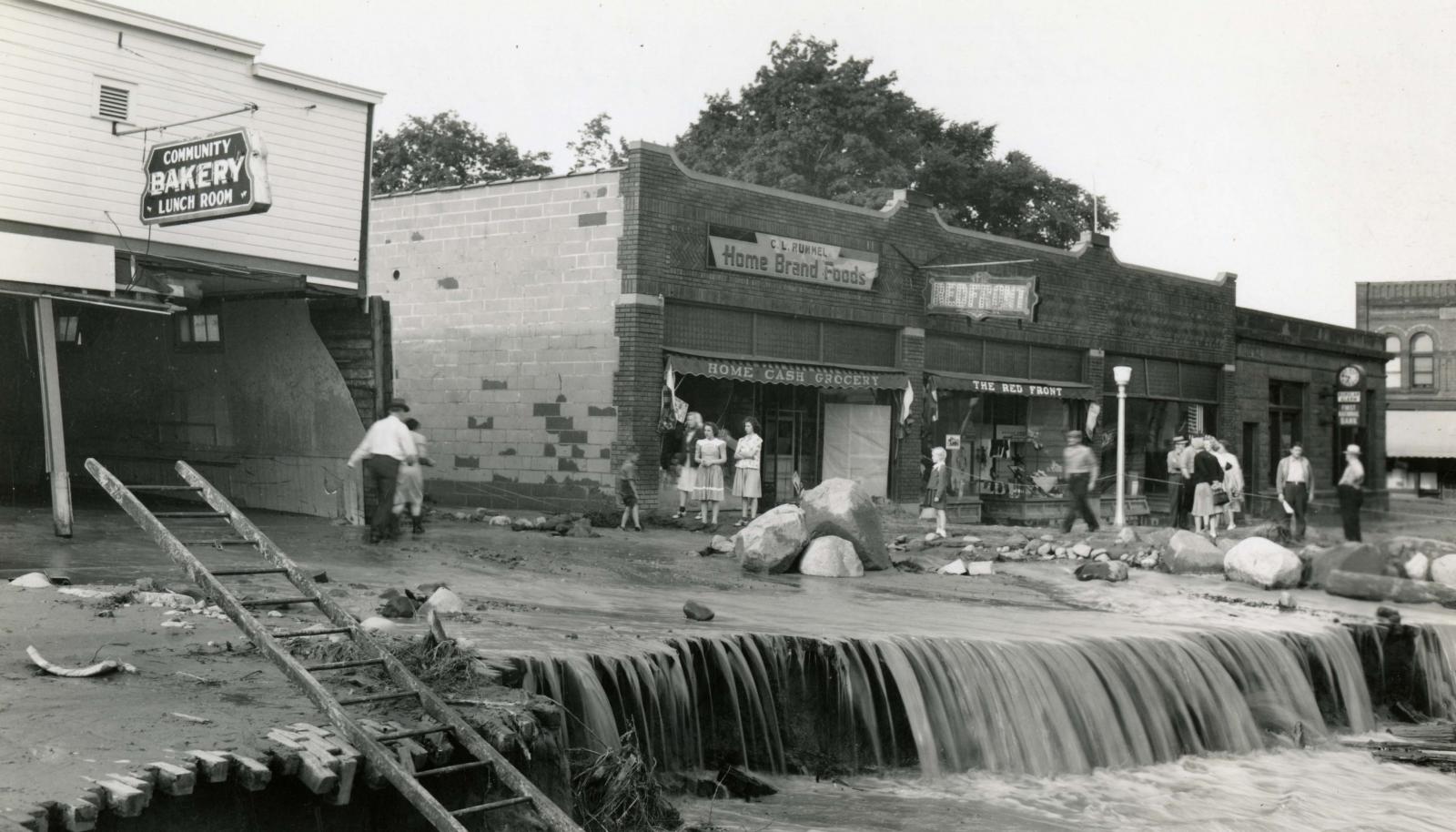
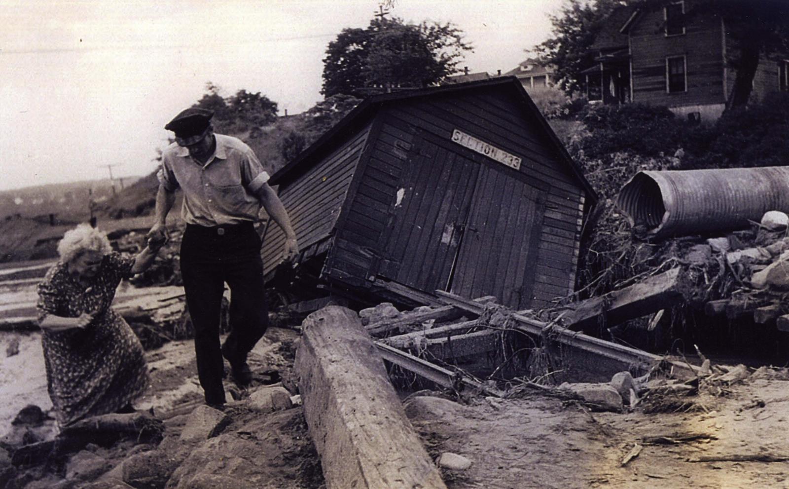
For the city of Bayfield, Wisconsin, water is a constant reminder of its geographic location, companionship with Lake Superior, and gateway to the Apostle Islands National Lakeshore. On the evening of July 16, 1942, water engulfed the city, dividing it during wartime. For 12 hours, intermittent heavy rainfall inundated the city. The rain began to fall at 9:30 PM on the 16th and would not cease until the following morning, July 17th, at 9:30 AM. The flood waters drained into two ravines that flowed into the city. The water rushed through the business district of Bayfield, Wisconsin, creating "gullies 50 feet wide and 20 feet deep in places" (Swenson, 1942). The rushing waves of water forced large boulders loose upon the city and into area businesses. Across the city, the flood waters deposited up to five feet of sand burying many doorways and windows of local businesses and homes. The flooding even impacted Evergreen Cemetery where unearthed caskets and various body parts were strewn across. In spite of the catastrophic damage and destruction to many homes and businesses, only one fatality was reported, a dog. The dog's name was Sandy Brunner and was owned by Helen Brunner. Helen's son Warren Brunner turned 97 in 2025 and still misses Sandy to this day. Total damage was estimated to $750,000 ($11.7 million in 2017) (Reque, 1942).
Area rainfall totals were high throughout much of northern Wisconsin. Bayfield received 8.68 inches, Big St. Germain Dam 4.98 inches, Brule Island 5.06 inches, Land O'Lakes 4.84 inches, Rest Lake 8.06 inches, and Ashland with 3.01 inches. In terms of precipitation frequency, 8.52 inches of rain fell over Bayfield for a 12-hour period, just under a 500-year rainfall event. This means that in any given year, there is a 0.2% likelihood of this given amount of rainfall to occur again.
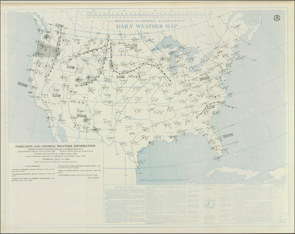
On the morning of July 16, 1942 an area of low pressure was centered over western Nebraska with an associated frontal boundary extending eastward across South Dakota, Minnesota, Wisconsin, and Illinois. As the low moved northeastward into South Dakota, thunderstorms formed to the north of the front across Northern Wisconsin and the Upper Peninsula of Michigan.
 |
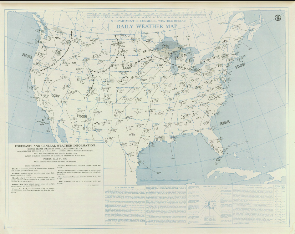 |
| Daily Weather Map for July 16, 1942 | Daily Weather Map for July 17, 1946 |
 |
 |
|
| Bayfield 1942 Flood: Main Street Photo courtesy of Bayfield Heritage Association, BHA 1983.27.30 |
Bayfield 1942 Flood: Gentleman helping woman among the debris Photo courtesy of Bayfield Heritage Association, BHA 2009.7.4 |
 |
 |
|
| Bayfield 1942 Flood: Two woman shoveling mud in dresses and boots. Ester Sandstrom (L) and Betty McQuade (R) Photo courtesy of Bayfield Heritage Association, BHA 2009.8.3 |
Bayfield 1942 Flood: Remains of Turnquist Building on Rittenhouse Ave on the alley in the block running from Broad Street to 2nd Street Photo courtesy of Bayfield Heritage Association, BHA 2009.8.2 |
|
 |
||
|
Helen Brunner and her dog, Sandy. Sandy was the sole fatality from this flood. (Photo courtesy Charlsa Hensley, used with permission.) |
REQUE, W.G., 1942: Bayfield County Press.
SWENSON, B., 1942: RIVER STAGES AND FLOODS. Mon. Wea. Rev., 70, 165–169, https://doi.org/10.1175/1520-0493(1942)070<0165:RSAF>2.0.CO;2
 |
Media use of NWS Web News Stories is encouraged! Please acknowledge the NWS as the source of any news information accessed from this site. |
|

