Duluth, MN
Weather Forecast Office
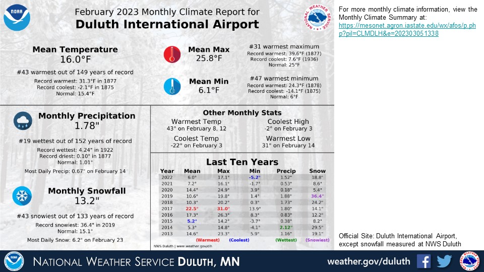
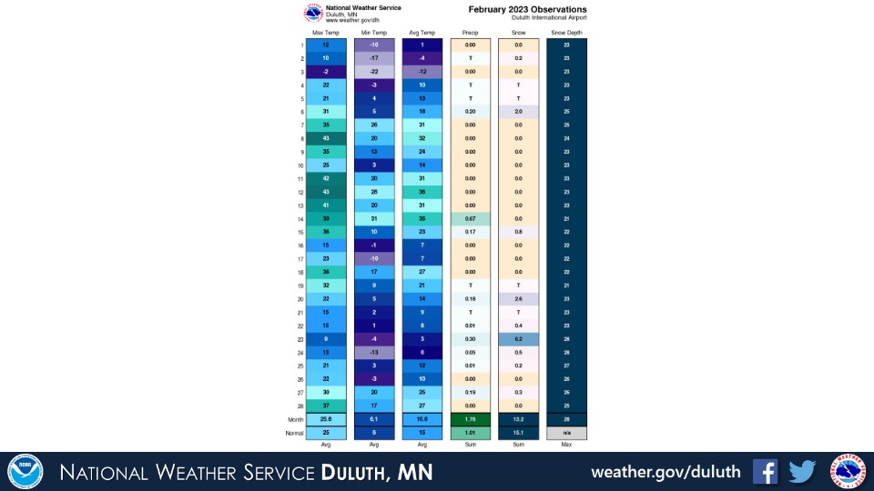
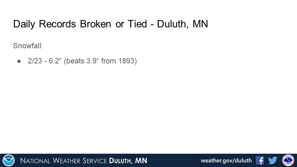
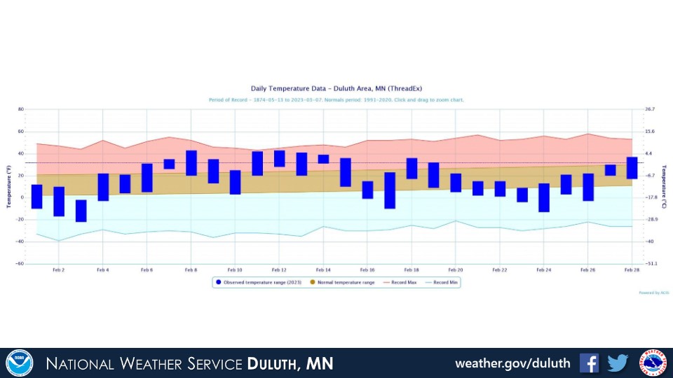
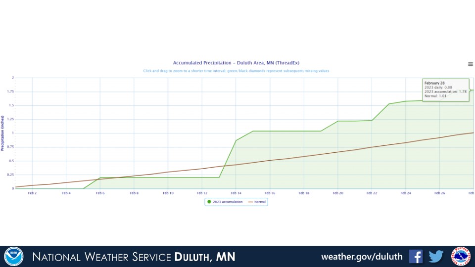
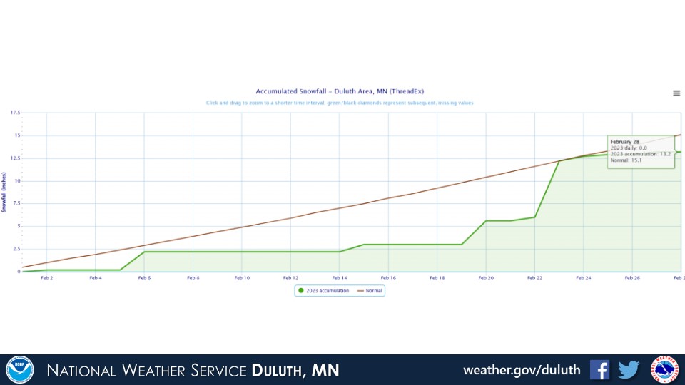
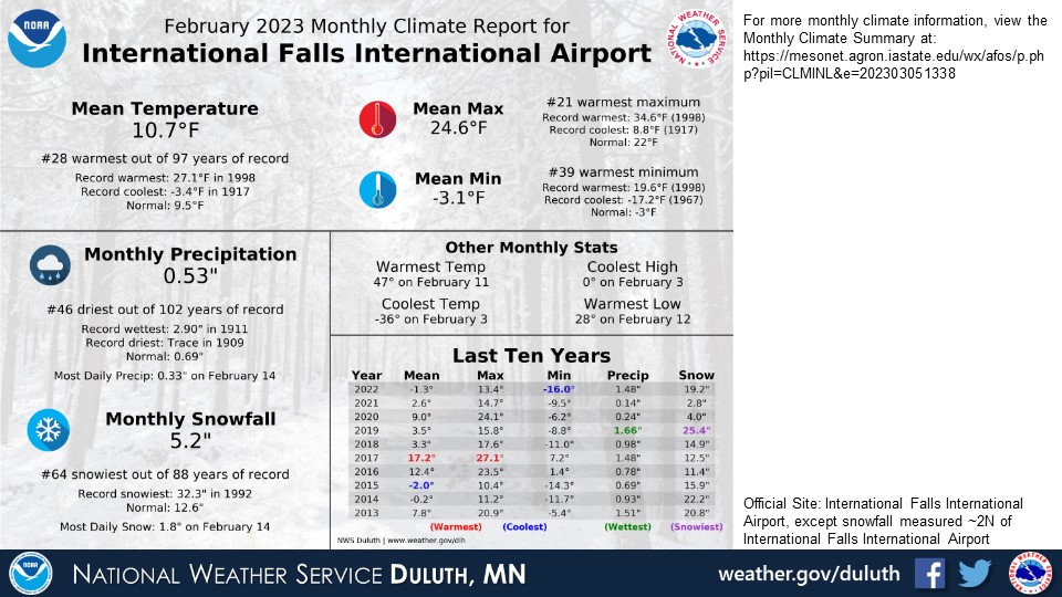
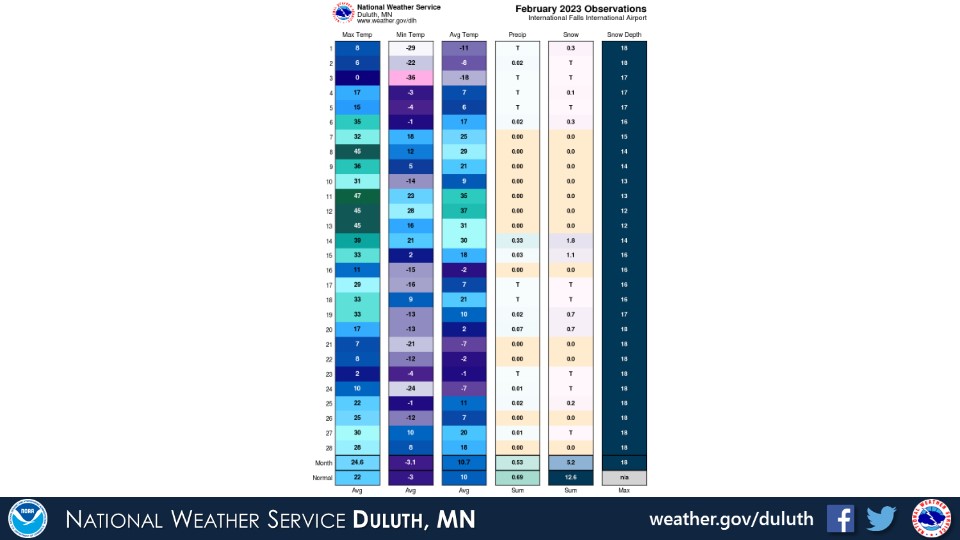
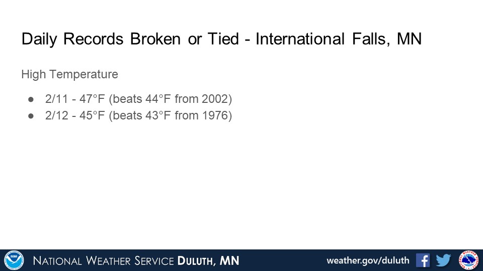
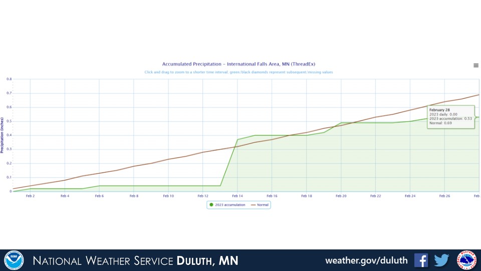
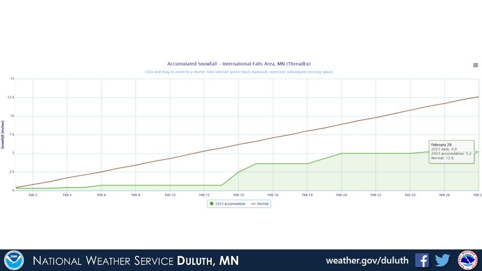
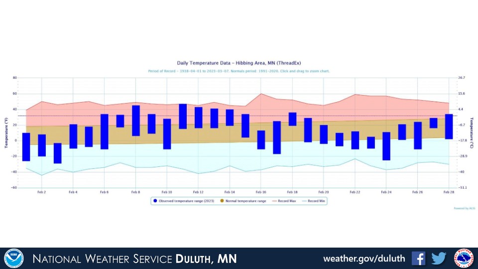
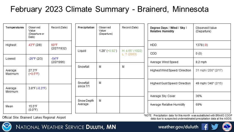
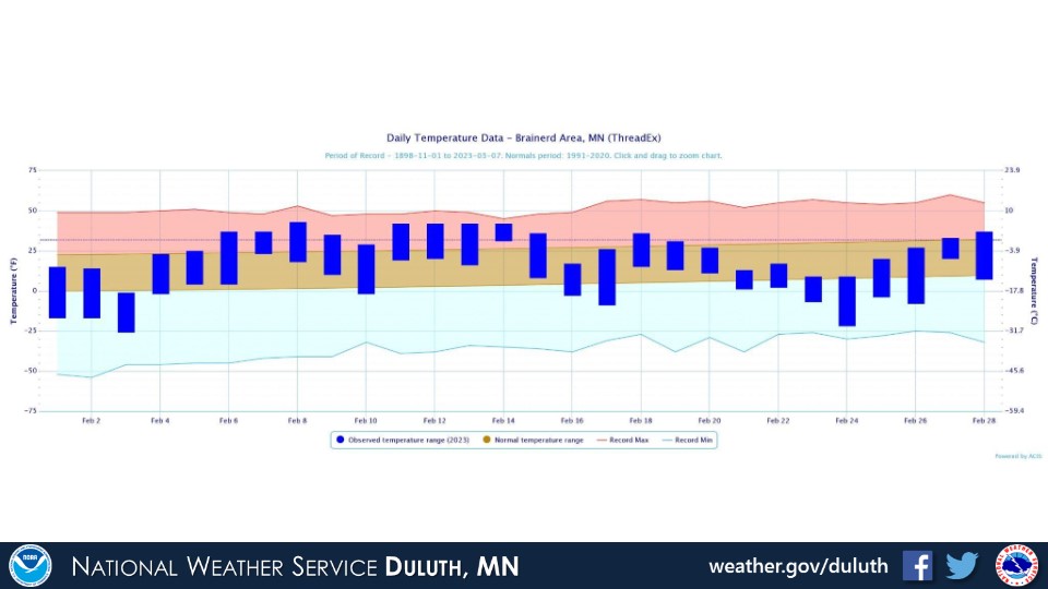
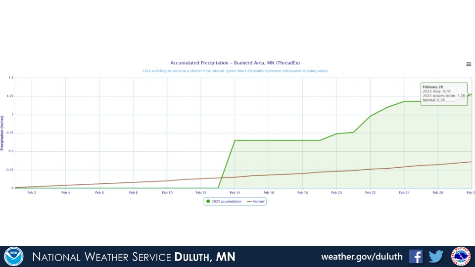
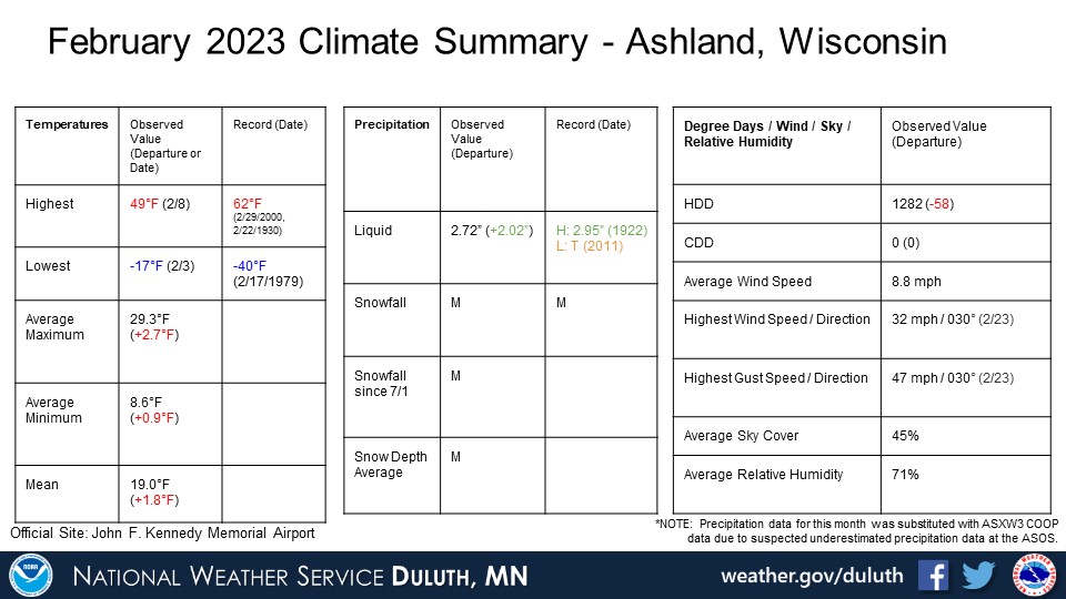
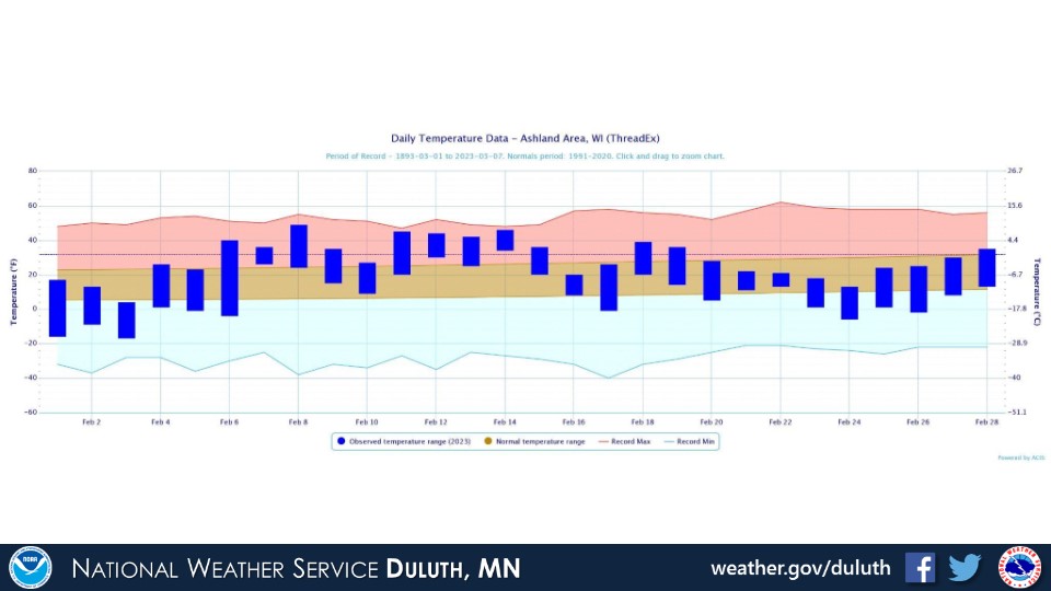
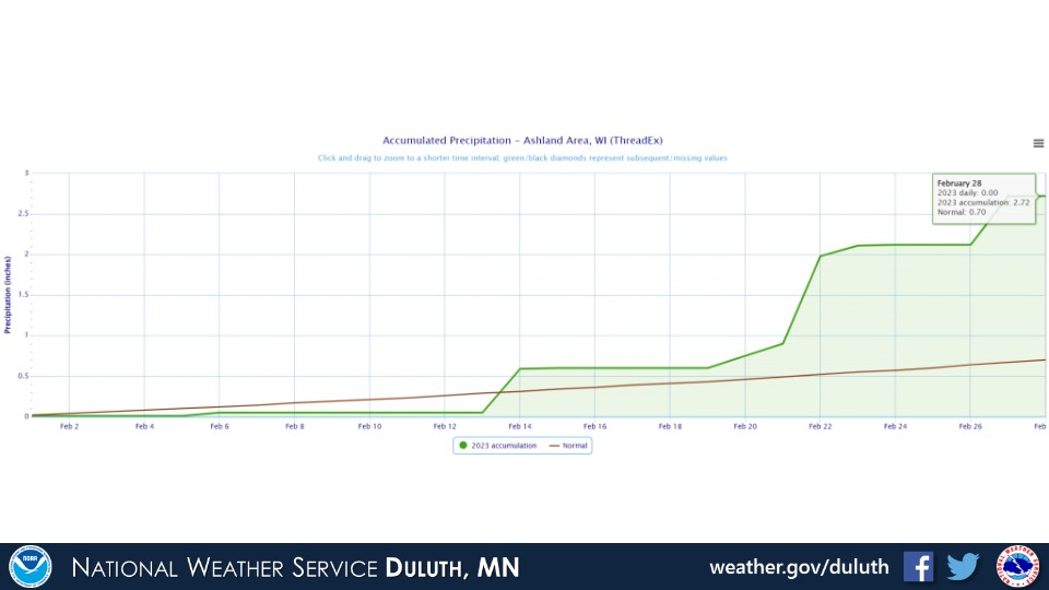
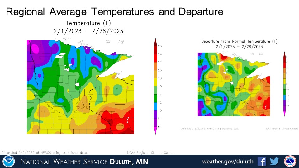
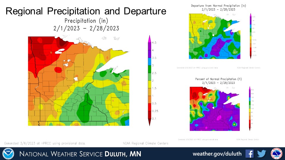
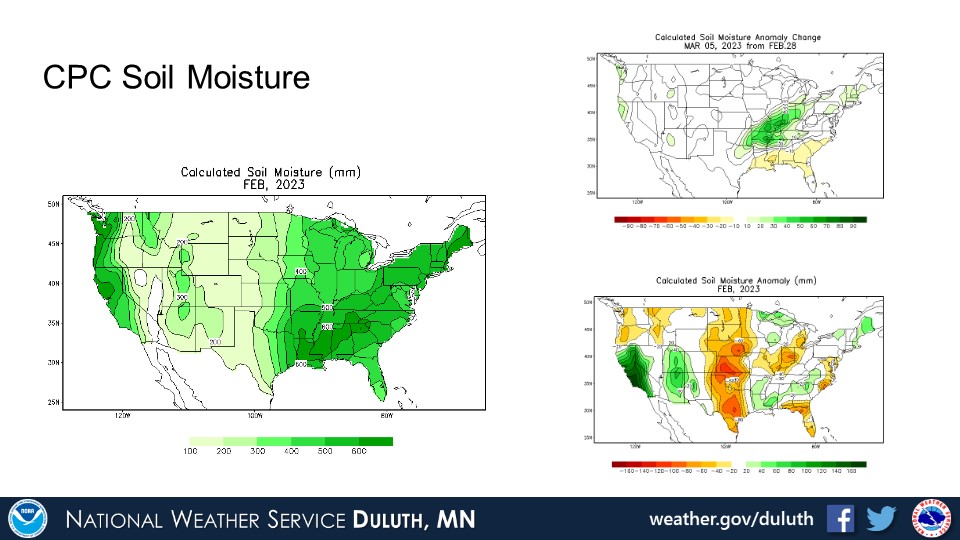
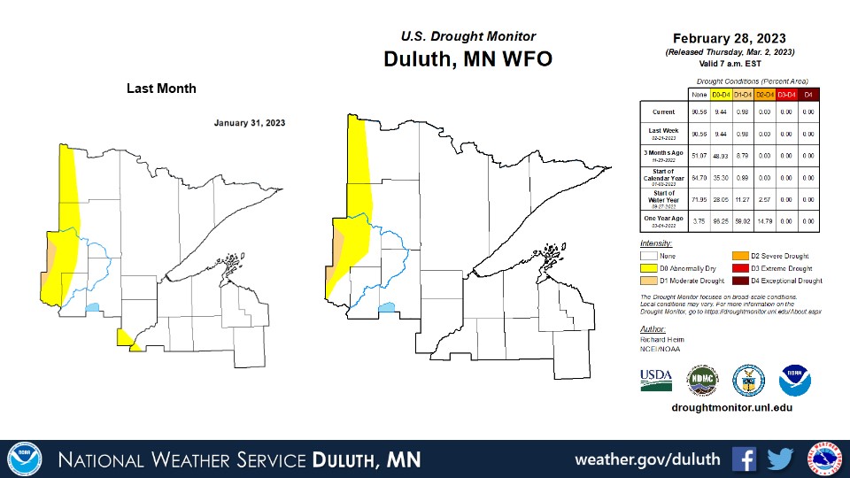
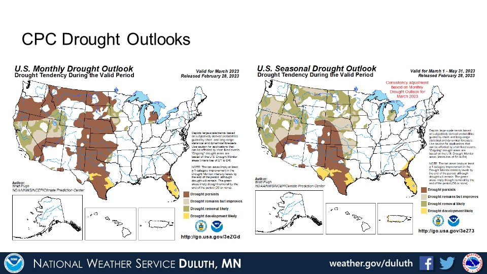
February 2023 featured temperatures that averaged a little above or below normal around the Northland. There were some warmer periods in the early-mid part of the month with a few daily high temperature records set. The warm weather was sandwiched between some colder weather at the very beginning and end of the month, which is why many places ended up only within a couple degrees of average as a whole. Precipitation patterns were variable across the region. The storm track favored northwest Wisconsin and into far east-central Minnesota most of the time, so the highest (above average) precipitation was found there. A mid-February rain event contributed to these totals along with some snowfall episodes. At Duluth and International Falls, snowfall was below average. With the excess precipitation, drought has been eradicated for all except a sliver of northern Minnesota.
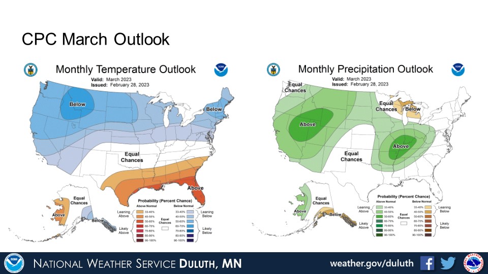
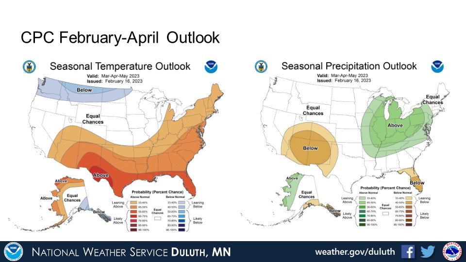
Looking ahead, the CPC is forecasting a greater likelihood for cold weather with equal chances for above or below normal precipitation through March. Equal chances for above or below normal temperatures and precipitation are in the forecast for almost all of the Northland in the 3-month spring outlook.
Duluth
International Falls

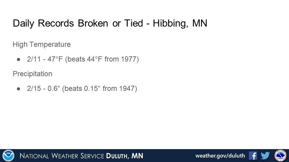
Hibbing


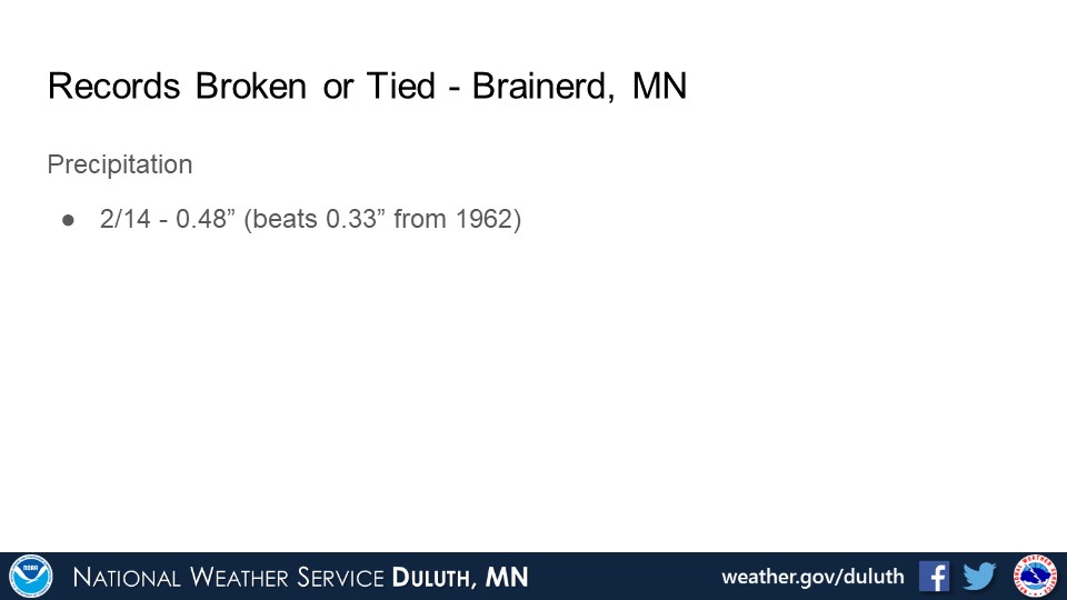
Brainerd
Ashland
Summary
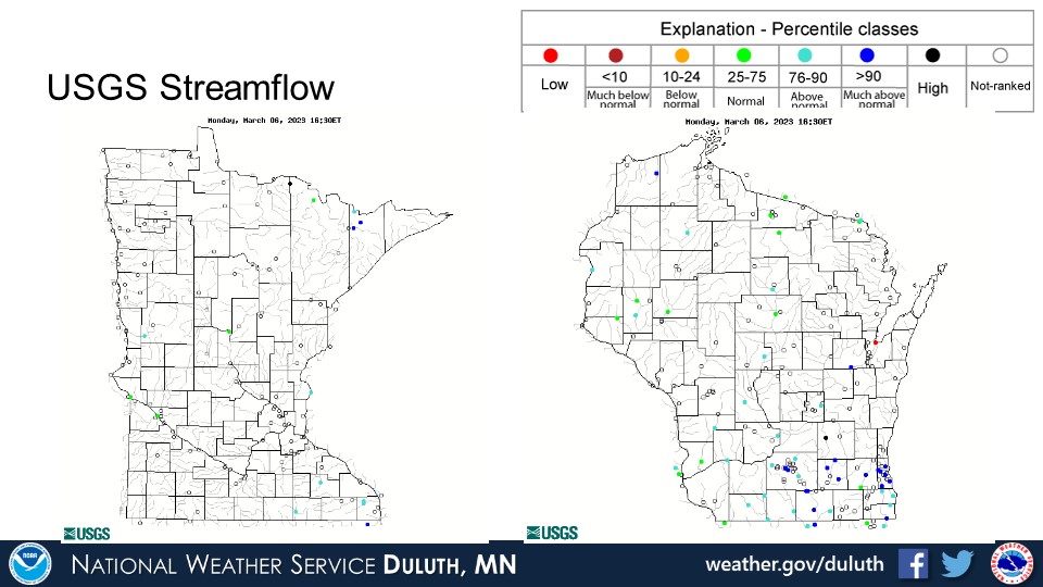
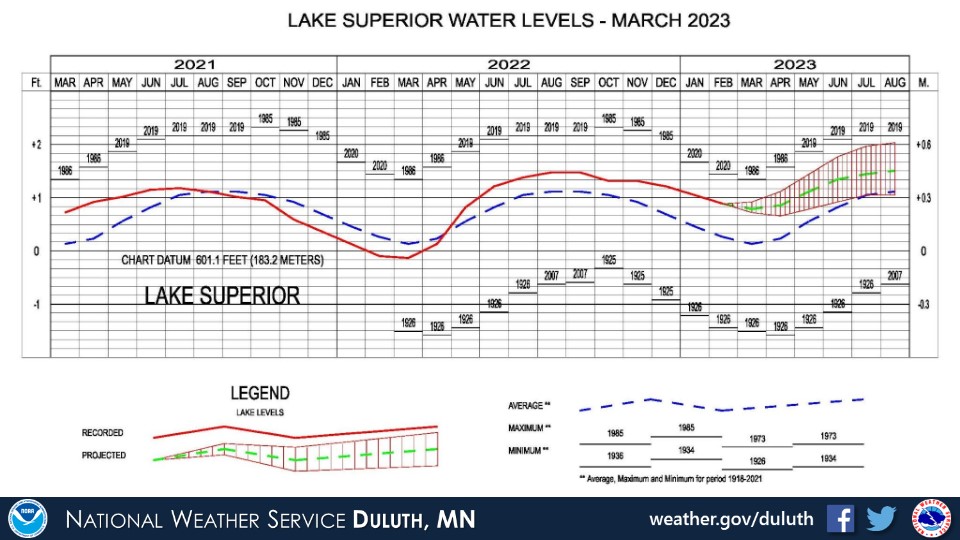
Hydro
Outlook
 |
Media use of NWS Web News Stories is encouraged! Please acknowledge the NWS as the source of any news information accessed from this site. |
|
Forecasts
Fire Weather
Great Lakes
Local Text Products
Winter Weather
Local Area Forecasts
Aviation
Marine
Rainy River Basin Page
Current Conditions
Current Observations
Public Information Statements
National Snowfall Map
NOHRSC Snow Analysis
Rain/Snow Reports
Winter Monitor
US Dept of Commerce
National Oceanic and Atmospheric Administration
National Weather Service
Duluth, MN
5027 Miller Trunk Highway
Duluth, MN 55811-1442
218-729-6697 - Duluth; 218-283-4615 - Intl Falls
Comments? Questions? Please Contact Us.

