Duluth, MN
Weather Forecast Office
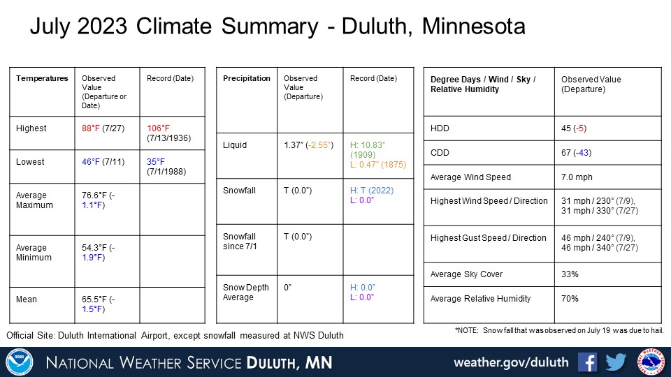
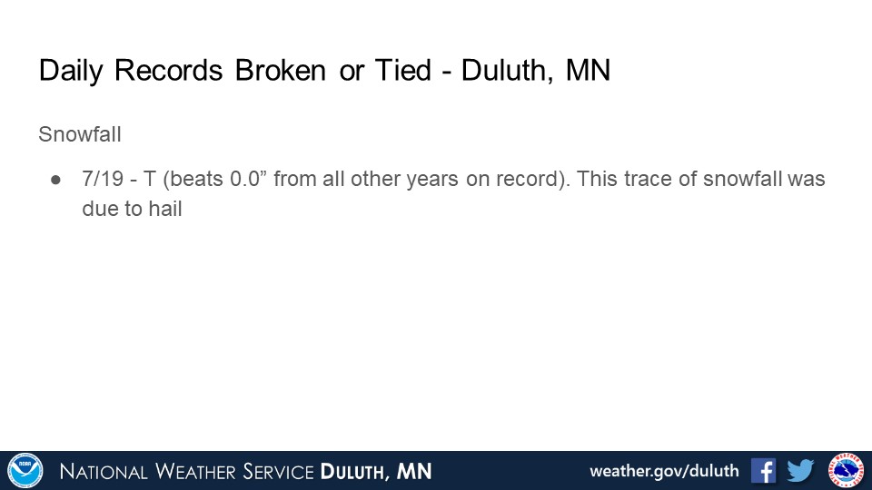
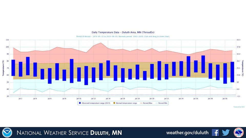
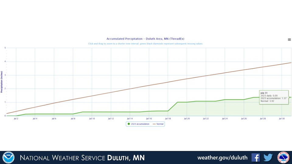
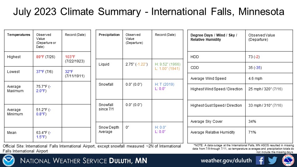
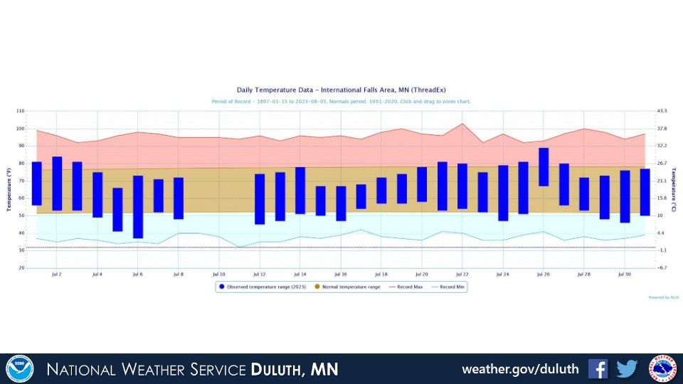
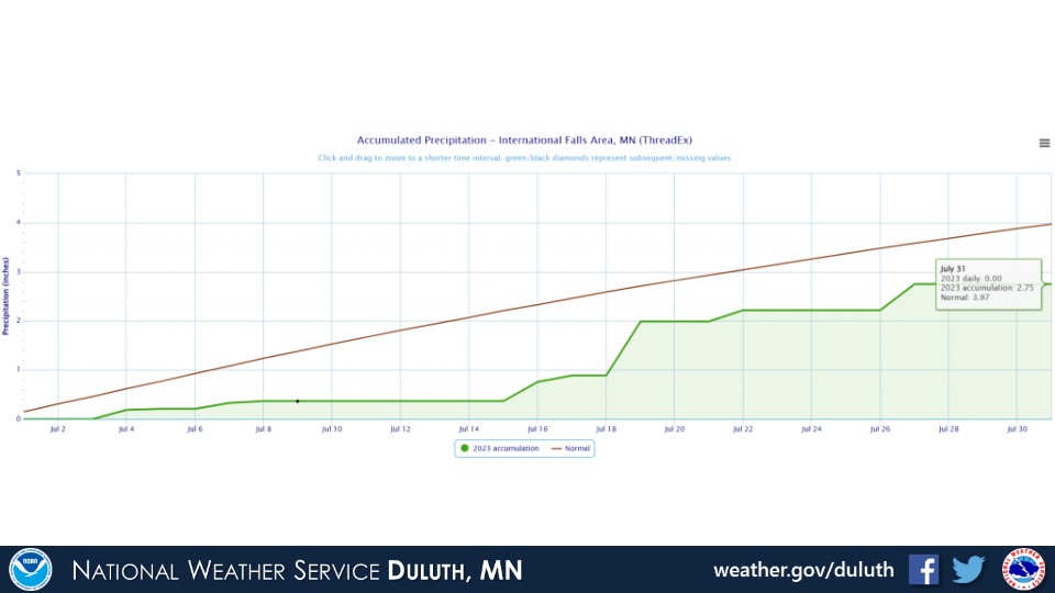
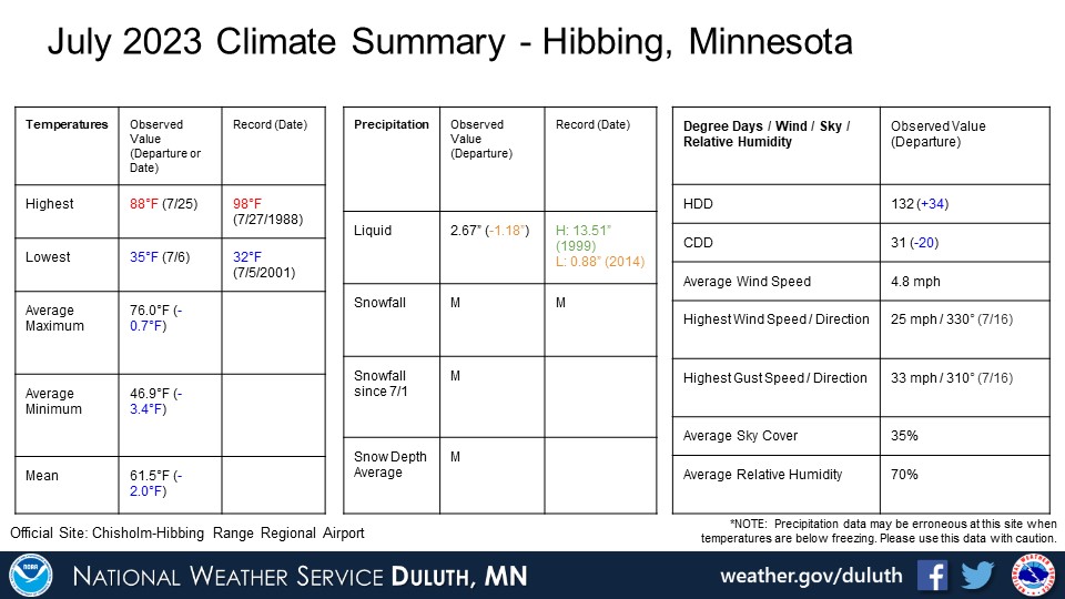
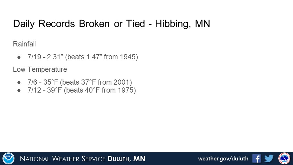
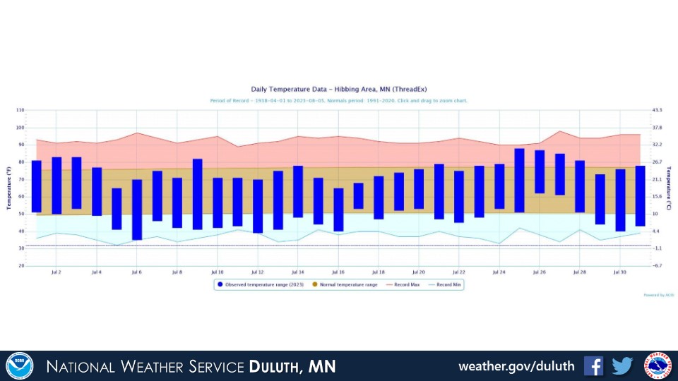
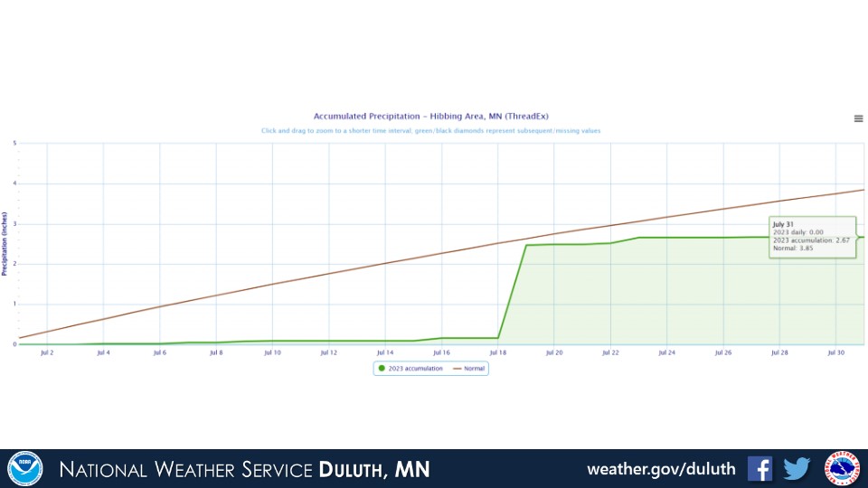
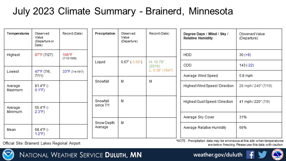
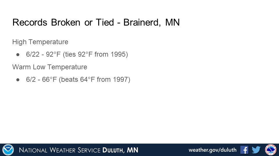
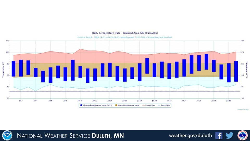
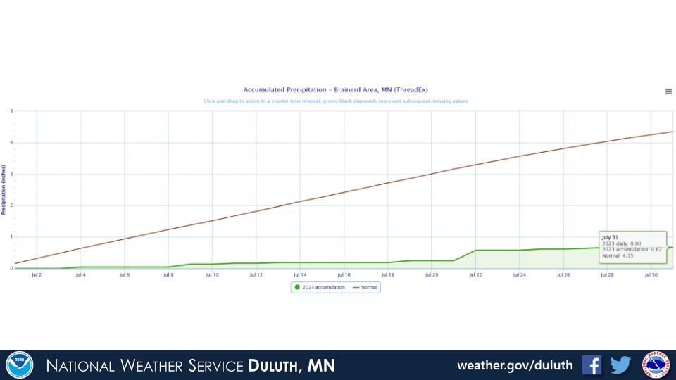
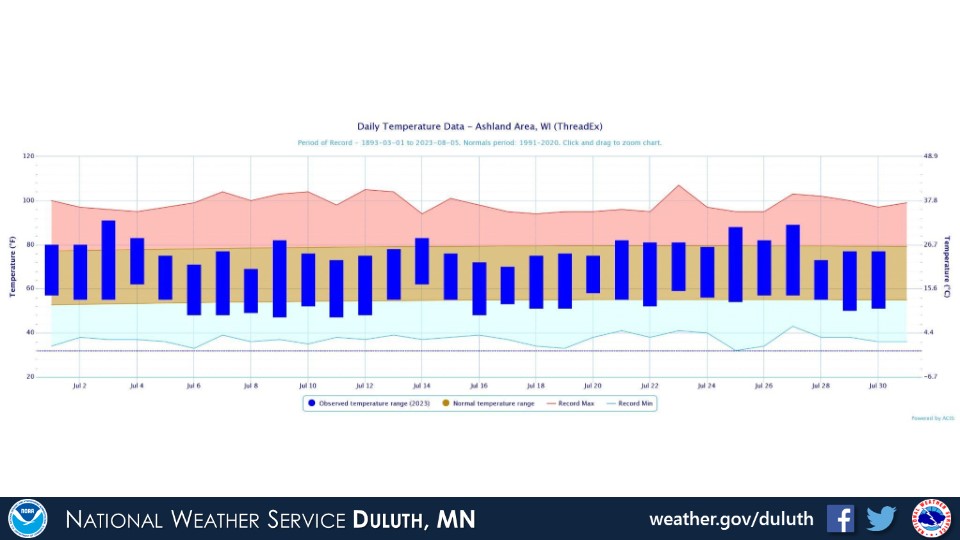
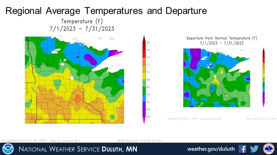
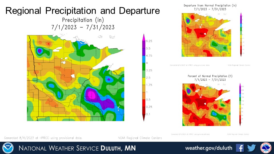
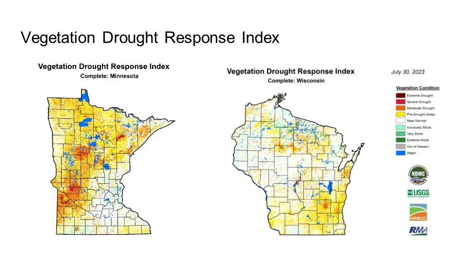
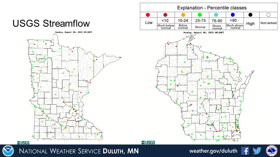
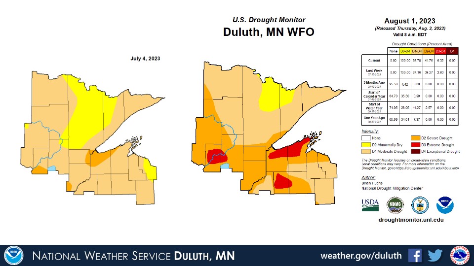
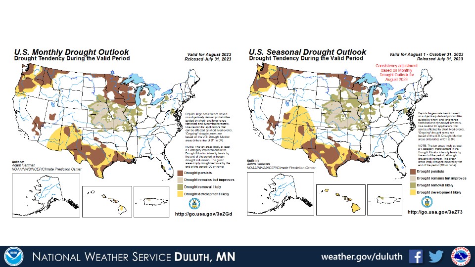
It was a very dry July across the Northland. Nearly every place observed below normal rainfall, and in many cases several inches below normal with totals only 25% to 50% of normal! It should come as no surprise that drought conditions have worsened regionwide, with widespread moderate to severe drought and a few pockets of extreme drought. Temperatures were generally a degree or two below average for the month. There were some hot days mixed with average and below average temperature days.
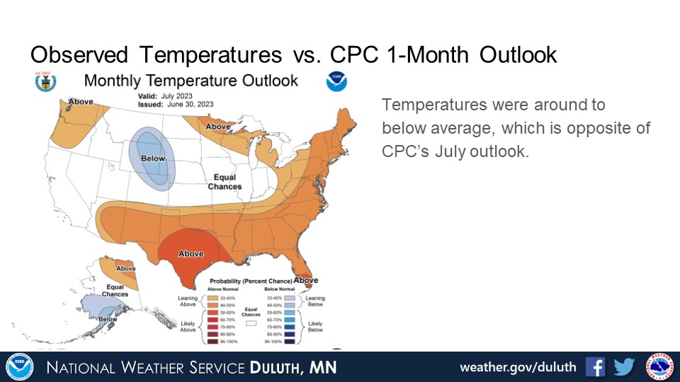
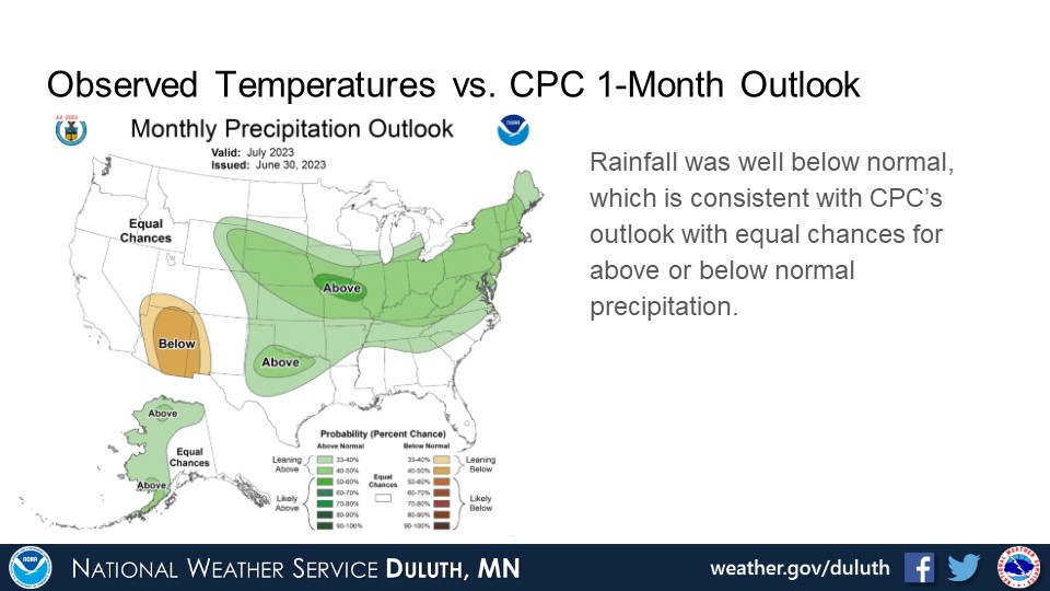
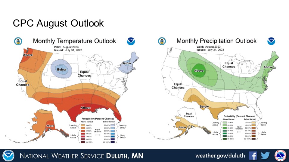
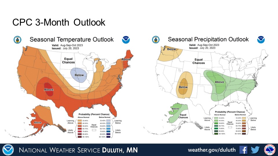
The CPC outlooks for August and the next three months do not suggest a clear trend for temperatures or rainfall. There are equal chances for above, below, or around normal temperatures and precipitation. With that, drought conditions are expected to persist into the foreseeable future even if rainfall trend towards average.
Duluth
International Falls
Hibbing
Brainerd
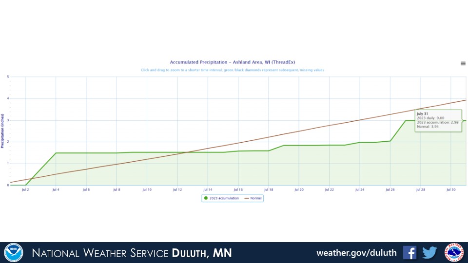
Ashland
Summary
Hydro

Outlook
 |
Media use of NWS Web News Stories is encouraged! Please acknowledge the NWS as the source of any news information accessed from this site. |
|
Forecasts
Fire Weather
Great Lakes
Local Text Products
Winter Weather
Local Area Forecasts
Aviation
Marine
Rainy River Basin Page
Current Conditions
Current Observations
Public Information Statements
National Snowfall Map
NOHRSC Snow Analysis
Rain/Snow Reports
Winter Monitor
US Dept of Commerce
National Oceanic and Atmospheric Administration
National Weather Service
Duluth, MN
5027 Miller Trunk Highway
Duluth, MN 55811-1442
218-729-6697 - Duluth; 218-283-4615 - Intl Falls
Comments? Questions? Please Contact Us.

