Overview
|
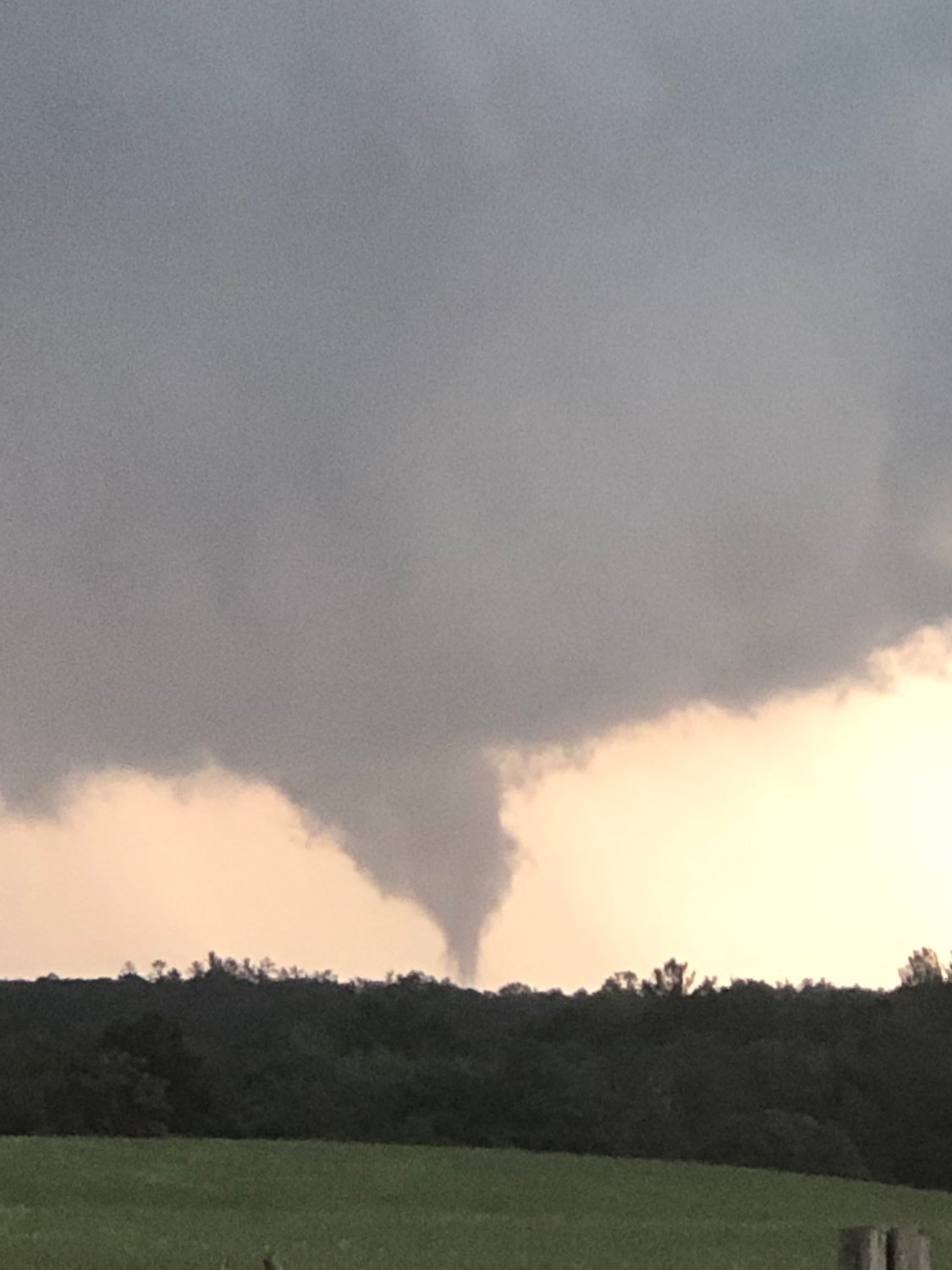
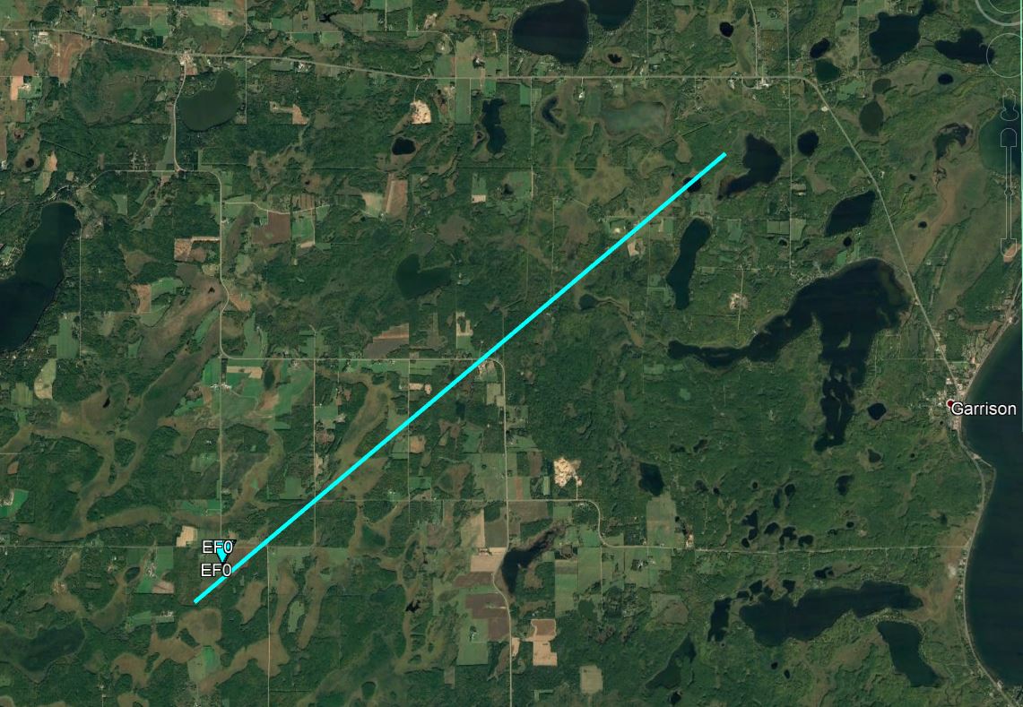
Several rounds of strong to severe thunderstorms impacted northeast Minnesota and northwest Wisconsin during the evening of Wednesday, July 8, 2020, into the early morning hours of Thursday, July 9, 2020. The primary impacts from these storms were heavy rainfall with localized flash flooding, sporadic tree damage from strong winds, multiple hail reports ranging from pea to half dollar-sized, and one EF-0 tornado in far southeast Crow Wing County. Tornado near South Long Lake |
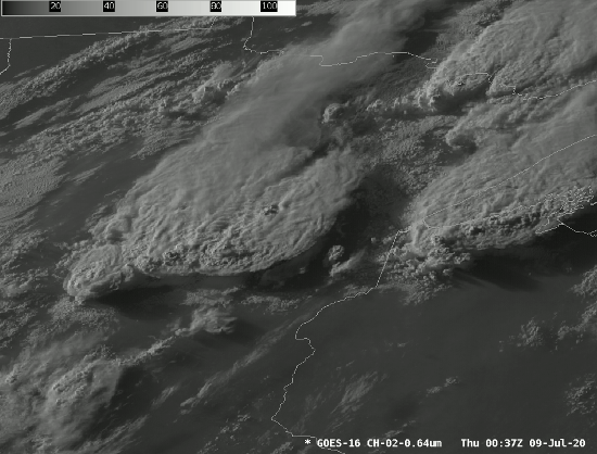 July 8, 2020, GOES-East visible satellite imagery at 1 minute intervals. |
Tornado:
|
Tornado - Near Pine Center and Garrison
|
||||||||||||||||
The Enhanced Fujita (EF) Scale classifies tornadoes into the following categories:
| EF0 Weak 65-85 mph |
EF1 Moderate 86-110 mph |
EF2 Significant 111-135 mph |
EF3 Severe 136-165 mph |
EF4 Extreme 166-200 mph |
EF5 Catastrophic 200+ mph |
 |
|||||
Radar/Photos/Video
 |
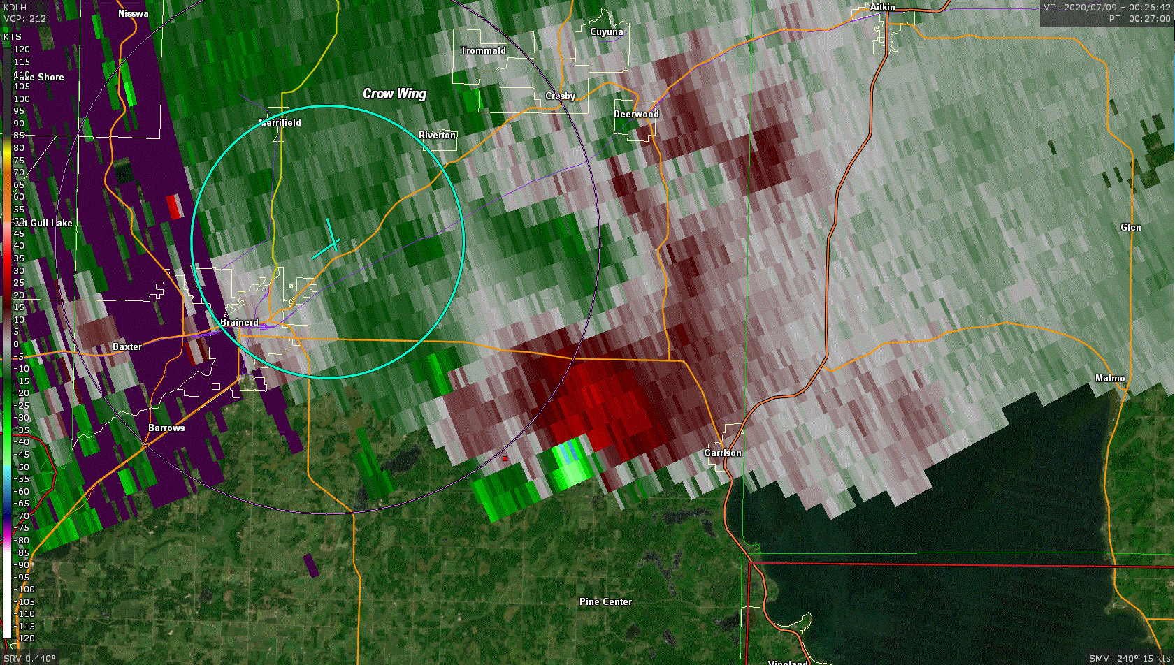 |
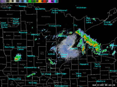
| Radar overview of the event. | KDLH Storm Relative Velocity image from 7:27PM |
 |
 |
 |
 |
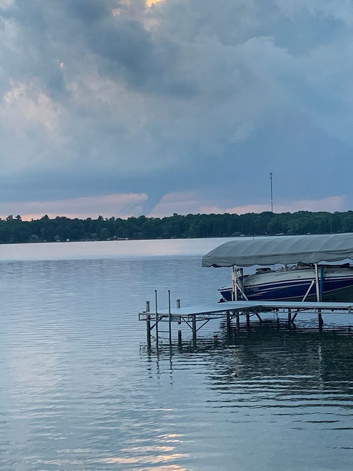
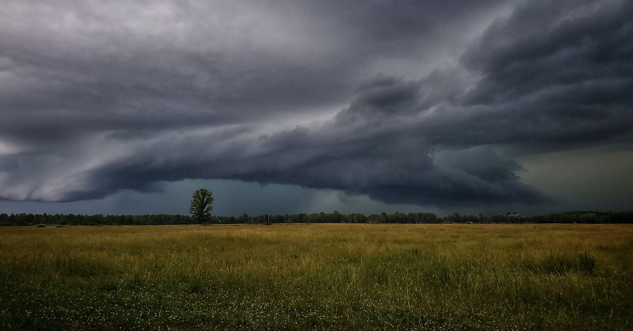
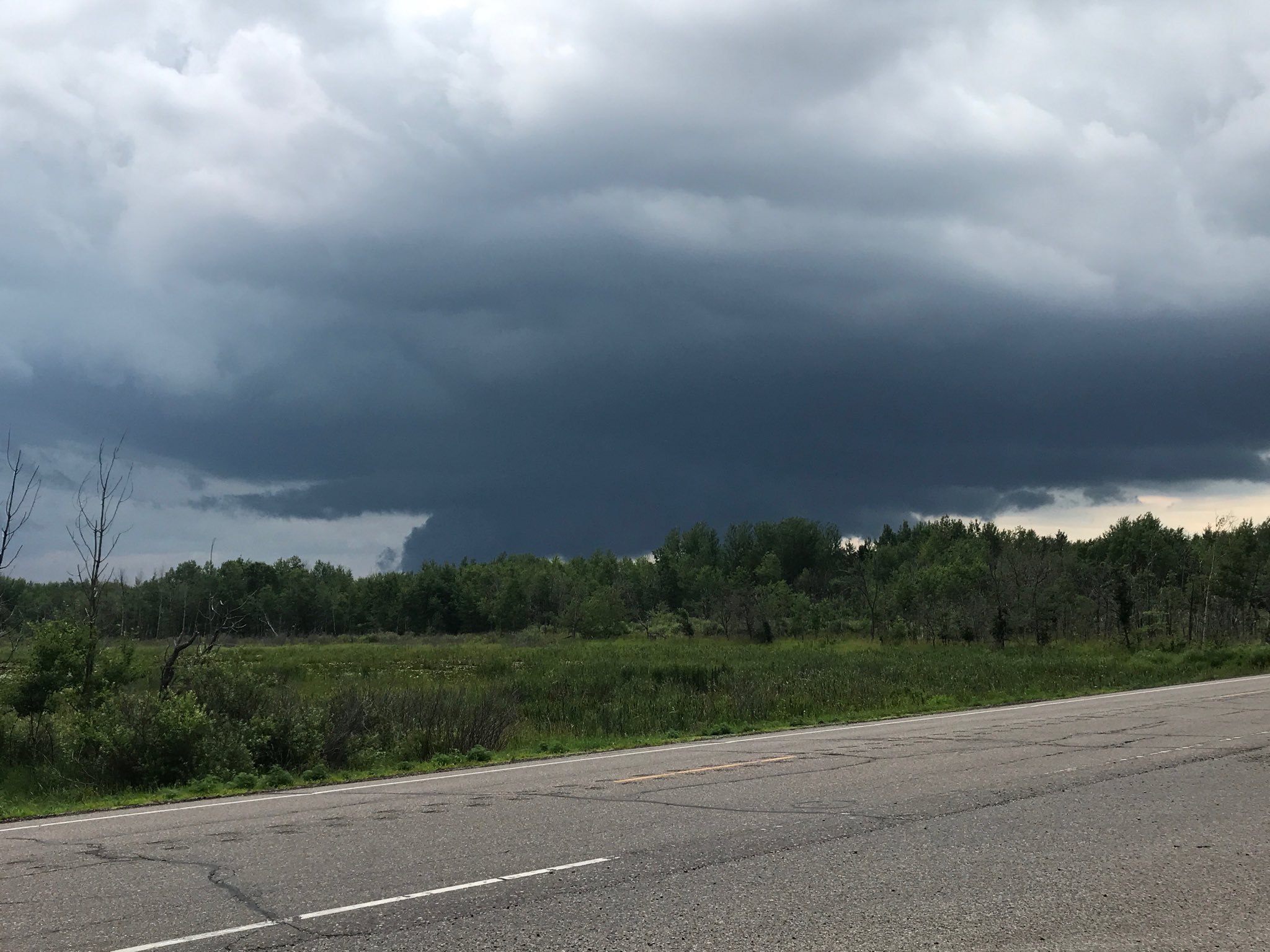
| The tornado looking southwest from near Brainerd, MN (source: Joe Berg) |
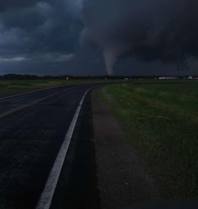
The tornado from CR 8 and Highway 18 (source: Spike Eannelli) |
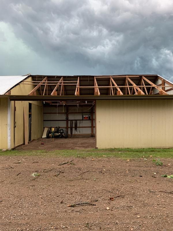
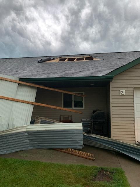
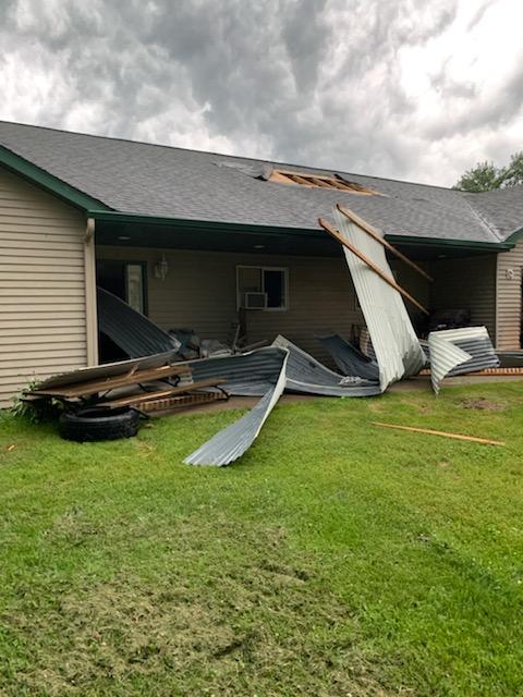
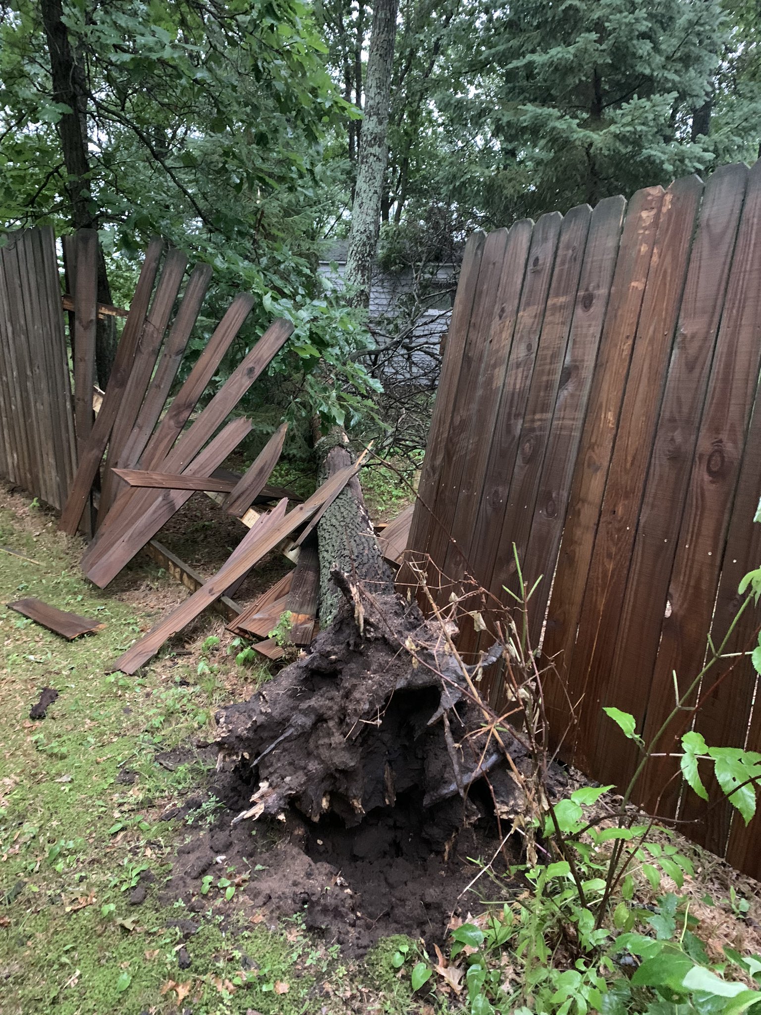
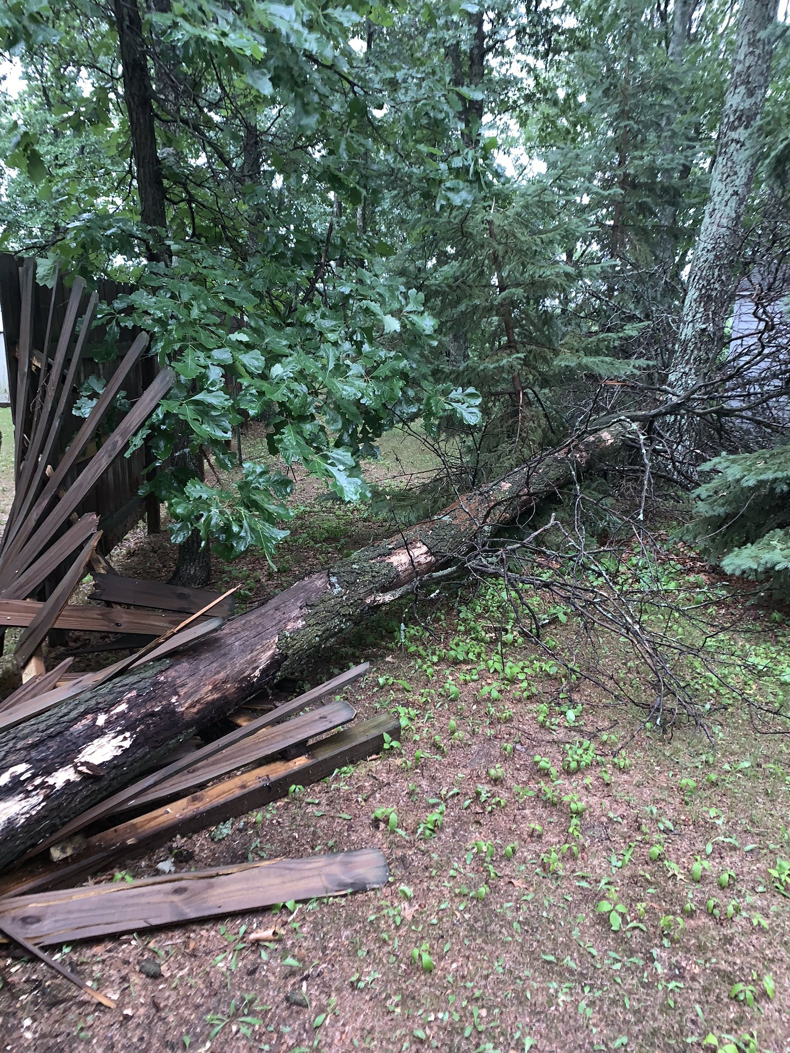
Damage to a home near CR 22 and 108 (source: Crow Wing EM) |
Damage to a home near CR 22 and 108 (source: Crow Wing EM) |
 |
 |
 |
| Damage to a home near CR 22 and 108N (source: Crow Wing EM) |
Damage to a home near CR 22 and 108 (source: Crow Wing EM) |
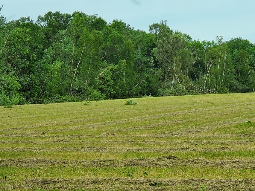
Tornadic tree damage near Pine Center (source: Melissa Rhuby Raddatz) |
Video of the tornado looking southeast from CR23 and Thompson Road near South Long Lake
(Source: Michael Solie)
Video of the tornado near Garrison, MN
(Source: Caitlin Scott)
Photos
Storm Structure and Damage Photos
 |
 |
 |
 |
| 2NW Marengo, WI (source: Meagan Wilson Van Beest) |
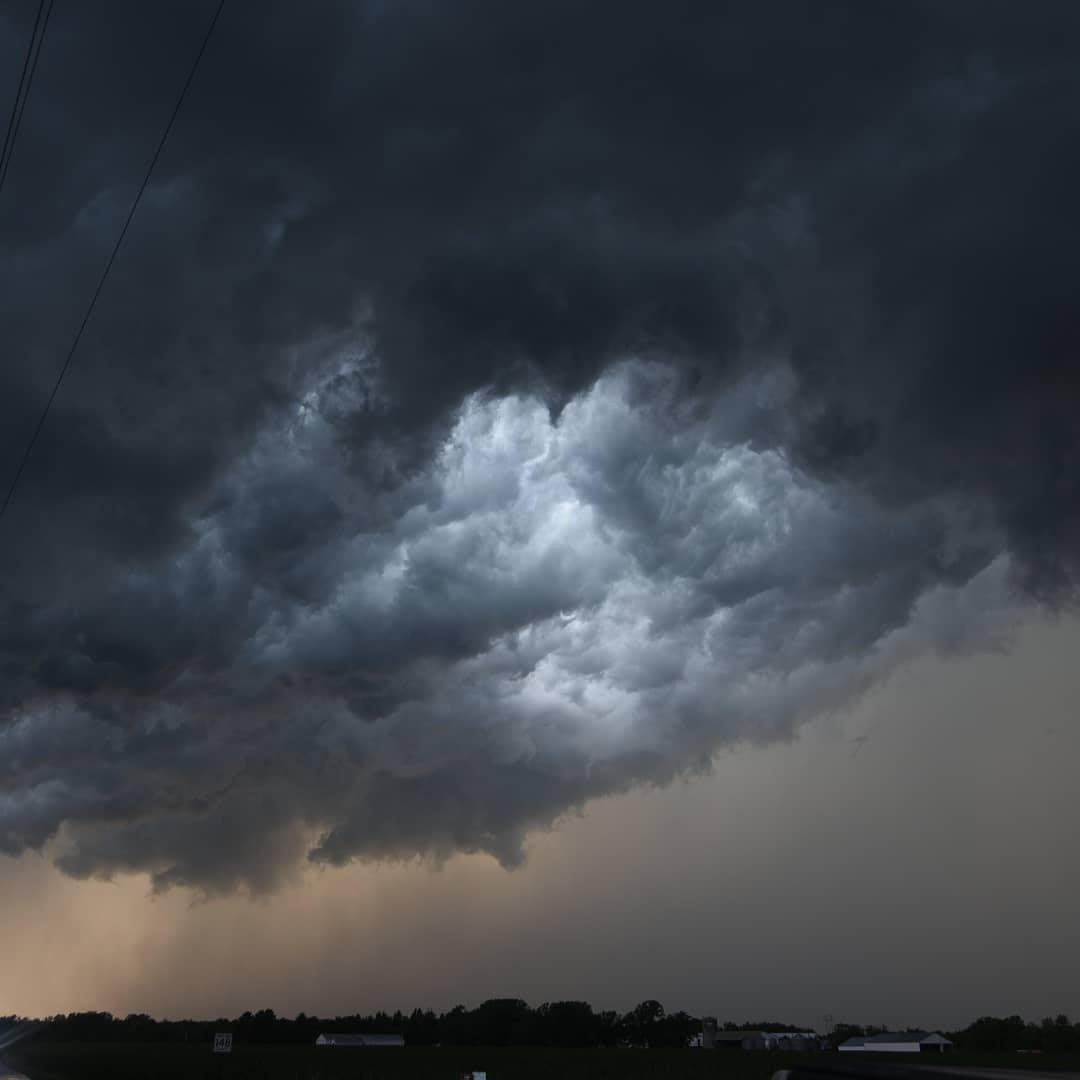
Near Brainerd Cty 23 and 148SE (source: Jessica Kowalke) |
Near Brainerd Cty 23 and 148SE (source: Jessica Kowalke) |
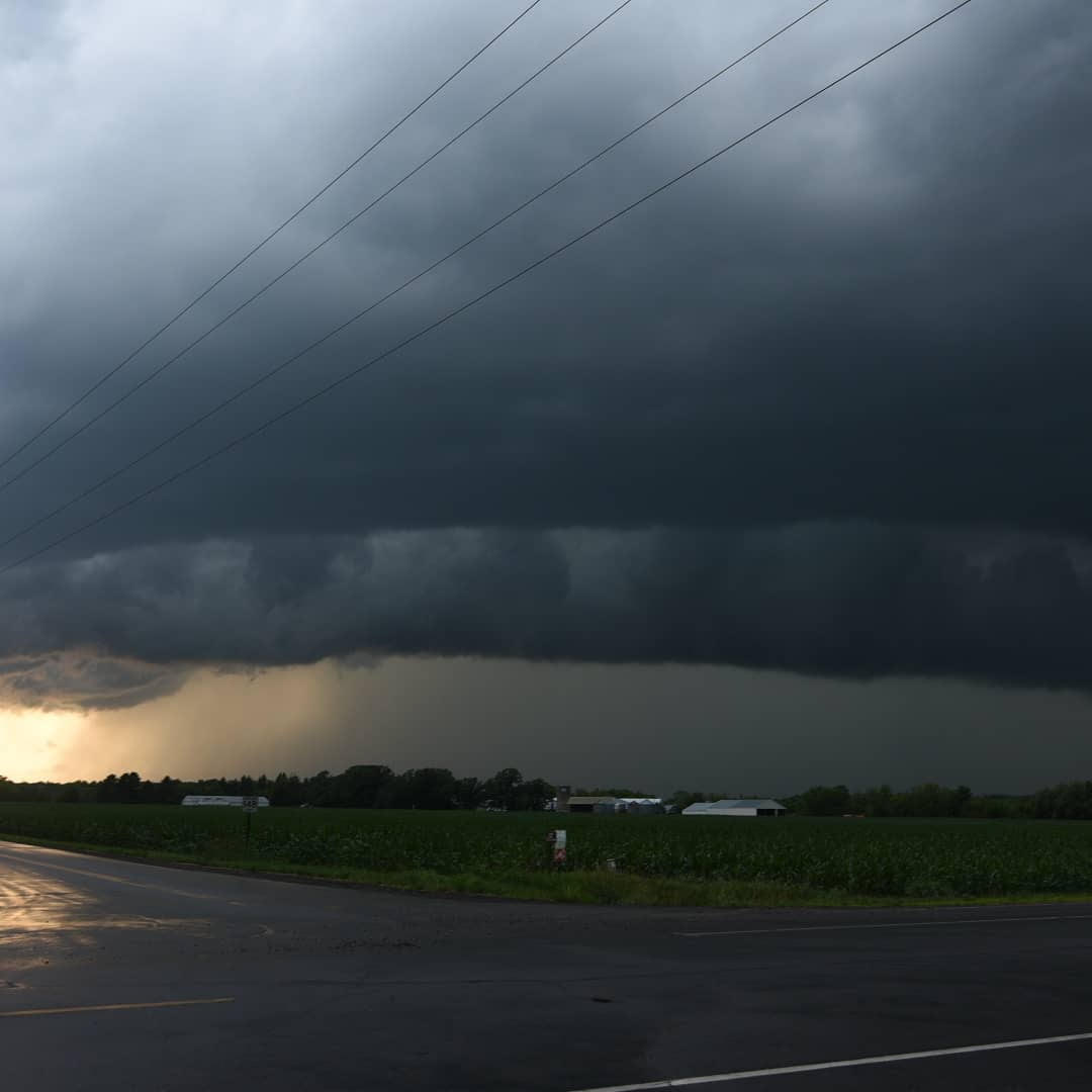
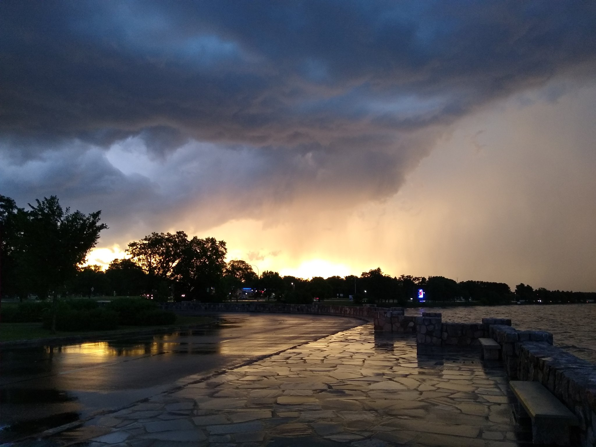
Near South Long Lake, MN (source: Chelsey Perkins) |
 |
 |
 |
 |
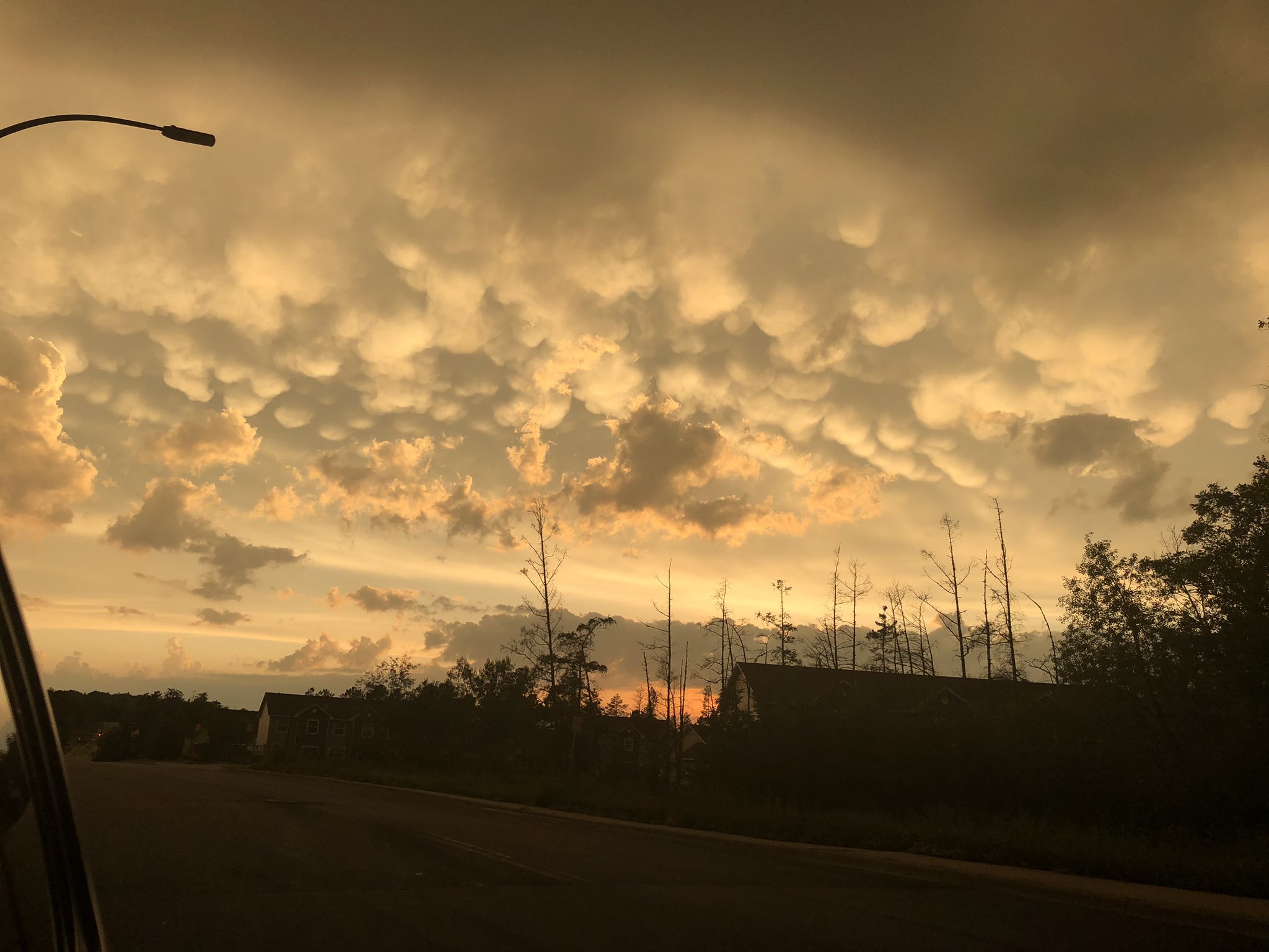
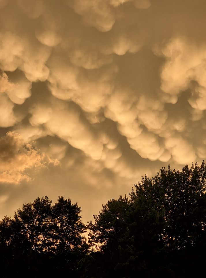
| Mammatus clouds near Coleraine, MN (source: Easton Siekkinen) |
Mammatus clouds near Grand Rapids, MN (source: Sarah Jane) |
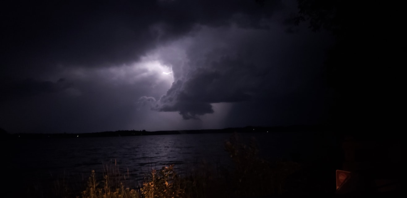
The tornadic storm moving over Garrison and Lake Mille Lacs (source: CM Storm Chaser) |
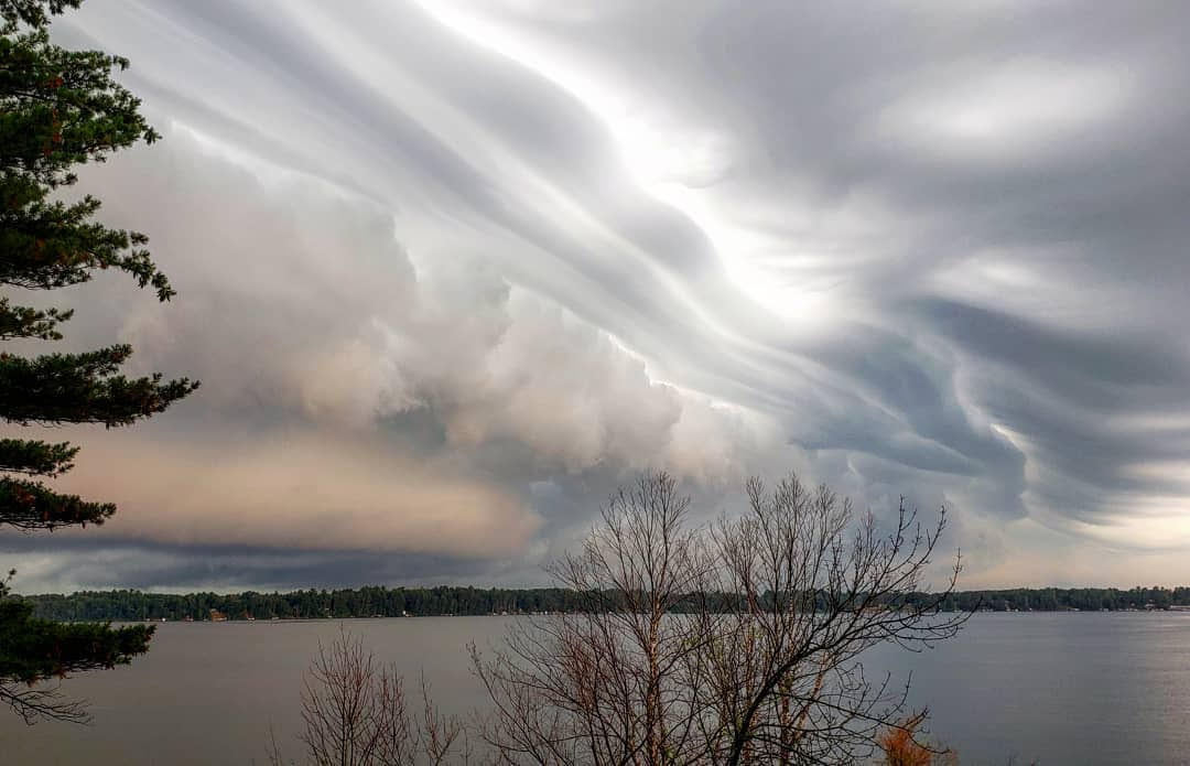
Shelf cloud from the morning storms over Devils Lake in Webster, WI (source: Tammy Ingalls) |
 |
 |
 |
 |
| One of the early morning storms over Buck Lake near Nashwauk, MN (source: Steven Washburn) |
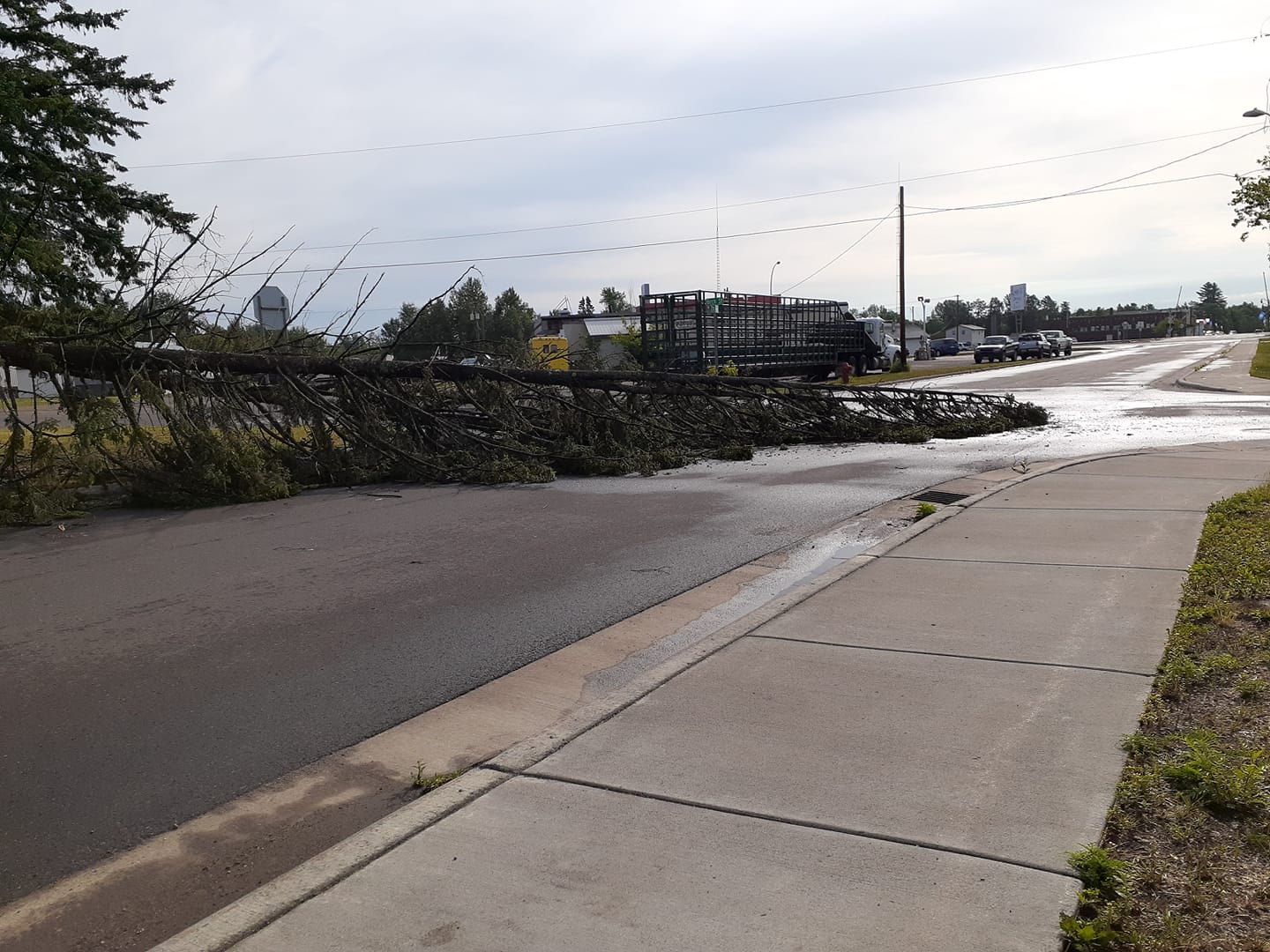
Tree damage from the early morning storms in Sylvan Twp. in Cass County, MN (source: Randy Aldous) |
Tree damage from the early morning storms in Sylvan Twp. in Cass County, MN (source: Randy Aldous) |
A tree downed during the early morning storms in Floodwood, MN (source: Tanya Forest) |
Hail Photos
 |
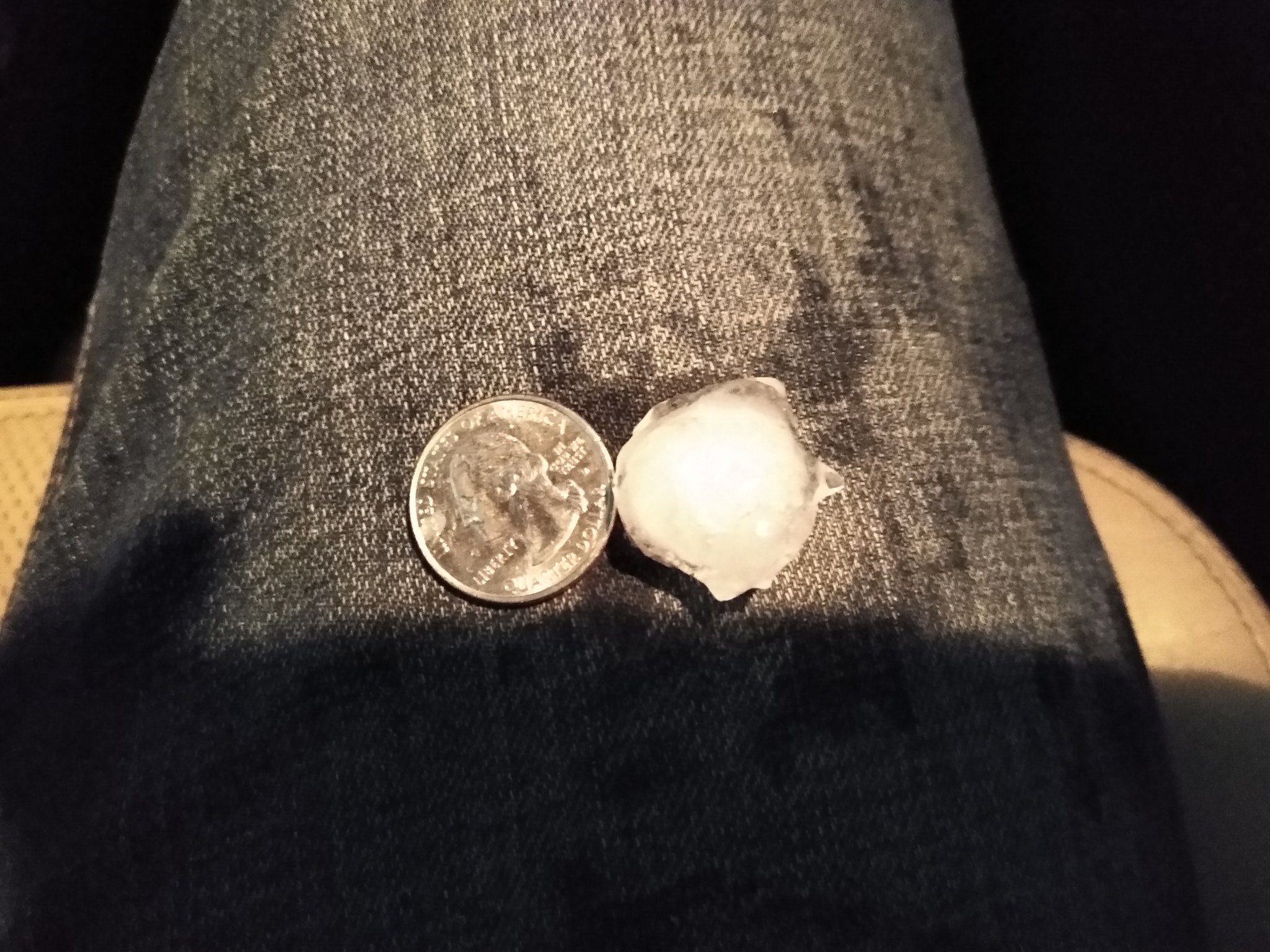 |
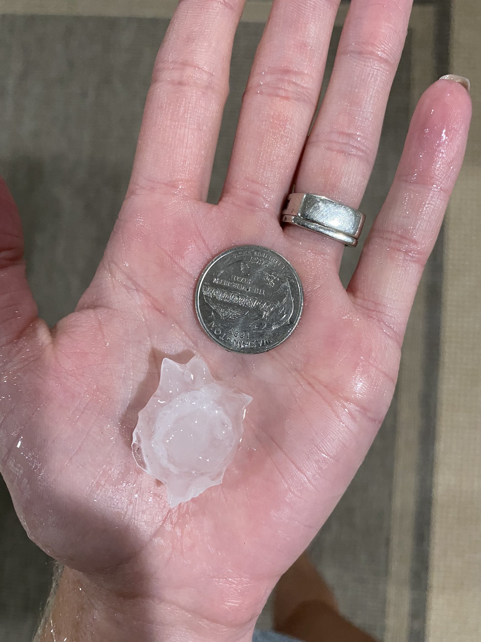
| Iron River, WI (source: Brooke Trettin) |
6NE Garrison, MN (source: CM Storm Chaser) |
Storm Reports
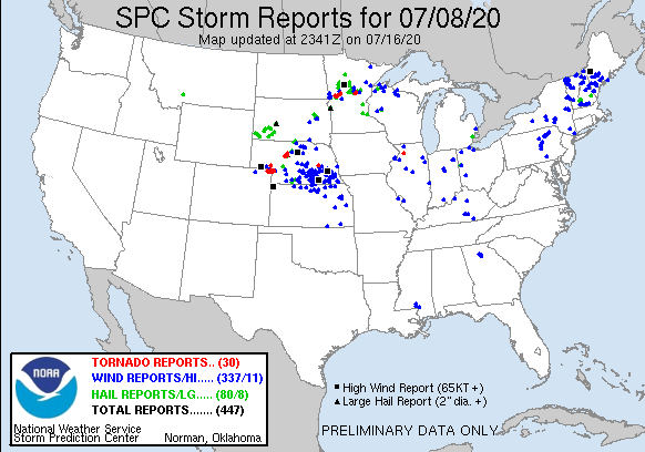
Click the image above for Storm Reports from around the country.
...HAIL REPORTS...

Location                     Size      Time/Date       Provider
4 NE Garrison                1.25 in   0807 PM 07/08   Public
6 S Woodrow                  1.00 in   0650 PM 07/08   Public
8 SE Brainerd                1.00 in   0704 PM 07/08   Trained Spotter
3 E Motley                   1.00 in   0714 PM 07/08   Trained Spotter
1 NNE Lake Shore             1.00 in   0945 PM 07/08   Trained Spotter
Backus                       1.00 in   0105 AM 07/09   Law Enforcement
1 N Solon Springs            0.88 in   0722 PM 07/08   Public
6 ESE Deerwood               0.88 in   0832 PM 07/08   Trained Spotter
6 W Warba                    0.75 in   0216 AM 07/09   Trained Spotter
Brainerd                     0.70 in   0730 PM 07/08   Trained Spotter
1 NW Motley                  0.70 in   0856 PM 07/08   Trained Spotter
Esko                         0.70 in   0912 PM 07/08   Public
Leader                       0.70 in   0922 PM 07/08   Public
2 S Rutledge                 0.70 in   0930 PM 07/08   Public
1 NNE Cloquet                0.70 in   0342 AM 07/09   Trained Spotter
8 NNE Island Lake            0.50 in   0900 PM 07/08   Trained Spotter
4 W Mission                  0.50 in   0903 PM 07/08   Trained Spotter
Esko                         0.50 in   0917 PM 07/08   Public
2 SSW Crosslake              0.50 in   1013 PM 07/08   Public
4 SW Crosslake               0.50 in   1020 PM 07/08   Trained Spotter
3 NE Hermantown              0.50 in   0253 AM 07/09   NWS Employee
2 ENE West Duluth            0.25 in   0347 PM 07/08   Trained Spotter
7 W Solon Springs            0.25 in   0649 PM 07/08   Trained Spotter
1 NNW Brainerd               0.25 in   0722 PM 07/08   Trained Spotter
Iron River                   0.25 in   0742 PM 07/08   Public
Ashland                      0.25 in   0750 PM 07/08   Trained Spotter
1 NW Motley                  0.25 in   0852 PM 07/08   Trained Spotter
Breezy Point                 0.25 in   1008 PM 07/08   Public
1 SW Cloquet                 0.25 in   0340 AM 07/09   Trained Spotter
1 NNE Duluth                 0.25 in   0400 AM 07/09   Trained Spotter

...HIGHEST WIND REPORTS...

Location                     Speed     Time/Date       Provider
3 SW Ashland                 60 MPH    1039 PM 07/08   ASOS
3 NE Hermantown              51 MPH    0354 AM 07/09   Official NWS Obs
Rain Reports
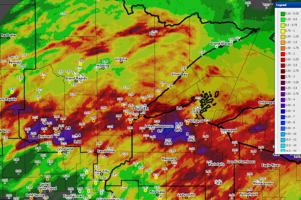 |
Location                     Amount    Time/Date       Provider
1 SSE Lake Nebagamon         6.70 in   0758 AM 07/09   Trained Spotter
Breezy Point                 4.00 in   1030 AM 07/09   Public
6 ESE Grand View             3.92 in   0700 AM 07/09   Cocorahs
1 SE Malmo                   3.38 in   0800 AM 07/09   CO-OP Observer
Phillips                     3.29 in   0855 AM 07/09   AWOS
10 NW Drummond               3.16 in   1012 PM 07/08   Cocorahs
6 NW Ino                     3.15 in   0802 AM 07/09   Mesonet
1 WSW Sanborn                3.00 in   1036 PM 07/08   Trained Spotter
Oulu                         2.94 in   0949 AM 07/09   Trained Spotter
2 SSW Deerwood               2.88 in   0700 AM 07/09   Cocorahs
Pequot Lakes                 2.75 in   1116 AM 07/09   Trained Spotter
2 S Hawthorne                2.65 in   0700 AM 07/09   Cocorahs
3 NNW Mellen                 2.60 in   0700 AM 07/09   Cocorahs
4 SSE Herbster               2.50 in   0658 AM 07/09   Trained Spotter
Ashland                      2.50 in   0902 AM 07/09   Mesonet
Ashland                      2.45 in   0700 AM 07/09   Cocorahs
8 W Solon Springs            2.32 in   0600 AM 07/09   Cocorahs
1 NE Proctor                 2.25 in   1021 AM 07/09   Public
4 WSW Cloquet                2.23 in   0830 AM 07/09   CO-OP Observer
1 S Pleasant Valley          2.22 in   0800 AM 07/09   Mesonet
1 N Aitkin                   2.20 in   0645 AM 07/09   Mesonet
3 WNW Clam Lake              2.18 in   0650 AM 07/09   Cocorahs
1 SW Lester Park             2.16 in   0600 AM 07/09   Cocorahs
Superior                     2.15 in   0730 AM 07/09   Trained Spotter
Glidden                      2.10 in   0909 AM 07/09   Mesonet
4 ESE Casino                 2.01 in   0630 AM 07/09   Cocorahs
Hill City                    2.00 in   1111 AM 07/09   Public
2 S Manitowish               1.80 in   1030 PM 07/08   Trained Spotter
1 S Duluth                   1.75 in   0842 AM 07/09   Trained Spotter
Clam Lake                    1.69 in   1103 AM 07/09   Public
3 NW Nisswa                  1.63 in   0832 AM 07/09   Trained Spotter
3 ESE Kimberly               1.62 in   0920 AM 07/09   Cocorahs
2 SW Iron Junction           1.40 in   0738 AM 07/09   Trained Spotter
4 S Superior                 1.40 in   0844 AM 07/09   Public
4 SE Britt                   1.07 in   0834 PM 07/08   Trained Spotter
2 E Iron Junction            0.90 in   1032 PM 07/08   Trained Spotter
3 N Brainerd                 0.87 in   0803 PM 07/08   Trained Spotter
5 S Herbster                 0.50 in   0822 PM 07/08   Trained Spotter
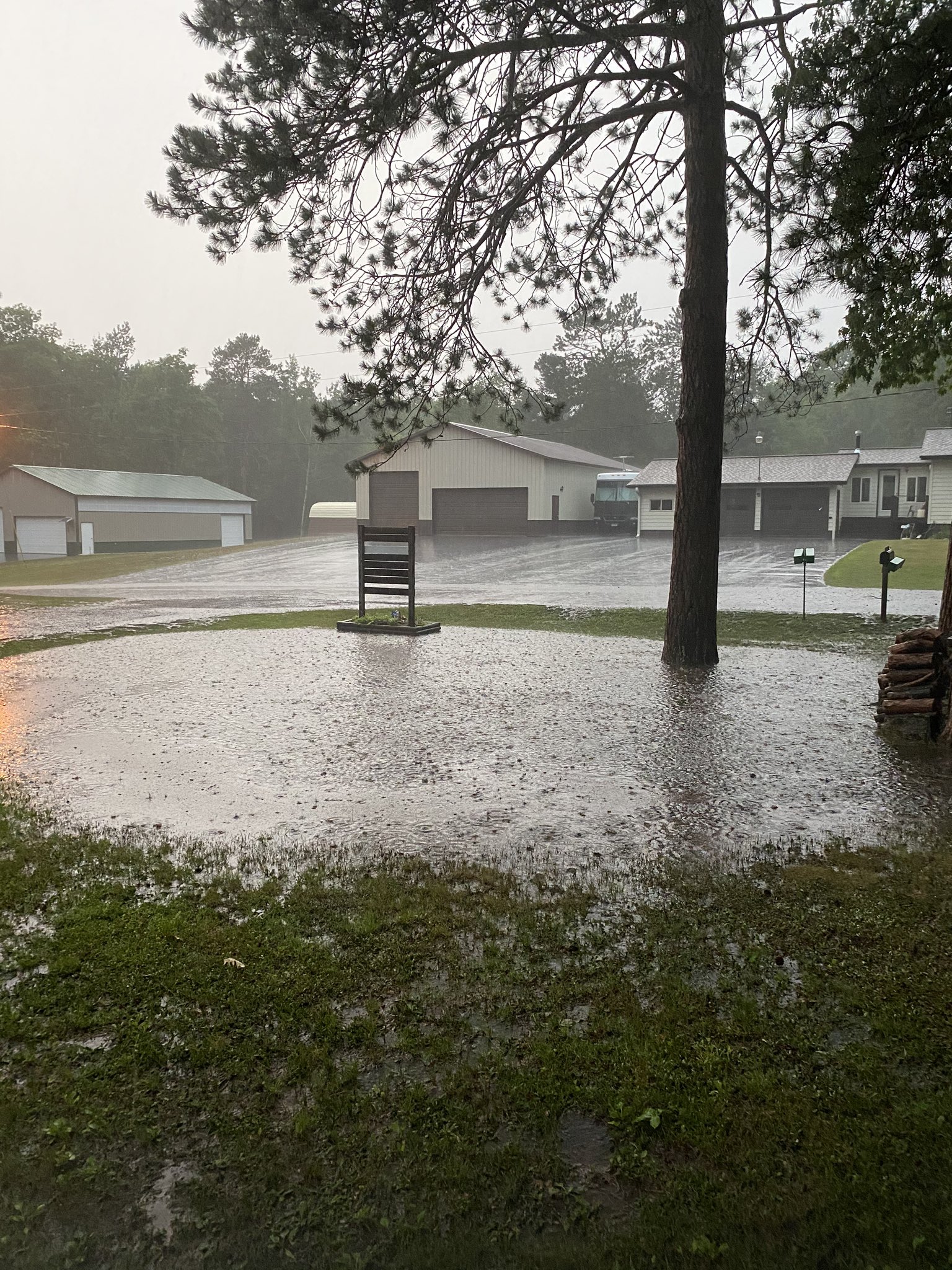
Photos
 |
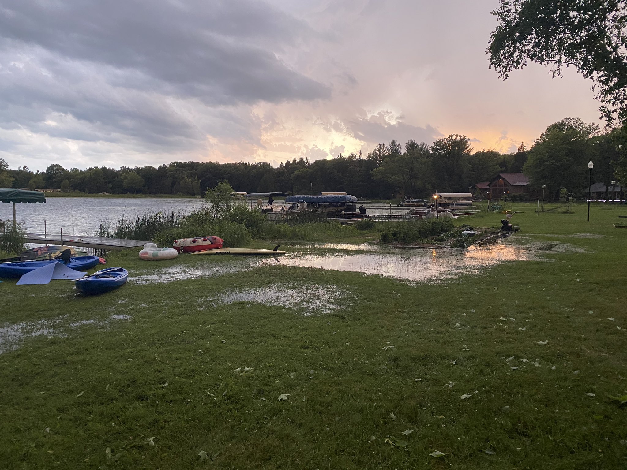 |
| Flooding in Iron River, WI (Source: Brooke Trettin) |
Flooding in Deerwood, MN (Source: Griffin Geving) |
Environment
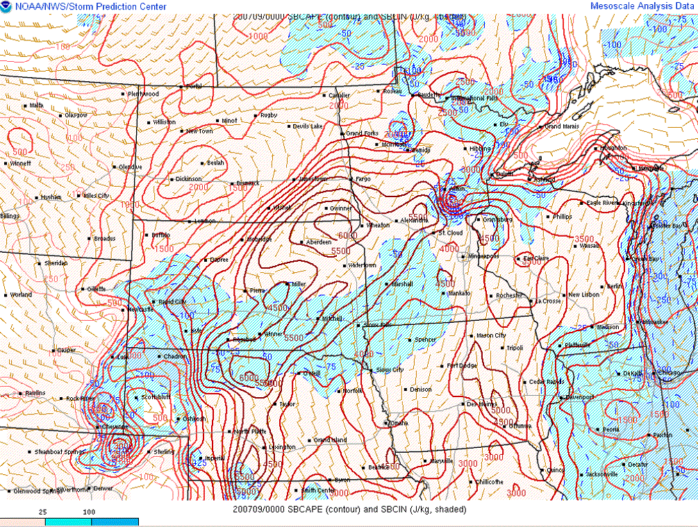
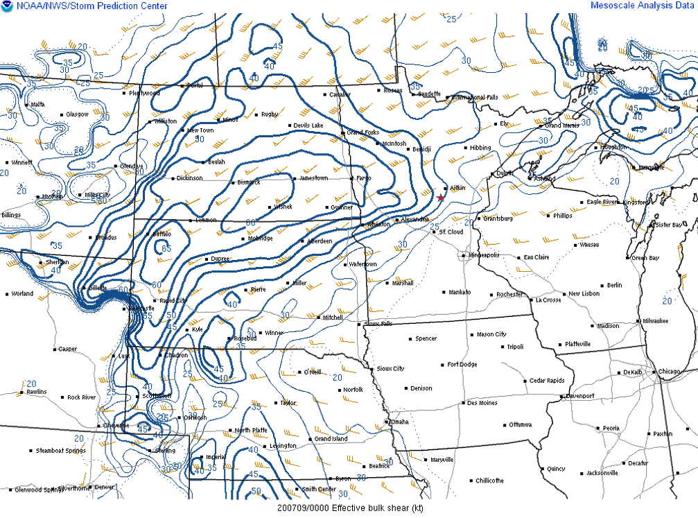
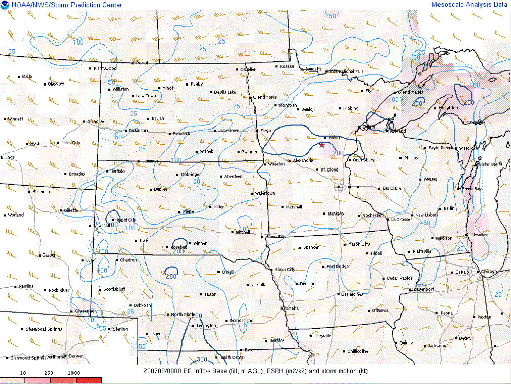
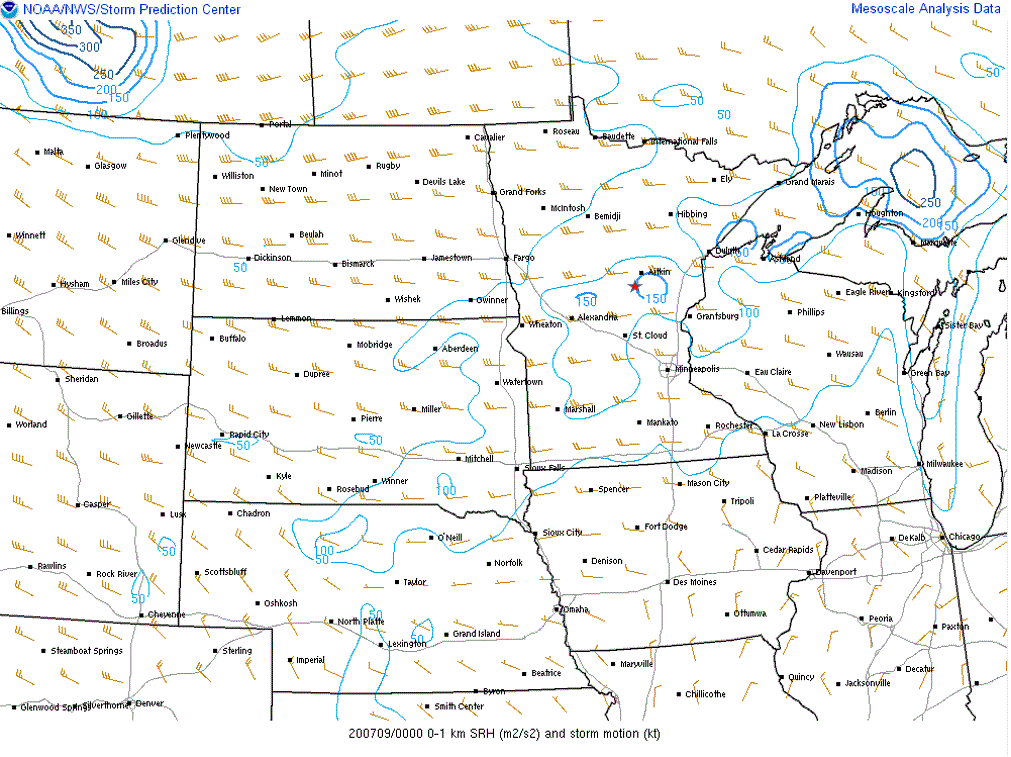
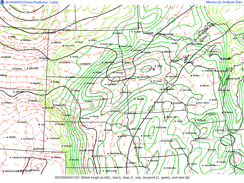
A surface cold front approaching the region from the west along with a warm front lifting into the southern reaches of the CWA became the focal points for severe weather the evening of July 8, 2020. A low level jet of 25 to 35 knots, a negatively tilted upper wave and a jet streak passing overhead acted to provide lift and the mechanisms for storm longevity. MLCAPE values of 1500-3000 J/kg were observed across parts of the region along with deep layer shear of 25 to 35 kts (peaking near 40 to 50 knots in the Brainerd Lakes area), which supported some discrete storms early on before upscale growth into clusters of storms as the evening progressed. Storms developed during the late afternoon and evening hours in this airmass that was quite supportive of severe storms. Once cell in southern Crow Wing County near the warm front was able to tap into higher SRH to produce a tornado between Brainerd and Garrison in an airmass that was very similar to the one in which the EF-4 tornado occurred earlier near Dalton, Minnesota, about 90 miles to the west. Storms then continued into the early morning hours producing mainly hail and heavy rainfall before weakening.
 |
 |
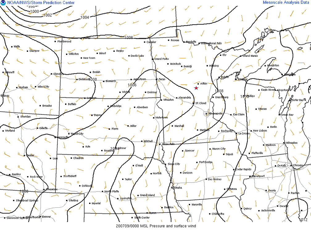 |
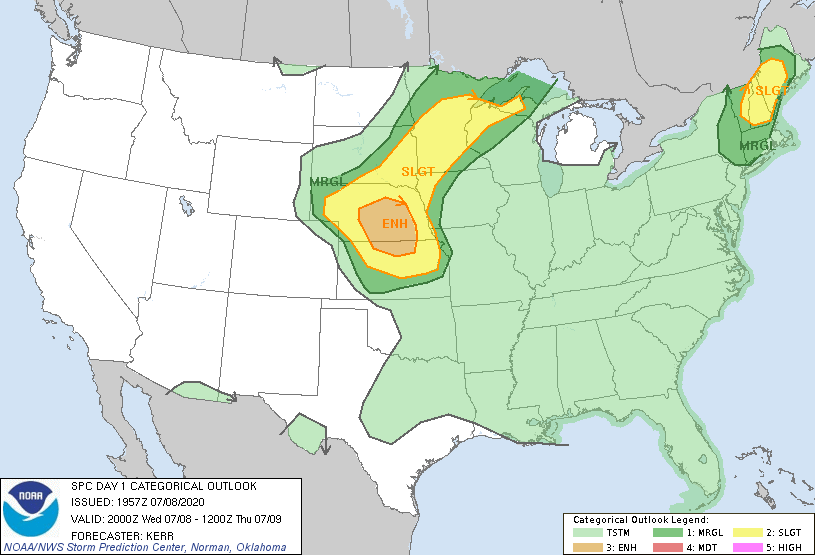
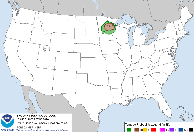
| Figure 1: SPC Day 1 outlook issued at 4 PM CDT. | Figure 2: SPC Day 1 tornado outlook issued at 4 PM CDT. | Figure 3: 00z Mean SLP and Surface Winds |
Near-storm environment:
 |
 |
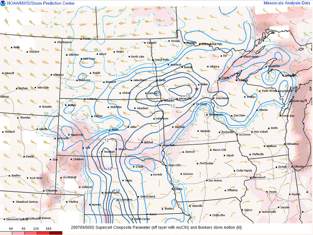 |
| Figure 4: 00z Surface-based CAPE analysis | Figure 5: 00z Effective Bulk Shear analysis | Figure 6: 00z Supercell Composite parameter |
 |
 |
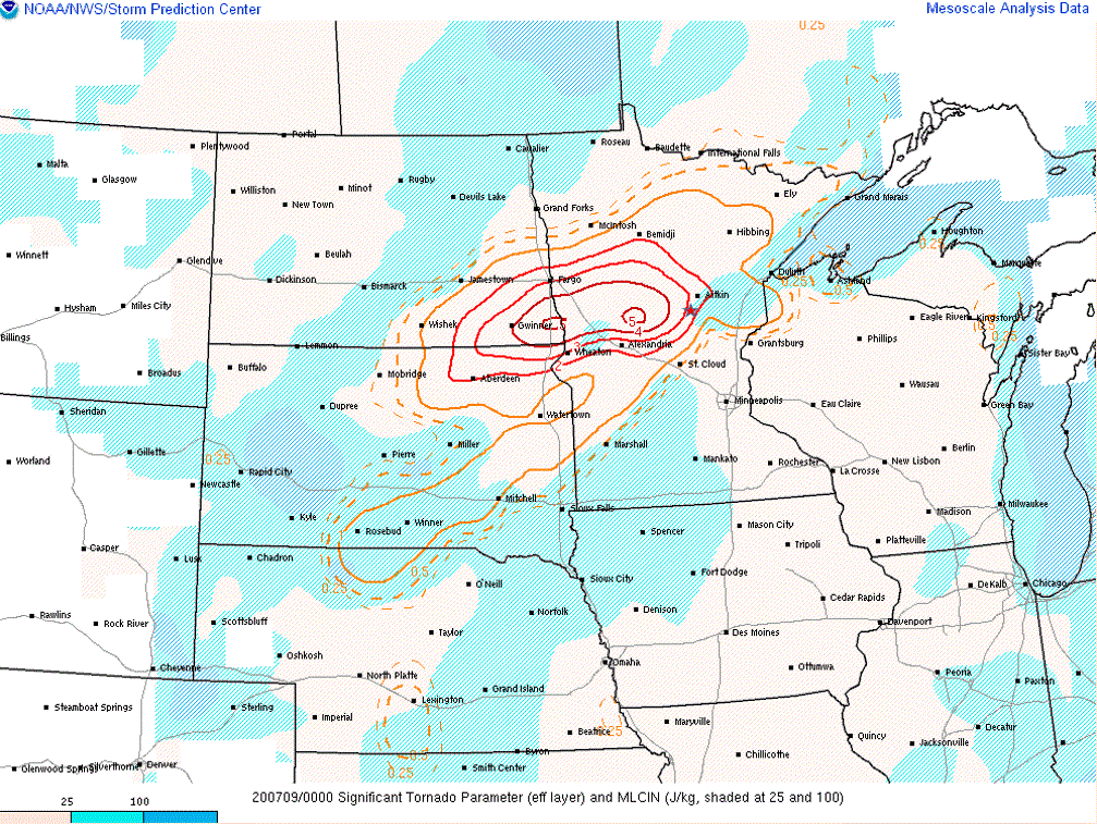 |
| Figure 7: 00z Effective Helicity analysis | Figure 8: 00z 0-1km Storm Relative Helicity | Figure 9: 00z Significant Tornado Parameter (effective layer) |
Additional upper-air data:
 |
 |
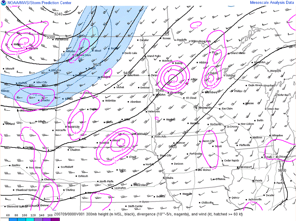 |
| Figure 10: 00z 850mb analysis | Figure 11: 00z 500mb analysis | Figure 12: 00z 300mb analysis |
 |
Media use of NWS Web News Stories is encouraged! Please acknowledge the NWS as the source of any news information accessed from this site. |
|