Click for 25th Anniversary StoryMap
Documenting the July 4, 1999 BWCA Derecho
20th Anniversary of the Boundary Waters Canoe Area (BWCA) Blowdown Event
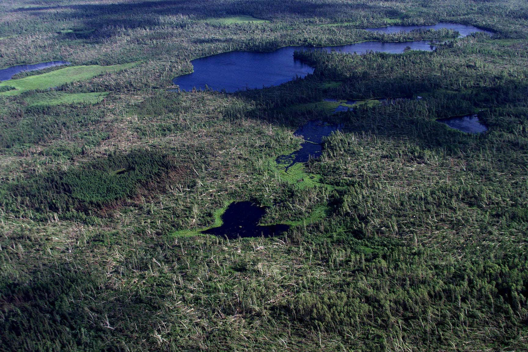
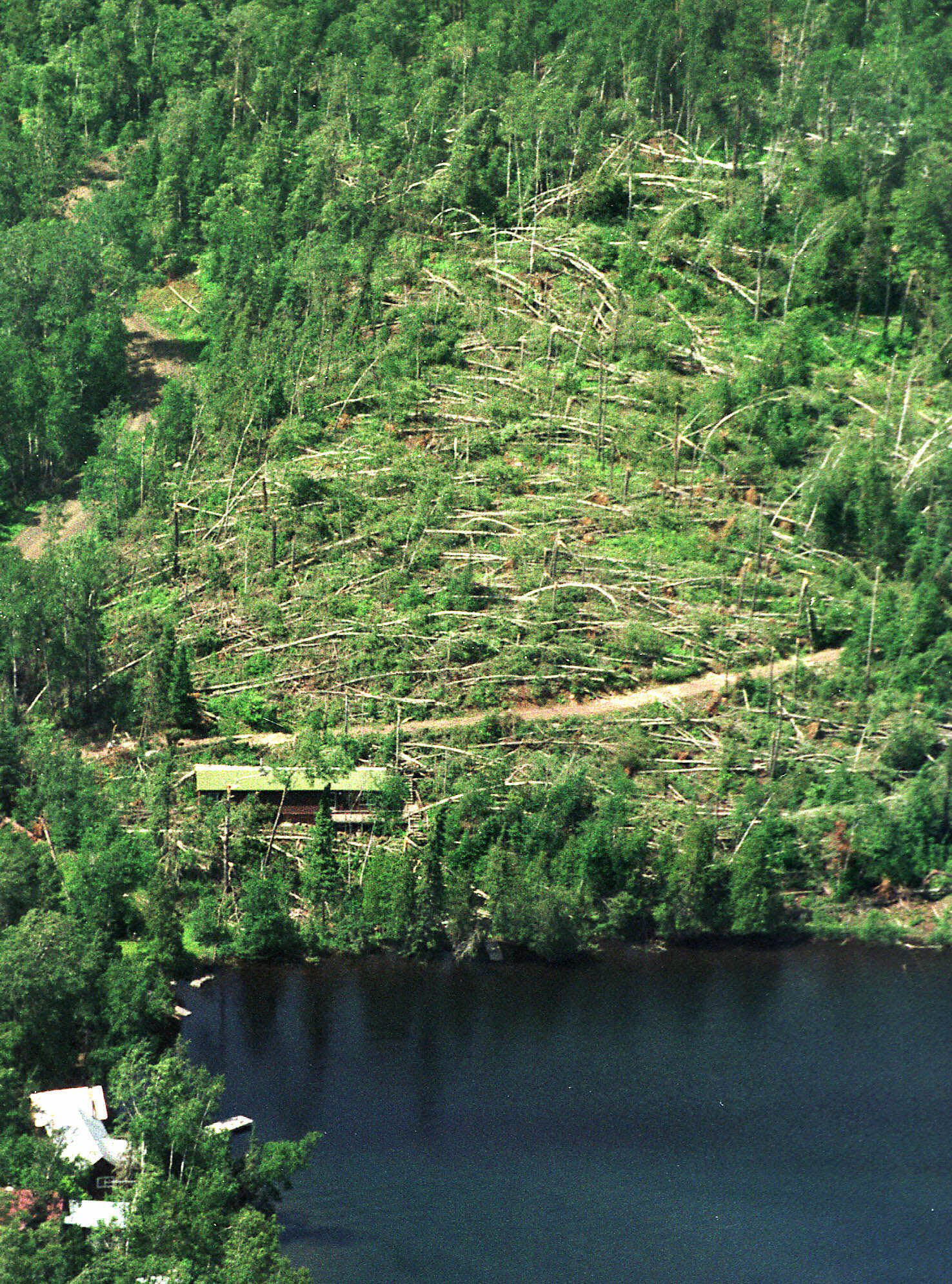
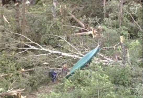
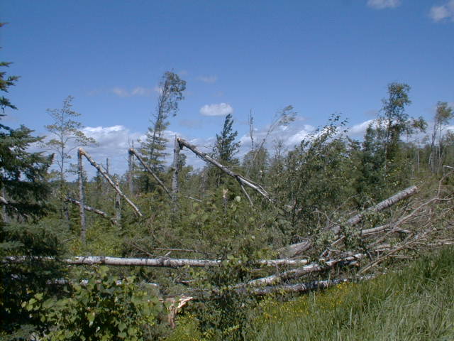
July 4, 2019 will mark the 20th anniversary of the historic Boundary Waters Canoe Area (BWCA) Blowdown event, which occurred over the midday hours of Sunday, July 4, 1999 across far northern Minnesota. This event has become part of Minnesota weather lore in the 20 years since its occurrence, and likely represents a benchmark for something very near the extreme that the atmosphere is capable of producing. In the blowdown event, nearly 500,000 acres of the Superior National Forest were almost completely flattened by intense thunderstorm winds estimated to have been between 80 and 100 mph, and hundreds of campers and paddlers that were in the Boundary Waters for the Independence Day Holiday Weekend were stranded in a maze of fallen trees and debris - many of them injured and in desperate need of assistance, only to be faced with the fact that all the ways in and out of the Boundary Waters were blocked by miles of fallen large trees.
Radar:
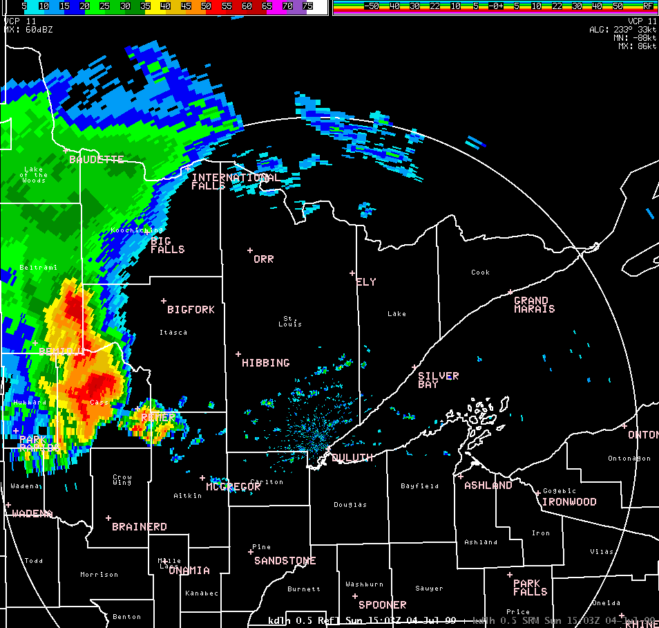
Loop of radar reflectivity from the Duluth (KDLH) radar of the derecho moving through northeast Minnesota
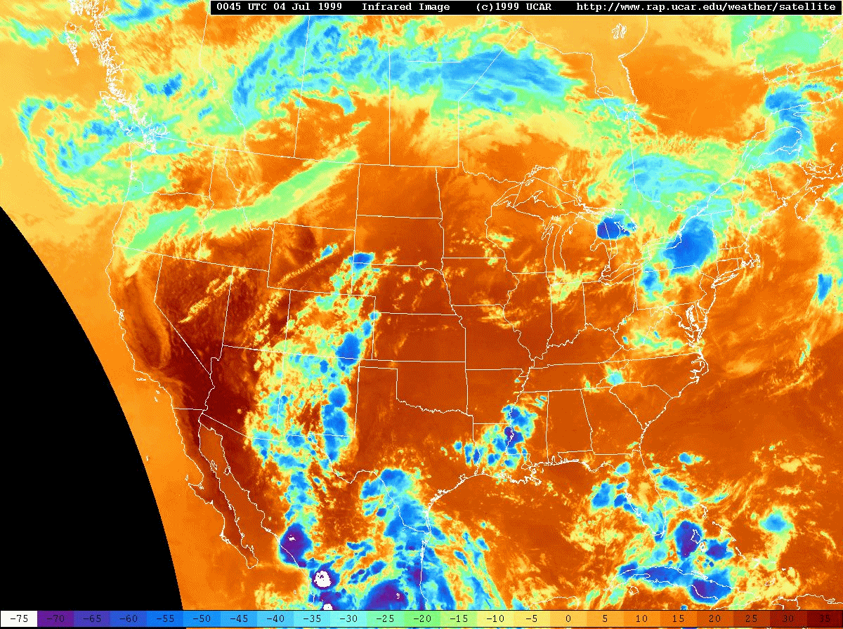
Satellite:
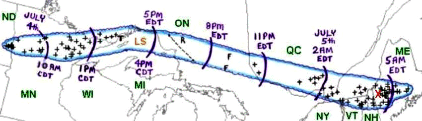
The extreme wind event in the Boundary Waters was only a small part of a much larger and very long-lived severe wind event that affected parts of both the United States and Canada, including 7 States, and 2 Canadian Provinces. During the evening hours of Saturday July 3, 1999, a cluster of thunderstorms called a mesoscale convective system, or MCS, formed over southwest South Dakota and moved northeastward into southeast North Dakota during the overnight hours of July 3-4. During the early morning hours of July 4, 1999, this MCS intensified, and became highly organized while accelerating its eastward movement to nearly 60 mph. As the MCS passed across Fargo, North Dakota between 7 and 8 AM, winds gusted over 58 mph for nearly 40 minutes, with a peak wind gust of 91 mph at 743 AM, with significant damage noted. The MCS then continued its east-northeastward movement across northern Minnesota, producing widespread wind damage, culminating with the Boundary Waters blowdown between 11 AM and 2 PM on July 4. Thereafter, the derecho-producing MCS continued to move eastward at around 60 mph across Ontario, producing widespread and significant wind damage in the Timmins, Ontario region, reaching the Montreal, Quebec area around 5 AM on the morning of July 5, 1999 producing significant wind damage to trees and structures, as well as widespread power outages. Finally, the thunderstorm complex moved back into the United States later during the morning of July 5, continuing to produce wind damage and power outages across parts of far northern New York State, Vermont, New Hampshire, and southern Maine.
All in all, the July 4-5, 1999 derecho-producing MCS lasted for approximately 22 hours, traveled over 1300 miles with an average forward speed of between 60 and 65 mph, and produced widespread devastation along most of its path, including around 70 injuries, 2 deaths, nearly $100 million in damage (~$153 million in 2019 dollars) and around 700,000 power outages across the affected areas of the United States and Canada.
Some of the damage accounts as noted by the U.S. Storm Prediction Center (SPC):
"Severe wind damage continued to occur as the derecho moved across central and northern Minnesota (MN). Damage in Cass, Itasca, and Aitkin Counties exceeded three million (1999 U. S. dollars), and several campers were injured in the Walker-Leech Lake area. As the thunderstorm complex moved across St. Louis County, a wind gust of 81 mph was recorded at the Chisholm-Hibbing Airport, and the terminal building and hanger suffered damage. A semi-trailer truck was blown over on U.S. Highway 53 near Canyon, Minnesota, just northwest of Duluth.
As the derecho-producing MCS raced eastward into the Arrowhead region of northeast Minnesota during the early afternoon of July 4th, many injuries occurred despite the low population density of this heavily forested area. Because it was Independence Day weekend, many people had traveled to the Boundary Waters Canoe Area (BWCA) to enjoy canoeing and camping. Winds estimated at 80 to 100 mph moved rapidly through the area, causing serious damage to 600 square miles of forest in the Arrowhead region. Tens of millions of trees were blown down. Sixty people in the BWCA were injured by falling trees, some seriously. Twenty of those injured were rescued by float planes flying to lakes located in the forest near the victims."
Damage Photos:
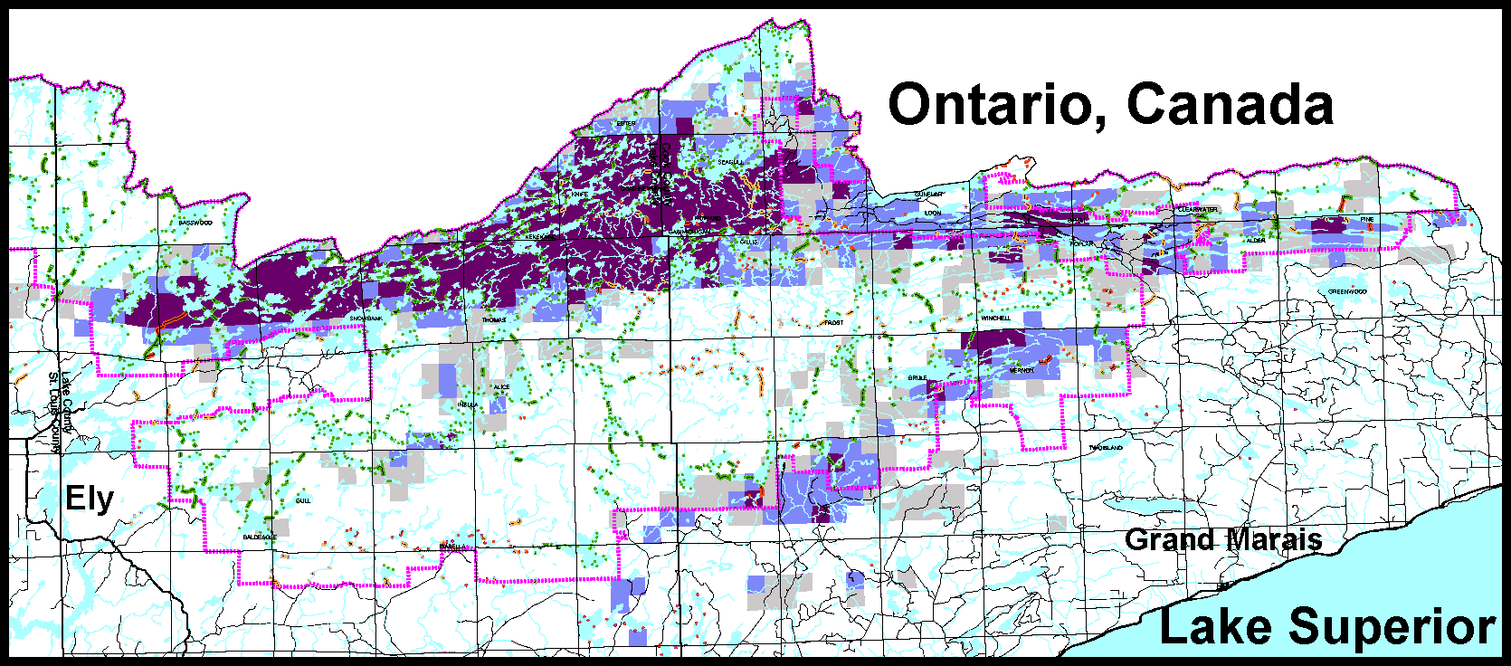
Caption: Amount of trees blown down per 1 mile in the Superior National Forest surveyed by a post storm overflight. Legend: Gray = 0-33%, Light purple = 34-66%, Purple = 67-100%
Stories:
Video: "Science Bulletins: Derecho" by the American Museum of Natural History created December 2003
WTIP: "The 1999 Blowdown Storm: Looking Back After 20 Years"
MPRNEWS: "Ten Years After Blowdown, Boundary Waters Still Recovering"
References:
July 4-5, 1999 Derecho: "The Boundary Waters - Canadian Derecho" by the National Weather Service Storm Prediction Center
Boundary Waters Windstorm, the Blowdown of July 4, 1999 by the National Weather Service, Weather Forecast Office, Duluth, MN

