Duluth, MN
Weather Forecast Office
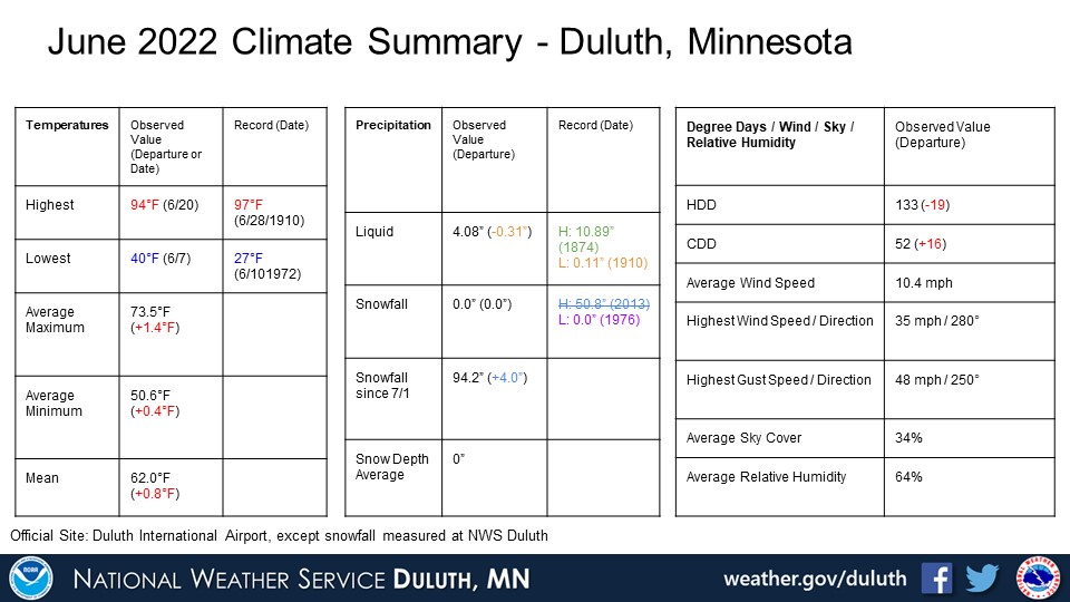
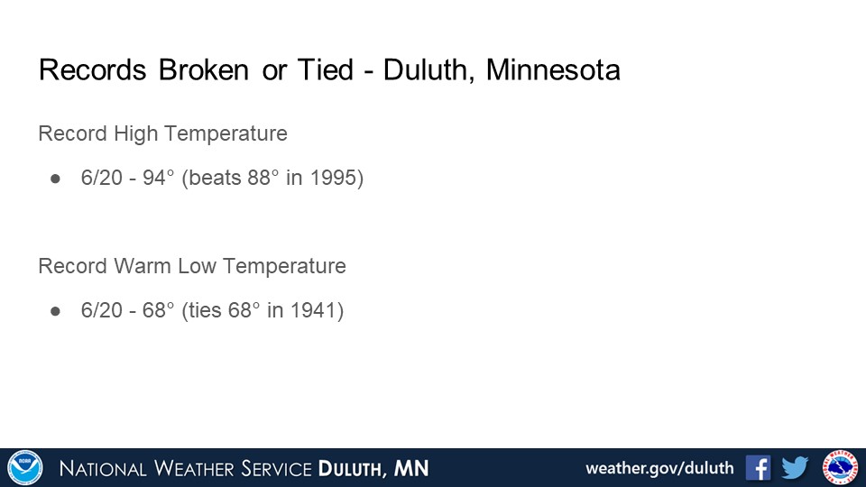
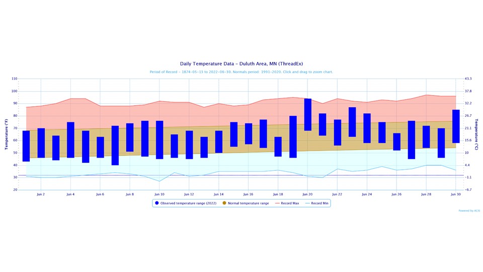
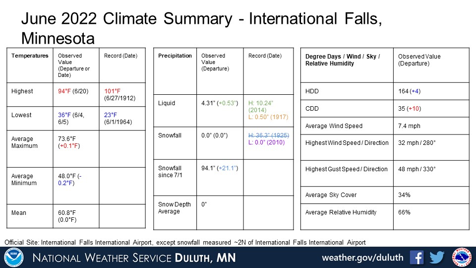
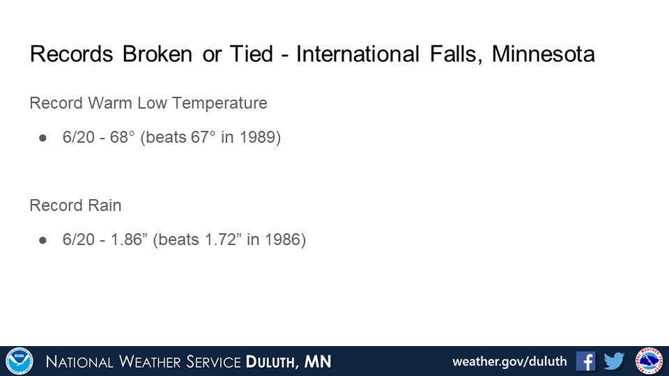
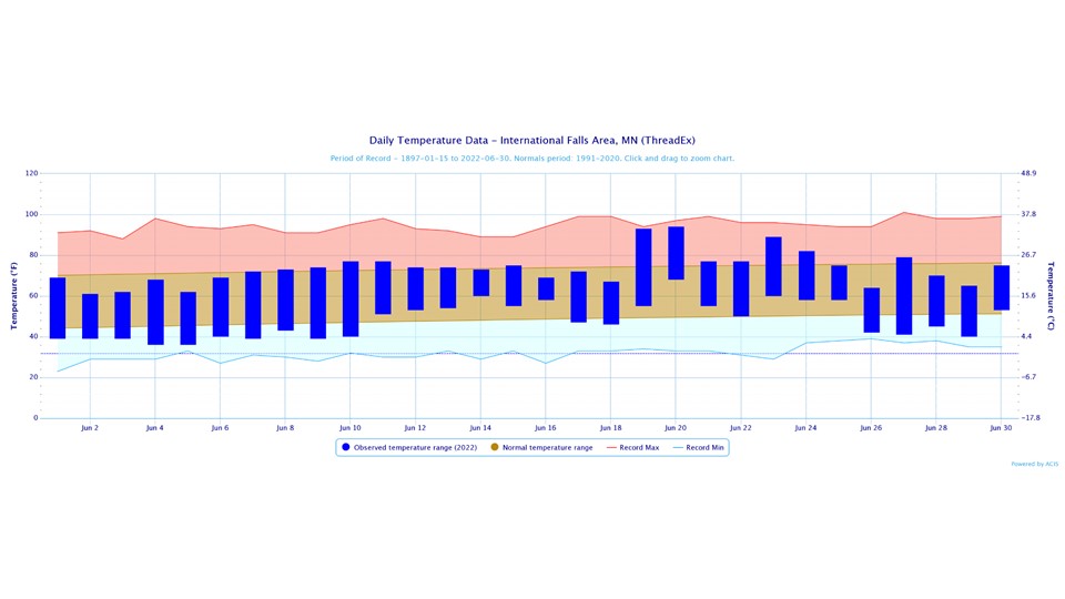
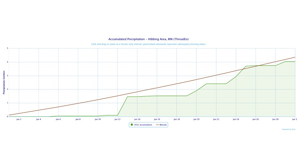
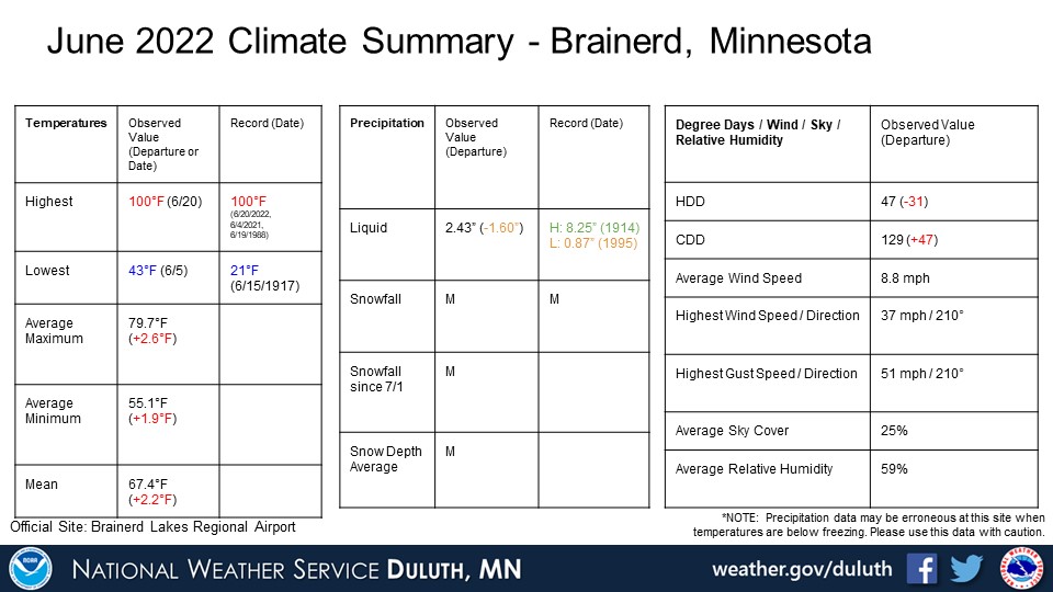
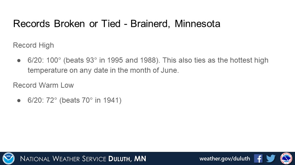
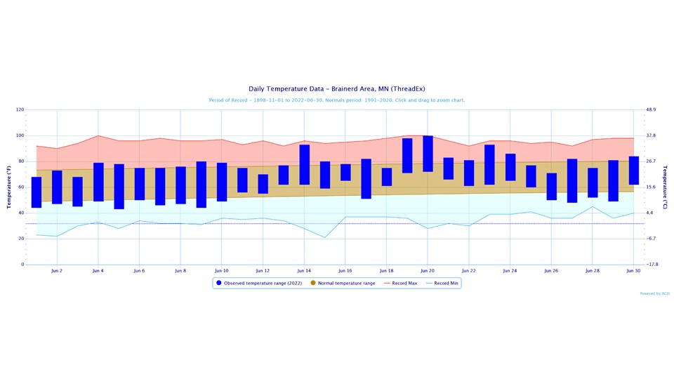
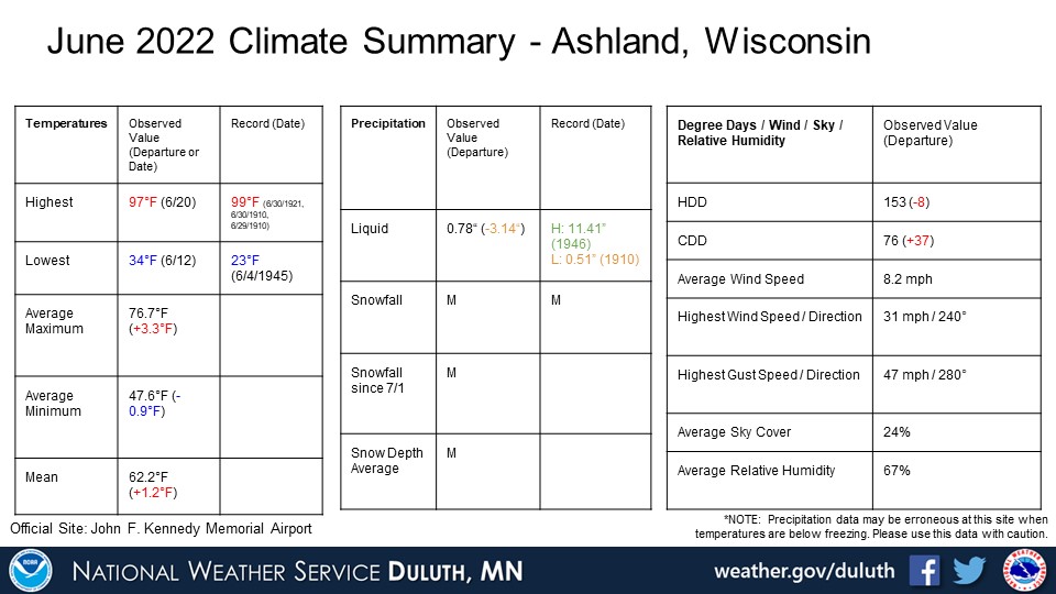
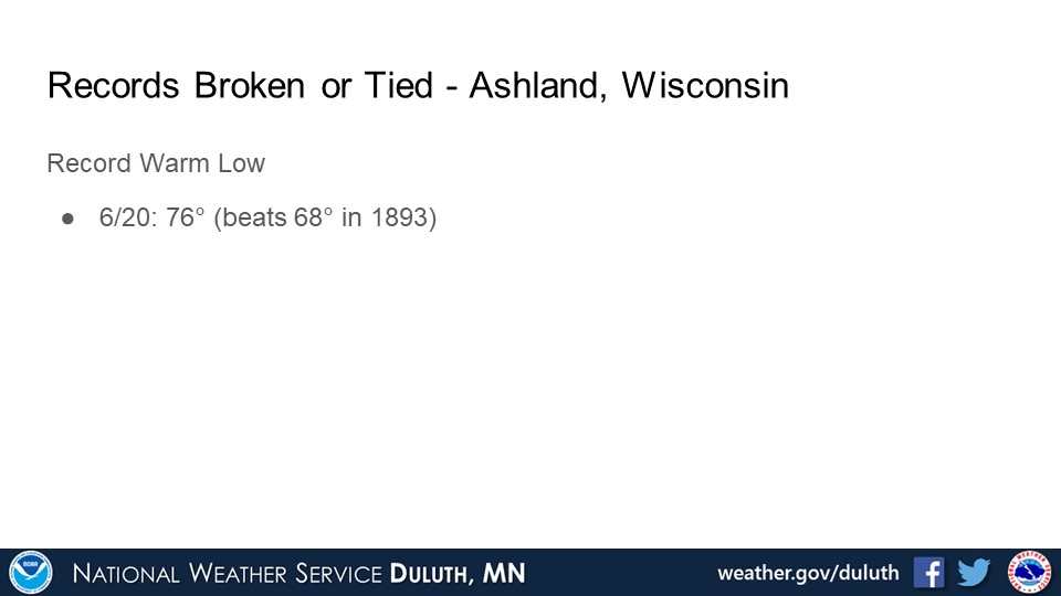
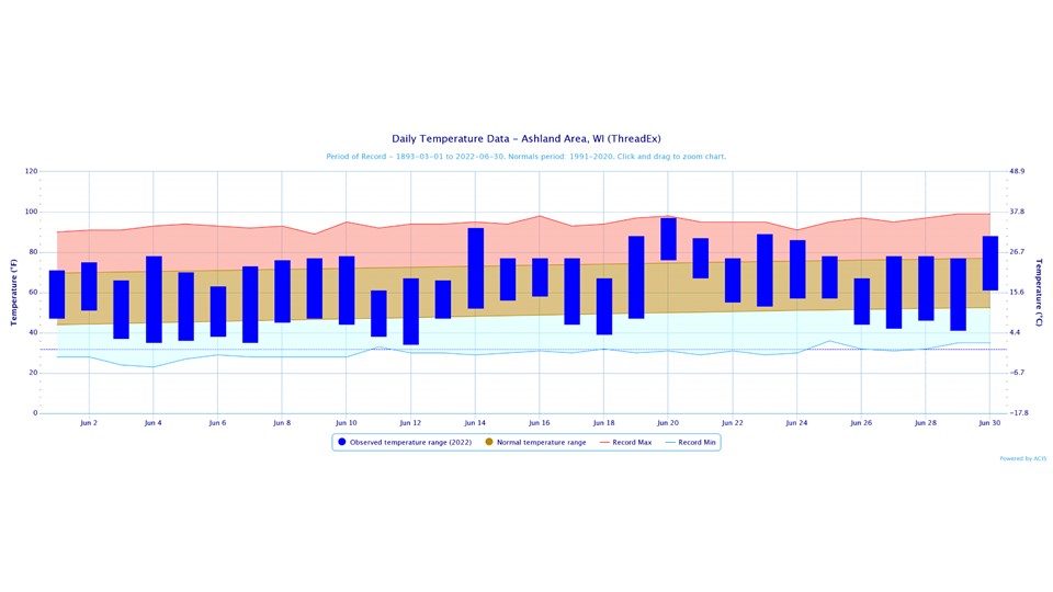
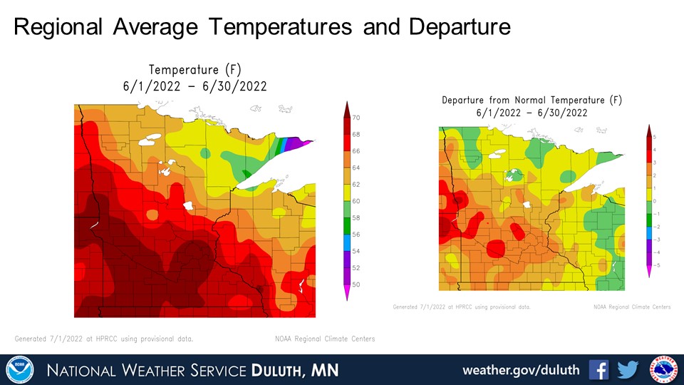
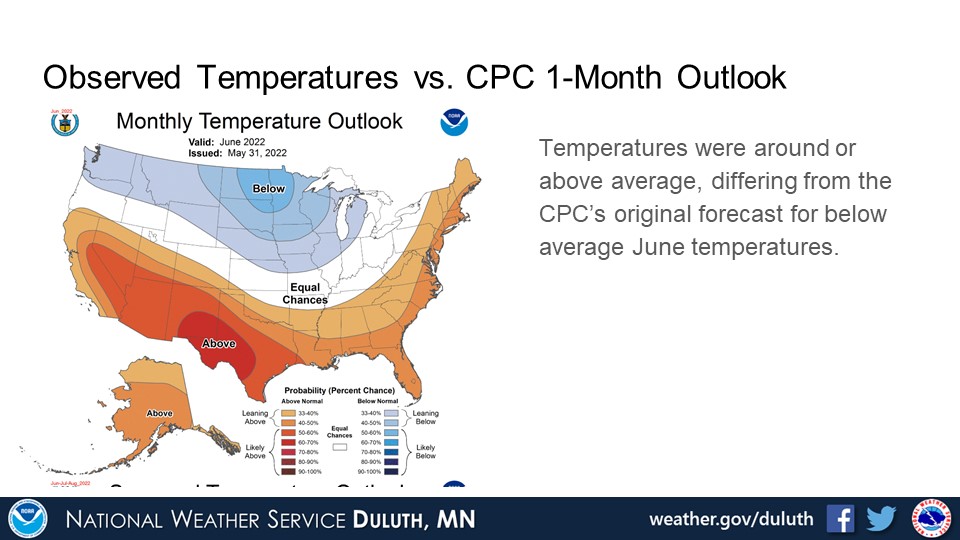
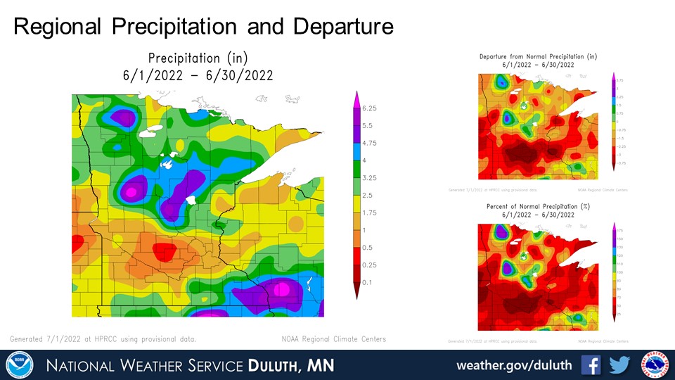
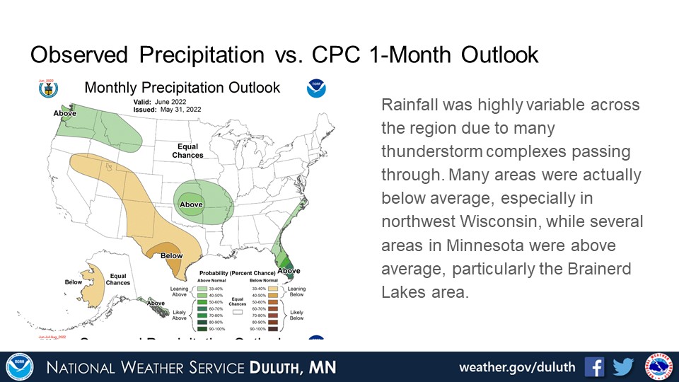
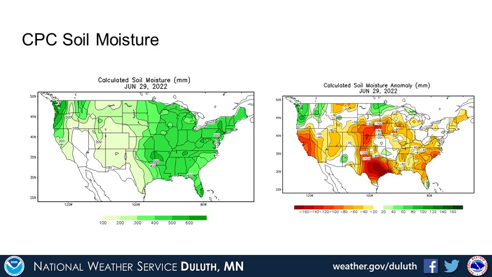
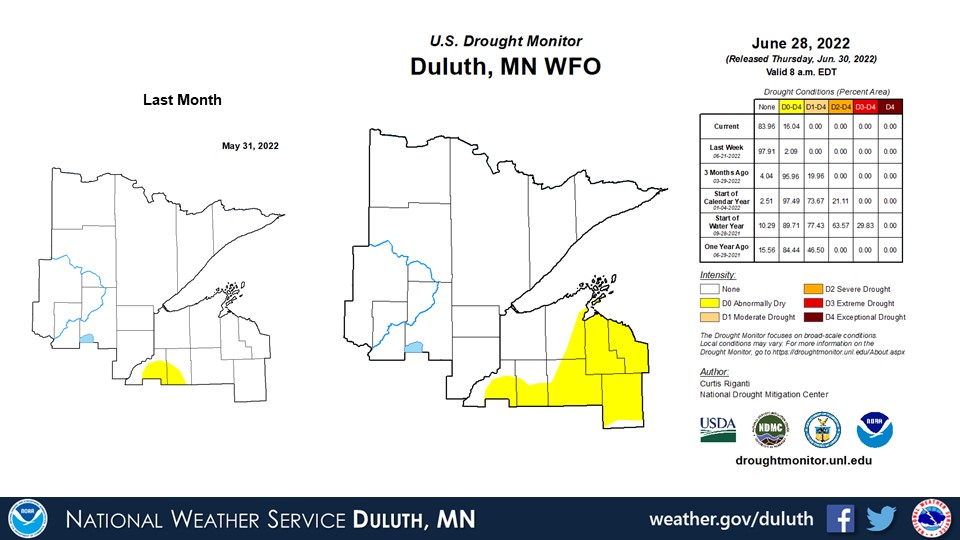
June 2022 saw a variety of different weather conditions. Depending on location, rainfall might have been above or below average. Generally, rainfall was below average in northwest Wisconsin and more variable across northeast Minnesota with a swath of above average rainfall most notable around the Brainerd Lakes region. Soil moisture anomalies are about what is expected based on June’s rainfall and the preceding spring patterns, with positive soil moisture anomalies in northeast Minnesota and negative anomalies in northwest Wisconsin. Temperatures were generally around to above average, and one of the most notable events of the month was the heat wave of 6/19-6/20 with widespread highs in the 90s and a high of 100 at Brainerd tying for the highest June high temperature ever recorded (which, interestingly, was also achieved in 2021). While statistics are not presented, severe weather was also quite prevalent throughout June.
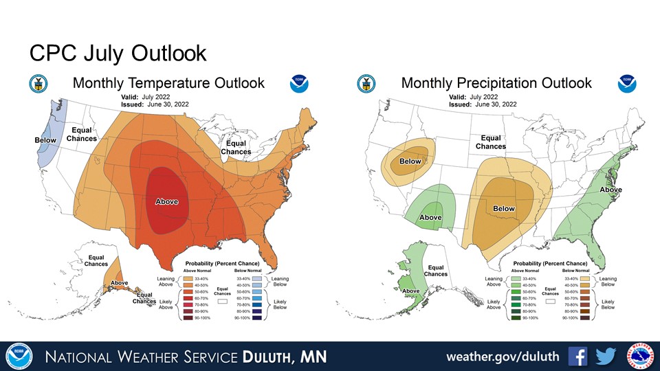
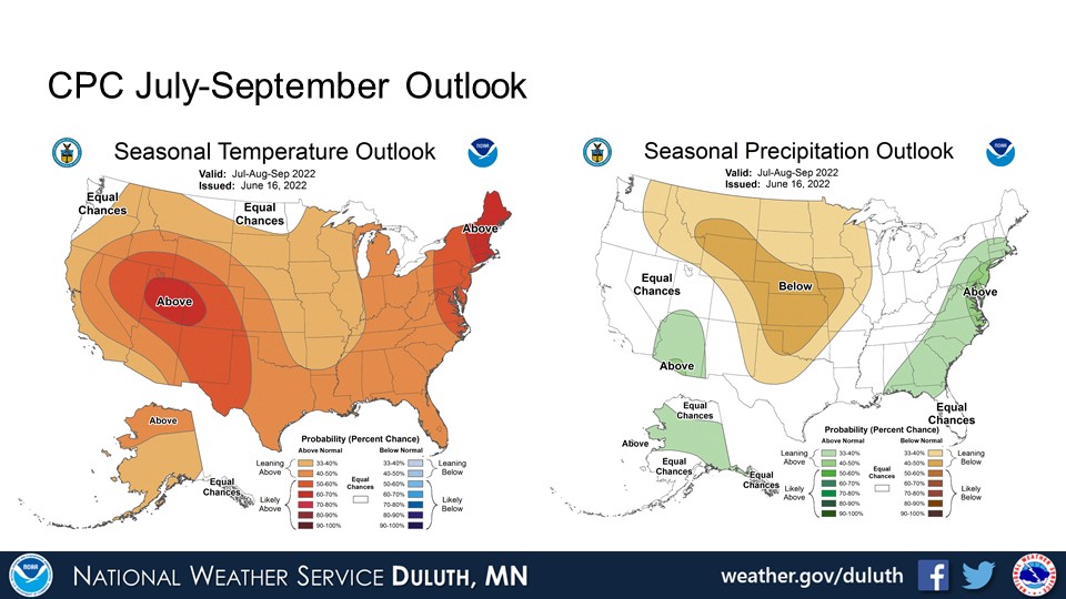
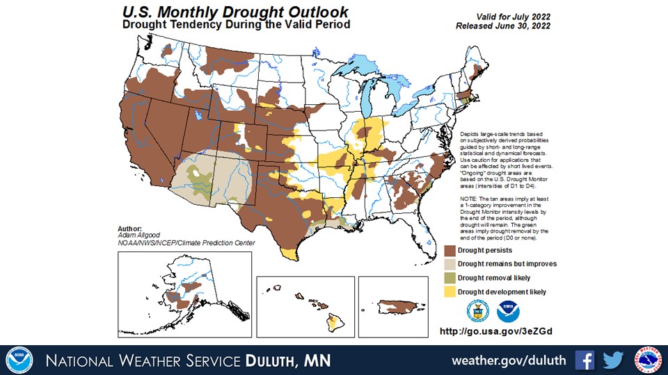
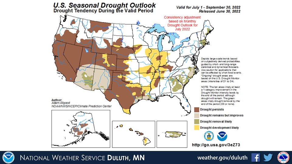
The CPC is forecasting above average temperatures for July and the rest of summer with equal chances for precipitation in July and favoring below average temperatures for the remainder of summer. While there are no forecasted drought developments, much of northwest Wisconsin could continue to dry out if storms continue to miss that area as a whole.
Duluth
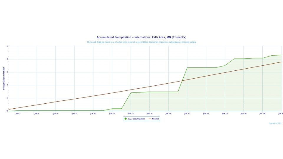
International Falls
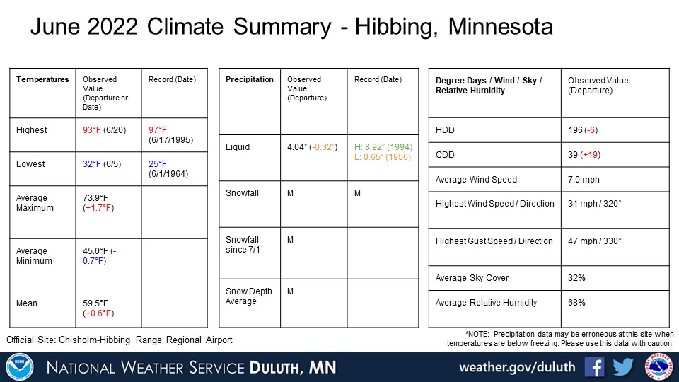
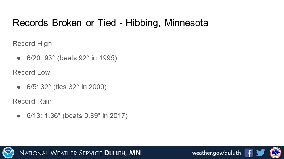
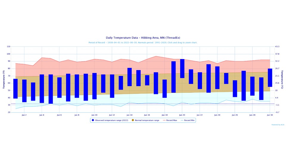
Hibbing
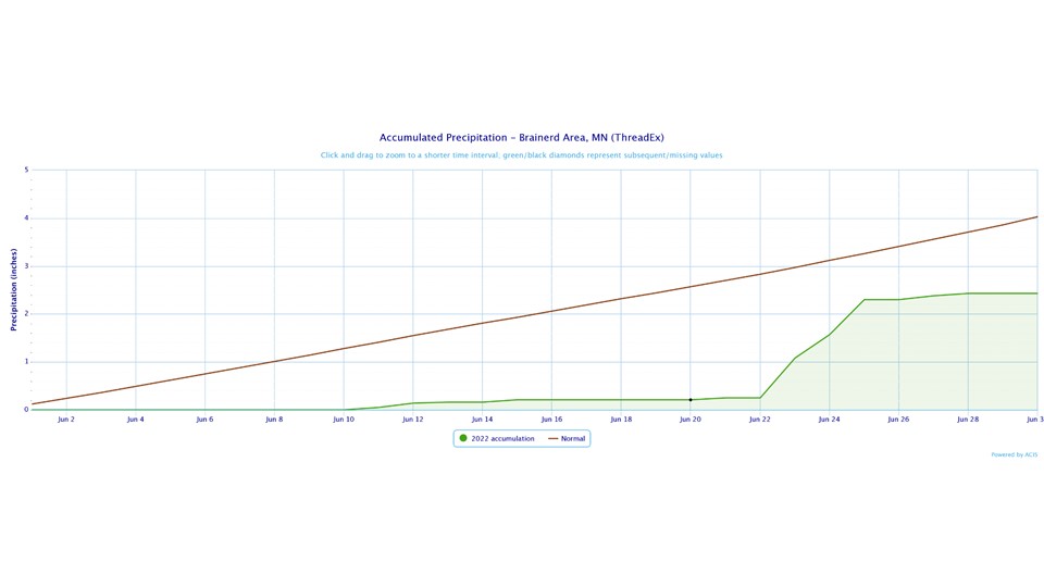
Brainerd
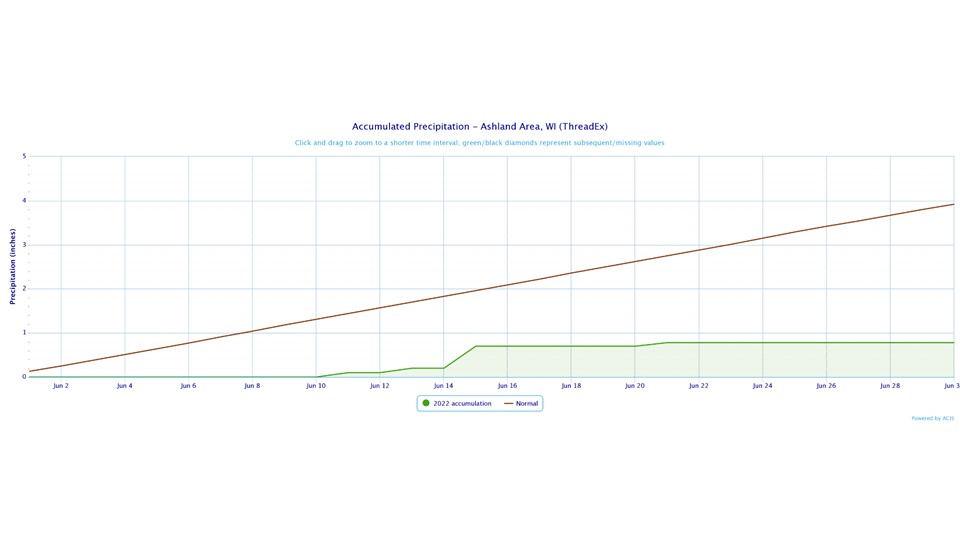
Ashland
Summary
Hydro
Outlook
 |
Media use of NWS Web News Stories is encouraged! Please acknowledge the NWS as the source of any news information accessed from this site. |
|
Forecasts
Fire Weather
Great Lakes
Local Text Products
Winter Weather
Local Area Forecasts
Aviation
Marine
Rainy River Basin Page
Current Conditions
Current Observations
Public Information Statements
National Snowfall Map
NOHRSC Snow Analysis
Rain/Snow Reports
Winter Monitor
US Dept of Commerce
National Oceanic and Atmospheric Administration
National Weather Service
Duluth, MN
5027 Miller Trunk Highway
Duluth, MN 55811-1442
218-729-6697 - Duluth; 218-283-4615 - Intl Falls
Comments? Questions? Please Contact Us.

