Duluth, MN
Weather Forecast Office
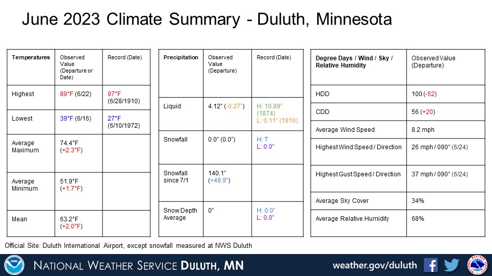
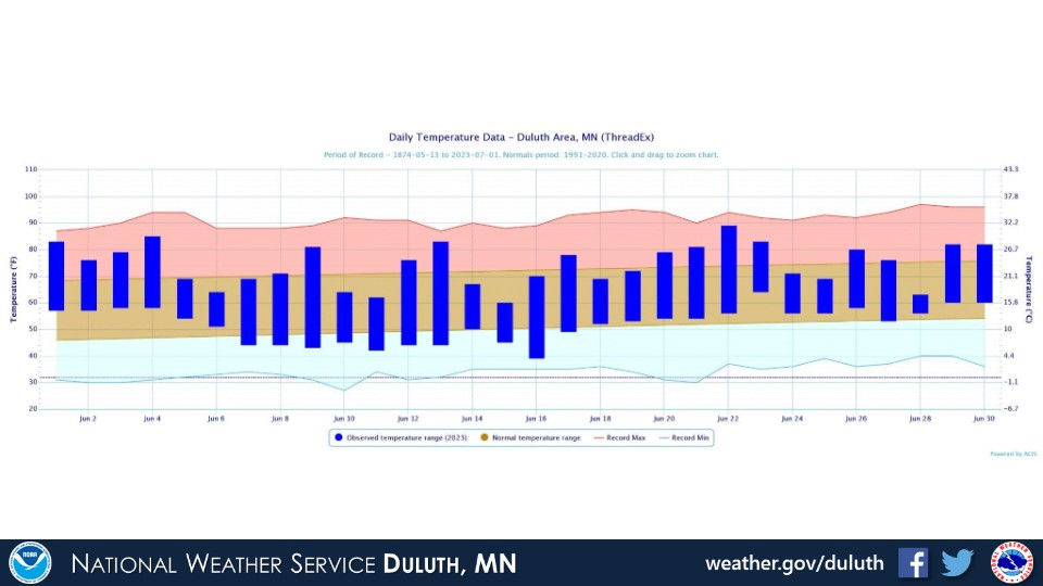
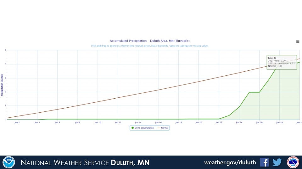
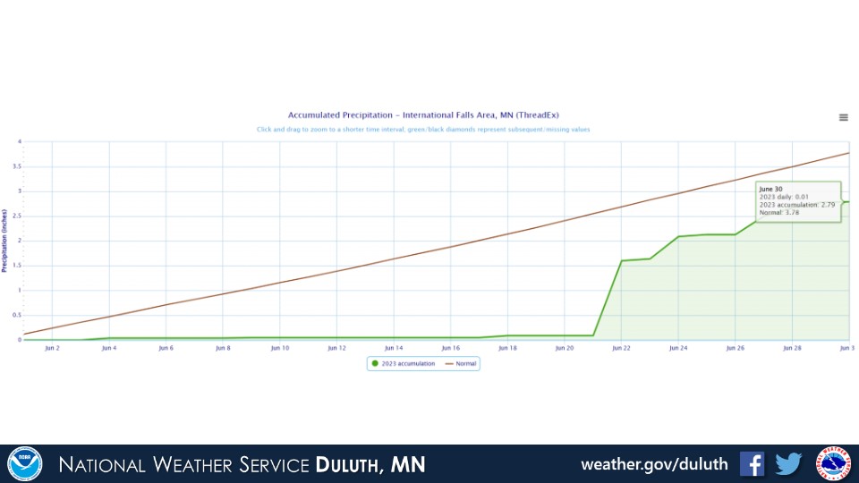
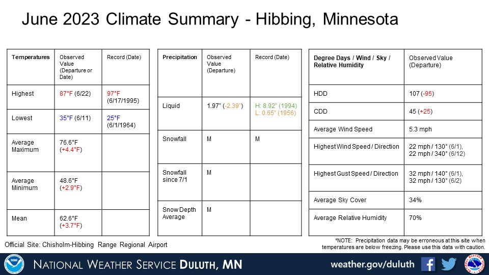
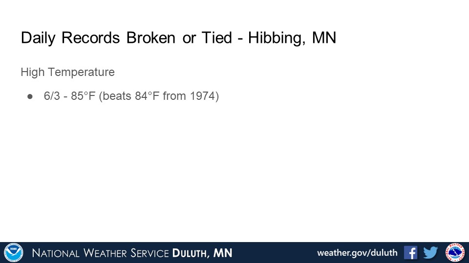
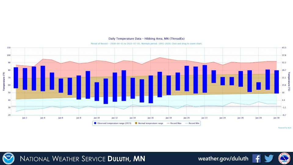
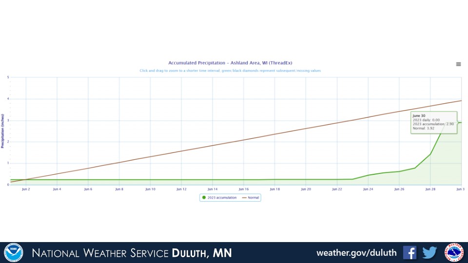
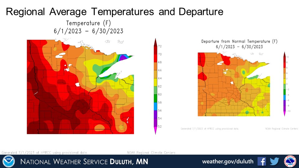
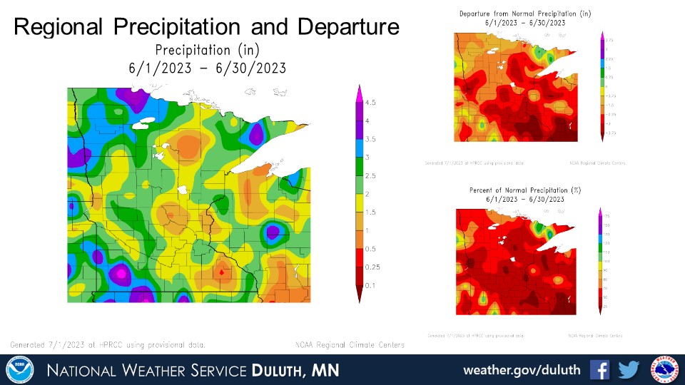
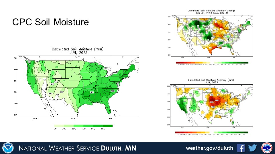
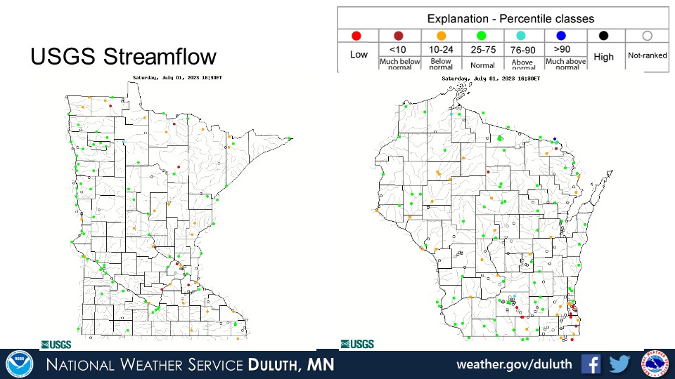
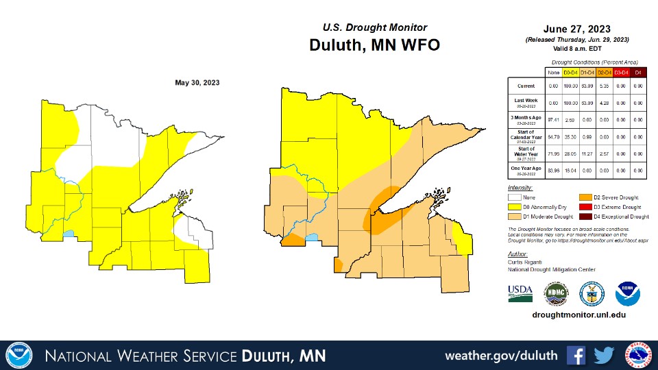
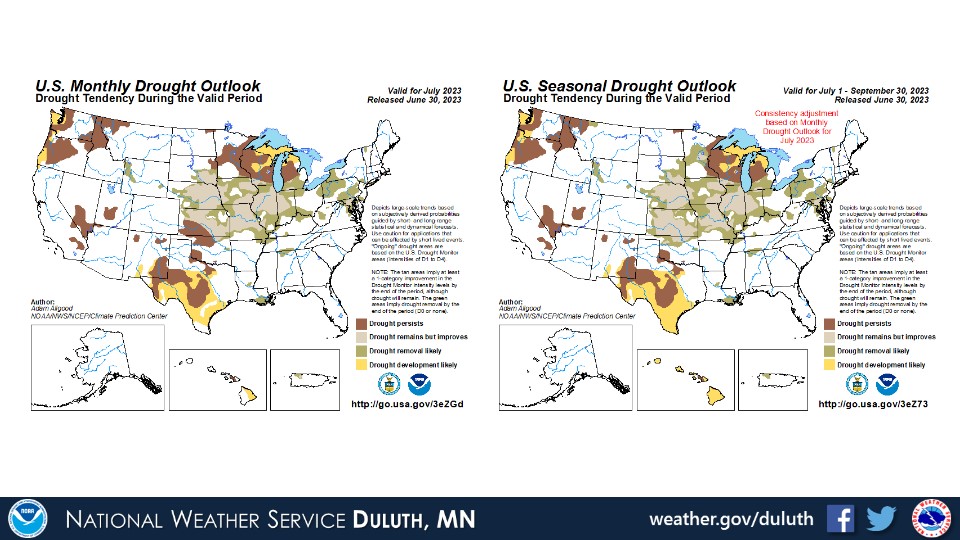
June was a flip-flop month in terms of rainfall, and in general, temperatures were pretty consistently above average throughout, though not necessarily breaking any major daily records. The only places with temperatures around average were adjacent to Lake Superior’s shorelines. Rainfall was below average everywhere, but what was most striking was the drastic change from very sparse rainfall for the first â…” to ¾ of the month, then quite rainy weather to end the month. For example, at Duluth, the rainfall was only 0.28” below average, but it’s notable that almost all of this rain fell between June 22 and June 30. Despite the recent rains, widespread abnormally dry conditions to severe drought persist across the Northland. This coverage has increased substantially since the beginning of June and is indicative of the flash drought that has been occurring since early May. With the recent rains, some rivers and streams have returned to near normal levels, but several are still running below normal.
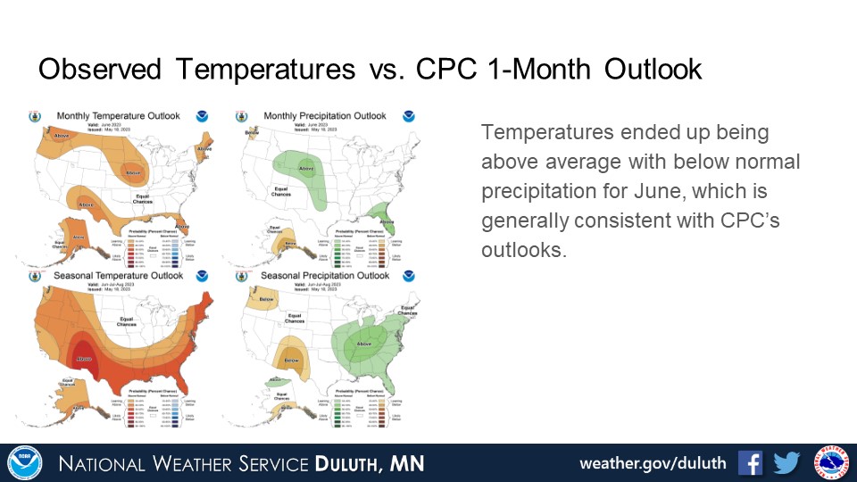
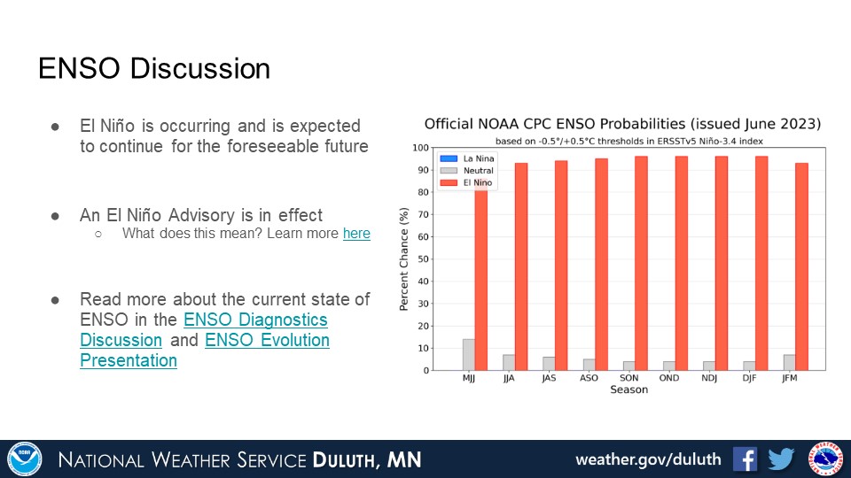
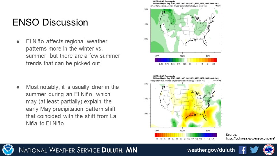
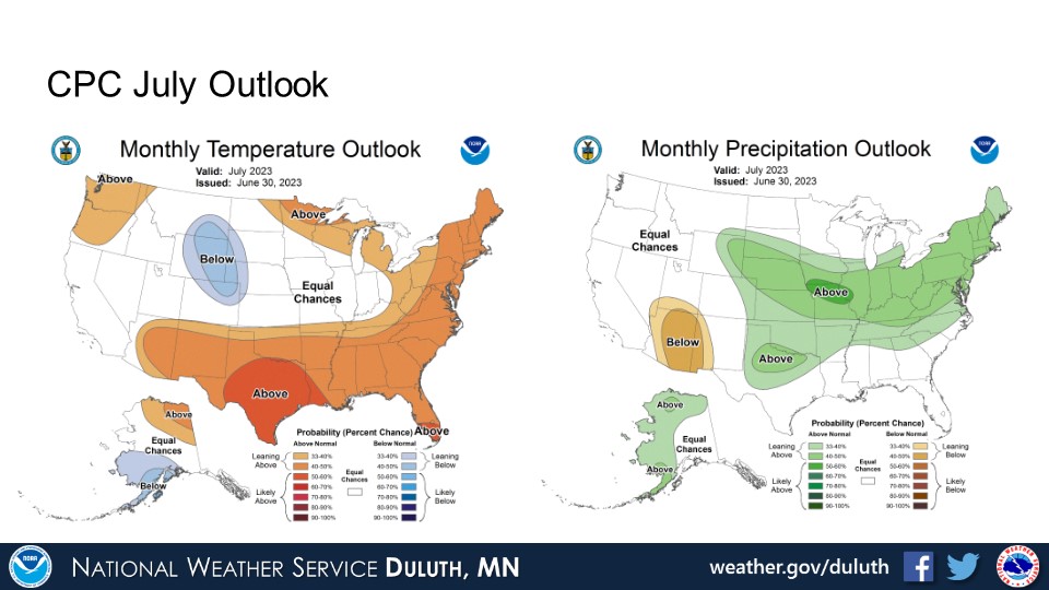
For the rest of July and through summer, the CPC suggests that temperatures may remain above normal and rain chances are generally equal for above, below, or around average. This is somewhat consistent with patterns that are normally observed in the summer during an El Niño, which is currently occurring.
Duluth
International Falls
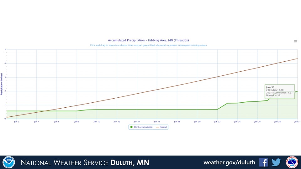
Hibbing
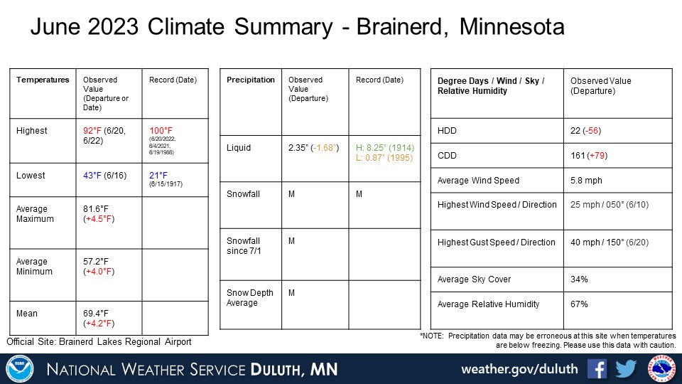
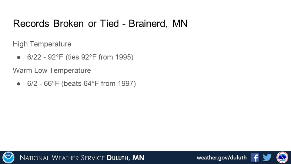
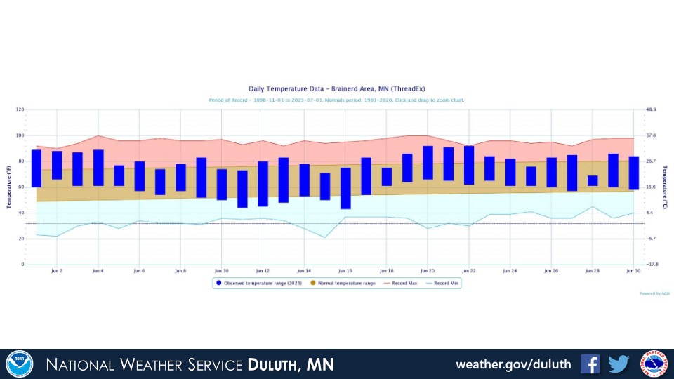
Brainerd
Ashland
Summary
Hydro
Outlook

 |
Media use of NWS Web News Stories is encouraged! Please acknowledge the NWS as the source of any news information accessed from this site. |
|
Forecasts
Fire Weather
Great Lakes
Local Text Products
Winter Weather
Local Area Forecasts
Aviation
Marine
Rainy River Basin Page
Current Conditions
Current Observations
Public Information Statements
National Snowfall Map
NOHRSC Snow Analysis
Rain/Snow Reports
Winter Monitor
US Dept of Commerce
National Oceanic and Atmospheric Administration
National Weather Service
Duluth, MN
5027 Miller Trunk Highway
Duluth, MN 55811-1442
218-729-6697 - Duluth; 218-283-4615 - Intl Falls
Comments? Questions? Please Contact Us.

